
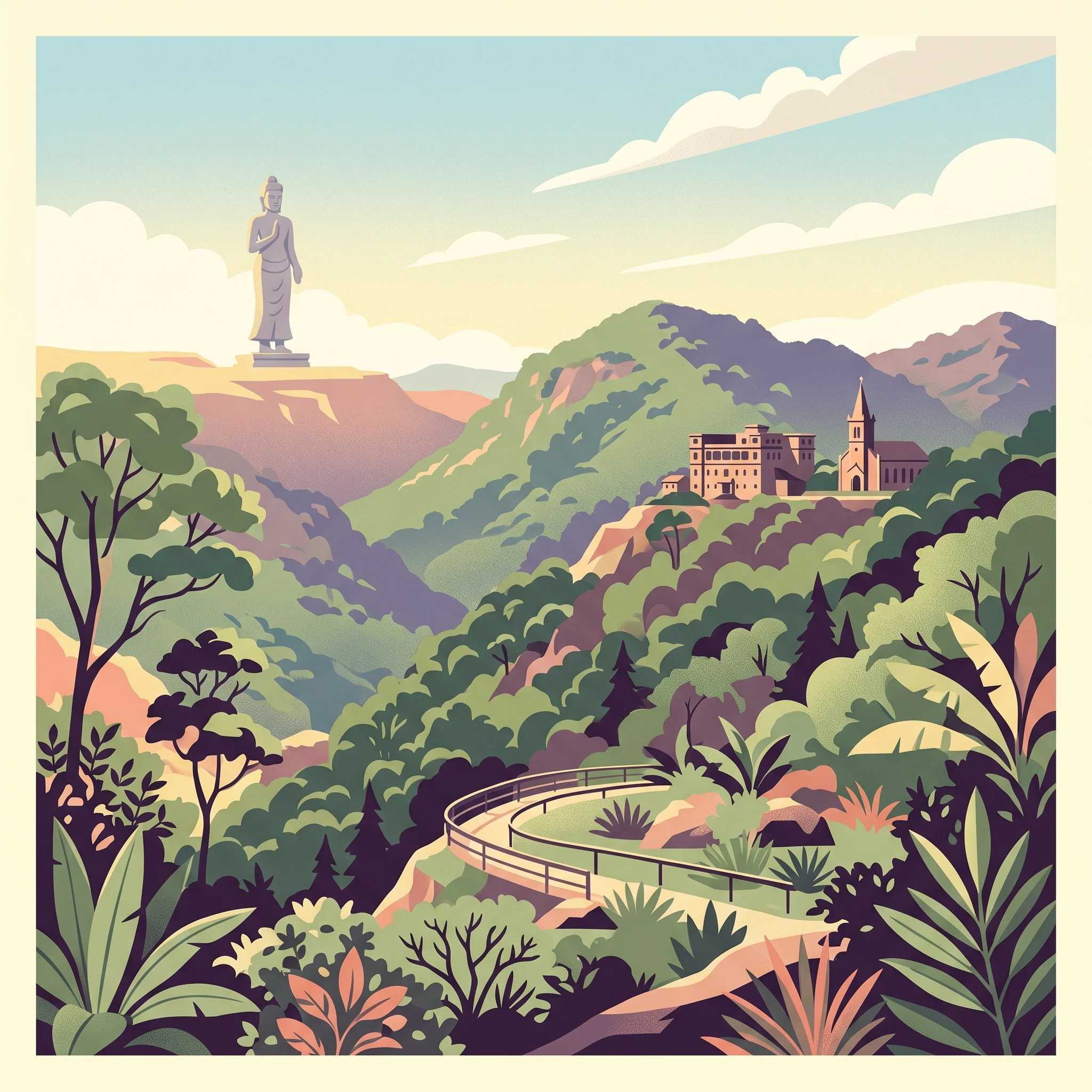
Trip Timing
Best Time to Visit Preah Monivong Bokor National Park: A Quick Overview
Determining the best time to visit Preah Monivong Bokor National Park requires balancing a desire for clear, panoramic mountain vistas against the reality of a tropical climate that fluctuates significantly across the year. The most reliable window for outdoor exploration occurs during the dry season, which typically runs from December through February. During these months, humidity levels remain lower than in other parts of the year, and rainfall is minimal, allowing for easier navigation of the historical sites scattered across the mountain plateaus.
The Role of Humidity and Precipitation in Planning
For most visitors, the primary trade-off is between the arid comfort of the dry season and the lush, atmospheric, but often challenging conditions of the wet season. As a mountainous region in the Dâmrei Mountains, the park experiences distinct climatic shifts. From May through October, monthly precipitation totals climb significantly, with sustained higher humidity levels. While this rain sustains the diverse tropical evergreen forests and helps maintain the park's biodiversity, it can also lead to limited visibility at the highest elevations, such as the 1,081-meter peak of Phnom Bokor. Travelers prioritizing photography of the French colonial-era ruins or the 29-meter Lok Yeay Mao statue will find that these structures are often shrouded in mist or heavy cloud cover during the peak of the monsoon, whereas the drier months offer a higher probability of expansive views across the landscape.
Elevation and Temperature Considerations
Because the park sits at a significant elevation, visitors should anticipate a different experience than that found in the surrounding lowlands of Kampot Province. Even during the warmest months, the mountain environment provides a respite from the extreme heat of the Cambodian plains. However, the drop in temperature during the evening and early morning hours is a consistent factor regardless of the month. Travelers often underestimate the effect of wind and altitude at the summit, which can make a bright, sunny day feel surprisingly cool, particularly if staying overnight. Effective planning involves preparing for this microclimate, as the temperature variance between the base and the mountain stations is meaningful for those planning extended stays or early morning hikes. Because operational factors like park access can be subject to change due to severe weather impacts or ongoing maintenance, visitors are encouraged to verify current road conditions and facility status through official channels before finalizing their itinerary, ensuring their selected dates align with the realities of the mountain environment.
Seasonal Planning
Best Months to Visit Preah Monivong Bokor National Park for Optimal Conditions
Choosing Your Window for Mountain Exploration
Selecting the best time to visit depends heavily on how you weigh outdoor comfort against the visual experience of the Dâmrei Mountains. The year is effectively split into two primary phases based on the shift in humidity and precipitation, which directly impacts the accessibility of trails and the atmosphere of the abandoned hill station. For those who prioritize mild temperatures and low rainfall, the period from December to February stands out as the most reliable window. During these months, precipitation is at its annual low, often averaging just over one millimeter per day. The lower humidity levels during this time reduce the persistent cloud cover that can frequently envelop the plateau, providing the clearest opportunities for panoramic photography and views from the higher elevations near the Lok Yeay Mao statue.
Transition Periods and Variable Conditions
If your travel schedule is flexible, the shoulder months of November and March serve as intriguing alternatives that balance conditions differently. November marks the end of the heaviest rains, often resulting in lush, vibrant vegetation without the intense downpours of the peak monsoon season. March, conversely, marks the transition toward the heat of the pre-monsoon cycle. While daytime temperatures can climb toward their annual maximums during this time, the trade-off is often a more stable environment for those arriving just before the onset of the most significant rainfall. Visitors during these shoulder periods should expect a mix of sunny intervals and occasional light showers, making them suitable for travelers who prefer a compromise between the peak dry season crowds and the wetter, more humid months.
Navigating the Monsoon Peak
From June through September, the park enters a phase defined by high precipitation and significantly elevated relative humidity, which often exceeds 90 percent. While these months offer a starkly different aesthetic with misty, atmospheric scenes around the colonial-era ruins, they present the greatest challenge for outdoor activities. The increased rainfall can impact ground conditions on trails, and the dense fog often reduces visibility across the plateau. This period is best suited for travelers who specifically seek the moody, isolated character of the mountain during its rainiest cycle and are less concerned with broad, clear vistas. If you choose these months, you should prepare for rapid weather shifts and prioritize flexible planning, as the environment can change significantly within a single day. Regardless of the month, the elevation of the park means that even if daytime temperatures remain moderate, humidity and wind speed often influence the perceived comfort, making an extra layer for overnight stays a consistent necessity throughout the year.
Annual Climate Normals
Monthly Weather and Climate Trends in Preah Monivong Bokor National Park
The Annual Temperature Rhythm in the Dâmrei Mountains
Preah Monivong Bokor National Park experiences a distinct annual temperature cycle shaped primarily by its elevation and regional tropical influences. While average temperatures across the year remain consistently warm, the park displays a notable cooling period from December through January. During these months, average minimum temperatures drop to their annual lows, often dipping below 18 degrees Celsius. This provides a refreshing contrast to the sweltering heat found in the lowlands of southern Cambodia, making the mountain summit a popular escape for those seeking relief from high heat.
As the year progresses into the pre-monsoon transition of March and April, the park sees its highest daily maximums. Daytime highs during these months can climb into the mid-30s Celsius. It is crucial to note that these values represent long-term climate normals rather than daily forecasts. Visitors should anticipate significant fluctuations based on cloud cover, wind exposure, and the specific altitude of their location within the park, as the summit and higher slopes generally remain cooler than the lower mountain reaches.
Patterns of Precipitation and Humidity
Rainfall in the park is heavily concentrated during the monsoon months, which typically run from June through September. During this peak period, daily precipitation averages can spike significantly compared to the drier months of December and January, where rainfall is minimal. This increased moisture brings high relative humidity, often exceeding 90 percent throughout the mid-year rainy season. This combination of heat and high humidity can make air feel heavier and more oppressive, creating a stark contrast to the drier, more manageable atmosphere of the early-year months.
While October and November mark a transition toward the drier season, rainfall remains elevated as the patterns slowly shift. Visitors planning travel during these transitional months should be prepared for lingering moisture. Even during the driest months, such as January and February, light precipitation is still possible, as the park is an expansive, natural mountain environment rather than a desert landscape.
Wind, Daylight, and Atmospheric Shifts
Daylight hours in the park follow a relatively stable pattern throughout the year, fluctuating between roughly 11.4 hours in December and peaking at 12.6 hours in June. While these variations are subtle, they do influence the length of time available for outdoor exploration. The park's exposed ridges and mountainous terrain also experience varying wind patterns, with mean wind speeds showing a slight uptick during the peak monsoon months of July and August. These winds can enhance the cooling effect at higher altitudes but may also contribute to rapid shifts in local cloud cover and visibility.
It is important to remember that these climate normals are based on a specific sample location and represent long-term trends rather than daily weather conditions. The park's diverse topography, ranging from forested valleys to mountain summits, creates complex microclimates. Consequently, travelers should check local forecasts immediately prior to their trip, as current weather will always deviate from multi-decade averages.
Seasonal Environment
Understanding Annual Climate Cycles and Weather Patterns in Preah Monivong Bokor National Park
Defining the Dry and Monsoon Cycles
The climate of the Dâmrei Mountains follows a distinct shift between a prolonged, high-humidity wet phase and a drier, more stable interval. Rather than the traditional four seasons often found in temperate zones, this region operates on a binary rhythm driven by the monsoon influence. The period from June through September marks the peak of the rainy season, characterized by high relative humidity frequently exceeding 90 percent and significant daily rainfall. During these months, the mountain environment is prone to heavy cloud cover and frequent mist, which significantly reduces visibility across the higher elevations of Phnom Bokor. Visitors during this window should expect saturated trails and an atmospheric, dampened forest environment that contrasts sharply with the conditions found later in the year.
The Transitional Windows
Transitioning out of the heavy monsoon cycle, the months of October and November serve as a crucial changeover period. Precipitation levels begin to drop noticeably, and the humidity starts to retreat from the extreme highs of the late summer. November, in particular, acts as a bridge where the landscape remains lush and green from the preceding months of rain, yet the frequency of daily downpours decreases. This phase offers a unique opportunity for visitors to experience the park with fewer logistical interruptions than the mid-monsoon period, though hikers should still remain prepared for lingering moisture on unpaved paths.
The Cool, Dry Period
From December through February, the park enters its most stable environmental phase. This is the period of lowest precipitation, with daily rainfall averages dropping to near-minimal levels compared to the rest of the year. The relative humidity also reaches its annual low point, making the daytime mountain air feel significantly more comfortable for extended outdoor activities. During these months, the combination of lower cloud cover and cleaner air frequently results in the clearest panoramic views from the higher elevations of the plateau. It is during this time that the cool mountain air is most distinct, providing a sharp contrast to the heat common in the lowlands of southern Cambodia.
The Pre-Monsoon Heat
March, April, and May represent a shift toward increasing warmth and the return of humidity. While precipitation begins to climb in April and accelerates rapidly in May, the early months of this phase can feature the highest daytime temperature maximums of the year. This period is marked by a gradual transition where the air becomes heavier as the monsoon approaches. By May, the environmental indicators suggest the imminent return of the heavy rains, as relative humidity begins to climb back toward the levels seen during the peak wet season. For those planning trips during this time, it is important to recognize that while the morning hours may remain clear, the late afternoons frequently see the onset of building clouds and the start of the convective rainfall cycles that define the coming summer months.
Seasonal Experiences
Seasonal Shifts and Visitor Experiences at Preah Monivong Bokor National Park
Navigating Colonial History and Hill Station Ruins
Visiting the abandoned structures at the Bokor Hill Station, including the old casino, church, and former residences, requires managing the significant shift in visibility and accessibility throughout the year. During the dry season months of December through February, the clearer skies provide the best conditions for architectural photography and viewing the decay of historical sites without the obscuring influence of persistent cloud cover. Visitors during these months often find the ground surfaces firmer, making it easier to walk between the scattered ruins of the station and the nearby Black Palace. As the moisture levels rise significantly toward the middle of the year, the atmosphere around these colonial remnants often becomes thick with dense mist. While this mist can enhance the haunting, historical character of the site for some travelers, it frequently restricts the panoramic visibility that defines the location on clear days.
Seasonal Influence on Water Features and Trail Exploration
Natural features within the park, such as the Popokvil Waterfalls, exhibit extreme variance based on the annual precipitation cycle. The intensity of these waterfalls is directly linked to the monsoon influence, which peaks from June through September. During the height of the dry season, these water features may be reduced to minimal trickles or stop flowing entirely. Travelers interested in observing the park's hydrological features must balance the increased flow during the wet months against the challenges of traversing unmaintained walking tracks.
Because park authorities do not maintain the majority of the forest tracks, the condition of these routes is highly variable. Heavy rainfall during the monsoon months can turn trails into muddy, difficult paths, complicating access for hikers. Visitors planning to explore the deeper forested regions or longer walking circuits should anticipate that the accessibility of these areas is often restricted during the peak wet season. Since these routes remain unmanaged, current conditions, including mud accumulation and vegetation overgrowth, fluctuate significantly from year to year. Travelers should always verify with local park rangers regarding the viability of any trail before attempting to navigate the park's more remote or unpaved sections, as the seasonal saturation of the soil can create localized safety concerns that are not reflected in long-term climate normals.
Travel Priorities
Choosing the Best Time to Visit Preah Monivong Bokor National Park by Interest
Balancing Climate Comfort with Outdoor Activity Goals
Choosing when to visit based on personal priorities requires a clear understanding of the trade-off between the park's distinct meteorological phases. If your primary goal is hiking and exploring the diverse forested terrain, the period between December and February is the most supported window. During these months, lower precipitation levels (averaging between 1.06 and 1.27 mm per day) significantly reduce the risk of encountering muddy or impassable trails. While humidity remains present, it is at its lowest relative levels for the year, typically hovering around 75 to 83 percent, which makes sustained physical exertion across the Dâmrei Mountains more manageable than during the peak monsoon season.
Targeting Cooler Temperatures for Mountain Exploration
For travelers who prioritize cooler ambient temperatures, the months of December and January provide the most consistent relief from the heat. Long-term climate normals indicate average minimums dipping into the 17°C range during these months. Because the park reaches elevations of over 1,000 meters, these temperatures feel significantly sharper, especially during early mornings or after sunset. If you are planning an overnight stay to fully explore the historical Bokor Hill Station, this window offers the best opportunity to experience the mountain air without the intense midday heat that characterizes March and April. The trade-off is the need to pack insulating layers, as the mountain climate drops rapidly once the sun sets, creating a stark contrast to the tropical warmth experienced at lower elevations in Kampot province.
Seeking Peak Visibility and Clearer Skies
Photography and landscape viewing depend heavily on cloud cover and rainfall frequency. The transitional weeks leading into the dry season, specifically November, and the established dry window of January and February, offer the highest probability of clear vistas across the valley. High humidity during the monsoon months often results in persistent mist and low-hanging cloud cover that can obscure the panoramic views from the summit of Phnom Bokor. While the wet season, spanning from June to September, offers its own moody, atmospheric aesthetic for those interested in the decaying architecture of the colonial era, visitors prioritizing long-distance sightlines should avoid the peak rainy months. During July and August, when precipitation averages exceed 15 mm per day, visibility is frequently restricted by heavy downpours and thick cloud banks that can settle over the plateau for days at a time.
Managing Daylight and Transit Constraints
If your schedule is driven by a desire for longer daylight hours to maximize outdoor time, the period from April to June provides the longest days, often exceeding 12.5 hours. However, this advantage comes with the significant compromise of the onset of the wet season. Increased rainfall during May and June can complicate travel plans and limit the time you can safely spend on unpaved trails. Travelers who require maximum daylight for longer excursions should weigh this against the increased likelihood of encountering slippery paths and restricted access as the monsoon season gains momentum. Most visitors find that the slightly shorter days of the early dry season represent a better value, as the guarantee of more predictable and stable weather facilitates a more productive visit.
Access and Logistics
Seasonal Access and Practical Trip Planning for Preah Monivong Bokor National Park
Access and Road Infrastructure to the Summit
The primary route into Preah Monivong Bokor National Park begins via Highway 3, with a turn-off situated approximately 8 kilometers from the town of Kampot and about 95 kilometers from Sihanoukville. The road leading to the park summit has undergone significant modernization to support hotel infrastructure, resulting in a paved surface that allows for relatively consistent vehicle transit compared to historical conditions. While the road quality has improved, travelers must recognize that high-altitude mountainous roads are susceptible to erosion and debris, particularly during periods of intense rainfall. Always verify current road status, any active construction, or localized transit restrictions with local authorities or reputable transport providers in Kampot before your departure.
Transport Options and Regional Logistics
Independent travel to the summit is possible, though the choice of vehicle significantly impacts your experience and safety. Renting a 125cc scooter is a common method for independent exploration, but visitors should be aware that the steep, sustained incline can be demanding for smaller engines and inexperienced riders. For those less familiar with mountain driving, renting a car or a scooter with an experienced local driver is a practical alternative. Local drivers are highly familiar with the road layout and the rapid, mist-driven weather shifts that occur at higher elevations. If you are considering renting larger dirt bikes, ensure you have verified your own experience level and insurance coverage. Tours remain a frequent way to access the site from Kampot, typically lasting around six hours, though you should confirm the specific inclusions of any booked tour package. Agents may present various add-ons or boat excursions that are not always guaranteed, so prioritize clarity on the tour itinerary and retain receipts for all bookings.
Preparing for Variable Site Access
Beyond the main road, the ease of movement within the park grounds varies by season. The transition from the dry season (December through February) into the wetter months (May through September) alters how accessible remote trails and secondary sites become. During the height of the monsoon, secondary paths may become muddy or overgrown, limiting access to more distant landmarks. While the core historical structures and main viewpoints remain generally accessible, always check for any temporary closures or maintenance-related access limitations at the park headquarters, which is located about 1 kilometer from the main highway entrance. Remember that official park rules regarding entry times or permits can change, and you should seek the most recent operational updates from the national park office or the provincial tourism department in Kampot.
Safety and Preparation
Seasonal Weather Safety and Preparation for Preah Monivong Bokor National Park
Adapting to Elevation and Humidity
Preparation for a visit to the Dâmrei Mountains involves understanding that local conditions often differ from those at lower, coastal elevations. The most significant environmental shifts occur between the relatively dry, cooler months and the peak monsoon season. During the months of December, January, and February, humidity levels start to decline, and the air becomes more stable, creating an environment where high-altitude cooling is more pronounced, especially during the early morning and evening hours. If you are planning a visit during these cooler months, layering is an effective way to manage these temperature fluctuations without needing specialized cold-weather gear. In contrast, from June through September, humidity levels often exceed 90 percent. This moisture can make even moderate temperatures feel more intense and is frequently accompanied by low-visibility cloud cover. Regardless of when you travel, carry rain protection as showers can develop rapidly in high-elevation forest environments.
Terrain Safety and Trail Awareness
Navigation within the park is influenced by the maintenance status of various trails. While main roads and established tourist zones are regularly monitored, many of the park's secondary trails are neither marked nor maintained. Because the park spans over 1,500 square kilometers of dense mountain forest, straying from recognized pathways is strongly discouraged. Historical clearance efforts have removed landmines from key sites, but it is a standard precaution to remain strictly on cleared paths. For those looking to explore more remote sections of the park or engage in serious hiking, the safest approach is to hire a local ranger. This provides not only expert route finding in complex terrain but also ensures you have someone familiar with current conditions and local wildlife behaviors.
Wildlife and Environmental Precautions
While the park is a vital sanctuary for species such as the pileated gibbon and the Asian elephant, interactions with wildlife are generally non-aggressive if proper distance is maintained. However, it remains wise to avoid trekking into dense brush during dusk or nighttime hours, as this is when the park's more elusive predators and larger mammals are most active. Always check for official park alerts before departing, as these notifications provide the most current information regarding trail closures, regional weather warnings, or changes in access rules. Preparation is not about carrying an extensive survival kit, but rather about remaining informed, respecting the boundaries of the park, and ensuring you are equipped for the rapid changes in visibility and rainfall that define this mountainous region. If you are uncertain about a route or the potential for local weather to impact your specific plans, consult with local authorities at the park entrance for real-time guidance.
Final Planning Decisions
Deciding on the Best Time for Your Preah Monivong Bokor National Park Trip
Synthesizing Your Travel Priorities
Deciding when to head to the Dâmrei Mountains requires aligning your personal comfort levels with the specific character of the park you wish to experience. The dry months from December through February serve as the most reliable window for visitors who prioritize clear, panoramic views from Phnom Bokor and consistent trail access. During this period, the lower precipitation and higher solar exposure create the most stable environment for exploring the colonial remains of the old Hill Station and the surrounding historical sites. If your primary goal is to avoid the complications of muddy tracks and the persistent low-cloud cover that often blankets the summit, this winter window is your most logical choice.
Conversely, those drawn to the park for its atmospheric, moody aesthetic may find the monsoon months, particularly from June through September, more compelling. While the high humidity and heavy rainfall significantly alter transit and can restrict visibility, these conditions drive the active flow of the Popokvil Waterfalls and transform the landscape into a lush, vibrant green. This choice requires a trade-off: you accept higher logistical friction and the potential for temporary access restrictions in exchange for a dynamic, water-rich environment. Travelers opting for these months must prioritize robust, moisture-resistant gear and maintain a flexible approach to their daily itinerary.
Refining Your Decision Framework
To finalize your travel dates, consider whether your interest lies in the cultural and historical legacy of the station or the ecological scale of the mountain forest. If you seek active, long-distance hiking, the dry season remains essential for safety, as many forest trails become treacherous or impassable under heavy monsoon saturation. If you prefer a more sedentary trip focused on photography or visiting religious landmarks like the Lok Yeay Mao statue, the shoulder months of November and March offer a middle ground where rainfall begins to stabilize or taper off, often providing more solitude than the peak dry season.
Ultimately, there is no universal perfect month. Each season dictates its own set of rules for movement and visibility. Remember that all climate data presented are long-term averages for the region and should not be confused with daily weather forecasts. Before your departure, monitor official park communications and local alerts for any changes in accessibility, road status, or safety warnings, as these factors can override seasonal norms. Your decision should be based on a realistic assessment of the trade-offs between your preferred weather, your tolerance for humidity, and your specific activity goals.