
Mori Atlas logo
Nature reserveProkopské údolí

Analyzing the limestone valleys, karst formations, and relict flora of this urban nature reserve

Prokopské údolí Nature Reserve: A Geological and Protected Landscape Study in Praha 5

(Přírodní rezervace Prokopské údolí)

Prokopské údolí serves as a vital protected nature reserve on the southwestern edge of Prague, characterized by its deeply incised limestone valley and complex geological history. Representing a northeastern spur of the Bohemian Karst, the area preserves internationally recognized Paleozoic fossil sites, rare volcanic basalt formations, and diverse xerothermic grassland habitats. The reserve maps a mosaic of relict thermophilic woodland and karst cave systems that remain remarkably intact despite the surrounding urban expansion of the Praha 5 district.

limestone valleyurban nature reservePaleozoic geologyfossil siterock steppexerothermic grassland
A flat, vector-style illustration of a green mountain valley with a winding river, a central waterfall, and steep dark cliffs on the left side under a soft sun.

Prokopské údolí

Nature reserve

Park overview

Structured park overview, official facts, and landscape profile for Prokopské údolí Nature Reserve

Prokopské údolí Nature Reserve park facts, protected area profile, and essential visitor context

Review the core facts for Prokopské údolí Nature Reserve, including designation, size, terrain, visitor scale, habitats, and operating context in one park-focused overview.

About Prokopské údolí Nature Reserve

Prokopské údolí is a narrowly cut limestone valley that opens into the southwestern outskirts of Prague, stretching between the districts of Jinonice and Hlubočepy. Designated as a nature reserve in 1978, it covers roughly 170 hectares along the Prokopský potok stream and is the most species-rich unit within the larger Přírodní park Prokopské a Dalejské údolí. Although it lies just beyond the official boundary of the Bohemian Karst (Český kras) protected landscape area, it represents the northeastern geological continuation of that Karst system.

The defining character of the reserve is geological. Its bedrock consists of Silurian and Devonian marine limestones that accumulated in warm, shallow seas more than 400 million years ago. These rocks preserve an outstanding fossil record first explored scientifically by Joachim Barrande in the 19th century. Today, sections such as Ctirad remain internationally recognized stratotypes, used to correlate Paleozoic sediments across Europe. Cave systems (including the famous Prokopská jeskyně, documented since the 19th century and historically associated with the hermit Saint Prokop) and basalt volcanic bodies at Hemrovy skály add further geological complexity to the valley.

Quarrying of these limestones has shaped the landscape for centuries. Beginning in the early 19th century, a succession of quarries (Bílá skála, Zlíchov, Švagerka, Vysoká, Schwarzenberský/Králův lom, Mušlovka, and Prokopský lom, among others) truncated the valley's flanks, opening walls 15 to 40 meters high and exposing new fossil-bearing sections. After 1905 most extraction ceased; later, in the 1940s, parts of the Prokopský lom were reused for a planned Junkers aero-engine factory, which was completed just as the Second World War ended. A guarded military facility, known as military object K-116, still occupies part of the quarry today and inadvertently protects its surroundings from the heaviest urban disturbance.

Ecologically, the valley is a mosaic of contrasting habitats. Warm, south-facing limestone slopes support xerothermic grasslands and rock steppes with species such as Koniklec luční, kavyl, and Třemdava bílá, while cooler shaded slopes are dominated by Sesleria caerulea and relict oak–hornbeam woodland. The flora includes approximately 600 vascular plant species, dozens of which are nationally red-listed, alongside thermophilic oaks (Quercus pubescens), dřín, and areas of non-native black locust and black pine that have invaded disturbed ground. The reserve is one of the most thoroughly inventoried sites in the country for mollusks (around 60 snail species), spiders (131 recorded species), butterflies, and beetles, and is used as a reference site for monitoring urban-edge invertebrate communities in the Czech Republic.

Quick facts and research context for Prokopské údolí Nature Reserve

Prokopské údolí is a Czech nature reserve (IUCN Category III; classified domestically as a přírodní rezervace) established on 28 December 1978 by the Ministry of Culture of the Czechoslovak Socialist Republic. It lies within Prague 5 on the southwestern edge of the Czech capital, covering terrain between Jinonice and Hlubočepy, and is part of the broader Přírodní park Prokopské a Dalejské údolí designated in 1993.

Geologically, the valley rests on Silurian and Devonian limestones that form the northeastern edge of the Bohemian Karst (Český kras). These strata have produced internationally recognized stratotype sections and rich fossil records of trilobites, cephalopods, brachiopods, and other Paleozoic invertebrates, first documented by the geologist Joachim Barrande.

The reserve is ecologically distinctive for its patchwork of rock steppes, xerothermic grasslands, thermophilic oak forests, scree woodland, and oak–hornbeam stands. It is directly bordered by dense urban neighborhoods (Barrandov, Nové Butovice, Jinonice, Hlubočepy) and two railway lines, making it a remarkable example of a high-value natural area surviving under intense metropolitan pressure.

Protection and recognition

Documented terrestrial protection history and Natura 2000 designation records

Prokopské údolí Protection Status and International Recognition Data

Prokopské údolí maintains documented terrestrial protection status established in 1978 alongside verified Natura 2000 recognition records. Structured conservation metadata outlines the baseline designation history and official international source listings for this protected area.

International recognition

Protection details

Protection scope
Terrestrial
Designated year
1978
Transboundary protection
No
Park context

Deeper park guide and search-rich context for Prokopské údolí Nature Reserve

Prokopské údolí Nature Reserve history, landscape, wildlife, and travel context

Explore Prokopské údolí Nature Reserve through its history, landscape character, ecosystems, wildlife, conservation priorities, cultural context, and seasonal travel timing in a structured park guide built for atlas discovery and search intent.

Why Prokopské údolí Nature Reserve stands out

Prokopské údolí is best known as one of the most important Paleozoic fossil sites in Central Europe. Its Silurian and Devonian limestone exposures, particularly at the Ctirad natural monument, were classic collecting localities of the French geologist Joachim Barrande and continue to provide internationally referenced stratotypes and abundant trilobite, cephalopod, and brachiopod fossils. The valley is equally celebrated for its rare combination of warm rock-steppe vegetation and karst phenomena within a major European capital. It preserves relict thermophilic plant communities (including oak, hornbeam woodland, Třemdava bílá, Koniklec luční, and the post-glacial relict pěchava vápnomilná) set against limestone cliffs, former quarries, caves such as the Prokopská jeskyně, and volcanic outcrops like the Hemrovy skály. The reserve has also become a symbol of urban nature conservation in the Czech Republic, demonstrating how a scientifically priceless landscape can persist intact despite being encircled by housing estates, railways, roads, and military infrastructure.
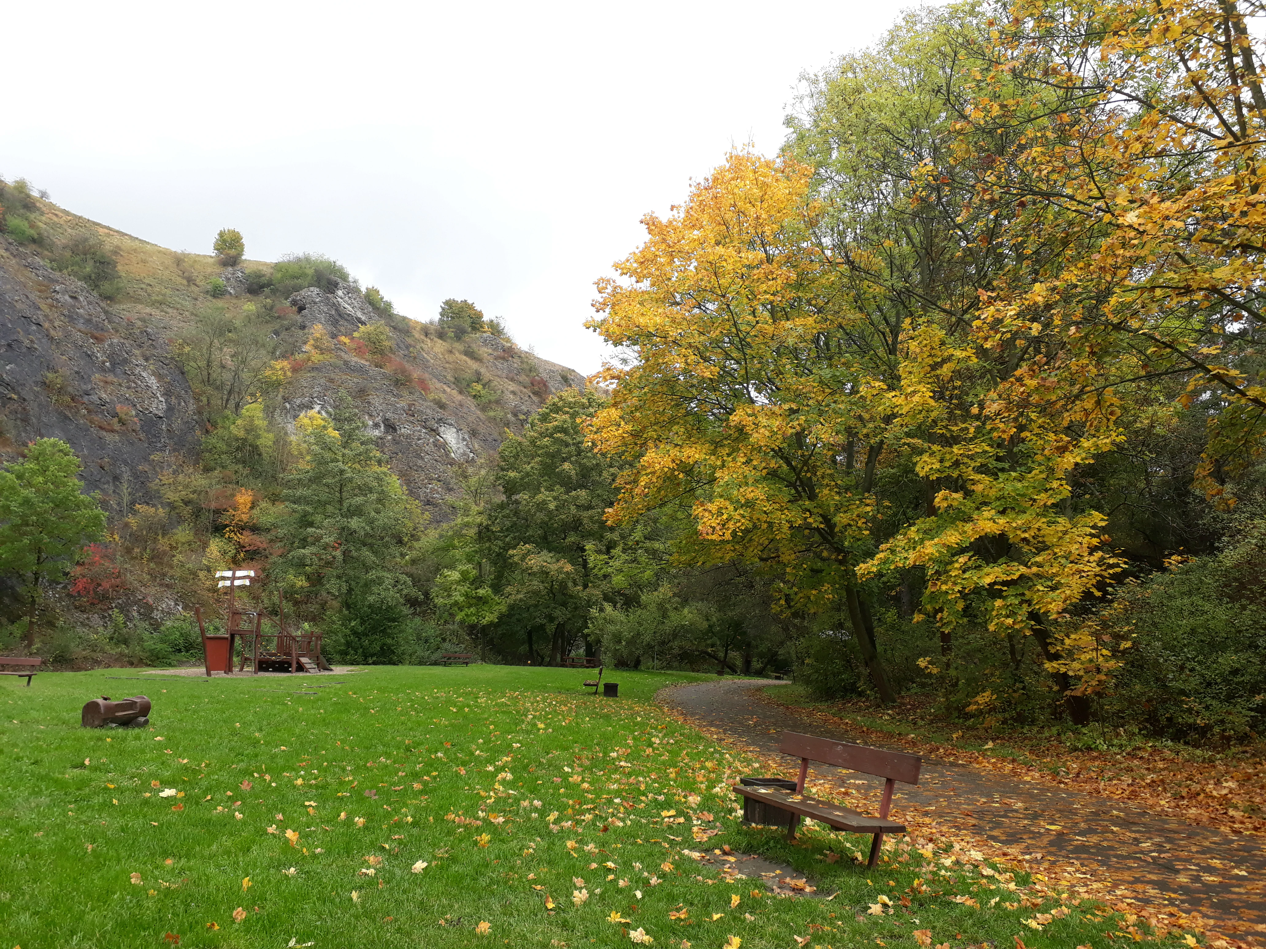
A park scene in autumn featuring a grassy area, a wooden bench, mature trees with yellow leaves, and a rocky cliff face in the background.
Autumn foliage at the base of a rocky hillside in Prokopské údolí nature reserve.

Prokopské údolí Nature Reserve history and protected-area timeline

The geological foundations of Prokopské údolí date back more than 400 million years. The first significant mountain-building activity began in the Silurian period, around 435 million years ago, when limestone, shale, and volcanic rocks accumulated on the floor of a shallow sea located south of the equator near the great continent Gondwana. By the Early Devonian, roughly 430 million years ago, submarine volcanic eruptions around what is today Hemrovy skály enriched the seafloor and supported rich invertebrate life, including trilobites, brachiopods, cephalopods, and crinoids. After the sea withdrew, tectonic pressures between the European and African blocks folded and uplifted these sediments, creating the structural setting later exploited by erosion.

In the Quaternary, rivers laid down layered sandy and gravelly sediments along the valley floor, while loess and slope deposits accumulated higher on the slopes. Humans have used the valley since prehistory: the name derives from Saint Prokop, a hermit who, according to legend, lived in the limestone cave later known as the Prokopská jeskyně. On the turn of the 16th and 17th centuries, part of the valley belonged to the noble family of Klukovský z Klukovic, whose boundary disputes with the estate of Adam II. z Hradce were later reconstructed by the historian Pavel Fabini.

Industrial activity began with the systematic quarrying of limestone in the 19th century. The earliest documented quarries date from 1820. By the mid-19th century, Bílá skála, Zlíchov, Švagerka, and other smaller quarries were active; in 1875 the Schwarzenberský (Králův) lom opened, and between 1880 and 1905 large quarries such as Vysoká, Mušlovka, Kalvárie, and others operated in succession. The limestone was both a building material and a source of fossils. After 1905 quarrying effectively ended, and during the Second World War a section of Prokopský lom was repurposed for a planned Junkers factory intended to produce Jumo 004 jet engines, which never began production. After the war, sections of the valley came under military control, and a guarded facility (military object K-116) still occupies part of the area.

The reserve was formally established on 28 December 1978 by the Ministry of Culture of the Czechoslovak Socialist Republic, in recognition of its outstanding geological, paleontological, and ecological values. Its protection was reinforced in 1993 when it became part of the Přírodní park Prokopské a Dalejské údolí. Since the early 21st century, the reserve has been the focus of active conservation programs, including reintroduced goat grazing funded by the City of Prague, which is used to maintain valuable steppe grassland.

Prokopské údolí Nature Reserve landscape and geographic character

Prokopské údolí is a linear, deeply incised limestone valley that cuts through the southwestern edge of Prague. Its general elevation lies between 220 and 330 meters above sea level, and the steep slopes rise 15 to 40 meters above the floor in many places. The valley floor is dominated by the small Prokopský potok, which has been constrained by quarrying, road building, and urban runoff over more than a century.

The bedrock is primarily Silurian and Devonian limestone of varying facies, with intercalations of calcareous shales that locally produce gentler terrain along the slopes. In the western part of the reserve, the upper geological layers include Cenomanian claystones and sandstones, together with Tertiary gravels and Quaternary loess, producing a stepped morphology capped by the volcanic basalt outcrops of Hemrovy skály. These exposures formed around a former submarine volcanic center and now rise as dark, blocky cliffs above the lighter-colored limestone.

Centuries of limestone quarrying have transformed the valley into a landscape of artificial cliffs, terraces, partially filled voids, and quarry lakes. Long-abandoned quarries such as Bílá skála, Vysoká, Schwarzenberský/Králův lom, Mušlovka, and Prokopský lom now form dramatic enclosures within the protected area. Karst phenomena are abundant: more than a dozen named caves occur within the reserve, including the historically significant Prokopská jeskyně, Korálové jeskyně, and several smaller cavities. A natural spring known as Stydlá voda is still chemically active, depositing travertine-like tufa from dissolved calcium carbonate. The result is a landscape that reads simultaneously as a natural canyon and an industrial-archaeological site.
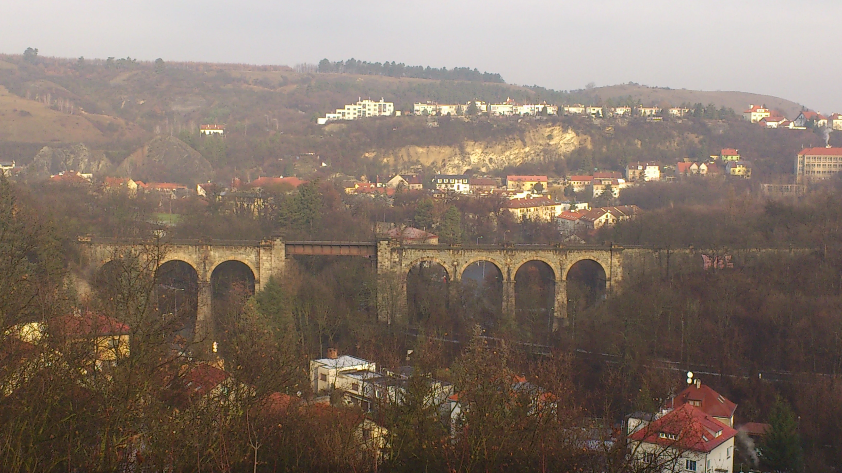
A wide shot of a stone arch railway viaduct spanning a wooded valley in the Prokop Valley, with suburban housing visible on the hillside above.
The historic railway viaduct crossing the Prokop Valley, framed by surrounding residential development and woodland.

Prokopské údolí Nature Reserve ecosystems, habitats, and plant life

The nature reserve contains a striking mosaic of vegetation types over a very small area. The warmest, south-facing slopes and former quarry terraces support rock steppes and xerothermic grasslands, characterized by narrow-leaved grasses, low shrubs, and small annual and bulbous plants able to withstand extreme drought and heat. Cooler north-facing slopes, in contrast, are dominated by Sesleria caerulea grassland, considered a post-glacial relict. Forest cover is patchy: thermophilic oak woodland (Quercus pubescens), oak–hornbeam stands, and scree forests occupy different parts of the valley, while disturbed ground has been colonized by non-native black locust, black pine, red oak, and spruce plantations.

Roughly 600 species of vascular plants have been documented in the reserve, of which several dozen appear on the Czech national Red List. Notable species include Lilium martagon, Anthericum liliago, Cornus mas, Stipa pennata, Dictamnus albus (the only freely growing representative of its family in the Czech Republic), Pulsatilla pratensis, Helianthemum canum, and the relict Sesleria caerulea. The endangered snail Xerolenta obvia, once common, has sharply declined due to airborne pollution.

The reserve's biological significance extends beyond plants. It is one of the most thoroughly studied mollusk sites in the country, with 56 terrestrial snail species and two freshwater snail species recorded in 2020 alone, and is similarly well inventoried for spiders (131 recorded species), butterflies, and beetles. The combination of warm, dry rock steppes, shaded forest, and rocky cliffs supports a mixed community of thermophilic and woodland species rarely found together within a single small urban site. Ongoing conservation efforts include controlled goat grazing, financed by the City of Prague, to maintain the open steppe communities.
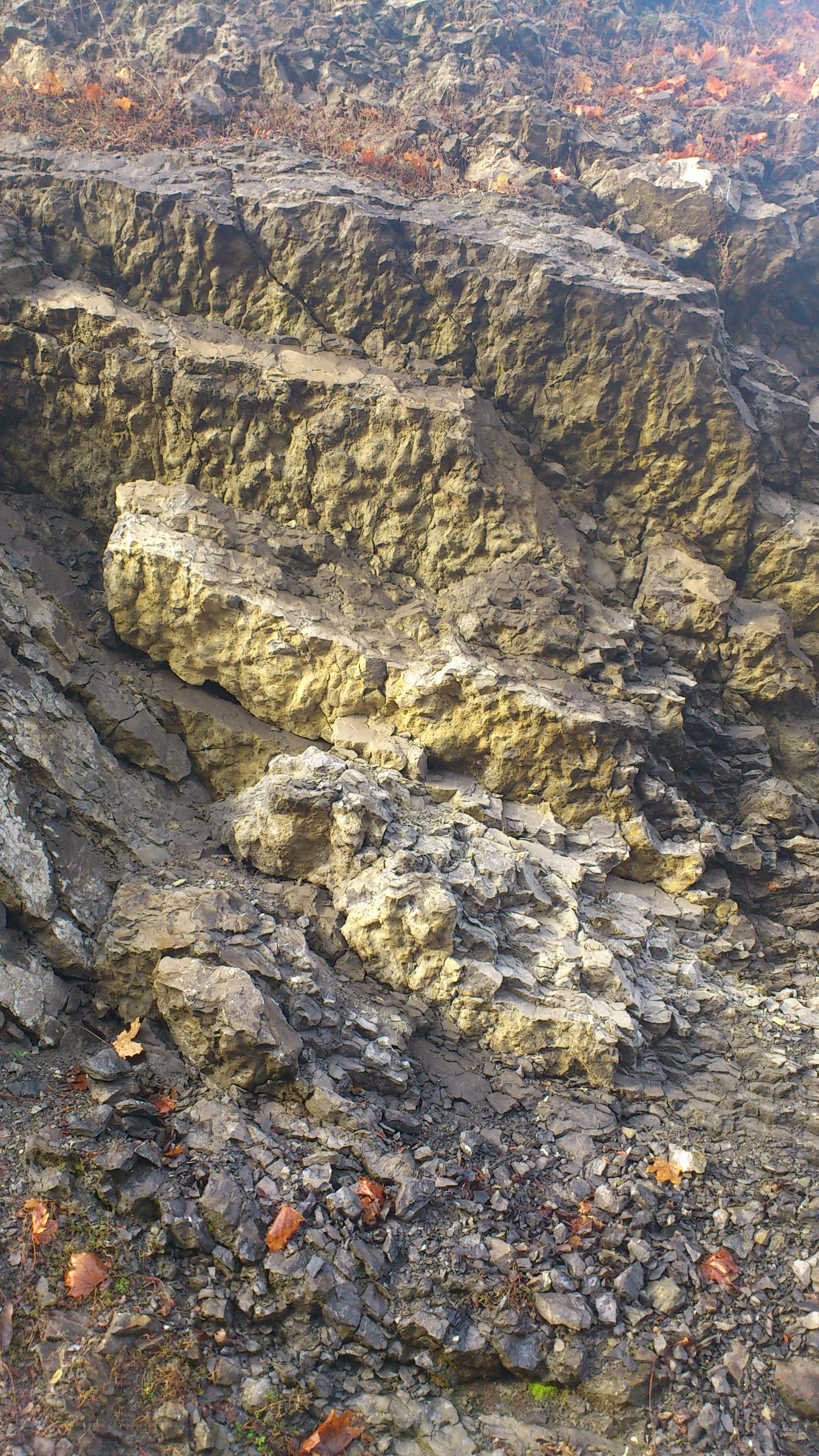
A close-up view of a rugged, textured limestone rock face showing layered geological strata and loose rocky debris at the base, with a few scattered fallen leaves.
Exposed limestone rock formations characteristic of the geological profile in Prokop Valley.

Prokopské údolí Nature Reserve wildlife and species highlights

Faunal diversity in Prokopské údolí is exceptionally high for an urban reserve. Despite being surrounded by housing estates, the valley supports significant populations of invertebrates, amphibians, reptiles, breeding birds, and mammals.

The reserve is a nationally important locality for mollusks, including Granaria frumentum, Pupilla triplicata, Chondrina avenacea, Vertigo pygmaea, and Tandonia rustica, which act as sensitive bioindicators of habitat quality. The spider fauna, with 131 recorded species, includes the rare Eresus kollari, Atypus muralis, and several jumping spiders; beetles include Apion austriacum, the rare steppe ground beetle Callistus lunatus, the stag beetle Lucanus cervus, and the jewel beetle Anthaxia candens. Butterflies of conservation interest include the locally endemic Czech clearwing moth Pennisetia bohemika, the rare Meleageria daphnis, and Episema glaucina.

Amphibians are limited but include Rana temporaria, Pelophylax ridibundus, Bufo bufo, and the declining Bufo viridis, while reptiles are represented by Lacerta agilis, Anguis fragilis, and probably Natrix natrix. The bird list for the broader Prokopské and Dalejské údolí natural park includes 62 regularly breeding species and roughly 11 occasional breeders, among them Anas platyrhynchos along the stream, Dryocopus martius, Picus viridis, Picus canus, Dendrocopos medius, Strix aluco, Asio otus, and a nesting pair of eagle owls (Bubo bubo) in the Prokopský lom, whose presence has displaced former jackdaw and kestrel breeding sites. Mammals include hedgehogs (Erinaceus europaeus and E. concolor), badger (Meles meles), stoat (Mustela mystacina), several bat species including Myotis mystacinus and Plecotus austriacus, and the widespread red squirrel (Sciurus vulgaris).
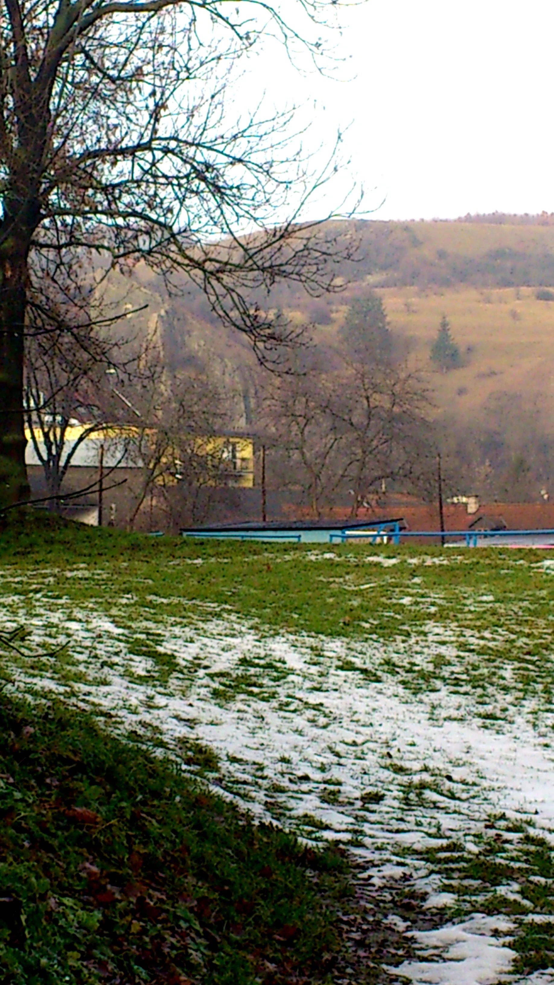
A partial view of a valley edge in winter, showing a snow-dusted grassy foreground with a large tree trunk on the left, looking toward distant hills and urban buildings.
A winter view overlooking the edge of Prokopské údolí nature reserve.

Prokopské údolí Nature Reserve conservation status and protection priorities

The primary aims of conservation in Prokopské údolí are the protection of internationally important geological stratotypes, paleontological sites, the karst and volcanic exposures of Hemrovy skály, and the characteristic thermophilic plant and animal communities, together with the broader landscape character of the valley. The reserve is a critical refugium for relict and steppe species within a heavily urbanized matrix, and its rock-steppe and oak–hornbeam communities are designated features of conservation interest.

Conservation management focuses on maintaining open habitats: controlled goat grazing has been reintroduced with financial support from the City of Prague, formerly extinct here since the 20th century, to preserve valuable xerothermic communities. Removal of non-native woody species (black locust, black pine, red oak, spruce) and reforestation with native oak, dřín, and hazel are planned to reduce shading of light-demanding species and to restore natural forest composition on former agricultural land.

The reserve nonetheless faces heavy pressures. It is encircled by dense residential development (Barrandov, Klukovice, Jinonice, Hlubočepy, Nové Butovice, Velká Ohrada), crossed by two active railway lines, and exposed to contamination from traffic, urban runoff, illegal burning, off-leash dogs, stray cats, littering, and recreational use. Pollution has measurably reduced populations of formerly common steppe snails and degraded the Prokopský potok stream, where only the most resistant organisms survive. The current forestry plan has been criticized for failing to ensure adequate species-appropriate regeneration. The most effective de facto protection today comes from a guarded military facility within the Prokopský lom, whose restricted access shields the area from the most damaging forms of disturbance.

Prokopské údolí Nature Reserve cultural meaning and human context

Prokopské údolí takes its name from Saint Prokop (Sv. Prokop), a hermit associated in local legend with the Prokopská jeskyně cave. According to tradition, the saint wrestled with the Devil here and drove him through the cave ceiling, an episode commemorated by a rock hollow called Čertova síň (the Devil's Hall). A pilgrimage church dedicated to Saint Prokop once stood in the valley; it was demolished in the post-war period when the military took control of the area.

The valley has also been a favored film location. The 1999 film Pelíšky (known in English as 'Cozy Dens') was shot around the Prokopské jezírko pond, and the summit of Děvín was featured in the 2007 film Všechno nejlepší! and on the cover of a Czech music album. The valley has long inspired Czech naturalists and historians, with archival research by Pavel Fabini reconstructing 16th and 17th-century land disputes, and modern publications by Jan Němec and by Zdeněk Eberl and Vladimír Petrovský documenting its history and natural values.

Top sights and standout views in Prokopské údolí Nature Reserve

Prokopské údolí is distinguished by its dual identity as a globally important Paleozoic fossil site and as a thriving urban-edge nature reserve. Its Silurian and Devonian limestones host internationally referenced stratotypes and some of the most historic trilobite and cephalopod localities in Europe; its abandoned quarries have exposed wall faces that continue to yield scientifically valuable fossils. The reserve's botanical richness is equally notable: roughly 600 vascular plant species, dozens of which are nationally protected, grow in a tiny area of just over 170 hectares, alongside relict thermophilic woodland and rare post-glacial steppe vegetation.

The valley's dramatic limestone cliffs, cave systems (including the Prokopská jeskyně and Korálové jeskyně), and the dark volcanic rocks of Hemrovy skály create a visually striking landscape, reinforced by the presence of breeding eagle owls and rare invertebrates. Prokopské údolí also stands as a landmark case study of nature conservation within a major European metropolis, demonstrating how a scientifically priceless landscape can remain protected despite being encircled by dense housing, railways, roads, and military infrastructure.

Best time to visit Prokopské údolí Nature Reserve

Spring and early summer are particularly rewarding in Prokopské údolí: xerothermic grasslands and rock steppes come into flower, supporting diverse communities of butterflies, beetles, and snails, while breeding birds (including eagle owls, woodpeckers, and typical passerine species) are active and acoustically prominent. Light rainfall in spring favors the visibility of fossils in freshly weathered limestone exposures, and cooler temperatures make the steep valley slopes comfortable to explore.

Autumn brings quieter conditions and clearer views across the valley as foliage thins, with warm-toned beech and oak foliage contrasting against pale limestone cliffs and dark basalt. Winter visits are possible but offer less biological activity, though the structurally exposed rocks of abandoned quarries, caves, and Hemrovy skály remain visible year-round. Because the reserve sits within the urban fabric of Prague, all seasons are accessible on foot via the green-marked trail 3063 and yellow trail 6079, but visitors should remain on marked paths to avoid damaging fragile steppe communities and disturbing wildlife.


Monthly climate preview

Long-term representative point measurements tracking monthly temperature ranges and precipitation rhythms

Prokopské údolí Climate Normals, Annual Temperature and Precipitation Patterns

Prokopské údolí records measured long-term averages spanning sub-zero winter minimums and warm summer maximums alongside consistent monthly precipitation. Detailed twelve-month climate normals provide complete statistical depth for analyzing the local meteorological baseline.
Annual mean9 °C
-2 °C20 °C
Jan-2°
Feb-1°
Mar
Apr
May13°
Jun17°
Jul20°
Aug19°
Sep14°
Oct
Nov
Dec-1°
Warmest month
July

19.7 °C

Coolest month
January

-2.2 °C

Wettest month
June

2.6 mm/day

Driest month
February

1.1 mm/day

Park location guide

Geography guide, regional context, and park location map for Prokopské údolí Nature Reserve

Prokopské údolí Nature Reserve park geography, regions, and map view in Czechia

Understand where Prokopské údolí Nature Reserve sits in Czechia through a broader geographic reading of the surrounding landscape, nearby location context, and its mapped position within the national park landscape.

How Prokopské údolí Nature Reserve fits into Czechia

Czech Republic is a landlocked Central European country with a population of approximately 10.9 million people. The nation was established as an independent state on January 1, 1993, following the dissolution of Czechoslovakia. Its capital and largest city is Prague, with other major urban centers including Brno, Ostrava, Plzeň, and Liberec.

Wider geography shaping Prokopské údolí Nature Reserve in Czechia

The Czech Republic is a landlocked country in Central Europe. It is bordered by Germany to the west, Austria to the south, Poland to the northeast, and Slovakia to the southeast. The landscape is predominantly hilly, with the territory covering 78,871 square kilometers.

Map view of Prokopské údolí Nature Reserve

Use this park location map to pinpoint Prokopské údolí Nature Reserve in Czechia, understand its exact geographic position, and read its mapped placement within the surrounding landscape more clearly.

Pigeon | © OpenStreetMap contributors

Location context for Prokopské údolí Nature Reserve

Praha 5
Recorded earthquake history

Examine the Historical Earthquake Catalog for Prokopské údolí

Review the documented history of seismic events associated with the geography of Prokopské údolí. This collection provides clear access to event dates, magnitudes, and epicentral distances, enabling a focused look at seismic activity near the valley through the MoriAtlas data framework.

Prokopské údolí Earthquake History

Catalogued events

2 events

Strongest magnitude

Magnitude 3.2

Most recent event

Jun 15, 2000

This history includes earthquakes recorded inside the park or within 50 km of its borders

Explore detailed imagery of limestone cliffs, fossil-rich outcrops, and rare rock-steppe habitats.

Prokopské údolí Photos and Landscape Scenery: Visualizing the Protected Limestone Valley

Visual records capture the dramatic terrain and rare ecological habitats of Prokopské údolí across its deeply incised limestone canyons and volcanic basalt formations. Examining these protected landscapes reveals the unique geological character and urban-edge environment preserved within the reserve.

A park scene in autumn featuring a grassy area, a wooden bench, mature trees with yellow leaves, and a rocky cliff face in the background.

Panoramic view of the rolling green hills and rocky terrain of Prokopské údolí valley in Prague, with a residential housing estate visible on the distant ridge.

A wide shot of a stone arch railway viaduct spanning a wooded valley in the Prokop Valley, with suburban housing visible on the hillside above.

A close-up view of a rugged, textured limestone rock face showing layered geological strata and loose rocky debris at the base, with a few scattered fallen leaves.

A partial view of a valley edge in winter, showing a snow-dusted grassy foreground with a large tree trunk on the left, looking toward distant hills and urban buildings.

Park atlas

Discover related limestone valleys and regional protected landscapes

Parks Near Prokopské údolí and Surrounding Protected Area Comparison

Browsing other protected areas near Prokopské údolí reveals broader geological patterns across the surrounding regional terrain. Comparing adjacent limestone formations and urban nature reserves provides valuable context for understanding Central European conservation landscapes.
Natural monumentPrague
About 1.7 km away#1 closest

North

Vidoule Natural Monument: Geological Profile and Protected Landscape Context in Prague

A table mountain remnant with exposed Cretaceous sandstone formations.

Vidoule stands as a significant natural monument in western Prague, defined by its flat-topped table mountain geometry and horizontal Cretaceous strata. The site offers a unique perspective on the regional geology of the Prague Plateau, where protected slopes guard rare dry grassland habitats and fossil-rich layers against a backdrop of dense urban development.

Area
0.087 km²
Established
1988
IUCN
III
Relief
Upland
Natural monumentPrague
About 3.4 km away#2 closest

Southwest

Zmrzlík Natural Monument: Geological Profile and Protected Landscape Map of Prague

Silurian stratotype sites and calcareous grassland ecosystems

Zmrzlík is a protected natural monument in Prague, defined by its rich Silurian geological sequences and fossil-bearing limestone deposits. The site offers a clear view into the Kopanina Formation, featuring distinct basaltic volcanic remains and rare xerothermic vegetation. This map-based resource details the terrain and ecological mosaic of the area, ranging from rocky ridges to the valleys of the Mlýnský potok.

Area
0.164 km²
Established
1988
IUCN
IV
Relief
Upland
A horizontal watercolor illustration of gentle, rolling green hills under a pale sky, with clusters of stylized trees in the foreground and faded distant mountains in the background.
Natural monumentPrague
About 4.9 km away#3 closest

South

Radotínské skály Natural Monument: Geological Mapping and Protected Landscapes in Prague

Geological profiles and steppe biodiversity near the capital.

Radotínské skály stands as a key protected area in Prague, showcasing an internationally significant stratigraphic record of the Prague Basin. From exposed rock walls to warm-loving forest-steppe communities, the site offers a detailed look at how geological heritage persists alongside urban development, making it an essential destination for those exploring the regional geography of the Czech Republic.

Area
0.277 km²
Established
1988
IUCN
III
Relief
Upland
Nature reservePrague
About 5.1 km away#4 closest

Southeast

V hrobech Nature Reserve: A Protected Botanical Island within the Urban Landscape of Prague

Rare dry-grassland habitats in the Kamýk district

V hrobech is a designated nature reserve in Prague featuring 1.3 hectares of southeast-facing slopes and species-rich grassland. This site is home to rare thermophilic plants and represents an important example of intensive conservation management in an urban environment. Its protected boundaries connect with local forest fragments to maintain ecological value amidst the residential developments of Lhotka and Libuš.

Area
0.013 km²
Established
1988
IUCN
IV
Relief
Lowland
Natural monumentPrague
6.9 km away#5 closest

North

Vizerka Natural Monument: Mapped Protected Landscapes and Rocky Terrain in Prague

A rare xerothermic steppe refuge on the edge of the Šárka Valley

Vizerka represents a compact yet significant natural monument located on the rocky slopes of the Šárecké údolí in Prague. Featuring exposed Proterozoic shale and shallow soils, this protected site serves as a vital island of thermophilic grasslands and shrubby terrain. It offers a fascinating look at relict warm-loving habitats and rare species survival within the dense geographical context of a European capital city.

Area
0.031 km²
Established
1988
IUCN
IV
Relief
Upland
A horizontal watercolor illustration showing a soft, dreamy landscape with rolling green hills, light purple and yellow tones, a winding path or stream, and a lone bare tree in the foreground.
Protected landscapePraha
About 7.1 km away#6 closest

North

Přírodní park Šárka-Lysolaje: Protected Landscape Mapping and Geographic Identity in Praha

A dense mosaic of stream valleys and protected natural monuments near the heart of Praha

Examine the detailed geography of Přírodní park Šárka-Lysolaje, an extensive protected landscape in Praha that functions as a critical green corridor. Its terrain, defined by deeply incised stream valleys and steep forested slopes, hosts a unique concentration of smaller nature reserves and monuments, creating a coherent ecological framework directly adjacent to the urban metropolitan environment.

Area
10.05 km²
Established
1990
Climate
Temperate
Scope
Terrestrial
A soft watercolor painting of a green landscape featuring a small body of water, rolling hills, and trees, painted in a minimalist style on a white background.
Protected landscapePrague
About 7.3 km away#7 closest

East

Hostivař-Záběhlice Nature Park: Protected Landscape and Mapped Prague Geography

River valleys and reservoir terrain within the capital city.

Hostivař-Záběhlice Nature Park represents a vital natural zone in Prague, characterized by the mature forests and meandering river paths along the Botič stream. This record highlights the park's geographic composition, including its reservoirs, lowland forest patches, and its function as a preserved natural corridor within the city.

Area
4.23 km²
Established
1990
Relief
Lowland
Climate
Temperate
Natural monumentPrague
About 8.6 km away#8 closest

Northeast

Velká skála Natural Monument: Geological Protected Area within the Prague Plateau

A landmark siliceous rock outcrop in the Troja district

Velká skála offers a concentrated look at the geological heritage of central Bohemia. As a designated natural monument, the site protects a rare siliceous rock outcrop that contrasts with the rolling terrain of the surrounding Prague Plateau, serving as a vital reference for regional geomorphology.

Area
0.018 km²
Established
1968
IUCN
III
Relief
Upland

Common questions about visiting, size, designation, and location context for Prokopské údolí Nature Reserve

Prokopské údolí Nature Reserve FAQs for park facts, access, geography, and protected area context

Find quick answers about Prokopské údolí Nature Reserve, including protected-area facts, park geography, trail and visitor context, and how the park fits into its surrounding country and regional landscape.
MoriAtlas Explorer

Continue Your Protected Areas Search Across the Global Atlas

Deepen your exploration by continuing the structured search for national parks and protected areas worldwide. Utilize the comprehensive filtering capabilities to compare different conservation landscapes and refine your understanding of global park geography. Discover more about the distribution and characteristics of protected natural areas.

Global natural geography