

Mori Atlas logo
State or regional parkProphet River Hot Springs Provincial Park

Explore the mapped boundaries and remote montane geography of this rugged backcountry destination in northern British Columbia.

Prophet River Hot Springs Provincial Park: A Geothermal Protected Landscape in the Muskwa Ranges

Prophet River Hot Springs Provincial Park serves as a critical protected area within the Muskwa-Kechika Management Area of northeastern British Columbia. Defined by its rare natural hot mineral springs and distinct tufa mound formations, the park offers a deep look into remote northern montane ecosystems. This atlas record provides context on the rugged terrain, surrounding river corridors, and undisturbed subalpine landscapes found deep within the Rocky Mountain foothills.

hot springstufa moundgeothermal featurebackcountry wildernessMuskwa RangesBritish Columbia

Prophet River Hot Springs Provincial Park

State or regional park

Park overview

Structured park overview, official facts, and landscape profile for Prophet River Hot Springs Provincial Park

Prophet River Hot Springs Provincial Park park facts, protected area profile, and essential visitor context

Review the core facts for Prophet River Hot Springs Provincial Park, including designation, size, terrain, visitor scale, habitats, and operating context in one park-focused overview.

About Prophet River Hot Springs Provincial Park

Prophet River Hot Springs Provincial Park is a small, deliberately remote provincial park in northeastern British Columbia, tucked into the Muskwa Ranges along the upper Prophet River. Although tiny compared to surrounding wilderness, it is a meaningful component of the broader Muskwa-Kechika Management Area, a vast region often described as one of the last great unroaded expanses in North America. Within this enormous landscape, the park serves as a focused protected node, anchored around a single extraordinary natural feature: a hot mineral spring that has built a tufa mound over time.

The park's identity is shaped by its inaccessibility. There is no road access, and reaching it requires either a long hike or a horseback ride through the surrounding wilderness. This character reinforces the Muskwa-Kechika ethos of low-impact, low-infrastructure conservation, where the land is preserved largely as it has existed for centuries. A trail links the park with neighboring Redfern-Keily Provincial Park, allowing backcountry travelers to combine visits and move deeper into the same ecological zone.

Geologically, the hot mineral spring is the park's signature feature. The spring emerges from the subsurface, carrying dissolved minerals that precipitate as tufa, a porous calcium-carbonite-rich rock, gradually accumulating into a mound. While tufa formations are more commonly associated with other settings, here they occur within a cold northern mountain environment, creating a distinctive and somewhat unexpected feature in the landscape.

Ecologically and culturally, the park sits within terrain traditionally used by Treaty 8 First Nations peoples. An archaeological site within the park boundaries reflects a long human relationship with this land, adding cultural depth to a place defined primarily by natural values. Together, the springs, the surrounding Muskwa Ranges terrain, and the deep human history make the park a small but unusually rich piece of British Columbia's protected-area network.

Quick facts and research context for Prophet River Hot Springs Provincial Park

Prophet River Hot Springs Provincial Park is a small BC Parks provincial park of roughly 1.84 square kilometers in northeastern British Columbia, near Fort St. John. It sits in the Muskwa Ranges, on the Prophet River, and lies within the broader Muskwa-Kechika Management Area, one of the largest intact wilderness regions in North America.

The park was established in 1999 and is classified as IUCN Category II, equivalent to a national park designation in terms of protection status. Its core attraction is a hot mineral spring that has built a tufa mound. There are no developed facilities inside the park, and access is restricted to hikers and horseback riders, with an established trail continuing on to Redfern-Keily Provincial Park.

Protection and recognition

Examine terrestrial protection status and designation records for Prophet River Hot Springs Provincial Park

Prophet River Hot Springs Provincial Park Protection Status and Records

Prophet River Hot Springs Provincial Park maintains a documented terrestrial protection status within its regional conservation landscape. Official records compile available management scope and designation details for systematic park atlas research.

Protection details

Protection scope
Terrestrial
Transboundary protection
No
Park context

Deeper park guide and search-rich context for Prophet River Hot Springs Provincial Park

Prophet River Hot Springs Provincial Park history, landscape, wildlife, and travel context

Explore Prophet River Hot Springs Provincial Park through its history, landscape character, ecosystems, wildlife, conservation priorities, cultural context, and seasonal travel timing in a structured park guide built for atlas discovery and search intent.

Why Prophet River Hot Springs Provincial Park stands out

Prophet River Hot Springs Provincial Park is best known for its natural hot mineral spring and the tufa mound it has created, set against a backdrop of Muskwa Ranges wilderness. The combination of geothermal activity and remote northern montane environment is uncommon in the region and is the core natural feature for which the park is remembered. The park is also recognized as a flagship example of British Columbia's backcountry-only protected areas. Its lack of road access, primitive camping, and location within the Muskwa-Kechika Management Area place it firmly within the category of wilderness parks where natural processes dominate and human presence is minimal.

Prophet River Hot Springs Provincial Park history and protected-area timeline

Prophet River Hot Springs Provincial Park was formally established on June 28, 1999, under the management of BC Parks. Its creation added a small but strategic parcel of land to the already extensive Muskwa-Kechika Management Area, expanding the protected footprint around the Prophet River hot springs and reinforcing the regional commitment to low-impact wilderness conservation.

The land within and around the park has a much longer human history, however. The area falls within territory traditionally used by Treaty 8 First Nations peoples, whose presence in this part of northeastern British Columbia extends far beyond the era of park designation. An archaeological site located within the park boundaries provides tangible evidence of this longstanding relationship between Indigenous communities and the land, indicating that the springs and the surrounding river valley have been visited and utilized over many generations.

The late-twentieth-century establishment of the park reflects a broader British Columbian and Canadian trend of formally protecting outstanding natural features such as hot springs, tufa formations, and wilderness corridors, especially in regions where industrial resource development pressures were increasing. The park's creation also contributed to a growing network of small, special-purpose protected areas embedded within large-scale management areas such as Muskwa-Kechika, where most of the land remains multiple-use but key natural and cultural sites are given long-term protection.

Prophet River Hot Springs Provincial Park landscape and geographic character

The park lies within the Muskwa Ranges, a northern extension of the Rocky Mountain system characterized by rugged ridges, forested valleys, and relatively undisturbed subalpine terrain. Elevation in the area rises significantly above the surrounding Peace River region, giving the park a cooler, more alpine-influenced climate than the lowlands to the east. The Prophet River, which gives the park its name, runs through this mountainous country, carving a corridor that has long served as both a travel route and a focus of wildlife activity.

The dominant physical feature inside the park itself is the tufa mound and its associated hot spring. Tufa forms when mineral-rich spring water emerges, cools, and deposits dissolved calcium carbonate, building up over many years into characteristic pale, porous mounds or terraces. In most of the world, tufa deposits are associated with calcareous regions or volcanic settings, and their appearance in this remote northern montane landscape gives the park a distinctive geological signature.

Around the springs, the surrounding terrain consists of boreal-style forest and open subalpine slopes typical of the Muskwa Ranges. Ridges and valley walls frame the river, while the springs themselves create a small microhabitat where warmth and mineral-rich water alter the local ground conditions. Although the park is small in area, its landscape combines river, mountain, forest, and geothermal components in a compact package that feels much larger than its measured size.

Prophet River Hot Springs Provincial Park ecosystems, habitats, and plant life

Ecologically, Prophet River Hot Springs Provincial Park sits within the broader Muskwa-Kechika Management Area, one of the most ecologically significant wilderness regions in North America. The surrounding landscape is dominated by boreal forest and subalpine ecosystems, with characteristic northern conifers such as spruce and pine dominating the slopes, interspersed with muskeg, meadow openings, and riparian zones along the Prophet River.

The hot springs themselves create a small but ecologically interesting microhabitat. Elevated ground temperatures and mineral-rich substrate conditions at and around the tufa mound can support distinctive vegetation patterns and micro-organism communities compared with the surrounding forest, contributing to habitat diversity within the park and creating a small ecological focal point within an otherwise boreal matrix.

The park's isolation and absence of road access play a major ecological role. With no vehicular penetration and limited human traffic, the area retains a high degree of ecological integrity, functioning as an undisturbed refuge within the much larger Muskwa-Kechika landscape. Wildlife movement corridors along the Prophet River and adjacent ridge systems remain largely intact, supporting the broader regional goal of sustaining wilderness ecological processes at a meaningful scale.

Prophet River Hot Springs Provincial Park wildlife and species highlights

Wildlife in Prophet River Hot Springs Provincial Park reflects the broader fauna of the Muskwa Ranges and surrounding Muskwa-Kechika region. The Prophet River corridor and adjacent forested slopes provide habitat typical of northern boreal and subalpine ecosystems, including ungulates such as moose, elk, and woodland caribou, as well as predators such as wolves and black bears. Grizzly bears are also present in the broader Muskwa-Kechika landscape.

The river and its surroundings support fur-bearing mammals such as beaver, marten, and other boreal species, while the forests and meadows support small mammals, ground-nesting birds, and typical northern woodland birdlife. The region as a whole is significant for large predator-prey systems that have been disrupted or lost across much of North America, and the park's location within the Muskwa-Kechika Management Area contributes, in a small way, to the persistence of these ecological relationships.

The hot spring area itself may also attract wildlife. Warm groundwater, mineral-rich soils, and the unique microclimate around the tufa mound can draw in animals seeking thermoregulation or salt and mineral sources, adding a subtle but characteristic dynamic to wildlife presence near the spring. Visitors traveling the trail to or from Redfern-Keily Provincial Park often encounter tracks and signs of larger mammals in the river valley.

Prophet River Hot Springs Provincial Park conservation status and protection priorities

Prophet River Hot Springs Provincial Park represents an important but focused conservation contribution within the much larger Muskwa-Kechika Management Area, one of the largest and most ecologically intact management areas in North America. Although the park itself is small, its protected status helps anchor conservation values around a specific natural feature, the hot mineral spring and tufa mound, that would otherwise be vulnerable within a broader multiple-use landscape.

The park's classification as IUCN Category II, equivalent to national park status in terms of protection level, underscores the strength of its conservation designation. BC Parks' management approach emphasizes preserving the hot springs, surrounding Muskwa Ranges terrain, and associated ecological systems in as natural a state as possible, while limiting infrastructure and access to non-motorized travel.

The park also contributes to cultural and archaeological conservation. By protecting land traditionally used by Treaty 8 First Nations peoples and preserving an archaeological site within its boundaries, the park serves not only an ecological role but also a heritage role, indicating that conservation in this part of British Columbia extends beyond wildlife and geology to include long-standing human connections to the land.

Prophet River Hot Springs Provincial Park cultural meaning and human context

Prophet River Hot Springs Provincial Park lies within territory traditionally used by Treaty 8 First Nations peoples, a fact that gives the park a meaningful cultural dimension beyond its purely natural values. The Prophet River valley and surrounding Muskwa Ranges have supported Indigenous use for generations, likely drawn by the river corridor itself, the wildlife it sustained, and the geothermal activity at the springs, which would have provided warm-water resources in a cold northern climate.

The presence of an archaeological site within the park boundaries reflects this longstanding relationship and is recognized as a protected component of the park's heritage value. Together with the broader history of Treaty 8, which covers a vast portion of northeastern British Columbia and adjacent regions, the park forms a small but tangible part of an ongoing Indigenous presence in the area.

For contemporary park visitors, this cultural context adds depth to the experience of reaching the springs. The hot mineral spring and tufa mound are not only geological curiosities but also features embedded in a long human history, where Indigenous peoples have utilized the land and the waters for countless generations before the park was formally established.

Recognition of this cultural layer is increasingly part of how protected areas in British Columbia are understood and managed, situating parks like Prophet River Hot Springs within both ecological and human narratives rather than treating wilderness as a purely natural concept.

Top sights and standout views in Prophet River Hot Springs Provincial Park

The defining highlight of Prophet River Hot Springs Provincial Park is the natural hot mineral spring and the tufa mound it has formed, a distinctive geological feature nestled within the rugged Muskwa Ranges of northeastern British Columbia. The contrast between cold northern montane terrain and warm, mineral-rich emerging water gives the site an unexpected and memorable character.

Equally compelling is the park's status as a true backcountry destination. With no road access and only hiking or horseback riding as means of entry, the park offers a rare sense of isolation and wilderness immersion, especially given its location within the enormous Muskwa-Kechika Management Area. A trail linking the park to Redfern-Keily Provincial Park further enhances its appeal for multi-day backcountry travelers.

Finally, the park's cultural depth, anchored by Treaty 8 First Nations traditional use and an archaeological site within its boundaries, adds a heritage dimension that elevates it beyond a simple natural attraction. The combination of geothermal landscape, wilderness character, and cultural history makes this small park a richly layered destination.

Best time to visit Prophet River Hot Springs Provincial Park

Prophet River Hot Springs Provincial Park is a backcountry destination in the Muskwa Ranges, so the character of a visit shifts significantly with the seasons. Summer and early autumn are generally the most practical windows for hiking or horseback access, when the ground is free of heavy snow, trail conditions are more favorable, and the boreal and subalpine landscapes are at their most accessible.

Visiting in warmer months also allows travelers to better appreciate the contrast between the surrounding cool northern terrain and the warmth of the mineral spring at the park's heart. Wildlife is often more active and visible along the Prophet River corridor during this period, and long daylight hours extend the useful window for travel between the park and Redfern-Keily Provincial Park.

Winter conditions in the Muskwa Ranges are harsh by any measure, with deep snow, cold temperatures, and limited trail visibility making the park extremely difficult and generally inadvisable to visit outside of the summer season. Anyone planning a trip should treat the park as a seasonal wilderness destination rather than a year-round attraction.
Monthly climate preview

Long-term representative temperature and precipitation patterns across the year

Prophet River Hot Springs Provincial Park Climate Normals and Weather by Month

Representative coordinate records show average temperatures ranging from deep winter lows to positive summer maximums alongside varying monthly precipitation rates. Detailed long-term climate normals offer a complete month-by-month examination of temperature and precipitation rhythms across the protected area.
Annual mean-4 °C
-15 °C10 °C
Jan-15°
Feb-14°
Mar-12°
Apr-5°
May
Jun
Jul10°
Aug
Sep
Oct-4°
Nov-12°
Dec-15°
Warmest month
July

9.8 °C

Coolest month
January

-15.4 °C

Wettest month
June

4.7 mm/day

Driest month
February

1.1 mm/day

Park location guide

Geography guide, regional context, and park location map for Prophet River Hot Springs Provincial Park

Prophet River Hot Springs Provincial Park park geography, regions, and map view in Canada

Understand where Prophet River Hot Springs Provincial Park sits in Canada through a broader geographic reading of the surrounding landscape, nearby location context, and its mapped position within the national park landscape.

How Prophet River Hot Springs Provincial Park fits into Canada

Canada is a federal parliamentary constitutional monarchy spanning North America from the Atlantic to the Pacific and Arctic Oceans. With a population of over 41 million, it is officially bilingual in English and French at the federal level. The country gained independence from the United Kingdom through a gradual process culminating in 1982.

Wider geography shaping Prophet River Hot Springs Provincial Park in Canada

Canada occupies the northern portion of North America, sharing its longest international border with the United States. The country extends from the Atlantic Ocean to the Pacific Ocean and northward into the Arctic Ocean, giving it the longest coastline of any nation.

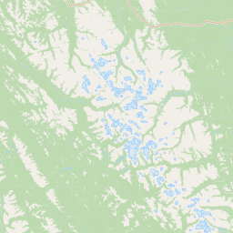
Map view of Prophet River Hot Springs Provincial Park

Use this park location map to pinpoint Prophet River Hot Springs Provincial Park in Canada, understand its exact geographic position, and read its mapped placement within the surrounding landscape more clearly.

Pigeon | © OpenStreetMap contributors

Location context for Prophet River Hot Springs Provincial Park

British Columbia
Park atlas

Compare connected northern wilderness areas and protected mountain landscapes

Other Parks Near Prophet River Hot Springs Provincial Park

Browsing other parks near Prophet River Hot Springs Provincial Park reveals a rugged network of remote subalpine terrain and protected river corridors. Comparing adjacent wilderness reserves provides deeper geographical context on the northern Rocky Mountain foothills.
State or regional parkBritish Columbia
About 12 km away#1 closest

South

Redfern-Keily Provincial Park: A Deep Dive into Muskwa Ranges Protected Geography

Remote Glacial Landscapes and Northern Wilderness Terrain

Redfern-Keily Provincial Park encompasses a significant stretch of remote wilderness in the Muskwa Ranges of northeastern British Columbia. Anchored by the eight-kilometer Redfern Lake and surrounding glaciers like the Ithaca and Achaean, the area serves as a primary example of intact boreal and subalpine geography. The terrain offers a rugged look at high-elevation ecosystems and glacial history within the Muskwa-Kechika Management Area.

Area
807.12 km²
Established
1999
IUCN
II
Relief
Mountain
State or regional parkBritish Columbia
About 35 km away#2 closest

West

Kwadacha Wilderness Provincial Park: Geographic Boundaries and Regional Protected Area Context

Untouched mountain wilderness in northern British Columbia

Kwadacha Wilderness Provincial Park provides a rare, roadless mountain experience within the northeastern interior of British Columbia. Characterized by high-relief alpine ridges, dense boreal forests, and challenging river systems, the park represents an essential wilderness corridor that remains free from human infrastructure and standard road access, prioritizing ecological integrity over recreation.

Area
1,302.79 km²
Established
1973
IUCN
Ib
Relief
Mountain
State or regional parkBritish Columbia
About 93 km away#3 closest

South

Graham-Laurier Provincial Park: Protected Boreal Landscape and Geographic Context

Remote wilderness exploration in the Peace River region

Graham-Laurier Provincial Park represents a massive, intact wilderness area in northeastern British Columbia. Defined by boreal forests, undulating ridges, and the cascading waters of Christina Falls, this region serves as a crucial natural refuge within the Muskwa-Kechika Management Area. Access is centered on rugged forest service roads and backcountry trails, making the area a primary destination for self-reliant exploration and terrain study.

Area
999.82 km²
Established
1999
IUCN
II
Relief
Mountain
State or regional parkBritish Columbia
About 95 km away#4 closest

Southeast

Pink Mountain Provincial Park: Regional Geography and Protected Alpine Landscapes

Muskwa Foothills terrain and scientific conservation history.

Situated in the eastern foothills of the Rocky Mountains, Pink Mountain Provincial Park is defined by its transition from forested valleys to high-altitude tundra. This protected area stands as a unique ecological corridor, preserving major Mesozoic fossil sites and providing a habitat for diverse northern wildlife species that thrive in the cold-adapted vegetation of the Muskwa Foothills.

Area
0.98 km²
Established
1999
IUCN
II
Relief
Mountain
State or regional parkBritish Columbia
About 130 km away#5 closest

West

Finlay-Russel Provincial Park and Protected Area: Mapping Northern British Columbia Wilderness

A remote river corridor in the Muskwa-Kechika Management Area.

Located in northern British Columbia, Finlay-Russel Provincial Park and Protected Area preserves an essential 85-kilometre river corridor along the Finlay River. This expansive wilderness territory serves as an integral part of the Muskwa-Kechika Management Area, showcasing deep boreal forest landscapes and rugged river valley terrain far from established road networks.

Area
1,092.05 km²
Established
2001
IUCN
II
Access
Remote access
State or regional parkBritish Columbia
About 158 km away#6 closest

Northwest

Dune Za Keyih Provincial Park and Protected Area: Watershed and Terrain Geography

Remote wilderness landscape in northern British Columbia

Dune Za Keyih Provincial Park and Protected Area protects the largest unlogged watershed in British Columbia. Situated within the Muskwa-Kechika Management Area, this remote wilderness is defined by the geological structures of the Rocky Mountain Trench, providing a continuous corridor of undisturbed mountain forest, riparian zones, and highland terrain.

Area
3,468.33 km²
Established
2001
IUCN
Ib
Relief
Mountain
State or regional parkBritish Columbia
About 180 km away#7 closest

North

Jackpine Remnant Provincial Park: Protected Boreal Landscape and Regional Map Context

Conservation and terrain data for the Fort Nelson region

Jackpine Remnant Provincial Park provides a critical study in northern conservation geography. Located in the Fort Nelson area of British Columbia, this 148-hectare site protects a rare stand of jack pine trees. Its mapped boundaries and boreal forest terrain offer a focused look at small-scale protected landscapes and their significance within the broader regional ecosystem of the Canadian north.

Area
1.48 km²
Established
2001
IUCN
II
Relief
Lowland
State or regional parkBritish Columbia
About 202 km away#8 closest

Northwest

Denetiah Provincial Park and Protected Area: Regional Geography and Wilderness Mapping

An undisturbed boreal reserve in the Stikine Region

Discover the geographic structure of Denetiah Provincial Park and Protected Area, a vast roadless landscape in northern British Columbia. This park protects pristine boreal forests, elongated glacial lake basins, and critical river headwaters that serve as a benchmark for northern conservation within the Muskwa-Kechika Management Area.

Area
1,053.49 km²
Established
1999
IUCN
II
Relief
Upland

Common questions about visiting, size, designation, and location context for Prophet River Hot Springs Provincial Park

Prophet River Hot Springs Provincial Park FAQs for park facts, access, geography, and protected area context

Find quick answers about Prophet River Hot Springs Provincial Park, including protected-area facts, park geography, trail and visitor context, and how the park fits into its surrounding country and regional landscape.
MoriAtlas Explorer

Continue Your Protected Areas Search Across the Global Atlas

Deepen your exploration by continuing the structured search for national parks and protected areas worldwide. Utilize the comprehensive filtering capabilities to compare different conservation landscapes and refine your understanding of global park geography. Discover more about the distribution and characteristics of protected natural areas.

Global natural geography