

Mori Atlas logo
Protected areaPrzełom Warty koło Mstowa

Examining the geological terrain, limestone outcrops, and riverine habitats along the Warta gorge corridor.

Przełom Warty koło Mstowa: A Significant Protected Landscape and River Gorge in Southern Poland

Przełom Warty koło Mstowa represents one of the largest erosional river breakthroughs within the Częstochowa Upland. This twelve kilometer protected area showcases a mosaic of limestone cliffs, riparian oxbow lakes, and oak hornbeam forests. Its formal status as a Natura 2000 site underscores its role as a vital ecological corridor within the broader Polish Jura, offering a distinct study of upland river geography and landscape evolution.

river gorgeWarta RiverCzęstochowa UplandPolish Juralimestone cliffsNatura 2000
A stylized flat illustration of a river gorge with a prominent limestone cliff, surrounding forest, and a winding path leading through a valley.

Przełom Warty koło Mstowa

Protected area

Park overview

Structured park overview, official facts, and landscape profile for Przełom Warty koło Mstowa

Przełom Warty koło Mstowa park facts, protected area profile, and essential visitor context

Review the core facts for Przełom Warty koło Mstowa, including designation, size, terrain, visitor scale, habitats, and operating context in one park-focused overview.

About Przełom Warty koło Mstowa

Przełom Warty koło Mstowa is a striking natural feature of the Polish Jura, where the Warta River has cut a long, narrow gorge through the limestone terrain of the Częstochowa Upland. Although the river today flows peacefully past villages and meadows, its course here follows an ancient epigenetic and overflow breakthrough formed during the Middle Polish glaciation, when waters of the proto-Warta spilled westward into the Włoszczowska Basin. This geological history created what is today considered one of the deepest and longest erosional incisions in the Kraków-Częstochowa Upland.

The landscape of the gorge is unusually varied for such a narrow corridor. Steep limestone cliffs and isolated rock outcrops rise directly above the river, while the valley floor supports a patchwork of meadows, forests, farmland, and inactive river channels known locally as starorzecza. The Brama Mirowska near Mirów marks the gateway into the gorge, defined by two limestone outliers, while further downstream near Mstów the Skała Miłości stands as one of the most photographed landmarks along the river. A small cave of approximately fifteen meters in length is also located near the Mirów nad Wartą rock.

Ecologically, the area is unusually rich. Its combination of dry limestone slopes, shaded forest patches, wet meadows, and the river channel itself creates habitats for a wide range of protected plant and animal species. The gorge's protected status reflects both its geological importance and its biodiversity value, while its position at the northern edge of the Orlich Gniazd Landscape Park places it within a larger conservation landscape of castles, cliffs, and forests that defines the Polish Jura.

Quick facts and research context for Przełom Warty koło Mstowa

Przełom Warty koło Mstowa is a river gorge of the Warta River located on the border between the Częstochowa Upland and the Wieluń Upland in the Silesian Voivodeship of southern Poland. The breakthrough extends approximately twelve kilometers from the Brama Warty gate near Mirów in Częstochowa to the area beneath Góra Wał near Mstów, within an elevation range of roughly 235 to 290 meters above sea level.

A portion of the site is formally protected under the European Natura 2000 network as the Przełom Warty koło Mstowa site, covering about 100.6 hectares across the territory of Częstochowa and Gmina Mstów. The gorge lies at the northern edge of the Orlich Gniazd Landscape Park and is recognized as one of the largest erosional incisions on the Kraków-Częstochowa Upland. Vegetation is dominated by meadows, including quaking-grass meadows, with lesser shares of woodland and agricultural land.

Protection and recognition

Documented terrestrial protection scope and international designation data

Przełom Warty koło Mstowa Protection Status and Natura 2000 Recognition

Przełom Warty koło Mstowa maintains structured protection status within a terrestrial conservation framework supported by Natura 2000 records. Verified designation sources establish official international recognition parameters for regional park analysis.

International recognition

Protection details

Protection scope
Terrestrial
Transboundary protection
No
Park context

Deeper park guide and search-rich context for Przełom Warty koło Mstowa

Przełom Warty koło Mstowa history, landscape, wildlife, and travel context

Explore Przełom Warty koło Mstowa through its history, landscape character, ecosystems, wildlife, conservation priorities, cultural context, and seasonal travel timing in a structured park guide built for atlas discovery and search intent.

Why Przełom Warty koło Mstowa stands out

Przełom Warty koło Mstowa is best known for being one of the largest erosional river breakthroughs on the entire Kraków-Częstochowa Upland and for its distinctive limestone rock formations lining the Warta River. Standout features include the Brama Mirowska gate formed by the Mirów nad Wartą (Balikowa Skała) rock and the Jaś i Małgosia rock near Mirów, as well as the prominent Skała Miłości above the river at Mstów. Together these cliffs and outcrops define the visual identity of the gorge. The site is equally valued for its mix of natural habitats within a relatively compact area: extensive meadows, including rare quaking-grass meadows, oak-hornbeam forest on the northern slope of Przeprośna Górka, riparian features such as oxbow lakes, and a range of protected plant and animal species. Its position at the edge of the Orlich Gniazd Landscape Park and its formal inclusion in the Natura 2000 network underline its significance as a protected landscape and ecological corridor in the Polish Jura.
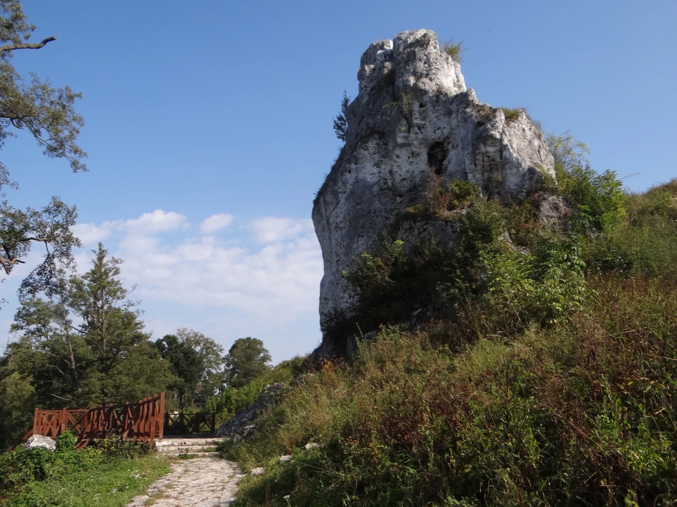
A large, jagged limestone rock formation rising above a grassy hill next to a stone path and a small wooden fence.
The Skala Milosci limestone rock formation in Mstow.

Przełom Warty koło Mstowa history and protected-area timeline

The gorge known today as Przełom Warty koło Mstowa was formed during the Middle Polish glaciation, when waters of the proto-Warta spilled across the upland and began incising the limestone plateau toward the Włoszczowska Basin. This dual process of epigenetic adjustment and overflow created the long, narrow breakthrough that defines the modern course of the river between Mirów and Mstów. The resulting erosional cut is now recognized as one of the largest such features on the Kraków-Częstochowa Upland.

In more recent times, the area has been recognized for its natural value through formal ecological protection. A portion of the gorge is designated as a Natura 2000 site under the name Przełom Warty koło Mstowa, covering about 100 hectares and spanning the territory of Częstochowa and Gmina Mstów. The gorge also marks the northern boundary of the Orlich Gniazd Landscape Park, integrating the site into a broader framework of regional landscape protection that has shaped public access and land management in the Polish Jura.

Przełom Warty koło Mstowa landscape and geographic character

The landscape of Przełom Warty koło Mstowa is defined by the contrast between the vertical limestone cliffs of the upland and the soft, low-lying river corridor of the Warta. The gorge stretches for about twelve kilometers from the Brama Warty, a narrow pass between the hills Sołek and Skałki on the outskirts of Częstochowa, down to the slopes beneath Góra Wał near Mstów. Within this corridor, the river descends gradually across an elevation band of roughly 235 to 290 meters above sea level.

Among the most prominent landforms are the limestone outliers that rise directly from the valley. Near Mirów, the Brama Mirowska pairs the approximately twenty-meter-high Mirów nad Wartą rock, also called Balikowa Skała, with the smaller, ten-meter Jaś i Małgosia rock, and includes a small cave in the vicinity. Downstream at Mstów, the fifteen-meter Skała Miłości stands above the river bank and has become one of the visual icons of the area. Beyond these cliffs, the valley opens intermittently into meadows, farmland, and patches of woodland, with abandoned river channels forming quiet, water-filled depressions characteristic of mature lowland rivers.

Przełom Warty koło Mstowa ecosystems, habitats, and plant life

The protected portion of Przełom Warty koło Mstowa reflects a remarkably concentrated mosaic of habitats along the Warta River. Meadows dominate the land cover, making up roughly seventy-one percent of the protected area, and include ecologically valuable quaking-grass meadows that are themselves a conservation priority in Central Europe. Forests account for about thirteen percent of the area, while agricultural land covers the remaining sixteen percent. The river itself shapes much of the ecological character of the site, with starorzecza, or oxbow lakes, providing still-water habitats along the valley floor.

A notable oak-hornbeam forest patch, known as a grad forest, covers about seven hectares on the northern slope of Przeprośna Górka and represents a more mature woodland community within an otherwise meadow-dominated landscape. The combination of dry limestone habitats, shaded forest, wet meadows, and the river itself supports a diverse flora, including the martagon lily, winter horsetail, large-flowered helleborine, broad-leaved helleborine, long-leaved birthwort, wild spikenard, and the eastern Carpathian vetchling, alongside aquatic plants such as yellow water-lily and curled pondweed.

Przełom Warty koło Mstowa wildlife and species highlights

The mosaic habitats of the gorge support a rich and varied fauna for its size. Wetland and meadow species benefit from the extensive quaking-grass meadows, oxbow lakes, and riparian zones of the Warta, while the cliff and forest habitats provide nesting and shelter for other groups. Among the bird species documented in the area are the bittern, marsh harrier, corncrake, and red-backed shrike, all of which depend on the open, structured landscape maintained along the river corridor.

The river and its associated wetlands also support notable mammal and amphibian life. The European beaver is present along the watercourse, taking advantage of the mature riparian vegetation and still waters of the oxbow channels, while the fire-bellied toad inhabits wetter parts of the valley. Together with the broader community of meadow, forest, and waterbirds, these species contribute to the conservation value of the Natura 2000 site and its importance for connectivity within the Polish Jura.

Przełom Warty koło Mstowa conservation status and protection priorities

Przełom Warty koło Mstowa is formally protected as a Natura 2000 site, recognizing its importance at the European scale for both its habitats and its species. The protected area, totaling roughly 100.6 hectares, covers portions of Częstochowa and Gmina Mstów and safeguards the combination of limestone cliffs, river habitats, oxbow lakes, meadows, and forest patches that together form one of the region's most ecologically valuable corridors. Its designation reflects the presence of habitat types such as quaking-grass meadows and oak-hornbeam forest, which are priorities for conservation under European nature policy.

Beyond the Natura 2000 designation, the gorge sits at the northern edge of the Orlich Gniazd Landscape Park, one of the most important protected landscape areas in southern Poland. This position extends the conservation value of the site into a broader network of protected cliffs, forests, and medieval castle ruins that define the Polish Jura. The integration of geological, botanical, and zoological values within a relatively compact area is a defining feature of the gorge's conservation significance.

Przełom Warty koło Mstowa cultural meaning and human context

While the gorge itself is primarily valued as a natural landscape, its surroundings carry a strong cultural heritage. The medieval monastery at Mstów, located near the downstream end of the breakthrough, is one of the most significant historical landmarks of the area and reflects centuries of religious and community life along the Warta Valley. On the slopes of Przeprośna Górka stands the Sanctuary of Saint Padre Pio, which has become a traditional stopping point for pilgrims walking toward Jasna Góra in Częstochowa, one of the most important pilgrimage destinations in Poland.

The presence of pilgrimage routes, hiking trails such as the Wieluń Jura Trail, and recreational areas around Góra Szwajcera and the Tasarki reservoir near Mstów shows how the natural landscape of the gorge is woven into regional traditions of walking, spiritual journey, and outdoor recreation. These cultural layers give the area a meaning that extends beyond its geological and ecological significance.

Top sights and standout views in Przełom Warty koło Mstowa

Przełom Warty koło Mstowa combines dramatic limestone scenery with a rich mosaic of protected habitats within a short river corridor. Its standout features include the Brama Mirowska gateway near Mirów, defined by the Mirów nad Wartą and Jaś i Małgosia rocks, and the iconic Skała Miłości above the river at Mstów. A small cave near the Mirów nad Wartą rock adds a further element of geological interest to the gorge.

Equally distinctive is the ecological richness compressed into the protected area: rare quaking-grass meadows, oak-hornbeam forest on Przeprośna Górka, oxbow lakes, and habitat for protected plants and animals such as the martagon lily, the European beaver, and the fire-bellied toad. The combination of Natura 2000 protection, integration with the Orlich Gniazd Landscape Park, and access through regional hiking trails and kayak routes makes the gorge a particularly well-rounded destination on the Polish Jura.

Best time to visit Przełom Warty koło Mstowa

The gorge of the Warta near Mstów is at its most visually expressive in late spring and early summer, when the extensive meadows are in full growth and the limestone cliffs catch warm light beside the river. Spring also brings active bird presence across the meadow and wetland habitats, while the river itself remains suitable for kayaking through the warmer months. Autumn adds a quieter atmosphere, with cooler conditions along the valley and changing colors in the oak-hornbeam forest and along the river banks. In winter, the bare slopes emphasize the geological structure of the cliffs, though visitors should be prepared for cold conditions in the exposed valley.

Monthly climate preview

Long-term monthly temperature averages and precipitation patterns for Poland

Przełom Warty koło Mstowa Climate Normals and Annual Temperature Rhythm

Representative coordinate records show average temperatures ranging from winter lows below freezing to summer maximums exceeding thirty degrees Celsius alongside stable daily precipitation rates. Examining the complete twelve-month climatology dataset reveals detailed baseline shifts across the entire annual cycle.
Annual mean9 °C
-3 °C20 °C
Jan-3°
Feb-2°
Mar
Apr
May14°
Jun18°
Jul20°
Aug20°
Sep15°
Oct
Nov
Dec-2°
Warmest month
July

20.2 °C

Coolest month
January

-3.3 °C

Wettest month
July

2.7 mm/day

Driest month
January

1.3 mm/day

Park location guide

Geography guide, regional context, and park location map for Przełom Warty koło Mstowa

Przełom Warty koło Mstowa park geography, regions, and map view in Poland

Understand where Przełom Warty koło Mstowa sits in Poland through a broader geographic reading of the surrounding landscape, nearby location context, and its mapped position within the national park landscape.

How Przełom Warty koło Mstowa fits into Poland

Poland, officially the Republic of Poland, is a Central European country spanning from the Baltic Sea in the north to the Carpathian Mountains in the south. It borders Germany, Czech Republic, Slovakia, Ukraine, Belarus, Lithuania, and Kaliningrad Oblast. The country has a temperate climate, diverse landscapes, and is known for its rich history, cultural heritage, and strong economic position within the EU.

Wider geography shaping Przełom Warty koło Mstowa in Poland

Poland occupies 312,696 km2 in Central Europe, extending from the Baltic Sea coast in the north to the Sudetes and Carpathian Mountains in the south. It borders Germany to the west, Czech Republic and Slovakia to the south, Ukraine and Belarus to the east, and Lithuania and Kaliningrad Oblast to the northeast. The landscape includes lowland plains, uplands, and mountain ranges.

Map view of Przełom Warty koło Mstowa

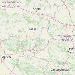
Use this park location map to pinpoint Przełom Warty koło Mstowa in Poland, understand its exact geographic position, and read its mapped placement within the surrounding landscape more clearly.

Pigeon | © OpenStreetMap contributors
Recorded earthquake history

Examine the Recorded Earthquake History of Przełom Warty koło Mstowa

Gain insight into the regional seismic profile of this protected river gorge through a curated collection of historical event data. Use these records to understand the distribution of activity near Przełom Warty koło Mstowa, as presented by MoriAtlas for those researching the geological context of the Częstochowa Upland.

Przełom Warty koło Mstowa Earthquake History

Catalogued events

140 events

Strongest magnitude

Magnitude 4.6

Most recent event

Nov 30, 2014

This history includes earthquakes recorded inside the park or within 50 km of its borders

Visual exploration of limestone cliffs, river gorges, and protected habitats

Przełom Warty koło Mstowa Photos and Landscape Scenery

Visual documentation captures the dramatic vertical limestone outcrops and low-lying river corridors defining Przełom Warty koło Mstowa. Detailed imagery illustrates the protected habitats, riparian oxbow lakes, and erosional terrain across the upland landscape.

A large, jagged limestone rock formation rising above a grassy hill next to a stone path and a small wooden fence.

A wide outdoor shot of a green grassy field with a dirt path winding through it towards a line of trees; a river bank is visible on the right under a blue, partly cloudy sky.

Park atlas

Compare adjacent limestone formations and regional river corridors across the upland

Parks Near Przełom Warty koło Mstowa and Related Protected Landscapes

Visitors exploring Przełom Warty koło Mstowa can compare nearby protected areas, river valleys, and upland limestone landscapes. Broadening the geographic scope reveals connected conservation networks and adjacent regional parks throughout the surrounding terrain.
A soft watercolor painting of a rolling landscape featuring light-colored limestone cliffs, green hills, and a winding path, rendered in pale pastel tones.
Nature reserveSilesian Voivodeship
0.4 km away#1 closest

South

Ostoja Olsztyńsko-Mirowska: A Detailed Map and Geographic Overview of the Protected Reserve

Karst limestone formations and diverse forest habitats in Silesian Voivodeship.

Ostoja Olsztyńsko-Mirowska stands as a centerpiece of the Częstochowa Upland, characterized by its dramatic mogotes, caves, and sheltered xerothermic grasslands. This atlas-focused entry details the area's topographic complexity, ranging from the wooded ridges of Sokole Góry to the historic limestone spurs housing medieval ruins. Uncover the ecological dynamics of this protected landscape where beech forest stands and rare cave systems form a critical regional biodiversity network.

Area
22.109 km²
Established
2008
Relief
Upland
Climate
Temperate
Nature reserveSilesian Voivodeship
About 15 km away#2 closest

East

Babski Las Nature Reserve: Regional Geography and Protected Forest Landscapes in Poland

Częstochowa Upland woodland and rare fir forest ecosystems

Babski Las Nature Reserve protects a distinct mosaic of forest types within the Silesian Voivodeship. From its rare fir stands to its moisture-dependent alder carrs, this reserve offers a deep look into the ecological diversity of the Częstochowa Upland, providing vital habitat for specialized amphibians, reptiles, and forest-dwelling birds.

Area
1.124 km²
Established
2025
Relief
Lowland
Climate
Temperate
Protected areaSilesian Voivodeship
16 km away#3 closest

Southeast

Ostoja Złotopotocka: Mapping the Protected Habitats and Limestone Geography of Silesian Voivodeship

Natura 2000 protected zone in southern Poland

Ostoja Złotopotocka encompasses a rich mosaic of natural habitats across the Częstochowa Upland. From the calcareous rock faces and deep karst caves to the expansive beechwood forests and inland sand dunes, this area serves as a primary site for ecological conservation. Use this resource to understand the complex terrain, boundary layout, and structural diversity that define this protected landscape within the Polish region.

Area
27.48 km²
Relief
Upland
Climate
Temperate
Access
Access unknown
A watercolor painting showing a soft landscape with green fields, a cluster of trees, and a small lookout tower against a plain white background.
Nature reserveŚląskie
About 22 km away#4 closest

West

Dębowa Góra Nature Reserve: Geographic Profile of an Urban-Adjacent Protected Forest

Preserving ancient mixed woodland in the Śląskie Voivodeship

Located in the town of Kłobuck, Dębowa Góra serves as a critical nature reserve shielding a fragmented but authentic relic of old-growth oak and hornbeam forest. The site occupies the elevated topography of the Wieluńska Upland, providing an important contrast to the surrounding industrial landscape through its ancient trees and protected understory vegetation.

Area
0.054 km²
Established
1953
Relief
Upland
Climate
Temperate
Nature reserveŁódź Voivodeship
About 25 km away#5 closest

Northeast

Rezerwat przyrody Bagno w Ewinie: Peatland Geography and Protected Landscape Context

Nature reserve in Łódź Voivodeship, Poland

Rezerwat przyrody Bagno w Ewinie preserves a compact but essential series of high bog and transitional mire ecosystems. Situated in the gently rolling hills of the Wzgórza Radomszczańskie, this nature reserve showcases specialized flora such as the royal fern and provides a clear look at the structural diversity of central Polish protected lands.

Area
0.208 km²
Established
2024
Relief
Lowland
Climate
Temperate
Watercolor painting of pale limestone rock formations with small cave openings and green vegetation on a soft, light background.
Nature reserveSilesian Voivodeship
25 km away#6 closest

Southeast

Ostoja Kroczycka Nature Reserve: Geological Formations and Protected Habitat Mapping

Karst limestone landscapes in the Częstochowa Upland

A core component of the Natura 2000 network, Ostoja Kroczycka concentrates four dramatic limestone ranges into a single conservation landscape. The area combines vertical rock towers, subterranean hibernacula for bats, and fragmented forest patches, serving as a primary site for understanding the geological and ecological mosaic of the Polish upland region.

Area
13.912 km²
Established
2011
Relief
Upland
Climate
Temperate
Nature reserveŁódzkie Voivodeship
About 34 km away#7 closest

East

Dębowiec Nature Reserve: Protected Forest Landscapes and Geography in Łódzkie Voivodeship

Deciduous woodland conservation and regional lowland forest terrain

Spanning over 200 hectares within the Niecka Włoszczowska region, Dębowiec Nature Reserve protects a diverse range of lowland oak-hornbeam and ash-elm riparian forest ecosystems. This important conservation site hosts approximately 355 recorded plant species, serving as a primary reference for the native deciduous woodland character of central Poland.

Area
2.059 km²
Established
1965
Relief
Lowland
Climate
Temperate
A watercolor painting of a green, tree-covered hillside set against a pale background.
Nature reserveSilesian Voivodeship
About 35 km away#8 closest

West

Modrzewiowa Góra Nature Reserve: Protected Forest Geography in Silesian Voivodeship

Veteran larch and oak woodland on the Wieluńska Upland

Modrzewiowa Góra functions as a critical nature reserve containing hundreds of mature Polish larch and ancient oaks. Representing a significant ecological fragment in southern Poland, the site maintains natural woodland structure that contrasts with the surrounding agricultural land. This map and geographic record explores the reserve's unique status as a botanical archive within the broader context of the Silesian Voivodeship's natural terrain.

Area
0.493 km²
Established
1957
Relief
Upland
Climate
Temperate

Common questions about visiting, size, designation, and location context for Przełom Warty koło Mstowa

Przełom Warty koło Mstowa FAQs for park facts, access, geography, and protected area context

Find quick answers about Przełom Warty koło Mstowa, including protected-area facts, park geography, trail and visitor context, and how the park fits into its surrounding country and regional landscape.
MoriAtlas Explorer

Continue Your Protected Areas Search Across the Global Atlas

Deepen your exploration by continuing the structured search for national parks and protected areas worldwide. Utilize the comprehensive filtering capabilities to compare different conservation landscapes and refine your understanding of global park geography. Discover more about the distribution and characteristics of protected natural areas.

Global natural geography