

Mori Atlas logo
Wildlife reservePulau Tioman Wildlife Reserve

Tracing the protected rainforest interior and its connection to surrounding coral reef ecosystems

Pulau Tioman Wildlife Reserve: A Mapped Exploration of Forest and Marine Protected Landscapes

Pulau Tioman Wildlife Reserve encompasses the rugged, forested heart of Tioman Island in the South China Sea. This protected area safeguards critical hill rainforests that rise toward Gunung Kajang, forming a vital watershed for the island. Beyond the forest, the land integrates with a broader marine landscape of coral reefs, seagrass meadows, and mangrove stands, creating a compact ecosystem that serves as a focal point for island biodiversity studies in Pahang.

tropical islandlowland rainforesthill forestcoral reef ecosystemseagrass bedsmangrove forest
A flat-style illustration of a sandy beach with turquoise water, lush green hills, and a prominent pink-hued rocky cliff, framed by palm fronds in the foreground.

Pulau Tioman Wildlife Reserve

Wildlife reserve

Park overview

Structured park overview, official facts, and landscape profile for Pulau Tioman Wildlife Reserve

Pulau Tioman Wildlife Reserve park facts, protected area profile, and essential visitor context

Review the core facts for Pulau Tioman Wildlife Reserve, including designation, size, terrain, visitor scale, habitats, and operating context in one park-focused overview.

About Pulau Tioman Wildlife Reserve

Pulau Tioman Wildlife Reserve protects the forested interior of Tioman Island, a sizeable and largely mountainous island in the South China Sea, off the east coast of Peninsular Malaysia. The reserve was gazetted in 1972, originally encompassing a large share of the island's rainforest, although substantial portions were later reallocated for agriculture and tourism in 1984, leaving an approximate 8,296 hectares under formal protection today. What remains is a contiguous block of mostly hill and lowland rainforest that climbs toward Gunung Kajang, the island's tallest peak and a dominant feature of the island's interior.

The reserve exists within a broader conservation context. The waters around Tioman and eight smaller neighbouring islands have been declared a marine park, while the inland rainforest behind the beaches carries the wildlife reserve designation itself. This combination of marine and terrestrial protection makes Tioman one of the more complete island conservation areas in Malaysia, where rainforest, fringing coral reefs, seagrass meadows, and mangrove stands fall under overlapping management regimes.

Ecologically, the reserve is significant for its isolation and the refugium effect it provides. The island's forests support a mammal and bird community that includes several protected species, while certain amphibians and fish are endemic to Tioman itself. The Kajang slender litter frog, recorded only from the slopes of Gunung Kajang, and the Tioman walking catfish are notable examples of the reserve's role in safeguarding narrow-range species.

Beyond its ecological value, the reserve is deeply entwined with the social and economic life of the island. Villages such as Kampung Tekek, Kampung Juara, Kampung Salang, Kampung Mukut, and Kampung Genting ring the coast, and the protected forest forms the watershed and freshwater source for these communities. Tourism, focused on diving, snorkelling, and beach visits, depends on both the marine park and the visual backdrop of the reserve's forested slopes, making conservation and local livelihoods tightly connected on Tioman.

Quick facts and research context for Pulau Tioman Wildlife Reserve

Pulau Tioman Wildlife Reserve is the inland rainforest component of a larger conservation framework centred on Tioman Island off the east coast of Pahang, Malaysia. The reserve was first gazetted in 1972, although a significant portion of its original extent was excised in 1984 for agricultural and tourism development, leaving roughly 8,296 hectares of contiguous protected forest.

The reserve sits within Rompin District and is surrounded entirely by sea, with the nearest mainland points at Mersing in Johor and Tanjung Gemok in Pahang. The mountain backbone of the island, dominated by Gunung Kajang, anchors the reserve's watershed and rainforest character, while the marine park around the island extends protection outward into coral reef, seagrass, and mangrove ecosystems.

Protection and recognition

Examine the mixed protection scope and historical designation data established in 1972.

Pulau Tioman Wildlife Reserve Protection Status and Designation History

Pulau Tioman Wildlife Reserve holds a documented mixed protection status established in the designated year 1972. Official records outline the conservation framework and management scope governing the natural landscape.

Protection details

Protection scope
Mixed
Designated year
1972
Transboundary protection
No
Core area
82.96 km²
Park context

Deeper park guide and search-rich context for Pulau Tioman Wildlife Reserve

Pulau Tioman Wildlife Reserve history, landscape, wildlife, and travel context

Explore Pulau Tioman Wildlife Reserve through its history, landscape character, ecosystems, wildlife, conservation priorities, cultural context, and seasonal travel timing in a structured park guide built for atlas discovery and search intent.

Why Pulau Tioman Wildlife Reserve stands out

The Pulau Tioman Wildlife Reserve is best known for protecting one of the last substantial patches of primary rainforest on a populated Malaysian island, isolated in the South China Sea. The reserve shelters endemic and range-restricted species such as the Tioman walking catfish and the Kajang slender litter frog, the latter known only from the slopes of Gunung Kajang. Equally central to its identity is the tight integration with the Tioman Marine Park, which extends the protected area from rainforest interior to coral-fringed coastline. Together, the land reserve and its surrounding marine ecosystems create an unusually compact conservation landscape, where steep forested ridges meet coral reefs, seagrass beds, and mangrove stands within a single small island setting.
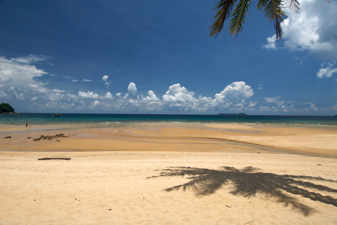
A wide view of a sunlit sandy beach on Tioman Island with turquoise water, a few clouds in a deep blue sky, and a palm tree shadow cast on the foreground sand.
A tranquil sandy beach on Tioman Island under a bright blue sky.

Pulau Tioman Wildlife Reserve history and protected-area timeline

Tioman has functioned as a navigation point and source of fresh water and timber for Austronesian fishermen for thousands of years, with archaeological finds of ceramics and ancient cookware near Kampung Juara and Teluk Nipah attesting to long-term human activity around the island. Over the past millennium, it served as a waypoint for Chinese, Arab, and European trading vessels travelling toward Champa, and shards of Chinese porcelain still turn up on its beaches from that era of maritime trade. The 17th-century Dutch ambassador Joan Nieuhof recorded the island as "Paulo Tymon" in his 1665 account of an embassy to China.

During the modern colonial period, the island's strategic position in the South China Sea brought it into the Second World War, with the waters around Tioman becoming a wartime theatre and the seabed later yielding remains of British warships including HMS Repulse and HMS Prince of Wales. A 1690 travel account by Dr. Kaempfer, passing through en route from Batavia to Ayuthia, is among the early European written descriptions of the island.

The conservation history of the reserve itself begins in 1972, when the inland rainforest was formally protected as the Pulau Tioman Wildlife Reserve. In 1984, however, a significant portion of the original reserve was excised to accommodate agricultural expansion and tourism development, shrinking the protected forest to its present approximate extent of 8,296 hectares. Sea-level protection followed with the declaration of the surrounding waters and eight neighbouring islands as a marine park system, creating the combined land-and-sea conservation framework that defines Tioman today. Local legend, distinct from but co-existing with these formal designations, holds the island as the transformed form of a dragon princess or of the dragon Sri Gumom, motifs that continue to shape Tioman's cultural identity.

Pulau Tioman Wildlife Reserve landscape and geographic character

Tioman Island stretches roughly 20 kilometres in length and 12 kilometres in width, shaped from the air like a piece that echoes the outline of a chicken drumstick, with a backbone of forested mountains running down its spine. The southern half of the island rises sharply into steep ridges and dense rainforest, while the northern portion transitions into lower terrain marked by the largest settlement, Kampung Tekek, and the bulk of the island's resort infrastructure. The surrounding coastline runs for about 245 kilometres and alternates between sandy bays, rocky headlands, and reef-fringed shores.

The dominant landform is Gunung Kajang, the island's highest summit at roughly 1,038 metres and the apex of the watershed that the wildlife reserve protects. From these mountains, short rivers and streams descend toward the coast, supporting both the island's freshwater supply and pockets of lowland forest along the valleys. The interior remains heavily forested and sparsely inhabited, with most settlement confined to a narrow coastal strip where flat land is available.

Offshore, the landscape shifts into a marine terrain of coral reefs, seagrass beds, and mangrove stands. Coral-dominated seascapes lie around Tioman and a cluster of smaller islands such as Tulai, Renggis, Soyak, and Tomok, while mangrove stands cluster near villages including Kampung Genting and Kampung Juara. Together, the rugged forested interior and the varied marine coastal zone give Tioman a layered topography that combines mountain, rainforest, beach, and reef within a relatively confined area.
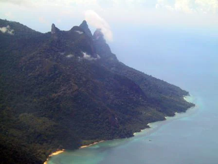
An aerial perspective of Tioman Island showing a sharp, dark, forested mountain range meeting the coastline of the South China Sea.
An aerial view of the mountainous, forest-covered landscape of Tioman Island.

Pulau Tioman Wildlife Reserve ecosystems, habitats, and plant life

The Pulau Tioman Wildlife Reserve protects lowland and hill rainforest that covers much of the island's mountainous interior, descending toward coastal lowlands and small river valleys. These forests form the catchment for the island's streams and upland springs, and act as the watershed that sustains both wildlife and human settlements along the coast. The rainforest character of Tioman's interior is broadly continuous with Peninsular Malaysian forest types but is set apart by its island isolation.

Ecologically, the reserve sits within a protected seascape rather than a stand-alone terrestrial block. The Tioman Marine Park surrounds the island and eight smaller neighbours with three intertwined ecosystems: fringing and patch coral reefs, seagrass beds along sheltered bays, and mangrove stands concentrated near Kampung Genting and Kampung Juara. The seagrass beds occur near Kampung Air Batang, Kampung Genting, Teluk Nipah, Teluk Mukut, and between Japamala Resort and Pasir Cina, while mangroves cover roughly 59.90 hectares of coastal habitat.

This combination of upland rainforest, freshwater streams, coastal forest margins, mangroves, seagrass, and reef gives Tioman an unusually compressed ecological profile. Animals associated with the forest interior, the shoreline, and the marine environment overlap within a small geographic frame, reinforcing the reserve's ecological coherence and its research and conservation value.
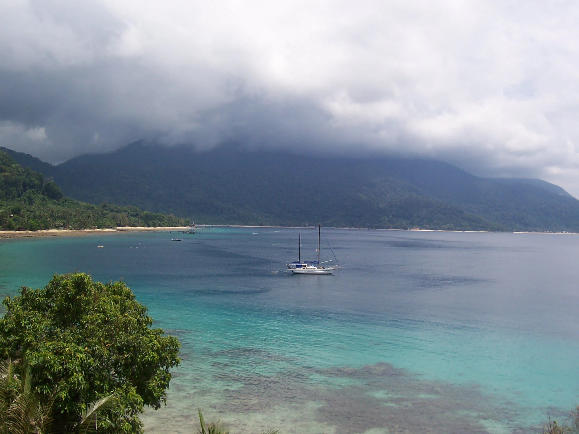
A wide view of a calm tropical bay with turquoise water in the foreground; a sailboat is anchored in the center; a forested coastline and hazy mountains are in the background under a cloudy sky.
A view of the coastline and bay at Panuba on Tioman Island.

Pulau Tioman Wildlife Reserve wildlife and species highlights

The forested interior of the reserve supports a mammal community of around 45 species and a bird list of roughly 138 species, including several protected mammals such as the binturong, long-tailed macaque, slow loris, black giant squirrel, red giant flying squirrel, mouse deer, brush-tailed porcupine, and common palm civet. Birds characteristic of the island include the frigatebird, often seen soaring along the coast, alongside many other species drawn from the broader Sundaic rainforest and island edge habitats.

A particular interest of the reserve lies in its endemic species. The Tioman walking catfish, Clarias batu, can be encountered on rainforest walks through the island, while the Kajang slender litter frog is known only from the slopes of Gunung Kajang within the reserve. These restricted-range species underline the conservation importance of the protected forest as a refugium for animals that occur nowhere else.

The marine environment surrounding the reserve adds a second wildlife dimension. Coral reefs support roughly 326 species of reef fish across 55 families, including notable sharks and rays such as the blacktip reef shark, slender bambooshark, tawny nurse shark, finless sleeper ray, and Jenkin's whipray, alongside groupers and parrotfishes. The manta-sized humphead wrasse is recorded here, and the reefs themselves host around 350 species of scleractinian corals. Mangrove stands near Kampung Genting and Kampung Juara harbour a mix of common, threatened, and newly recorded mangrove species, including the endangered Heritiera globosa, extending the wildlife profile of the protected landscape beyond the forest interior.
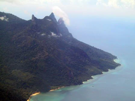
An aerial view of the mountainous, heavily forested coast of Tioman Island, showing jagged peaks and the meeting of dense forest and turquoise sea.
Aerial view of the rugged, forested terrain and coastline of Tioman Island.

Pulau Tioman Wildlife Reserve conservation status and protection priorities

Pulau Tioman Wildlife Reserve carries strong conservation significance as one of the few formal rainforest reserves on an inhabited Malaysian island. The reserve was established in 1972, but its history also illustrates the pressures facing protected areas in tourism-active regions: in 1984, a large share of the original reserve was excised for agriculture and tourism development, leaving its present approximate footprint of 8,296 hectares of contiguous hill and lowland rainforest. This history underlines the reserve's role as the surviving core of what was once a much larger protected block, and increases the importance of the area that remains.

Protection extends beyond the forest itself. The waters around Tioman and eight neighbouring islands have been declared a marine park, creating a connected conservation landscape that incorporates coral reefs, seagrass beds, and mangrove stands alongside the upland reserve. The reef system carries formal recognition through the presence of three endangered coral species, dozens of vulnerable and near-threatened corals, and a similar profile among reef fishes, lending the marine component of the protected landscape a recognised biodiversity value.

Conservation management on Tioman must also contend with ongoing pressures. Coral bleaching events have affected the island's reefs, with a significant bleaching episode in 2010 and a more limited one in 2016. Proposals for a larger international airport through land reclamation within the marine park have raised concerns about direct reef destruction, sediment plumes, pollution, and displacement of village economies, while ghost nets increasingly threaten marine wildlife. Local initiatives such as the Juara Turtle Project and Reef Check Malaysia's Cintai Tioman programme contribute community-based conservation action alongside formal reserve protections.

Pulau Tioman Wildlife Reserve cultural meaning and human context

Tioman's cultural identity weaves together the island's small Malay and Chinese communities with deep maritime folklore and a long history of trade-related visitation. Local legend tells of the island as the resting place of a dragon princess who stopped to rest in the South China Sea, while another telling describes Tioman as the stone form of the dragon Sri Gumom, frozen apart from his sister at Gunung Linga by the intervention of Sri Rama. A separate legend from local oral tradition refers to a pair of dragons that left Tasik Chini via Sungai Pahang and were transformed into the island and nearby Gunung Nenek Semukut after a cultural taboo involving a crowing rooster.

These mythic motifs coexist with more grounded cultural traces of the island's trading past. Shards of Chinese porcelain regularly surface on Tioman's beaches, physical reminders of centuries of Chinese, Arab, and European maritime traffic through the South China Sea. Archaeological work in 1992 by J. Collin uncovered ancient cookware and ceramics near Kampung Juara and Teluk Nipah, extending the documented cultural timeline of habitation on the island.

The contemporary village communities, including Kampung Tekek, Kampung Juara, Kampung Salang, Kampung Mukut, and Kampung Genting, sustain a distinctive island Malay dialect with historical affinities to the Malay of the Riau archipelago, especially the varieties spoken in the Natuna and Anambas islands. This linguistic link reflects older maritime connections between Peninsular Malaysia and the Malay world to the south. Folklore, linguistic heritage, and an economy shaped by long-standing interaction with visitors give Tioman a layered cultural context beyond its natural conservation profile.

Top sights and standout views in Pulau Tioman Wildlife Reserve

The reserve stands out for compressing rainforest, hill, reef, mangrove, and human settlement into one protected island frame. Its wildlife profile is anchored by endemic amphibians and fish that depend directly on its continued protection, including the Kajang slender litter frog and the Tioman walking catfish, while its coastal waters host internationally recognised reef biodiversity.

The reserve's conservation history, including its original 1972 gazettement and the subsequent 1984 reduction of its extent, makes it a meaningful case study in island rainforest protection under tourism pressure. Surrounding marine ecosystems, including three endangered coral species and an array of reef sharks, groupers, and rays, extend the reserve's significance beyond its forest interior into the broader Tioman Marine Park landscape.

Best time to visit Pulau Tioman Wildlife Reserve

Tioman's climate is shaped by monsoon seasonality, with the northeast monsoon months of December, January, and February typically bringing rough seas, limited ferry services, and a quiet period for tourism. During this window, high swells from the South China Sea can disrupt boat travel, and many visitor activities slow substantially, which also gives the island and its reefs a quieter phase.

Outside the monsoon months, conditions become more favourable for marine and beach-focused visits, with warmer sea temperatures, calmer seas, and the main diving and snorkelling season in the surrounding marine park. The inland rainforest of the reserve is evergreen and accessible to walkers year-round, but wildlife observation tends to be most rewarding in the drier, more settled months between the monsoons. Visitors seeking a balance of marine visibility, comfortable travel, and rainforest access generally plan around the months flanking the monsoon peaks.

Monthly climate preview

Long-term temperature ranges and monthly precipitation distributions for Pahang

Pulau Tioman Wildlife Reserve Climate Normals and Annual Weather Patterns

Representative coordinate records show sustained thermal levels alongside distinct monthly precipitation variations across the sampled terrain. Examining the complete twelve-month climate profile reveals granular shifts in average temperatures and rainfall amounts.
Annual mean28 °C
27 °C29 °C
Jan27°
Feb27°
Mar27°
Apr28°
May29°
Jun29°
Jul28°
Aug28°
Sep28°
Oct28°
Nov28°
Dec27°
Warmest month
May

28.8 °C

Coolest month
January

26.6 °C

Wettest month
December

14.7 mm/day

Driest month
February

3.5 mm/day

Park location guide

Geography guide, regional context, and park location map for Pulau Tioman Wildlife Reserve

Pulau Tioman Wildlife Reserve park geography, regions, and map view in Malaysia

Understand where Pulau Tioman Wildlife Reserve sits in Malaysia through a broader geographic reading of the surrounding landscape, nearby location context, and its mapped position within the national park landscape.

How Pulau Tioman Wildlife Reserve fits into Malaysia

Malaysia is a federal constitutional monarchy located in Southeast Asia. The country consists of 13 states and three federal territories, divided by the South China Sea into Peninsular Malaysia on the Indochinese Peninsula and East Malaysia on the island of Borneo. With a population of over 34 million, it achieved independence from Britain in 1957 and became a modern federation in 1963. The country is recognized for its multicultural population, tropical climate, and significant economic role in the region.

Wider geography shaping Pulau Tioman Wildlife Reserve in Malaysia

Malaysia occupies a strategic position in Southeast Asia, split by the South China Sea into two distinct regions. Peninsular Malaysia lies on the Indochinese Peninsula, sharing a land border with Thailand to the north and maritime borders with Singapore, Vietnam, and Indonesia. East Malaysia occupies the northern portion of Borneo, sharing land borders with Brunei and Indonesia, and maritime borders with the Philippines and Vietnam. The country's terrain includes coastal plains, mountain ranges such as the Titiwangsa in the peninsula, and extensive tropical rainforests.

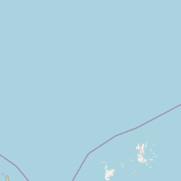
Map view of Pulau Tioman Wildlife Reserve

Use this park location map to pinpoint Pulau Tioman Wildlife Reserve in Malaysia, understand its exact geographic position, and read its mapped placement within the surrounding landscape more clearly.

Pigeon | © OpenStreetMap contributors

Location context for Pulau Tioman Wildlife Reserve

Pahang

Visual reference for rainforest terrain, mountain ridges, and marine habitats

Pulau Tioman Wildlife Reserve Photos, Landscapes, and Scenery Exploration

Visual documentation captures the rugged topography, lowland rainforest watersheds, and coral-fringed coastlines defining Pulau Tioman Wildlife Reserve. Examining protected-area photography provides clear insight into the island's steep forested interior, freshwater streams, and marine habitats.

A wide view of a sunlit sandy beach on Tioman Island with turquoise water, a few clouds in a deep blue sky, and a palm tree shadow cast on the foreground sand.

A wide, eye-level shot of a large, mountainous island silhouette against a clear blue sky, viewed from across the open ocean.

An aerial perspective of Tioman Island showing a sharp, dark, forested mountain range meeting the coastline of the South China Sea.

A wide view of a calm tropical bay with turquoise water in the foreground; a sailboat is anchored in the center; a forested coastline and hazy mountains are in the background under a cloudy sky.

An aerial view of the mountainous, heavily forested coast of Tioman Island, showing jagged peaks and the meeting of dense forest and turquoise sea.

Park atlas

Compare regional park geography and adjacent protected habitats across the South China Sea

Exploring Parks Near Pulau Tioman Wildlife Reserve And Surrounding Protected Landscapes

Visitors reviewing Pulau Tioman Wildlife Reserve can examine other nearby national parks and protected areas to compare regional forest and marine ecosystems. Extending geographic research across adjacent conservation landscapes reveals broader patterns in island biodiversity and coastal terrain.
Protected areaJohor
About 31 km away#1 closest

Southeast

Pemanggil Island Protected Landscape: Johor Offshore Geography and Island Topography

Mapping coastal features and inland terrain in the South China Sea.

Pemanggil Island serves as a significant geographic landmark within the Mersing cluster of Johor. This detailed atlas entry focuses on the island's structural composition, including its prominent central hill, the rocky interior, and coastal features such as Teluk Lancang. Understand the maritime geography and spatial character of this protected area within the context of the southern Malay Peninsula.

Area
8.82 km²
Relief
Upland
Climate
Tropical
Access
Moderate access
A watercolor painting showing layers of soft green and pink rolling hills, with a line of trees in the midground and an open, flat foreground.
Protected areaJohor
About 40 km away#2 closest

Southwest

Rawa Island Protected Area: Coastal Geography and Island Landscape Context in Johor

A protected coral island within the Johor archipelago

Rawa Island serves as a significant protected landscape off the coast of Johor, Malaysia. Defined by its sharp contrast between rocky cliffs and clear, coral-filled waters, the island represents a crucial node in regional island geography. Delve into the spatial characteristics and environmental features of this South China Sea destination through our map-driven atlas framework.

Area
0.23 km²
Water
Water-dominated
A minimalist watercolor illustration depicting a tropical island coastline with sand beaches, green trees, and rolling hills in the background.
Marine protected areaJohor
About 47 km away#3 closest

Southwest

Besar Island Marine Protected Area: Coastal Geography and Protected Waters in Johor

Mapping the island's reef ecosystems and tropical landscape

Besar Island offers a distinct look at a small-scale marine protected area off the Johor coast. Its geography encompasses a transition from sandy beach fronts to a hilly, jungle-clad interior, all contained within a gazetted two-nautical-mile conservation zone. The surrounding waters support approximately 60 marine species, making this an essential case study for understanding protected marine habitats within the Babi Islands archipelago.

Area
4.77 km²
Relief
Upland
Climate
Tropical
Access
Easy access
Watercolor illustration of a horizontal landscape featuring a winding river, green forests, and soft, pastel colored mountain ridges against a white background.
Marine protected areaJohor
About 55 km away#4 closest

Southeast

Aur Island Marine Protected Area: Johor Regional Coastal and Island Geography

Rugged island terrain and sheltered coral ecosystems.

Aur Island serves as a significant marine protected area within the Johor Marine Park archipelago. Located in the South China Sea, the island is characterized by its hilly interior, white-sand shorelines, and diverse offshore coral reef systems. Its geographic proximity to neighbouring Dayang Island creates a paired landscape that highlights the environmental importance of these remote Malaysian waters.

Area
14.5 km²
Relief
Lowland
Climate
Tropical
Access
Moderate access
Protected areaJohor
About 58 km away#5 closest

South

Tinggi Island Protected Area: Geography, Rainforest Terrain, and Johor Coastal Map

Mountainous forest meets extensive coral-rich coastal waters.

Located southeast of Mersing, Tinggi Island is defined by its dramatic silhouette and dense rainforest interior. The protected landscape stretches from the elevated peak of Mount Semundu down to a shoreline of white sand and coastal caves, creating a distinct marine and terrestrial environment unique to the Johor region.

Water
Major water bodies
Season
Year-round
Marine protected areaJohor
About 69 km away#6 closest

South

Sibu Island: Marine Protected Area and Coastal Landscape Analysis

Mapping the coral reefs and pyroclastic terrain of the Johor coast

Sibu Island is a protected marine area in the South China Sea, distinguished by its unique pyroclastic geology and surrounding coral reef ecosystems. This entry provides a structured look at the island's coastal geography, vegetation, and maritime boundaries off the coast of Mersing, Johor. Access detailed geographic context for this tropical landscape.

Area
4.05 km²
Established
1993
Relief
Lowland
Climate
Tropical
National parkJohor
About 90 km away#7 closest

West

Endau-Rompin National Park: Ancient Tropical Rainforest Protected Landscape in Johor, Malaysia

Explore unique mapped geography and ancient geological features.

Endau-Rompin National Park in Johor, Malaysia, is a testament to Earth's ancient history, housing tropical rainforests built upon geological formations around 248 million years old. This protected area offers a detailed look at rugged mountainous terrain, vital river systems, and a diverse mapped landscape, crucial for understanding regional geography and conservation. Its status as one of the oldest rainforest complexes makes it a significant site for exploring the planet's prehistoric natural heritage and protected land distribution.

Area
870 km²
Established
1993
IUCN
II
Relief
Mountain
A soft watercolor painting of a serene lake scene with rolling hills in the background, green vegetation along the banks, and pale pink blooms, likely lotus flowers, in the water.
Biosphere reservePahang
About 156 km away#8 closest

Northwest

Chini Lake Biosphere Reserve: Protected Freshwater Geography in Pahang, Malaysia

Examining the interconnected lake basins and tropical wetland terrain

Chini Lake is an essential protected freshwater system in Pahang, Malaysia, comprising a series of twelve connected lake basins and tropical forest margins. This landscape is a recognized UNESCO Biosphere Reserve, characterized by seasonal lotus blooms, peat-influenced wetlands, and deep cultural connections to the indigenous Jakun communities. Discover the geography and environmental context of this river-fed ecosystem.

Area
50.85 km²
Established
2019
Relief
Lowland
Climate
Tropical

Common questions about visiting, size, designation, and location context for Pulau Tioman Wildlife Reserve

Pulau Tioman Wildlife Reserve FAQs for park facts, access, geography, and protected area context

Find quick answers about Pulau Tioman Wildlife Reserve, including protected-area facts, park geography, trail and visitor context, and how the park fits into its surrounding country and regional landscape.
MoriAtlas Explorer

Continue Your Protected Areas Search Across the Global Atlas

Deepen your exploration by continuing the structured search for national parks and protected areas worldwide. Utilize the comprehensive filtering capabilities to compare different conservation landscapes and refine your understanding of global park geography. Discover more about the distribution and characteristics of protected natural areas.

Global natural geography