
Why Quezon Protected Landscape stands out
The park is best known for its lowland rainforest growing over karst terrain, a network of waterfalls and caves such as Bantakay Falls and Bantakay Caves, and the symbolic summit of Mount Mirador, also called Mount Pinagbanderahan, where the Philippine flag was first raised during the Philippine Revolution and again at independence in 1946. It is also recognized for its population of endemic Philippine wildlife, including the monitor lizard Varanus bitatawa, known locally as butikaw.
Quezon Protected Landscape history and protected-area timeline
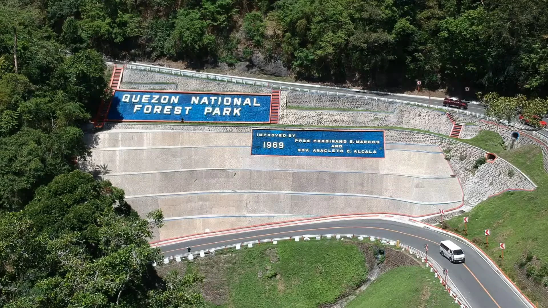
The area now known as Quezon Protected Landscape was first set aside as Quezon National Park on October 25, 1934, through Proclamation No. 740, with an initial area of about 535 hectares. The park was named after Manuel Quezon, a prominent figure in Philippine political history who served as president of the Commonwealth. In 1940, the reserve was enlarged through Proclamation No. 594, extending its footprint across more of the surrounding forest.
Following the enactment of the National Integrated Protected Areas System (NIPAS) in 1992, the park's classification was updated to reflect its broader landscape values. On June 2, 2003, through Proclamation No. 394, the area was reestablished as Quezon Protected Landscape, with a reduced core area of about 938 hectares and a new management mandate under the Department of Environment and Natural Resources.
Beyond its formal administrative milestones, the park carries strong symbolic meaning in Philippine national memory. Mount Mirador, the park's highest peak, was a site where revolutionary forces raised the Philippine flag during the Philippine Revolution. The same summit later saw the American and Japanese flags raised during the periods of foreign occupation, and in 1946 the Philippine flag was once again raised there to mark the country's independence. The mountain is now also called Mount Pinagbanderahan, or "where the flag was hoisted," in reference to this layered history.
Quezon Protected Landscape landscape and geographic character
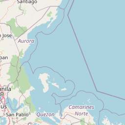
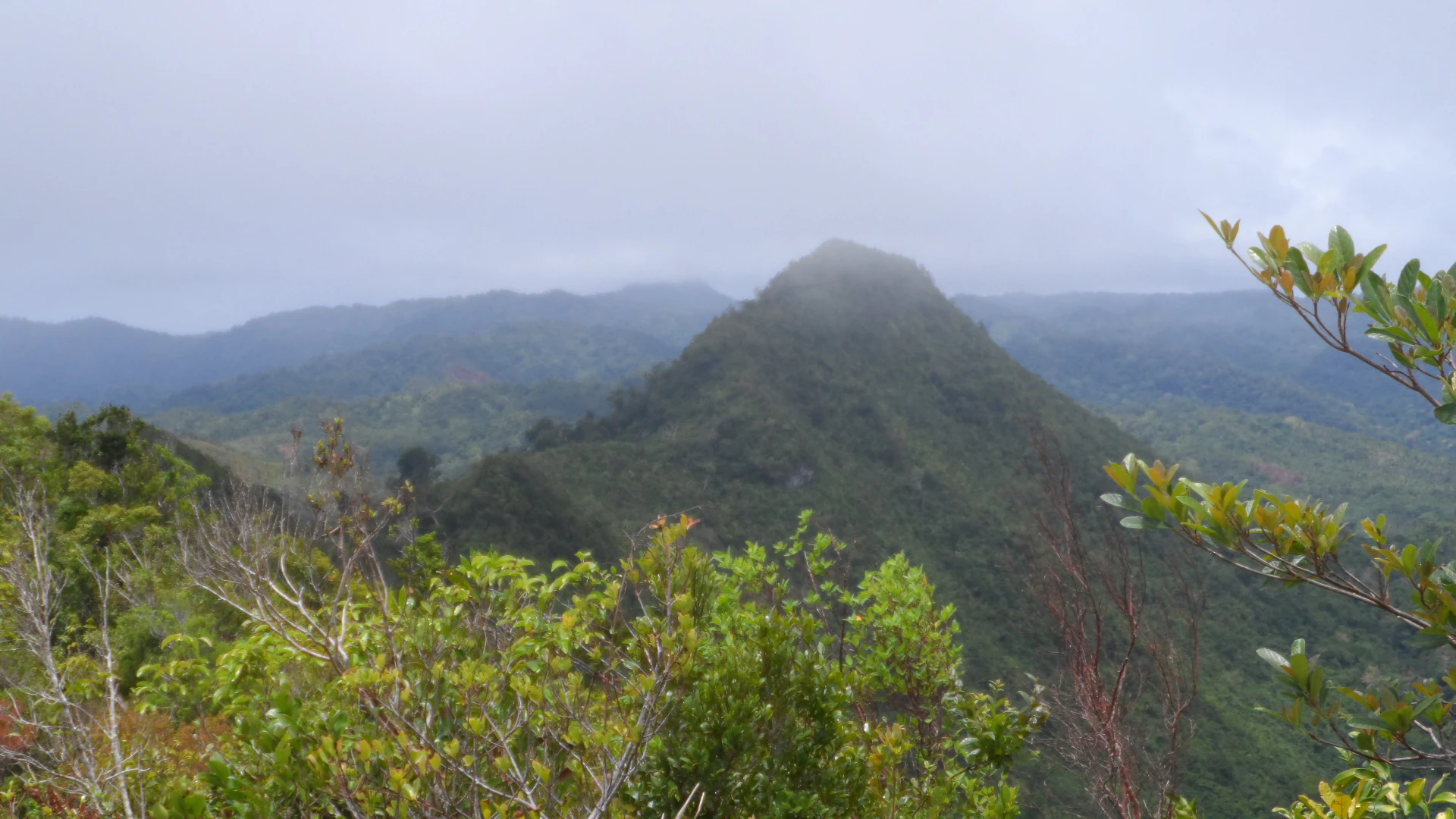
The protected landscape sits in the southern foothills of the Sierra Madre, where steep forested ridges descend toward the Tayabas Bay coastline. The terrain is shaped by karst processes, producing a distinctive mix of forested limestone hills, sinkholes, cliffs, and cave systems. Dense lowland rainforest cloaks most of the slopes, broken only by clearings, river valleys, and the engineered cuts of the Pan-Philippine Highway.
The park's highest elevation is Mount Mirador at 366 meters, a peak that serves as both a natural vantage point and a cultural landmark. From the summit, panoramic views extend to nearby Mount Banahaw as well as the island provinces of Marinduque and Mindoro, and the major towns of Quezon province are visible below. The combination of ridges, basins, and river-carved valleys creates a varied microtopography within a relatively compact protected footprint.
Hydrological features are central to the park's scenery. At least five waterfalls run through the reserve, with the 80-meter Bantakay Falls in Barangay Santa Catalina being the most prominent. Rivers feeding these cascades have also carved caves such as the accessible Bantakay Caves, while deeper systems like Cueva Santa and Nilubugan Cave extend the landscape underground.
Quezon Protected Landscape ecosystems, habitats, and plant life
The park's vegetation is dominated by lowland rainforest, much of it classified as virgin or near-virgin forest, growing over karst substrates typical of the southern Sierra Madre. This dense canopy supports a vertical structure of emergent trees, mid-story species, and understory plants adapted to humid tropical conditions and the irregular soils of limestone terrain. Forest patches edge into agricultural land and coastal habitats near Pagbilao and Padre Burgos, creating transitional zones where different ecological communities meet.
Riparian corridors, waterfall basins, and cave mouths contribute additional habitat diversity, while the moisture retained by the karst topography sustains lush growth even along drier ridge sections. The combination of forest cover and varied topography produces a layered habitat mosaic that supports both resident species and seasonal visitors.
Quezon Protected Landscape wildlife and species highlights
Wildlife in Quezon Protected Landscape reflects the broader biodiversity of Luzon's southern Sierra Madre forests, with a notable presence of endemic Philippine species. Mammals reported in the area include monitor lizards, monkeys, deer, and wild pigs, while the avifauna is particularly rich. The park hosts species such as the yellow bittern, cinnamon bittern, buff-banded rail, barred rail, white-browed crake, marsh sandpiper, long-toed stint, and Swinhoe's snipe in wetland-influenced habitats.
In the canopy and forest interior, birdlife includes the rufous hornbill, Luzon hornbill, pink-bellied imperial pigeon, guaiabero, colasisi, blackish cuckooshrike, flaming sunbird, and various flowerpeckers, alongside more familiar groups like parrots, doves, pigeons, and the native jungle fowl known locally as manok labuyo. Striated grassbirds occupy grassland and scrub edges.
One of the most significant zoological stories associated with the park is the rediscovery of the Northern Sierra Madre Forest monitor lizard, Varanus bitatawa, locally called butikaw. Long familiar to the Aeta and Ilongot indigenous communities as a food source, this monitor lizard was formally introduced to Western science in April 2010 through specimens and observations from this region, highlighting the global conservation importance of the park's still-intact forest ecosystems.
Quezon Protected Landscape conservation status and protection priorities
Quezon Protected Landscape plays an important conservation role as one of the remaining lowland rainforest refuges in southern Luzon. Its reclassification under the National Integrated Protected Areas System in 2003 underscored the value of the area not only as a strict nature reserve but as a working landscape that combines biodiversity protection with sustainable use, recreation, and watershed functions.
The forest provides habitat for numerous endemic species, making it a key site for protecting genetic diversity that is vulnerable elsewhere in the Philippines. Features such as virgin forest stands, intact karst hydrology, and cave systems add layers of ecological value beyond typical terrestrial forest reserves. The recognition of species like Varanus bitatawa in 2010 placed the park on the international scientific map and reinforced the importance of protecting indigenous knowledge and the habitats that sustain these species.
Quezon Protected Landscape cultural meaning and human context
The park carries deep cultural weight through Mount Mirador, also known as Mount Pinagbanderahan, a peak that has served as a stage for the raising of successive national flags since the Philippine Revolution. From revolutionary symbolism to the moment of independence in 1946, the summit embodies key chapters in the formation of the modern Philippine nation, and it remains a place where visitors encounter this layered history directly in the landscape.
The park also sits within the traditional territories of indigenous communities such as the Aeta and Ilongot, who have long interacted with the forest. Their existing knowledge of species like Varanus bitatawa, used locally as a food source, has proven important to broader scientific understanding of the area's biodiversity. The road through the park, including the Atimonan zigzag section, also has its own local memory, marked by the names of political figures from a specific era in Philippine governance.
Top sights and standout views in Quezon Protected Landscape
Within a relatively compact area, Quezon Protected Landscape combines accessible recreation, biodiversity, and national symbolism. Mount Mirador anchors the park both as its highest point and as a site of layered historical meaning. The karst terrain produces a distinctive landscape of forests, caves, and waterfalls, with Bantakay Falls and the surrounding cave systems offering focal points for visitors.
Equally important is the park's ecological role, especially the surviving virgin forest that supports endemic wildlife, including the scientifically important monitor lizard Varanus bitatawa. Easy access via the Pan-Philippine Highway makes the protected landscape a natural extension of trips between Manila and the rest of southern Luzon, giving visitors an unusually direct way to experience a forest ecosystem still shaped by the Sierra Madre ridge system.
Best time to visit Quezon Protected Landscape
Like much of southern Luzon's lowland rainforest, the park's climate is shaped by the regional wet and dry seasons rather than sharp temperature swings. The cooler and generally drier months typical of the Philippine dry season offer more comfortable conditions for hiking to Mount Mirador and for exploring waterfalls and caves, while the lush green character of the forest is most pronounced during and just after the rainy season. Bird watching and general wildlife observation can be rewarding throughout the year, though attention to prevailing rains and trail conditions is advisable during peak monsoon months.