Mori Atlas logo
Protected landscapeRajah Sikatuna Protected Landscape

A vast protected landscape featuring limestone ridges, natural springs, and endemic forest habitats

Rajah Sikatuna Protected Landscape: Mapping the Biodiversity and Karst Terrain of Bohol

Rajah Sikatuna Protected Landscape represents the largest remaining tract of natural forest on Bohol, serving as a critical refuge for endemic species. This protected area encompasses steep limestone hills, over one hundred cave systems, and essential freshwater springs that support the southern Bohol region. The geography reveals a complex mosaic of forested karst ridges and grassy clearings, offering a distinct look into the island's interior mountain terrain.

limestone forestkarst landscapebirdwatchingendemic birdsprotected landscapecaves

Rajah Sikatuna Protected Landscape

Protected landscape

Park overview

Structured park overview, official facts, and landscape profile for Rajah Sikatuna Protected Landscape

Rajah Sikatuna Protected Landscape park facts, protected area profile, and essential visitor context

Review the core facts for Rajah Sikatuna Protected Landscape, including designation, size, terrain, visitor scale, habitats, and operating context in one park-focused overview.

About Rajah Sikatuna Protected Landscape

Rajah Sikatuna Protected Landscape is centred on the low mountain range that runs through the southern portion of Bohol island, covering parts of Carmen, Sierra Bullones, Garcia Hernandez, Valencia, Dimiao, Bilar, Loboc and Batuan. The protected area preserves a mosaic of steep limestone ridges, residual natural forest, plantation stands, degraded hills and open grasslands, creating a transitional landscape between intact wilderness and the agricultural lands that surround it.

Roughly 60 percent of the park is limestone forest, with smaller portions made up of grassland, plantation and permanent agricultural areas. Bilar Peak, at about 510 metres above sea level, is one of the highest points in the province and serves as the focal point of the park's trail network. From its summit, an observation tower offers wide views across the surrounding countryside, including glimpses of Panglao Island and, on clear days, Cebu across the Bohol Sea.

The park is more than a scenic reserve: it holds ecological, hydrological and cultural importance for Bohol. Its four major mountain springs, Logarita, Anislag, Mabugnao and Aghuban, supply water to surrounding communities, and the area's network of more than 100 caves contributes to both biodiversity and the regional karst landscape. Named after the Bohol chieftain Datu Sikatuna, who forged a blood compact with Miguel López de Legazpi in 1565, the park also carries strong cultural symbolism for the island, blending ecological protection with a sense of shared heritage.

Quick facts and research context for Rajah Sikatuna Protected Landscape

Rajah Sikatuna Protected Landscape lies in the southern interior of Bohol island in the Central Visayas and is administered by the Department of Environment and Natural Resources under the National Integrated Protected Areas System. The protected area covers roughly 10,452 hectares and was first gazetted as a national park on July 10, 1987 before being reclassified as a protected landscape on April 23, 2000.

The terrain is dominated by rolling limestone hills averaging around 400 metres in elevation, with Bilar Peak rising to about 510 metres above sea level. The landscape consists primarily of limestone forest, with smaller shares of grassland, plantation and permanent agricultural land, and contains more than 100 caves plus several mountain springs that supply surrounding communities.

Protection and recognition

Examine the official terrestrial protection scope and 2000 designation timeline.

Rajah Sikatuna Protected Landscape Protection Status and Designation History

Rajah Sikatuna Protected Landscape holds a documented terrestrial protection scope established through its 2000 designation history. Conservation records review the formal management framework and official status details governing the landscape.

Protection details

Protection scope
Terrestrial
Designated year
2000
Transboundary protection
No
Park context

Deeper park guide and search-rich context for Rajah Sikatuna Protected Landscape

Rajah Sikatuna Protected Landscape history, landscape, wildlife, and travel context

Explore Rajah Sikatuna Protected Landscape through its history, landscape character, ecosystems, wildlife, conservation priorities, cultural context, and seasonal travel timing in a structured park guide built for atlas discovery and search intent.

Why Rajah Sikatuna Protected Landscape stands out

Rajah Sikatuna is best known as the largest remaining block of natural forest on Bohol and as one of the Philippines' premier birdwatching sites. Its importance stems from the combination of intact limestone karst forest, numerous caves, endemic bird species and the rare presence of six species of large mammals, including the iconic Philippine tarsier. The park also stands out for its scenic and recreational offerings: an observation tower atop Bilar Peak provides panoramic views over Bohol, the nearby island of Panglao and even Cebu on clear days, while a network of more than 30 kilometres of marked trails supports wildlife observation and nature-based tourism.

Rajah Sikatuna Protected Landscape history and protected-area timeline

Rajah Sikatuna was first gazetted as a national park on July 10, 1987, initially covering approximately 9,023 hectares of forested limestone terrain in southern Bohol. Its early designation reflected recognition of the area as the largest remaining tract of natural forest on the island and as habitat of significant conservation value.

On April 23, 2000, the park was reclassified and expanded under the National Integrated Protected Areas System as a protected landscape, bringing its total area to roughly 10,452.6 hectares. This change broadened the management mandate from strict national park protection toward a balanced approach that acknowledges the surrounding communities, agricultural lands and water resources.

Since its reclassification, the park has been administered by the Department of Environment and Natural Resources and has continued to be promoted as both a conservation area and a destination for nature-based tourism, with infrastructure such as trails, an observation tower at Bilar Peak, and visitor facilities developed to support public access.

Rajah Sikatuna Protected Landscape landscape and geographic character

The landscape of Rajah Sikatuna is shaped by the southern Bohol karst, a series of rolling, steep-sided limestone hills rising out of the interior of the island. The terrain has an average elevation of around 400 metres, with the highest point at Bilar Peak reaching about 510 metres above sea level. The scenery shifts between forested ridges, exposed rocky slopes, grassy clearings and pockets of plantation and farmland, giving the area a patterned, mosaic appearance typical of upland Bohol.

Much of the park's surface is karst limestone, deeply weathered into ridges, sinkholes and cave systems. More than 100 caves have been identified within the protected area, contributing to the broader geological identity of Bohol, which is known for its karst formations and islet-studded coastlines. Four major springs, Logarita, Anislag, Mabugnao and Aghuban, emerge from this karst system and channel fresh water outward into the surrounding valleys and communities.

From the Bilar Peak observation tower, the surrounding countryside opens into a broad panorama of agricultural lowlands interspersed with forested hills, with the distant silhouettes of Panglao Island and Cebu visible on clear days. This combination of karst topography, forested ridges and distant sea views defines the visual character of Rajah Sikatuna.

Rajah Sikatuna Protected Landscape ecosystems, habitats, and plant life

The ecology of Rajah Sikatuna Protected Landscape is defined by its dominance of limestone forest, which supports the largest area of native lowland and submontane forest remaining on Bohol. The forest cover is built around native dipterocarp trees such as molave, along with other hardwood species adapted to thin, well-drained soils over limestone bedrock. These forests form a backdrop for the park's reputation as a stronghold of Philippine biodiversity.

Surrounding and interspersed with the forested core are areas of grassland, plantation forest and agricultural land, producing an ecological gradient that ranges from closed-canopy habitat to more open, edge environments. The karst system beneath the surface, with its more than 100 caves and numerous springs, adds a subterranean dimension to the park, providing roosting and breeding habitat for bats and cave-dwelling swiftlets.

The combination of mature limestone forest, open grassland and a heavily karstified underlay creates conditions that support many endemic Philippine species. The result is an unusually rich ecological mosaic for an island that has otherwise lost much of its original forest cover to agriculture and settlement.

Rajah Sikatuna Protected Landscape wildlife and species highlights

Rajah Sikatuna is one of the most important bird areas in the Philippines, with records of more than 120 bird species, many of which are endemic to the country. The park's avifauna includes the endangered Philippine cockatoo and streaked reed warbler, as well as a broad cast of forest specialists such as the Philippine hawk-eagle, Visayan broadbill, Samar hornbill, Philippine eagle-owl, Philippine frogmouth, azure-breasted pitta, rufous-tailed jungle flycatcher, rufous-lored kingfisher, southern silvery kingfisher and the Philippine trogon. This diversity has made the park a key destination for birdwatchers from across the region.

Mammals are also a defining feature of the park. Six species of large mammals are present, including the Philippine tarsier, one of the world's smallest primates, along with the long-tailed macaque, Philippine flying lemur (colugo), Malayan civet, Asian palm civet and Philippine warty pig. A number of rodent species, including the Philippine forest rat, rice-field rat and Mindanao hairy-tailed rat, also inhabit the area.

The caves of Rajah Sikatuna host colonies of bats and swiftlets, adding another important component to the park's wildlife profile. The mix of endemic birds, primates, civets, cave-roosting bats and forest rodents gives the landscape a layered, biologically significant character that goes well beyond its reputation for scenery alone.

Rajah Sikatuna Protected Landscape conservation status and protection priorities

Rajah Sikatuna Protected Landscape is of major conservation significance because it contains the largest remaining block of natural forest on Bohol, an island where much of the original forest cover has been converted to agriculture and settlement. Its limestone forest, karst systems and grassland mosaic collectively sustain a high proportion of the island's remaining native biodiversity, including numerous endemic and threatened species.

The park's protected status under the National Integrated Protected Areas System recognises both its ecological and hydrological value. Beyond providing habitat for wildlife, the area's four mountain springs supply water to surrounding communities, making the conservation of the forest cover directly tied to local water security.

Recognition as an important bird area, combined with the presence of threatened species such as the Philippine cockatoo and the Philippine tarsier, gives the park a strong national profile within Philippine conservation. The combination of formal protection, biological richness and water-resource value places Rajah Sikatuna among the cornerstone conservation landscapes of the Central Visayas.

Rajah Sikatuna Protected Landscape cultural meaning and human context

Beyond its ecological role, Rajah Sikatuna carries deep cultural meaning for Bohol. The protected landscape is named after Datu Sikatuna, a Boholano chieftain who, in 1565, entered into a blood compact, or sandugo, with the Spanish conquistador Miguel López de Legazpi. This compact is one of the most celebrated symbols of friendship and indigenous-Hispanic accord in Philippine history and is commemorated annually in Bohol through the Sandugo Festival.

By bearing the name of this chieftain, the park links contemporary environmental protection to a broader identity of the island, in which natural heritage and cultural memory are closely intertwined. The park's presence in southern Bohol, a region rich in both karst landscapes and historical sites, reinforces this connection between landscape and local heritage.

Top sights and standout views in Rajah Sikatuna Protected Landscape

Rajah Sikatuna Protected Landscape combines Bohol's largest remaining natural forest with one of the country's most important birdwatching destinations, set amid limestone karst hills just east of the famous Chocolate Hills. Its network of more than 30 kilometres of marked trails, with over 100 documented caves, provides sustained opportunities for both birding and exploration.

Equally distinctive are the panoramic views from the Bilar Peak observation tower, the freshwater springs that supply surrounding communities, and the chance to encounter flagship species such as the Philippine tarsier, Philippine cockatoo and a wide range of endemic forest birds. The park's blend of biodiversity, karst scenery and cultural symbolism makes it a defining natural landmark of southern Bohol.

Best time to visit Rajah Sikatuna Protected Landscape

The most favourable conditions for visiting Rajah Sikatuna generally coincide with the drier months in the Central Visayas, when forest trails are more accessible, visibility from Bilar Peak is clearer and birdwatching is rewarding. The park's low mountain setting means temperatures are typically moderate, and morning hours are particularly productive for bird activity along the forest edges and along marked trails.

Wet-season months bring heavier rainfall and can make trails muddy and viewpoints obscured by cloud, though they also maintain lush forest conditions and active spring flows. Birdwatchers often find the forest especially lively year-round due to the park's high species diversity, while visitors focused on panoramic views from Bilar Peak benefit from the clearer skies of the drier season.
Monthly climate preview

Long-term monthly averages for temperature and precipitation rhythms across Bohol terrain

Rajah Sikatuna Protected Landscape Climate Normals and Annual Weather Patterns

Historical data records sustained monthly temperature ranges alongside fluctuating daily precipitation averages across representative park coordinates. Examining the complete twelve-month record clarifies long-term meteorological trends within the protected landscape.
Annual mean27 °C
26 °C28 °C
Jan26°
Feb26°
Mar27°
Apr28°
May28°
Jun28°
Jul28°
Aug28°
Sep27°
Oct28°
Nov27°
Dec27°
Warmest month
May

28.2 °C

Coolest month
February

26.1 °C

Wettest month
October

6.4 mm/day

Driest month
April

2.4 mm/day

Park location guide

Geography guide, regional context, and park location map for Rajah Sikatuna Protected Landscape

Rajah Sikatuna Protected Landscape park geography, regions, and map view in Philippines

Understand where Rajah Sikatuna Protected Landscape sits in Philippines through a broader geographic reading of the surrounding landscape, nearby location context, and its mapped position within the national park landscape.

How Rajah Sikatuna Protected Landscape fits into Philippines

The Philippines, officially the Republic of the Philippines, is an archipelagic nation in Southeast Asia comprising approximately 7,641 islands categorized into three main geographical divisions: Luzon, Visayas, and Mindanao. Located in the western Pacific Ocean, it shares maritime borders with Taiwan, Japan, Palau, Indonesia, Malaysia, Vietnam, and China. Manila serves as the capital city, while Quezon City is the most populated city, both within Metro Manila.

Wider geography shaping Rajah Sikatuna Protected Landscape in Philippines

The Philippines is an archipelagic nation in Southeast Asia, positioned in the western Pacific Ocean. Its islands are bounded by the South China Sea to the west, Philippine Sea to the east, and Celebes Sea to the south. The country shares maritime borders with Taiwan to the north, Japan to the northeast, Palau to the east and southeast, Indonesia to the south, Malaysia to the southwest, Vietnam to the west, and China to the northwest.

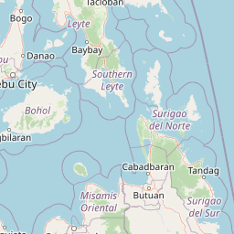
Map view of Rajah Sikatuna Protected Landscape

Use this park location map to pinpoint Rajah Sikatuna Protected Landscape in Philippines, understand its exact geographic position, and read its mapped placement within the surrounding landscape more clearly.

Pigeon | © OpenStreetMap contributors

Location context for Rajah Sikatuna Protected Landscape

BoholCentral Visayas
Park atlas

Compare surrounding limestone terrain and regional conservation landscapes across Bohol

Explore Parks Near Rajah Sikatuna Protected Landscape and Regional Protected Areas

Browse other parks near Rajah Sikatuna Protected Landscape to examine related limestone forests and regional wildlife habitats. Expanding the conservation view provides deeper geographic context across the surrounding upland terrain and protected landscapes.
A horizontal watercolor painting showing a soft, hazy landscape with a body of water in the foreground, grassy banks, and rolling hills in the distance.
National parkCentral Visayas
About 35 km away#1 closest

West

Panglao Island Protected Seascape: Geographic Atlas and Marine Park Boundaries

A vital protected marine zone in Central Visayas

The Panglao Island Protected Seascape acts as a key site for studying tropical marine biodiversity and karst-driven coastal geography in the Philippines. Spanning the waters around Panglao Island, this protected area features a mosaic of coral reefs, white sand beaches, and offshore limestone islets that provide essential habitats for thousands of mollusk and crustacean species.

Area
91.12 km²
Established
2018
Relief
Mixed relief
Scope
Mixed
A watercolor painting showing a panoramic view of a lush wetland landscape with gentle green hills in the distance, a winding stream, and tall grasses and pink wildflowers in the foreground.
Wildlife reserveCentral Visayas
About 63 km away#2 closest

North

Olango Island Wildlife Sanctuary: Coastal Protected Area and Migratory Bird Habitat in Central Visayas

Explore the interconnected mudflats, reefs, and mangrove forest ecosystems

Olango Island Wildlife Sanctuary stands as a key protected landscape in the Central Visayas, defined by its vast tidal flats and critical role in international bird migration patterns. This site features a unique mosaic of salt marshes, seagrass beds, and coral reef systems that support diverse coastal life within the low-lying terrain of the Olango Island Group.

Area
10.3 km²
Established
1992
Relief
Lowland
Climate
Tropical
National parkCebu
About 74 km away#3 closest

Northwest

Guadalupe Mabugnao Mainit Hot Spring National Park: Protected Landscape and Watershed Geography

Explore hot springs, caves, and mapped terrain in Cebu.

Guadalupe Mabugnao Mainit Hot Spring National Park is a protected national park in Cebu, Philippines, recognized for its significant watershed function and unique natural features. Spanning forested highland terrain within the Mantalongon mountain range, the park protects natural hot springs, explored cave systems such as Cave Lorett, and river networks vital to local water supply. Its identity as a protected landscape offers rich opportunities for geographic exploration, mapping its boundaries, and understanding its role within the regional natural terrain and conservation efforts.

Area
0.575 km²
Established
1972
IUCN
V
Relief
Mountain
Marine protected areaVisayas
About 103 km away#4 closest

Northwest

Tañon Strait Protected Seascape: Marine Geography and Protected Landscape Analysis

An expansive marine passage located within the central Visayas island group.

As the largest marine protected area in the Philippines, the Tañon Strait Protected Seascape represents a complex aquatic geography spanning 160 kilometres. Its protected waters serve as a vital corridor for marine biodiversity, linking the northern Visayan Sea to the southern Bohol Sea. This resource provides a detailed look at the strait's maritime boundaries, coastal ecosystems, and the distinct underwater terrain that defines this critical conservation zone.

Area
5,000 km²
Established
1998
IUCN
V
Scope
Marine
A soft watercolor painting of a coastal landscape with green rolling hills, distant faint mountains, and light water reflections.
Protected landscapeLeyte
About 108 km away#5 closest

Northeast

Cuatro Islas Protected Landscape/Seascape: Leyte Marine and Island Geography Exploration

Detailed protected area atlas for the Camotes Sea island group

The Cuatro Islas Protected Landscape/Seascape is a notable Philippine conservation zone consisting of four distinct islands including Apid, Mahaba, Digyo, and Himokilan. This geographic profile details the diverse terrain, ranging from uplifted former coral reefs to coral sand islets, while providing a clear understanding of the surrounding marine ecosystem and its role in regional conservation.

Area
125 km²
Established
2000
Scope
Mixed
Wildlife reserveNegros Occidental
About 131 km away#6 closest

West

Ilog-Hilabangan Watershed Forest Reserve: Geography and Protected Forest Boundaries

A vital wildlife reserve and watershed landscape in Negros Occidental

This protected area covers a vast expanse of lowland and montane tropical forest in the heart of Negros Island. By regulating the headwaters of major rivers and maintaining a secure habitat for threatened endemic species, the reserve acts as a fundamental component of the regional geography and biodiversity network in the Western Visayas.

Area
102.11 km²
Established
1990
Relief
Mountain
Scope
Terrestrial
A watercolor painting featuring soft green hills in the midground and faint, pale purple mountain silhouettes in the background against a white backdrop.
National parkNegros Occidental
About 134 km away#7 closest

Northwest

Mount Kanlaon Natural Park: Mapping the Volcanic Heart of Negros Island Protected Lands

A comprehensive geographic overview of volcanic terrain and rainforest habitats.

Mount Kanlaon Natural Park protects a defining massif in the Western Visayas, blending active volcanic features with some of the most intact tropical rainforests remaining on Negros Island. This geographic record maps the transition from steep, high-elevation ridges to lower-altitude forest boundaries, providing context on its importance as a refuge for threatened endemic wildlife and a significant center for regional biodiversity conservation.

Area
248.54 km²
Established
1934
Relief
Mountain
Scope
Terrestrial
National parkPhilippines
About 145 km away#8 closest

Northeast

Kuapnit Balinsasayao National Park: Philippines Old-Growth Forest and Endemic Wildlife Atlas

Explore protected landscape boundaries and mountainous terrain on Leyte Island.

Kuapnit Balinsasayao National Park stands as a key protected area within the Philippines, distinguished by its mature old-growth forests and its critical role in conserving endemic bird species unique to the Eastern Visayas. Located on Leyte Island within the mountainous terrain of the Anonang-Lobi Mountain Range, the park's protected landscape identity is central to understanding its geographic significance. This park offers a valuable entry point for exploring the mapped natural features and conservation importance of protected areas across the Philippine archipelago.

Area
3.64 km²
Established
1937
IUCN
V
Relief
Mountain

Common questions about visiting, size, designation, and location context for Rajah Sikatuna Protected Landscape

Rajah Sikatuna Protected Landscape FAQs for park facts, access, geography, and protected area context

Find quick answers about Rajah Sikatuna Protected Landscape, including protected-area facts, park geography, trail and visitor context, and how the park fits into its surrounding country and regional landscape.
MoriAtlas Explorer

Continue Your Protected Areas Search Across the Global Atlas

Deepen your exploration by continuing the structured search for national parks and protected areas worldwide. Utilize the comprehensive filtering capabilities to compare different conservation landscapes and refine your understanding of global park geography. Discover more about the distribution and characteristics of protected natural areas.

Global natural geography