
Mori Atlas logo
Nature reserveRájecká rašeliniště

Understanding the rare hydrology and sandstone-based bog geography of this protected site.

Rájecká rašeliniště Nature Reserve: Protected Peatland Landscapes in the Ústecký kraj Region

(Přírodní rezervace Rájecká rašeliniště)

Rájecká rašeliniště is a significant nature reserve in the Ústecký kraj of the Czech Republic, recognized for its unusual peat bog biotope developed atop a porous sandstone substrate. This protected site features rare moss flora, bog cranberry, and sphagnum mosses, illustrating a fragile hydrological balance within the broader sandstone terrain of northern Bohemia. The area remains a vital focus for studying how small, localized wetlands persist within arid, high-relief geological formations.

peat bogsandstone landscapeLabské pískovceBohemian Switzerlandnature reservemosses and bryophytes
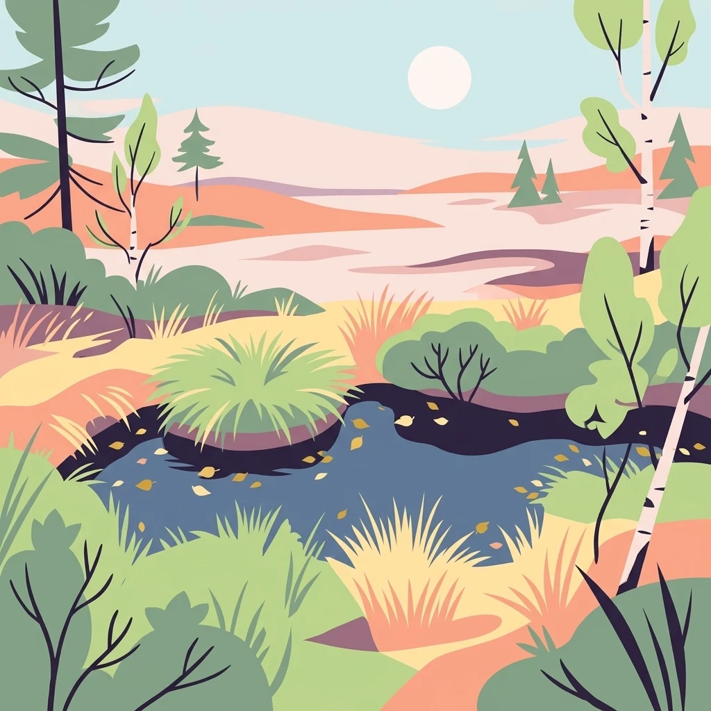
A flat-style digital illustration of a bog landscape with a small dark pool, surrounded by grasses, birch trees, and soft-colored rolling terrain under a pale sun.

Rájecká rašeliniště

Nature reserve

Park overview

Structured park overview, official facts, and landscape profile for Rájecká rašeliniště

Rájecká rašeliniště park facts, protected area profile, and essential visitor context

Review the core facts for Rájecká rašeliniště, including designation, size, terrain, visitor scale, habitats, and operating context in one park-focused overview.

About Rájecká rašeliniště

Rájecká rašeliniště is a small but ecologically distinctive protected area in the Ústecký region of the Czech Republic. It sits inside the much larger Labské pískovce Protected Landscape Area, a landscape dominated by Cretaceous-era sandstone formations that generally allow water to drain away rapidly. Against this backdrop, the reserve preserves an unusual and fragile peat bog ecosystem that formed where impermeable clay-sandy sediments interrupted the otherwise free-draining sandstone.

The protected territory is split into two parts: Rájec I, lying along the state border with Germany, and Rájec II, about 150 meters to the southeast. Together they cover only about 1.68 hectares, making the reserve one of the smallest yet specialized nature reserves in the region. Despite its modest size, Rájecká rašeliniště is ecologically meaningful because peatland vegetation of this quality is extremely uncommon on sandstone substrates anywhere in Bohemia.

Geologically, the area belongs to the Děčínská vrchovina (Děčín Highlands), specifically the Sněžnická hornatina subunit. The bedrock is composed of blocky sandstones from the lower and middle Turonian stage of the Cretaceous, resting on older crystalline rocks of the Krušné hory (Ore Mountains) basement. The peat itself reaches a maximum depth of only about 78 centimeters at Rájec II and roughly 44 centimeters at Rájec I, and both sites show signs of past degradation from drainage and human disturbance.

The reserve's biodiversity extends well beyond its small footprint. Botanists have documented a characteristic mix of bog shrubs such as Vaccinium vitis-idaea, Vaccinium uliginosum, Vaccinium oxycoccos, Calluna vulgaris, and cottongrass species, along with 44 moss taxa, several of which are nationally red-listed. Zoologists have logged 196 moth species, including tyrphobionts that depend entirely on peatland habitats, as well as cold-adapted true bugs, viviparous lizards, adders, pygmy shrews, and brown hares. Ungulates from the surrounding forests also use the area, prompting active wildlife management.

Declared a nature reserve in 2004, Rájecká rašeliniště now serves as both a refuge for bog biodiversity and a small but important outdoor laboratory for understanding how peat ecosystems survive in an otherwise dry sandstone environment.

Quick facts and research context for Rájecká rašeliniště

Rájecká rašeliniště is a state nature reserve (přírodní rezervace, IUCN management category IV) covering approximately 1.68 hectares in two separate plots near the village of Tisá in the Ústecký region of the Czech Republic. The reserve lies inside the Labské pískovce Protected Landscape Area, close to the German border, at an elevation of roughly 546 meters. It was officially declared a nature reserve in 2004 and is administered by the Administration of the Bohemian Switzerland National Park under the Czech Agency for Nature Conservation and Landscape Protection.

Park context

Deeper park guide and search-rich context for Rájecká rašeliniště

Rájecká rašeliniště history, landscape, wildlife, and travel context

Explore Rájecká rašeliniště through its history, landscape character, ecosystems, wildlife, conservation priorities, cultural context, and seasonal travel timing in a structured park guide built for atlas discovery and search intent.

Why Rájecká rašeliniště stands out

The reserve is most notable for hosting one of the very few peat bogs that managed to develop on sandstone bedrock within the Labské pískovce Protected Landscape Area. Bog cranberry, cottongrass, heather, bog bilberry, and sphagnum mosses characterize its vegetation, and the site supports peatland-specific invertebrates, mosses, and reptiles that would otherwise be rare in this dry sandstone region.
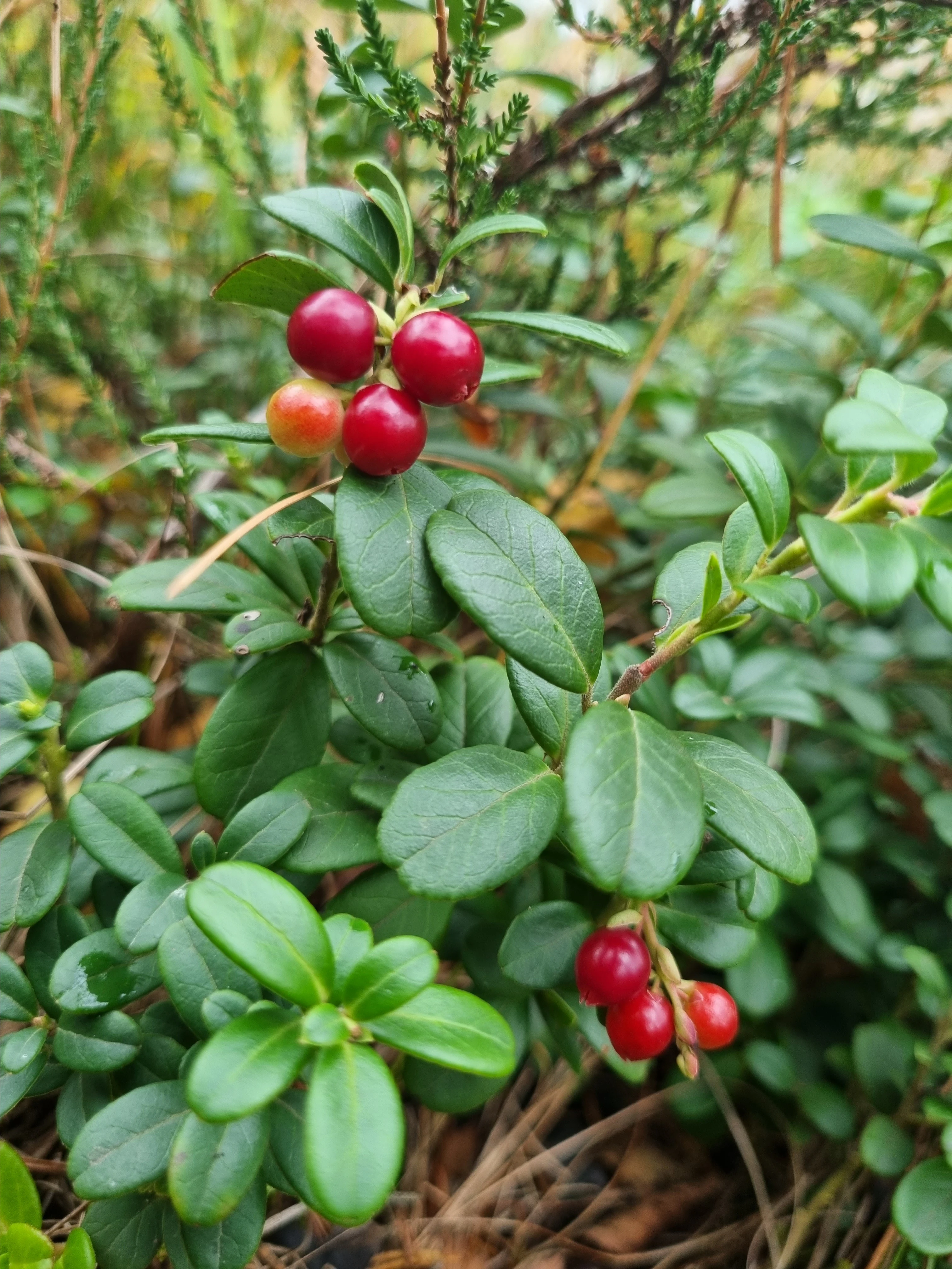
A close-up photograph of a lingonberry plant showing clusters of small, bright red berries and oval, dark green leaves.
Clusters of ripe red lingonberries in the Rájecká rašeliniště peat bog.

Rájecká rašeliniště history and protected-area timeline

The peatland around Rájec was once richer than what remains today. Research from the 1960s and 1970s recorded a more diverse bog community at the site, including crowberry (Empetrum nigrum), round-leaved sundew (Drosera rotundifolia), dwarf birch (Betula nana), and marsh pine (Pinus palustris), with peat covering roughly 0.6 hectares and peat mass reaching about 3000 cubic meters. At that time the area was still undisturbed by drainage or other major human intervention.

Over the second half of the twentieth century, the wider peatland complex began to decline. A separate bog southeast of today's reserve disappeared entirely due to artificial drainage. The two surviving sites were also affected: drainage channels were dug at Rájec II, and Rájec I suffered from heavy machinery crossing the fragile peat soils.

In the 1990s, conservation managers began active restoration. Small dams were installed to retain water, and invasive tree regeneration was cut back to prevent forest succession from transforming the bog vegetation. The site's rarity on sandstone substrate, combined with its continued vulnerability, justified formal protection, and in 2004 Rájecká rašeliniště was officially declared a nature reserve. Since then, it has been managed as part of the broader Labské pískovce Protected Landscape Area and the Bohemian Switzerland National Park framework.

Rájecká rašeliniště landscape and geographic character

The reserve lies in the Děčínská vrchovina, within the Sněžnická hornatina, a high, deeply dissected sandstone upland typical of northern Bohemia. The surrounding country is shaped by Cretaceous block sandstones resting on the crystalline basement of the Krušné hory, producing cliffs, rock towers, and narrow valleys.

Within this dry, rocky terrain, the reserve itself occupies shallow depressions where clay-rich subsoil has prevented water from draining away. These depressions hold the surviving peatland, while steep sandstone formations, including the climbing area known as Ptačí stěny, rise nearby and define the visual character of the area. Meadow flats, sandstone outcrops, and forest patches fringe the small bog pockets, creating a sharp local contrast between wet, open mire and the surrounding arid sandstone scenery.
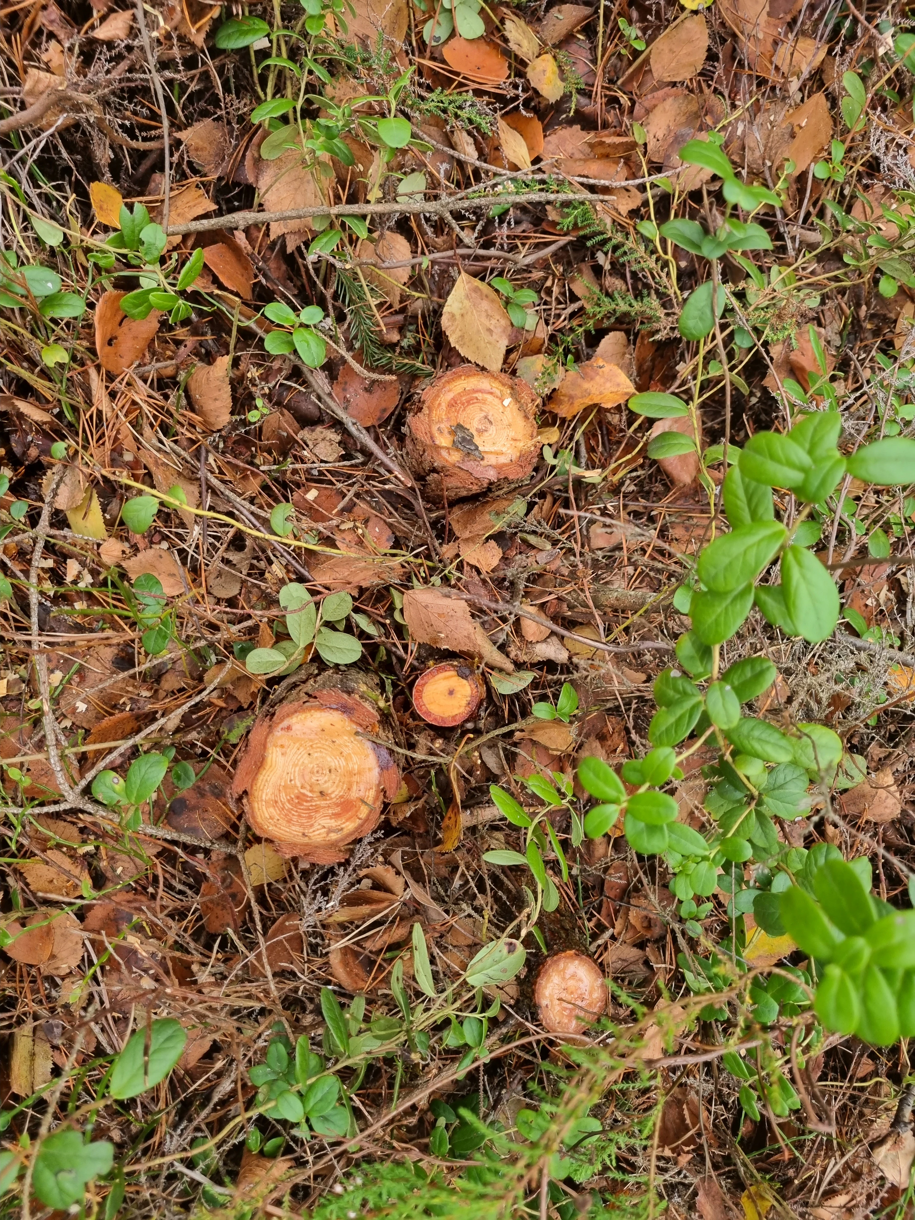
Top-down view of several small, fresh tree stumps surrounded by forest floor litter and green lingonberry shrubs.
Recent tree stump removal as part of peat bog ecosystem management at Rájecká rašeliniště.

Rájecká rašeliniště ecosystems, habitats, and plant life

The site is a true bog ecosystem despite its very small size. The vegetation is dominated by ericaceous dwarf shrubs such as lingonberry, bog bilberry, bog cranberry, and common heather, with cottongrass species, sphagnum mosses, and willows forming the supporting layer. The canopy is sparse, consisting mainly of Scots pine, silver birch, downy birch, and rowan, and conservation managers regularly remove encroaching trees to keep the mire open.

Beneath the plant cover, the reserve contains a remarkable diversity of bryophytes. Surveys have identified 44 moss and liverwort taxa, including vulnerable species such as Cephaloziella spinigera and Ptilium crista-castrensis, both nationally red-listed. Cottongrass, sphagnum, and bog bilberry define the habitat structure, while drying has allowed purple moor-grass (Molinia caerulea) to expand in some spots, a sign of ongoing hydrological stress.
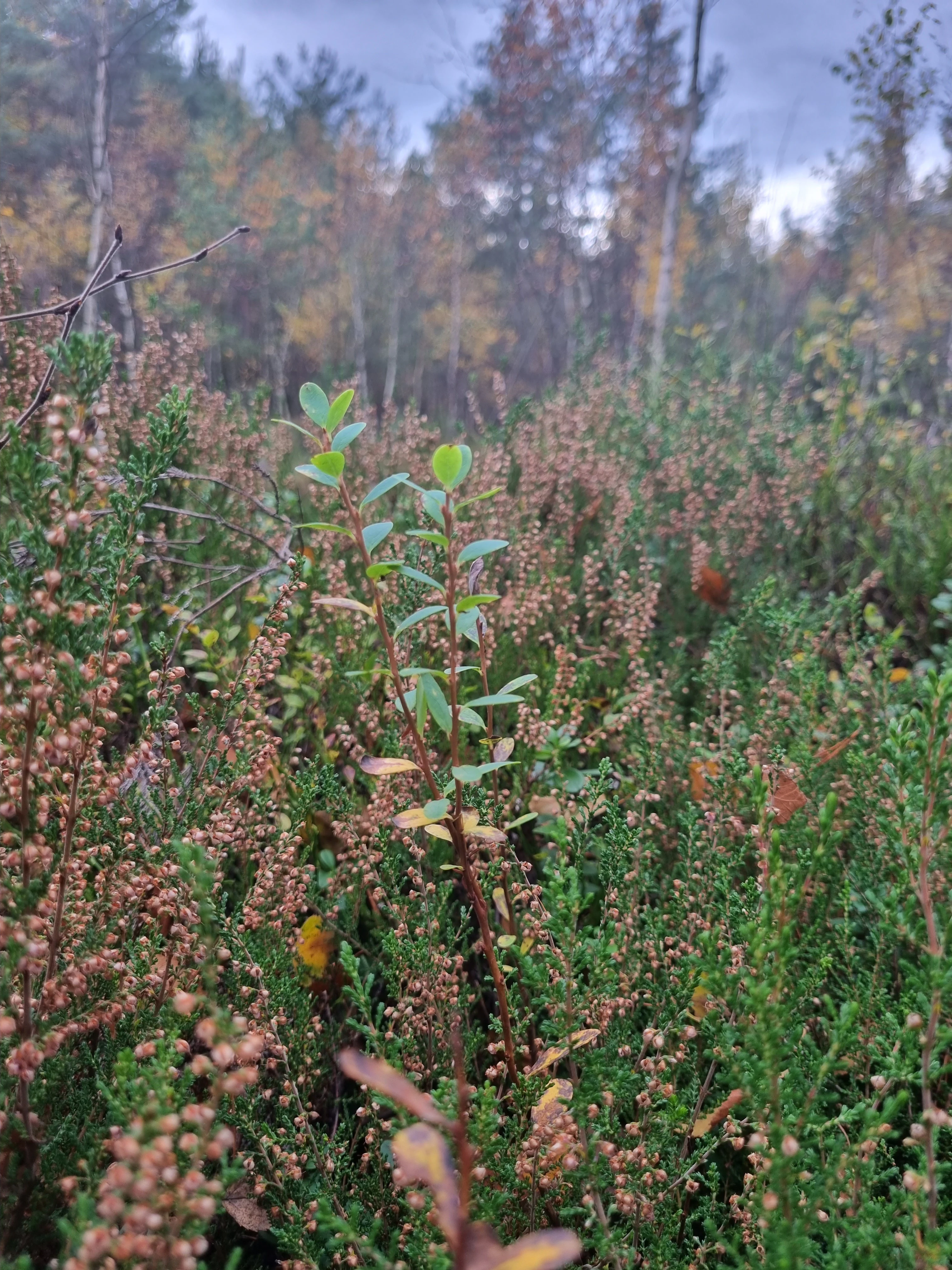
A close up view of low-lying bog plants, including green leafy stems of bog bilberry and numerous small brownish-pink heather flowers, with a blurred forest in the background.
Bog vegetation including common heather and bog bilberry at Rájecká rašeliniště.

Rájecká rašeliniště wildlife and species highlights

Even though the reserve covers barely more than a hectare and a half, its invertebrate fauna is unusually rich. Researchers have recorded 196 moth species, including tyrphobionts such as the bog-specialist Lithomoia solidaginis and several rare micro-moths that are otherwise scarce in the region. Cold-loving true bugs typical of acidic peatlands, including Nabicula limbata, Nabicula flavomarginata, Drymus brunneus, and Oxycarenus modestus, have also been documented.

Among vertebrates, the reptile fauna includes viviparous lizard and common European adder, while mammals observed at the site range from the tiny pygmy shrew and European hare to larger ungulates that pass through the area from the surrounding forests. The combination of bog specialists, edge-of-range species, and larger browsing animals helps make the reserve an important component of regional biodiversity, despite its small size.
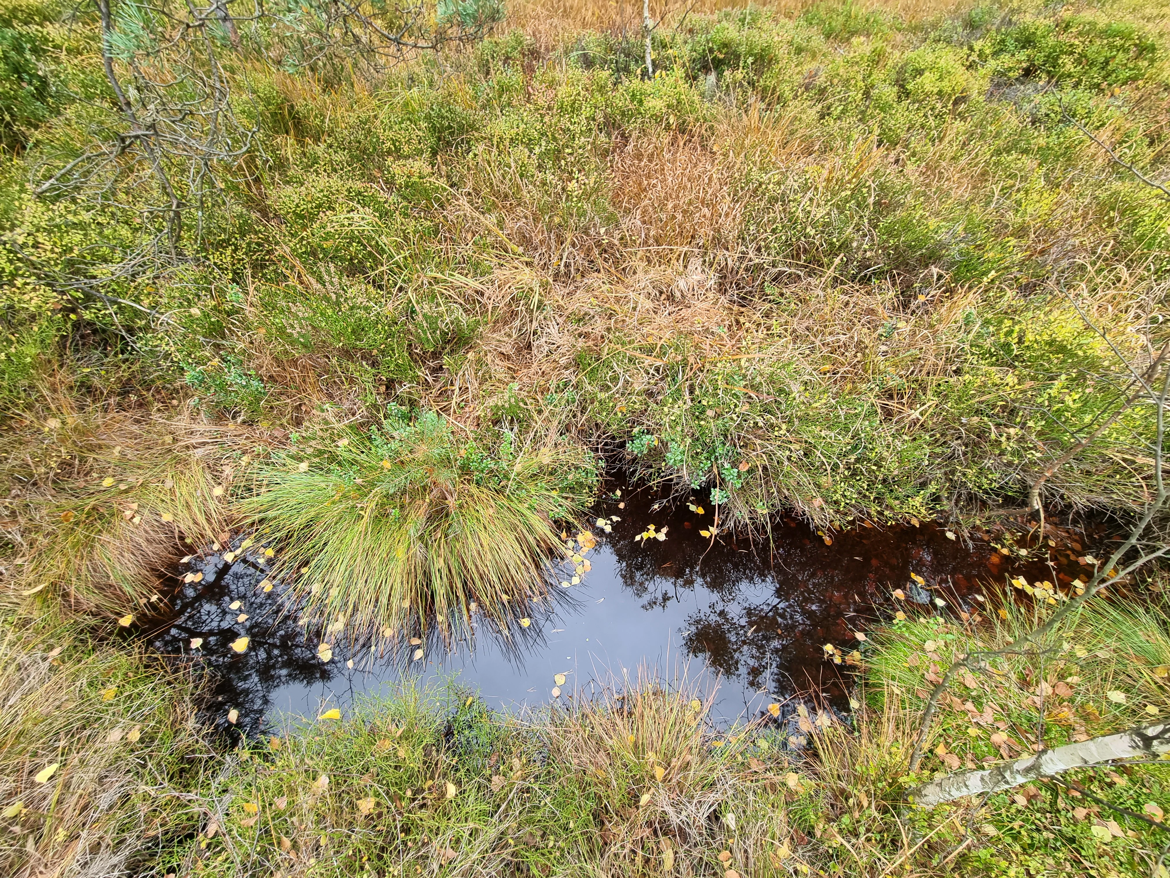
A top-down view of a small, dark, still pond surrounded by dense grasses, bog shrubs, and scattered fallen leaves in a peatland environment.
A small, dark pool of water nestled within the peat bog vegetation at Rájecká rašeliniště.

Rájecká rašeliniště conservation status and protection priorities

Rájecká rašeliniště is protected primarily because peat bog habitats of this type are exceptionally rare on sandstone substrate, where high permeability normally prevents peat accumulation. The reserve preserves a relict bog community that supports protected and red-listed species, and its small size makes active management essential.

The site overlaps with several wider conservation designations. It lies inside the Labské pískovce Protected Landscape Area, partially overlaps the Labské pískovce Bird Protection Area (ptačí oblast), and intersects with the Olšovský potok Site of Community Importance (evropsky významná lokalita) under the European Natura network.

Active management has focused on restoring the hydrology, including blocking old drainage channels, building small dams, and even using impermeable sheeting to retain water in the peat. Conservation workers have also removed non-native and invasive trees such as eastern white pine and European larch, as well as self-seeded Scots pine and birch, to prevent forest succession from smothering the bog flora. Ungulate browsing is controlled using scent-based fencing rather than physical barriers, reflecting an ongoing balance between ecological restoration and practical site management.

Rájecká rašeliniště cultural meaning and human context

The reserve lies in the former borderland between Czechoslovakia and the former East Germany, and the nearby educational trail "Zapomenuté pohraničí" (Forgotten Borderland) recalls the human history of this once restricted frontier zone. The boulder marked with the reserve symbol, seen in photographs at the site, reflects the broader Czech tradition of marking protected areas with carved border-like monuments.

Sandstone areas like Labské pískovce also have a strong climbing culture, and the Rájec area is one of the recognized climbing sites used by the Czech Mountaineering Federation. This combination of ecological and recreational use is part of the regional identity around Tisá, where sandstone cliffs, former borderland trails, and small bog pockets together shape both natural and cultural heritage.
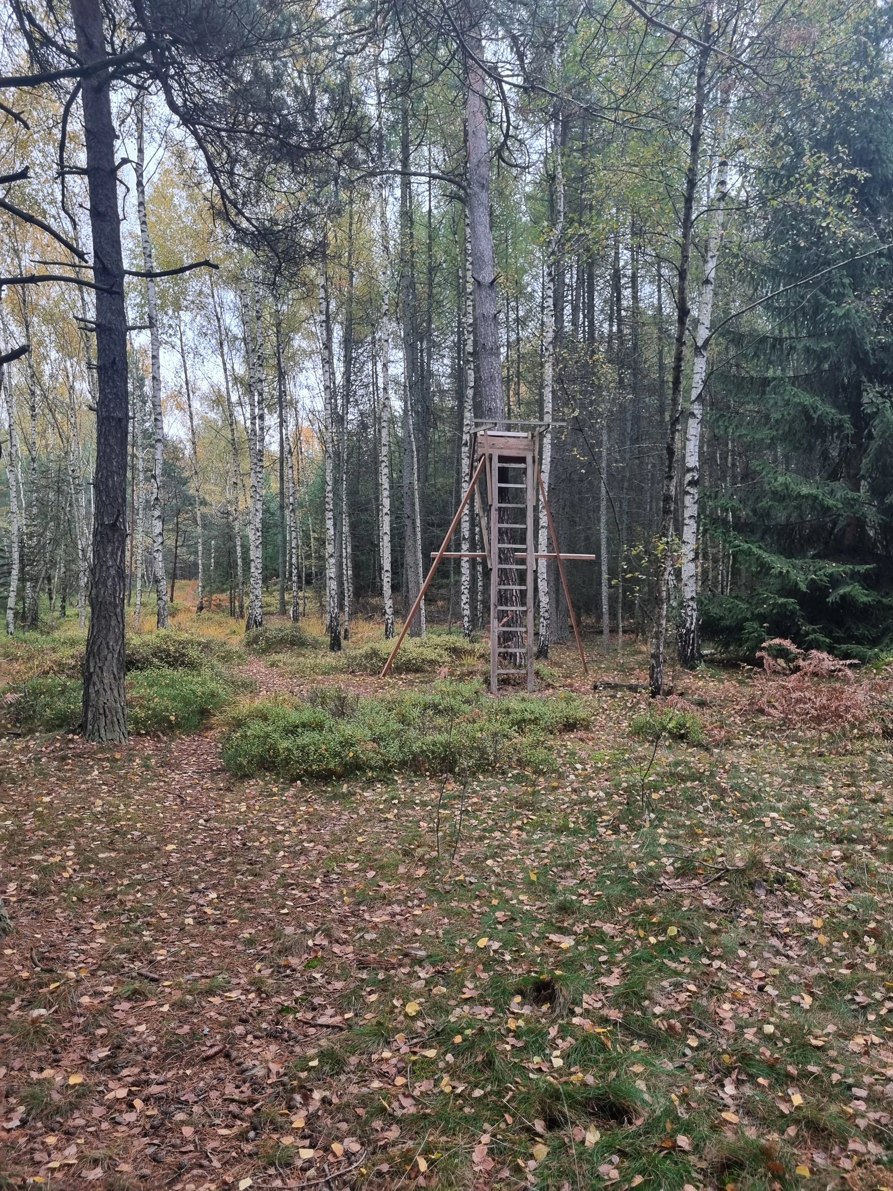
A wooden hunting stand elevated on four poles stands in a clearing within a dense forest of birch and conifer trees with fallen autumn leaves on the ground.
A wooden hunting stand situated among the trees in the Rájecká rašeliniště nature reserve.

Top sights and standout views in Rájecká rašeliniště

Rájecká rašeliniště is remarkable for fitting an entire bog ecosystem into a fraction of two hectares. Highlights include peat-forming vegetation on normally porous sandstone, the protected bog cranberry, cottongrass-dominated communities, and a nationally significant moss flora. The reserve also overlaps with the Labské pískovce Bird Protection Area and the Olšovský potok European Site, giving a very small site broad conservation recognition.

Best time to visit Rájecká rašeliniště

The reserve is accessible year-round through unmarked paths near the Czech-German border, with the surrounding educational trail and Via Czechia pilgrimage route offering broader seasonal walking opportunities. Spring and early summer are the most rewarding periods for observing bog vegetation in bloom and for seeing active birdlife around the sandstone cliffs. Late summer and autumn highlight the heather and the changing colors of the bog shrubs, though visitors should note that the peat surface remains fragile in all seasons and the area is best treated as a quiet nature-spot rather than a hiking destination.

Monthly climate preview

Long-term representative point measurements tracking monthly temperature and precipitation patterns

Rájecká rašeliniště Climate Normals and Annual Temperature Rhythm

Historical data records mean monthly temperatures ranging from sub-zero winter lows to warm summer maximums alongside consistent daily precipitation levels across the coordinate. Reviewing the complete twelve-month climatology profile provides deeper analytical context on long-term weather variations within the protected terrain.
Annual mean8 °C
-2 °C19 °C
Jan-2°
Feb-1°
Mar
Apr
May13°
Jun17°
Jul19°
Aug19°
Sep14°
Oct
Nov
Dec-1°
Warmest month
July

19.1 °C

Coolest month
January

-1.8 °C

Wettest month
July

2.8 mm/day

Driest month
April

1.3 mm/day

Park location guide

Geography guide, regional context, and park location map for Rájecká rašeliniště

Rájecká rašeliniště park geography, regions, and map view in Czechia

Understand where Rájecká rašeliniště sits in Czechia through a broader geographic reading of the surrounding landscape, nearby location context, and its mapped position within the national park landscape.

How Rájecká rašeliniště fits into Czechia

Czech Republic is a landlocked Central European country with a population of approximately 10.9 million people. The nation was established as an independent state on January 1, 1993, following the dissolution of Czechoslovakia. Its capital and largest city is Prague, with other major urban centers including Brno, Ostrava, Plzeň, and Liberec.

Wider geography shaping Rájecká rašeliniště in Czechia

The Czech Republic is a landlocked country in Central Europe. It is bordered by Germany to the west, Austria to the south, Poland to the northeast, and Slovakia to the southeast. The landscape is predominantly hilly, with the territory covering 78,871 square kilometers.

Map view of Rájecká rašeliniště

Use this park location map to pinpoint Rájecká rašeliniště in Czechia, understand its exact geographic position, and read its mapped placement within the surrounding landscape more clearly.

Pigeon | © OpenStreetMap contributors

Location context for Rájecká rašeliniště

Ústecký kraj

Explore protected area views, rare bog habitats, and the distinctive upland terrain surrounding Rájecká rašeliniště.

Rájecká rašeliniště Photos and Landscapes: Visualizing Sandstone Peat Bogs

Visual documentation captures the rare peat bogs and sandstone formations that define Rájecká rašeliniště within its northern Bohemian upland setting. Examining these detailed landscape photographs helps researchers understand the delicate wetland habitats and unique geological contrast of the reserve.

A close-up photograph of a lingonberry plant showing clusters of small, bright red berries and oval, dark green leaves.

A wooden informational signpost with the Czech lion crest labeled PŘÍRODNÍ REZERVACE stands in a grassy, forested area.

Top-down view of several small, fresh tree stumps surrounded by forest floor litter and green lingonberry shrubs.

A close up view of low-lying bog plants, including green leafy stems of bog bilberry and numerous small brownish-pink heather flowers, with a blurred forest in the background.

A top-down view of a small, dark, still pond surrounded by dense grasses, bog shrubs, and scattered fallen leaves in a peatland environment.

A nature reserve sign attached to a wooden post and a small stone pillar in a grassy meadow surrounded by an autumn forest.

A wooden hunting stand elevated on four poles stands in a clearing within a dense forest of birch and conifer trees with fallen autumn leaves on the ground.

Park atlas

Discover related reserves and regional sandstone conservation areas nearby

Exploring Parks Near Rájecká Rašeliniště and Surrounding Protected Landscapes

Compare Rájecká rašeliniště with other protected areas across the surrounding sandstone region and adjacent upland habitats. Examining nearby reserves reveals broader patterns of rare peatland hydrology, diverse bryophyte flora, and specialized conservation landscapes.
Watercolor painting showing a landscape with green hills, trees, and a river winding through the scene
National parkGermany
About 13 km away#1 closest

Northeast

Saxon Switzerland National Park: Protected Area Geography and Map Exploration

Discover its mapped boundaries and regional landscape context.

Saxon Switzerland National Park, a protected national park in Germany, offers a distinct focus for geographic and atlas-based discovery. This page details the park's specific protected landscape, its mapped boundaries, and its contribution to the regional geography. MoriAtlas allows for in-depth exploration of such natural areas, providing essential context for understanding their place within broader natural systems and mapped terrains.

Area
93.5 km²
Established
1990
IUCN
II
Visitors
1.7M annual
Nature reserveSächsische Schweiz-Osterzgebirge
About 17 km away#2 closest

West

Weicholdswald Nature Reserve: Mapped Protected Landscapes of the Eastern Ore Mountains

A preserved beech forest enclave within the Sächsische Schweiz-Osterzgebirge

Weicholdswald stands as a primary nature reserve in the Sächsische Schweiz-Osterzgebirge district, known for its 160-year-old beech trees and extensive deadwood habitats. This protected area provides a rare look at near-natural forest ecosystems that have remained free from historic clear-cutting or coniferous monocultures, maintaining rich biodiversity across its streams and granitic slopes.

Area
1.037 km²
Established
1961
IUCN
IV
Watercolor illustration of rolling green hills, forests, and distant mountains
National parkCzechia
About 17 km away#3 closest

East

Bohemian Switzerland National Park: Czech Sandstone Protected Landscape and Map Exploration

Discover its unique terrain and protected area geography.

Bohemian Switzerland National Park is a protected area in the Czech Republic known for its exceptional sandstone geology. This national park showcases a dramatic landscape of towering rock formations, deep gorges, and striking canyons, forming a significant part of the Elbe Sandstone Mountains. Through MoriAtlas, users can explore its mapped protected boundaries, understand its regional geographic context, and appreciate its unique natural heritage.

Area
79 km²
Established
2000
IUCN
II
Relief
Mixed relief
A wide watercolor painting depicting a green landscape with rolling hills, scattered trees, and a pale sky.
Nature reserveSaxony
About 17 km away#4 closest

West

Bergwiesen im Osterzgebirge Nature Reserve: Saxony Regional Protected Area Atlas

Mapping cultural montane meadow landscapes and stone-strip field systems.

Bergwiesen im Osterzgebirge protects an extensive network of open-land habitats across the eastern Ore Mountains of Saxony. The area is defined by its complex mosaic of mountain meadows, mat-grass swards, and remnants of bog systems. This record examines the geographic extent of these preserved lands and their role in maintaining traditional agricultural heritage within the regional mountain topography.

Established
1999
Relief
Mountain
Climate
Temperate
Scope
Terrestrial
Watercolor painting of a panoramic mountain landscape with rolling green hills, patches of forest, and distant peaks under a soft sky.
Nature reserveSaxony
About 18 km away#5 closest

West

Geisingberg Nature Reserve: A Volcanic Basalt Peak in the Eastern Ore Mountains of Saxony

Exploration of protected mountain terrain and volcanic geology

Geisingberg serves as a rare volcanic Quellkuppe rising above the Saxon mining landscapes of Altenberg. The nature reserve protects 300 hectares of high-altitude bogs, species-rich meadows, and historic forest clearings. Gain a deeper understanding of this mountain through detailed mapped terrain, topographic features, and long-standing protected-area status within the Ore Mountains.

Area
3 km²
Established
1960
Relief
Mountain
Climate
Temperate
A watercolor illustration depicting rolling, soft hills and green vegetation with distant, faded mountains in the background, set against a plain white background.
Nature reserveGermany
About 20 km away#6 closest

Northwest

Spargründe bei Dohna: Nature Reserve and Protected Valley Landscapes in Germany

Examining the crystalline ravines and forest ecosystems of the Saxon landscape

Spargründe bei Dohna stands as a distinct nature reserve at the northern margin of the Elbtalschiefergebirge. The site encompasses narrow, steeply-sided valleys carved into Dohna Granodiorite, creating a rugged terrain of rocky ridges and shaded deciduous woodland. This geographic overview examines the boundaries and natural features of the reserve, highlighting its role within the wider Müglitztal protected area network.

Area
0.373 km²
Relief
Upland
Climate
Temperate
Access
Easy access
Watercolor painting of a peat bog with a small meandering stream, scattered deadwood, and a distant mountain range under a pale sky.
Nature reserveSachsen
About 21 km away#7 closest

Southwest

Georgenfelder Hochmoor Nature Reserve: A Protected Highland Bog in the Ore Mountains

Examining the geography and mapped peatland terrain in the Sachsen region

Georgenfelder Hochmoor is a distinct ridge-top raised bog located on the high plateau of the Osterzgebirge. This protected area maintains a significant ten-thousand-year peat profile and plays a vital role in the watershed divide of the Ore Mountains, offering a clear example of modern transboundary conservation and mountain moorland development.

Area
0.135 km²
Established
1961
IUCN
IV
Visitors
17.5K annual
A soft watercolor illustration featuring a panoramic view of a peat bog landscape with evergreen trees and distant rolling mountains under a white background.
Nature reserveÚstecký kraj
About 21 km away#8 closest

Southwest

Rašeliniště U jezera, Cínovecké rašeliniště: Protected Nature Reserve and Bog Landscape

Geography and environmental context in the Ústecký kraj mountain range.

Situated at high elevations in the Ore Mountains, Rašeliniště U jezera, Cínovecké rašeliniště protects a functioning example of a rare raised bog ecosystem. This reserve contains diverse bog-pool flora and peat-forming habitats, standing as a significant site for understanding the montane geography of northern Bohemia and the ongoing conservation of Krušné hory wilderness areas.

Area
0.601 km²
Established
2001
IUCN
IV
Relief
Mountain

Common questions about visiting, size, designation, and location context for Rájecká rašeliniště

Rájecká rašeliniště FAQs for park facts, access, geography, and protected area context

Find quick answers about Rájecká rašeliniště, including protected-area facts, park geography, trail and visitor context, and how the park fits into its surrounding country and regional landscape.
MoriAtlas Explorer

Continue Your Protected Areas Search Across the Global Atlas

Deepen your exploration by continuing the structured search for national parks and protected areas worldwide. Utilize the comprehensive filtering capabilities to compare different conservation landscapes and refine your understanding of global park geography. Discover more about the distribution and characteristics of protected natural areas.

Global natural geography