
Mori Atlas logo
Nature reserveRangatira Island

Explore the isolated terrain, rugged maritime cliffs, and ecological boundaries of this remote Pacific sanctuary.

Rangatira Island Nature Reserve: Geographic Mapping and Protected Landscapes of the Chatham Islands

Rangatira Island stands as a significant nature reserve within the remote Chatham Islands archipelago of New Zealand. This rugged island landscape features diverse habitats ranging from wind-swept coastal cliffs and offshore stacks to sheltered interior shrublands, serving as a vital refuge for endemic wildlife and massive seabird breeding colonies. Detailed mapping of the island provides context for its role in long-term conservation and its position as a unique, uninhabited landmass within the broader Pacific geography.

Chatham IslandsNature ReserveIsland SanctuarySeabird Breeding ColonyEndemic SpeciesBlack Robin Recovery
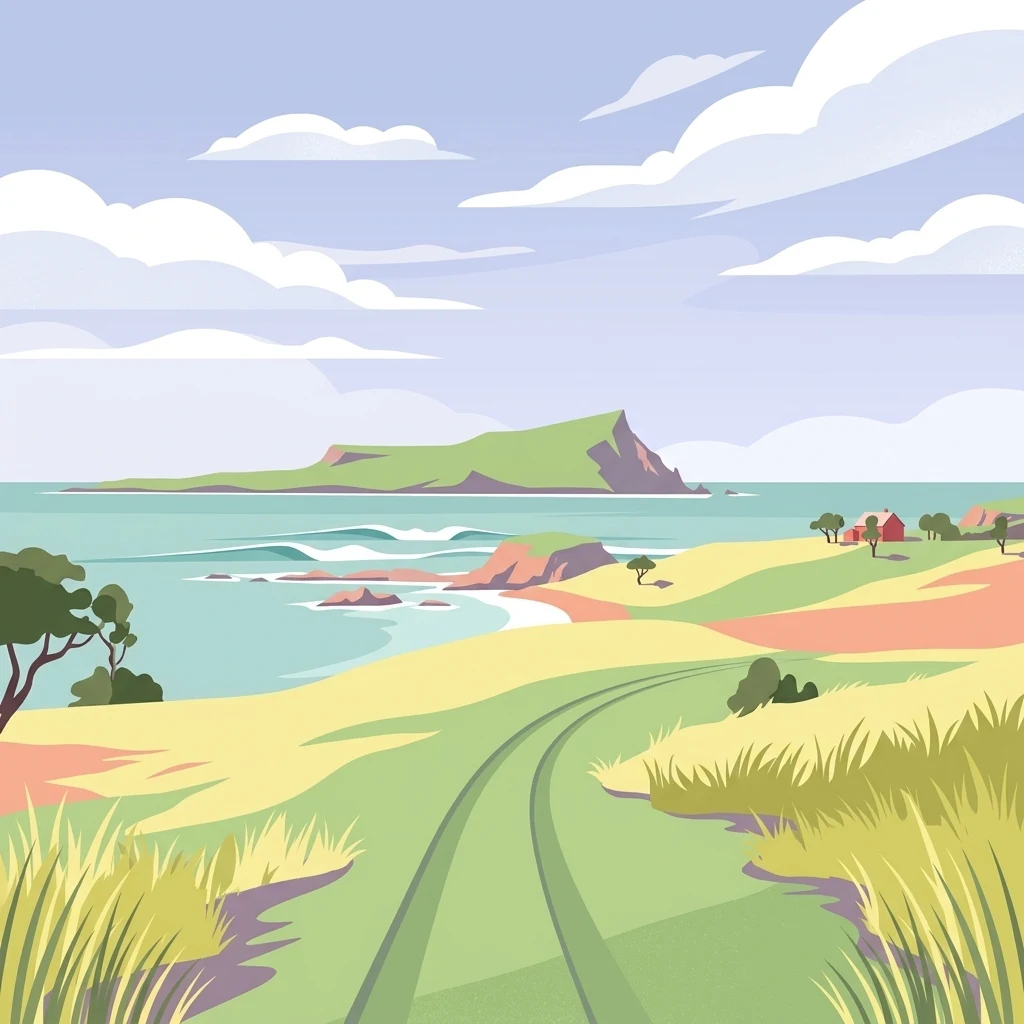
A flat-style digital illustration showing a grassy dirt track leading toward a coastal view with rolling green hills, a turquoise sea, and a distant rocky island under a cloudy sky.

Rangatira Island

Nature reserve

Park overview

Structured park overview, official facts, and landscape profile for Rangatira Island

Rangatira Island park facts, protected area profile, and essential visitor context

Review the core facts for Rangatira Island, including designation, size, terrain, visitor scale, habitats, and operating context in one park-focused overview.

About Rangatira Island

Rangatira Island, widely called South East Island and known in Moriori tradition as Hokorereoro, is a remote and uninhabited nature reserve in the Chatham Islands archipelago. The Chatham Islands themselves are an isolated outpost of New Zealand territory, sitting roughly 800 kilometres east of the South Island in the Pacific Ocean. Within that archipelago, Rangatira lies off the south-east coast of Pitt Island, the second largest landmass in the group, and forms part of a network of protected islands that together safeguard much of the region's unique biodiversity.

The island covers about 218 hectares of varied terrain that rises to a modest high point of 224 metres. Its coastal cliffs, slopes, and interior vegetation communities support a dense concentration of breeding seabirds, while its sheltered interior areas and forest patches provide refuge for land birds and invertebrates that have disappeared from the larger, more-modified islands of the archipelago. The terrain is rugged enough that access is restricted and controlled by the New Zealand Department of Conservation.

Rangatira's modern identity is inseparable from its conservation role. It is most widely recognized internationally as the place where the black robin was rescued from extinction in the latter half of the twentieth century, a recovery effort that has become one of the most celebrated examples of single-species conservation in the world. The island's protected status, its isolation, and its lack of permanent human population have allowed it to maintain populations of seabirds, forest birds, and invertebrates that no longer survive on the inhabited Chatham Islands. As a result, Rangatira functions not only as a stand-alone reserve but as a keystone site for the survival of multiple species found nowhere else on Earth.

For ecologists and visitors alike, the island represents one of the purest expressions of the Chatham Islands' natural character. Because public access is strictly controlled, Rangatira remains primarily a working scientific and conservation site rather than a destination of mass tourism, with its importance measured in species protected and ecological processes maintained rather than in visitor numbers.

Quick facts and research context for Rangatira Island

Rangatira Island is the third largest island in the Chatham Islands archipelago, covering roughly 218 hectares of land. It sits about 55 kilometres south-east of Waitangi, the main settlement on Chatham Island, and approximately 800 kilometres east of New Zealand's South Island. The island has no permanent human population and is administered as a gazetted nature reserve under New Zealand's Department of Conservation.

The island has been identified by BirdLife International as an Important Bird Area because it supports exceptionally large breeding colonies of broad-billed prions, Chatham petrels, and white-faced storm petrels. It is also notable for hosting several endemic invertebrate species and a population of the Rangatira spider, one of New Zealand's largest spiders.

Protection and recognition

Documented conservation scope, management framing, and international recognition records

Rangatira Island Protection Status and International Recognition Data

Rangatira Island maintains a mixed protection scope with documented status details and management records. Official conservation data outlines designated boundaries, administrative frameworks, and international recognition sources where verified.

Protection details

Protection scope
Mixed
Transboundary protection
No
Park context

Deeper park guide and search-rich context for Rangatira Island

Rangatira Island history, landscape, wildlife, and travel context

Explore Rangatira Island through its history, landscape character, ecosystems, wildlife, conservation priorities, cultural context, and seasonal travel timing in a structured park guide built for atlas discovery and search intent.

Why Rangatira Island stands out

Rangatira Island is best known for being the last remaining stronghold of the black robin, an endangered Chatham Islands songbird that was saved from extinction through a sustained conservation program led by Don Merton. The island became the species' final refuge and the location of the fostering efforts that revived the population from a tiny handful of birds. In addition to this famous rescue story, Rangatira is recognized for its enormous seabird colonies. The island hosts hundreds of thousands of breeding pairs of broad-billed prions and white-faced storm petrels, along with a significant population of Chatham petrels, the island having once been the only known breeding site for that species. The combination of globally significant seabird numbers, endemic invertebrates, and a dramatic single-species recovery story gives Rangatira a distinctive place in New Zealand conservation history.
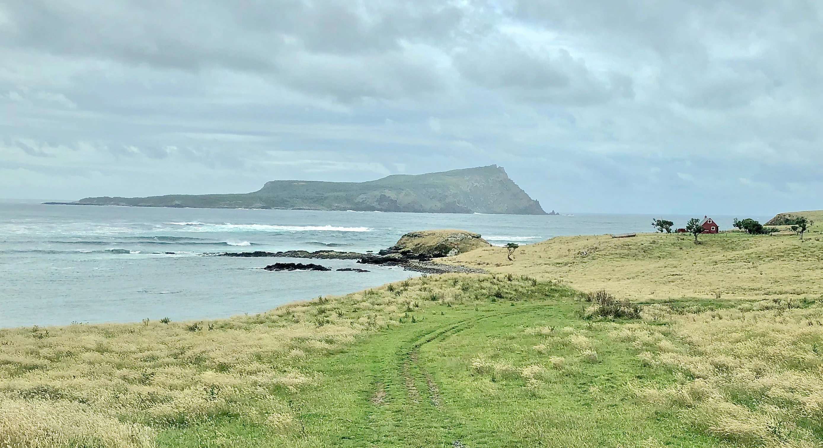
A coastal landscape view featuring a grassy foreground sloping down toward the ocean, with Rangatira Island visible as a large, flat-topped landmass in the distance under a cloudy sky.
A view across Glory Bay looking toward Rangatira Island in the Chatham Islands.

Rangatira Island history and protected-area timeline

The human history of Rangatira Island is shaped by the broader story of the Chatham Islands and by the relatively limited physical evidence of prolonged settlement on the island itself. The Chatham Islands have been inhabited for centuries, and oral traditions of the indigenous Moriori people include accounts of journeys to Hokorereoro by canoe, undertaken in seasonal quests for muttonbirds, the local name for sooty shearwaters and related seabirds harvested as a traditional food source. Despite these traditions, no material traces such as dendroglyphs or rock carvings have been documented on the island, leaving its pre-European human footprint largely uncertain.

In the modern era, the island was used for European-style farming, with settlers running sheep, goats, and cattle on Hokorereoro through much of the nineteenth and twentieth centuries. This pastoral use continued until the 1960s, when the last remaining livestock were removed, marking a turning point in the island's ecological trajectory. Following the withdrawal of grazing animals, the island was gazetted as a nature reserve and placed under the control of New Zealand's Department of Conservation, which continues to manage access today.

The island's scientific and conservation history began in earnest in 1954, when researchers taking part in the 1954 Chatham Islands expedition visited Rangatira. Their work, and the research that followed, helped reveal the extraordinary ecological value of the island, from its seabird colonies to its uncommon invertebrates. The most famous chapter of Rangatira's history, however, came later: the rescue of the black robin from extinction, an effort led by conservation biologist Don Merton and his team, who relocated birds to the island and used foster parents to raise successive generations of chicks. That program transformed Rangatira from a remote island pasture into a globally recognized symbol of species recovery.

Rangatira Island landscape and geographic character

Rangatira Island is a compact but rugged landmass shaped by its oceanic exposure and its position within the wider Chatham Islands archipelago. The terrain climbs to a modest high point of 224 metres, creating slopes that descend toward a coastline marked by cliffs, low shores, and small coves such as Glory Bay. The interplay of elevated ground and irregular coastline produces a landscape with strong contrast between sheltered interior valleys and exposed coastal faces.

The island's vegetation reflects both its isolation and its history. Former pastoral use has left traces, but without ongoing grazing pressure the island is reverting to native plant cover characteristic of the Chathams, including shrublands and forest patches suited to the windy, maritime climate. This mosaic of habitats, woven together across a relatively small area, contributes to Rangatira's ecological richness by offering distinct environments for ground-nesting seabirds, forest-dwelling land birds, and invertebrates that depend on undisturbed native vegetation.

The surrounding ocean is as much a part of the island's landscape character as the land itself. Sea cliffs, offshore stacks including the prominent Tarakoikoia (locally known as The Pyramid), and the waters around Rangatira shape the island's identity as a remote, wind-swept Pacific landfall where terrestrial and marine ecosystems meet directly along the shoreline.

Rangatira Island ecosystems, habitats, and plant life

Rangatira supports a distinctive ecological profile that sets it apart even within the Chatham Islands. Its habitats span coastal cliffs and slopes, regenerating native shrubland, forest patches, and small inland areas that together host a remarkable concentration of breeding seabirds and a variety of rare terrestrial species. The island's protected status and the absence of permanent human residents have allowed ecological processes to function with relatively little disruption.

The vegetation communities on Hokorereoro are characteristically Chatham Islands in composition, with endemic plant species and forms adapted to strong winds, salt spray, and the cool maritime climate. Regeneration from former pasture land has progressed significantly since livestock were removed in the 1960s, allowing native flora to gradually reclaim the landscape. This recovering vegetation is vital not only for the island's plant communities but also for the land birds and invertebrates that rely on it for food and shelter.

Marine and coastal influences are felt throughout the island's ecosystems. Seabirds nesting on the cliffs and slopes connect the terrestrial habitats directly to the surrounding ocean, transferring nutrients and shaping vegetation patterns near colonies. Even inland habitats carry a strong maritime character, reflecting the constant influence of sea spray, wind, and the island's small size. Rangatira thus functions ecologically as a tightly integrated island ecosystem rather than as a simple collection of separate habitats.

Rangatira Island wildlife and species highlights

Rangatira Island is one of the most important wildlife sites in the New Zealand region, with an exceptional concentration of endemic and threatened species packed into a relatively small land area. The island's most famous resident is the black robin, an endangered songbird that was rescued from extinction through a deliberate conservation program involving transfers to Rangatira and the use of foster parents to rear successive generations of chicks. Following the intervention led by Don Merton, the black robin population recovered on the island, making Rangatira the species' secure stronghold.

The island is also a globally significant seabird refuge. Rangatira has been recognized by BirdLife International as an Important Bird Area because of the sheer scale of its breeding colonies, which include hundreds of thousands of pairs of broad-billed prions and white-faced storm petrels, along with a substantial population of Chatham petrels, a species for which Rangatira long served as the only known breeding site. Recent conservation work has established new Chatham petrel colonies on Pitt Island and Chatham Island, but the seabird numbers on Rangatira remain exceptional.

Beyond birds, Rangatira supports a striking array of rare and endemic invertebrates. These include the giant stick insect, the coxella weevil, the flightless rove beetle Creophilus rekohuensis, and the Pitt Island longhorn beetle. The island is also locally notorious for the presence of the Rangatira spider, one of New Zealand's largest spiders, a species that adds to the island's reputation as a refuge for invertebrates with very limited natural ranges. Together, this mix of seabirds, land birds, and invertebrates makes Rangatira one of the most wildlife-rich small islands in the New Zealand realm.

Rangatira Island conservation status and protection priorities

Rangatira Island stands as one of the most important conservation sites in the New Zealand region. Its status as a gazetted nature reserve, combined with strict access controls managed by the Department of Conservation, has allowed it to maintain ecological values that have been lost on inhabited islands nearby. The withdrawal of sheep, goats, and cattle by the 1960s marked the beginning of its modern role as a protected refuge, and the island has since become a focal point for species recovery at both a national and international scale.

The island's most celebrated conservation achievement is the rescue of the black robin from extinction, one of the most ambitious single-species recoveries ever undertaken. A team led by Don Merton used foster parent birds to raise black robin chicks, gradually rebuilding the population from a tiny remnant to a viable wild population, with Rangatira serving as the species' secure breeding stronghold. This story has become a global reference point for intensive species recovery work.

Rangatira also plays a central role in the conservation of seabirds and invertebrates endemic to the Chatham Islands. Its identification by BirdLife International as an Important Bird Area highlights the importance of its enormous prion and storm petrel colonies, while ongoing work to establish new Chatham petrel colonies on other islands shows how Rangatira has functioned as a source population for wider regional recovery. For several invertebrate species found nowhere else, the island is effectively the last secure habitat, underscoring its role as a critical refuge for the Chatham Islands' most evolutionarily distinctive fauna.

Rangatira Island cultural meaning and human context

The cultural context of Rangatira Island is closely tied to the indigenous heritage of the Chatham Islands, particularly the oral traditions of the Moriori people, the original inhabitants of the archipelago. Moriori tradition recounts seasonal canoe journeys to Hokorereoro for the harvesting of muttonbirds, linking the island to long-standing practices of seasonal resource use and traditional ecological knowledge. While no physical evidence of these visits, such as tree carvings or rock art, has been found, the traditions themselves remain an important part of the island's place within Moriori cultural memory.

In the more recent era, the island's European pastoral history, marked by sheep, goats, and cattle grazing until the 1960s, left its own imprint before conservation priorities shifted. Today, the absence of permanent residents and the strict control of access mean that Rangatira's human connections are primarily scientific, administrative, and cultural-historical rather than residential. The island's significance within New Zealand conservation culture, especially through the black robin recovery story, has also made it a touchstone in discussions of how small nations can protect highly endangered species.

Top sights and standout views in Rangatira Island

Rangatira's standout feature is its role as the surviving stronghold of the black robin, an endangered Chatham Islands songbird famously saved from extinction through a landmark conservation program. The island's protected status and the absence of ongoing farming have been central to that recovery, and the black robin story remains the single most recognizable element of Rangatira's identity.

Equally distinctive are the island's seabird colonies, which rank among the largest in the New Zealand region. Hundreds of thousands of broad-billed prions and white-faced storm petrels breed on the island, alongside significant numbers of Chatham petrels, a species for which Rangatira was the only known breeding site until recently. Combined with a remarkable suite of rare endemic invertebrates and a remote, rugged landscape, these features make Rangatira one of the most ecologically concentrated small islands in the southern Pacific.

Best time to visit Rangatira Island

Because Rangatira Island is a strictly controlled nature reserve with access managed by the Department of Conservation, any visit is shaped primarily by conservation considerations rather than personal scheduling. The island's climate reflects its position far to the east of mainland New Zealand, with conditions that are typically cool, changeable, and exposed to strong Pacific weather systems throughout the year.

For those interested in wildlife observation, the most dramatic periods to visit, where permission allows, tend to align with the seabird breeding season, when the island's enormous prion and storm petrel colonies are most active on land. Outside of these periods, the island's vegetation regenerating after decades without grazing contributes to a quieter, more contemplative character. Visitors should anticipate that weather, sea conditions, and conservation priorities all influence when travel to the island is feasible.
Monthly climate preview

Track measured monthly weather variations and representative baseline averages for Rangatira Island

Rangatira Island Climate Normals, Long Term Temperature and Precipitation Patterns

Historical coordinate data outlines annual temperature and precipitation rhythms across Rangatira Island through representative long term normals. Detailed monthly breakdowns provide complete climatological profiles for comprehensive regional analysis.
Annual mean12 °C
10 °C15 °C
Jan14°
Feb15°
Mar14°
Apr13°
May12°
Jun11°
Jul10°
Aug10°
Sep10°
Oct10°
Nov11°
Dec13°
Warmest month
February

15 °C

Coolest month
August

9.6 °C

Wettest month
June

3 mm/day

Driest month
January

1.9 mm/day

Park location guide

Geography guide, regional context, and park location map for Rangatira Island

Rangatira Island park geography, regions, and map view in New Zealand

Understand where Rangatira Island sits in New Zealand through a broader geographic reading of the surrounding landscape, nearby location context, and its mapped position within the national park landscape.

How Rangatira Island fits into New Zealand

New Zealand is an island nation in the southwestern Pacific Ocean comprising two main islands and numerous smaller islands. Located east of Australia across the Tasman Sea, it features varied topography with the Southern Alps running along the South Island and volcanic terrain on the North Island. The country was settled by Maori people between 1280 and 1350, followed by European exploration beginning in 1642, and became a Dominion in 1907 before gaining full independence in 1947.

Wider geography shaping Rangatira Island in New Zealand

New Zealand lies in the southwestern Pacific Ocean, east of Australia across the Tasman Sea. The country consists of two main islands, the North Island and South Island, plus over 600 smaller islands. The North Island features volcanic plateaus and hills while the South Island is dominated by the Southern Alps mountain range. The country has a long coastline and is surrounded by the Pacific Ocean.

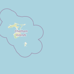
Map view of Rangatira Island

Use this park location map to pinpoint Rangatira Island in New Zealand, understand its exact geographic position, and read its mapped placement within the surrounding landscape more clearly.

Pigeon | © OpenStreetMap contributors

Location context for Rangatira Island

Chatham Islands

Explore visual records of terrain, seabird habitats, and remote coastal geography.

Rangatira Island Photos and Scenery: Visualizing Protected Landscapes

Photographic views capture the rugged terrain, native shrublands, and exposed sea cliffs that define the sanctuary environment of Rangatira Island. Visual research helps observers understand the distinct island habitats, maritime exposure, and conservation geography of this remote Pacific reserve.

A coastal landscape view featuring a grassy foreground sloping down toward the ocean, with Rangatira Island visible as a large, flat-topped landmass in the distance under a cloudy sky.

A high-angle view over a green, grassy coastline with shrubbery, looking out towards the ocean where Rangatira Island is visible in the distance.

Park atlas

Compare adjacent island sanctuaries and remote oceanic reserves

Parks Near Rangatira Island and Surrounding Regional Protected Areas

Visitors studying Rangatira Island can compare adjacent protected areas, island sanctuaries, and remote oceanic reserves across the surrounding region. Analyzing these connected environments reveals broader patterns in Pacific seabird nesting habitats, endemic flora distribution, and isolated island conservation strategies.
Nature reserveChatham Islands
About 13 km away#1 closest

Northwest

Mangere Island Nature Reserve: A Volcanic Landscape in the Chatham Islands

Exploration of remote volcanic terrain and protected island habitats

Situated in the remote Chatham Islands, Mangere Island is a protected nature reserve formed from the eroded remnants of a Pliocene volcano. This small, steep-sided island serves as a landmark for New Zealand conservation efforts, providing a vital refuge for endemic bird populations. Its geography is characterized by rugged coastlines and recovering vegetation, reflecting a significant history of restoration within the Southern Pacific environment.

Area
1.13 km²
Established
1966
Relief
Mountain
Scope
Terrestrial
A soft watercolor illustration of a coastal landscape with green hills, rocky outcrops, and a serene bay.
Marine protected areaNew Zealand
About 506 km away#2 closest

Southwest

Moutere Hauriri / Bounty Islands Marine Reserve: Mapped Protected Landscapes in New Zealand

Subantarctic marine reserve and granite island ecosystem.

Moutere Hauriri / Bounty Islands Marine Reserve represents a critical marine protected area located 700 kilometers from the South Island. Defined by its barren granite islets and transparent waters, the reserve serves as a sanctuary for diverse seabirds and large marine colonies. This atlas entry provides essential geographic context regarding the reserve boundaries and the stark, sculptural terrain of this remote oceanic site.

Area
1,046.26 km²
Established
2014
Scope
Marine
Water
Water-dominated
A soft watercolor painting of a rolling green landscape with distant hills and foreground vegetation on a plain white background.
Nature reserveWairarapa
About 776 km away#3 closest

Northwest

Fensham Reserve: Protected Lowland Forest Geography and Conservation Mapping in Wairarapa

An essential lowland sanctuary for ancient podocarp and swamp forest ecosystems

Fensham Reserve preserves 48 hectares of significant native forest in the southern North Island of New Zealand. This nature reserve provides essential landscape context for rare kahikatea and pukatea associations, while serving as a crucial wetland refuge for endangered species like the brown mudfish. The area remains a key reference point for understanding regional forest restoration and the protection of long-standing ecological fragments.

Area
0.48 km²
Established
1957
Relief
Lowland
Climate
Temperate
A soft watercolor painting of a rolling forested landscape featuring distant mountains and a calm body of water in the foreground.
Protected landscapeWellington Region
About 794 km away#4 closest

West

Remutaka Forest Park: Protected Landscape and Regional Hill Country Geography

A rugged forested reserve spanning the Wellington Region.

Covering extensive territory across the Remutaka Range, this protected landscape is defined by its dramatic ridges and deep river valleys. The area functions as a vital refuge for native bush and birdlife, offering a layered environment that stretches from accessible valley floors to remote upland slopes in the southern North Island.

Area
220 km²
Established
1972
IUCN
V
Relief
Mountain
Protected landscapeNew Zealand
About 795 km away#5 closest

Northwest

Tararua Forest Park: Protected Landscape Geography and Mapped Natural Terrain

Defining the rugged mountain spine of New Zealand's southern North Island

Covering the core of the Tararua Range, this protected landscape represents a vital ecological corridor in New Zealand. The terrain offers a diverse gradient of native forests, steep river valleys, and windswept alpine ridges. It serves as a primary example of forest conservation and complex mountain geography within the island nation's larger network of protected lands.

Area
1,149.93 km²
Established
1954
Relief
Mountain
Climate
Temperate
Wildlife reserveWellington Region
About 798 km away#6 closest

West

Wainuiomata Water Collection Area: Protected Forest Terrain and Wellington Catchment Geography

Mapping the native forest canopy and river catchments of New Zealand.

The Wainuiomata Water Collection Area remains a vital conservation landscape, preserving deep river valleys and mature podocarp-broadleaf forest within the Wellington Region. This wildlife reserve functions as a major ecological hub, featuring continuous native bush that supports intensive predator control and species recovery efforts. Its geographic integrity provides a unique perspective on protected catchment management and pristine lowland wilderness in the southern North Island.

Water
Major water bodies
Regional parkWellington Region
About 799 km away#7 closest

West

Wainuiomata Regional Park: Geography and Protected Area Atlas

River valley terrain in the Wellington Region

Wainuiomata Regional Park is a protected river valley setting featuring significant lowland native forest, historic water infrastructure, and restored wetland habitats. This landscape provides a critical link in the conservation geography of the Wellington Region, connecting to extensive forest remnants and supporting a variety of native ecosystems within the Wainuiomata catchment.

Relief
Mixed relief
Water
Major water bodies
A horizontal watercolor painting showing a calm river winding through green banks with coniferous trees in the background, set against a soft, light-filled sky.
Nature reserveWellington Region
About 801 km away#8 closest

Northwest

Hutt Water Collection Area: Protected Mountain Nature Reserve in the Wellington Region

Forested catchment geography and mountain wilderness

The Hutt Water Collection Area covers 8,900 hectares of steep ridge and valley terrain in the southern Tararua Range. This nature reserve serves as a essential water catchment for the Wellington Region, protecting a diverse environment of native forest, alpine tussock, and sub-alpine bogs. Explore the mapped geography of this critical protected landscape and its role as a sanctuary for rare plant species and native birds.

Area
89 km²
Established
1951
Relief
Mountain
Climate
Temperate

Common questions about visiting, size, designation, and location context for Rangatira Island

Rangatira Island FAQs for park facts, access, geography, and protected area context

Find quick answers about Rangatira Island, including protected-area facts, park geography, trail and visitor context, and how the park fits into its surrounding country and regional landscape.
MoriAtlas Explorer

Continue Your Protected Areas Search Across the Global Atlas

Deepen your exploration by continuing the structured search for national parks and protected areas worldwide. Utilize the comprehensive filtering capabilities to compare different conservation landscapes and refine your understanding of global park geography. Discover more about the distribution and characteristics of protected natural areas.

Global natural geography