

Mori Atlas logo
State or regional parkRedfern-Keily Provincial Park

Mapping the Glacial Valleys and Protected Wilderness of Northeastern British Columbia

Redfern-Keily Provincial Park and the Rugged Geography of the Northern Muskwa Ranges

Redfern-Keily Provincial Park represents a vast and remote protected area within the Muskwa-Kechika Management Area of northeastern British Columbia. This expansive wilderness is defined by the Muskwa Ranges, where glacier-fed waters like Redfern Lake shape the terrain alongside rugged subalpine plateaus. The park provides an essential look at intact northern Rocky Mountain geography, characterized by high valleys, steep ridges, and significant predator-prey ecosystems that define this roadless landscape.

Muskwa RangesNorthern Rockiesglacier-fed lakeboreal forestsubalpine terrainroadless wilderness

Redfern-Keily Provincial Park

State or regional park

Park overview

Structured park overview, official facts, and landscape profile for Redfern-Keily Provincial Park

Redfern-Keily Provincial Park park facts, protected area profile, and essential visitor context

Review the core facts for Redfern-Keily Provincial Park, including designation, size, terrain, visitor scale, habitats, and operating context in one park-focused overview.

About Redfern-Keily Provincial Park

Redfern-Keily Provincial Park occupies a substantial block of the Muskwa Ranges in northeastern British Columbia, within the Peace River Regional District and the larger Muskwa-Kechika Management Area. This region is widely regarded as one of the most expansive intact wilderness zones in North America, a vast mosaic of boreal forest, subalpine ridges, river valleys, and glacial remnants that has been shielded from the dense road networks found elsewhere in the province. Redfern-Keily contributes a particularly rugged portion of that landscape, where terrain, elevation, and remoteness combine to create a classic Northern Rockies character.

The defining geographic element of the park is Redfern Lake, formed along the Besa River and sustained by meltwater from surrounding glaciers, including the Ithaca and Achaean Glaciers. The lake's elongated shape mirrors the structural grain of the Muskwa Ranges, with broad forested flats giving way to steep shoulders and rocky high country. Beyond the lake basin, the park envelops tributaries of the Besa and adjacent watersheds, producing the kind of interconnected valley-and-ridge topography that caribou, sheep, and other large mammals need to move seasonally.

Access to the park reflects its wilderness character. There is no road infrastructure for general visitors. Travel into and within Redfern-Keily relies on snowmobile, off-road vehicle, or horseback, with off-road vehicles restricted to under 750 kilograms. This access regime keeps visitation very low, preserves the roadless quality of the surrounding Muskwa-Kechika landscape, and supports the persistence of wide-ranging species that tolerate little human disturbance. The park is open year-round, providing a small number of established wilderness campsites along trails such as the Nevis Creek and Besa River route and the Sikanni Chief River and Trimble Lake trail, plus one maintained cabin on the northeast side of Redfern Lake.

Although removed from the active provincial park roster, the area retains the ecological character and management values for which it was originally established. Within the broader Muskwa-Kechika framework, Redfern-Keily represents a high-value wildlife linkage and a refuge for the full suite of northern Rockies fauna. Its identity is less about dramatic single vistas and more about deep, uninterrupted wilderness, the kind of landscape that supports long-term ecological processes across multiple seasons.

Quick facts and research context for Redfern-Keily Provincial Park

Redfern-Keily Provincial Park is located in the Peace River Regional District of northeastern British Columbia, within Canada's Northern Rockies. Established on June 29, 1999, and later removed from the active provincial park system, it is administratively linked to the broader Muskwa-Kechika Management Area, a globally significant zone of intact northern wilderness.

The park's central geographic feature is Redfern Lake, an 8-kilometer-long, glacier-fed lake on the Besa River, accompanied by surrounding glaciers including the Ithaca and Achaean Glaciers. It is a backcountry-only protected landscape, reached mainly by snowmobile, off-road vehicle, or horseback, and is known for free-ranging populations of grizzly bear, moose, caribou, stone sheep, elk, lynx, and wolf.

Protection and recognition

Documented terrestrial protection status and international recognition framework records

Redfern-Keily Provincial Park Protection Status and Designated Conservation Scope

Redfern-Keily Provincial Park maintains a documented terrestrial protection status within official conservation frameworks. Official records organize management scope and designation parameters for structured park analysis.

Protection details

Protection scope
Terrestrial
Transboundary protection
No
Park context

Deeper park guide and search-rich context for Redfern-Keily Provincial Park

Redfern-Keily Provincial Park history, landscape, wildlife, and travel context

Explore Redfern-Keily Provincial Park through its history, landscape character, ecosystems, wildlife, conservation priorities, cultural context, and seasonal travel timing in a structured park guide built for atlas discovery and search intent.

Why Redfern-Keily Provincial Park stands out

Redfern-Keily Provincial Park is best known for its scale and remoteness within the Muskwa-Kechika Management Area, a vast corridor of near-pristine northern Rockies wilderness in northeastern British Columbia. Its signature feature is Redfern Lake, a long, narrow glacier-fed lake that defines the park's central valley, surrounded by rugged Muskwa Range terrain and named glaciers like the Ithaca and Achaean. The park is also recognized for its populations of large northern mammals, including grizzly bear, moose, caribou, stone sheep, elk, lynx, and wolf, coexisting across a roadless landscape that has remained largely free of industrial development. This combination of glacial lakes, high muskeg valleys, and intact predator-prey dynamics gives Redfern-Keily a strong identity as a true northern backcountry wilderness.

Redfern-Keily Provincial Park history and protected-area timeline

Redfern-Keily Provincial Park was established on June 29, 1999, as part of British Columbia's effort to formally protect representative landscapes within the vast Muskwa-Kechika Management Area of the northeast. The Muskwa Ranges had long been associated with trapping, guiding, and exploration, and the park's boundaries were drawn to encompass a significant span of the Besa River watershed, including Redfern Lake and several surrounding glaciers.

The park was named after William, known as Bill, Keily, born in January 1878 in Valcartier Village, Quebec. Keily became a trapper, photographer, and wilderness guide in the Muskwa region, spending decades working in the same valleys and ranges the park now encompasses. His name reflects the long human history of the area, in which people who lived from the land, harvested furs, documented remote landscapes, and guided others through the country left a lasting imprint on local memory, even as the broader region remained largely roadless.

The park was later removed from British Columbia's active system of provincial parks. Even so, the area continues to function as part of the Muskwa-Kechika Management Area, where land-use planning emphasizes the preservation of wilderness values alongside limited resource activity elsewhere in the larger management zone. As a result, Redfern-Keily's present-day identity reflects both its formal designation history and its enduring role within a much broader conservation landscape.

Redfern-Keily Provincial Park landscape and geographic character

Redfern-Keily's landscape is defined by the Muskwa Ranges, a deeply dissected portion of the Northern Rockies in northeastern British Columbia. Elevations rise into rugged ridges and high subalpine plateaus, separated by broad U-shaped valleys carved by glacial action. The terrain has the characteristic feel of northern Rocky Mountain wilderness: long sightlines broken by clusters of spruce, valleys softened by muskeg, and sudden rocky shoulders rising above forest stands.

The park's central landform is Redfern Lake, a glacier-fed lake roughly 8 kilometers long and about a kilometer wide, formed along the course of the Besa River. The lake is a defining visual and ecological anchor of the park, occupying a long, narrow basin with forested slopes climbing away from its shoreline on either side. Its setting captures the structural rhythm of the surrounding ranges, where parallel ridges and valleys shape how water, wildlife, and travelers move through the country.

Surrounding glaciers, including the Ithaca Glacier and Achaean Glacier, are themselves notable landscape features. Their meltwater feeds not only Redfern Lake but also a network of creeks and tributary streams descending into the Besa system. The combination of active glacial remnants, post-glacial lakes, and steep mountain terrain gives the park a strong sense of place, one tied less to human-scale attractions and more to the broader rhythms of ice, water, and stone that shape the Northern Rockies.

Redfern-Keily Provincial Park ecosystems, habitats, and plant life

The park sits within the boreal and subalpine ecological zones of northeastern British Columbia, where the Muskwa Ranges transition between montane forest and high exposed terrain. Vegetation patterns reflect elevation, exposure, and glacial history: lower valleys support a mix of spruce, fir, birch, and lodgepole pine interspersed with wet meadows and muskeg, while higher elevations thin into subalpine parkland and open rocky slopes. Riparian corridors along the Besa River and its tributaries create productive habitat edges where aquatic and terrestrial systems meet.

The Muskwa-Kechika Management Area, of which Redfern-Keily is a part, is recognized for maintaining large, ecologically intact landscapes at a scale increasingly rare in North America. Within that context, Redfern-Keily acts as a refuge for ecological processes such as predator-prey dynamics, seasonal ungulate migrations, and the natural disturbance regimes of fire and ice that shape these northern forests.

Wetland complexes, glacial streams, and old-growth forest stands together give the park a layered habitat structure. This complexity supports a wide range of species and reinforces the area's value as habitat for wide-ranging mammals that depend on multiple ecological zones throughout the year.

Redfern-Keily Provincial Park wildlife and species highlights

Redfern-Keily Provincial Park is known for wildlife populations more typical of intact northern Rockies landscapes than of more accessible parks. Free-ranging predators such as grizzly bear, wolf, and lynx move through the territory alongside some of the region's signature ungulates. Moose browse the wetland and willow habitats along the Besa River and around Redfern Lake, while elk and stone sheep are found in the broader valley-and-ridge mosaic. Caribou, a species of particular conservation concern in many parts of British Columbia, are also recorded here, underscoring the park's role within a broader landscape that still supports slow-moving, disturbance-sensitive herds.

The combination of large predators and full communities of prey species indicates that the area continues to function as a working predator-prey ecosystem. Such ecosystems are increasingly rare in landscapes fragmented by roads, industry, or settlement, making Redfern-Keily a notable refuge for these natural dynamics. Smaller mammals, waterfowl, and a variety of upland and alpine birds occupy supporting roles across the elevation gradient, though the park's most distinctive wildlife narrative centers on the presence of its larger mammals.

Together, the wildlife profile of Redfern-Keily helps explain why the broader Muskwa-Kechika region is held in high regard for conservation. The park functions not just as habitat but as a connectivity anchor, allowing wide-ranging species to use a substantial, roadless portion of the northern Rockies as a continuous home range.

Redfern-Keily Provincial Park conservation status and protection priorities

Redfern-Keily was established in 1999 as a provincial park within the Muskwa-Kechika Management Area, one of the largest intact wilderness management frameworks in North America. Its conservation value lies less in its status as a single small reserve and more in its contribution to a much larger landscape-level approach to protecting ecological integrity in northeastern British Columbia. By maintaining a roadless core of mountain terrain, wetlands, and glacial valleys, the area supports ecological processes that are degraded or absent elsewhere in the region.

The park's restricted access regime is itself a conservation tool. Travel by snowmobile, off-road vehicle, and horseback, with off-road vehicles required to weigh under 750 kilograms, limits the volume and character of human activity. This helps preserve habitat conditions for wildlife that respond negatively to heavy or chronic disturbance, particularly caribou and other wide-ranging ungulates.

Although the park was later removed from the formal provincial park roster, it continues to sit within the Muskwa-Kechika Management Area, where land-use zoning balances conservation, cultural values, and limited resource activity elsewhere in the larger zone. Within this framework, Redfern-Keily represents a key piece of a regional conservation mosaic, contributing directly to the protection of northern Rockies biodiversity at landscape scale.

Redfern-Keily Provincial Park cultural meaning and human context

The park's name preserves the legacy of Bill Keily, a trapper, photographer, and wilderness guide who worked for decades in the Muskwa Ranges. Born in 1878 in Valcartier Village, Quebec, Keily became part of the long tradition of outfitters and trappers who explored, documented, and depended on the remote valleys of northeastern British Columbia. His life reflects a period when the region was known primarily through the eyes of people who traveled it on foot, on horseback, and by dog team, rather than by road.

Although Indigenous use of the landscape long predates written records, the broader Muskwa-Kechika Management Area has been recognized as significant territory for First Nations whose traditional lands include the Muskwa Ranges. The park sits within that wider cultural frame, where names, trails, and seasonal use patterns carry deep historical weight. Redfern-Keily's cultural identity is therefore layered: a formally named wilderness reserve, a piece of a major conservation landscape, and a region whose human story is rooted in long-standing relationships with the people who have lived, worked, and traveled through it.

Top sights and standout views in Redfern-Keily Provincial Park

Redfern-Keily stands out for its combination of scale, remoteness, and ecological completeness within the Muskwa-Kechika Management Area. The park anchors an 8-kilometer glacier-fed lake along the Besa River, surrounded by named glaciers including the Ithaca and Achaean, and set among some of the most intact boreal-montane terrain in North America.

Its wildlife profile, characterized by free-ranging grizzly bear, wolf, lynx, moose, elk, stone sheep, and caribou, gives the park a near-textbook example of a northern Rockies predator-prey ecosystem. Together, these features make Redfern-Keily less a destination park and more a representative piece of one of the continent's great remaining wilderness complexes.

Best time to visit Redfern-Keily Provincial Park

Redfern-Keily's deep northern location means the experience changes dramatically across seasons. Winter brings long, cold periods with reliable snow cover, when access is most often via snowmobile along frozen river routes, gear-packed trails, and the lake basin itself. This is also the season when the park's roadless character is at its most enveloping, with quiet, snow-covered valleys and clear views across frozen terrain.

Summer and early autumn open up horseback and overland off-road travel, with warmer temperatures, longer days, and more active wildlife movement. Wildlife viewing tends to feel most dynamic during shoulder seasons, when animals move between elevations and habitats. Because the park has no road access for general visitors and weather in the Muskwa Ranges can shift quickly, those who travel here tend to plan around seasonal windows, broad enough to accommodate the character of the country rather than specific calendar dates.
Monthly climate preview

Long-term representative monthly averages for temperature and precipitation

Redfern-Keily Provincial Park Climate Normals and Temperature Patterns

Redfern-Keily Provincial Park experiences sustained sub-zero winter temperatures alongside milder summer peaks and measurable monthly precipitation shifts. Detailed monthly data records provide complete baseline climate normals for comparative geographic analysis across the protected area.
Annual mean-4 °C
-15 °C10 °C
Jan-15°
Feb-14°
Mar-12°
Apr-5°
May
Jun
Jul10°
Aug
Sep
Oct-4°
Nov-12°
Dec-15°
Warmest month
July

9.8 °C

Coolest month
January

-15.4 °C

Wettest month
June

4.7 mm/day

Driest month
February

1.1 mm/day

Park location guide

Geography guide, regional context, and park location map for Redfern-Keily Provincial Park

Redfern-Keily Provincial Park park geography, regions, and map view in Canada

Understand where Redfern-Keily Provincial Park sits in Canada through a broader geographic reading of the surrounding landscape, nearby location context, and its mapped position within the national park landscape.

How Redfern-Keily Provincial Park fits into Canada

Canada is a federal parliamentary constitutional monarchy spanning North America from the Atlantic to the Pacific and Arctic Oceans. With a population of over 41 million, it is officially bilingual in English and French at the federal level. The country gained independence from the United Kingdom through a gradual process culminating in 1982.

Wider geography shaping Redfern-Keily Provincial Park in Canada

Canada occupies the northern portion of North America, sharing its longest international border with the United States. The country extends from the Atlantic Ocean to the Pacific Ocean and northward into the Arctic Ocean, giving it the longest coastline of any nation.

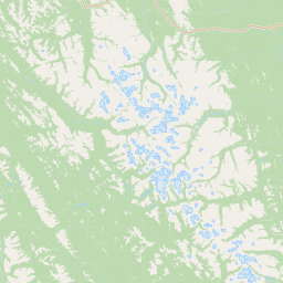
Map view of Redfern-Keily Provincial Park

Use this park location map to pinpoint Redfern-Keily Provincial Park in Canada, understand its exact geographic position, and read its mapped placement within the surrounding landscape more clearly.

Pigeon | © OpenStreetMap contributors

Location context for Redfern-Keily Provincial Park

British Columbia
Recorded earthquake history

Review the Earthquake History of Redfern-Keily Provincial Park

Explore a curated collection of recorded earthquake data and seismic events associated with the remote Muskwa Ranges surrounding Redfern-Keily Provincial Park. Use this catalogue to examine the documented history of ground motion and epicentre distribution within this protected wilderness on MoriAtlas.

Redfern-Keily Provincial Park Earthquake History

Catalogued events

1 event

Strongest magnitude

Magnitude 4.4

Most recent event

Aug 4, 2014

This history includes earthquakes recorded inside the park or within 50 km of its borders

Park atlas

Compare adjacent wilderness landscapes and regional Northern Rockies parks

Explore Protected Areas and Parks Near Redfern-Keily Provincial Park

Browse neighboring protected areas and remote mountain reserves that share the rugged terrain of the Northern Rockies. Comparing adjacent wilderness terrain helps reveal the broader ecological scope of the regional park network.
State or regional parkBritish Columbia
About 12 km away#1 closest

North

Prophet River Hot Springs Provincial Park: Protected Landscape and Geothermal Geography

Remote backcountry wilderness in northeastern British Columbia

Prophet River Hot Springs Provincial Park is a specialized protected area known for its unique tufa mounds and geothermal features. Set against the mountainous backdrop of the Muskwa Ranges, this backcountry destination offers a compelling study of boreal and subalpine geography, accessible only by hiking or horseback through undisturbed wilderness corridors.

Area
1.84 km²
Established
1999
IUCN
II
Relief
Mountain
State or regional parkBritish Columbia
32 km away#2 closest

Northwest

Kwadacha Wilderness Provincial Park: Geographic Boundaries and Regional Protected Area Context

Untouched mountain wilderness in northern British Columbia

Kwadacha Wilderness Provincial Park provides a rare, roadless mountain experience within the northeastern interior of British Columbia. Characterized by high-relief alpine ridges, dense boreal forests, and challenging river systems, the park represents an essential wilderness corridor that remains free from human infrastructure and standard road access, prioritizing ecological integrity over recreation.

Area
1,302.79 km²
Established
1973
IUCN
Ib
Relief
Mountain
State or regional parkBritish Columbia
43 km away#3 closest

South

Graham-Laurier Provincial Park: Protected Boreal Landscape and Geographic Context

Remote wilderness exploration in the Peace River region

Graham-Laurier Provincial Park represents a massive, intact wilderness area in northeastern British Columbia. Defined by boreal forests, undulating ridges, and the cascading waters of Christina Falls, this region serves as a crucial natural refuge within the Muskwa-Kechika Management Area. Access is centered on rugged forest service roads and backcountry trails, making the area a primary destination for self-reliant exploration and terrain study.

Area
999.82 km²
Established
1999
IUCN
II
Relief
Mountain
State or regional parkBritish Columbia
About 45 km away#4 closest

Southeast

Pink Mountain Provincial Park: Regional Geography and Protected Alpine Landscapes

Muskwa Foothills terrain and scientific conservation history.

Situated in the eastern foothills of the Rocky Mountains, Pink Mountain Provincial Park is defined by its transition from forested valleys to high-altitude tundra. This protected area stands as a unique ecological corridor, preserving major Mesozoic fossil sites and providing a habitat for diverse northern wildlife species that thrive in the cold-adapted vegetation of the Muskwa Foothills.

Area
0.98 km²
Established
1999
IUCN
II
Relief
Mountain
State or regional parkBritish Columbia
About 119 km away#5 closest

West

Finlay-Russel Provincial Park and Protected Area: Mapping Northern British Columbia Wilderness

A remote river corridor in the Muskwa-Kechika Management Area.

Located in northern British Columbia, Finlay-Russel Provincial Park and Protected Area preserves an essential 85-kilometre river corridor along the Finlay River. This expansive wilderness territory serves as an integral part of the Muskwa-Kechika Management Area, showcasing deep boreal forest landscapes and rugged river valley terrain far from established road networks.

Area
1,092.05 km²
Established
2001
IUCN
II
Access
Remote access
State or regional parkBritish Columbia
About 157 km away#6 closest

Northwest

Dune Za Keyih Provincial Park and Protected Area: Watershed and Terrain Geography

Remote wilderness landscape in northern British Columbia

Dune Za Keyih Provincial Park and Protected Area protects the largest unlogged watershed in British Columbia. Situated within the Muskwa-Kechika Management Area, this remote wilderness is defined by the geological structures of the Rocky Mountain Trench, providing a continuous corridor of undisturbed mountain forest, riparian zones, and highland terrain.

Area
3,468.33 km²
Established
2001
IUCN
Ib
Relief
Mountain
State or regional parkBritish Columbia
About 191 km away#7 closest

North

Jackpine Remnant Provincial Park: Protected Boreal Landscape and Regional Map Context

Conservation and terrain data for the Fort Nelson region

Jackpine Remnant Provincial Park provides a critical study in northern conservation geography. Located in the Fort Nelson area of British Columbia, this 148-hectare site protects a rare stand of jack pine trees. Its mapped boundaries and boreal forest terrain offer a focused look at small-scale protected landscapes and their significance within the broader regional ecosystem of the Canadian north.

Area
1.48 km²
Established
2001
IUCN
II
Relief
Lowland
State or regional parkBritish Columbia
201 km away#8 closest

Northwest

Denetiah Provincial Park and Protected Area: Regional Geography and Wilderness Mapping

An undisturbed boreal reserve in the Stikine Region

Discover the geographic structure of Denetiah Provincial Park and Protected Area, a vast roadless landscape in northern British Columbia. This park protects pristine boreal forests, elongated glacial lake basins, and critical river headwaters that serve as a benchmark for northern conservation within the Muskwa-Kechika Management Area.

Area
1,053.49 km²
Established
1999
IUCN
II
Relief
Upland

Common questions about visiting, size, designation, and location context for Redfern-Keily Provincial Park

Redfern-Keily Provincial Park FAQs for park facts, access, geography, and protected area context

Find quick answers about Redfern-Keily Provincial Park, including protected-area facts, park geography, trail and visitor context, and how the park fits into its surrounding country and regional landscape.
MoriAtlas Explorer

Continue Your Protected Areas Search Across the Global Atlas

Deepen your exploration by continuing the structured search for national parks and protected areas worldwide. Utilize the comprehensive filtering capabilities to compare different conservation landscapes and refine your understanding of global park geography. Discover more about the distribution and characteristics of protected natural areas.

Global natural geography