Why Imataca Forest Reserve stands out
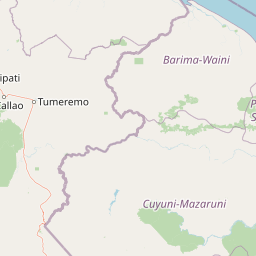
Imataca Forest Reserve is best known for the Sierra de Imataca, a distinctive low mountain range wrapped in tropical forest that defines the geography of northeastern Venezuela. The reserve is also recognized for the immense size of its protected forest area and for the dense network of rivers that flow through its territory. The area stands out as a frontier forest landscape where upland terrain, broadleaf tropical forest, and major river systems meet. This combination of large-scale forest protection and varied topography is the defining feature of Imataca and shapes both its ecological importance and its conservation challenges.
Imataca Forest Reserve history and protected-area timeline
Imataca Forest Reserve was formally established on February 9, 1961, as part of Venezuela's efforts to protect the extensive forest resources of the Guayana region. The reserve was carved out as a forested protected area of more than 38,000 square kilometers, encompassing the Sierra de Imataca and the surrounding river basins.
Over the decades since its creation, the reserve has remained a key reference area for forest conservation in Venezuela, while also becoming a region of intense natural resource interest. Its mineral deposits and forest resources have attracted both regulated extractive activity and unregulated exploitation. Mining, both legal and illegal, has come to represent the most significant ongoing threat to the reserve's ecological condition and continues to shape how the area is managed and contested.
Imataca Forest Reserve landscape and geographic character
The landscape of Imataca Forest Reserve is defined by the Sierra de Imataca, a low but clearly defined mountain range that runs through the heart of the reserve. The Sierra gives the area its name and provides the topographic backbone for the surrounding forest and river systems. Beyond the Sierra, the terrain includes extensive forested plains, river valleys, and isolated hill formations such as the Cerros de La Chicharra and Dolomita.
Hydrology is a key element of the Imataca landscape. Major rivers including the Cuyuní, Grande, Brazo de Imataca, and Yerúan flow through the reserve, shaping valleys and connecting forested lowlands to larger regional drainage networks. The combination of upland terrain, dense tropical forest cover, and a dense network of rivers creates a landscape in which forest and water are the dominant visual and ecological features.
Where mining and other human activities have occurred, natural patterns of forest cover and drainage have been disrupted, but large portions of the reserve retain their original forested character. The overall impression of the Imataca landscape is one of vast, relatively intact tropical wilderness, anchored by the Sierra de Imataca and threaded by the rivers that drain its slopes.
Imataca Forest Reserve ecosystems, habitats, and plant life
Imataca Forest Reserve protects a very large block of tropical forest within the Guayana region of northeastern Venezuela. The vegetation is dominated by broadleaf tropical forest typical of the Guayana shield, with continuous forest cover across both the uplands of the Sierra de Imataca and the surrounding lowlands.
The reserve's ecosystems are closely tied to its hydrology. River valleys, slopes, and lowland basins each support their own vegetation patterns, and the continuous forested matrix supports a wide variety of ecological communities. The combination of relatively intact forest and varied topography contributes to the reserve's importance for regional biodiversity and watershed function.
Because the reserve covers such a large and ecologically diverse area, it plays an important role in maintaining ecological connectivity in the Guayana region. Its forests link to surrounding protected and unprotected forest landscapes, allowing for the movement of species and ecological processes across a broad geographic area.
Imataca Forest Reserve wildlife and species highlights
The forests of Imataca support the wildlife communities typical of the Guayana region's tropical forests, including mammals, birds, reptiles, and amphibians associated with continuous broadleaf forest and river systems. The reserve's size, forest cover, and relatively undisturbed character provide habitat for forest-dependent species that require large areas of intact wilderness.
Rivers and forest corridors within the reserve are particularly important for freshwater species and for forest wildlife that depends on riparian environments. Upland areas of the Sierra de Imataca and the isolated hill formations such as the Cerros de La Chicharra and Dolomita create localized habitat conditions that support distinct ecological communities within the broader forested landscape.
Because detailed species-level documentation of the reserve is limited, the wildlife value of Imataca is best understood in terms of its role as a large, continuous forest refuge capable of supporting populations of species that depend on extensive tracts of intact tropical habitat.
Imataca Forest Reserve conservation status and protection priorities
Imataca Forest Reserve is one of the largest forest protected areas in Venezuela and represents a major component of conservation strategy in the country's Guayana region. Its scale makes it significant for forest preservation, watershed protection, and the maintenance of ecological connectivity across a large portion of northeastern South America.
The reserve's conservation value is heavily influenced by threats from mineral extraction. Both legal and illegal mining activities constitute the most serious ongoing challenges to the reserve, contributing to deforestation, river contamination, habitat fragmentation, and pressure on indigenous communities. These threats have made Imataca an important focal point in broader discussions about resource governance, indigenous rights, and forest protection in Venezuela.
Despite these pressures, the reserve continues to play a central role in regional conservation because of the sheer size of its protected forest area and its position within the larger Guayana forest landscape. Maintaining the integrity of Imataca is widely regarded as essential for the long-term conservation of tropical forest ecosystems in northeastern Venezuela.
Imataca Forest Reserve cultural meaning and human context
Imataca Forest Reserve lies within a region of long-standing indigenous presence and traditional land use. The broader Guayana region, including areas around the Sierra de Imataca, is home to indigenous communities whose relationship with the forest and rivers predates modern conservation designations. Local administrative units such as the Parroquia Francisco Aniceto Lugo are found within the reserve's area and reflect the ongoing human presence in the territory.
The reserve's cultural significance is closely tied to how the land has been used and contested over time. Mining, settlement, and indigenous land use have all shaped human interactions with the forest, and these activities continue to influence the management and perception of the reserve today. The cultural history of Imataca is therefore inseparable from its role as both a natural and a living landscape.
Top sights and standout views in Imataca Forest Reserve
Imataca Forest Reserve is distinguished by the combination of its enormous size, its forested Sierra de Imataca, and its dense network of major rivers. The Sierra de Imataca provides the defining topographic feature of the reserve, while rivers such as the Cuyuní, Grande, Brazo de Imataca, and Yerúan shape its hydrology and ecological character.
The reserve also stands out as a major forest conservation area within the Guayana region, protecting one of the most extensive continuous tracts of tropical forest in northeastern Venezuela. Its importance for regional biodiversity, watershed function, and ecological connectivity makes it a key reference area for conservation in northern South America.
Best time to visit Imataca Forest Reserve
As a large, humid tropical forest environment, Imataca Forest Reserve experiences consistently warm conditions year-round, with rainfall patterns shaping accessibility and atmosphere rather than temperature. Periods of lower rainfall generally offer more comfortable conditions for travel and exploration within the reserve, while wetter periods can make rivers swell, forest trails difficult, and lowland areas harder to access.
Visitors interested in experiencing the forest under more accessible conditions typically favor drier intervals, when river crossings, forest observation, and activity in upland areas around the Sierra de Imataca are more manageable. The reserve's tropical character means that conditions vary primarily in terms of moisture and river behavior rather than seasonal climate extremes.