

Mori Atlas logo
Nature reserveReserva científica, ecológica y arqueológica Kenneth Lee

Mapping the ecological mosaic of Amazonian forests, flooded savannas, and ancient hydraulic engineering sites.

Reserva científica, ecológica y arqueológica Kenneth Lee: Protected Landscapes in the Beni Lowlands

(Reserva Científica, Ecológica y Arqueológica Kenneth Lee)

The Reserva científica, ecológica y arqueológica Kenneth Lee safeguards a transitional landscape of southwestern Amazonia within the Beni department. This protected area features a unique mosaic of forested islands, gallery corridors, and seasonally flooded savannas that form a vital component of the larger Llanos de Moxos wetland complex. Beyond its ecological reach, the terrain holds an extensive archaeological footprint of pre-Columbian hydraulic cultures that historically managed these plains.

AmazoniaLlanos de Moxossavannawetlandsfloodplainwild cacao
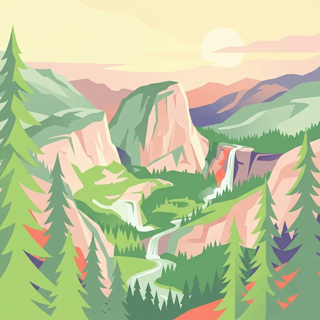
A graphic illustration showing a mountain valley at sunrise, featuring prominent cliffs, a waterfall, a winding river, and surrounding evergreen trees in a flat design style.

Reserva científica, ecológica y arqueológica Kenneth Lee

Nature reserve

Park overview

Structured park overview, official facts, and landscape profile for Reserva Científica, Ecológica y Arqueológica Kenneth Lee

Reserva Científica, Ecológica y Arqueológica Kenneth Lee park facts, protected area profile, and essential visitor context

Review the core facts for Reserva Científica, Ecológica y Arqueológica Kenneth Lee, including designation, size, terrain, visitor scale, habitats, and operating context in one park-focused overview.

About Reserva Científica, Ecológica y Arqueológica Kenneth Lee

The Reserva Científica, Ecológica y Arqueológica Kenneth Lee stands out within Bolivia's protected-area system because it combines Amazonian ecology with profound archaeological heritage. Covering roughly 439,300 hectares in the municipality of Baures, the reserve straddles forest and savanna formations characteristic of the southwestern Amazon basin. Its ecosystems range from terra firme woodlands to seasonally flooded grasslands, situating the area within the broader Llanos de Moxos landscape, one of the most important wetland complexes in South America.

Ecologically, the reserve serves as a buffer for the rich intermingling of Amazonian forest with the vast wetland savannas of the Beni. The territory contributes to one of the largest wetland systems on Earth recognized by the Ramsar Convention, making it a significant reference site for research on floodplain processes, savanna-forest dynamics, and tropical conservation. Within the area, a substantial share of Bolivia's wild cacao populations occurs in the wild, giving the reserve an additional conservation priority tied to genetic diversity of an internationally important crop ancestor.

Culturally, the reserve is anchored to the legacy of the hydraulic cultures of the Llanos de Moxos. Long before modern settlement planning, the peoples of the Moxos region engineered raised fields, embankments, causeways, lakes, and other land and water management features that supported dense populations and stable agriculture in a seasonally challenging floodplain landscape. Their successful administration of the natural environment is widely regarded as one of the most sophisticated examples of pre-Columbian land management in lowland South America.

By combining ecological conservation, scientific research, and heritage protection within a single area, the Kenneth Lee Reserve operates as more than a typical forest reserve. It is a living laboratory where Amazonian ecology, indigenous land use history, and modern conservation policy meet, and where visitors and researchers can engage directly with both natural and archaeological values.

Quick facts and research context for Reserva Científica, Ecológica y Arqueológica Kenneth Lee

The Kenneth Lee Reserve is a departmental-level protected area in the Beni department of northern Bolivia, located in the municipality of Baures within the province of Iténez. It covers roughly 439,300 hectares of savanna and forest habitats typical of the southwestern Amazon and was declared in December 1996 through Prefectural Resolution 139 and reaffirmed by municipal ordinance in 2010. The area forms part of a Ramsar-recognized wetland complex and preserves both significant wild cacao populations and the archaeological remains of the hydraulic cultures of the Llanos de Moxos.

Protection and recognition

Documented terrestrial protection scope, designation history, and management framework details

Protection Status and International Recognition for Reserva científica, ecológica y arqueológica Kenneth Lee

Terrestrial protection status, management scope, and official international designation details are compiled for Reserva científica, ecológica y arqueológica Kenneth Lee. Factual conservation metrics and formal recognition records establish the structural baseline for this protected area.

Protection details

Protection scope
Terrestrial
Transboundary protection
No
Park context

Deeper park guide and search-rich context for Reserva Científica, Ecológica y Arqueológica Kenneth Lee

Reserva Científica, Ecológica y Arqueológica Kenneth Lee history, landscape, wildlife, and travel context

Explore Reserva Científica, Ecológica y Arqueológica Kenneth Lee through its history, landscape character, ecosystems, wildlife, conservation priorities, cultural context, and seasonal travel timing in a structured park guide built for atlas discovery and search intent.

Why Reserva Científica, Ecológica y Arqueológica Kenneth Lee stands out

The reserve is best known for two intertwined legacies: a tropical ecological mosaic of Amazonian forest and seasonally flooded savanna that includes one of Bolivia's most important concentrations of wild cacao, and an extraordinary archaeological landscape shaped by the hydraulic cultures of the Llanos de Moxos. These pre-Columbian societies developed sophisticated agricultural and water management systems that supported dense, well-organized populations, leaving engineered landscapes that still define the region today.
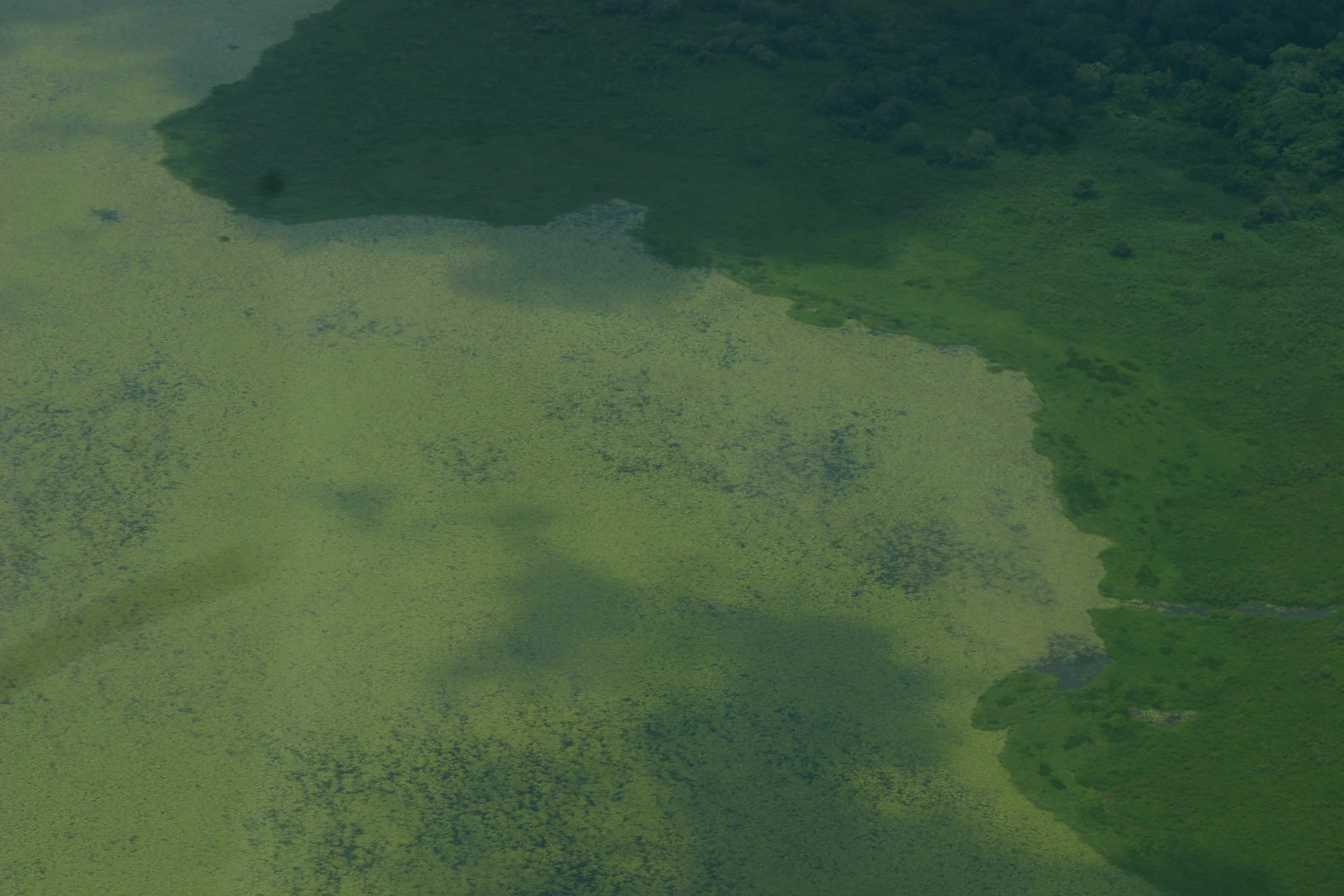
An aerial view showing a boundary between a light green flooded area and darker green vegetation.
Aerial perspective of flooded savanna and vegetation in the Kenneth Lee Scientific, Ecological and Archaeological Reserve.

Reserva Científica, Ecológica y Arqueológica Kenneth Lee history and protected-area timeline

The Reserva Científica, Ecológica y Arqueológica Kenneth Lee was formally established as a protected area on December 16, 1996 through Prefectural Resolution 139 of the Prefectura del Beni, classifying it as a departmental-level area managed under Beni authorities. In February 2010, the municipal government of Baures reaffirmed and consolidated the reserve through municipal ordinance 02/2010, anchoring the protected area within local governance and ensuring continuity of its management framework.

The reserve is named in homage to the Bolivian archaeologist Kenneth Lee, whose long career in the Beni lowlands helped reveal the depth of the hydraulic cultures of the Llanos de Moxos. The naming itself signals the dual purpose of the protected area: scientific research and archaeological heritage are explicitly part of its institutional mandate, alongside ecological conservation. By the time of its formal declaration, much of the research context that justified the protection was already documented, making the reserve a continuation of decades of effort to safeguard both the natural and cultural heritage of the northern Beni.

Reserva Científica, Ecológica y Arqueológica Kenneth Lee landscape and geographic character

The reserve's terrain reflects the transitional geography of southwestern Amazonia, where continuous forest cover gradually yields to expansive seasonal savannas and wetland plains. Within the Kenneth Lee Reserve, the landscape alternates between forested islands that rise above the surrounding plain and broad stretches of savanna subject to seasonal flooding, creating a habitat mosaic of wooded uplands, gallery corridors along waterways, paleochannels, and seasonally inundated grasslands.

This savanna-forest interface is one of the most distinctive physical features of the Beni, shaping both patterns of life and movement of wildlife. Many of the forested patches visible in the lowland plain function as refuges during the wet season, while the surrounding savannas act as floodplains for much of the year. The cumulative effect is a landscape of constantly shifting tones, where green forest and water-strewn grassland alternate according to rainfall, giving the reserve its characteristic Amazonian wetland character.

Reserva Científica, Ecológica y Arqueológica Kenneth Lee ecosystems, habitats, and plant life

Ecologically, the reserve conserves a representative sample of southwestern Amazon habitats, including dryland and seasonally flooded forest, semideciduous tropical woodlands, and open savanna formations that include palm-rich and shrubby communities typical of the Beni lowlands. The mixing of forest and savanna within a single protected area supports an unusual combination of species adapted to floodplain dynamics, dryseason survival, and ecotonal transitions.

As part of the larger Llanos de Moxos wetland system recognized under the Ramsar Convention, the Kenneth Lee Reserve contributes to the conservation of ecosystem processes that depend on regular seasonal flooding. The fluctuating water regime, alternating between deep inundation and dry-season concentration, controls nutrient cycling, vegetation regeneration, and habitat availability for a wide range of organisms. The presence of extensive populations of wild cacao is a defining element of the reserve's natural value: these wild stands are scientifically important as reservoirs of genetic diversity for one of the world's most important tropical crops.

Reserva Científica, Ecológica y Arqueológica Kenneth Lee wildlife and species highlights

Because the reserve encompasses forests, savannas, and wetlands, it supports wildlife drawn from several Amazonian habitat types. Species typical of seasonally flooded savannas, gallery forests, and terra firme woodland can all occur within or adjacent to its boundaries, reflecting the rich source area of the Llanos de Moxos. This diversity of habitat translates into strong potential for birdlife, large mammals associated with the Beni wetlands, and aquatic species tied to the region's renowned fishery resources.

The mosaic configuration of the landscape, with forested islands embedded within broader flooded grasslands, is particularly important for species that depend on refuge habitat during the high-water season. Forested patches, riverbanks, and emergent vegetation all contribute to seasonal habitat availability, while the reserve's connection to larger conservation landscapes in northern Beni strengthens its role as part of an interconnected wildlife network.

Reserva Científica, Ecológica y Arqueológica Kenneth Lee conservation status and protection priorities

From a conservation perspective, the Kenneth Lee Reserve is significant for three main reasons: it protects a major portion of the Llanos de Moxos wetland complex, designated by countries under the Ramsar Convention for its global wetland importance; it conserves substantial populations of wild cacao, making it a key site for crop genetic diversity conservation; and it safeguards archaeological landforms that are themselves part of the cultural heritage of the Beni.

The combination of departmental status, reaffirmation by municipal ordinance, and its role within broader Amazonian wetland conservation frameworks gives the reserve both legal protection and a recognized place in regional ecological planning. Its declared objectives of supporting scientific research, conservation, and tourism reflect a model in which biodiversity, ecosystem services, and research value reinforce one another within a single protected area.

Reserva Científica, Ecológica y Arqueológica Kenneth Lee cultural meaning and human context

The cultural dimension of the Kenneth Lee Reserve is inseparable from the natural landscape. The area lies within the broader Llanos de Moxos, whose pre-Columbian peoples, often referred to as the hydraulic cultures, developed dense, well-organized populations supported by sophisticated agricultural and water management practices. Their engineered fields, drainage channels, and raised landscapes allowed sustained habitation in a seasonally flooded environment and are widely considered to reflect one of the most successful land and water management traditions of lowland South America.

The reserve specifically preserves part of this archaeological complex, providing a protected environment in which the physical traces of ancient settlement, agriculture, and infrastructure can continue to be studied. Naming the protected area after archaeologist Kenneth Lee underscores the cultural and scientific importance of this heritage, ensuring that the area's value is understood not just ecologically but as a continuum between indigenous landscape history and modern Bolivia.

Top sights and standout views in Reserva Científica, Ecológica y Arqueológica Kenneth Lee

The reserve's strongest distinctions are its dual ecological and archaeological character, occupying a key position in the Ramsar-recognized Llanos de Moxos wetland complex and protecting one of Bolivia's most important concentrations of wild cacao. Its landscape combines forest islands with seasonally flooded savanna, while its archaeological record links visitors to the hydraulic cultures whose land management shaped much of the northern Beni. Together, these traits make it a reference site for integrated natural-cultural conservation in southwestern Amazonia.

Best time to visit Reserva Científica, Ecológica y Arqueológica Kenneth Lee

Because the reserve's character shifts with the annual flood cycle, the experience of visiting the Kenneth Lee area depends heavily on season. The dry months tend to highlight the contrast between forested islands and open savanna, with easier overland movement and better visibility for terrestrial wildlife. The wet season transforms the savannas into broad shallow lakes, limiting access to elevated areas and forested patches but offering a dramatic floodplain landscape and rich conditions for waterbird observation. Travelers seeking ecosystem-level impressions of the Llanos de Moxos will find both seasons rewarding, though the specific activities available naturally differ between high-water and low-water months.
Monthly climate preview

Long term temperature and precipitation patterns across representative coordinates in Beni

Reserva científica, ecológica y arqueológica Kenneth Lee Climate Normals and Weather by Month

Representative coordinate records show sustained monthly temperature variations alongside distinct precipitation shifts throughout the year at Reserva científica, ecológica y arqueológica Kenneth Lee. Detailed monthly climate normals provide comprehensive historical averages for ongoing geographical analysis.
Annual mean26 °C
24 °C29 °C
Jan26°
Feb26°
Mar26°
Apr25°
May24°
Jun24°
Jul25°
Aug27°
Sep29°
Oct29°
Nov28°
Dec27°
Warmest month
September

29.1 °C

Coolest month
June

24.4 °C

Wettest month
February

8 mm/day

Driest month
July

0.6 mm/day

Park location guide

Geography guide, regional context, and park location map for Reserva Científica, Ecológica y Arqueológica Kenneth Lee

Reserva Científica, Ecológica y Arqueológica Kenneth Lee park geography, regions, and map view in Bolivia

Understand where Reserva Científica, Ecológica y Arqueológica Kenneth Lee sits in Bolivia through a broader geographic reading of the surrounding landscape, nearby location context, and its mapped position within the national park landscape.

How Reserva Científica, Ecológica y Arqueológica Kenneth Lee fits into Bolivia

Bolivia, officially the Plurinational State of Bolivia, is a landlocked country in central South America. It features diverse geography including the Andean mountain range, Amazonian plains, Gran Chaco, and the Pantanal wetland. The country has a population of approximately 11.4 million and is administratively divided into nine departments, with La Paz as the seat of government and Sucre as the constitutional capital.

Wider geography shaping Reserva Científica, Ecológica y Arqueológica Kenneth Lee in Bolivia

Bolivia is located in central South America, bordered by Brazil to the north and east, Paraguay to the southeast, Argentina to the south, Chile to the southwest, and Peru to the west. The country is divided between a western Andean region and tropical lowlands to the east and north. It includes the Amazonian plain, Gran Chaco, temperate valleys, the high-altitude Altiplano plateau, and part of the Pantanal wetland along its eastern border.

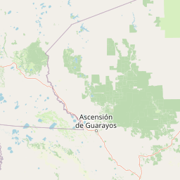
Map view of Reserva Científica, Ecológica y Arqueológica Kenneth Lee

Use this park location map to pinpoint Reserva Científica, Ecológica y Arqueológica Kenneth Lee in Bolivia, understand its exact geographic position, and read its mapped placement within the surrounding landscape more clearly.

Pigeon | © OpenStreetMap contributors

Location context for Reserva Científica, Ecológica y Arqueológica Kenneth Lee

Beni

Visual exploration of Amazonian forest islands, seasonal savannas, and protected wetland habitats

Reserva científica, ecológica y arqueológica Kenneth Lee Photos and Landscape Scenery

Photographic records reveal the distinct transition zones of forest patches and seasonally flooded savannas across the protected Beni lowlands. Visual analysis of terrain mosaics and archaeological earthworks helps observers understand the environmental character of southwestern Amazonia.

An aerial view showing a boundary between a light green flooded area and darker green vegetation.

Park atlas

Compare adjacent wetland reserves and surrounding Amazonian ecosystems

Other Protected Areas Near Reserva científica, ecológica y arqueológica Kenneth Lee

Browsing other protected areas near Reserva científica, ecológica y arqueológica Kenneth Lee reveals wider patterns in Amazonian wetland terrain. Such comparisons help contextualize regional floodplains and forest savannas across northern Bolivia.
Wildlife reserveSanta Cruz
About 98 km away#1 closest

Southeast

Reserva de Vida Silvestre Ríos Blanco y Negro: Protected Area Geography and Landscape Map

Transitional lowland forests and river floodplains in Santa Cruz

The Reserva de Vida Silvestre Ríos Blanco y Negro protects a massive stretch of lowland forest in northeastern Bolivia. This area is characterized by its transitional ecology where dry forests meet the Amazon, shaped by the dynamic flooding of the San Pablo and Blanco rivers. Access this detailed geographic overview to understand the conservation significance and territorial extent of this critical wetland and forest environment.

Area
14,000 km²
Established
1990
Relief
Lowland
Climate
Tropical
National parkSanta Cruz Department
About 117 km away#2 closest

East

Noel Kempff Mercado National Park: Detailed Protected Landscape Map and Geography

Explore national park boundaries and regional landscape context in Santa Cruz.

Noel Kempff Mercado National Park is a crucial protected area offering deep insights into Bolivia's natural geography. This entry provides specific details on its mapped landscape and geographic position within the Santa Cruz Department, enabling users to explore its protected boundaries and understand its regional context for atlas-based discovery. Dive into the mapped terrain and natural features that define this significant national park.

Area
15,523 km²
Established
1979
IUCN
II
Relief
Mixed relief
Protected areaSanta Cruz Department
About 141 km away#3 closest

Southeast

Área protegida municipal Bajo Paraguá: Geographic and Protected Area Overview

Lowland forest landscapes in Santa Cruz Department, Bolivia.

Deepen your knowledge of the Área protegida municipal Bajo Paraguá, a significant protected landscape that anchors conservation efforts in the Chiquitano dry forest. This area borders the Noel Kempff Mercado National Park and serves as a vital transition zone for lowland ecosystems and indigenous territorial defense.

Area
9,830.06 km²
Established
2021
Visitors
16K annual
Relief
Upland
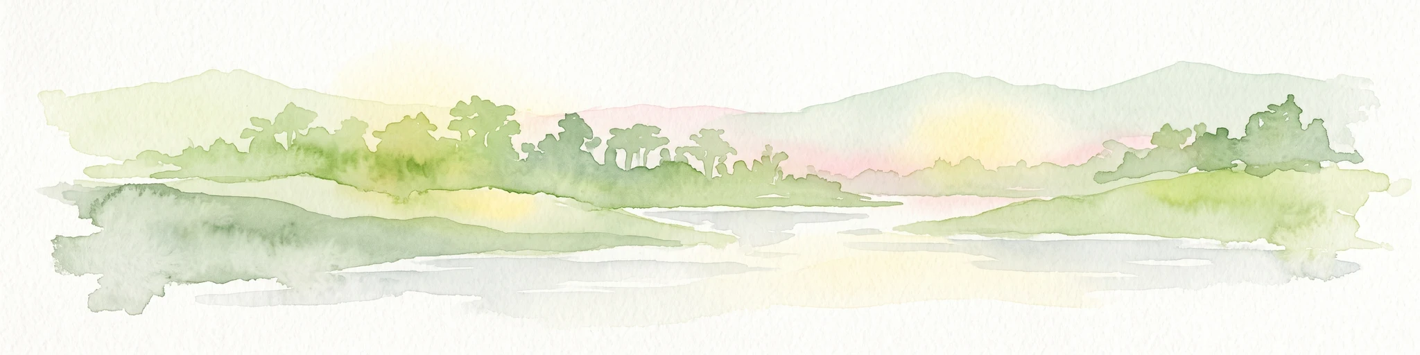
A watercolor painting showing a soft, atmospheric landscape with a winding river, green banks, trees, and distant low hills against a white background.
Protected areaBeni Department
About 242 km away#4 closest

Southwest

Área Protegida Municipal Ibare-Mamoré: Geography and Protected Area Context

Riverine landscapes and wetlands in Bolivia's Beni Department

The Área Protegida Municipal Ibare-Mamoré encompasses a diverse range of ecosystems, from upland forests to open grasslands and shifting river channels. As a key conservation unit near the city of Trinidad, this area highlights the ecological importance of the Llanos de Moxos region through its interconnected aquatic and terrestrial habitats.

Area
256.08 km²
Established
2011
Relief
Lowland
Climate
Tropical
Protected landscapeBeni
About 249 km away#5 closest

Southwest

Parque Municipal y Área Natural de Manejo Integrado Gran Mojos: Regional Geography

Protected floodplain ecosystems in the Beni department of Bolivia.

Analyze the spatial distribution of this large protected area located in the Mamoré River basin. Learn about its dual-designation structure, bridging core municipal forests with integrated management zones that preserve vital lowland Amazonian habitats and endemic biodiversity within the Llanos de Moxos ecoregion.

Area
5,804.3 km²
Established
2017
Relief
Lowland
Scope
Terrestrial
Protected landscapeSanta Cruz
About 278 km away#6 closest

Southwest

Área Natural de Manejo Integrado Humedales del Norte Protected Landscape and Wetland Atlas

Mapping the floodplain ecosystems of northern Santa Cruz, Bolivia.

An extensive protected area in northern Santa Cruz that sustains vital Amazonian river systems and seasonal wetland mosaics. This landscape supports complex hydrological functions, including the regulation of climate and regional water cycles, through its vast network of periodically flooded forest tracts and permanent waterways.

Area
4,900.51 km²
Established
2012
Relief
Lowland
Scope
Terrestrial
Regional parkBeni
About 350 km away#7 closest

West

Parque regional Yacuma: Geographic Overview and Protected Landscape Mapping

Riparian ecosystems and flooded savanna terrain in Beni, Bolivia

Explore the expansive floodplain mosaic of Parque regional Yacuma, where the Yacuma and Beni river systems create a vital refuge for lowland wildlife. The park offers an essential view into the seasonal transitions of northern Bolivia, bridging pre-Andean forests and inundated savanna plains that define this significant regional conservation corridor.

Area
1,200 km²
Established
1990
Water
Major water bodies
Nature reserveBeni Department
About 352 km away#8 closest

West

Reserva natural Barba Azul: A Protected Savanna Sanctuary in the Beni Department

Mapping flooded grasslands and gallery forest ecosystems

Reserva natural Barba Azul stands as a key protected area within the Bolivian Amazon lowlands. This nature reserve, centered in the Beni Department, preserves a rare mosaic of motacú palm forests and seasonal wetlands that serve as a critical stronghold for endangered parrots and migratory shorebirds within the larger Llanos de Moxos region.

Area
110 km²
Established
2008
Relief
Lowland
Climate
Tropical

Common questions about visiting, size, designation, and location context for Reserva Científica, Ecológica y Arqueológica Kenneth Lee

Reserva Científica, Ecológica y Arqueológica Kenneth Lee FAQs for park facts, access, geography, and protected area context

Find quick answers about Reserva Científica, Ecológica y Arqueológica Kenneth Lee, including protected-area facts, park geography, trail and visitor context, and how the park fits into its surrounding country and regional landscape.
MoriAtlas Explorer

Continue Your Protected Areas Search Across the Global Atlas

Deepen your exploration by continuing the structured search for national parks and protected areas worldwide. Utilize the comprehensive filtering capabilities to compare different conservation landscapes and refine your understanding of global park geography. Discover more about the distribution and characteristics of protected natural areas.

Global natural geography