
Mori Atlas logo
Nature reserveRéserve naturelle régionale de la tourbière de Vred

A rare alkaline wetland mosaic situated within the lower Scarpe valley alluvial basin

Réserve naturelle régionale de la tourbière de Vred: Protected Wetland and Peatbog Atlas

The Réserve naturelle régionale de la tourbière de Vred represents one of the last remaining active alkaline peatbogs in the Hauts-de-France region. This protected landscape covers 41 hectares of flat, peat-rich alluvial ground characterized by a central pond, dense reedbeds, and ash-alder woodland. As a crucial component of the Scarpe-Escaut Regional Natural Park, the area offers a compact yet diverse wetland ecosystem that preserves rare habitats for regional flora and fauna.

peatbogalkaline peatlandwetlandreedbedmarshlandregional nature reserve
A vector art illustration of a mountain landscape with a central waterfall flowing into a river, framed by pine trees and pastel colored peaks.

Réserve naturelle régionale de la tourbière de Vred

Nature reserve

Park overview

Structured park overview, official facts, and landscape profile for Vred Peatbog Regional Nature Reserve

Vred Peatbog Regional Nature Reserve park facts, protected area profile, and essential visitor context

Review the core facts for Vred Peatbog Regional Nature Reserve, including designation, size, terrain, visitor scale, habitats, and operating context in one park-focused overview.

About Vred Peatbog Regional Nature Reserve

Vred Peatbog Regional Nature Reserve is a compact but ecologically rich protected area that concentrates a surprising amount of biodiversity into a small wetland footprint in the industrial lowlands of northern France. It belongs to a cluster of peatland reserves in the Scarpe valley that together represent some of the rarest wetland habitats remaining in the Hauts-de-France region.

The site occupies a former peat-extraction and truck-farming area that was also used at one point as an informal dump, according to local accounts. Rehabilitation and protection efforts transformed it into a functioning nature reserve, first recognized voluntarily in 1988 and given full regional nature reserve status in 2008. The flat topography of the alluvial Scarpe floodplain means that surface water drains extremely slowly, which is precisely what allows peat-forming conditions to persist here.

Beyond the peat itself, the reserve is defined by a mosaic of wetland habitats. A large pond now occupies the center of the site, while reedbeds, wet meadows, ash-alder woodland, and poplar plantations surround it. Old drainage features and watergangs, the characteristic shallow canals of the Watringue system, crisscross the terrain and add to the landscape's distinctive man-made yet ecologically productive character.

The ecological value of Vred is amplified by the fact that true alkaline peatbogs are extremely rare in this part of France. Most of the historic peatlands of the Nord-Pas-de-Calais have been drained, farmed, or built over, leaving only a handful of sites like Vred and the neighboring Marchiennes marsh where the original bog dynamics still function. The reserve's distinctive floating wooded peat formation with sphagnum mosses is highlighted as almost unique in the region, making it a reference site for conservationists studying disappearing wetland habitats in heavily modified landscapes.

Quick facts and research context for Vred Peatbog Regional Nature Reserve

Vred Peatbog Regional Nature Reserve is a regional nature reserve (réserve naturelle régionale) located in the commune of Vred, in the Nord department of the Hauts-de-France region in northern France. It falls within the territory of the Scarpe-Escaut Regional Natural Park and lies near two other protected peat-rich sites, the Pré des Nonnettes regional reserve and the Marchiennes national reserve.

The reserve was classified on 26 May 2008, having previously been recognized as a voluntary nature reserve in 1988. It is classified as an IUCN Category IV protected area, focused on the management of habitats and species. Its core feature is a rare active alkaline peatbog ecosystem supported by slow-moving groundwater in an extremely flat alluvial setting, with a large central pond as a defining landscape element.

Protection and recognition

Review documented terrestrial protection scope and official conservation designations

Protection Status and International Recognition for Réserve naturelle régionale de la tourbière de Vred

Terrestrial protection records and management data define the conservation framework for Réserve naturelle régionale de la tourbière de Vred. Structured database entries outline official protected area designations and international recognition sources without assuming active management outcomes.

Protection details

Protection scope
Terrestrial
Transboundary protection
No
WDPA ID
555514385
Park context

Deeper park guide and search-rich context for Vred Peatbog Regional Nature Reserve

Vred Peatbog Regional Nature Reserve history, landscape, wildlife, and travel context

Explore Vred Peatbog Regional Nature Reserve through its history, landscape character, ecosystems, wildlife, conservation priorities, cultural context, and seasonal travel timing in a structured park guide built for atlas discovery and search intent.

Why Vred Peatbog Regional Nature Reserve stands out

Vred is best known as one of the last active alkaline peatbogs in northern France, a habitat type that has almost vanished from the lowlands of the Nord-Pas-de-Calais. The reserve's partially floating peat dome with sphagnum mosses is described as nearly unique at the regional level. Its combination of reedbeds, slow-moving drainage channels, ash-alder and poplar woodlands, and open water supports a remarkably dense biodiversity for such a small site. The reserve is also recognized for its strong amphibian populations and for hosting bird species closely tied to marsh and reedbed habitats.
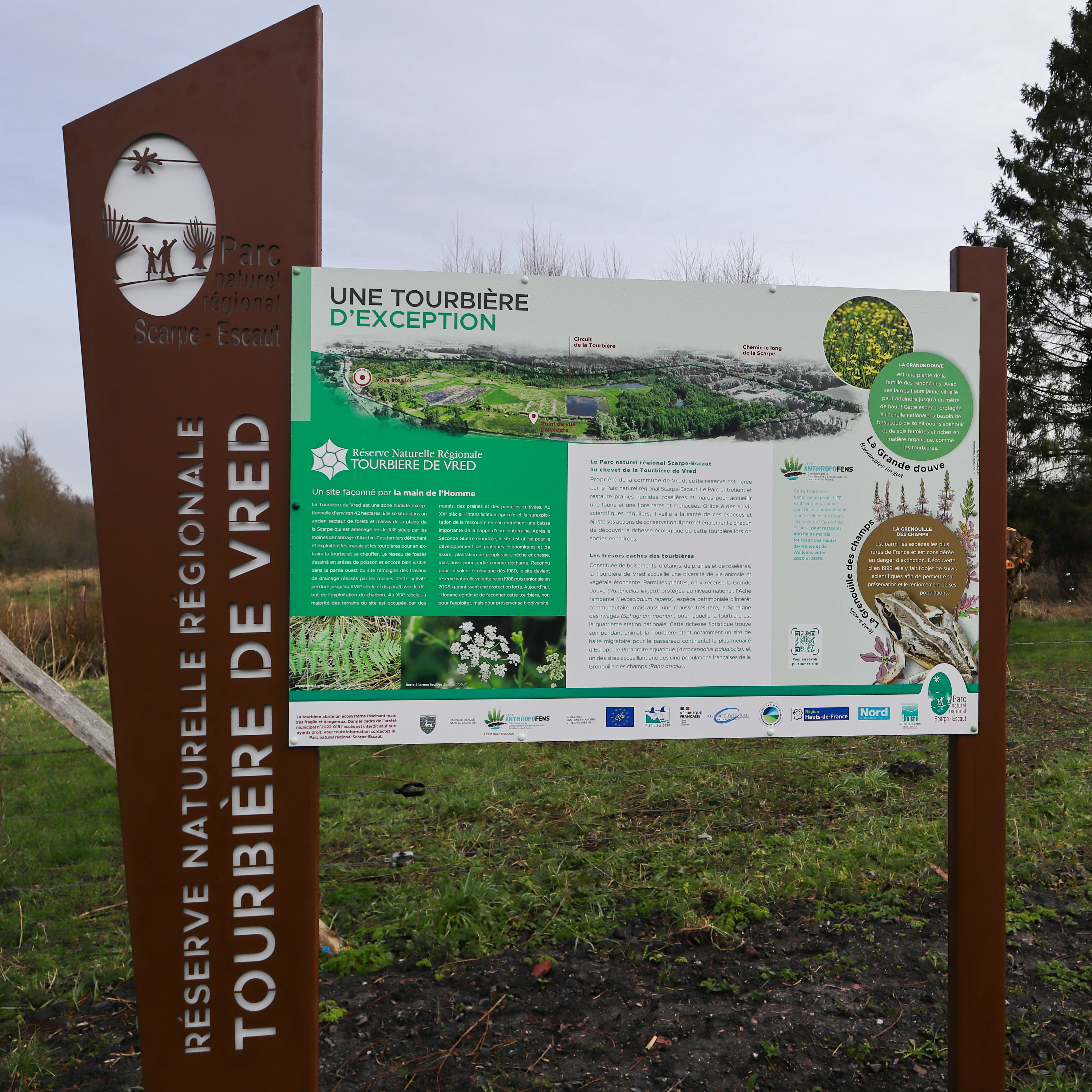
A large brown and white informational sign standing in a grassy field, displaying text, graphics, and an aerial map about the Vred Peatland Regional Nature Reserve.
Official information sign for the Réserve naturelle régionale de la tourbière de Vred.

Vred Peatbog Regional Nature Reserve history and protected-area timeline

The human history of the Vred peatbog is a story of gradual transformation. The wetland was once exploited for peat extraction, supplying fuel and soil amendments for the surrounding communities. After peat resources diminished, the land was reused for truck farming, taking advantage of the peat-rich soils.

In the twentieth century, the site also served briefly as an informal dump, according to the local mayor, illustrating how the wetland was undervalued before its ecological importance was recognized. A turning point came in 1988, when the site was officially approved as a voluntary nature reserve (réserve naturelle volontaire), marking the beginning of organized conservation management.

Twenty years later, on 26 May 2008, the regional council formally classified the site as a regional nature reserve, giving it a stronger juridical foundation and integrating it into the broader wetland protection strategy of the Scarpe-Escaut Regional Natural Park. This step solidified the reserve's role in protecting one of the last active alkaline peatbogs of the region.

Vred Peatbog Regional Nature Reserve landscape and geographic character

The landscape of the Vred reserve is extremely flat, typical of the lower Scarpe alluvial plain. There is essentially no relief, and water moves almost imperceptibly across the peat-rich alluvial soils, creating a shallow basin where organic matter has accumulated over time.

A large pond occupies the central portion of the site, with extensive reedbeds forming one of the most visually striking features, as seen in much of the reserve's photographic record. These reedbeds give way at the edges to damp meadows, while to the north and east of the main peat area stand plantations of poplars and patches of ash-alder woodland.

An important element of the landscape is the network of drainage channels and watergangs, shallow managed canals characteristic of the Watringue drainage system. These straight, slow-moving channels, combined with older peat-extraction marks and abandoned drainage ditches, give the site a distinctive cultural-historical texture layered on top of its ecological value.
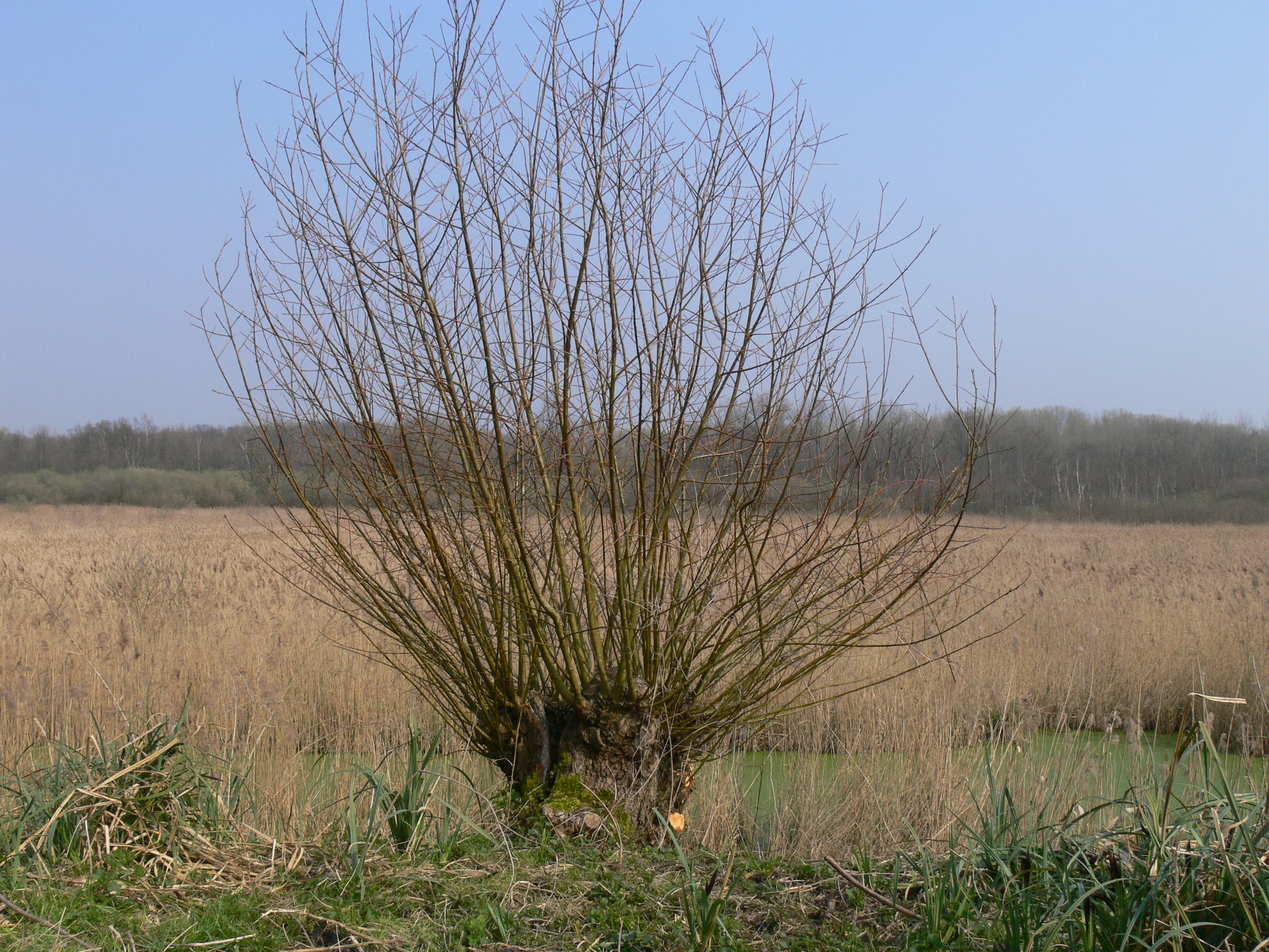
A pollarded willow tree with bare branches stands in the foreground of a flat reed bed landscape under a clear blue sky
Pollarded willow standing in the reed bed of the Vred Peat Bog Regional Nature Reserve

Vred Peatbog Regional Nature Reserve ecosystems, habitats, and plant life

Vred is fundamentally a wetland reserve, and its ecological identity is defined by an alkaline peatbog ecosystem that depends on stable hydrology and very slow water flow.

The alluvial peat of the lower Scarpe valley is poorly drained due to the near-total absence of slope, which is what has allowed peat-forming processes to persist here. This rare combination of flat topography, peat substrate, and slow-moving groundwater gives rise to a gradient of habitats, from open water and reedbeds to wet woodland and floating peat formations.

Around fifty hectares of marshland biotopes have differentiated in the broader area, including a particularly rare structure: a floating, sphagnum-rich wooded peatbog described as nearly unique at the regional level. Peatland habitats of this kind are exceptionally uncommon in northern France, where most wetlands have been drained or converted.
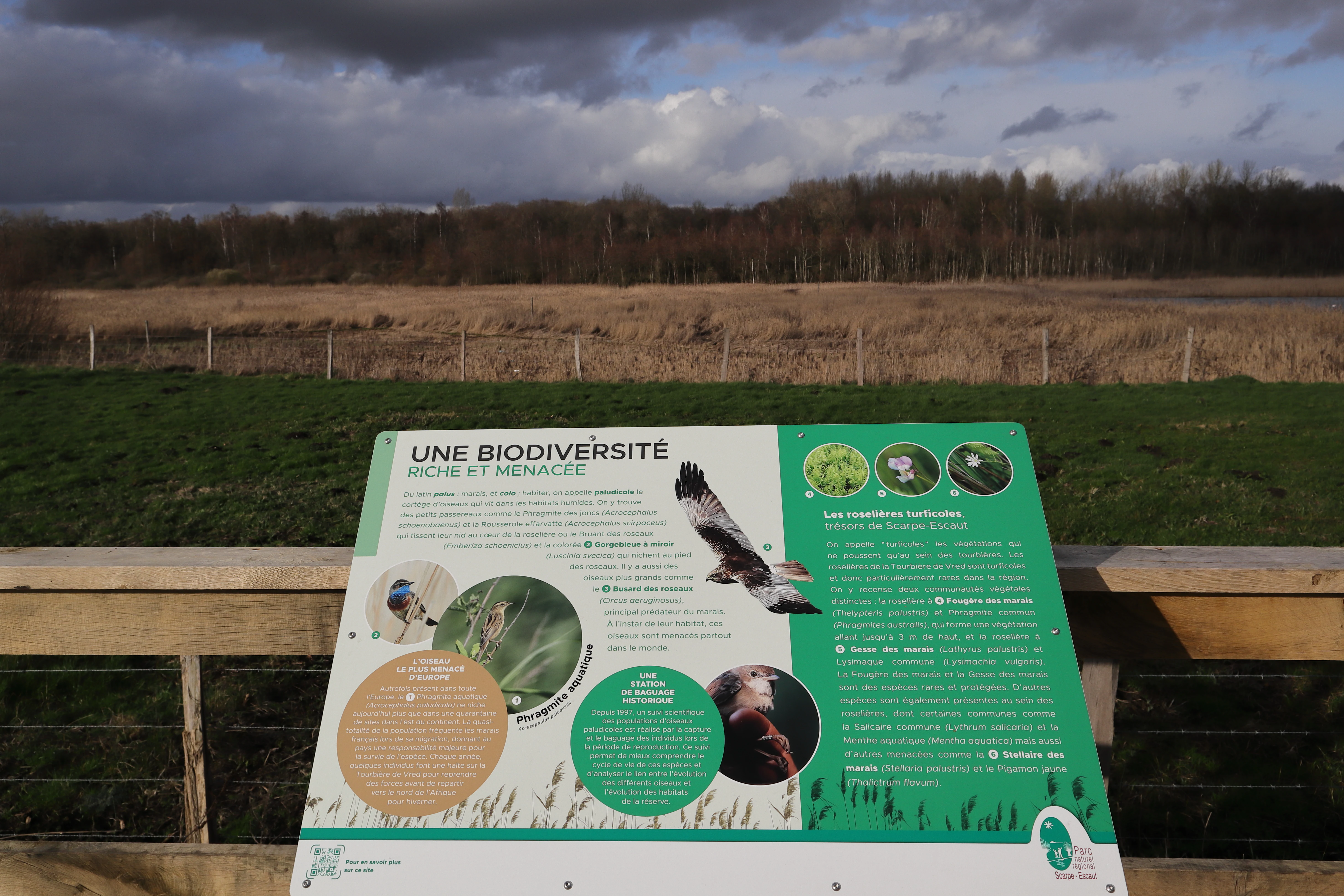
An informational sign about biodiversity at a nature reserve, with a grassy field and bare treeline visible in the background under a cloudy sky
Biodiversity information sign at the Vred Peat Bog Regional Nature Reserve in Hauts-de-France, France

Vred Peatbog Regional Nature Reserve wildlife and species highlights

Wildlife at Vred is closely tied to the wetland environment, and amphibian diversity is one of the standout features of the reserve. Six amphibian species have been recorded, including the field frog, the Italian pool frog (Lessona's frog), and the alpine newt, all of which depend on the network of ponds, ditches, and slow-moving water.

Reedbeds and marshes also support a notable bird community, with around 98 bird species documented on or near the site. Several of these are characteristic marsh specialists of conservation interest, including the little bittern, the marsh harrier, the Savi's warbler, and the sedge warbler, all species that find increasingly scarce habitat across the intensively farmed lowlands of the region.

The invertebrate fauna is similarly tied to the wetland. Eleven dragonfly species have been recorded, including two of special conservation interest, such as the small bluet. Together, these groups indicate a healthy, structurally diverse wetland ecosystem capable of sustaining both resident and migratory species.
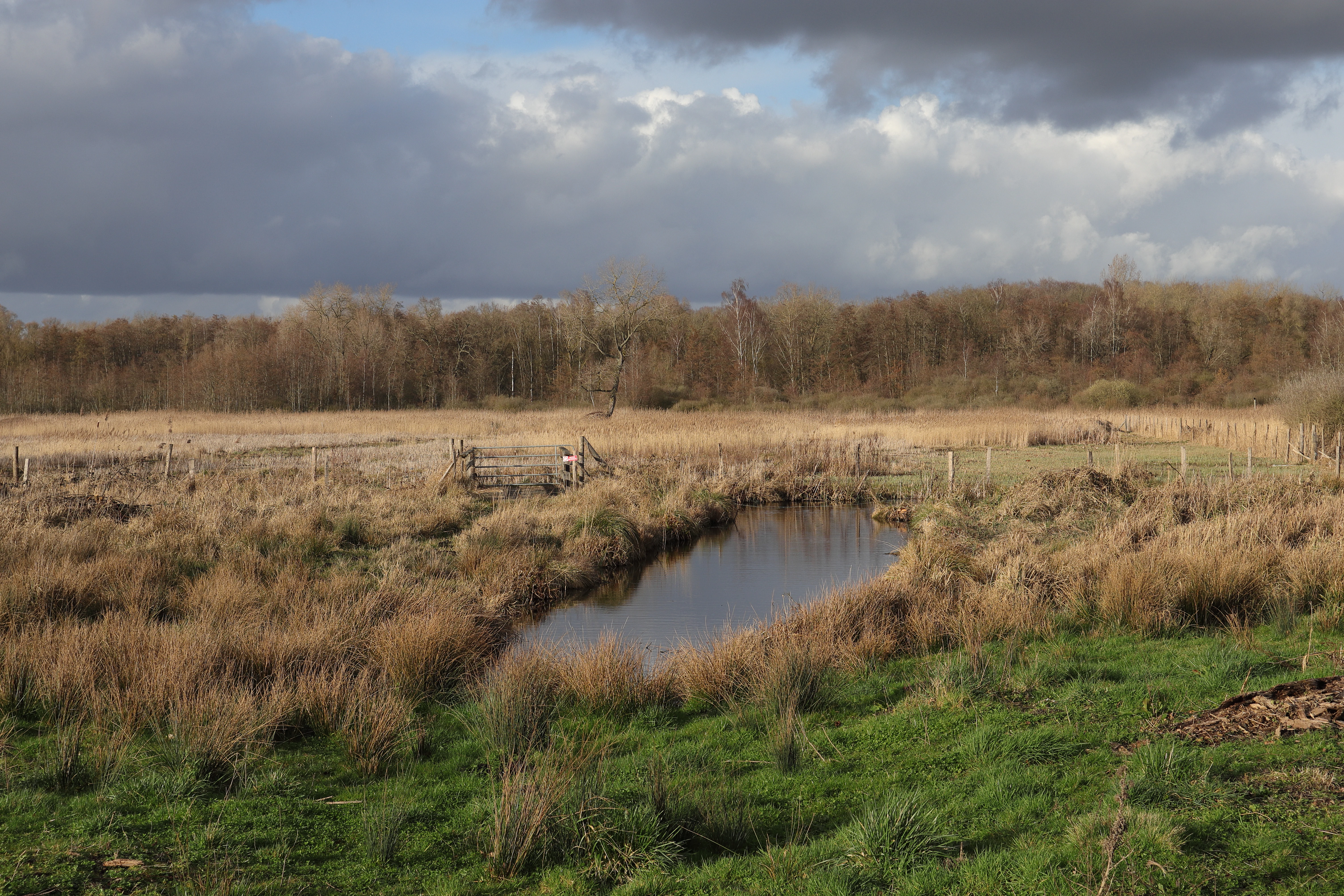
A landscape photograph of a peat bog featuring a small pool of water surrounded by brown reeds and green grass, with a line of trees in the background under a cloudy sky.
A view of the Vred Peatland Regional Nature Reserve showing a small pool surrounded by reeds and a treeline in the distance.

Vred Peatbog Regional Nature Reserve conservation status and protection priorities

Vred's principal conservation value lies in the survival of an active alkaline peatbog in a region where such habitats are otherwise almost extinct. Fewer than three truly active peatbogs remain in the Hauts-de-France region, which makes Vred both a refuge for peat-forming processes and a reservoir for species that depend on them.

Designated as a regional nature reserve in 2008, the site carries IUCN Category IV protection, recognizing it as a habitat and species management area. It is also recorded as a ZNIEFF type I site, reinforcing its recognition as a nationally significant natural area.

Beyond its own boundaries, Vred is part of a wider peatland conservation network in the Scarpe valley, alongside the Pré des Nonnettes regional reserve and the Marchiennes national reserve. The management by the Scarpe-Escaut Regional Natural Park connects Vred into landscape-scale conservation planning, including reedbed, woodland, and peatland restoration, as well as water management through the historic Watringue network.

Vred Peatbog Regional Nature Reserve cultural meaning and human context

The cultural context of Vred is shaped by the long interaction between local communities and this wetland. Peat cutting was historically part of the rural economy, and the peatlands once provided essential fuel and growing media for surrounding villages.

The surrounding Scarpe plain is also marked by an extensive water-management heritage, with the Watringue system of drainage canals representing centuries of human effort to make the floodplain productive. Today, the remnant watergangs and drainage traces on the reserve are both ecological features and cultural artifacts, recording the transition of the landscape from exploited peatland to protected nature reserve.
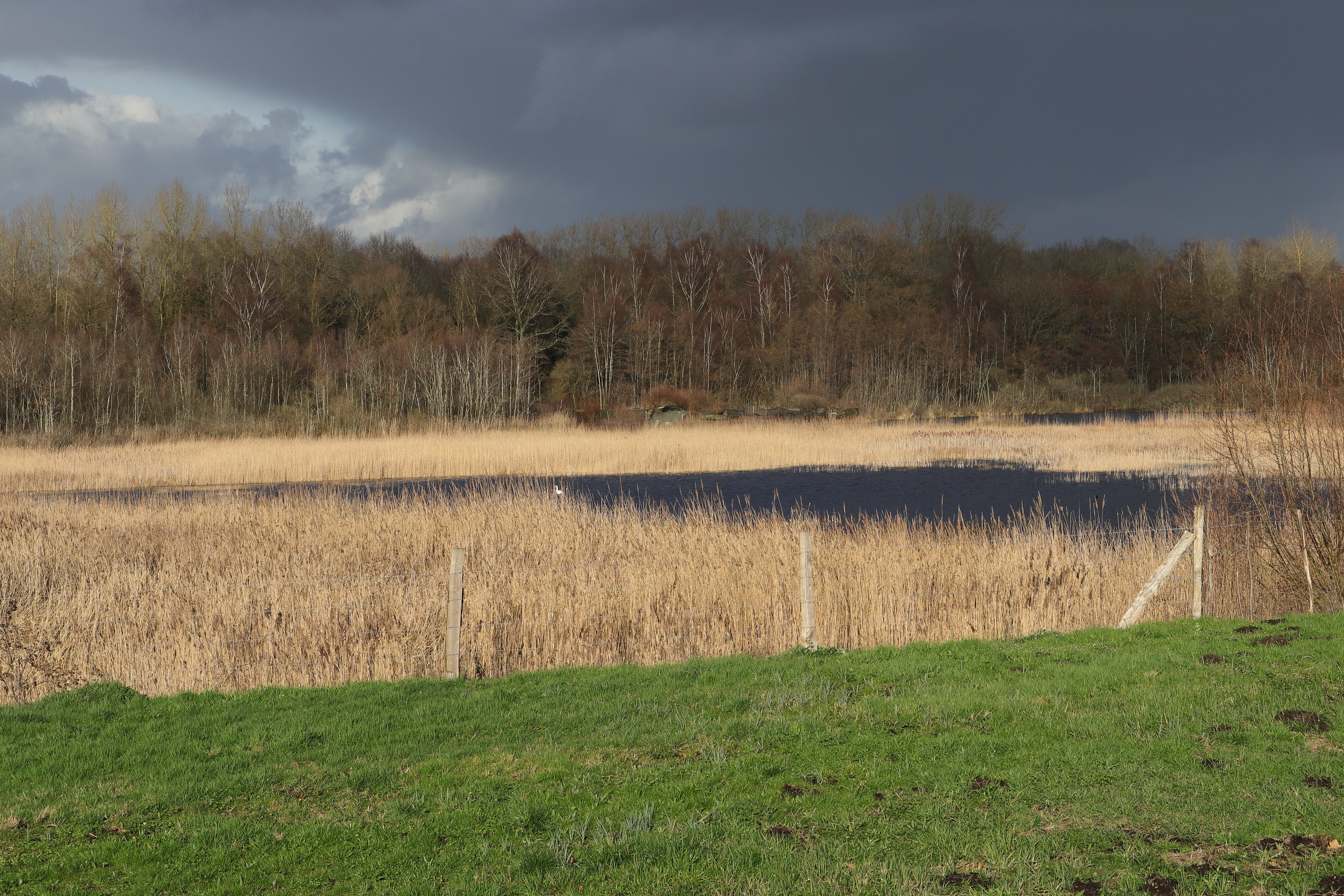
Peat bog landscape with tall dry reeds, a narrow strip of open water, wooden fence posts, green grass in the foreground, and a line of bare deciduous trees under a dark cloudy sky.
A view of the Vred Peat Bog showing tall dry reeds, a strip of open water, and a dark stormy sky over a line of bare trees.

Top sights and standout views in Vred Peatbog Regional Nature Reserve

The Vred Peatbog Regional Nature Reserve stands out as one of the very last active alkaline peatbogs remaining in the Hauts-de-France region, an ecosystem that has been largely lost elsewhere in northern France. Its near-flat alluvial setting, central pond, and surrounding reedbeds create a compact wetland mosaic unusually rich in biodiversity for its size.

The reserve is particularly notable for its floating, sphagnum-bearing wooded peat formation, almost unique at the regional level, and for the more than 90 bird species and 11 dragonfly species recorded in wetland habitat. Managed within the framework of the Scarpe-Escaut Regional Natural Park, it exemplifies how small, strategically protected sites can anchor the conservation of an entire regional peatland heritage.

Best time to visit Vred Peatbog Regional Nature Reserve

Late spring and early summer are generally the most rewarding times to experience wetland habitats like Vred, when reedbeds are in full growth and active breeding populations of marsh birds, amphibians, and dragonflies are at their peak visibility. Spring also offers the best chance to hear characteristic wetland birdsong, including warblers and bitterns.

Autumn can also be an attractive period, with cooler weather and changing reed colors giving the landscape a softer character, and reduced insect activity often making walking the 4 km pedestrian circuit more comfortable. Visitors should remember that this is an ecologically sensitive site and that seasonal water levels, which are central to its conservation value, may influence which sections of the wetland are accessible at any given time.


Monthly climate preview

Long term temperature ranges and monthly precipitation patterns across representative protected coordinates

Climate Normals and Average Temperatures for Réserve naturelle régionale de la tourbière de Vred

Representative coordinates record annual temperature progression alongside stable monthly precipitation averages for Réserve naturelle régionale de la tourbière de Vred. Deeper twelve month climate profiles provide comprehensive weather data for structured geographical analysis.
Annual mean10 °C
3 °C18 °C
Jan
Feb
Mar
Apr
May13°
Jun16°
Jul18°
Aug18°
Sep15°
Oct11°
Nov
Dec
Warmest month
July

18 °C

Coolest month
January

2.9 °C

Wettest month
December

2.5 mm/day

Driest month
April

1.5 mm/day

Park location guide

Geography guide, regional context, and park location map for Vred Peatbog Regional Nature Reserve

Vred Peatbog Regional Nature Reserve park geography, regions, and map view in France

Understand where Vred Peatbog Regional Nature Reserve sits in France through a broader geographic reading of the surrounding landscape, nearby location context, and its mapped position within the national park landscape.

How Vred Peatbog Regional Nature Reserve fits into France

France is a unitary semi-presidential republic and one of the world's largest economies. It borders Belgium, Luxembourg, Germany, Switzerland, Italy, Monaco, Andorra, and Spain, with a maritime border to the United Kingdom. The country is known for its cultural influence, art, cuisine, and political history spanning centuries.

Wider geography shaping Vred Peatbog Regional Nature Reserve in France

France is located in Western Europe. Metropolitan France extends from the Rhine to the Atlantic Ocean and from the Mediterranean Sea to the English Channel and North Sea. The country borders Belgium, Luxembourg, Germany, Switzerland, Italy, Monaco, Andorra, Spain, and has a maritime border with the United Kingdom.

Map view of Vred Peatbog Regional Nature Reserve

Use this park location map to pinpoint Vred Peatbog Regional Nature Reserve in France, understand its exact geographic position, and read its mapped placement within the surrounding landscape more clearly.

Pigeon | © OpenStreetMap contributors

Location context for Vred Peatbog Regional Nature Reserve

Hauts-de-France

Photographic reference for alkaline peatbogs, extensive reedbeds, and alluvial wetland habitats.

Visualizing Réserve naturelle régionale de la tourbière de Vred Photos and Landscape Scenery

Visual documentation captures the flat terrain, central ponds, and rare alkaline peat formations defining Réserve naturelle régionale de la tourbière de Vred. Photographic records provide clear environmental context for studying regional wetland conservation, marsh ecosystems, and protected floodplain habitats.

A large brown and white informational sign standing in a grassy field, displaying text, graphics, and an aerial map about the Vred Peatland Regional Nature Reserve.

A moss-covered fallen log with ferns growing on it, partially submerged in dark water within a forest.

A pollarded willow tree with bare branches stands in the foreground of a flat reed bed landscape under a clear blue sky

An informational sign about biodiversity at a nature reserve, with a grassy field and bare treeline visible in the background under a cloudy sky

A landscape photograph of a peat bog featuring a small pool of water surrounded by brown reeds and green grass, with a line of trees in the background under a cloudy sky.

A narrow stream or water channel reflecting bare tree trunks, winding through a muddy forest floor with low green vegetation.

Peat bog landscape with tall dry reeds, a narrow strip of open water, wooden fence posts, green grass in the foreground, and a line of bare deciduous trees under a dark cloudy sky.

Park atlas

Compare surrounding wetland reserves and regional protected landscapes across the lower Scarpe valley.

Parks and Protected Areas Near Réserve naturelle régionale de la tourbière de Vred

Browse protected areas and wetland habitats situated close to Réserve naturelle régionale de la tourbière de Vred. Expanding the regional park comparison reveals wider conservation networks and connected lowland ecosystems throughout northern France.
Protected areaNord
Mapped location lies within the park boundary#1 closest

East

Vallées de la Scarpe et de l'Escaut Protected Landscape Geography and Map Context

Wetland mosaic, subsidence lakes, and river floodplains in Nord

Examine the physical geography of the Scarpe and Escaut Valleys, a premier wetland site in northern France. The protected area features a mosaic of marshes, wet meadows, and mining-subsidence lakes that provide vital habitats for migratory waterbirds and support carbon storage through rare alkaline peatlands.

Area
276.22 km²
Established
2020
Relief
Lowland
Scope
Terrestrial
Watercolor painting of a soft, hazy landscape featuring low hills in the background and marshy wetlands in the foreground with pastel shades of green, yellow, and soft pink.
Nature reserveHauts-de-France
About 2.9 km away#2 closest

Northeast

Réserve naturelle régionale du pré des Nonnettes: Regional Nature Reserve and Wetland Atlas

Alluvial marshland and hay meadow terrain in the Hauts-de-France

The Réserve naturelle régionale du pré des Nonnettes preserves a rare wet hay meadow habitat within the Marais du Vivier. Located in the lower Scarpe river valley, this nature reserve integrates marshy ground, ponds, and riparian woods to support a concentrated mosaic of wetland biodiversity. MoriAtlas provides detailed geographic context for this protected site and its significance within the larger Hauts-de-France wetland conservation network.

Area
0.173 km²
Established
2008
IUCN
IV
Relief
Lowland
Nature reserveHauts-de-France
About 11 km away#3 closest

West

Réserve naturelle régionale des Annelles, Lains et Pont Pinnet: Protected Landscape Geography

A unique biodiversity refuge in the Hauts-de-France region of France.

The Réserve naturelle régionale des Annelles, Lains et Pont Pinnet showcases a dense patchwork of 26 natural habitats across a 14-hectare expanse. Its mapped boundaries reveal a mosaic of wet marshes, coal-shale terrils, and peat-forming ecosystems that support a significant variety of amphibians, dragonflies, and metallophyte flora. This protected area offers a clear look at how industrial landscapes can transition into essential botanical refuges within the northern French coal basin.

Area
0.146 km²
Established
2010
IUCN
IV
Relief
Lowland
Nature reserveHauts-de-France
About 12 km away#4 closest

West

Réserve naturelle régionale du marais de Wagnonville: Protected Wetland and Bog Geography

A resilient marshland ecosystem in the Douai urban landscape.

This reserve provides a comprehensive look at the surviving wetlands of the Escrebieux valley. Covering 20 hectares, the area hosts a dense variety of habitats from open ponds to rare sphagnum peat bogs, marking an essential node of biodiversity and ecological restoration within the northern French administrative landscape.

Area
0.2 km²
Established
1994
IUCN
IV
Relief
Lowland
A soft, painterly watercolor illustration showing a winding river flowing through a lush green valley with rolling hills in the background.
Nature reserveHauts-de-France
About 26 km away#5 closest

South

Réserve naturelle régionale de l'Escaut-rivière: Protected Wetland and Alluvial Corridor

Regional nature reserve in the Hauts-de-France floodplain

Spanning sixty hectares in the Cambrésis plain, this reserve protects a unique alluvial floodplain mosaic. The site provides a critical habitat refuge of wet meadows and regenerating woodland, marking a significant success in ecological restoration and fluvial corridor protection along the Escaut river.

Area
0.594 km²
Established
2011
IUCN
IV
Relief
Lowland
A watercolor illustration of a natural reserve landscape featuring foreground shrubs and grasses with a distant treeline, set against a plain white background.
Nature reserveHauts-de-France
About 26 km away#6 closest

North

Réserve naturelle régionale du Héron: Wetland and Birding Landscape in Hauts-de-France

Periurban protected area near Lille.

Located in the Hauts-de-France region, Réserve naturelle régionale du Héron serves as an important ornithological site centered on the Lac du Héron. The protected boundaries encompass a diverse terrain of wetlands, reed-fringed margins, and woodland that support significant migratory avian populations within an urban-adjacent setting.

Area
0.732 km²
Established
2012
IUCN
IV
Relief
Lowland
A watercolor painting of a pastoral landscape featuring a grassy foreground with a small pool of water, a line of trees, and soft hills in the background.
Protected landscapeHainaut
About 29 km away#7 closest

Northeast

Parc naturel des Plaines de l'Escaut: Geographic Overview of the Hainaut Protected Area

Scheldt valley wetlands, forested ridges, and historical landscape estates.

Located in the Hainaut province of Belgium, Parc naturel des Plaines de l'Escaut protects a complex mosaic of lowlands and heritage sites. This area integrates wetlands, heathland openings, and castle estates within a heavily humanized region. Learn about its role as a cross-border protected entity and its contribution to the pan-European ecological network through its varied terrain and water-dominated geography.

Area
465 km²
Established
1996
IUCN
V
Relief
Lowland
Protected areaHauts-de-France
About 34 km away#8 closest

Southeast

Neuvilly Protected Area: Geography, Mapped Boundaries, and Regional Landscape Context

A detailed geographic overview of protected lands in Hauts-de-France.

Gain insights into the Neuvilly protected area through detailed mapping and geographic analysis. This resource provides a clear breakdown of the site footprint and its place within the Hauts-de-France landscape, ensuring a structured understanding of its ecological boundaries and regional significance for mapping and environmental study.

Area
0.193 km²
Established
1990
Climate
Temperate
Scope
Terrestrial

Common questions about visiting, size, designation, and location context for Vred Peatbog Regional Nature Reserve

Vred Peatbog Regional Nature Reserve FAQs for park facts, access, geography, and protected area context

Find quick answers about Vred Peatbog Regional Nature Reserve, including protected-area facts, park geography, trail and visitor context, and how the park fits into its surrounding country and regional landscape.
MoriAtlas Explorer

Continue Your Protected Areas Search Across the Global Atlas

Deepen your exploration by continuing the structured search for national parks and protected areas worldwide. Utilize the comprehensive filtering capabilities to compare different conservation landscapes and refine your understanding of global park geography. Discover more about the distribution and characteristics of protected natural areas.

Global natural geography