
Mori Atlas logo
Nature reserveRéserve naturelle régionale du pré des Nonnettes

Mapped alluvial wetlands and preserved wet hay meadow landscapes within the lower Scarpe river valley

Réserve naturelle régionale du pré des Nonnettes: Geographic Atlas of a Northern French Nature Reserve

(Réserve naturelle régionale du pré des Nonnettes (RNR22))

The Réserve naturelle régionale du pré des Nonnettes protects a seventeen hectare fragment of traditional wet hay meadow located at the heart of the Marais du Vivier in Hauts-de-France. This regional nature reserve represents a vital component of the lower Scarpe valley alluvial wetland network, characterized by a mosaic of open marsh, riparian woodland, and waterlogged grassland. MoriAtlas provides a geographic perspective on this compact site, tracing its role as a preserved remnant of centuries-old agricultural land use within the broader northern France river system.

regional nature reservewet hay meadowalluvial wetlandmarshlandScorpe valleyHauts-de-France
A digital illustration of a scenic valley surrounded by mountains with a wooden gate in the foreground and a meadow filled with pink wildflowers.

Réserve naturelle régionale du pré des Nonnettes

Nature reserve

Park overview

Structured park overview, official facts, and landscape profile for Réserve naturelle régionale du pré des Nonnettes

Réserve naturelle régionale du pré des Nonnettes park facts, protected area profile, and essential visitor context

Review the core facts for Réserve naturelle régionale du pré des Nonnettes, including designation, size, terrain, visitor scale, habitats, and operating context in one park-focused overview.

About Réserve naturelle régionale du pré des Nonnettes

The Réserve naturelle régionale du pré des Nonnettes is a compact but ecologically meaningful regional nature reserve in northern France. It sits within the Parc naturel régional Scarpe-Escaut, on the territory of Marchiennes in the Nord department, and forms part of the broader Marais du Vivier, an alluvial wetland landscape shaped by the lower course of the Scarpe river.

At roughly 17 hectares, the reserve is small in absolute terms, yet it captures an unusually diverse set of lowland wetland habitats. Within and around its perimeter, open wet meadows, ponds, marshy ground, riparian woodland, and poplar stands combine into a habitat mosaic that contrasts strongly with the more intensively used agricultural land surrounding it. This mosaic has long attracted the attention of regional naturalists, who consider the site a rare surviving example of a traditionally managed wet hay meadow in the Scarpe valley.

The reserve's identity is closely tied to its past. The meadows it protects were historically part of the fish ponds, or viviers, operated by the medieval Abbey of Marchiennes. Centuries of low-intensity mowing and grazing have left an imprint on the vegetation that still defines the site today. The open structure of the meadow supports plant communities that would otherwise be lost to drainage or agricultural intensification, and provides nesting and feeding habitat for a range of wetland birds.

As a designated regional nature reserve, the pré des Nonnettes is managed by the Parc naturel régional Scarpe-Escaut in cooperation with local naturalist associations, hunting societies, and research institutions. The reserve sits within a small cluster of protected peatland and marsh sites in the area, including the nearby RNR de la tourbière de Vred and the RNN de la tourbière alcaline de Marchiennes, forming a regional network of complementary wetland habitats.

For visitors, the reserve is most readily experienced through the Circuit des Oiseaux, a short interpretive trail that introduces the wetland habitats and the birdlife of the Marais du Vivier. Although the site's overall footprint is modest, its combination of ecological richness, cultural landscape history, and proximity to other Scarpe valley reserves gives it a clear identity within the regional conservation network of Hauts-de-France.

Quick facts and research context for Réserve naturelle régionale du pré des Nonnettes

The Réserve naturelle régionale du pré des Nonnettes is a French regional nature reserve located in the commune of Marchiennes, department of Nord, in the Hauts-de-France region. It covers approximately 17 hectares within the larger Marais du Vivier, an alluvial wetland complex of the lower Scarpe valley.

Designated in 2008 by the Conseil régional following an earlier 1990 classification as a voluntary nature reserve, the site is administered by the Parc naturel régional Scarpe-Escaut. It holds IUCN Category IV status as a habitat and species management area, and is recognized regionally as one of the last surviving traditional hay meadows in the area.

Protection and recognition

Review documented terrestrial protection scope and baseline designation data for Réserve naturelle régionale du pré des Nonnettes.

Protection Status and Designation History for Réserve naturelle régionale du pré des Nonnettes

Structured protection records for Réserve naturelle régionale du pré des Nonnettes outline official terrestrial designation history established in 2008. Verified database entries track the administrative framework and international recognition status associated with this protected area.

Protection details

Protection scope
Terrestrial
Designated year
2008
Transboundary protection
No
WDPA ID
555514384
Park context

Deeper park guide and search-rich context for Réserve naturelle régionale du pré des Nonnettes

Réserve naturelle régionale du pré des Nonnettes history, landscape, wildlife, and travel context

Explore Réserve naturelle régionale du pré des Nonnettes through its history, landscape character, ecosystems, wildlife, conservation priorities, cultural context, and seasonal travel timing in a structured park guide built for atlas discovery and search intent.

Why Réserve naturelle régionale du pré des Nonnettes stands out

The reserve is best known for safeguarding a small but ecologically rich fragment of the Marais du Vivier, including one of the last traditional wet hay meadows of the lower Scarpe valley. Its compact area holds a remarkable density of biodiversity, with notable breeding bird species, a rich dragonfly assemblage, and rare wetland plants such as Achillée sternutatoire and Pigamon jaune. The site also stands out as a demonstration of how historical land use can still shape conservation value. The open meadow structure that the reserve protects is the direct continuation of centuries-old mowing practices on land once managed as fish ponds for the nearby Abbey of Marchiennes, giving the pré des Nonnettes both an ecological and a cultural landscape identity.
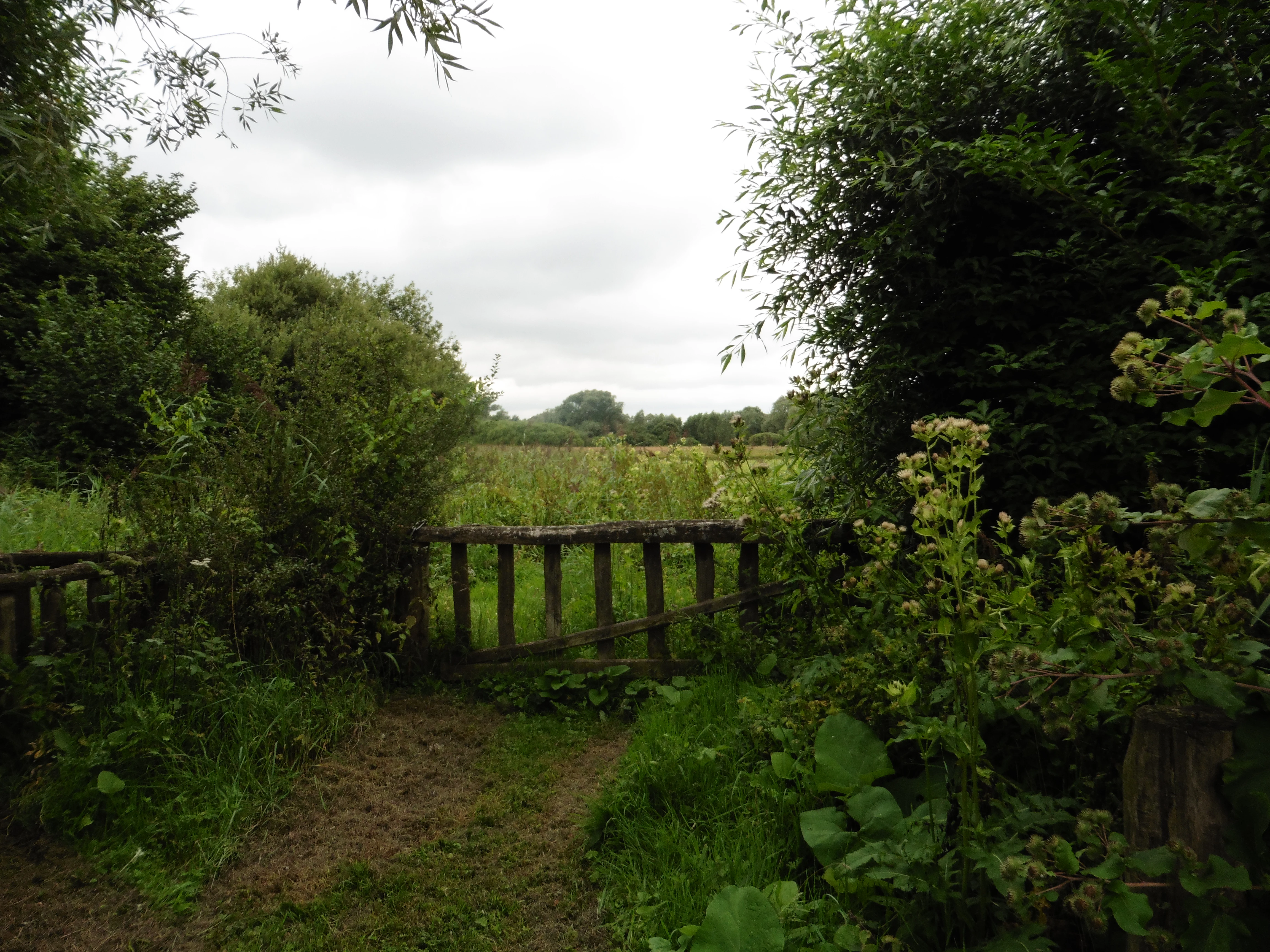
A rustic wooden gate set within a lush green landscape overlooking a meadow and distant trees under an overcast sky.
A wooden gate bordering the wetlands of the Réserve naturelle régionale du pré des Nonnettes.

Réserve naturelle régionale du pré des Nonnettes history and protected-area timeline

The landscape of the pré des Nonnettes has been shaped by human activity for centuries. The meadow is part of the Marais du Vivier, a low-lying wetland area whose ponds historically served as fish ponds, or viviers, for the nearby Abbey of Marchiennes. This monastic management established the open, periodically mown character of the site long before any formal conservation framework existed.

By the late twentieth century, regional scientists had come to view the pré des Nonnettes as a rare and threatened habitat. Its combination of botanical interest, breeding bird populations, and invertebrate fauna led to its inclusion in numerous regional scientific inventories. In recognition of these values, the commune classified the site as a réserve naturelle volontaire on 25 September 1990, giving it a first formal layer of protection.

The site's current status dates from 29 April 2008, when the Conseil régional du Nord-Pas-de-Calais formally designated it as a réserve naturelle régionale. The classification was granted for an initial period of twenty years and placed the reserve under the management of the Parc naturel régional Scarpe-Escaut, integrating the site more fully into the regional protected area network of the Scarpe valley.

Réserve naturelle régionale du pré des Nonnettes landscape and geographic character

The reserve occupies a low-lying position within the broader Marais du Vivier, an alluvial valley formed by the lower Scarpe river. The terrain is flat and waterlogged, shaped by centuries of pond management and meadow use rather than dramatic topography. The openness of the surrounding wetland gives the site a quiet, expansive character in a region otherwise dominated by agriculture and small towns.

Within the Marais du Vivier, the pré des Nonnettes represents a particularly open and traditional landscape element. The reserve is essentially a piece of wet hay meadow embedded in a wider wetland mosaic that includes ponds, marshy fringes, riparian woodland, and poplar plantations. This combination of low-intensity open ground and adjacent wetter, more vegetated habitats creates clear landscape contrasts at a very local scale, even though the elevation changes are minor.

The site is one of the last examples of a traditional fauche, or hay meadow, in this part of the Scarpe valley. Most of the historically comparable meadows have either been drained, ploughed, or converted to other uses. The persistence of an open, regularly mown sward here is the key visual and ecological signature of the reserve, and it strongly influences what visitors experience when walking the site's interpretive trail.

Réserve naturelle régionale du pré des Nonnettes ecosystems, habitats, and plant life

Ecologically, the pré des Nonnettes belongs to the alluvial wetland systems of the lower Scarpe. Although the reserve itself is small, it sits within a much larger wetland complex of roughly 400 hectares of varied biotopes, a scale that gives local ecological processes more space to operate than the protected perimeter alone would suggest.

The reserve's vegetation reflects a long history of traditional mowing on wet, nutrient-rich alluvial soil. Open hay meadow dominates the core of the site, while the edges grade into reed- and sedge-dominated marsh, pond margins, and patches of wet woodland and poplar plantation. The mix of open and more vegetated habitats produces a structured mosaic that supports both meadow-dependent species and those tied to taller, wetter vegetation.

Particular botanical interest comes from species such as Achillée sternutatoire and Pigamon jaune, which are considered characteristic of the site's traditional meadow character. The maintenance of an open sward through annual mowing is central to preserving these plant communities, which would otherwise be shaded out by scrub or replaced by more intensive grassland.

Réserve naturelle régionale du pré des Nonnettes wildlife and species highlights

The animal life of the reserve is shaped by the interplay of open wet meadow, marsh, and pond habitats. Birds are the most visible component of the fauna and include a suite of species associated with marshland and damp meadows. Among the breeding and visiting birds documented on the site are the Gorgebleue à miroir, Rousserolle effarvatte, Locustelle tachetée, Bruant des roseaux, Bruant jaune, and the Busard des roseaux, a raptor closely tied to reedbed and marsh environments.

The invertebrates of the site are also notable. The reserve hosts 25 recorded species of dragonflies, a remarkably high count for such a small area and one that reflects the diversity of still-water habitats within and around the meadow. Seven species of orthopterans have also been recorded, completing the picture of a meadow that supports a broad grassland and marsh invertebrate community.

Together, the bird and invertebrate richness gives the pré des Nonnettes an ecological profile that punches well above its weight by area, and underlines why the site has been included in numerous regional scientific inventories over the decades.

Réserve naturelle régionale du pré des Nonnettes conservation status and protection priorities

The pré des Nonnettes is significant from a conservation perspective because it preserves a habitat type, a wet hay meadow, that has largely disappeared from the lower Scarpe valley. Its designation as a régional nature reserve reflects both the rarity of the habitat mosaic it contains and the unusually high species density recorded within its modest surface area.

The reserve forms part of a broader cluster of wetland protections in the Scarpe valley, working alongside sites such as the RNR de la tourbière de Vred and the RNN de la tourbière alcaline de Marchiennes. Together, these reserves protect complementary elements of the region's peatland and marsh heritage, and the pré des Nonnettes contributes the traditionally managed open meadow component of this network.

Management is led by the Parc naturel régional Scarpe-Escaut in partnership with local naturalist associations, hunting organizations, and scientific institutions. Active stewardship focuses on maintaining the open meadow structure through traditional mowing, conserving the wetland mosaic, and sustaining favorable conditions for the site's characteristic plant, dragonfly, and breeding bird communities.

Réserve naturelle régionale du pré des Nonnettes cultural meaning and human context

The reserve carries a strong, if understated, cultural dimension rooted in the medieval landscape of the Scarpe valley. The wet meadow it protects was historically part of the viviers, or fish ponds, operated by the Abbey of Marchiennes, and the open character of the site is a direct legacy of that monastic land management.

This continuity between centuries-old land use and present-day conservation gives the pré des Nonnettes a recognizable identity within its region. The maintenance of hay-cutting practices, in cooperation with local stakeholders including hunting societies, embeds the reserve in the rural rhythms of Marchiennes and the surrounding communes, rather than separating it as a purely natural enclave.

Top sights and standout views in Réserve naturelle régionale du pré des Nonnettes

The reserve's strongest qualities are its combination of small size and concentrated biodiversity. Within roughly 17 hectares, the site preserves a traditional wet hay meadow, a rich dragonfly assemblage of 25 species, a documented orthopteran community of 7 species, and a breeding bird list that includes marsh specialists such as the Busard des roseaux and the Gorgebleue à miroir.

Its location within the Marais du Vivier and proximity to neighboring peatland and marsh reserves also enhance its value, allowing the pré des Nonnettes to function as the open meadow component of a larger wetland conservation network in the lower Scarpe valley.

Best time to visit Réserve naturelle régionale du pré des Nonnettes

The reserve is designed around the seasonal cycle of a traditional wet hay meadow. Late spring and early summer are typically the most rewarding periods for the breeding birds of the marsh and meadow, while the dragonfly community is most active during warm, settled weather from late spring through summer. Visitors interested in the meadow's botanical interest, including Pigamon jaune, will generally find the most expressive displays of meadow vegetation in late spring and early summer, when the sward is at its richest before the annual cut.

The site's interpretive Circuit des Oiseaux trail offers a structured way to experience these seasonal variations, and visiting on a calm day tends to bring out the best of the site's bird and dragonfly activity.


Monthly climate preview

Long-term representative temperature and precipitation averages across the annual cycle

Réserve naturelle régionale du pré des Nonnettes Climate Normals and Monthly Weather Patterns

Representative coordinates record measured multi-year temperature variations alongside consistent daily precipitation patterns throughout the annual cycle at Réserve naturelle régionale du pré des Nonnettes. Examining the full twelve-month profile provides complete historical climate data for this protected area in Hauts-de-France.
Annual mean10 °C
3 °C18 °C
Jan
Feb
Mar
Apr
May13°
Jun16°
Jul18°
Aug18°
Sep15°
Oct11°
Nov
Dec
Warmest month
July

18 °C

Coolest month
January

2.9 °C

Wettest month
December

2.5 mm/day

Driest month
April

1.5 mm/day

Park location guide

Geography guide, regional context, and park location map for Réserve naturelle régionale du pré des Nonnettes

Réserve naturelle régionale du pré des Nonnettes park geography, regions, and map view in France

Understand where Réserve naturelle régionale du pré des Nonnettes sits in France through a broader geographic reading of the surrounding landscape, nearby location context, and its mapped position within the national park landscape.

How Réserve naturelle régionale du pré des Nonnettes fits into France

France is a unitary semi-presidential republic and one of the world's largest economies. It borders Belgium, Luxembourg, Germany, Switzerland, Italy, Monaco, Andorra, and Spain, with a maritime border to the United Kingdom. The country is known for its cultural influence, art, cuisine, and political history spanning centuries.

Wider geography shaping Réserve naturelle régionale du pré des Nonnettes in France

France is located in Western Europe. Metropolitan France extends from the Rhine to the Atlantic Ocean and from the Mediterranean Sea to the English Channel and North Sea. The country borders Belgium, Luxembourg, Germany, Switzerland, Italy, Monaco, Andorra, Spain, and has a maritime border with the United Kingdom.

Map view of Réserve naturelle régionale du pré des Nonnettes

Use this park location map to pinpoint Réserve naturelle régionale du pré des Nonnettes in France, understand its exact geographic position, and read its mapped placement within the surrounding landscape more clearly.

Pigeon | © OpenStreetMap contributors

Location context for Réserve naturelle régionale du pré des Nonnettes

Hauts-de-France

Visual exploration of alluvial wetlands, wet hay meadows, and protected habitats in northern France

Réserve naturelle régionale du pré des Nonnettes Photos and Scenery

Visual records capture the low-lying terrain, open marshes, and traditional wet hay meadows that define the protected landscape. Examining these field photographs reveals the rare wetland habitats and localized biodiversity sustained across the Scarpe river valley.

A rustic wooden gate set within a lush green landscape overlooking a meadow and distant trees under an overcast sky.

Park atlas

Compare adjacent wetland reserves and regional conservation areas across northern France

Parks Near Réserve naturelle régionale du pré des Nonnettes And Related Protected Landscapes

Explore other protected areas and wetland reserves situated near Réserve naturelle régionale du pré des Nonnettes to compare surrounding lowland ecosystems. Expanding geographic comparison helps place local alluvial habitats and regional park networks into a broader natural context.
Protected areaNord
Mapped location lies within the park boundary#1 closest

East

Vallées de la Scarpe et de l'Escaut Protected Landscape Geography and Map Context

Wetland mosaic, subsidence lakes, and river floodplains in Nord

Examine the physical geography of the Scarpe and Escaut Valleys, a premier wetland site in northern France. The protected area features a mosaic of marshes, wet meadows, and mining-subsidence lakes that provide vital habitats for migratory waterbirds and support carbon storage through rare alkaline peatlands.

Area
276.22 km²
Established
2020
Relief
Lowland
Scope
Terrestrial
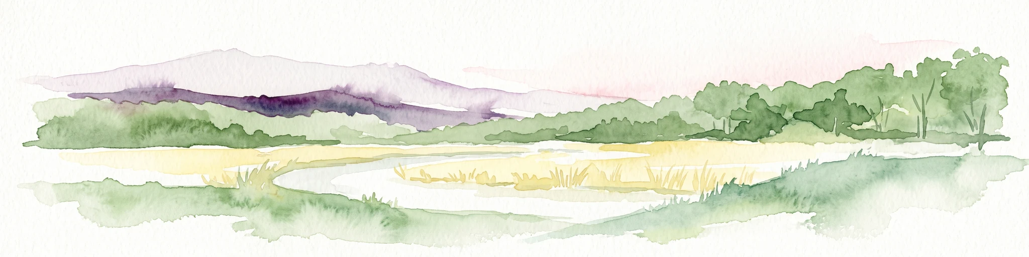
A panoramic watercolor painting showing a winding river in a green meadow, with a line of trees on the right and purple mountains in the background.
Nature reserveHauts-de-France
About 2.9 km away#2 closest

Southwest

Réserve naturelle régionale de la tourbière de Vred: Protected Peatbog and Wetland Map

Geographic landscape in the Hauts-de-France alluvial plain

Vred Peatbog is an ecologically significant protected site in northern France, known for its floating sphagnum-bearing peat formation. The reserve contains a mosaic of managed drainage channels, reedbeds, and woodlands that provide a critical sanctuary for wetland species within the Scarpe valley landscape. This mapping data provides a detailed look at the site's unique alluvial basin and regional conservation status.

Area
0.41 km²
Established
2008
IUCN
IV
Relief
Lowland
Nature reserveHauts-de-France
About 12 km away#3 closest

West

Réserve naturelle régionale des Annelles, Lains et Pont Pinnet: Protected Landscape Geography

A unique biodiversity refuge in the Hauts-de-France region of France.

The Réserve naturelle régionale des Annelles, Lains et Pont Pinnet showcases a dense patchwork of 26 natural habitats across a 14-hectare expanse. Its mapped boundaries reveal a mosaic of wet marshes, coal-shale terrils, and peat-forming ecosystems that support a significant variety of amphibians, dragonflies, and metallophyte flora. This protected area offers a clear look at how industrial landscapes can transition into essential botanical refuges within the northern French coal basin.

Area
0.146 km²
Established
2010
IUCN
IV
Relief
Lowland
Nature reserveHauts-de-France
About 14 km away#4 closest

West

Réserve naturelle régionale du marais de Wagnonville: Protected Wetland and Bog Geography

A resilient marshland ecosystem in the Douai urban landscape.

This reserve provides a comprehensive look at the surviving wetlands of the Escrebieux valley. Covering 20 hectares, the area hosts a dense variety of habitats from open ponds to rare sphagnum peat bogs, marking an essential node of biodiversity and ecological restoration within the northern French administrative landscape.

Area
0.2 km²
Established
1994
IUCN
IV
Relief
Lowland
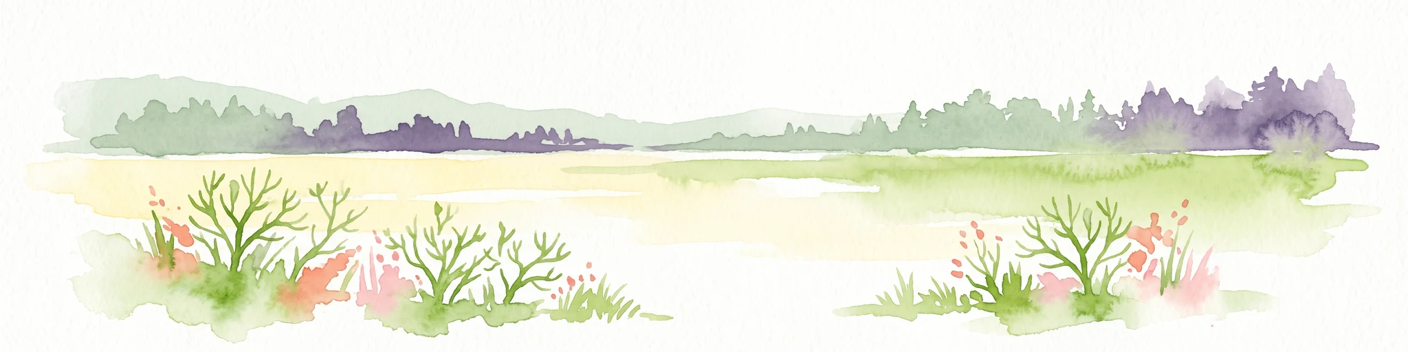
A watercolor illustration of a natural reserve landscape featuring foreground shrubs and grasses with a distant treeline, set against a plain white background.
Nature reserveHauts-de-France
About 24 km away#5 closest

North

Réserve naturelle régionale du Héron: Wetland and Birding Landscape in Hauts-de-France

Periurban protected area near Lille.

Located in the Hauts-de-France region, Réserve naturelle régionale du Héron serves as an important ornithological site centered on the Lac du Héron. The protected boundaries encompass a diverse terrain of wetlands, reed-fringed margins, and woodland that support significant migratory avian populations within an urban-adjacent setting.

Area
0.732 km²
Established
2012
IUCN
IV
Relief
Lowland
A watercolor painting of a pastoral landscape featuring a grassy foreground with a small pool of water, a line of trees, and soft hills in the background.
Protected landscapeHainaut
About 27 km away#6 closest

East

Parc naturel des Plaines de l'Escaut: Geographic Overview of the Hainaut Protected Area

Scheldt valley wetlands, forested ridges, and historical landscape estates.

Located in the Hainaut province of Belgium, Parc naturel des Plaines de l'Escaut protects a complex mosaic of lowlands and heritage sites. This area integrates wetlands, heathland openings, and castle estates within a heavily humanized region. Learn about its role as a cross-border protected entity and its contribution to the pan-European ecological network through its varied terrain and water-dominated geography.

Area
465 km²
Established
1996
IUCN
V
Relief
Lowland
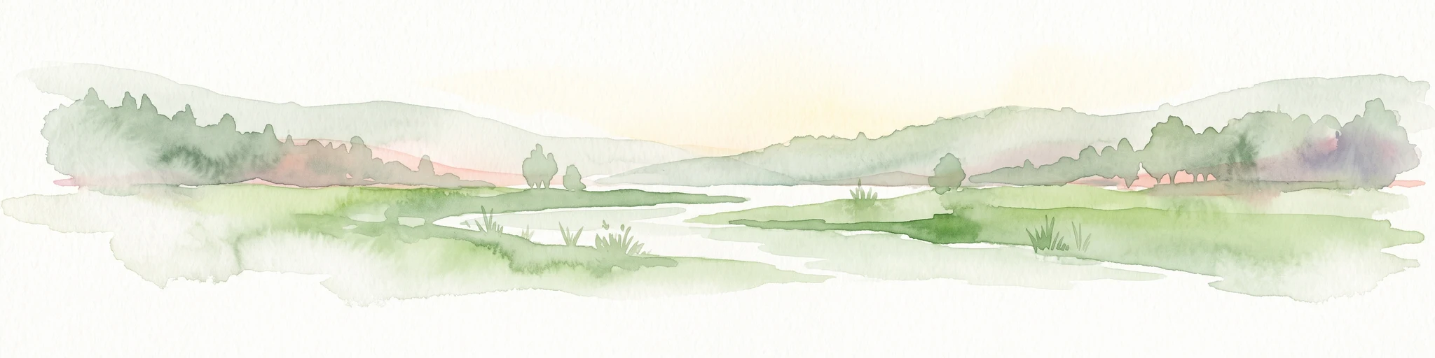
A soft, painterly watercolor illustration showing a winding river flowing through a lush green valley with rolling hills in the background.
Nature reserveHauts-de-France
About 29 km away#7 closest

South

Réserve naturelle régionale de l'Escaut-rivière: Protected Wetland and Alluvial Corridor

Regional nature reserve in the Hauts-de-France floodplain

Spanning sixty hectares in the Cambrésis plain, this reserve protects a unique alluvial floodplain mosaic. The site provides a critical habitat refuge of wet meadows and regenerating woodland, marking a significant success in ecological restoration and fluvial corridor protection along the Escaut river.

Area
0.594 km²
Established
2011
IUCN
IV
Relief
Lowland
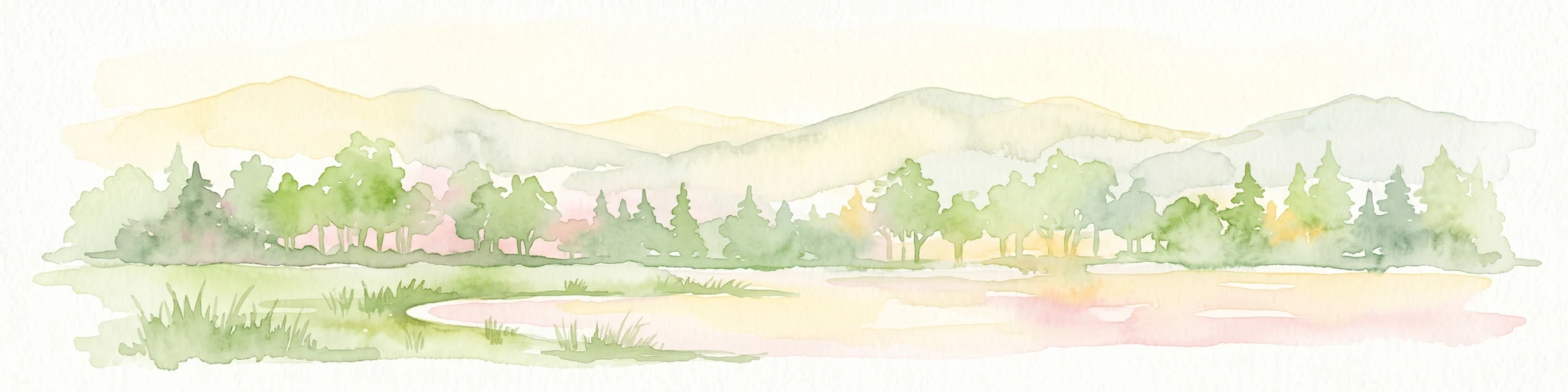
A wide watercolor illustration showing a calm river reflecting pink and yellow hues, bordered by green trees and vegetation on both banks.
Nature reserveHauts-de-France
About 35 km away#8 closest

East

Réserve naturelle régionale du bois d'Encade: Protected Woodland and Quarry Mosaic

Regional Nature Reserve in the Hauts-de-France river valley.

Spanning a compact stretch of the Hogneau valley, this nature reserve protects diverse habitats including fern-rich rock crevices and mature forest stands. The site represents a crucial ecological stepping stone that provides refuge for numerous bird, bat, and invertebrate species within a heavily cultivated agricultural corridor of northern France.

Area
0.021 km²
Established
2001
IUCN
IV
Relief
Lowland

Common questions about visiting, size, designation, and location context for Réserve naturelle régionale du pré des Nonnettes

Réserve naturelle régionale du pré des Nonnettes FAQs for park facts, access, geography, and protected area context

Find quick answers about Réserve naturelle régionale du pré des Nonnettes, including protected-area facts, park geography, trail and visitor context, and how the park fits into its surrounding country and regional landscape.
MoriAtlas Explorer

Continue Your Protected Areas Search Across the Global Atlas

Deepen your exploration by continuing the structured search for national parks and protected areas worldwide. Utilize the comprehensive filtering capabilities to compare different conservation landscapes and refine your understanding of global park geography. Discover more about the distribution and characteristics of protected natural areas.

Global natural geography