
Mori Atlas logo
Nature reserveRéserve naturelle régionale du site de Saint-Cyr

A vital migratory stopover site along the Clain river floodplain in western France.

Réserve naturelle régionale du site de Saint-Cyr: Protected Wetland Landscapes and Geography

The Réserve naturelle régionale du site de Saint-Cyr encompasses a 39-hectare mosaic of water bodies, reedbeds, and alluvial woodlands situated in the Vienne department. Created from former aggregate extraction basins, this protected area serves as an essential ecological refuge for migratory birds and diverse plant life. Understanding its role within the broader Clain river valley reveals how post-industrial terrain transforms into a significant wetland corridor for regional conservation.

regional nature reservewetlandmigratory birdsalluvial woodlandreedbedsriver floodplain
A digital illustration showing a river winding through a valley flanked by rocky cliffs and mountains under a warm, soft-lit sky. In the foreground, there are willow trees, grassy banks, and a shoreline with posts extending into the water.

Réserve naturelle régionale du site de Saint-Cyr

Nature reserve

Park overview

Structured park overview, official facts, and landscape profile for Réserve naturelle régionale du site de Saint-Cyr

Réserve naturelle régionale du site de Saint-Cyr park facts, protected area profile, and essential visitor context

Review the core facts for Réserve naturelle régionale du site de Saint-Cyr, including designation, size, terrain, visitor scale, habitats, and operating context in one park-focused overview.

About Réserve naturelle régionale du site de Saint-Cyr

The Réserve naturelle régionale du site de Saint-Cyr is a compact but ecologically meaningful protected area in the Nouvelle-Aquitaine region of western France, formally classified in 2022 after years of natural recolonization on a former industrial site.

Stretching across roughly 39 hectares along the Clain river, on the territory of the commune of Beaumont Saint-Cyr in the Vienne department, the reserve captures a transitional zone between river and floodplain. Its location within a flood expansion area of the Clain shapes both the character of its habitats and the rhythm of its hydrology, producing conditions that have proven especially favorable for waterbirds and wetland plant communities.

Ecologically, the reserve is shaped by water. The site includes ponds, small islands, reedbeds, and alluvial woodlands, and surveys have documented 14 distinct natural habitats, three of which are recognized as habitats of community interest under European classifications. This concentration of habitat types in such a small area is one of the defining features of the reserve, making it function almost like an ecological intensification zone within the broader agricultural and urbanized landscape of the Poitou region.

The reserve is also notable for being situated within a larger leisure park complex around the Lac de Saint-Cyr, an area that welcomes substantial public use. Despite this surrounding recreational activity, the protected core of the site retains habitat that is unusually quiet and undisturbed, allowing it to serve as a refuge not only for resident species but also for migratory birds stopping along the broader Loire-to-Atlantic flyway. Visitor infrastructure, including discovery trails and bird observation hides, provides structured ways for the public to engage with the reserve without compromising its conservation role.

Quick facts and research context for Réserve naturelle régionale du site de Saint-Cyr

Réserve naturelle régionale du site de Saint-Cyr is a regional nature reserve in the Nouvelle-Aquitaine region of France. It was formally classified on 20 June 2022 and encompasses roughly 39 hectares along the Clain river.

The reserve lies in the Vienne department, on the commune of Beaumont Saint-Cyr, and is embedded within a larger leisure park area around the Lac de Saint-Cyr. It is classified under IUCN Category IV and carries the national identifier RNR336, reflecting its role as a habitat and species management area of regional importance.

Protection and recognition

Structured conservation records, official WDPA data, and protected area designation details

Protection Status and Designated Recognition for Réserve naturelle régionale du site de Saint-Cyr

Examine the verified protection status, management scope, and official designation history for Réserve naturelle régionale du site de Saint-Cyr. Consult the documented conservation records and global database identifiers compiled for this protected area.

Protection details

WDPA ID
555766615
Park context

Deeper park guide and search-rich context for Réserve naturelle régionale du site de Saint-Cyr

Réserve naturelle régionale du site de Saint-Cyr history, landscape, wildlife, and travel context

Explore Réserve naturelle régionale du site de Saint-Cyr through its history, landscape character, ecosystems, wildlife, conservation priorities, cultural context, and seasonal travel timing in a structured park guide built for atlas discovery and search intent.

Why Réserve naturelle régionale du site de Saint-Cyr stands out

The reserve is best known for its network of ponds, reedbeds, small islands, and alluvial woodlands forming a wetland complex along the Clain river. This mosaic provides a key stopover point for migratory birds moving along the corridor between the Loire and the Atlantic coast. Its ecological value comes from the diversity of habitats concentrated in a relatively small area, including three habitats of community interest. Inventories have recorded a substantial number of plant species, several of which hold regional heritage value, reinforcing the site's role as a small but ecologically dense natural area within an otherwise heavily used rural and recreational landscape.
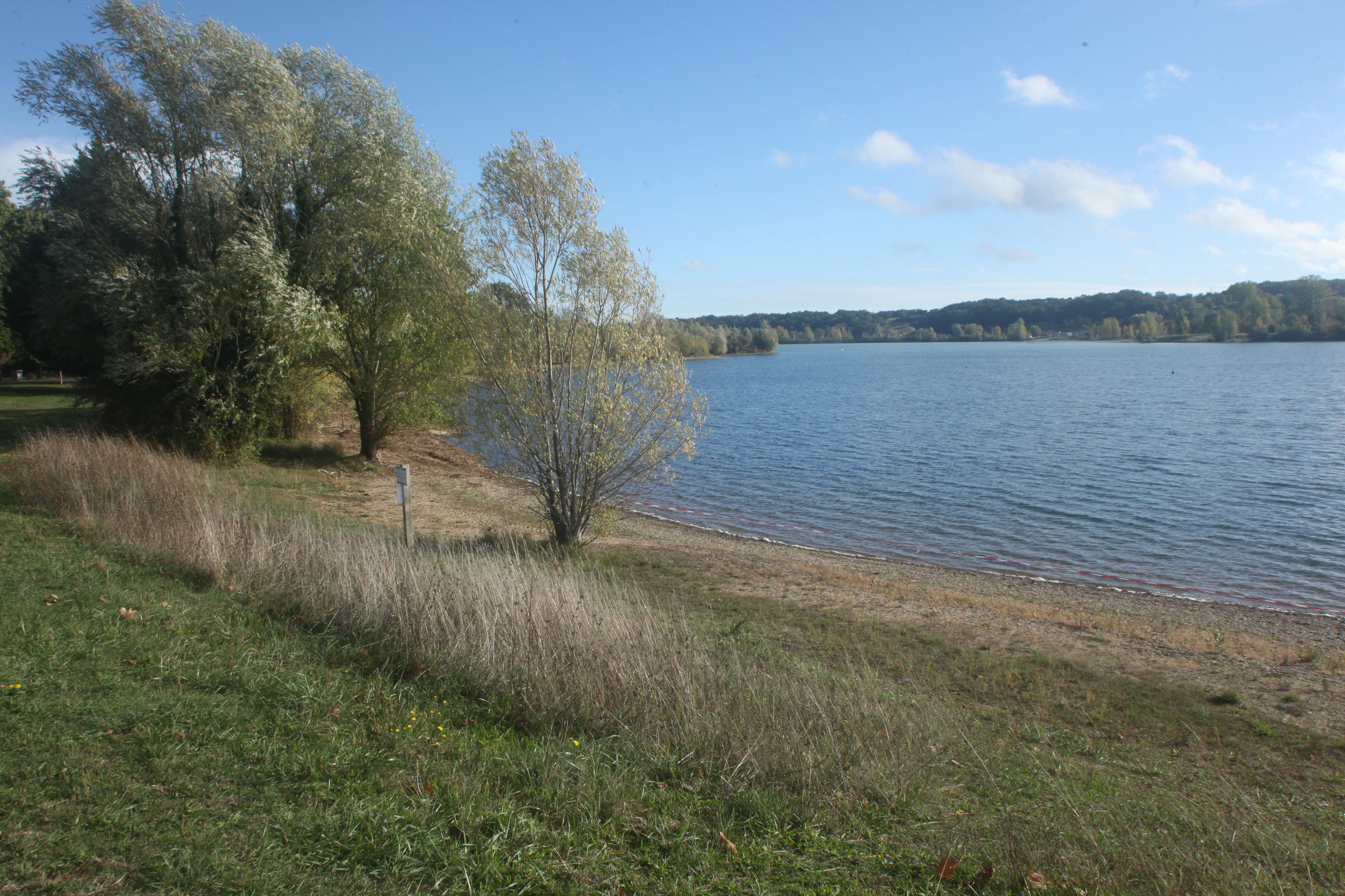
A wide view of a calm lake in the Saint-Cyr leisure park, showing a grassy, sloping bank with trees on the left side and a sandy beach meeting the water.
The lake shoreline at the Saint-Cyr leisure park.

Réserve naturelle régionale du site de Saint-Cyr history and protected-area timeline

The current nature reserve is the product of an industrial past and a long ecological recovery. The area was originally an aggregate extraction site in the floodplain of the Clain river, where gravel and similar materials were quarried for use in nearby construction projects, including works linked to the Futuroscope development.

After extraction ceased, the disturbed ground was gradually recolonized by vegetation, while the workings themselves filled with water, generating an accidental mosaic of ponds, marshy zones, and disturbed ground that evolved over time into a habitat-rich wetland complex. The site's combination of floodplain geology, varied water depths, and minimal subsequent disturbance allowed it to develop into a refuge for plants and birds far more diverse than the surrounding agricultural land.

The conservation value of the site was eventually formalized when the Conseil régional classified it as a regional nature reserve through a deliberation of 20 June 2022. Since then, the reserve has operated as a managed protected area, balancing ecological preservation with public engagement through the surrounding leisure infrastructure.

Réserve naturelle régionale du site de Saint-Cyr landscape and geographic character

The reserve occupies a low-lying strip of floodplain in the Clain valley, where former quarry basins now form a network of still water bodies interspersed with emergent vegetation. The terrain is largely flat and water-influenced, shaped by the river's historical flooding patterns.

Scattered across the water bodies are small islands, marshy margins, and belts of reeds, while surrounding areas support alluvial woodlands that reflect the periodic influence of the river. The resulting landscape is one of soft horizons, shallow water edges, reedy fringes, and wooded patches, blending the visual character of a working leisure park with the quieter atmosphere of a wetland refuge.

Within this setting, the contrast between open water surfaces, vertical reed stands, and enclosed woodland creates a varied microtopography that is felt at close range even though the relief of the wider area is gentle. The presence of bird observation hides and discovery trails emphasizes the modest scale of the site, where landscape appreciation happens primarily through water-level views and intimate encounters with wetland vegetation.
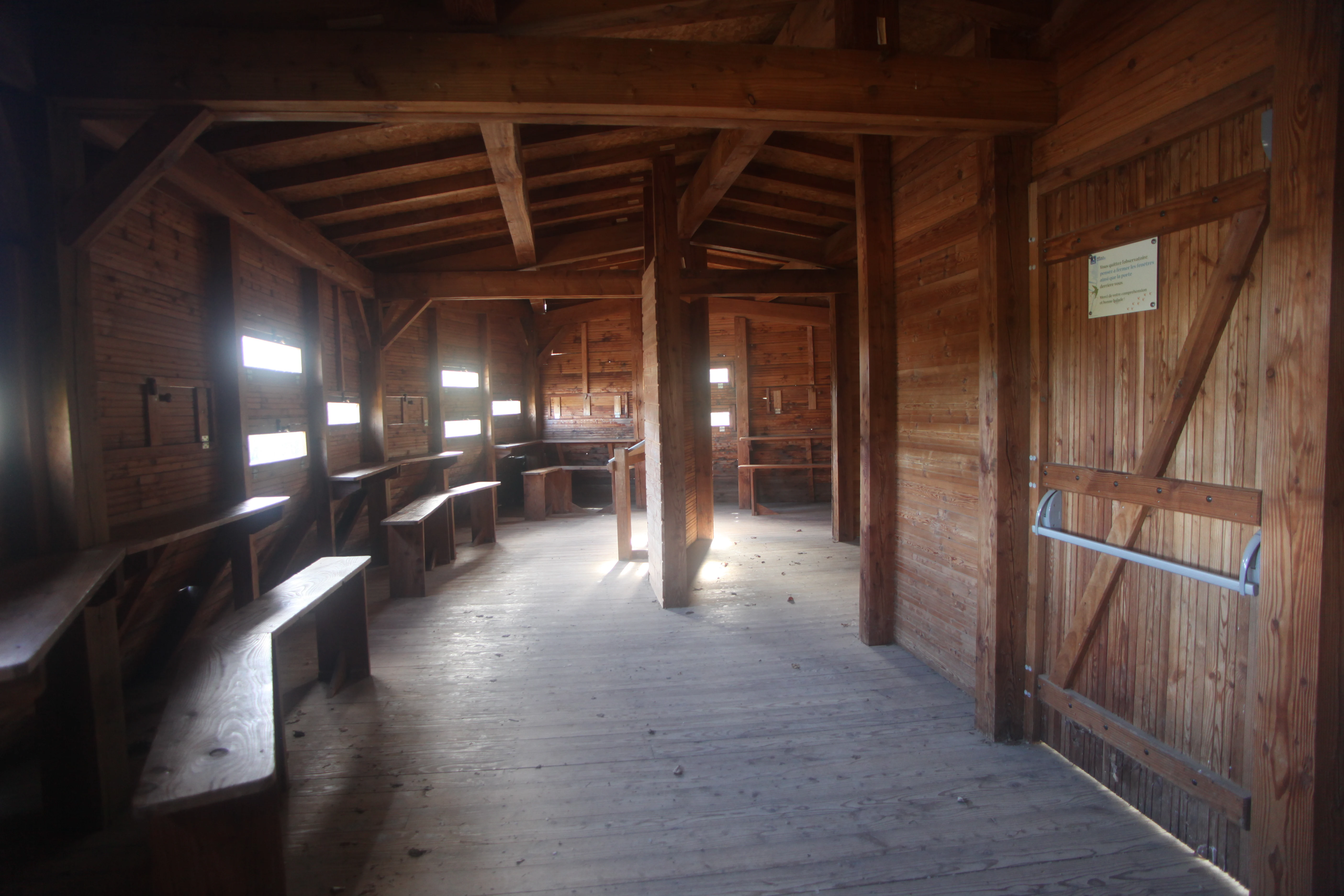
The interior of a rustic wooden building with wooden benches and viewing slits along the walls, indicating a bird-watching or observation shelter.
Interior of a wooden bird-watching blind or shelter at the Saint-Cyr site.

Réserve naturelle régionale du site de Saint-Cyr ecosystems, habitats, and plant life

Ecologically, the reserve is dominated by wetland habitats. The 14 recorded natural habitats include open water, marsh zones, reedbeds, small insular formations, and alluvial woodlands, three of which are recognized as habitats of community interest under European habitat classification frameworks.

This concentration of habitats gives the reserve an outsized ecological role relative to its modest surface area. The interplay between permanent water, seasonal flooding from the Clain, and successional alluvial forest produces a dynamic environment where plant and animal communities shift in response to water levels and seasons.

The flora of the reserve is particularly notable, with inventories documenting around 293 plant species, including several species of regional conservation interest such as the snake's head fritillary, the large naiad, and the small naiad. These sensitive aquatic and meadow species benefit from the reserve's relatively undisturbed water margins and its hydrological stability, marking the site as an important refuge for wetland flora in the Vienne.
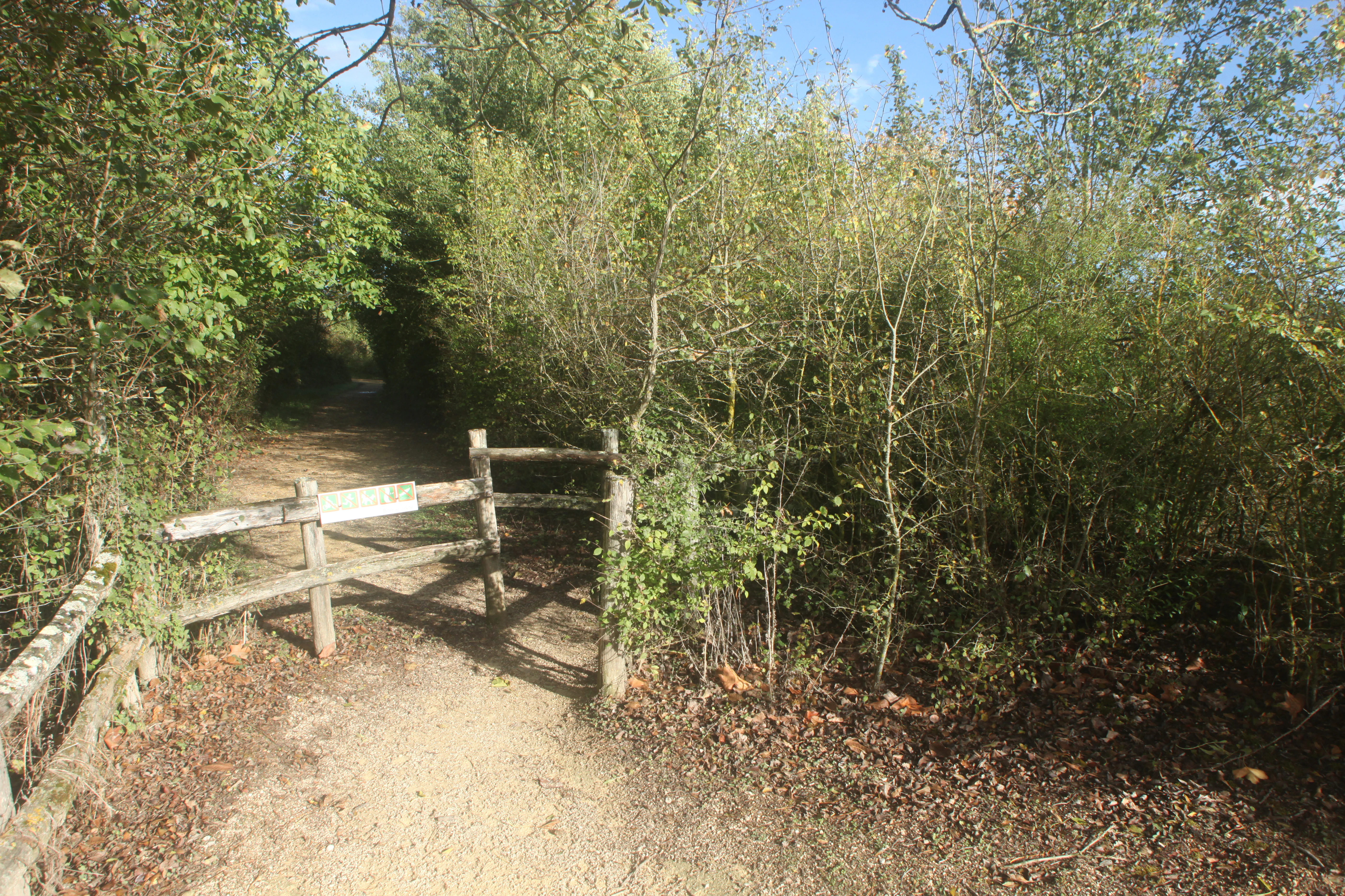
A dirt trail entrance featuring a rustic wooden fence and gate, surrounded by dense trees and shrubs.
A wooden gate marks the entrance to a wooded walking path at the Site de Saint-Cyr.

Réserve naturelle régionale du site de Saint-Cyr wildlife and species highlights

Despite its small size, the reserve holds considerable value for fauna, especially birds. Its position along the migratory corridor between the Loire and the Atlantic coast makes it an important stopover site, providing resting and feeding habitat for waterbirds that travel between the interior of France and the coast.

The combination of open water, sheltered bays, reedbeds, and alluvial woodland creates a habitat mosaic attractive to a wide range of birdlife, including species that favor shallow water, species that nest in reeds and islands, and woodland-associated species. Beyond its ornithological significance, the reserve's mix of aquatic and terrestrial habitats supports broader faunal communities, including freshwater invertebrates and other wetland-dependent animals, although detailed faunal inventories remain partial.
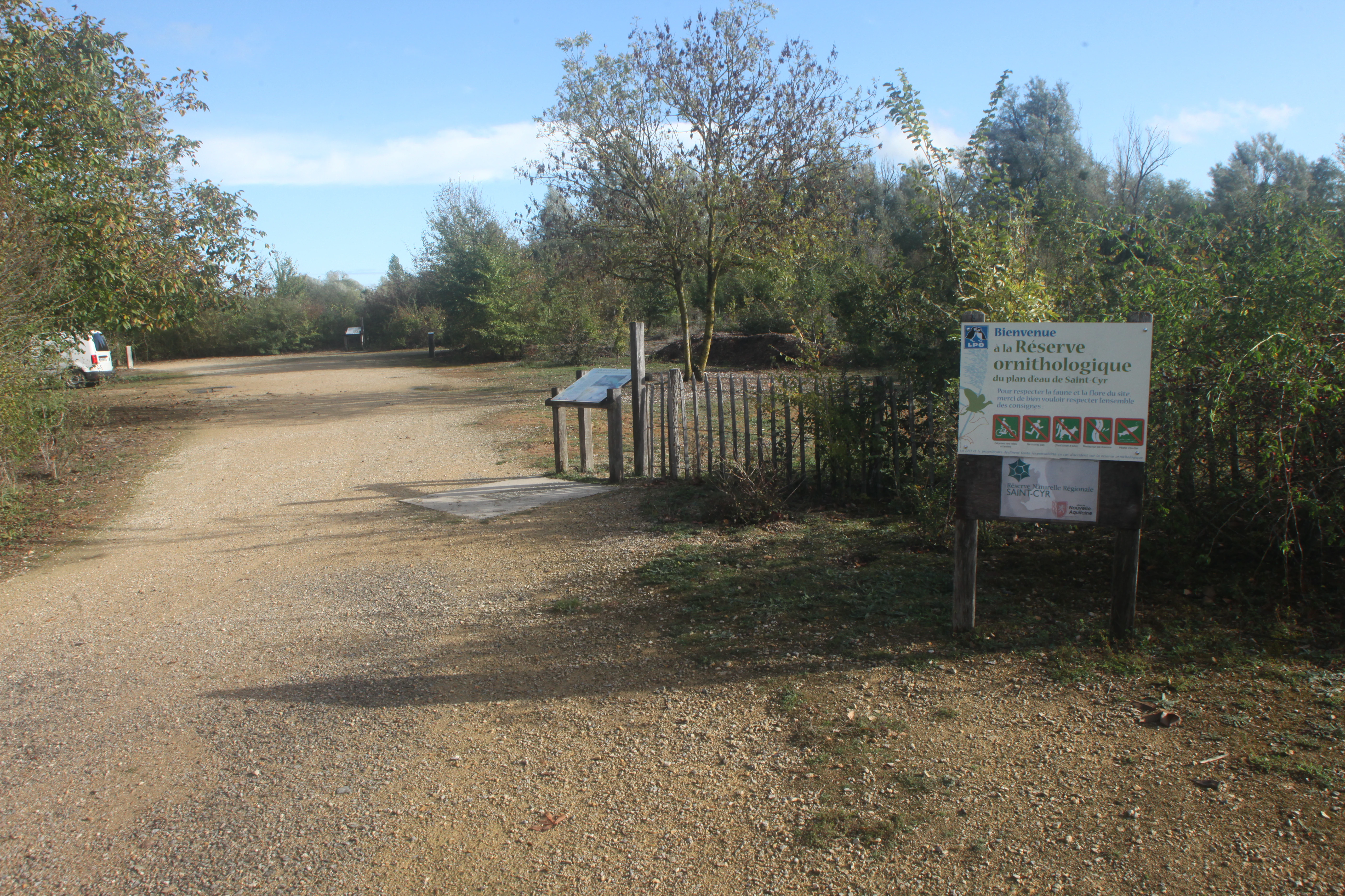
A dirt path leading into a wooded area with an information sign on the right and a wooden fence.
Information signage at the entrance to the Réserve naturelle régionale du site de Saint-Cyr.

Réserve naturelle régionale du site de Saint-Cyr conservation status and protection priorities

The reserve's establishment in 2022 recognized that a former extraction site along the Clain had, through ecological succession, acquired conservation value disproportionate to its small size. Protecting this area is a way of locking in the biodiversity that has developed naturally on disturbed land and preventing its loss to redevelopment or intensive land use.

Its classification as a regional nature reserve, categorized under IUCN Category IV, places it within a framework dedicated to the conservation of habitats and species through targeted management. The reserve's ecological profile, including habitats of community interest and plant species of regional heritage value, gives it a meaningful role in regional biodiversity strategies.

In practical terms, conservation here also means managing the relationship between the protected core and the surrounding leisure park. Visitor infrastructure such as discovery trails and bird observation hides allow the reserve to fulfill educational and recreational functions while keeping disturbance to sensitive areas under control, reinforcing the site's value as a small but well-integrated case of conservation within a heavily visited landscape.

Réserve naturelle régionale du site de Saint-Cyr cultural meaning and human context

The reserve's identity is closely tied to the modern industrial and recreational history of the Beaumont Saint-Cyr area. The quarrying activity that shaped the original landforms supported major local construction projects, including works associated with Futuroscope, one of the region's most prominent cultural and tourism landmarks.

Today, this industrial past has been reframed as an ecological opportunity, and the reserve sits within a broader leisure and cultural identity centered on the Lac de Saint-Cyr. The transition from extraction site to a place of natural heritage and public recreation reflects a regional narrative of converting former extractive landscapes into shared natural spaces.
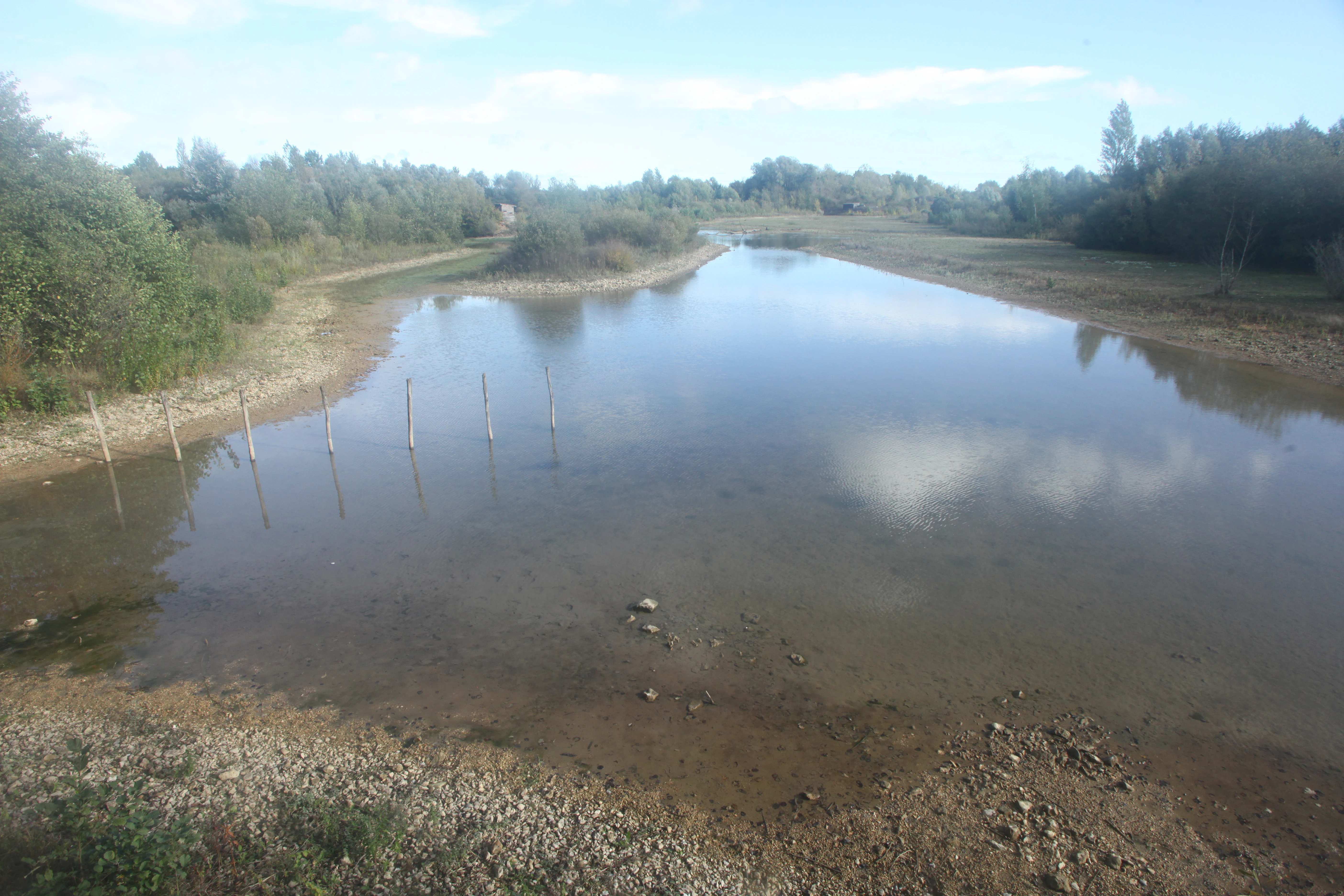
A wide shot of a shallow lake or pond surrounded by trees and vegetation at the Saint-Cyr site in France.
A view of the water body at the Saint-Cyr regional nature reserve.

Top sights and standout views in Réserve naturelle régionale du site de Saint-Cyr

A compact 39-hectare wetland reserve along the Clain river, recognized as a stopover site on the migratory route between the Loire and the Atlantic coast. The reserve combines ponds, reedbeds, small islands, and alluvial woodlands across 14 recorded natural habitats, three of which are habitats of community interest.

Its recent classification in 2022 and its 293 recorded plant species, including several of regional conservation interest, make it a small site with disproportionate ecological significance. The integration of the reserve within a larger leisure park setting adds a distinctive dimension, allowing high visitor engagement without compromising its conservation role.

Best time to visit Réserve naturelle régionale du site de Saint-Cyr

The reserve experiences most of its seasonal variability through water levels and bird activity rather than dramatic landscape shifts. Spring and autumn tend to be the most dynamic periods, as flood pulses from the Clain can reshape water margins, and migratory birds pass through or settle on the ponds and reedbeds.

Summer offers warmer conditions and active vegetation, with the wetland at its most visually lush, while winter can bring quieter scenes with overwintering waterfowl. Because the reserve is integrated within a broader leisure park, surroundings remain accessible through much of the year, though weather conditions can affect trail conditions and visibility from observation hides.
Monthly climate preview

Long-term temperature ranges and monthly precipitation patterns sampled at representative park coordinates

Annual Climate Normals and Weather by Month for Réserve Naturelle Régionale du Site de Saint-Cyr

Representative coordinate records trace long-term average temperature variations and monthly precipitation rates across the landscape. Detailed monthly statistics provide comprehensive insight into annual climatic rhythms for the protected area.
Annual mean12 °C
4 °C21 °C
Jan
Feb
Mar
Apr10°
May14°
Jun18°
Jul21°
Aug21°
Sep17°
Oct13°
Nov
Dec
Warmest month
August

20.8 °C

Coolest month
January

4 °C

Wettest month
November

2.7 mm/day

Driest month
August

1.7 mm/day

Park location guide

Geography guide, regional context, and park location map for Réserve naturelle régionale du site de Saint-Cyr

Réserve naturelle régionale du site de Saint-Cyr park geography, regions, and map view in France

Understand where Réserve naturelle régionale du site de Saint-Cyr sits in France through a broader geographic reading of the surrounding landscape, nearby location context, and its mapped position within the national park landscape.

How Réserve naturelle régionale du site de Saint-Cyr fits into France

France is a unitary semi-presidential republic and one of the world's largest economies. It borders Belgium, Luxembourg, Germany, Switzerland, Italy, Monaco, Andorra, and Spain, with a maritime border to the United Kingdom. The country is known for its cultural influence, art, cuisine, and political history spanning centuries.

Wider geography shaping Réserve naturelle régionale du site de Saint-Cyr in France

France is located in Western Europe. Metropolitan France extends from the Rhine to the Atlantic Ocean and from the Mediterranean Sea to the English Channel and North Sea. The country borders Belgium, Luxembourg, Germany, Switzerland, Italy, Monaco, Andorra, Spain, and has a maritime border with the United Kingdom.

Map view of Réserve naturelle régionale du site de Saint-Cyr

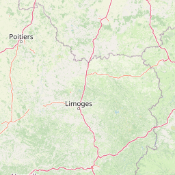
Use this park location map to pinpoint Réserve naturelle régionale du site de Saint-Cyr in France, understand its exact geographic position, and read its mapped placement within the surrounding landscape more clearly.

Pigeon | © OpenStreetMap contributors

Explore protected wetland scenery, alluvial woodlands, and habitat mosaics across the reserve.

Visualizing Réserve naturelle régionale du site de Saint-Cyr Photos and Landscapes

Examine curated photography revealing the wetland terrain, open water bodies, and reedy margins defining Réserve naturelle régionale du site de Saint-Cyr. Visual records document the unique floodplain ecosystem, alluvial woodlands, and critical bird habitats protected along the Clain river valley.

A wide view of a calm lake in the Saint-Cyr leisure park, showing a grassy, sloping bank with trees on the left side and a sandy beach meeting the water.

A calm, shallow waterway winding through a nature reserve with a wooden structure on a low hill in the background.

The interior of a rustic wooden building with wooden benches and viewing slits along the walls, indicating a bird-watching or observation shelter.

A dirt trail entrance featuring a rustic wooden fence and gate, surrounded by dense trees and shrubs.

A dirt path leading into a wooded area with an information sign on the right and a wooden fence.

A gravel path leads toward a small, one-story wooden structure nestled among trees and shrubs, with a stone wall visible on the left.

A wide shot of a shallow lake or pond surrounded by trees and vegetation at the Saint-Cyr site in France.

Park atlas

Compare surrounding regional reserves and wetland habitats across western France

Explore Protected Areas and Parks Near Réserve naturelle régionale du site de Saint-Cyr

Browse other protected areas and river valley reserves located within the surrounding region of western France. Comparing adjacent wetland habitats helps expand regional geography understanding and reveals broader conservation patterns beyond a single protected site.
A soft watercolor painting of a calm pond surrounded by green grasses, shrubs, and rolling hills in the background.
Nature reserveNouvelle-Aquitaine
About 5.4 km away#1 closest

Southeast

Réserve naturelle nationale du Pinail: Protected Pond and Heathland Mosaic in Nouvelle-Aquitaine

Mapped geography of a unique French nature reserve

Located in the Nouvelle-Aquitaine region, Réserve naturelle nationale du Pinail preserves a rare cultural-ecological landscape. The site features an extraordinary concentration of three thousand small acidic ponds created by medieval millstone quarrying, now surrounded by protected heather and dwarf gorse heathland. This structured overview highlights the terrain, habitat connectivity, and regional importance of this internationally recognized Ramsar wetland site.

Area
1.35 km²
Established
1980
IUCN
IV
Relief
Lowland
Watercolor painting of a winding river flowing through a grassy plain, with soft green hills in the distance and a large rock in the foreground.
Nature reserveCentre-Val de Loire
About 42 km away#2 closest

East

Réserve naturelle régionale du Bois des Roches: Geographic Overview and Protected Area Atlas

Limestone cliffs and archaeological landscapes in Centre-Val de Loire

Situated in the Indre department of France, this nature reserve is defined by its south-facing limestone cliffs and diverse ecological layers. Beyond its role as a sanctuary for bat colonies and thermophilic flora, the site reveals a deep history of Upper Paleolithic human occupation. MoriAtlas provides a comprehensive geographic look at this protected landscape and its structural role within the broader Brenne ecological context.

Area
0.122 km²
Established
1997
IUCN
IV
Relief
Upland
Nature reserveCentre-Val de Loire
About 49 km away#3 closest

Northwest

Marais de Taligny Regional Nature Reserve: A Protected Wetland in Centre-Val de Loire

Alluvial valley geography and restored marshland habitats

Spanning the Négron valley, this regional nature reserve serves as an vital sanctuary for alkaline fen formations and diverse aquatic species. The site provides a detailed look at the intersection of riverine drainage, alluvial woodland, and the successful ecological restoration of historical French wetland landscapes.

Area
0.354 km²
Established
2014
IUCN
IV
Relief
Lowland
Nature reserveCentre-Val de Loire
About 58 km away#4 closest

East

Réserve naturelle régionale des terres et étangs de Brenne, Massé, Foucault Geographic Details

A managed wetland landscape in the Centre-Val de Loire

Analyze the terrain of the Réserve naturelle régionale des terres et étangs de Brenne, Massé, Foucault. This reserve showcases a dense network of freshwater ponds and diverse plant communities, including rare species like the marsh gentian, across a finely textured wetland environment in central France.

Area
3.19 km²
Established
2014
IUCN
IV
Relief
Lowland
Nature reserveNouvelle-Aquitaine
About 61 km away#5 closest

Northwest

Réserve naturelle régionale de la vallée du Pressoir: Protected Limestone Valley and Geoheritage

A rare natural and cultural mosaic in Nouvelle-Aquitaine

Trace the boundaries and natural features of the Réserve naturelle régionale de la vallée du Pressoir. This protected site in the Deux-Sèvres department is defined by thin calcareous soils, the historic Pommiers cascade, and fossil-rich limestone outcrops that form an unusual geoheritage landscape.

Area
0.56 km²
Established
2025
IUCN
IV
Visitors
10K annual
Nature reservePays de la Loire
About 62 km away#6 closest

Northwest

Réserve naturelle régionale Champagne de Méron: Geographic and Protected Area Overview

A regional nature reserve within the Maine-et-Loire department.

Located in the heart of the Anjou countryside, Réserve naturelle régionale Champagne de Méron represents a strategic effort to safeguard biodiversity within western France. Covering 146 hectares, this protected area illustrates the intersection of modern conservation goals and historic rural landscapes, offering a clear view of how regional authorities manage and restore fragmented natural habitats.

Area
1.461 km²
Established
2023
IUCN
IV
Scope
Terrestrial
Nature reserveNouvelle-Aquitaine
About 62 km away#7 closest

Northwest

Réserve naturelle nationale du Toarcien: Protected Jurassic Stratotype and Geological Map

A vital paleontological heritage site in the Nouvelle-Aquitaine region

As the smallest national nature reserve in France, Réserve naturelle nationale du Toarcien provides a concentrated, scientifically essential view of Jurassic marine sediments. The protected quarries preserve ammonite-rich strata and complex geological unconformities, serving as the international definition for the Toarcian geological stage within the Thouet valley landscape.

Area
0.006 km²
Established
1987
IUCN
III
Relief
Lowland
Nature reserveDeux-Sèvres
About 68 km away#8 closest

West

Réserve naturelle régionale du bocage des Antonins: Protected Landscape and Geographic Atlas

Detailed ecological mapping of the Gâtine armoricaine countryside

The Réserve naturelle régionale du bocage des Antonins occupies a distinct space in the Deux-Sèvres department. This protected area serves as a repository for the traditional bocage countryside, featuring a complex arrangement of pollarded trees, wet meadows, and the historic étang des Forges. The site offers a significant look at the structural history of rural western France through its preserved environmental matrix.

Area
0.226 km²
Established
2015
IUCN
IV
Relief
Lowland

Common questions about visiting, size, designation, and location context for Réserve naturelle régionale du site de Saint-Cyr

Réserve naturelle régionale du site de Saint-Cyr FAQs for park facts, access, geography, and protected area context

Find quick answers about Réserve naturelle régionale du site de Saint-Cyr, including protected-area facts, park geography, trail and visitor context, and how the park fits into its surrounding country and regional landscape.
MoriAtlas Explorer

Continue Your Protected Areas Search Across the Global Atlas

Deepen your exploration by continuing the structured search for national parks and protected areas worldwide. Utilize the comprehensive filtering capabilities to compare different conservation landscapes and refine your understanding of global park geography. Discover more about the distribution and characteristics of protected natural areas.

Global natural geography