
Mori Atlas logo
Nature reserveRhäden bei Obersuhl und Bosserode

Discover the mapped boundaries and geographic context of this cross-border nature reserve.

Rhäden bei Obersuhl und Bosserode: A Restored Wetland Landscape in the Hessian Werra Valley

Rhäden bei Obersuhl und Bosserode is a vital protected wetland situated within a shallow subsidence basin in the northern Hessian Werra valley. This restored floodplain mosaic, consisting of shallow ponds, reedbeds, and wet meadows, occupies a unique position in the regional geography along the former inner-German border. The site provides a critical habitat for diverse avian species and rare amphibians, serving as an essential ecological corridor within the central German landscape.

floodplain wetlandnature reservebird sanctuarymigratory birdswet meadowsreedbeds
A flat-style digital illustration showing a marshy wetland with grasses and purple flowers in the foreground, a pine forest in the midground, and a large snow-capped mountain in the distance against a pastel pink and orange sky.

Rhäden bei Obersuhl und Bosserode

Nature reserve

Park overview

Structured park overview, official facts, and landscape profile for Rhäden bei Obersuhl und Bosserode

Rhäden bei Obersuhl und Bosserode park facts, protected area profile, and essential visitor context

Review the core facts for Rhäden bei Obersuhl und Bosserode, including designation, size, terrain, visitor scale, habitats, and operating context in one park-focused overview.

About Rhäden bei Obersuhl und Bosserode

Rhäden bei Obersuhl und Bosserode is a compact but ecologically rich nature reserve in the upper Werra valley, occupying a geological subsidence basin where Permian salt deposits dissolved and caused the surface to gradually sink. This natural depression once held a prehistoric lake fed by streams flowing westward toward the Fulda system, then evolved into a marshy landscape that was progressively drained for agriculture during the nineteenth century. After decades of drainage and limited farming on the divided German border, the area was abandoned and began to revert to wetland.

Since the early 1970s, an engaged local bird and nature protection group led a stepwise restoration program that recreated shallow lakes, reedbeds, wet meadows, ponds with gently sloping shorelines, and shrubby islands. The reserve today contains several named water bodies, including the Grosser Suhlsee, Paulsteich, and Froschweiher, all of which are managed to expose muddy feeding flats in autumn for migratory waders and to provide higher water levels in winter and spring for waterfowl.

Covering about 120 hectares and recognized as a national nature reserve, a European Fauna-Flora-Habitat site, and a component of a larger EU bird protection area, the Rhäden carries strong protection status at multiple levels. Its value lies less in habitat diversity than in the density and rarity of its bird and amphibian fauna, and in its position as a key stepping stone along the Werra floodplain corridor for species migrating between northern Europe and warmer winter quarters.

Quick facts and research context for Rhäden bei Obersuhl und Bosserode

Rhäden bei Obersuhl und Bosserode is a roughly 120 hectare nature reserve in the municipality of Wildeck, in the Hersfeld-Rotenburg district of northeastern Hesse. It lies in a subsided basin of the Werra valley close to the Thuringian border. The site has been a protected nature reserve since 1973, was designated as a European Fauna-Flora-Habitat site in 2008, and forms part of the larger EU bird protection area Rhäden von Obersuhl and the floodplains of the Middle Werra.

Its ecological importance is primarily as a floodplain mosaic of ponds, reedbeds, wet grassland, willow and alder thickets, and successor woodland on former poplar plantings. More than two hundred bird species have been recorded, around fifty of them listed under Annex I of the EU Birds Directive. The site also hosts protected amphibians, fish, and butterflies, and serves as a key stepping stone within the Werra floodplain network.

Protection and recognition

Documented terrestrial protection history, management scope, and Natura 2000 listings.

Rhäden bei Obersuhl und Bosserode Protection Status and International Recognition

Rhäden bei Obersuhl und Bosserode holds documented terrestrial protection status established in 2008 alongside verified Natura 2000 recognition records. Official records outline the designation timeline and transboundary framework governing this protected landscape.

International recognition

Protection details

Protection scope
Terrestrial
Designated year
2008
Transboundary protection
Yes
WDPA ID
165150
Park context

Deeper park guide and search-rich context for Rhäden bei Obersuhl und Bosserode

Rhäden bei Obersuhl und Bosserode history, landscape, wildlife, and travel context

Explore Rhäden bei Obersuhl und Bosserode through its history, landscape character, ecosystems, wildlife, conservation priorities, cultural context, and seasonal travel timing in a structured park guide built for atlas discovery and search intent.

Why Rhäden bei Obersuhl und Bosserode stands out

The Rhäden is best known for its exceptional value to birdlife, serving as a breeding ground for rare ground-nesting species, a migratory stopover along the Werra floodplain corridor, and a wintering area for geese, cranes, and waterfowl. More than two hundred bird species have been documented, including numerous Annex I species such as bitterns, egrets, white and black storks, harriers, osprey, and aquatic warblers. Equally distinctive is the landscape itself: a subsidence basin restored from drained farmland into a structured mosaic of shallow ponds, reed-fringed water bodies, wet meadows, and developing floodplain woodland. The reserve is recognized as one of the most significant inland birdwatching sites in Hesse and Thuringia, and as an early model of cross-border habitat restoration along the former divided Germany.
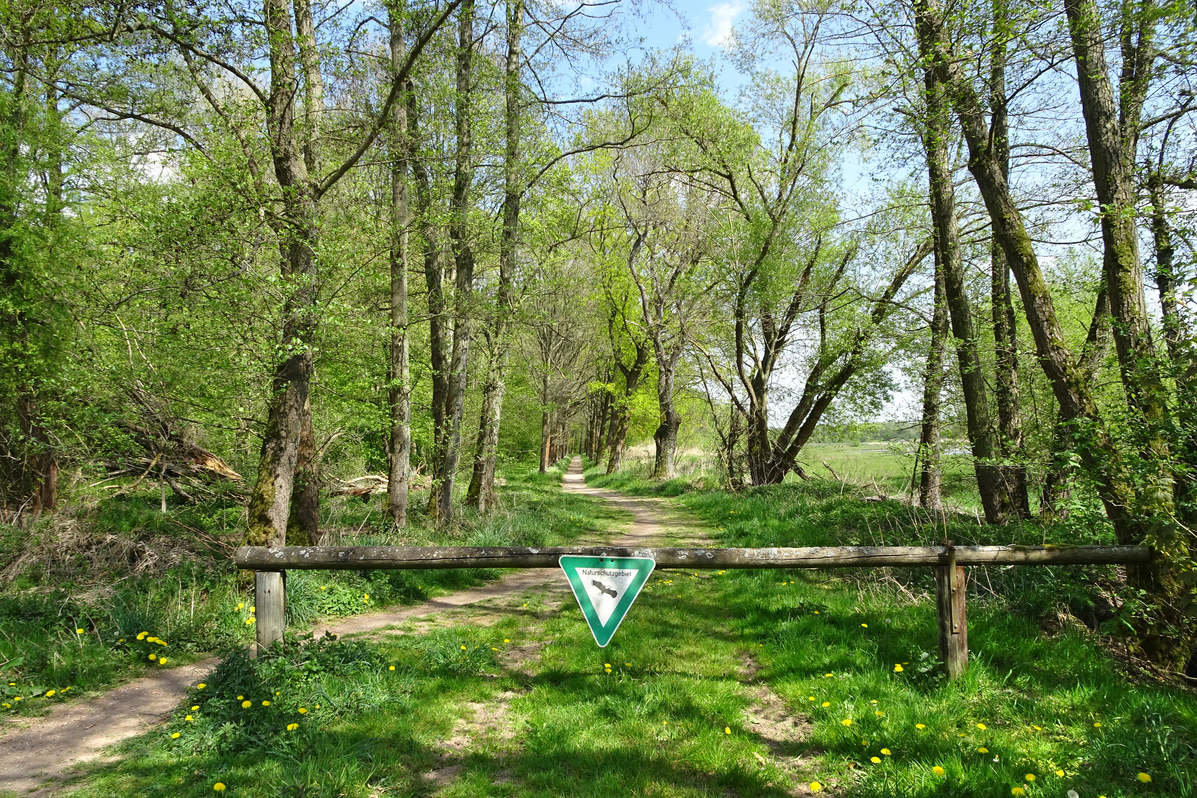
A dirt path leads into a lush, green forest, blocked by a wooden barrier featuring a triangular nature reserve sign.
A woodland trail marked by a protective nature reserve sign at the Rhäden bei Obersuhl und Bosserode nature reserve.

Rhäden bei Obersuhl und Bosserode history and protected-area timeline

The Rhäden's history begins with its geological origin: the gradual underground leaching of Zechstein salt layers during the Mesozoic era caused the overlying rock to collapse and form the Rhädensenke, a depression that in Pleistocene times held an extensive lake. Prehistoric artifacts from Bronze Age and pre-Roman Iron Age cremation burials and settlement remnants show that the fish-rich lake supported early human habitation; in the Middle Ages, the lake silted up, peat formed, and a sedge-rich boggy landscape emerged.

In 1859, administrators from Dankmarshausen, Obersuhl, and Bosserode decided to drain the bog, and the work was carried out the following year. The area was then used as arable land and as hay and green fodder fields, in part for nearby cavalry garrisons, and by around 1900 had declined into extensive grassland use. Agricultural significance fell further after World War II, and with the construction of the inner-German border installations, the drainage system deteriorated completely, ending farming activity; the final hay harvest was reportedly in 1968.

In 1970, the local bird protection group of Obersuhl petitioned for formal protection, and in 1973 the area was officially declared a nature reserve. Restoration to a near-natural floodplain began in the 1970s through more than a decade of phased works; following German reunification, the formerly separated Thuringian section, the Dankmarshäuser Rhäden, was added to create one of the earliest cross-border conservation projects in reunified Germany.

Rhäden bei Obersuhl und Bosserode landscape and geographic character

The Rhäden lies in a shallow subsidence bowl in the middle Werra valley, at an elevation of roughly 215 to 222 meters above sea level. It is part of the Berkaer Becken natural area within the Salunger Werrabergland of the eastern Hessian uplands. The basin is drained by the Suhl, a small meandering stream also locally known as the Rhedengraben, which is the main tributary of the Weihe and ultimately flows into the Werra at Untersuhl.

Geologically the area sits on the eastern Hessian red sandstone block. Layers of the Permian Zechstein deposited thick salt sequences beneath the surface, and tectonic movements during the Saxonian faulting phase opened fissures that allowed groundwater to dissolve the salts. The resulting collapse produced the Rhädensenke, which during the Pleistocene first held a lake and then, as it silted up, a sedge-rich marsh. Quaternary loam, gravel, and peat fill the basin floor, creating the substrate for the wetland habitats seen today.

Viewers approaching the reserve typically see a flat mosaic of open water edged by reedbeds, wet meadows, and tall poplar woodland that visually frames the area. In the background rises the bright white spoil tip of the Monte Kali, a distinctive landmark of the potash mining region around Heringen to the south.
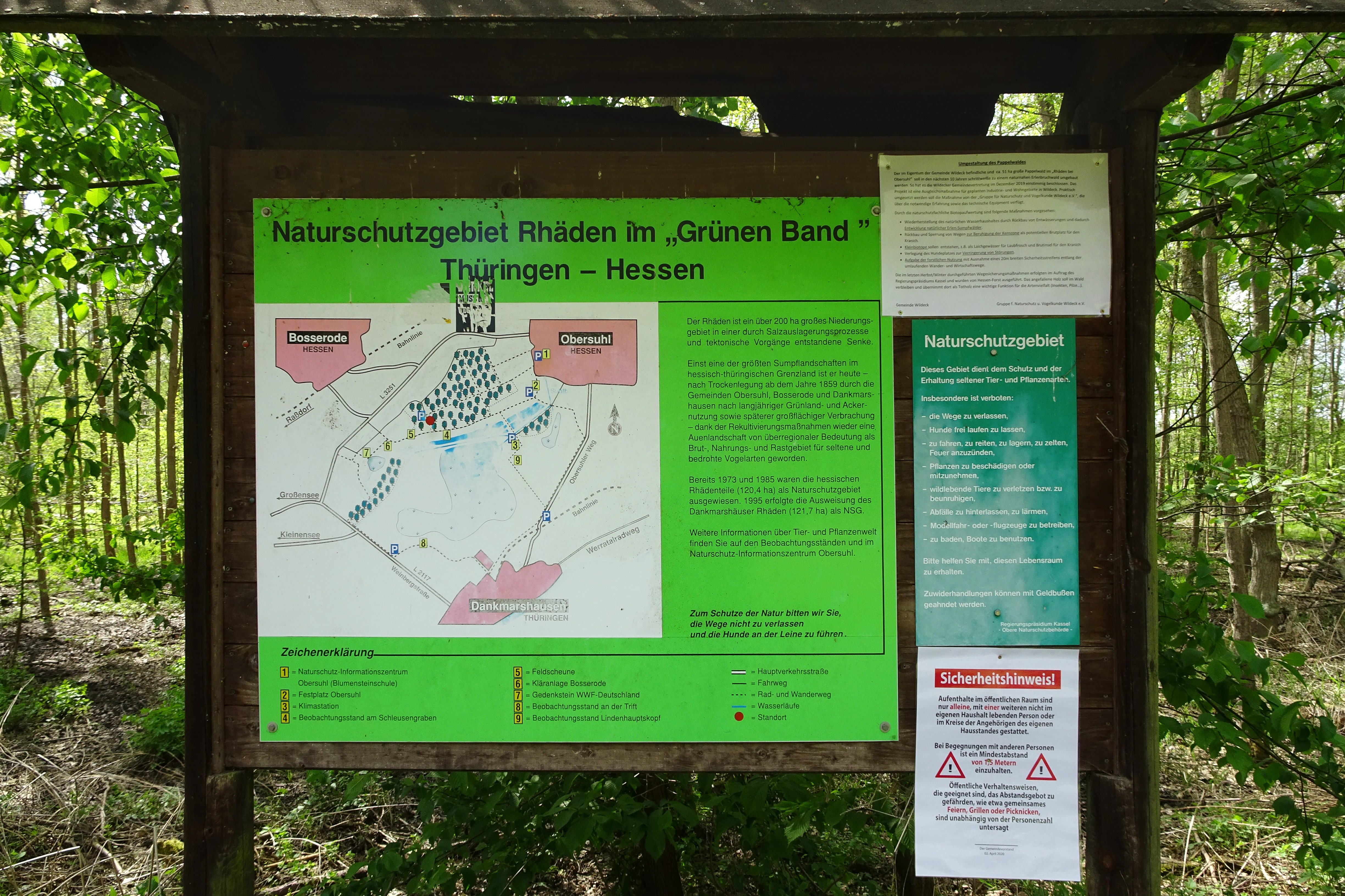
A green-framed informational signpost in a forest, displaying a map and text about the Naturschutzgebiet Rhäden within the Green Belt of Germany.
An informational sign providing a map and details about the Naturschutzgebiet Rhäden nature reserve.

Rhäden bei Obersuhl und Bosserode ecosystems, habitats, and plant life

The reserve is now a structurally rich wetland mosaic on roughly 120 hectares. Around 30 percent of the area is high forest, 5 percent is arable, 20 percent is grassland under use, and the remaining 45 percent consists of open water, reedbeds, sedge marshes, scrub, and fallow land. The Rhädenwald of hybrid poplars planted from the mid-1950s is gradually being transformed toward a native floodplain woodland, with drainage ditches being removed to create permanently wet micro-habitats.

Three principal shallow ponds, the Grosser Suhlsee, Paulsteich, and Froschweiher, are managed for ecological function rather than for plant species richness. Their water levels are deliberately lowered in late summer to expose muddy edges for migrating waders and raised in winter and spring to support waterfowl. Each pond has extensive shallow shoreline zones, floating-leaf plant communities, and emergent reed fringes dominated by reed sweet-grass and broadleaf cattail, with broadleaf pondweed, yellow water-lily, and spiked water-milfoil in parts of the water bodies.

Surrounding the ponds are valuable low-intensity meadows of the Glatthafer type with wild flowers such as yarrow, meadow bellflower, oxeye daisy, and rough hawkbit, and indicators of low productivity including bulbous saxifrage and field wood-rush. Drier transitional and ruderal vegetation persists along the former inner-German border strip, while abandoned extraction ponds along the edges now support extensive sedge stands and willow thickets.
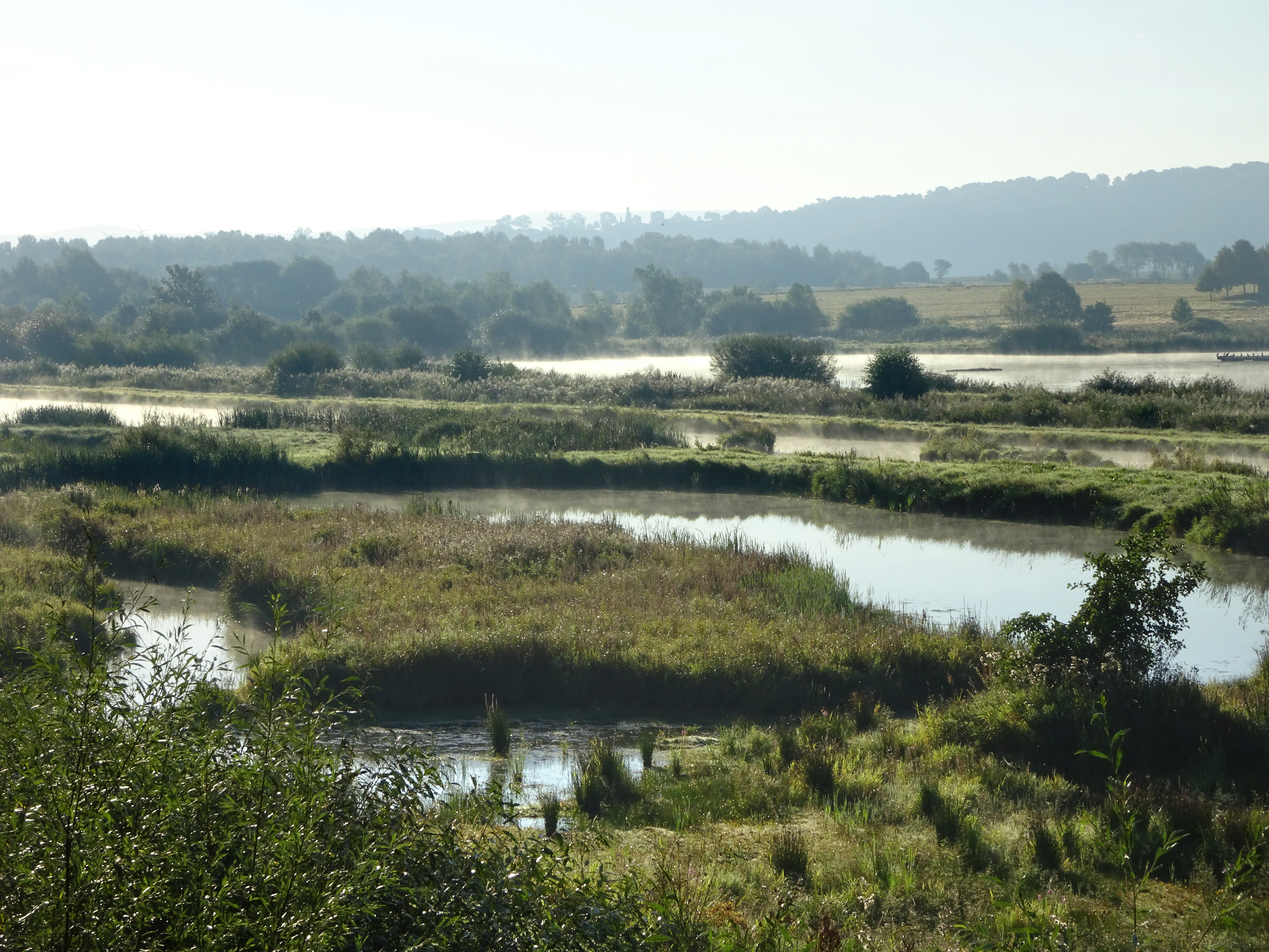
A wide view of a wetland landscape featuring small ponds and grassy islands under a misty, overcast sky with rolling hills in the background.
A misty morning view of the restored wetland at Rhäden bei Obersuhl und Bosserode.

Rhäden bei Obersuhl und Bosserode wildlife and species highlights

More than two hundred bird species have been recorded in the Rhäden since 1971, with around fifty of them listed under Annex I of the European Birds Directive. The site is a regionally important breeding area for rare ground breeders, an important landing and resting stop for cranes passing through in autumn, with flocks of two to several hundred cranes traditionally pausing here for several weeks, and a strong feeding and resting area for migratory and wintering waterfowl, including notable winter populations of greylag geese.

Migratory waders use the reserve as an essential refueling stop, especially species such as curlew sandpipers, golden plovers, ruff, snipes, and greenshanks that depend on rich muddy feeding grounds and predator-safe shallow water for roosting. The ponds and reedbeds also host a varied community of ducks, grebes, reed warblers, and herons, with kingfisher, hobby, and three species of woodpecker recorded among the more characteristic residents. Among amphibians, the reserve holds large populations of common toads, common frogs, and smooth newts, and one of the most important Hessian populations of water frogs with an estimated ten thousand individuals, together with the strictly protected northern crested newt, natterjack toad, and European tree frog.
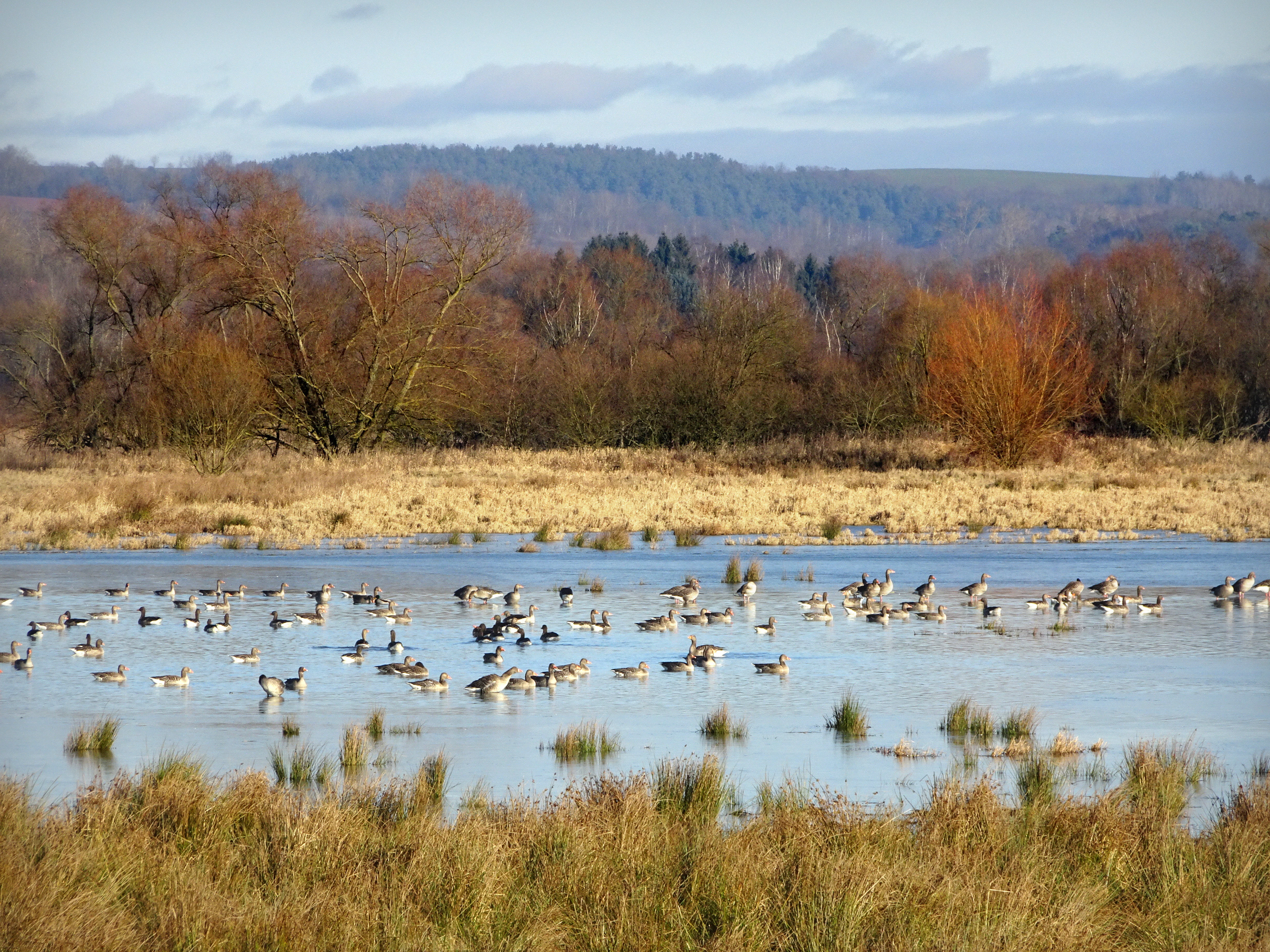
A wide shot of a wetland area with a large flock of geese swimming in shallow water against a backdrop of dormant trees and rolling hills.
A flock of geese resting in the wetlands of the Rhäden area.

Rhäden bei Obersuhl und Bosserode conservation status and protection priorities

The conservation significance of the Rhäden is reflected in its layered protection status: a national nature reserve since 1973, a European Fauna-Flora-Habitat site since 2008, and an integral component of the larger EU bird protection area Rhäden von Obersuhl and the floodplains of the middle Werra. The overarching aim is to safeguard the diverse wetland habitats and their exceptional value for threatened birds, amphibians, and other species.

The site's importance goes well beyond its boundaries. Within the Werra-Weser floodplain corridor, the Rhäden functions as a critical stepping stone for migratory birds travelling between their northern breeding grounds and southern wintering areas. Long-distance migrants in particular depend on quiet, food-rich resting sites to replenish their energy reserves, and the protected area is explicitly situated within the German contribution to international commitments such as the Bonn Convention on migratory species.

The reserve is also a flagship example of habitat restoration, demonstrating how drained and abandoned farmland can be transformed step by step into a functioning floodplain. Local conservationists played a key role in initiating and shepherding the project, and the successful reunification of the Hessian and Thuringian sections after 1990 turned the Rhäden into one of the first cross-border conservation projects of reunified Germany, contributing to the broader Grünes Band, or Green Belt, network of protected areas along the former frontier.

Rhäden bei Obersuhl und Bosserode cultural meaning and human context

The Rhäden sits within a landscape shaped by the former inner-German border, whose infrastructure once ran directly through the wetland. The collapse of drainage channels, and the abandonment of farming because the border zone became inaccessible, allowed nature to reclaim the fields. The reserve's modern story therefore carries an unusually strong memory of divided Germany, and its transboundary cooperation with the former East German community of Dankmarshausen is widely regarded as an early symbolic example of unified German nature protection.
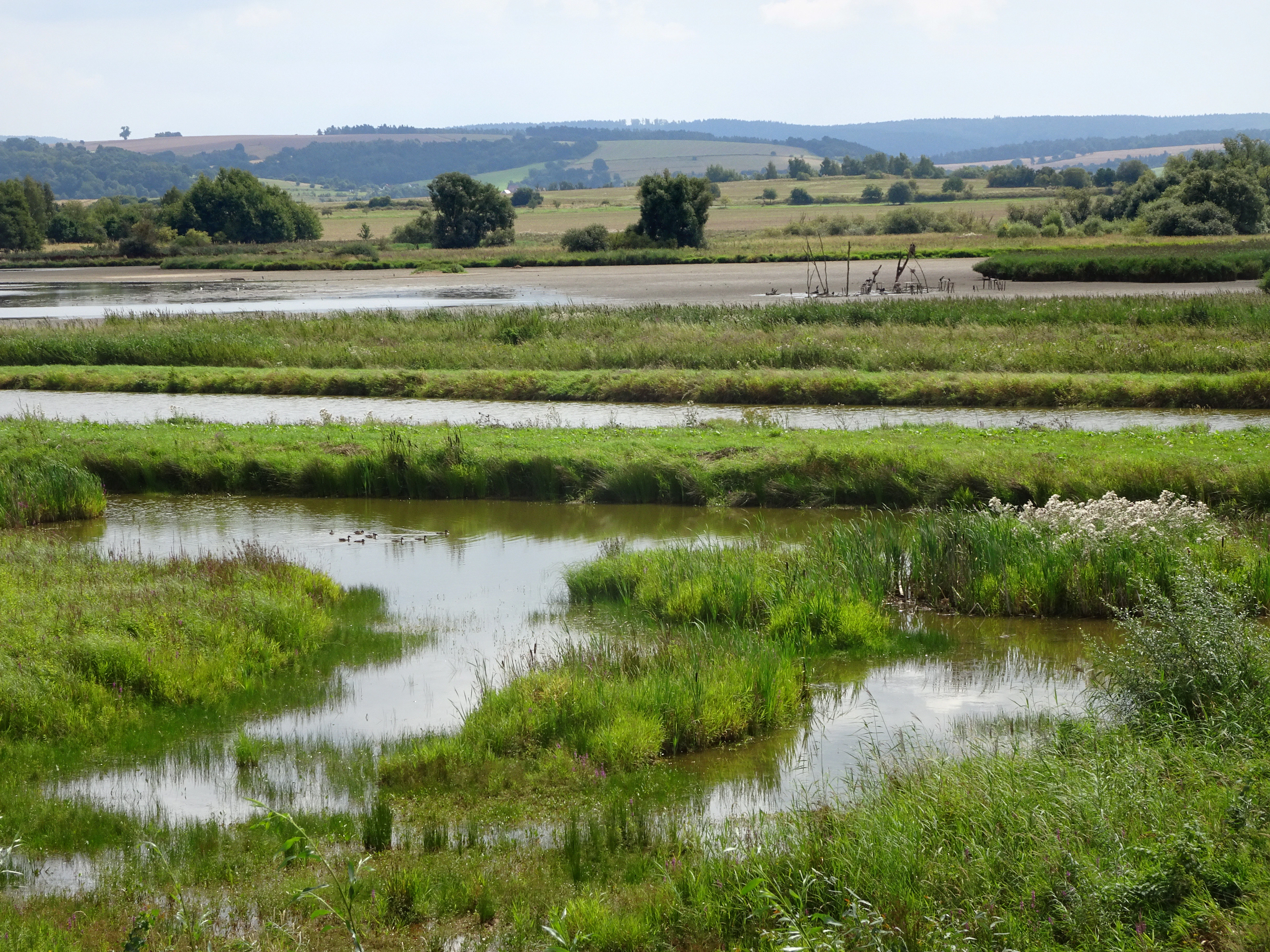
A wide view of a wetland with shallow pools, grassy banks, and scattered bushes under a bright sky.
A view of the wetland habitat at Rhäden bei Obersuhl und Bosserode.

Top sights and standout views in Rhäden bei Obersuhl und Bosserode

The Rhäden stands out as a wetland reborn: a former agricultural plain restored into a structured floodplain mosaic of ponds, reedbeds, wet meadows, and developing woodland. More than two hundred recorded bird species, including many Annex I species such as bitterns, egrets, storks, harriers, osprey, and aquatic warblers, mark it as one of the most important inland birdwatching sites in Hesse and Thuringia.

Its transboundary nature, with the Thuringian Dankmarshäuser Rhäden linking to the Hessian reserve, places it within the symbolic Green Belt along the former East-West frontier and makes it a flagship of cross-border conservation. Strictly protected species such as the northern crested newt, the bitterling fish, and the dusky large blue butterfly confirm its strong biodiversity value beyond birds, while a network of observation hides, an eight-kilometer circular trail, and a local nature information center at Obersuhl make this richness accessible to visitors.
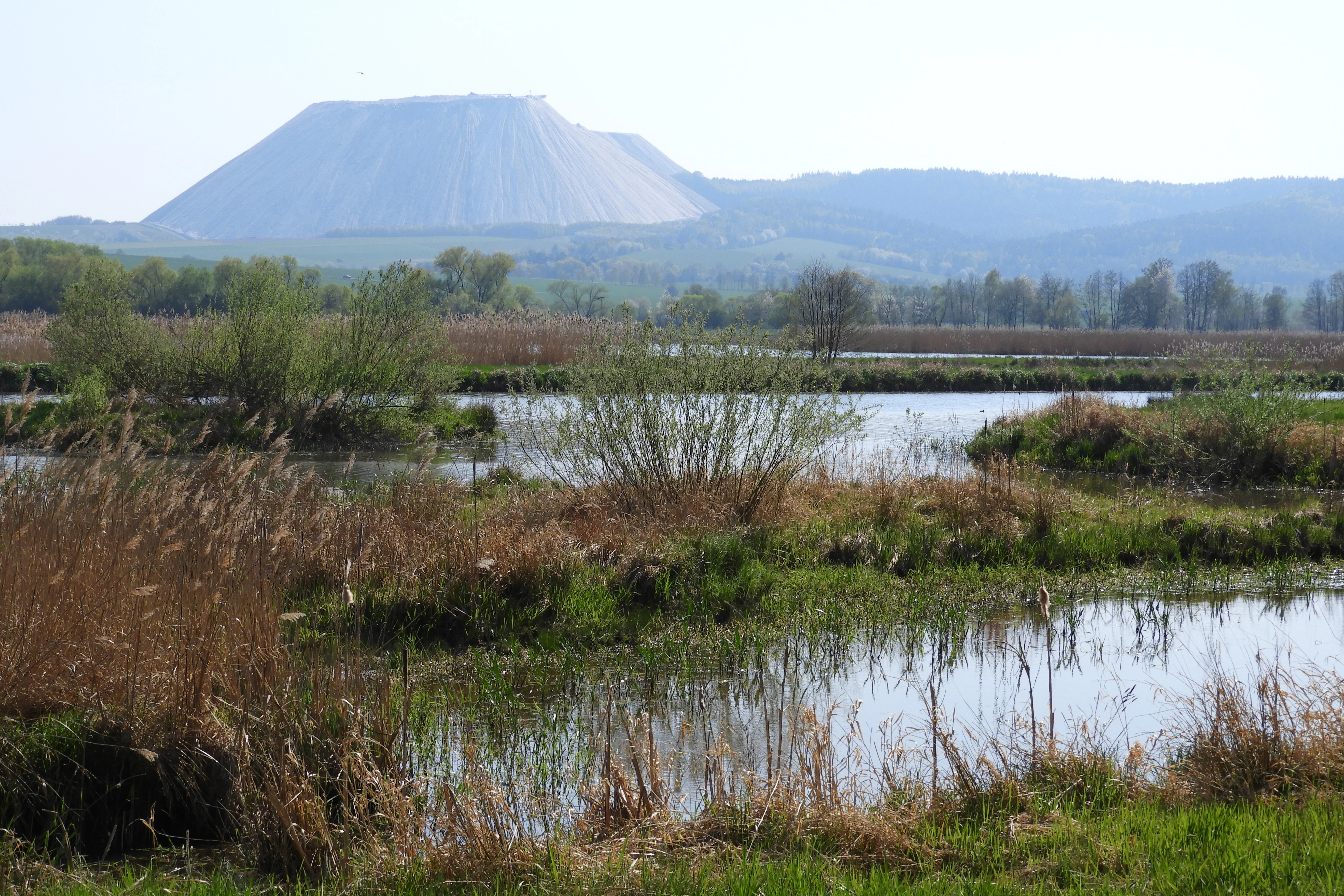
A wide view of a marshy wetland area with low-lying water, reeds, and grasses in the foreground, with a large, flat-topped conical spoil heap rising in the background.
The wetland landscape of Rhäden bei Obersuhl und Bosserode with a prominent industrial spoil tip in the distance.

Best time to visit Rhäden bei Obersuhl und Bosserode

The Rhäden rewards visits throughout the year, but the character of the experience shifts strongly with the seasons. Spring brings the chorus of breeding birds in the reedbeds and wet meadows, while the ponds attract arriving waterfowl and the first passage of waders along the Werra corridor.

Summer offers dense vegetation, active amphibian populations around the ponds, and high insect activity in the meadows, which is also the main flight period for butterflies such as the dusky large blue. Autumn is perhaps the most distinctive season: water levels in the Suhlsee and related ponds are deliberately lowered to expose muddy edges for migratory waders, and flocks of cranes regularly pause here for several weeks on their way to winter quarters, while greylag geese gather in large winter flocks.

In winter, raised water levels again attract ducks and other waterfowl, and a thin dusting of frost against the backdrop of the Monte Kali spoil tip can give the wetland a particularly atmospheric quality. Cooler air sinks into the basin, producing local fog and frost pockets that give the microclimate a slightly more continental feel than the surrounding hills.

Monthly climate preview

Long-term representative point measurements for annual weather patterns in Hesse

Rhäden bei Obersuhl und Bosserode Climate Normals and Temperature Rhythms

Representative coordinates record measured monthly temperature swings from sub-zero winter minimums to warm summer maximums alongside steady daily precipitation averages. Examining the complete twelve-month climatology dataset reveals broader regional patterns and detailed thermal variations across the protected terrain.
Annual mean8 °C
-1 °C18 °C
Jan-1°
Feb
Mar
Apr
May12°
Jun16°
Jul18°
Aug18°
Sep14°
Oct
Nov
Dec
Warmest month
July

18.3 °C

Coolest month
January

-1.1 °C

Wettest month
July

2.6 mm/day

Driest month
April

1.4 mm/day

Park location guide

Geography guide, regional context, and park location map for Rhäden bei Obersuhl und Bosserode

Rhäden bei Obersuhl und Bosserode park geography, regions, and map view in Germany

Understand where Rhäden bei Obersuhl und Bosserode sits in Germany through a broader geographic reading of the surrounding landscape, nearby location context, and its mapped position within the national park landscape.

How Rhäden bei Obersuhl und Bosserode fits into Germany

Germany is a federal republic in Western and Central Europe with a population of over 83 million across sixteen constituent states. It is Europe's largest economy by nominal GDP and a major global exporter and importer. The capital is Berlin, and the country borders Denmark, Poland, Czech Republic, Austria, Switzerland, France, Luxembourg, Belgium, and the Netherlands.

Wider geography shaping Rhäden bei Obersuhl und Bosserode in Germany

Germany is located in Western and Central Europe, spanning 357,022 km². It borders Denmark to the north, Poland and the Czech Republic to the east, Austria and Switzerland to the south, and France, Luxembourg, Belgium, and the Netherlands to the west. The country has coastlines on the Baltic Sea and North Sea to the north, with the Alps located in the southern region.

Map view of Rhäden bei Obersuhl und Bosserode

Use this park location map to pinpoint Rhäden bei Obersuhl und Bosserode in Germany, understand its exact geographic position, and read its mapped placement within the surrounding landscape more clearly.

Pigeon | © OpenStreetMap contributors

Location context for Rhäden bei Obersuhl und Bosserode

Hesse
Recorded earthquake history

View the Documented Seismic History of Rhäden bei Obersuhl und Bosserode

Explore a catalog of recorded earthquakes located near Rhäden bei Obersuhl und Bosserode. This MoriAtlas collection tracks regional seismic events, providing essential historical context for the geography surrounding this protected nature reserve in the Werra valley.

Rhäden bei Obersuhl und Bosserode Earthquake History

Catalogued events

3 events

Strongest magnitude

Magnitude 5.3

Most recent event

Sep 22, 2005

This history includes earthquakes recorded inside the park or within 50 km of its borders

Visualizing the habitats, shallow ponds, and scenery of the Werra valley floodplain reserve.

Rhäden bei Obersuhl und Bosserode Photos and Protected Wetland Landscapes

Photographic records document the structured mosaic of open water, reedbeds, and wet meadows across the protected basin. Visual exploration reveals the terrain, vegetation patterns, and conservation character of the lowland wetland environment.

A dirt path leads into a lush, green forest, blocked by a wooden barrier featuring a triangular nature reserve sign.

A dirt path flanked by tall, mature trees and lush green undergrowth in a woodland setting.

A green-framed informational signpost in a forest, displaying a map and text about the Naturschutzgebiet Rhäden within the Green Belt of Germany.

A wide view of a wetland landscape featuring small ponds and grassy islands under a misty, overcast sky with rolling hills in the background.

A wide shot of a wetland area with a large flock of geese swimming in shallow water against a backdrop of dormant trees and rolling hills.

A wide view of a marshy wetland area with purple wildflowers in the foreground and a line of green trees; a large white industrial mound rises in the background.

A wide view of a wetland with shallow pools, grassy banks, and scattered bushes under a bright sky.

A wide view of a marshy wetland area with low-lying water, reeds, and grasses in the foreground, with a large, flat-topped conical spoil heap rising in the background.

Park atlas

Compare adjacent wetland reserves, river valley habitats, and regional conservation areas.

Other Parks Near Rhäden bei Obersuhl und Bosserode and Surrounding Protected Landscapes

Visitors exploring Rhäden bei Obersuhl und Bosserode can discover nearby protected wetlands and river valley habitats across the surrounding region. Comparing adjacent nature reserves provides deeper insight into regional floodplain ecosystems and cross border conservation networks.
A soft watercolor illustration of a calm pond surrounded by green vegetation and rolling hills in the background.
Nature reserveWartburgkreis
Park boundaries overlap#1 closest

Southwest

Dankmarshäuser Rhäden: Protected Wetland Reserve and Mapped Floodplain in Wartburgkreis

Restored basin landscape along the historic Green Belt corridor.

Dankmarshäuser Rhäden comprises a complex wetland mosaic in the Wartburgkreis district. This nature reserve, characterized by shallow subsidence basins and active floodplain management, represents a critical migratory bird sanctuary and a key component of the protected Green Belt. The area reveals a history of land-use transition, from agricultural depression to a functional, water-managed ecosystem supporting diverse meadow-nesting and migratory bird populations.

Area
1.217 km²
Established
1995
IUCN
IV
Nature reserveThuringia
Park boundaries overlap#2 closest

Northeast

Werra-Aue zwischen Breitungen und Creuzburg: Protected Floodplain and River Geography

Nature reserve sanctuary in western Thuringia

Spanning over 33 kilometers of the Werra river, this protected floodplain is defined by its distinctive geological sinkholes, seasonal wetlands, and diverse bird habitats. Discover the layered conservation status and riparian terrain that mark this significant Thuringian nature reserve as a crucial node for European ecological connectivity.

Area
25.78 km²
Established
2007
IUCN
IV
Relief
Lowland
Nature reserveThuringia
0.9 km away#3 closest

Northeast

Werra bis Treffurt mit Zuflüssen: Protected River and Floodplain Network in Thuringia

Mapping an extensive 191 kilometer Natura 2000 river corridor.

The Werra bis Treffurt mit Zuflüssen protected area serves as a vital ecological corridor in Thuringia. This site encompasses a complex mosaic of fast-flowing highland brooks, expansive floodplain meadows, inland salt sites, and rare dissolution lakes. Its geography bridges high-altitude source regions with lower river valleys, creating a distinctive landscape transect that supports essential freshwater habitats and rare aquatic species across the state.

Area
22.6 km²
Established
2008
IUCN
IV
Relief
Mixed relief
A soft watercolor illustration of a wetland landscape featuring trees, green grasses, a small pond, and distant rolling hills against a pale pink sky.
Nature reserveHesse
1.9 km away#4 closest

East

Obersuhler Aue Protected Meadow Complex and Werra Valley Geographic Mapping

Expansive floodplain ecosystems and conservation corridors in Hesse

Obersuhler Aue comprises a vital lowland meadow system that spans the Werra valley floor. The area is characterized by its open, unfragmented grassland terrain, which serves as a landmark site for biodiversity within the Hessian Green Belt. From historic linden avenues to seasonally flooded reedbeds, the landscape provides essential habitat continuity across the regional basin.

Area
0.679 km²
Established
1990
IUCN
IV
A horizontal watercolor painting showing a soft landscape with green meadows, trees, a winding stream, and distant rolling hills in a light, atmospheric style.
Nature reserveHessen
About 2.2 km away#5 closest

West

Säulingssee Nature Reserve: Atlas Overview of this Hessen Protected Wetland Basin

Mapped geography and landscape context of a unique German reserve

Säulingssee serves as an important nature reserve within the Werra valley region of Hessen. This former lake basin now acts as a sophisticated wetland complex featuring subrosion-driven pools, reedbeds, and varied meadow habitats. As part of the Natura 2000 network and the Grünes Band Hessen corridor, the area offers a significant case study for conservation grazing and the restoration of endangered aquatic plants within Germany.

Area
0.214 km²
Established
1984
IUCN
IV
Relief
Lowland
Nature reserveWartburgkreis
About 2.6 km away#6 closest

East

Werraaue bei Berka und Untersuhl: Protected Floodplain and Wetland Geography in Wartburgkreis

Mapped riverine habitat and regional conservation area

Located in the heart of the Berka basin, this nature reserve protects a diverse floodplain environment featuring rare inland saline habitats and intricate oxbow lake systems. Serving as a vital ecological stepping stone along the former inner-German border, it represents one of the most important meadow bird corridors within the Wartburgkreis district.

Area
2.558 km²
Established
1996
IUCN
IV
Relief
Lowland
A soft watercolor illustration of a wetland scene with light blue water in the foreground, green trees in the midground, and soft pink hills in the background.
Nature reserveHessen
2.9 km away#7 closest

South

Rohrlache von Heringen Protected Area and Werra Valley Wetland Geography

Nature reserve featuring rare saline meadows and alluvial terrain

Rohrlache von Heringen stands as the largest inland saline site in Hesse. This protected area preserves a rare ecosystem of salt-tolerant flora and vital breeding grounds for waterbirds, shaped by both natural Zechstein geology and long-term industrial influences along the Werra river floodplain.

Area
0.765 km²
Established
1979
IUCN
IV
Relief
Lowland
A horizontal watercolor illustration of a gentle, rolling landscape with green trees, meadow grass, and distant hills under a light blue sky.
Nature reserveWartburgkreis
About 6.7 km away#8 closest

Northeast

Alte Werra Nature Reserve: Floodplain Geography and Protected Meadow Landscapes in Wartburgkreis

Essential river valley habitats and Natura 2000 protected areas.

Alte Werra serves as a critical protected landscape in the Wartburgkreis district of Germany. Centered on the Middle Werra valley, this 258 hectare nature reserve protects unique floodplain terrain including oxbow remnants, the Böllerteiche ponds, and diverse wet grassland habitats. The site remains a key reference point for studying riverine geomorphology and protected bird corridors in the Thuringia region.

Area
2.578 km²
Established
1996
IUCN
IV
Relief
Lowland

Common questions about visiting, size, designation, and location context for Rhäden bei Obersuhl und Bosserode

Rhäden bei Obersuhl und Bosserode FAQs for park facts, access, geography, and protected area context

Find quick answers about Rhäden bei Obersuhl und Bosserode, including protected-area facts, park geography, trail and visitor context, and how the park fits into its surrounding country and regional landscape.
MoriAtlas Explorer

Continue Your Protected Areas Search Across the Global Atlas

Deepen your exploration by continuing the structured search for national parks and protected areas worldwide. Utilize the comprehensive filtering capabilities to compare different conservation landscapes and refine your understanding of global park geography. Discover more about the distribution and characteristics of protected natural areas.

Global natural geography