
Why Roaring Plains West Wilderness stands out
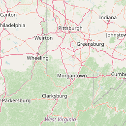
Roaring Plains West Wilderness is best known for being one of the highest and largest flat-topped plateaus in eastern North America, a windswept expanse of rocky plains and high-elevation sphagnum bogs perched along the Allegheny Front. Its combination of red spruce forest, dense mountain laurel thickets, and the state's highest bogs creates a striking landscape that feels far more boreal than Appalachian. The wilderness is also recognized for the dramatic seasonal character of that high country, where deep winter snows and frequent blizzard conditions above four thousand feet give the plateau an unusually harsh, exposed atmosphere. Mount Porte Crayon, the sixth-highest peak in West Virginia, anchors the wilderness and contributes to its reputation as a remote, weather-driven highland preserve linked by trails to Dolly Sods Wilderness and Canaan Valley.
Roaring Plains West Wilderness history and protected-area timeline
Roaring Plains West Wilderness was formally established on 30 March 2009 through the Wild Monongahela Act, federal legislation that set aside this portion of the Monongahela National Forest as wilderness. Conservation advocates had pushed for protection of a much larger area of about 15,138 acres collectively known as the Roaring Plains, but the final designation protected only the western section, leaving the northern and eastern portions of the proposed complex outside the wilderness boundary.
The naming of the protected area reflects that broader advocacy history. Within the conservation community, "Roaring Plains West" referred specifically to this western segment of a larger envisioned preserve, distinguishing it from the informal "Roaring Plains North" and "Roaring Plains East" designations that did not receive statutory protection. The 2009 act thus represents a partial fulfillment of those earlier preservation ambitions, securing a core high-elevation area while leaving the larger landscape question unresolved.
Roaring Plains West Wilderness landscape and geographic character
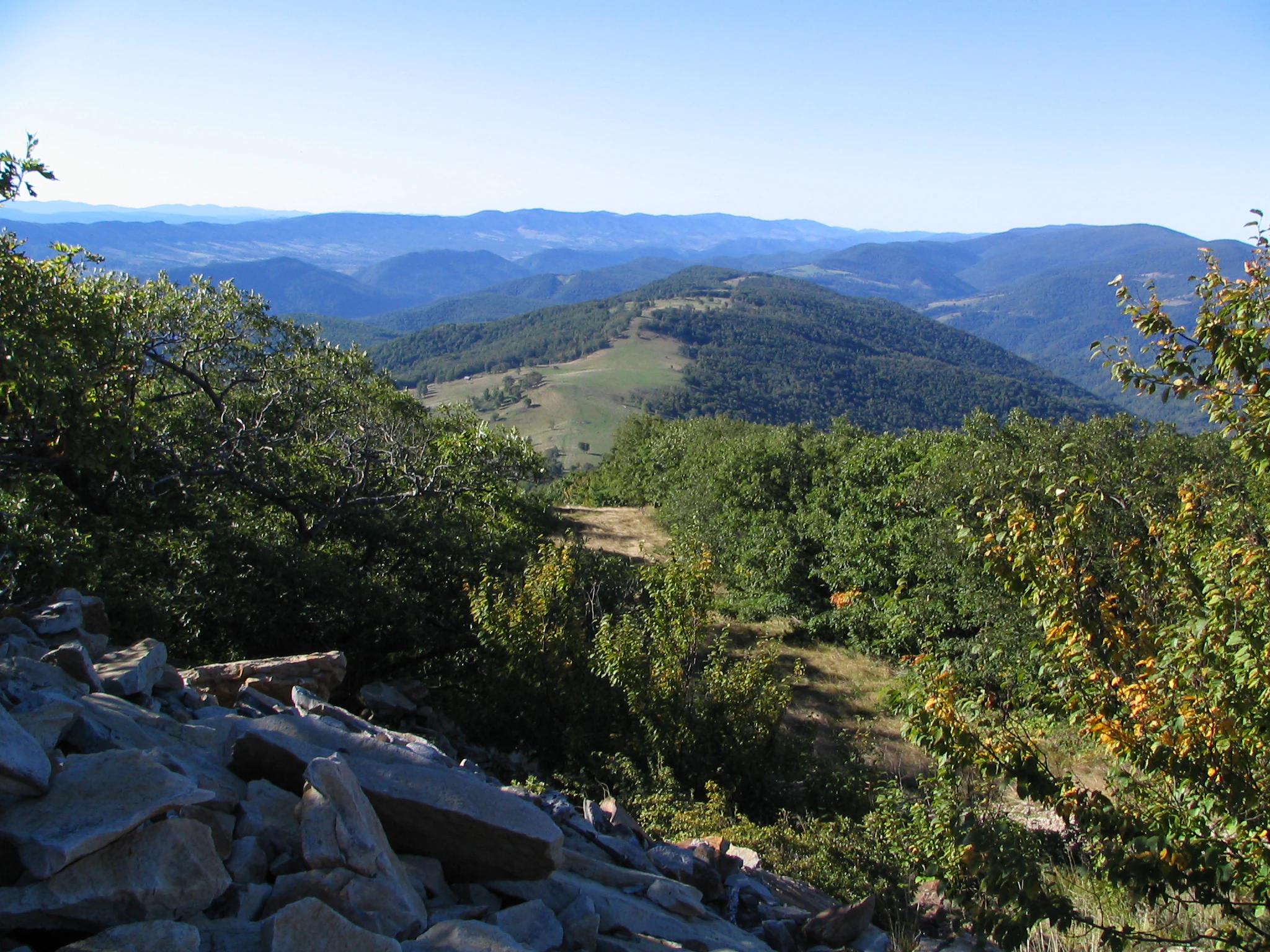
Roaring Plains West Wilderness is defined by a sweeping high-elevation plateau that ranks among the largest and highest flat-topped uplands in eastern North America. The terrain consists of broad, rocky plains studded with stunted trees and bordered by exposed sandstone outcrops and cliffs. From these rim rocks, the wilderness opens onto dramatic vistas of the surrounding Allegheny ridges and valleys, a contrast that gives the plateau a striking, open character quite unlike the dense forests of the lower slopes.
Elevations across the wilderness range from about 2,360 feet along lower approaches to 4,770 feet atop Mount Porte Crayon, the highest point in the protected area and the sixth-highest summit in West Virginia. Roughly 5.5 square miles of the wilderness sit at or above the 4,500-foot contour, an unusual concentration of high flat ground for the eastern United States. The Allegheny Front, the local expression of the Eastern Continental Divide, cuts through the area, reinforcing the sense of a high, exposed landscape perched between two great watersheds.
Roaring Plains West Wilderness ecosystems, habitats, and plant life
The ecological character of Roaring Plains West Wilderness is shaped by elevation, exposure, and persistent moisture, producing communities more typical of northern latitudes than of typical mid-Appalachian forests. Red spruce is the dominant canopy species across much of the wilderness, interspersed with mixed hardwood stands and extensive openings of low brush and rocky ground. Dense, often nearly impenetrable thickets of mountain laurel and rhododendron ring many of the plateau's edges and swales, with mountain laurel producing a notable pink and white bloom in late June.
Embedded within this upland forest matrix are seven known high-elevation sphagnum bogs, which hold particular ecological significance because they are the highest bogs documented in West Virginia. These wetlands act as natural reservoirs at the headwaters of streams flowing off both sides of the Allegheny Front, helping to regulate flow into the Potomac and Cheat River systems. The combination of acidic peatlands, boreal-like spruce forest, and rocky plateau openings gives Roaring Plains West a distinctive ecological profile that is rare anywhere in the central Appalachians.
Roaring Plains West Wilderness wildlife and species highlights
The high-elevation habitats of Roaring Plains West Wilderness support a wildlife community that mixes northern-affinity species with more typical Appalachian fauna. The sphagnum bogs and damp spruce forests provide refuge for animals such as the snowshoe hare, southern bog lemming, bobcat, and fisher, all species strongly associated with cool, moist, forested environments. White-tailed deer, wild turkey, and American black bear are also abundant and represent more familiar Appalachian residents that thrive across the plateau.
The wilderness carries particular conservation importance for the Cheat Mountain salamander, a federally threatened species that depends on the moist red spruce and mixed hardwood habitats of the West Virginia highlands. Protecting a substantial block of those habitats within Roaring Plains West contributes to the broader effort to maintain viable populations of this rare amphibian across its limited range.
Roaring Plains West Wilderness conservation status and protection priorities
Roaring Plains West Wilderness is a conservation area of regional significance because it locks in legal wilderness protection for one of the largest and highest high-elevation plateaus in eastern North America. Its establishment in 2009 under the Wild Monongahela Act added a critical unit to the Monongahela National Forest's protected estate and reinforced a growing high-country conservation corridor that links Roaring Plains with Dolly Sods Wilderness and, further north, Canaan Valley.
The wilderness matters ecologically because it secures fragile, geographically restricted habitats that cannot be easily replaced if lost. The seven high-elevation sphagnum bogs are some of the highest in West Virginia and play an important hydrological role as headwaters for both sides of the Allegheny Front. At the same time, the red spruce and mixed hardwood uplands shelter the federally threatened Cheat Mountain salamander, giving the wilderness direct significance for species-level conservation in addition to its broader landscape protection role.
Top sights and standout views in Roaring Plains West Wilderness
Roaring Plains West Wilderness stands out for the unusual combination of high plateau terrain, exposed rim-rock scenery, and ecologically rare boreal-like habitats within the central Appalachians. Its summit of Mount Porte Crayon at 4,770 feet makes it the home of the sixth-highest point in West Virginia, while roughly 5.5 square miles of wilderness above 4,500 feet make it one of the largest flat-topped uplands in eastern North America.
The wilderness also distinguishes itself through its deep winter snowpack, commonly around 180 inches per year, which transforms the plateau into a major season-defining landscape. Combined with its network of trails connecting to Dolly Sods Wilderness and Canaan Valley, Roaring Plains West anchors a high-country recreation and conservation corridor that is rare in the eastern United States.
Best time to visit Roaring Plains West Wilderness
Roaring Plains West Wilderness is a strongly seasonal landscape whose character shifts dramatically between summer and winter. Late spring through early fall generally offers the most accessible conditions for exploring the plateau's rocky plains, sphagnum bogs, and cliff-edge viewpoints, with late June standing out as a particularly vivid period when mountain laurel thickets bloom in pink and white across the wilderness.
Winter brings a very different experience, with snow typically present from early October into early May and an average annual snowfall around 180 inches. Above four thousand feet, the plateau sees frequent blizzard conditions from November into April, which can make travel difficult but also create one of the more pronounced cross-country skiing and snowshoeing environments in the Appalachians. Visitors in colder months should be prepared for severe weather, while those coming in milder months will find the high-elevation bogs and red spruce forests most approachable.