

Mori Atlas logo
Marine protected areaRock Islands

A comprehensive geographic overview of the reef-derived landforms and marine habitats near Koror.

Rock Islands Marine Protected Area: Mapping the Limestone Archipelago and Lagoon Geography

(Rock Islands Southern Lagoon)

The Rock Islands represent a complex collection of hundreds of limestone and coral uprises within the Southern Lagoon of Palau. These protected landscapes are renowned for their distinct mushroom-shaped profiles created by centuries of marine erosion and intertidal weathering. This atlas entry details the geographic mosaic of the archipelago, the extent of the marine protected area, and the surrounding reef systems that define this unique Micronesian terrain.

limestone islandsUNESCO World Heritage Sitemarine lakesreef archipelagodiving destinationMicronesian islands

Rock Islands

Marine protected area

Park overview

Structured park overview, official facts, and landscape profile for Rock Islands

Rock Islands park facts, protected area profile, and essential visitor context

Review the core facts for Rock Islands, including designation, size, terrain, visitor scale, habitats, and operating context in one park-focused overview.

About Rock Islands

The Rock Islands form the heart of Palau's coastal and marine scenery, a constellation of small reef-derived limestone islands spread across the Southern Lagoon between Koror and Peleliu. Rather than dramatic high-rises, they are a low-lying archipelago shaped by subtle, persistent forces, including wave action, biological erosion, and tropical weathering, that have produced their characteristic umbrella-like silhouettes. Many islands share a mushroom-shaped form, wider at the top and narrower at a notched intertidal zone, where sponges, bivalves, chitons, snails, sea urchins, and algae collectively wear away the limestone base.

The archipelago's natural significance is matched by its cultural weight. Palau's traditional communities have long interacted with the lagoon, and the Rock Islands contain sacred and historical locations that reflect centuries of maritime life. In recognition of these intertwined natural and cultural values, the Rock Islands Southern Lagoon was inscribed as a UNESCO World Heritage Site in 2012, evaluated under both cultural and natural criteria. The protected designation covers well over 100,000 hectares and includes a substantial buffer zone, providing one of the strongest formal protections of any marine-insular landscape in the region.

Today, the Rock Islands function as Palau's premier natural attraction and as a working marine ecosystem shaped by ongoing research, conservation management, and tourism. The waters around the islands hold dive sites such as the Blue Corner, Blue Holes, German Channel, and Ngermeaus Island, while inland features include the iconic marine lakes of Eil Malk and other islands. The complex interplay between reef, lagoon, island forest, and sky makes the Rock Islands a defining symbol of Palauan geography and ecology.

Quick facts and research context for Rock Islands

The Rock Islands are a chain of small coral and limestone islands in Palau's Southern Lagoon, administered as part of Koror State. The archipelago comprises 250 to 300 islands covering roughly 42 square kilometers, with a maximum elevation around 207 meters. Despite their small size, the islands support a remarkable concentration of Palau's endemic birds, marine biodiversity, and culturally significant sites. The Rock Islands Southern Lagoon was added to the UNESCO World Heritage List in 2012 under both cultural and natural criteria.

Protection and recognition

Explore documented designation history and official international recognition records.

Rock Islands Protection Status and International Recognition Details

Rock Islands features mixed protection status established in the year 2012, alongside official UNESCO World Heritage recognition. Structured records outline the formal designation history and international status associated with the protected landscape.

International recognition

Protection details

Protection scope
Mixed
Designated year
2012
Transboundary protection
No
Core area
1,002 km²
Buffer area
1,640 km²
Park context

Deeper park guide and search-rich context for Rock Islands

Rock Islands history, landscape, wildlife, and travel context

Explore Rock Islands through its history, landscape character, ecosystems, wildlife, conservation priorities, cultural context, and seasonal travel timing in a structured park guide built for atlas discovery and search intent.

Why Rock Islands stands out

The Rock Islands are best known for their strikingly shaped limestone islands rising from a turquoise lagoon, with many displaying the signature mushroom-profile form created by centuries of marine erosion at the waterline. Beyond their scenery, they are renowned for having among the most diverse dive sites on the planet, encompassing wall dives, high-current drift dives, manta ray encounters, shark watching, and shallow decorated caves. The archipelago is also celebrated for its unusual marine lakes, most famously Jellyfish Lake, where millions of stingless golden jellyfish drift across sunlit surface waters in a phenomenon found only in Palau. Together, the islands' geology, reef systems, and endemic wildlife make the Rock Islands one of the most distinctive island groups in the western Pacific.
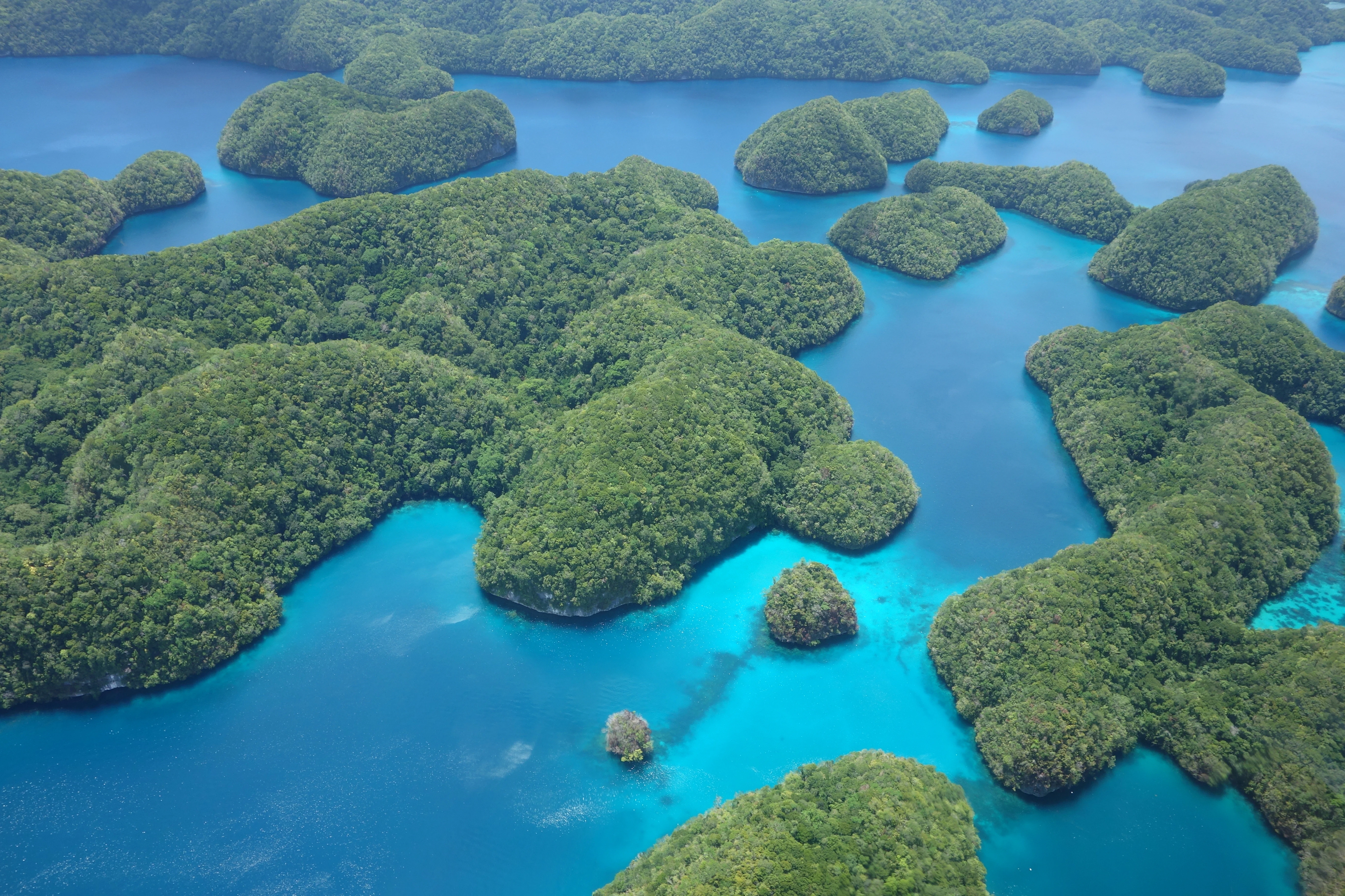
Aerial view of Rock Islands
An aerial view of the Rock Islands in Palau, captured in 2016.

Rock Islands history and protected-area timeline

The Rock Islands have long been part of Palauan cultural and maritime life, with communities in the Southern Lagoon drawing on the islands and reefs for traditional navigation, fishing, and spiritual practice. The archipelago was not originally designated as a single national park in the conventional sense; instead, the islands were gradually integrated into the broader management of Koror State as Palau developed its modern environmental framework.

In 2012, after years of advocacy and conservation work highlighting both the natural uniqueness of the islands and their cultural importance, the Rock Islands Southern Lagoon was inscribed as a UNESCO World Heritage Site. The recognition was awarded under a combination of cultural criteria recognizing the islands' role in Palauan heritage and natural criteria recognizing their ecological and geological value. This dual inscription gave the Rock Islands an international profile and reinforced their protection as one of Micronesia's most significant natural and cultural landscapes. Today, the area continues to be managed as a protected site, with ranger headquarters located at Ngeruktabel and ongoing marine conservation programs protecting reef systems, native bird populations, and iconic features such as Jellyfish Lake.

Rock Islands landscape and geographic character

The landscape of the Rock Islands is composed of low, rounded limestone and coral uprises that rise abruptly from shallow lagoon waters. Although their total aggregate area is modest, the visual scale of the archipelago is enormous when viewed from above, with hundreds of densely packed islands creating a continuous mosaic of green crowns, white limestone slopes, and bright blue channels. The highest point in the group reaches about 207 meters, while many islands sit at only a few meters above sea level.

The most defining landscape feature is the islands' shape. A large proportion of the Rock Islands display a distinctive mushroom or umbrella profile, with a wider vegetated cap and a noticeably narrower notched base at the waterline. This form is the cumulative product of biological and physical erosion: sponges, mollusks, chitons, snails, sea urchins, and grazing algae all contribute to undercutting the limestone in the intertidal zone, while wind, rain, and tropical vegetation continue to weather the upper surfaces. Over time, these slow processes have produced some of the most photogenic island silhouettes in the Pacific.

Beyond the islands themselves, the surrounding lagoon environment is an inseparable part of the Rock Islands' landscape identity. Shallow sandy flats give way to fringing reefs, drop-offs, channels, and the famous 'Blue Holes', all of which combine with the islands to produce a richly varied seascape that changes dramatically with the tide and light.
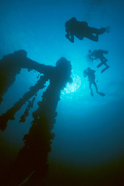
Divers near the Iro shipwreck
Divers swimming near the mast of the Japanese tanker Iro in Palau

Rock Islands ecosystems, habitats, and plant life

Ecologically, the Rock Islands sit at the intersection of tropical island forest and tropical marine ecosystems. The vegetated caps of the islands support small stands of island forest adapted to thin, limestone-derived soils, while their shorelines and the surrounding lagoon host reef communities that connect the islands into a single functioning marine system. The narrow intertidal notches around the islands are not simply geological curiosities, but active biological zones colonized by sponges, bivalves, chitons, snails, sea urchins, and various algae, all of which graze the limestone and contribute to the constant reshaping of the islands.

The islands also harbor a series of unique marine lakes, the most famous being Jellyfish Lake, where isolated populations of stingless jellyfish thrive in stratified, predator-free waters. Across the archipelago, similar marine lakes offer rare examples of enclosed marine ecosystems that have evolved in isolation from the open lagoon, making the Rock Islands internationally important for evolutionary biology and marine science. The combination of reef, lagoon, marine lake, and island forest gives the Rock Islands an unusually layered ecological character for such a small archipelago.
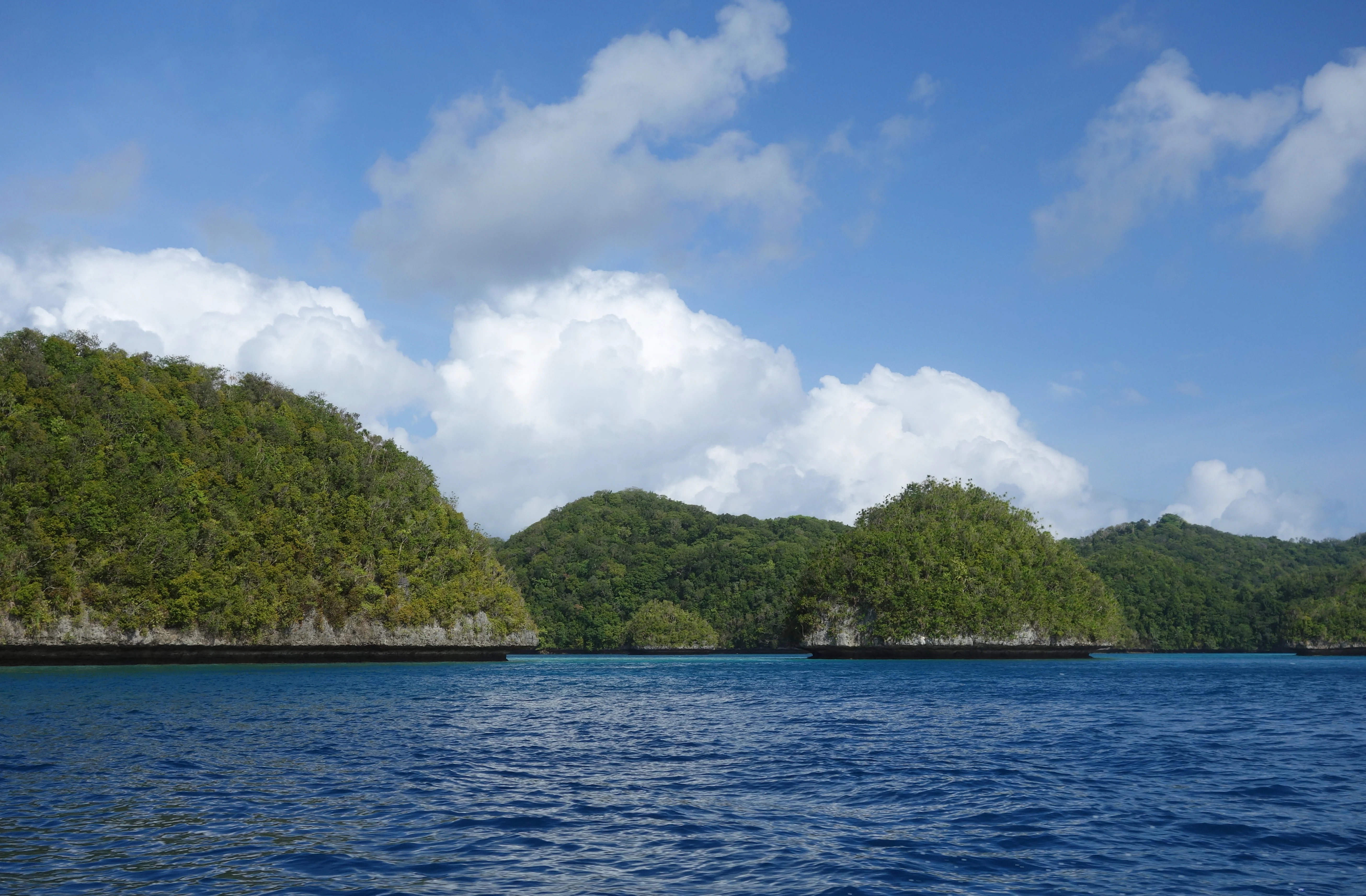
Rock Islands sea view
View of the Rock Islands in Palau from the surrounding lagoon.

Rock Islands wildlife and species highlights

The Rock Islands are internationally recognized for their birdlife, particularly as a stronghold for Palau's endemic and range-restricted species. A 4,912-hectare Important Bird Area has been formally designated across the islands by BirdLife International because of its role in supporting most of Palau's characteristic land birds. These include Micronesian megapodes; Palau ground doves; Micronesian imperial pigeons; Palau fruit doves; Palau swiftlets and Palau kingfishers; Micronesian myzomelas; morningbirds; Palau fantails; Palau flycatchers; Palau bush warblers; giant, dusky, and citrine white-eyes; and Micronesian starlings. The concentration of so many endemic or near-endemic species in such a compact island chain highlights the conservation importance of the archipelago.

The marine wildlife around the Rock Islands is equally significant. Reef systems around the islands host sharks, manta rays, sea turtles, schooling pelagic fish, and dense communities of reef fish, which is why the area is considered among the most diverse dive destinations on Earth. The marine lakes, especially Jellyfish Lake, are home to unique stingless jellyfish populations found nowhere else, while lagoon environments support anemones, reef-building corals, and the creatures that graze the island bases. Together, the bird fauna and marine life make the Rock Islands a vital refuge for biodiversity in the western Pacific.
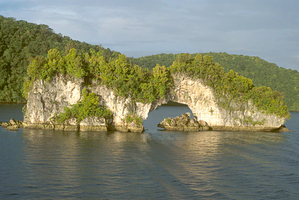
Rock Islands landscape
View of one of the Rock Islands in Palau, Micronesia.

Rock Islands conservation status and protection priorities

The Rock Islands hold a particularly strong conservation profile because their formal protection layers cultural and natural values together. Their 2012 inscription as the UNESCO World Heritage Site 'Rock Islands Southern Lagoon' was awarded under both cultural criteria, recognizing the islands' role in Palauan heritage, and natural criteria, recognizing ecological and geological importance. The protected designation covers roughly 100,200 hectares of core area, supported by an even larger buffer zone of approximately 164,000 hectares, giving the site one of the most extensive formal protections of any Pacific marine-insular landscape.

Beyond the UNESCO designation, the Rock Islands are also formally protected through BirdLife International as an Important Bird Area, providing additional recognition for their importance in safeguarding Palau's endemic bird fauna. Marine conservation efforts in the lagoon ecosystem include managed tourism, ranger operations based at Ngeruktabel within the national aquatics park, and ongoing research on reef health, marine lakes, and iconic species such as the jellyfish of Jellyfish Lake. Together these layers of recognition and management give the Rock Islands a strong framework for preserving both their scenic character and their ecological function.

Rock Islands cultural meaning and human context

The Rock Islands carry deep significance in Palauan cultural identity, having been part of the Southern Lagoon communities for generations. The islands are embedded in traditional knowledge systems related to fishing, navigation, and the sea, and many specific islands within the group are associated with stories, names, and customary practices. The UNESCO listing explicitly recognized this cultural dimension, listing the Rock Islands Southern Lagoon under cultural as well as natural criteria, which is unusual and reflects the strong interplay between environment and traditional life in Palau.

In modern Palau, the Rock Islands continue to function as a shared cultural and natural landmark, with Palauan communities, research institutions, conservation organizations, and visitors all engaging with the archipelago in different ways. The fact that the islands were recognized not just for their scenic and ecological value but also for their broader cultural meaning underscores how closely landscape and cultural heritage are intertwined in the Palauan context.

Top sights and standout views in Rock Islands

The Rock Islands' defined highlights include the mushroom-shaped limestone islands themselves, the surrounding reef and lagoon system, and a remarkable density of ecological and cultural significance packed into a small archipelago. Standout features include Jellyfish Lake with its stingless jellyfish, the Blue Corner and Blue Holes dive sites, German Channel, marine lakes on Eil Malk and other islands, and the concentration of Palau's endemic land birds across the island chain.

What ties these highlights together is their uniqueness: the Rock Islands combine a globally rare geological form, an exceptionally rich reef and marine-lake ecosystem, a significant assemblage of endemic birds, and a recognized cultural heritage, all within a single UNESCO-protected seascape off the coast of Koror.

Best time to visit Rock Islands

The Rock Islands sit within Palau's tropical maritime climate, where conditions vary more between wet and dry seasons than between summer and winter. The dry season, roughly from November through April, generally brings calmer seas, clearer visibility for snorkeling and diving, and drier weather that makes boat travel between islands more comfortable.

The wetter months, roughly May through October, bring higher rainfall, stronger winds, and somewhat reduced underwater visibility, though the islands remain lush and visually striking. Because the archipelago's appeal spans both above-water scenery and underwater experiences, the dry period tends to be favored for diving-focused visits, while birdwatching, lagoon exploration, and appreciation of the islands' lush tropical vegetation can be rewarding across much of the year. Visitors interested in specific phenomena, such as the famous stingless jellyfish of Jellyfish Lake or active bird breeding periods, may wish to plan around these seasonal cues.

Monthly climate preview

Measured annual temperature rhythms and monthly precipitation data for Rock Islands

Rock Islands Climate Normals, Long Term Temperature and Precipitation Patterns

Long term climate data for Rock Islands reveals consistent monthly temperatures alongside varying daily precipitation averages spanning the year. Reviewing the complete twelve month profile provides detailed perspective on historical weather patterns at this representative coordinate.
Annual mean28 °C
28 °C28 °C
Jan28°
Feb28°
Mar28°
Apr28°
May28°
Jun28°
Jul28°
Aug28°
Sep28°
Oct28°
Nov28°
Dec28°
Warmest month
November

28.4 °C

Coolest month
February

27.6 °C

Wettest month
July

11.9 mm/day

Driest month
March

5.7 mm/day

Park location guide

Geography guide, regional context, and park location map for Rock Islands

Rock Islands park geography, regions, and map view in Palau

Understand where Rock Islands sits in Palau through a broader geographic reading of the surrounding landscape, nearby location context, and its mapped position within the national park landscape.

How Rock Islands fits into Palau

Palau is a sovereign island nation located in the western Pacific Ocean within the Micronesia subregion of Oceania. The country consists of roughly 340 islands forming part of the Caroline Islands chain. It achieved full independence in 1994 through a Compact of Free Association with the United States, having previously been under Spanish, German, Japanese, and US administration.

Wider geography shaping Rock Islands in Palau

Palau is located in the western Pacific Ocean as part of the Caroline Islands in the Micronesia region of Oceania. The archipelago sits near Indonesia to the south, the Philippines to the northwest, and the Federated States of Micronesia to the east. The largest island is Babeldaob, where the capital Ngerulmud is located in Melekeok State.

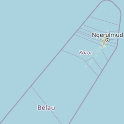
Map view of Rock Islands

Use this park location map to pinpoint Rock Islands in Palau, understand its exact geographic position, and read its mapped placement within the surrounding landscape more clearly.

Pigeon | © OpenStreetMap contributors

Location context for Rock Islands

Koror

Examine the limestone formations, lagoon waters, and protected marine habitats of Palau

Rock Islands Landscape Photography and Scenery Visual Explorer

Photographic records capture the mushroom-shaped limestone landforms and turquoise lagoon channels defining the Rock Islands. Visual exploration reveals the intricate geological architecture and marine habitats shaping this protected island archipelago.

Aerial view of Rock Islands

Ngerukewid Islands aerial view

Divers near the Iro shipwreck

Rock Islands sea view

Rock Islands landscape

Park atlas

Compare adjacent reef archipelagos and regional marine reserves in Micronesia

Explore Protected Areas and Other Notable Parks Near Rock Islands

Visitors exploring Rock Islands can continue browsing surrounding protected areas and related island landscapes across the region. Extending the geographic review helps place local marine ecosystems, limestone formations, and regional marine habitats into a broader conservation context.
Nature reserveState of Airai
About 30 km away#1 closest

Northeast

Airai State Conservation Area: Protected Forest and Watershed Geography in the State of Airai

Nature reserve on Babeldaob Island, Palau

Located in the State of Airai on Babeldaob Island, this nature reserve protects native forest and watershed headwaters. The area is a key example of state-level terrestrial conservation in Palau, providing essential inland habitat and contributing to the island's overall ecological health through its managed landscape boundaries.

Relief
Lowland
Nature reserveState of Ngeremlengui
About 39 km away#2 closest

Northeast

Bkulabeluu Conservation Area: Inland Forest Nature Reserve in Ngeremlengui, Palau

Mapped protected landscapes of northern Babeldaob

Deepen your understanding of Bkulabeluu Conservation Area, a significant nature reserve situated in the interior highlands of the State of Ngeremlengui. This atlas entry details the volcanic ridges, tropical rainforest vegetation, and watershed connectivity that define the protected landscape of Babeldaob island, serving as a cornerstone for terrestrial conservation in Palau.

Nature reserveMelekeok
About 46 km away#3 closest

Northeast

Lake Ngardok Nature Reserve: Mapped Protected Area and Freshwater Geography in Melekeok

Protected wetland landscapes of central Babeldaob Island

Lake Ngardok serves as a landmark freshwater reserve in Melekeok, featuring extensive marshlands and a connected river drainage system. As a protected watershed on Babeldaob Island, the area offers significant insights into Pacific island freshwater ecology, providing a stable habitat within a dense tropical forest catchment for diverse endemic species and rare wildlife.

Area
4.93 km²
Established
2002
Water
Water-dominated
Marine protected areaNgaraard
About 59 km away#4 closest

Northeast

East Coast Ngaraad Marine Conservation Area: Marine Protected Area and Coastal Map

Northern Babeldaob coastal geography and marine reserve boundaries

Located in Ngaraard State, this marine protected area serves as a significant site for reef conservation and coastal habitat preservation in Palau. The region illustrates the connection between tropical island forest watersheds and reef-fringed lagoons, providing a clear view of the protected coastal environment in northern Babeldaob.

Relief
Lowland
Climate
Tropical
Access
Access unknown
Scope
Marine
Protected areaPalau
About 69 km away#5 closest

Northeast

Ebiil Channel Conservation Area: Geographic Map and Protected Marine Landscape Profile

Coastal conservation mapping in northern Palau

Examine the physical geography and protected maritime boundaries of the Ebiil Channel Conservation Area. This site highlights the coastal transition zones between land and sea in northern Palau, providing essential context for the reef-based topography and marine reserves of the archipelago.

Water
Water-dominated
Marine protected areaYap
About 488 km away#6 closest

Northeast

Nimpal Channel Marine Conservation Area: Geography and Protected Marine Landscapes in Yap

Community-managed coastal reefs and tidal mangrove systems

Located in Yap, the Nimpal Channel Marine Conservation Area functions as a protective node for local reef ecosystems. This 77-hectare reserve serves as a model for community-based stewardship, linking the health of mangrove-fringed shorelines with the resilience of the surrounding tidal channel habitats in the western Pacific.

Area
0.77 km²
Relief
Lowland
Climate
Tropical
Access
Access unknown
Marine protected areaDavao Oriental
About 891 km away#7 closest

West

Pujada Bay Protected Seascape: Marine Protected Area and Coastal Landscape in Davao Oriental

Coastal geography and protected marine ecosystems of Mindanao

Pujada Bay Protected Seascape serves as a primary coastal sanctuary along the Davao Oriental shoreline. Defined by the convergence of mountain-fed rivers, mangrove forests, and coral reef habitats within a semi-enclosed bay, this protected area offers a deep look into the marine geography of the Philippine archipelago.

Area
212 km²
Established
1994
Relief
Mixed relief
Access
Access unknown
Wildlife reserveAgusan del Sur
About 938 km away#8 closest

West

Agusan Marsh Wildlife Sanctuary: Mapping a Vast Freshwater Protected Area

Swamp forests and river basin geography in Agusan del Sur

Agusan Marsh Wildlife Sanctuary represents a crucial freshwater wetland complex within the Agusan River basin. The area is defined by its expansive swamp forests and semi-permanent floating lakes, which serve as essential migratory transit points and support an intricate network of aquatic ecosystems across the Mindanao region.

Area
148.36 km²
Established
1996
IUCN
IV
Relief
Lowland

Common questions about visiting, size, designation, and location context for Rock Islands

Rock Islands FAQs for park facts, access, geography, and protected area context

Find quick answers about Rock Islands, including protected-area facts, park geography, trail and visitor context, and how the park fits into its surrounding country and regional landscape.
MoriAtlas Explorer

Continue Your Protected Areas Search Across the Global Atlas

Deepen your exploration by continuing the structured search for national parks and protected areas worldwide. Utilize the comprehensive filtering capabilities to compare different conservation landscapes and refine your understanding of global park geography. Discover more about the distribution and characteristics of protected natural areas.

Global natural geography
