
Mori Atlas logo
Nature reserveRodauwiesen bei Rollwald

Understanding the geography of open meadows and reed habitats in the Rodau valley

Rodauwiesen bei Rollwald Nature Reserve: A Protected Floodplain Landscape in Hessen

(Naturschutzgebiet Rodauwiesen bei Rollwald)

Rodauwiesen bei Rollwald is a designated nature reserve located in the Untermainebene of southern Hessen. This protected area preserves a surviving fragment of traditional grassland floodplain along the Rodau stream, serving as an ecological refuge within the densely populated Rhine-Main region. Its landscape is defined by expansive meadow complexes and continuous reed beds that provide vital habitat within the lowland plain between Rollwald and Ober-Roden.

wet meadowreed bedlowland floodplainRodau streamgrassland reservehabitat management area
A flat style digital illustration showing a green meadow, a winding river, a dense pine forest, and distant rock formations under a soft sun.

Rodauwiesen bei Rollwald

Nature reserve

Park overview

Structured park overview, official facts, and landscape profile for Rodauwiesen bei Rollwald

Rodauwiesen bei Rollwald park facts, protected area profile, and essential visitor context

Review the core facts for Rodauwiesen bei Rollwald, including designation, size, terrain, visitor scale, habitats, and operating context in one park-focused overview.

About Rodauwiesen bei Rollwald

Rodauwiesen bei Rollwald is a formally protected nature reserve in the southern part of the German state of Hesse, situated in the municipality of Rodgau within the Landkreis Offenbach. It occupies a modest but ecologically significant portion of the lowland plain of the River Main (Untermainebene), specifically the meadow floor of the Rodau stream, a small tributary that drains this part of the Main lowlands. The reserve is sandwiched between two Rodgau districts, Rollwald and Ober-Roden, in a region where urbanization and agricultural land use have significantly reduced the availability of open greenland and wetland habitats.

The protected area encompasses roughly 32 hectares of open landscape dominated by grassland, with substantial patches of wet and moist meadow still present alongside a large continuous reed bed of common reed (Schilfröhricht). This combination is the defining feature of the site: it preserves the open, traditionally managed floodplain character of the Rodau valley, where meadows and reed stands once merged into larger wetland complexes. By protecting these structures, the reserve safeguards habitat conditions for a range of plant and animal species that are tied to wet grasslands and reed fringes, two of the most threatened habitat types in central European lowlands.

Designation as a Naturschutzgebiet took place in 1999, reflecting a recognition that only formal protection could secure the long-term survival of these habitats in the face of continuing land-use pressure around Rodgau. Under the IUCN protected-area framework, the reserve is classified as Category IV, a Habitat/Species Management Area, which underscores its applied management role rather than that of a strict wilderness reserve. Administratively, it is supervised by the lower nature conservation authority (Untere Naturschutzbehörde) of the Landkreis Offenbach, and it is a registered member of the broader network of protected areas in Hesse, recorded under German NSG identifier 1438033 and WDPA identifier 318995.

The overall ecological and cultural value of Rodauwiesen bei Rollwald lies in the fact that it preserves a recognizable fragment of the historical meadow landscape of the lower Main valley, an open, species-rich greenland corridor that now exists only in isolated patches across the region. Within the heavily populated and economically dynamic Rhine-Main area, the reserve functions as a refuge and stepping stone for meadow- and reed-dependent biodiversity, contributing to the broader network of small but ecologically meaningful nature reserves of Landkreis Offenbach.

Quick facts and research context for Rodauwiesen bei Rollwald

Rodauwiesen bei Rollwald is a nature reserve (Naturschutzgebiet) located in the Landkreis Offenbach within the state of Hesse, Germany. It lies in the municipal territory of Rodgau, between the districts of Rollwald and Ober-Roden, and sits in the natural region of the Untermainebene. The reserve covers roughly 32 hectares and has been officially protected since 1999. Its classification under the IUCN system corresponds to Category IV, a Habitat/Species Management Area, recognizing its role in maintaining species-rich grassland and reed habitats. The area corresponds to identification number 1438033 in the German NSG register and is also recorded in the World Database on Protected Areas under ID 318995. Administratively, the reserve falls under the jurisdiction of the lower nature conservation authority (Untere Naturschutzbehörde) of the Landkreis Offenbach.

Protection and recognition

Documented terrestrial protection metrics and official conservation status records

Rodauwiesen bei Rollwald Protection Status and International Recognition Data

Rodauwiesen bei Rollwald maintains a documented terrestrial protection scope managed through established conservation frameworks. Official records assemble baseline designation data, management metrics, and international recognition details where available.

Protection details

Protection scope
Terrestrial
Transboundary protection
No
WDPA ID
318995
Park context

Deeper park guide and search-rich context for Rodauwiesen bei Rollwald

Rodauwiesen bei Rollwald history, landscape, wildlife, and travel context

Explore Rodauwiesen bei Rollwald through its history, landscape character, ecosystems, wildlife, conservation priorities, cultural context, and seasonal travel timing in a structured park guide built for atlas discovery and search intent.

Why Rodauwiesen bei Rollwald stands out

Rodauwiesen bei Rollwald is best known for its extensive meadow complexes and reed beds along the Rodau lowland stream. It represents a surviving example of the traditional open greenland floodplain landscape that once characterized much of the lower Main valley. The combination of wet meadows and a sizeable common reed (Phragmites) stand gives the area its ecological character and its conservation value, offering habitat continuity for species that depend on these increasingly rare open wetland-influenced habitats within the densely populated Rhine-Main area.
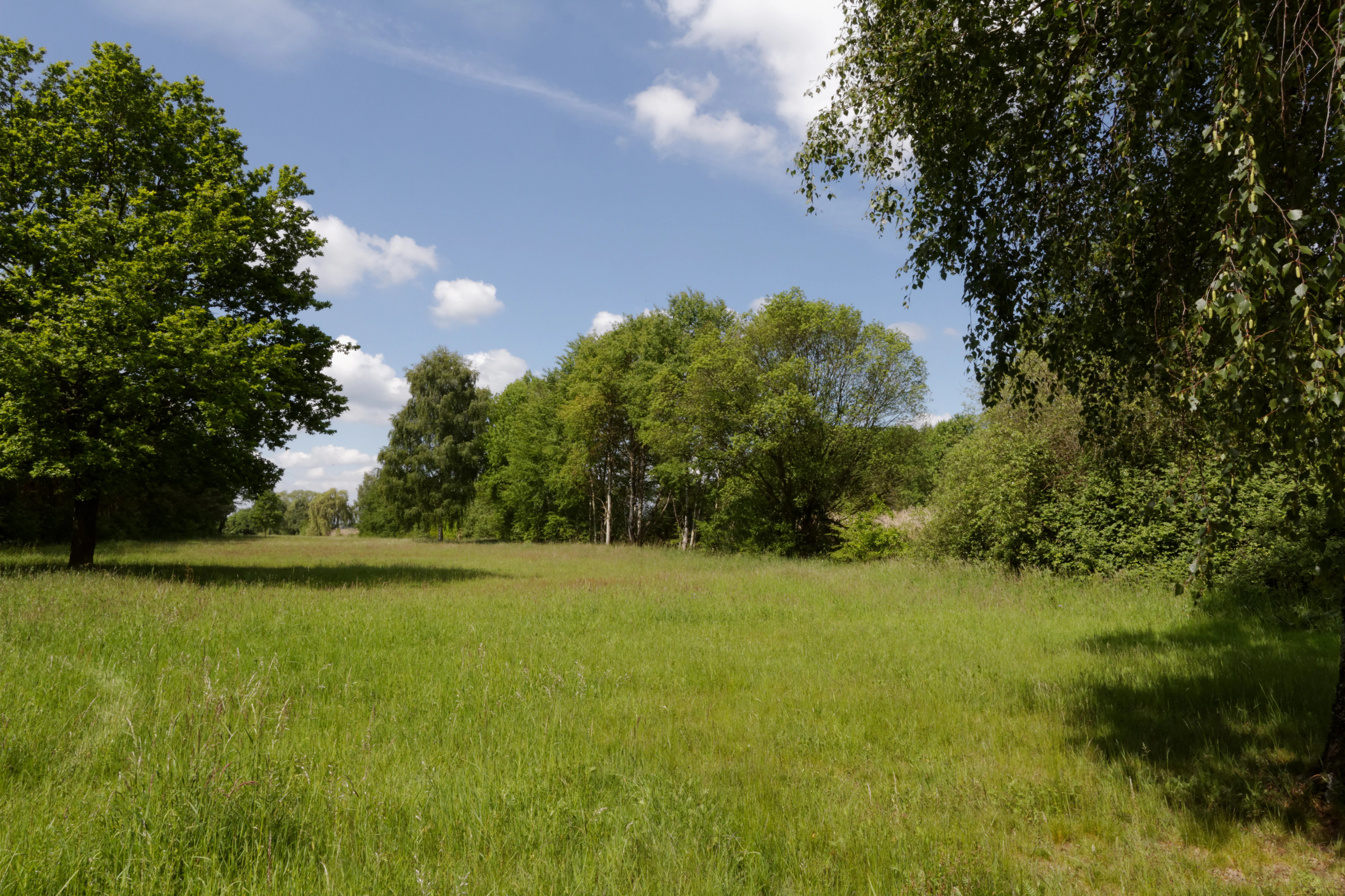
A sunny, open green meadow surrounded by deciduous trees under a blue sky with light clouds.
Open grassland and surrounding trees within the Rodauwiesen bei Rollwald nature reserve.

Rodauwiesen bei Rollwald history and protected-area timeline

The current protected status of Rodauwiesen bei Rollwald dates to 1999, when the area was formally designated as a Naturschutzgebiet under Hessian nature conservation law. This designation reflected a deliberate effort to safeguard one of the last remaining larger complexes of meadow and reed habitat along the Rodau stream near the settlement of Rodgau, within a region where farmland, settlement expansion, and infrastructure have steadily reduced the share of open wetland-influenced landscapes.

Its inclusion in the Hessian register of nature reserves (NSG-Kennung 1438033) and its recording in the international World Database on Protected Areas indicate recognition beyond the local scale. Administratively, the reserve has been managed since designation by the lower nature conservation authority (Untere Naturschutzbehörde) of the Landkreis Offenbach, which has responsibility for supervision and oversight within its district. No earlier formal protection regime is documented, suggesting that the 1999 designation marks the first continuous statutory protection of the meadows and reed stands at this site.

Rodauwiesen bei Rollwald landscape and geographic character

Rodauwiesen bei Rollwald lies within the Untermainebene, the broad, gently undulating lowland plain of the lower Main river in southern Hesse. The site itself is a flat to very gently sloping section of the Rodau stream valley, with elevations running roughly from 130 m to 140 m above sea level, characteristic of a mature, slow-flowing lowland stream environment in the wider Main drainage system.

The visual character of the landscape is dominated by open greenland. Expansive meadows extend across the protected area, framed by the course of the Rodau stream, which shapes the floodplain and the hydrological conditions of the soils. Interspersed among the meadows are surviving wet and moist grassland patches that retain their original moisture regime, and these give way in places to a substantial, near-continuous reed bed of common reed (Schilfröhricht). Together, these features produce a layered, open lowland scene in which water, meadow vegetation, and reed form an uninterrupted habitat gradient through the Rodau valley.

Despite its modest size, the reserve feels like a distinct landscape island within the surrounding region. Beyond its boundaries, the land transitions quickly toward the urban edges of Rollwald and Ober-Roden, two districts of the town of Rodgau, so the reserve serves as one of the most visible reminders of the older, meadow-dominated character of the local floodplain.

Rodauwiesen bei Rollwald ecosystems, habitats, and plant life

Ecologically, Rodauwiesen bei Rollwald belongs to the family of lowland meadow and reed habitats that historically characterized the floodplains of the Untermainebene. The reserve focuses on preserving grassland communities in their natural floodplain setting, with emphasis on the species-rich wet and moist meadows that survive along the Rodau.

Hydrology is the fundamental ecological driver. The Rodau stream and its floodplain soils maintain a moisture gradient that expresses itself across the site, supporting dry grassland on slightly raised ground, moist meadows on intermediate levels, and wet meadow communities in the lowest sections. Where the wet meadow transitions into reed, a large, contiguous reed bed (Schilfröhricht) of common reed has developed. Reed stands of this continuity are rare in the surrounding region and represent one of the reserve's most important habitat features.

The habitat mosaic formed by meadow, wet meadow, and reed supports a community of plant and animal species adapted to open, periodically wet landscapes. Because reed and wet meadow habitats have retreated sharply across much of Hesse under modern drainage and land conversion, the reserve has become an important refuge for the biodiversity that depends on these open, lowland wetland-influenced environments. The site's protected status is explicitly intended to maintain this habitat continuity and to prevent further loss of these particular habitat types in the Landkreis Offenbach.

Rodauwiesen bei Rollwald wildlife and species highlights

The wildlife focus of Rodauwiesen bei Rollwald centers on the species groups that depend on open wet meadow and reed habitats in the lower Main lowlands. Although the source documentation frames this primarily in terms of habitat protection rather than individual species, the reserve's value lies in supporting animal communities tied to the meadow and reed mosaic, including bird, insect, and other fauna typical of lowland wet grassland and reed fringes in central Europe.

The combination of large, structurally diverse reed beds with surrounding meadows produces a varied habitat structure that accommodates different feeding, nesting, and sheltering niches. Reed stands in particular are recognized for their importance as breeding and roosting habitat for a range of bird species and as habitat for characteristic reed-associated insects, while the surrounding wet and moist meadows provide foraging areas and additional nesting opportunities for ground-nesting species and pollinators.

By maintaining this habitat structure through formal protection, the reserve offers continuity for populations that have been fragmented or reduced elsewhere in the Landkreis Offenbach. Its role as a local refuge for meadow- and reed-associated wildlife gives it disproportionate ecological significance relative to its size within the regional landscape.

Rodauwiesen bei Rollwald conservation status and protection priorities

The reserve is classified under the IUCN framework as a Category IV area, a Habitat/Species Management Area. This places it in the category of protected areas whose primary conservation objective is to maintain, manage, and where necessary restore particular habitats and the species they support, rather than to preserve a strictly untouched natural ecosystem. This framing is appropriate for a site whose value derives overwhelmingly from its surviving meadow and reed habitats and the species associated with them.

The core conservation purpose of the designation is to secure open greenland complexes with extensive reed stands as habitats for rare and threatened plant and animal species. Protection is justified not by the size of the area alone but by the scarcity of this habitat type in the broader region: surviving complexes of wet meadow and large reed beds in the lower Main lowlands are limited, and their continued existence within the urbanizing landscape of the Rhine-Main area requires active, statute-based protection.

At the administrative level, conservation oversight rests with the Untere Naturschutzbehörde of the Landkreis Offenbach, which is responsible for implementation of management measures and enforcement of protection rules. The reserve is integrated into the Hessian network of Naturschutzgebiete and the international World Database on Protected Areas, confirming its recognition within higher-level conservation frameworks. Its long-term significance lies in its function as a stable, protected refuge within a network of small but ecologically meaningful reserves that together preserve fragments of the historic meadow landscape of southern Hesse.

Top sights and standout views in Rodauwiesen bei Rollwald

The defining highlights of Rodauwiesen bei Rollwald are its extensive meadow landscape along the Rodau stream and its large, near-continuous common reed bed, two habitat features that are increasingly rare in the surrounding lower Main lowlands. The reserve's protected status since 1999 and its IUCN Category IV classification underline that its value is fundamentally tied to habitat management for meadow- and reed-associated biodiversity.

Its location between the Rodgau districts of Rollwald and Ober-Roden, within the natural region of the Untermainebene, places the reserve in a heavily populated and economically dynamic part of the Rhine-Main area, making it a distinct green refuge in an otherwise built-up landscape. Small in size but carefully designated, the area preserves a recognizable fragment of the traditional open floodplain character of the southern Hesse lowlands.

Best time to visit Rodauwiesen bei Rollwald

The reserve is most rewarding to experience in late spring and early summer, when the meadow and reed vegetation is at its peak growth and a wide range of herbaceous plants and reed-associated birds and insects are active. Late summer offers tall, mature reed and ripened grassland, while autumn and winter tend to reduce visibility and activity in the open habitats. Detailed accessibility, trail conditions, and operational details are not documented in the available source material and should be checked locally before visiting.

Monthly climate preview

Long-term representative monthly temperature and precipitation data for Hessen

Rodauwiesen bei Rollwald Climate Normals and Annual Temperature Rhythm

Representative coordinate records show average monthly temperatures ranging from near freezing in winter to peak warmth in summer alongside consistent daily precipitation. Exploring the full twelve-month profile provides detailed meteorological normals for this protected area.
Annual mean10 °C
0 °C21 °C
Jan
Feb
Mar
Apr10°
May14°
Jun18°
Jul21°
Aug20°
Sep15°
Oct10°
Nov
Dec
Warmest month
July

20.6 °C

Coolest month
January

0.2 °C

Wettest month
July

2.2 mm/day

Driest month
April

1.4 mm/day

Park location guide

Geography guide, regional context, and park location map for Rodauwiesen bei Rollwald

Rodauwiesen bei Rollwald park geography, regions, and map view in Germany

Understand where Rodauwiesen bei Rollwald sits in Germany through a broader geographic reading of the surrounding landscape, nearby location context, and its mapped position within the national park landscape.

How Rodauwiesen bei Rollwald fits into Germany

Germany is a federal republic in Western and Central Europe with a population of over 83 million across sixteen constituent states. It is Europe's largest economy by nominal GDP and a major global exporter and importer. The capital is Berlin, and the country borders Denmark, Poland, Czech Republic, Austria, Switzerland, France, Luxembourg, Belgium, and the Netherlands.

Wider geography shaping Rodauwiesen bei Rollwald in Germany

Germany is located in Western and Central Europe, spanning 357,022 km². It borders Denmark to the north, Poland and the Czech Republic to the east, Austria and Switzerland to the south, and France, Luxembourg, Belgium, and the Netherlands to the west. The country has coastlines on the Baltic Sea and North Sea to the north, with the Alps located in the southern region.

Map view of Rodauwiesen bei Rollwald

Use this park location map to pinpoint Rodauwiesen bei Rollwald in Germany, understand its exact geographic position, and read its mapped placement within the surrounding landscape more clearly.

Pigeon | © OpenStreetMap contributors

Location context for Rodauwiesen bei Rollwald

Hessen

Explore the visual character of moist meadows and riverine terrain within the Untermainebene region.

Rodauwiesen bei Rollwald Photos and Landscapes: Visualizing the Lowland Floodplain and Reed Habitats

Visual records capture the expansive greenland meadows and continuous reed beds that define the Rodau valley floodplain. Examining these protected habitats reveals the flat terrain and open wetland character preserved among the surrounding urban settlements.

A sunny, open green meadow surrounded by deciduous trees under a blue sky with light clouds.

Park atlas

Compare adjacent wetland reserves and lowland floodplain habitats across southern Hesse

Explore Parks Near Rodauwiesen bei Rollwald and Surrounding Protected Landscapes

Browse other protected areas near Rodauwiesen bei Rollwald to discover similar lowland floodplains and grassland habitats in the region. Comparing adjacent nature reserves provides a broader geographic understanding of local stream valleys and wetland preservation.
Nature reserveLandkreis Offenbach
About 2.4 km away#1 closest

Southeast

Niederrodener Lache: A Protected Nature Reserve in Landkreis Offenbach, Germany

Brook-side habitat mosaic and regional landscape geography

Niederrodener Lache encompasses 124 hectares of protected woodland and grassland in the Landkreis Offenbach district. Centered on the Lache brook, the reserve hosts a dense interweaving of alder-fringed streams and varied meadow types. Its landscape profile provides a vital refuge for threatened vegetation and wetland biotopes within the suburbanizing Rhine-Main metropolitan area.

Area
1.246 km²
Established
1986
IUCN
IV
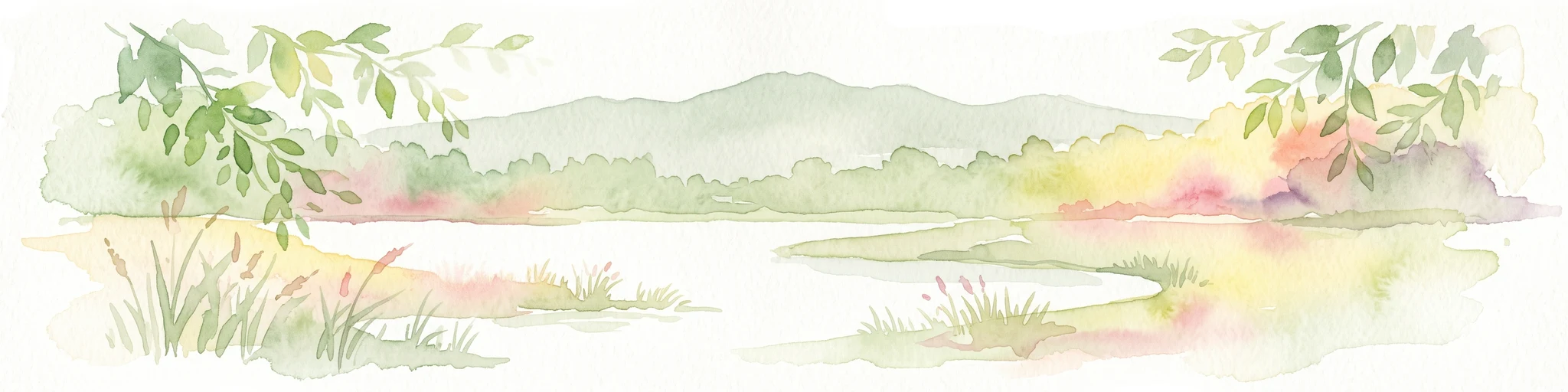
A soft watercolor painting showing a tranquil wetland landscape with calm water, grassy shores, and hazy mountains in the background.
Nature reserveHessen
About 4.3 km away#2 closest

Southeast

Kies- und Sandgrube von Dudenhofen: Regional Nature Reserve and Wetland Mapping

Protected post-extraction landscape in the Hessen region

Kies- und Sandgrube von Dudenhofen protects a distinct network of shallow-water habitats and open-ground terrain near Rodgau. Managed as a nature reserve, this area serves as an essential regional hub for wetland biodiversity, mapping the transition between industrial remnants and regenerated forest ecosystems within the Rhine-Main lowlands.

Area
0.173 km²
Established
1995
IUCN
IV
A soft watercolor illustration depicting a calm wetland scene with distant rolling hills, foreground reeds, and overhanging tree branches.
Nature reserveHesse
About 4.5 km away#3 closest

South

Rallenteich von Eppertshausen Nature Reserve: Protected Landscape and Regional Geography

Wetland and forest mosaic in the Hesse region

Examine the geographic footprint of Rallenteich von Eppertshausen, a significant nature reserve in Hesse, Germany. This 12-hectare protected area showcases a dense mosaic of pond, reedbed, and acidic oak forest that evolved from historical clay mining. Understanding the park's topography and internal landscape zones offers insight into the evolution of post-industrial protected lands.

Area
0.12 km²
Established
1976
IUCN
IV
Relief
Lowland
Nature reserveHessen
About 4.5 km away#4 closest

Southwest

Erlenwiesen bei Ober-Roden Nature Reserve: Landscape and Geography in Hessen, Germany

Protected riparian forest and wetland habitat mosaic

Erlenwiesen bei Ober-Roden is a specialized nature reserve in the Messeler Hügelland of Hessen, protecting a dense concentration of alder-ash floodplain forests, sedge swamps, and wet meadows. Spanning approximately 14 hectares, it remains a crucial example of lowland stream valley conservation and habitat management within the German landscape.

Area
0.143 km²
Established
1996
IUCN
IV
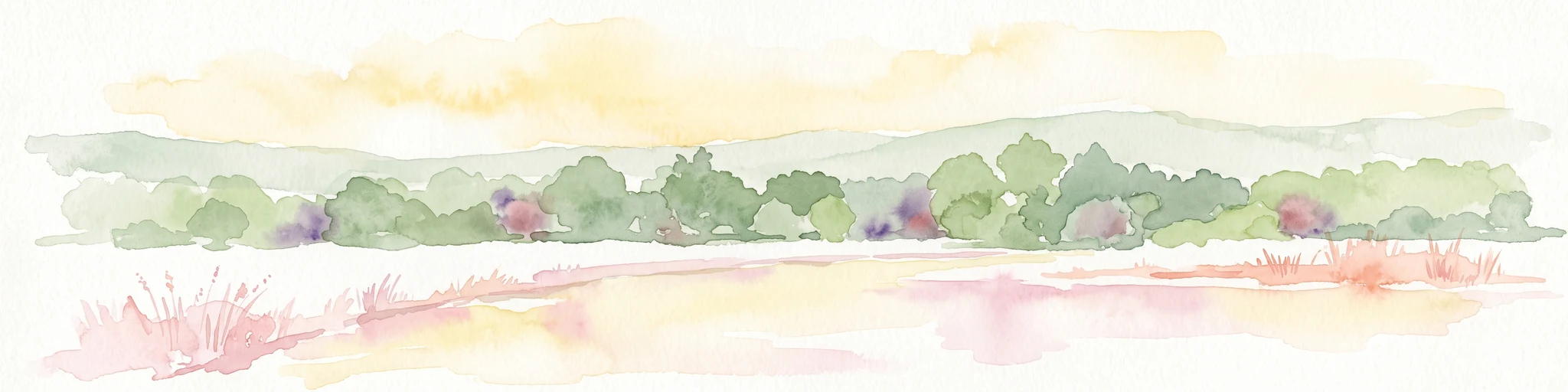
Watercolor painting of a soft landscape showing a light orange foreground, a band of green trees and bushes in the midground, and faint rolling hills against a pale yellow sky in the background.
Nature reserveLandkreis Darmstadt-Dieburg
About 5.5 km away#5 closest

Southeast

Brackenbruch bei Hergershausen: Nature Reserve and Floodplain Ecosystem in Darmstadt-Dieburg

Protected wetland landscapes and Lache stream geography

Located in the Darmstadt-Dieburg district, Brackenbruch bei Hergershausen preserves a characteristic lowland floodplain mosaic. The terrain includes wet meadows, reed beds, and developing oak-hornbeam forests that reflect the natural vegetation of the southern Hessian river valleys. This site maintains essential wetland habitats for regional biodiversity within its protected boundaries.

Area
0.523 km²
Established
1999
A horizontal watercolor painting depicting a landscape with calm water, grassy marshlands, and distant rolling hills in soft pastel colors.
Nature reserveHessen
About 5.7 km away#6 closest

Northwest

Nachtweide von Patershausen: Nature Reserve Geography and Mapped Protected Boundaries

Protected landscape and habitat atlas for the Hessen region

Nachtweide von Patershausen stands as a vital nature reserve in Hessen, characterized by a textured cultural landscape that includes rare nutrient-poor grassland and historical carp ponds. This protected site offers significant insight into the regional ecology of the Rhine-Main area, providing a dense mosaic of habitats that anchor the local natural environment near Heusenstamm.

Area
0.178 km²
Established
1987
IUCN
IV
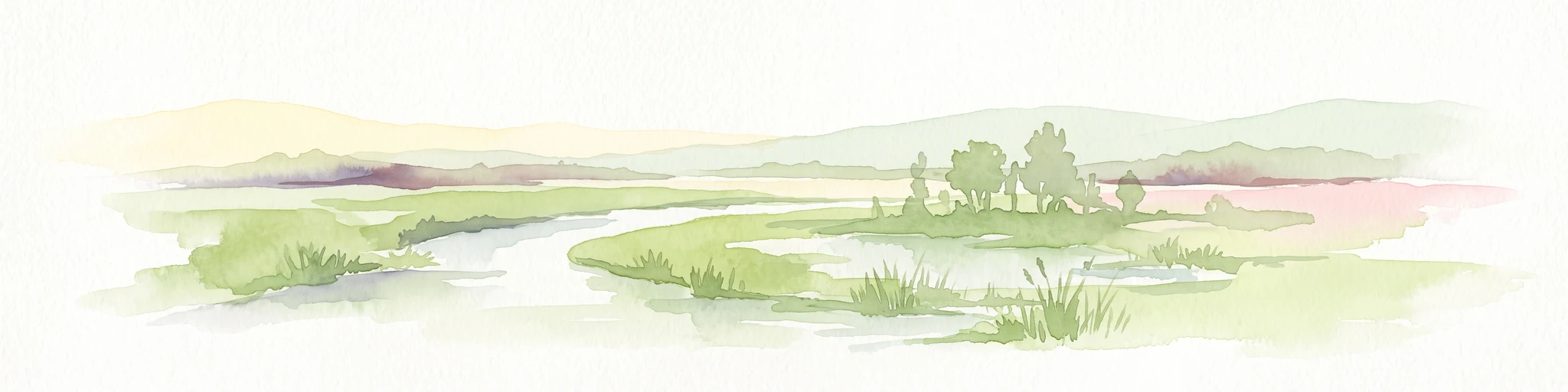
A soft watercolor painting of a winding stream through a green wetland with trees and distant hills in the background.
Nature reserveHessen
About 5.9 km away#7 closest

South

Faulbruch von Münster Nature Reserve: Hessen Wetland and Forest Geography

Mapped protected landscapes in southern Germany.

Discover the geographic composition of Faulbruch von Münster, a protected nature reserve in Hessen. This area features a distinctive mix of alder swamp forest and wet meadows, providing a valuable habitat within the Rhine-Main region. Analyze the terrain, forest patches, and wetland boundaries through our detailed regional atlas.

Area
0.77 km²
Established
1985
IUCN
IV
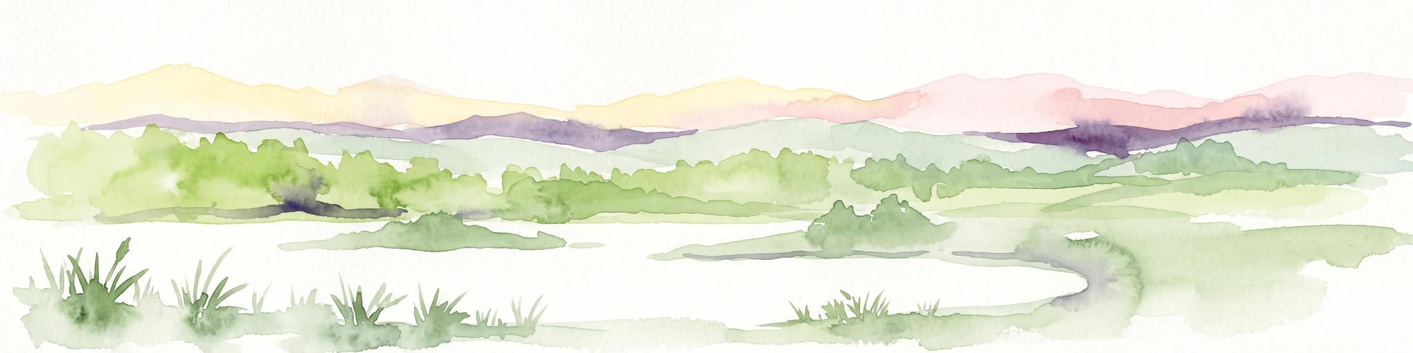
A horizontal watercolor illustration depicting a soft, pastel-colored meadow with wildflowers in the foreground and a gentle forest line in the background against a white background.
Nature reserveLandkreis Darmstadt-Dieburg
About 6.1 km away#8 closest

Southwest

Neuwiese von Messel Nature Reserve: Mapped Geography and Protected Landscape Context

Essential nature reserve located in Landkreis Darmstadt-Dieburg

Neuwiese von Messel consists of open meadow islands surrounded by mature deciduous forest, creating a representative forest-meadow mosaic in the Messeler Hügelland. This nature reserve functions as a vital conservation site for specialized plants and habitat types, protected within the European Natura 2000 network. Gain insight into its terrain, soil-based biodiversity, and the centuries-old traditional management that sustains this protected German landscape.

Area
1.072 km²
Established
1986
IUCN
IV
Relief
Lowland

Common questions about visiting, size, designation, and location context for Rodauwiesen bei Rollwald

Rodauwiesen bei Rollwald FAQs for park facts, access, geography, and protected area context

Find quick answers about Rodauwiesen bei Rollwald, including protected-area facts, park geography, trail and visitor context, and how the park fits into its surrounding country and regional landscape.
MoriAtlas Explorer

Continue Your Protected Areas Search Across the Global Atlas

Deepen your exploration by continuing the structured search for national parks and protected areas worldwide. Utilize the comprehensive filtering capabilities to compare different conservation landscapes and refine your understanding of global park geography. Discover more about the distribution and characteristics of protected natural areas.

Global natural geography