
Mori Atlas logo
State or regional parkRolley Lake Provincial Park

Explore the lakeshore topography, forested terrain, and regional mapping of this British Columbia park.

Rolley Lake Provincial Park: A Comprehensive Geographic Atlas of Protected Forest Landscapes

Rolley Lake Provincial Park is a protected area located within the Fraser Valley Regional District of British Columbia, defined by its central freshwater lake and surrounding second-growth forest. This detailed geographic entry offers insights into the park's mapped boundaries, internal trail network, and the natural drainage patterns that shape its compact forest ecosystem. Visitors can examine the interplay between the lakeshore environment and the nearby waterfall terrain that characterizes this significant regional landscape.

provincial parkfreshwater lakelakeside recreationlakeshore loop trailcampingday-use area
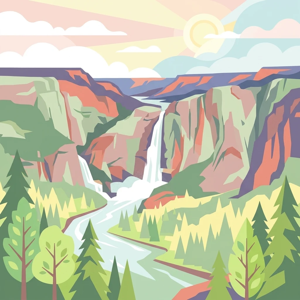
An artistic, stylized illustration of a canyon with two waterfalls cascading into a river, surrounded by evergreen trees under a pale sun.

Rolley Lake Provincial Park

State or regional park

Park overview

Structured park overview, official facts, and landscape profile for Rolley Lake Provincial Park

Rolley Lake Provincial Park park facts, protected area profile, and essential visitor context

Review the core facts for Rolley Lake Provincial Park, including designation, size, terrain, visitor scale, habitats, and operating context in one park-focused overview.

About Rolley Lake Provincial Park

Rolley Lake Provincial Park sits within the productive river country of southwestern British Columbia, where the Fraser Valley transitions from the urban influence of Greater Vancouver into the forested terrain of the Stave River watershed. The park lies within the Fraser Valley Regional District, in the Stave Falls area near the district municipality of Mission, and occupies a modest footprint of about 115 hectares centred on Rolley Lake. Despite its small size, the park acts as an important local outdoor anchor, providing a rare combination of lakeside recreation, camping, and forested hiking opportunities in a region otherwise defined by active forestry and hydroelectric infrastructure.

The geography of the park is shaped by its lake and the surrounding low-elevation forest. The lake itself sets the tone for the visitor experience: a calm, freshwater body that supports both passive enjoyment and active water-based recreation, surrounded by a forested shoreline that the park's trail network follows closely. Beyond the immediate lakeshore, the terrain extends into mixed forest typical of the eastern Fraser Valley, with mature second-growth stands, mossy groundlayer vegetation, and small creek systems that drain toward the lake and ultimately into the broader Stave watershed.

The park's role within the regional recreation system is significant for its accessibility. Visitors arrive from Mission, from neighbouring communities in the Fraser Valley, and from the wider Lower Mainland, drawn by the combination of camping facilities, a day-use area, and a short trail network that rewards even brief visits. The park is also a meaningful cultural landscape, layered with Indigenous, homesteading, and industrial history that gives the place a deeper identity than its modest size would suggest.

Quick facts and research context for Rolley Lake Provincial Park

Rolley Lake Provincial Park is a 115-hectare BC Parks protected area in the Fraser Valley Regional District of British Columbia, established on February 3, 1961. The park is centred on Rolley Lake in the Stave Falls area near Mission and is classified as an IUCN Category II area. Its setting combines a freshwater lake, forested terrain, and small waterfalls reached by short trails, and the climate of the area is classified as oceanic, with very wet winters and mild, relatively dry summers.

Park context

Deeper park guide and search-rich context for Rolley Lake Provincial Park

Rolley Lake Provincial Park history, landscape, wildlife, and travel context

Explore Rolley Lake Provincial Park through its history, landscape character, ecosystems, wildlife, conservation priorities, cultural context, and seasonal travel timing in a structured park guide built for atlas discovery and search intent.

Why Rolley Lake Provincial Park stands out

Rolley Lake Provincial Park is best known for its namesake lake, which forms the scenic and recreational heart of the protected area. The lake is ringed by accessible forest trails, most notably the easy 3-kilometre loop that circles the shoreline and offers continuous lake views, bathing beaches, and swimming access. Equally distinctive is the short out-and-back trail leading to nearby waterfalls, which extends the park's appeal beyond the lakeshore and into the broader forest landscape. Together, these compact but varied features, the lake, the loop trail, the falls, and the campground, give a small park an unusually well-rounded visitor profile within the Fraser Valley recreation network.
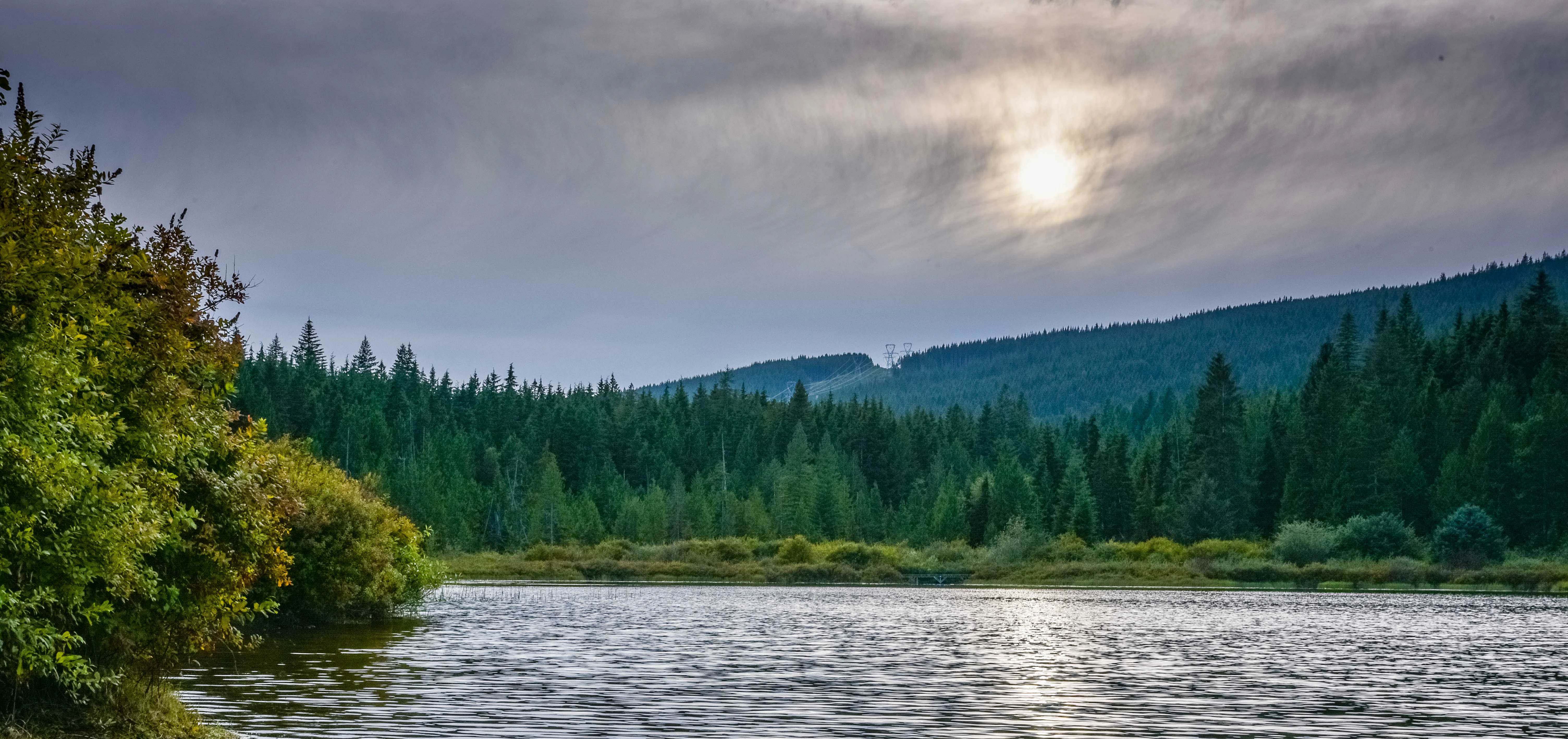
A calm lake surrounded by dense evergreen forest under a cloudy sky with the sun filtering through.
A serene late afternoon view across Rolley Lake in British Columbia.

Rolley Lake Provincial Park history and protected-area timeline

The land that now comprises Rolley Lake Provincial Park has a layered human history stretching back well beyond the establishment of the protected area. Before European-era settlement, the area around Rolley Lake was part of the traditional territory of the Sto:lo people, whose presence along the Fraser River and its tributaries shaped the broader cultural landscape of the Fraser Valley. The lake and its surroundings formed part of the seasonal and resource use patterns of these communities long before the park was formalised.

In 1888, the area was homesteaded by James Rolley and his wife Fanny, giving the lake and, later, the park their name. The Rolley homestead marked the beginning of sustained European-era settlement in the immediate vicinity, and the family's presence became closely associated with the local identity of the Stave Falls area. Following the homestead era, the surrounding forest landscape was shaped by logging operations, which altered species composition and stand structure and produced the second-growth forests that most visitors now encounter.

The park itself was formally established on February 3, 1961 as a BC Parks protected area, with an area of about 115 hectares. Since then, the park has been managed to balance conservation of its lake and forest setting with public recreation, including the development of campsites, a day-use area, and the trail network that links the lake loop and the nearby waterfalls.

Rolley Lake Provincial Park landscape and geographic character

The landscape of Rolley Lake Provincial Park is defined first and foremost by its freshwater lake, which occupies a central position in the protected area and serves as the visual and recreational anchor for visitors. The lake's calm waters reflect the surrounding forest and provide the backdrop for the park's day-use area and beaches. The shoreline is relatively accessible and is mirrored by an easy loop trail that maintains close contact with the water throughout much of its length.

Beyond the lake, the terrain transitions into the typical forested topography of the eastern Fraser Valley. The surrounding forest is largely second growth, a legacy of the area's logging history, and creates an enclosed, intimate atmosphere for visitors. Small creeks drain the surrounding slopes toward the lake, and the forested terrain is broken by the small waterfalls that are reached via a short out-and-back trail from the campground. These cascades add vertical interest and acoustic character to the otherwise gentle topography of the park.

The altitude of the area is relatively low, consistent with the lower Fraser Valley, and the surrounding region carries the imprint of both natural drainage patterns and human-modified land use. The result is a landscape that feels quiet and contained, where the lake, the surrounding forest, and the falls combine into a compact but visually varied outdoor setting.

Rolley Lake Provincial Park ecosystems, habitats, and plant life

The ecological character of Rolley Lake Provincial Park is shaped by its position within the moist, temperate climate zone of southwestern British Columbia. The park falls within the regional Pacific Northwest influence, where mild, wet winters and drier summers support a lush forest understory and high overall productivity. The oceanic climate brings substantial annual precipitation, sustaining the dense vegetation and abundant mosses typical of the area.

Forest cover dominates the terrestrial environment of the park. Second-growth stands, derived from the area's logging history, occupy most of the upland terrain around the lake. These forests include a mix of coniferous and broadleaf species characteristic of the eastern Fraser Valley, and they provide habitat structure for the region's typical assemblages of songbirds, small mammals, and forest-dwelling species. The lakeshore itself forms a distinct ecological zone, transitioning between aquatic open-water habitat, riparian margins, and the upland forest.

The waterfalls and small creek systems within the park contribute additional microhabitats, with cooler, shaded conditions supporting moisture-loving plants, mosses, and amphibians. Together, the lake, the riparian edges, the creek corridors, and the surrounding forest create a layered ecological mosaic whose small scale does not diminish its ecological interest within the broader Stave watershed.

Rolley Lake Provincial Park wildlife and species highlights

Wildlife in and around Rolley Lake Provincial Park reflects the typical species mix of the forested lower Fraser Valley, with strong representation from forest-interior and shoreline-associated species. The combination of mature and second-growth forest, riparian margins, and a freshwater lake supports a varied community of birds, small mammals, and amphibians.

Songbirds and other forest birds are prominent visitors to the park, particularly along the lakeshore loop trail where edge habitat between water, understory, and canopy creates rich foraging opportunities. The lake itself attracts water-associated birdlife, including species that use freshwater margins for feeding and resting during seasonal movements. The quiet, sheltered character of the park, combined with its relative proximity to larger tracts of forest, makes it a useful seasonal refuge within the more heavily populated Fraser Valley landscape.

Rolley Lake Provincial Park conservation status and protection priorities

Rolley Lake Provincial Park plays a meaningful conservation role within the Fraser Valley Regional District, a region otherwise dominated by agriculture, forestry, urban development, and hydroelectric infrastructure centred on the Stave River system. The park protects about 115 hectares of lake, riparian, and forest habitat in a setting where intact natural vegetation is increasingly fragmented.

By safeguarding the shoreline of Rolley Lake, the surrounding second-growth forest, and the creek systems that drain into the lake, the park contributes to maintaining local habitat connectivity, water quality, and the presence of native vegetation in the broader Stave Falls area. Its designation as an IUCN Category II protected area reflects a recognition of its ecological value, while its management by BC Parks balances habitat protection with well-established public recreation use, ensuring that the park continues to serve both conservation and community purposes over the long term.

Rolley Lake Provincial Park cultural meaning and human context

Rolley Lake Provincial Park carries meaningful cultural context that extends beyond its current recreational role. The area was part of the traditional territory of the Sto:lo people, whose longstanding presence along the Fraser River and its watershed landscapes shaped the broader regional identity long before the park was established.

In the late nineteenth century, the park's namesake settlers, James and Fanny Rolley, homesteaded the area in 1888, beginning the European-era land use patterns that would eventually follow into industrial logging. The Rolley name has remained attached to the lake and the park, anchoring local memory of the homestead era. The park today functions not only as a natural area but also as a place where these layered Indigenous, homesteading, and industrial histories remain present in the landscape itself.

Top sights and standout views in Rolley Lake Provincial Park

Rolley Lake Provincial Park's highlights centre on the surprisingly rich experience packed into a small footprint. The Rolley Lake loop trail, a roughly 3-kilometre easy hike that circles the lake, ranks among the park's signature features, offering continuous water views, forest ambience, and accessible shoreline access. The shorter waterfall trail from the campground adds a secondary but memorable destination, providing acoustic and visual variety beyond the lake itself.

Equally important are the park's campground and day-use area, which together support both extended visits and quick recreational stops. The layered cultural and historical background, from Sto:lo traditional presence to Rolley homestead era and subsequent logging history, further enriches the experience, making the park a place where natural setting, recreation, and regional heritage intersect within easy reach of the Fraser Valley population centres.

Best time to visit Rolley Lake Provincial Park

Rolley Lake Provincial Park's oceanic climate strongly shapes the best timing for a visit. Summers, particularly from late June through August, are the most attractive season, when warm temperatures, the lowest rainfall totals of the year, and the longest days combine to make lake activities, the loop trail, and the campground most rewarding. High daily maxima in the low to mid twenties Celsius are typical at this time.

Shoulder seasons can also be appealing for visitors who prefer quieter conditions and lush green forest scenery, though precipitation rises sharply outside of summer. Winters are very wet, with significant rainfall totals and occasional snow, and temperatures generally hover near or just above freezing, making the park far less oriented to casual visits in that season. Visitors seeking the full range of lake and trail experiences will find the warmer half of the year most rewarding.
Monthly climate preview

Long-term temperature ranges and monthly precipitation patterns from representative coordinates

Rolley Lake Provincial Park Climate Normals and Average Temperature Rhythms

Representative coordinate records outline the measured annual temperature progression and monthly precipitation averages across Rolley Lake Provincial Park. Reviewing the complete twelve-month climatology dataset clarifies long-term thermal variations and precipitation shifts.
Annual mean10 °C
2 °C18 °C
Jan
Feb
Mar
Apr
May12°
Jun15°
Jul18°
Aug18°
Sep15°
Oct10°
Nov
Dec
Warmest month
August

17.8 °C

Coolest month
December

1.9 °C

Wettest month
November

7.3 mm/day

Driest month
July

1.2 mm/day

Park location guide

Geography guide, regional context, and park location map for Rolley Lake Provincial Park

Rolley Lake Provincial Park park geography, regions, and map view in Canada

Understand where Rolley Lake Provincial Park sits in Canada through a broader geographic reading of the surrounding landscape, nearby location context, and its mapped position within the national park landscape.

How Rolley Lake Provincial Park fits into Canada

Canada is a federal parliamentary constitutional monarchy spanning North America from the Atlantic to the Pacific and Arctic Oceans. With a population of over 41 million, it is officially bilingual in English and French at the federal level. The country gained independence from the United Kingdom through a gradual process culminating in 1982.

Wider geography shaping Rolley Lake Provincial Park in Canada

Canada occupies the northern portion of North America, sharing its longest international border with the United States. The country extends from the Atlantic Ocean to the Pacific Ocean and northward into the Arctic Ocean, giving it the longest coastline of any nation.

Map view of Rolley Lake Provincial Park

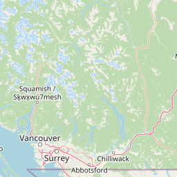
Use this park location map to pinpoint Rolley Lake Provincial Park in Canada, understand its exact geographic position, and read its mapped placement within the surrounding landscape more clearly.

Pigeon | © OpenStreetMap contributors

Location context for Rolley Lake Provincial Park

British ColumbiaFraser Valley Regional District

Visual reference of freshwater lakes, second growth forests, and cascading waterfalls

Rolley Lake Provincial Park Photos, Scenery, and Protected Area Landscapes

Visual records capture the distinctive protected landscape surrounding Rolley Lake Provincial Park, revealing dense second growth forests and calm freshwater shorelines. Photographic documentation provides a clear reference for the terrain, forest habitats, and topography characteristic of the Fraser Valley region.

A calm lake surrounded by dense evergreen forest under a cloudy sky with the sun filtering through.

Park atlas

Compare adjacent forest landscapes and freshwater reserves across the Fraser Valley

Parks Near Rolley Lake Provincial Park and Surrounding Regional Protected Areas

Browse other protected areas near Rolley Lake Provincial Park to examine connected forest ecosystems and regional freshwater habitats. Comparing adjacent park geography expands your understanding of southwestern British Columbia natural reserves.
A watercolor painting showing a soft-focus landscape with rolling green hills, distant mountains, and a central river or water feature.
State or regional parkBritish Columbia
About 8.1 km away#1 closest

North

Golden Ears Provincial Park: Geographic Atlas and Protected Landscape Overview

Coast Mountains terrain and protected wilderness boundaries

Golden Ears Provincial Park is a major protected wilderness in British Columbia, defined by the twin peaks of the Golden Ears massif and vast glacial lake systems like Alouette and Pitt. This site serves as a vital ecological corridor where lowland forests meet high subalpine ridges. Explore the park through its mapped boundaries and diverse ecological zones within the Pacific Northwest mountain landscape.

Area
609 km²
Established
1967
IUCN
II
Visitors
956.5K annual
A watercolor painting showing a soft, hazy landscape of a lake with green forest along the shore and distant purple mountains under a pale sky.
State or regional parkBritish Columbia
About 12 km away#2 closest

Northeast

Davis Lake Provincial Park: Protected Forest and Lake Geography in British Columbia

Regional protected area with old-growth forest and waterfalls

Davis Lake Provincial Park represents a significant protected area in the Fraser Valley, characterized by its undisturbed Western Hemlock forest and the scenic descent of Murdo Creek into McDonald Falls. The park provides an essential look at the regional geography of southwestern British Columbia, balancing dense coniferous canopy with accessible lake-based terrain in a quiet, natural setting.

Area
0.75 km²
Established
1963
IUCN
II
Relief
Upland
A watercolor illustration of a mountain landscape featuring soft rolling hills, evergreen trees, and low-lying vegetation on a white background.
State or regional parkBritish Columbia
About 21 km away#3 closest

Northwest

Pinecone Burke Provincial Park: Coast Mountain Wilderness and Protected Terrain Geography

Mapping a vast ecological corridor in British Columbia

Spanning over 38,000 hectares, Pinecone Burke Provincial Park represents a dramatic transition from the urban proximity of Coquitlam to the remote interiors of the southern Coast Mountains. The landscape is defined by its rugged relief, featuring subalpine meadows, deep freshwater systems, and historically significant forested slopes. This park provides a critical look at the complex topography of the Pacific Northwest, serving as a sanctuary for wildlife and a foundational piece of regional conservation.

Area
380 km²
Established
1995
IUCN
II
Relief
Mountain
State or regional parkBritish Columbia
About 31 km away#4 closest

East

Kilby Provincial Park: Protected Riverfront Geography and Historic Sites in BC

A unique riparian landscape along the Harrison River

Kilby Provincial Park offers an intimate look at the flood plain geography of the Harrison River. The site features an elevated, boardwalk-linked heritage environment integrated with sandy riverfronts and seasonal wildlife corridors. This protected area stands out for its combination of historical pioneer preservation and river-based ecosystem monitoring within the Upper Fraser Valley region of British Columbia.

Area
0.03 km²
Established
1973
IUCN
II
Relief
Lowland
A horizontal watercolor painting depicting a soft-toned landscape with green trees, rolling hills, a calm body of water, and distant pale mountains.
State or regional parkBritish Columbia
About 38 km away#5 closest

Southwest

Peace Arch Park: Mapped Geography and Protected Landscapes of the Canada and US Border

Coastal binational protected area in British Columbia

Peace Arch Park is a notable protected landscape positioned directly on the international border. This site acts as a continuous green space between Canada and the United States, offering an unusual study of territorial boundaries and coastal geography. Spanning manicured terrain and historic monument grounds, the park provides an essential vantage point for understanding land-based connectivity in the Pacific Northwest region.

Area
0.17 km²
Established
1939
Visitors
500K annual
Access
Easy access
A watercolor painting showing a panoramic view of mountain peaks in the distance above green foothills and plains.
Protected landscapeWashington
About 42 km away#6 closest

Southeast

Mount Baker, Snoqualmie National Forest: Mapped Geography and Protected Landscape Analysis

Exploratory atlas of Washington's primary Cascade Range wilderness

Delve into the structural geography of Mount Baker, Snoqualmie National Forest. This protected area corridor serves as a major ecological transition zone between the Puget Sound lowlands and the interior Cascades, characterized by extensive glaciers, wild river systems, and iconic stratovolcanoes that define the regional landscape of Washington state.

Area
6,978 km²
Established
1974
Relief
Mountain
Climate
Alpine
State or regional parkBritish Columbia
About 44 km away#7 closest

East

Ferry Island Provincial Park: Geography, Riparian Terrain, and Protected River Boundaries

A study of Fraser River alluvial landscapes and provincial park land use

Ferry Island Provincial Park provides a rare protected island setting along the Fraser River in British Columbia. Spanning 29 hectares near the Agassiz-Rosedale Bridge, this Class C park represents an important alluvial riparian ecosystem within the heavily cultivated Fraser Valley, offering key insights into regional river-corridor geography and protected land management.

Area
0.29 km²
Established
1963
IUCN
II
Access
Access unknown
A horizontal watercolor painting showing a range of purple-tinted mountain peaks above a green forest and a light pinkish shoreline.
Wildlife reserveWashington
About 54 km away#8 closest

Southeast

Mount Baker Wilderness: Mapped Volcanic Peaks and Glacial Geography in Washington State

Protected wilderness boundaries in the Northern Cascades

Mount Baker Wilderness encompasses a vast mountain landscape characterized by an active stratovolcano and significant permanent snowfields. The terrain features a vertical gradient from dense west side conifer forests to exposed alpine summits, creating a distinct ecological corridor connected to neighboring protected areas in the Pacific Northwest.

Area
485.58 km²
Established
1984
IUCN
Ib
Relief
Mountain

Common questions about visiting, size, designation, and location context for Rolley Lake Provincial Park

Rolley Lake Provincial Park FAQs for park facts, access, geography, and protected area context

Find quick answers about Rolley Lake Provincial Park, including protected-area facts, park geography, trail and visitor context, and how the park fits into its surrounding country and regional landscape.
MoriAtlas Explorer

Continue Your Protected Areas Search Across the Global Atlas

Deepen your exploration by continuing the structured search for national parks and protected areas worldwide. Utilize the comprehensive filtering capabilities to compare different conservation landscapes and refine your understanding of global park geography. Discover more about the distribution and characteristics of protected natural areas.

Global natural geography