
Mori Atlas logo
Protected landscapeRoss Lake National Recreation Area

A vital protected landscape corridor tracing the Skagit River through the North Cascades

Ross Lake National Recreation Area: Mapping the Glacial Valleys and Alpine Terrain of Washington

Ross Lake National Recreation Area forms a dramatic, glacially carved corridor in north central Washington that serves as the central gateway to the North Cascades. The area features a series of distinctive reservoirs, including Ross Lake and Diablo Lake, set within deep mountain valleys and bordered by the steep, rugged slopes of the Cascade Range. This protected landscape provides a unique vertical gradient where water, dense conifer forests, and jagged alpine summits converge within the greater North Cascades complex.

national recreation areaNorth CascadesSkagit Riverreservoir lakesglacial landscapeAmerican Alps
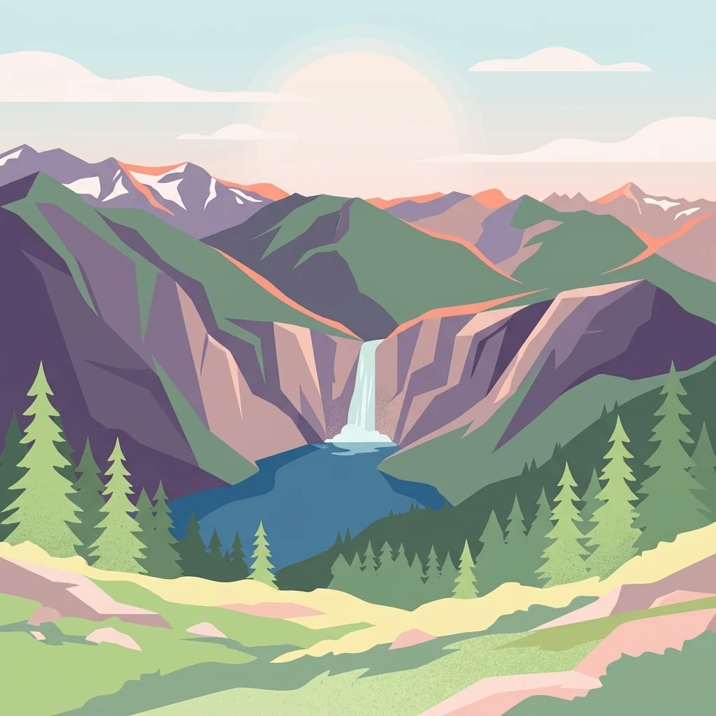
A stylized digital illustration of a mountain range with snowy peaks, a central waterfall flowing into a blue lake, and a foreground of coniferous trees and grassy hills at sunrise.

Ross Lake National Recreation Area

Protected landscape

Park overview

Structured park overview, official facts, and landscape profile for Ross Lake National Recreation Area

Ross Lake National Recreation Area park facts, protected area profile, and essential visitor context

Review the core facts for Ross Lake National Recreation Area, including designation, size, terrain, visitor scale, habitats, and operating context in one park-focused overview.

About Ross Lake National Recreation Area

Ross Lake National Recreation Area is a long, corridor-shaped protected landscape in the heart of the North Cascades, stretching from the Canada-US border southward along the Skagit River into the rugged interior of Washington State. Although it has a different designation than a national park, the recreation area plays a central role in the larger North Cascades National Park Service Complex, providing the main road, trail, and water routes that connect visitors to the surrounding wilderness.

The recreation area's identity is shaped by water and mountains working together. Three reservoirs, Ross Lake, Diablo Lake, and Gorge Lake, line up along the Skagit River and together form the Skagit River Hydroelectric Project, one of the most important sources of clean hydropower for the Seattle metropolitan area. These lakes fill glacially carved valleys, producing the steep-walled scenery, long forested shorelines, and the brilliant jade and turquoise colors that make Diablo Lake one of the most photographed reservoirs in the Pacific Northwest.

Ross Lake National Recreation Area acts as a hinge within the North Cascades complex. The recreation area literally bisects North Cascades National Park, separating its northern unit near Hozomeen Mountain from its southern unit, which contains peaks such as Glacier Peak, and ties together adjacent protected landscapes such as the Pasayten Wilderness to the east and Skagit Valley Provincial Park just across the Canadian border. This geographic position gives the recreation area an unusually varied character: deep wilderness along the northern reaches of Ross Lake, lake-and-road landscapes along Diablo and Gorge Lakes, and forested river valleys near the western edge near Newhalem.

For visitors, the recreation area functions as the most practical gateway into one of the most rugged and ecologically rich mountain regions in the lower 48 states. Washington State Route 20, the North Cascades Highway, travels across the recreation area, and along its length visitors find visitor centers, campgrounds, trailheads, and boat launches. From those trailheads, hikers can reach hundreds of miles of wilderness routes, while paddlers can explore remote stretches of Ross Lake by canoe or kayak, often camping at boat-in sites along the lakeshore.

Quick facts and research context for Ross Lake National Recreation Area

Ross Lake National Recreation Area spans parts of Whatcom and Skagit Counties in north central Washington and was established on October 2, 1968. It is administered by the National Park Service as part of the larger North Cascades National Park Service Complex, which also includes North Cascades National Park and Lake Chelan National Recreation Area.

The recreation area encompasses roughly 117,575 acres and is centered on a chain of three hydroelectric reservoirs along the Skagit River: Ross Lake, Diablo Lake, and Gorge Lake. Washington State Route 20, the North Cascades Highway, crosses the area and provides the principal motor access for visitors. No entrance fee is charged to enter the recreation area, the adjoining national park, or Lake Chelan National Recreation Area.

Protection and recognition

Examine documented terrestrial protection records and international recognition data for Ross Lake National Recreation Area

Ross Lake National Recreation Area Protection Status and Conservation Scope

Ross Lake National Recreation Area maintains a documented terrestrial protection scope within its primary conservation boundary. Structured records outline available designation details and international recognition status for the protected landscape.

Protection details

Protection scope
Terrestrial
Transboundary protection
No
Park context

Deeper park guide and search-rich context for Ross Lake National Recreation Area

Ross Lake National Recreation Area history, landscape, wildlife, and travel context

Explore Ross Lake National Recreation Area through its history, landscape character, ecosystems, wildlife, conservation priorities, cultural context, and seasonal travel timing in a structured park guide built for atlas discovery and search intent.

Why Ross Lake National Recreation Area stands out

Ross Lake National Recreation Area is best known for its long, narrow reservoirs tucked deep into the glacially carved valleys of the North Cascades, often described as part of the American Alps. Diablo Lake in particular is famous for its strikingly turquoise water, a vivid color produced by glacial sediment known as rock flour suspended in the lake. The area is also recognized as the principal recreational corridor of the North Cascades National Park Service Complex, offering the most accessible entry points for visitors who want to experience one of the wildest mountain landscapes in the contiguous United States. Hiking, canoeing and kayaking on Ross Lake, climbing routes in the surrounding peaks, and the historic Desolation Peak Lookout, where writer Jack Kerouac spent the summer of 1956, are among the defining features associated with the recreation area.
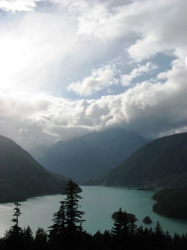
A high-angle view looking over the turquoise water of Diablo Lake, surrounded by dark forested mountains under a cloudy sky.
A scenic view of the turquoise waters of Diablo Lake in Ross Lake National Recreation Area.

Ross Lake National Recreation Area history and protected-area timeline

Ross Lake National Recreation Area was formally established on October 2, 1968, as part of a broader legislative effort to protect the exceptional scenery and recreation opportunities of the North Cascades in north central Washington. The recreation area was designated alongside what would become North Cascades National Park, and the two together were intended to preserve both a high-level wilderness experience and a more accessible corridor for outdoor activity.

The reservoirs that now define much of the recreation area have a separate but closely linked history. Ross Lake, Diablo Lake, and Gorge Lake were developed by Seattle City Light along the Skagit River to generate hydroelectric power, a project that began in the early twentieth century and expanded through the middle decades of the century. The creation of these long, narrow lakes reshaped the Skagit River corridor and produced the dramatic lake scenery that the recreation area is known for today.

The recreation area also holds a place in American literary culture due to the Desolation Peak Lookout, an isolated fire-observation structure perched above Ross Lake. The lookout is best known as the place where writer Jack Kerouac spent the summer of 1956 working for the US Forest Service. Kerouac's time at the lookout became the setting and inspiration for parts of his novel Desolation Angels, drawing later visitors to hike the trail up to the lookout and experience the same sweeping vistas of the surrounding North Cascade peaks.

Ross Lake National Recreation Area landscape and geographic character

The landscape of Ross Lake National Recreation Area is the landscape of the North Cascades in microcosm, combining glacial valleys, steep forested mountainsides, and a chain of reservoir lakes along the Skagit River. The Cascade Range in this region has been deeply carved by past glaciers, leaving a terrain of sharp ridges, hanging valleys, and dramatic vertical relief that has earned the area the nickname the American Alps.

Ross Lake itself is the largest and most elongated of the three reservoirs, stretching roughly from the international boundary southward in a narrow, fjord-like body of water set between forested slopes and rocky peaks. To its south, Diablo Lake fills another deeply carved section of the Skagit River drainage and is widely recognized for its vivid turquoise color, and finally Gorge Lake occupies the steepest, narrowest section of the original river gorge. Together, these lakes create a continuous water corridor through the mountains.

Outside the reservoirs, the terrain rises quickly into mountains such as Hozomeen Mountain near the Canadian border and Desolation Peak above Ross Lake, while lower elevations near Newhalem and along Highway 20 support dense conifer forests, river flats, and smaller tributary valleys. The varied topography gives the recreation area a strong vertical gradient in a relatively compact corridor, allowing visitors to move between lakeshore, forest, and alpine terrain in a single trip.

Ross Lake National Recreation Area ecosystems, habitats, and plant life

Ross Lake National Recreation Area sits within one of the most ecologically diverse temperate mountain regions in North America. The Skagit River corridor runs through a transition zone where marine moisture from the Pacific meets the rising land of the Cascades, producing a climate that supports an unusually wide range of plant communities for a single drainage.

Low and middle elevations along the reservoirs and the Skagit River are dominated by dense conifer forests of Douglas fir, western red cedar, and western hemlock, often layered with bigleaf maple, alder, and a rich understory of shrubs and ferns. As elevation rises, these forests give way to subalpine stands of mountain hemlock, subalpine fir, and scattered meadows, and eventually to true alpine zones near the crests of the surrounding peaks. The mix of wet coastal forest types and drier east-side influences gives the area's vegetation a complex, mosaic character.

The recreation area's long shoreline and remote inlets also support distinct aquatic and riparian habitats. The cold, clear waters of the reservoirs sustain native fish populations, while side streams and wetlands along the Skagit River corridor contribute to the broader ecological network of the North Cascades, which is internationally recognized for its concentration of native plant and animal species within a relatively small geographic area.

Ross Lake National Recreation Area wildlife and species highlights

Wildlife in Ross Lake National Recreation Area reflects the broader richness of the North Cascades ecosystem, where marine, temperate forest, and alpine environments meet in close proximity. The lakes, rivers, and old-growth forests of the recreation area provide habitat for a wide variety of mammals, birds, and fish.

Large mammals such as black bear, mule deer, elk, and mountain goats are present in the surrounding mountains, and the area is also part of the range of the gray wolf and other wide-ranging predators that move through the larger North Cascades landscape. The dense forests near the reservoirs shelter smaller mammals such as marmots, pikas in higher rocky terrain, and various squirrels and chipmunks, while the rivers and lakes support beaver and otter in suitable habitats.

Birdlife is particularly varied, owing to the recreation area's location along both freshwater and forested mountain corridors. Resident species include bald eagles and ospreys hunting along the lakes, while the surrounding forests host northern spotted owls, pileated woodpeckers, and a wide suite of passerines. The reservoirs are also stocked and managed for fishing, and the cold, well-oxygenated waters of the Skagit system support native salmon and trout, making the recreation area a significant destination for anglers as well as wildlife observers.

Ross Lake National Recreation Area conservation status and protection priorities

Ross Lake National Recreation Area is protected for its combination of scenic, recreational, and ecological values within the larger North Cascades landscape. By joining North Cascades National Park and Lake Chelan National Recreation Area, the recreation area helps create a continuous complex of federal protection that conserves the wilderness character of the Skagit River corridor and the surrounding peaks.

From a conservation perspective, the recreation area is significant for the habitat connectivity it provides. Its forests link low-elevation river valley ecosystems with high-elevation alpine terrain, and its position adjacent to the Pasayten Wilderness and Skagit Valley Provincial Park in Canada creates a transboundary corridor that supports wide-ranging wildlife. The native fish populations of the Skagit River, including salmon and trout, are an important conservation focus for both the National Park Service and regional partners.

The recreation area's hydropower reservoirs also play a dual role in regional environmental management. While the dams altered the original Skagit River, they are operated as a relatively clean source of energy for the Seattle area, and ongoing management seeks to balance hydropower production with ecological flows, fish passage, and protection of the surrounding shoreline habitats. Free public access, with no entrance fee, reinforces the recreation area's role as a publicly accessible conservation landscape rather than a strictly reserved wilderness block.

Ross Lake National Recreation Area cultural meaning and human context

The cultural context of Ross Lake National Recreation Area is closely tied to the human history of the Skagit River valley and the broader North Cascades. Before the construction of the hydroelectric project, the Skagit corridor was home to Indigenous communities with deep connections to the river's salmon resources and the surrounding forests, and the region continues to hold significance for tribes with traditional ties to the area.

In the twentieth century, the Skagit valley became an important corridor for resource extraction, road building, and eventually tourism. The construction of the dams and the later completion of the North Cascades Highway opened the region to broader public use and shaped the modern identity of the recreation area as an outdoor recreation destination. The literary legacy of Jack Kerouac's 1956 summer at the Desolation Peak Lookout has added a distinct cultural layer, turning the lookout into a pilgrimage site for readers interested in the Beat generation and the experience of solitude in the North Cascades.

Gateway communities such as Newhalem, Marblemount, and nearby Sedro-Woolley continue to serve as important points of contact between the recreation area and its visitors, with visitor centers, historic company towns associated with Seattle City Light, and local outfitters all contributing to the cultural landscape surrounding the lakes and highways of Ross Lake National Recreation Area.

Top sights and standout views in Ross Lake National Recreation Area

Ross Lake National Recreation Area stands out for three connected qualities: the long, glacially carved reservoirs of the Skagit River, the rugged alpine scenery of the American Alps, and the role of the area as the main scenic and recreational corridor through the North Cascades National Park Service Complex. Diablo Lake's vivid turquoise water, the remote reaches of Ross Lake paddled by canoe and kayak, and the views from the historic Desolation Peak Lookout rank among the area's most memorable experiences.

Equally important are the recreation area's trail systems and campgrounds, which provide the most accessible entry points into some of the wildest terrain in the contiguous United States. The North Cascades Highway, the Silver Skagit Road, and the boat-in sites along the lakes together allow visitors to choose between a short scenic drive, a backcountry paddle, or a multi-day wilderness hike, all within a single corridor-shaped protected landscape.

Best time to visit Ross Lake National Recreation Area

Ross Lake National Recreation Area is best experienced from late spring through early fall, when snow has melted from most roads and trails and the reservoirs and surrounding forests are fully accessible. Summer brings the warmest conditions, the longest days, and the best opportunities for canoeing and kayaking on Ross Lake, hiking to high viewpoints such as Desolation Peak, and fishing the reservoirs. Wildlife viewing is also active during this period, with bald eagles, ospreys, and a wide range of forest and alpine species most easily observed.

Shoulder seasons in late spring and early fall offer quieter conditions and vivid scenery, including wildflower displays in meadows during early summer and early autumn color in the larch and other deciduous conifers at higher elevations. Winter brings heavy snow to most of the higher terrain and can close portions of the North Cascades Highway, restricting access primarily to lower-elevation viewpoints; visitors interested in winter scenery should be prepared for variable road conditions and limited services.

Monthly climate preview

Long-term monthly temperature ranges and precipitation patterns recorded at representative park elevations

Ross Lake National Recreation Area Climate Normals, Temperature, and Precipitation

Temperature and precipitation data from NASA POWER record multi-year averages across twelve distinct monthly intervals for Ross Lake National Recreation Area. Analyzing the complete climate profile provides detailed insight into long-term meteorological normals and seasonal fluctuations.
Annual mean3 °C
-5 °C13 °C
Jan-5°
Feb-5°
Mar-3°
Apr
May
Jun10°
Jul13°
Aug13°
Sep10°
Oct
Nov-2°
Dec-5°
Warmest month
August

13.2 °C

Coolest month
December

-5.4 °C

Wettest month
November

9 mm/day

Driest month
July

1.4 mm/day

Park location guide

Geography guide, regional context, and park location map for Ross Lake National Recreation Area

Ross Lake National Recreation Area park geography, regions, and map view in United States of America

Understand where Ross Lake National Recreation Area sits in United States of America through a broader geographic reading of the surrounding landscape, nearby location context, and its mapped position within the national park landscape.

How Ross Lake National Recreation Area fits into United States of America

The United States of America is a federal presidential republic and one of the world's largest countries by area and population. It consists of 50 states across a vast territory spanning multiple time zones, with its capital in Washington, D.C. and largest city in New York City. The nation has a diverse economy, influential political system, and significant cultural and military presence globally.

Wider geography shaping Ross Lake National Recreation Area in United States of America

The United States occupies a vast territory in North America, bordered by Canada to the north and Mexico to the south. The 48 contiguous states stretch from the Atlantic to the Pacific Ocean, while Alaska occupies the northwestern region and Hawaii is an archipelago in the Pacific. The country encompasses diverse terrain including the Rocky Mountains, Appalachian Mountains, Great Plains, and extensive river systems.

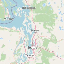
Map view of Ross Lake National Recreation Area

Use this park location map to pinpoint Ross Lake National Recreation Area in United States of America, understand its exact geographic position, and read its mapped placement within the surrounding landscape more clearly.

Pigeon | © OpenStreetMap contributors

Location context for Ross Lake National Recreation Area

Washington
Recorded earthquake history

Examine Recorded Earthquake History Near Ross Lake National Recreation Area

Browse the documented seismic history associated with this region to observe long-term patterns in recorded epicentre activity. The MoriAtlas catalogue provides structured access to historical magnitude and proximity data for every recorded event surrounding the recreation area.

Ross Lake National Recreation Area Earthquakes

Catalogued events

28 events

Strongest magnitude

Magnitude 4.1

Most recent event

Apr 28, 2023

This history includes earthquakes recorded inside the park or within 50 km of its borders

Visual reference of glacial reservoirs, steep mountain terrain, and forest habitats

Ross Lake National Recreation Area Photos: Mapped Landscape and Scenery

Visual documentation captures the dramatic topography, fjord-like reservoir waters, and dense conifer forests defining the protected landscape. Detailed photography reveals the rugged character of the mountain terrain and the distinct natural environments shaping the region.

A high-angle view looking over the turquoise water of Diablo Lake, surrounded by dark forested mountains under a cloudy sky.

A wide, elevated mountain landscape view looking down onto the deep blue waters of Ross Lake, flanked by forested ridges and distant snow-capped peaks under a clear sky.

Park atlas

Compare adjacent mountain reserves and connected wilderness areas across the northern Cascades.

Parks Near Ross Lake National Recreation Area and Surrounding Protected Landscapes

Browsing other protected areas near Ross Lake National Recreation Area reveals broader regional topography, connecting glacial river valleys and rugged alpine terrain. Continuing through surrounding parks expands geographic comparison, highlighting related conservation landscapes across the mountain corridor.
A horizontal watercolor painting depicting a soft-focus mountain landscape with rolling green meadows, patches of coniferous forest, and distant pale mountains under a white sky.
State or regional parkBritish Columbia
Park boundaries overlap#1 closest

Northeast

E. C. Manning Provincial Park: A Comprehensive Geographic Atlas and Protected Area Overview

Mountainous terrain and ecological transitions in southern British Columbia

Spanning the cross section of the Canadian Cascades, E. C. Manning Provincial Park preserves a high-elevation landscape of wildflowers, glacial valleys, and mountain ridges. The protected area links temperate coastal rainforests with the arid interior, providing a study in regional hydrology and subalpine ecology defined by the Hozameen Range and the northern reaches of the Pacific Crest Trail.

Area
836.71 km²
Established
1941
IUCN
II
Visitors
1.1M annual
A watercolor painting showing a panoramic view of mountain peaks in the distance above green foothills and plains.
Protected landscapeWashington
Park boundaries overlap#2 closest

South

Mount Baker, Snoqualmie National Forest: Mapped Geography and Protected Landscape Analysis

Exploratory atlas of Washington's primary Cascade Range wilderness

Delve into the structural geography of Mount Baker, Snoqualmie National Forest. This protected area corridor serves as a major ecological transition zone between the Puget Sound lowlands and the interior Cascades, characterized by extensive glaciers, wild river systems, and iconic stratovolcanoes that define the regional landscape of Washington state.

Area
6,978 km²
Established
1974
Relief
Mountain
Climate
Alpine
National parkWashington
Park boundaries overlap#3 closest

Northwest

North Cascades National Park: US National Park Protected Landscape and Geographic Context

Explore mapped boundaries and regional Washington geography.

Gain insight into North Cascades National Park, a vital US National Park located in Washington. This entry focuses on its protected land status, mapped geographic extent, and its role within the regional atlas. Users seeking to understand the park's landscape character, natural terrain, and its specific location in Washington will find this an essential point for detailed park geography exploration and protected area discovery.

Area
2,042.26 km²
Established
1968
IUCN
II
Visitors
16.5K annual
A watercolor painting of a mountain landscape with soft-colored rolling hills, a green forest line, and foreground vegetation on a white background.
Protected landscapeWashington
Park boundaries overlap#4 closest

East

Okanogan, Wenatchee National Forest: A Comprehensive Look at Washington's Protected Mountain Landscapes

Mapping ecological gradients and wilderness boundaries across the eastern Cascade Range

Spanning from the moist coniferous forests of the western Cascades to the arid plateaus of the Okanogan, this massive national forest protects an unmatched diversity of terrain. Explore the intricate geography of river-carved valleys, glacial cirques, and remote wilderness areas that characterize this critical environmental corridor in the Pacific Northwest.

Area
6,066.33 km²
Established
1911
Visitors
397K annual
Relief
Mountain
A soft watercolor illustration depicting a range of layered mountain peaks with green slopes and snow-covered summits against a white background.
Wildlife reserveWashington
12 km away#5 closest

South

Glacier Peak Wilderness: Mapping the Volcanic and Glaciated Geography of Washington State

A detailed look at one of the most remote volcanic reserves in the Cascade Range.

Defined by the presence of an isolated stratovolcano and extensive glacial systems, Glacier Peak Wilderness represents a significant protected area within the Washington Cascades. This overview details the rugged landscape, from the deeply incised river valleys of the Chiwawa and Suiattle to the high-alpine rock and ice environment at the peak summit, providing essential geographic context for this roadless wilderness.

Area
2,290.75 km²
Established
1960
IUCN
Ib
Relief
Mountain
A horizontal watercolor painting showing a range of purple-tinted mountain peaks above a green forest and a light pinkish shoreline.
Wildlife reserveWashington
25 km away#6 closest

West

Mount Baker Wilderness: Mapped Volcanic Peaks and Glacial Geography in Washington State

Protected wilderness boundaries in the Northern Cascades

Mount Baker Wilderness encompasses a vast mountain landscape characterized by an active stratovolcano and significant permanent snowfields. The terrain features a vertical gradient from dense west side conifer forests to exposed alpine summits, creating a distinct ecological corridor connected to neighboring protected areas in the Pacific Northwest.

Area
485.58 km²
Established
1984
IUCN
Ib
Relief
Mountain
A pale, minimalist watercolor painting depicting a calm lake surrounded by low, rolling mountains and forest under a soft pastel sky.
Protected landscapeChelan County
28 km away#7 closest

Southeast

Lake Chelan National Recreation Area: Protected Geography and North Cascades Map

Glacial terrain and remote mountain valleys in Chelan County

Lake Chelan National Recreation Area protects a rare transition of alpine environments and river-carved valleys in north-central Washington. The terrain is dominated by the long, deep waters of the lake and the steep ridges of the North Cascades, creating an isolated habitat for wild landscapes and historic inland communities. Explore the physical boundaries and topographic features that define this rugged recreation area.

Area
250.74 km²
Established
1968
IUCN
V
Visitors
38.2K annual
A watercolor painting showing a range of mountains in the background with soft pink, green, and yellow hues, with forest vegetation in the midground and foreground on a white background.
Protected landscapeWashington
29 km away#8 closest

West

Mount Baker National Recreation Area: An Atlas of Washington's Volcanic Terrain

Exploration of a remote, roadless Cascade protected landscape

The Mount Baker National Recreation Area provides a unique geographic window into the volcanic heart of the Pacific Northwest. Characterized by its glacier-clad massif and network of subalpine trails, the area serves as a vital protected habitat for elk, mountain goats, and diverse conifer forests. This record details the park's topography, ranging from deep glacial valleys to high-elevation ridges that overlook the broader North Cascades region.

Area
34.29 km²
Established
1984
Relief
Mountain
Climate
Alpine

Common questions about visiting, size, designation, and location context for Ross Lake National Recreation Area

Ross Lake National Recreation Area FAQs for park facts, access, geography, and protected area context

Find quick answers about Ross Lake National Recreation Area, including protected-area facts, park geography, trail and visitor context, and how the park fits into its surrounding country and regional landscape.
MoriAtlas Explorer

Continue Your Protected Areas Search Across the Global Atlas

Deepen your exploration by continuing the structured search for national parks and protected areas worldwide. Utilize the comprehensive filtering capabilities to compare different conservation landscapes and refine your understanding of global park geography. Discover more about the distribution and characteristics of protected natural areas.

Global natural geography