
Mori Atlas logo
Nature reserveRotes Moor

A detailed look at peatland restoration, high plateau geography, and protected wetland ecosystems

Rotes Moor Nature Reserve: Mapping the Highland Bog Landscapes and Basalt Terrain of the Rhön in Hesse

(Naturschutzgebiet Rotes Moor)

Rotes Moor represents a critical protected landscape situated on the high plateau of the Hessian Rhön between the Wasserkuppe and the Heidelstein. As the largest raised bog in Hesse, this nature reserve provides a unique vantage point for observing long term peatland regeneration, Carpathian birch woodlands, and the distinct basalt geography of the region. The area serves as a primary hub within the Rhön Biosphere Reserve and the Natura 2000 network.

raised bogpeat boghighland moorwetlandNatura 2000biosphere reserve
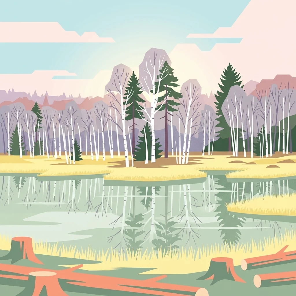
An illustration of a marshy bog area featuring birch and evergreen trees reflected in calm water, with tree stumps in the foreground.

Rotes Moor

Nature reserve

Park overview

Structured park overview, official facts, and landscape profile for Rotes Moor

Rotes Moor park facts, protected area profile, and essential visitor context

Review the core facts for Rotes Moor, including designation, size, terrain, visitor scale, habitats, and operating context in one park-focused overview.

About Rotes Moor

Rotes Moor occupies a bowl-shaped depression on the high plateau of the Hohe Rhön, near the border between Hesse and Bavaria. It is a classic raised bog, the kind of wet, acidic peatland that forms when cool, rainy climate and water-retaining sediments allow Sphagnum mosses to accumulate peat faster than it decomposes. The moor sits at about 800 to 830 metres above sea level, surrounded by basalt hills that include the Heidelstein, the Ottilienstein, the Mathesberg, the Kesselstein, the Mostberg, and the Feldberg.

The larger protected landscape, the Naturschutzgebiet Rotes Moor, covers approximately 315 hectares and stretches nearly 3.5 kilometres from north to south. Although today it looks like a single piece of wilderness, it actually consists of two separated bog bodies: the Großes Rotes Moor to the northwest and the Kleines Rotes Moor to the southeast, divided by a stream called the Moorwasser. Because of the long history of peat cutting, only a small core surface still behaves as a true raised bog. The surrounding area functions as a transitional landscape of bog woodland, wet grassland, boggy hollows, and a man-made reservoir.

A notable feature of the site is its location on a major European watershed. Water flowing from the southern part of the moor eventually reaches the Fränkische Saale and the Rhine, while water from the western and northern flanks flows to the Fulda, the Werra, and ultimately the Weser. This hydrological crossroads gives the moor added importance as both a water source and a natural reference point on the Rhön plateau.

Quick facts and research context for Rotes Moor

Rotes Moor is a highland raised bog in the Hessian Rhön, located roughly five kilometres southeast of the Wasserkuppe, the highest peak of the Rhön mountains. The protected area was designated in 1979 and lies within the Rhön Biosphere Reserve and the Natura 2000 network.

Protection and recognition

Documented management scope and formal protected area recognition data for Rotes Moor

Rotes Moor Protection Status and Designated Terrestrial Conservation Records

Rotes Moor maintains a documented terrestrial protection status within official conservation frameworks. Official records aggregate available management details and formal designation metrics without external assumptions.

Protection details

Protection scope
Terrestrial
Transboundary protection
No
Park context

Deeper park guide and search-rich context for Rotes Moor

Rotes Moor history, landscape, wildlife, and travel context

Explore Rotes Moor through its history, landscape character, ecosystems, wildlife, conservation priorities, cultural context, and seasonal travel timing in a structured park guide built for atlas discovery and search intent.

Why Rotes Moor stands out

Rotes Moor is best known as one of the most important remaining raised bogs in central Germany and as a textbook example of long-term peatland restoration in a heavily disturbed highland setting. Its defining trait is the unusual contrast within a single landscape: a small surviving core of living peat moss bog sits beside an artificially dammed lake, an actively regenerating cutover area, and a fringe of rare Carpathian birch woodland. The bog is also recognised as a significant site for birdlife in the upland Rhön, especially for wet meadow specialists such as snipe, lapwing, and curlew, as well as for raptors like the red kite that hunt over the open mire. Together with the neighbouring Schwarzen Moor, it forms the most important cluster of raised bogs in the entire Rhön range.
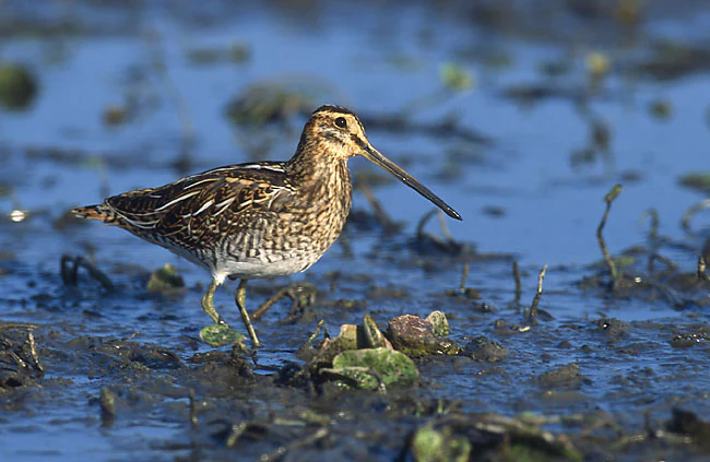
A common snipe, a small brown and white speckled bird with a long straight bill, stands in shallow muddy water.
A common snipe stands in the shallow marshy waters of the Rotes Moor nature reserve.

Rotes Moor history and protected-area timeline

The history of Rotes Moor is shaped by centuries of human pressure on what was once regarded as useless wasteland. The first settlement of the high Rhön plateau dates from around 744 AD, after the founding of Fulda Abbey. As colonists cleared forests for charcoal, potash, and glassmaking, and grazed their animals in the open highlands, the landscape was transformed. The moor itself, however, was mostly avoided, because in the early modern period it was considered dangerous, mysterious, and unproductive land.

The first written account of the bog comes from the local chronicler Franz Anton Jäger, who in 1803 described the rising mist and mysterious lights of the moor surface. Real exploitation of the moor began in the Kleines Rotes Moor in 1799, with trial digging that soon lapsed. Serious peat cutting began in 1809 and continued, with interruptions, until 1984. During the second half of the 19th century, peat was sold in large quantities as fuel and, from 1837 onwards, also as therapeutic mud for spas such as Bad Bocklet, Bad Brückenau, Bad Kissingen, Bad Neustadt, and ultimately Bad Homburg vor der Höhe. From 1886 onward, a Rhön peat works drained the Großes Rotes Moor with a regular grid of ditches, after which the high bog surface began to collapse into heath and birch forest.

In 1960, industrial peat cutting accelerated with the use of excavators and narrow-gauge railways. By the time the state of Hesse formally designated the area as a nature reserve in 1979, the bog had lost most of its high bog surface. Peat mining finally ended in 1984. Restorative work began almost immediately, with the construction of dams, the blocking of old drainage ditches, the removal of encroaching spruce forest, and the clearing of shrubs to reopen the bog horizon. By the early 2020s, the rewetting of the Leegmoor section had allowed the formation of a new floating mire of Sphagnum mosses, sedges, and cottongrass, marking what conservation officials describe as the near completion of the long restoration effort.

Two small villages once stood in the immediate vicinity of the moor. The settlement of Rotenmohr, also called Mohrdorf, was founded around 1545 by the lords of Gersfeld and grew to 36 houses before it was destroyed in 1634 by Croatian troops during the Thirty Years' War and never rebuilt. The Hasenhof nearby met a similar fate. Both sites are now archaeological traces in the forest, with information boards marking the location of the old village well.

Rotes Moor landscape and geographic character

The landscape of Rotes Moor is shaped by the geology of the Rhön, a region built from Tertiary sediments capped with weathered basalt lava flows from volcanoes active roughly 25 to 18 million years ago. After the last ice age, depressions left by periglacial processes collected water above clay-rich layers, allowing the slow accumulation of peat that shaped the present-day bog.

The protected area lies on a gently undulating saddle of the Hohe Rhön, between the Wasserkuppe and the Heidelstein. Bog surfaces alternate with wet meadows, boggy hollows, and Carpathian birch forest, while the surrounding ridge of basalt hills forms a clear horizon. The highest point of the moor area lies near 835 metres above sea level, and the lowest streams edge approach 720 metres, giving the landscape a vertical range of more than 100 metres within a small radius.

A small reservoir, the Moorweiher, sits in the south where the Moorwasser stream was dammed in 1973. Beyond the bog itself, the visitor sees a tapestry of spruce plantations planted around 1900, mixed forest, and grassy highland pastures typical of the Rhön plateau. The combination of wide open bog, dark forests, and rounded basalt summits gives Rotes Moor its distinctive highland atmosphere.
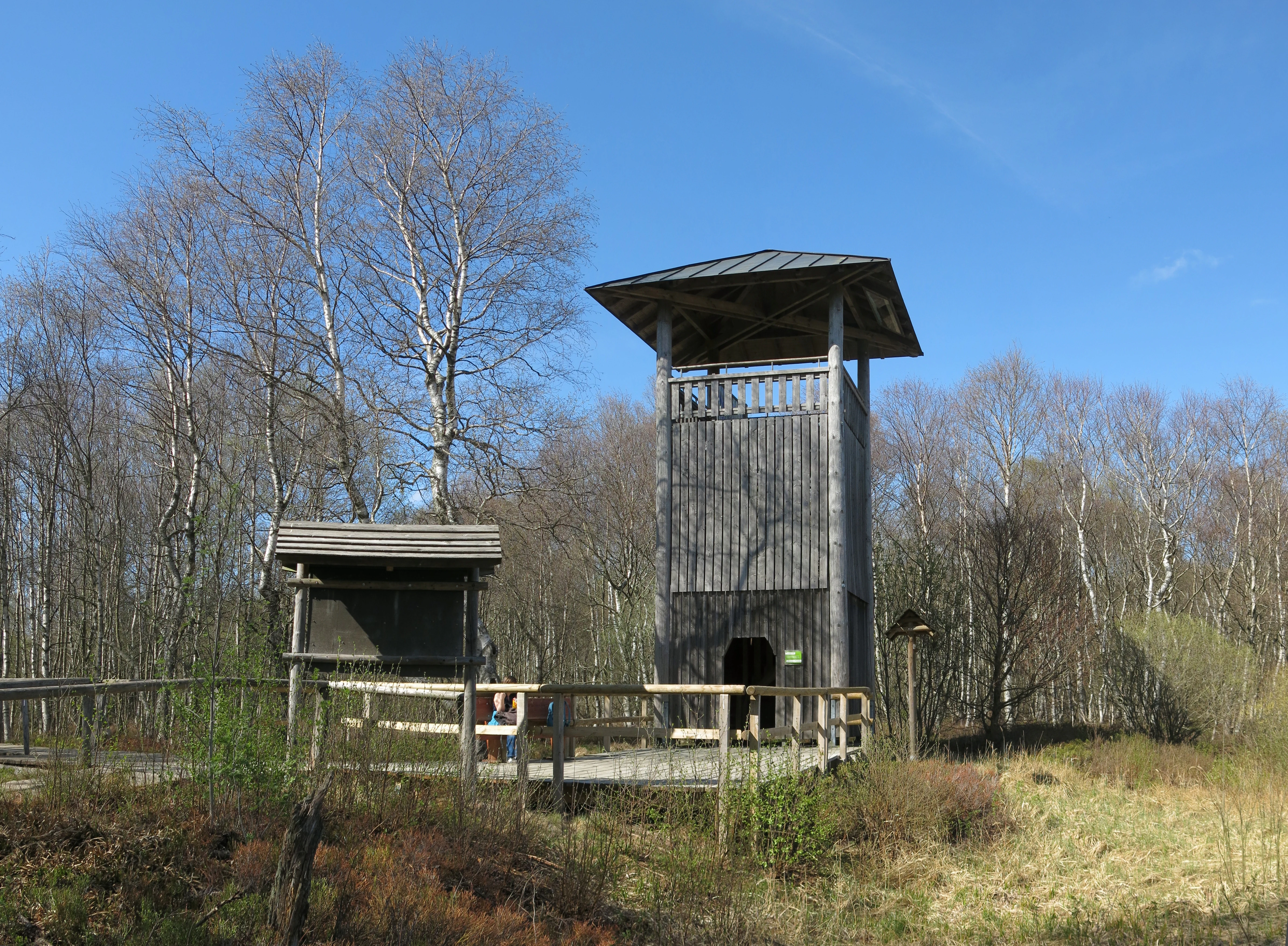
A wooden observation tower stands in a moorland area, surrounded by bare trees under a clear blue sky, with a wooden boardwalk and signage in the foreground.
The wooden observation tower at Rotes Moor.

Rotes Moor ecosystems, habitats, and plant life

Rotes Moor is a layered ecological system in which a true raised bog core is surrounded by concentric zones of bog margin, transitional mire, wet grassland, and boggy woodland. The bog core is built of peat mosses, including the reddish Sphagnum magellanicum that gives the moor part of its character and its name, and the greenish Sphagnum cuspidatum that fills wet hollows. Within this acidic, nutrient-poor centre, scattered starved pines still stand, alongside the carnivorous round-leaved sundews and butterworts, the rare bog rosemary, bell heather, and grey heather.

The wet bog margin transitions into sedge mires, with cottongrass, grey sedge, and various small sedges, and into damp meadows that bloom with marsh marigolds and globeflowers. A distinctive fringe of knotted Carpathian birches marks the upper slope, while willow scrub, scattered pines, and dwarf shrubs such as crowberry, cranberry, and bog blueberry occupy the higher, drier parts of the margin.

The renaturation work has gradually added new habitats. The dammed reservoir attracts ducks and dragonflies, while the rewetted cutover area is recovering toward reed beds, wet peat moss mats, and floating mire surfaces. Together, the different zones support a striking concentration of habitat types within a relatively small area.
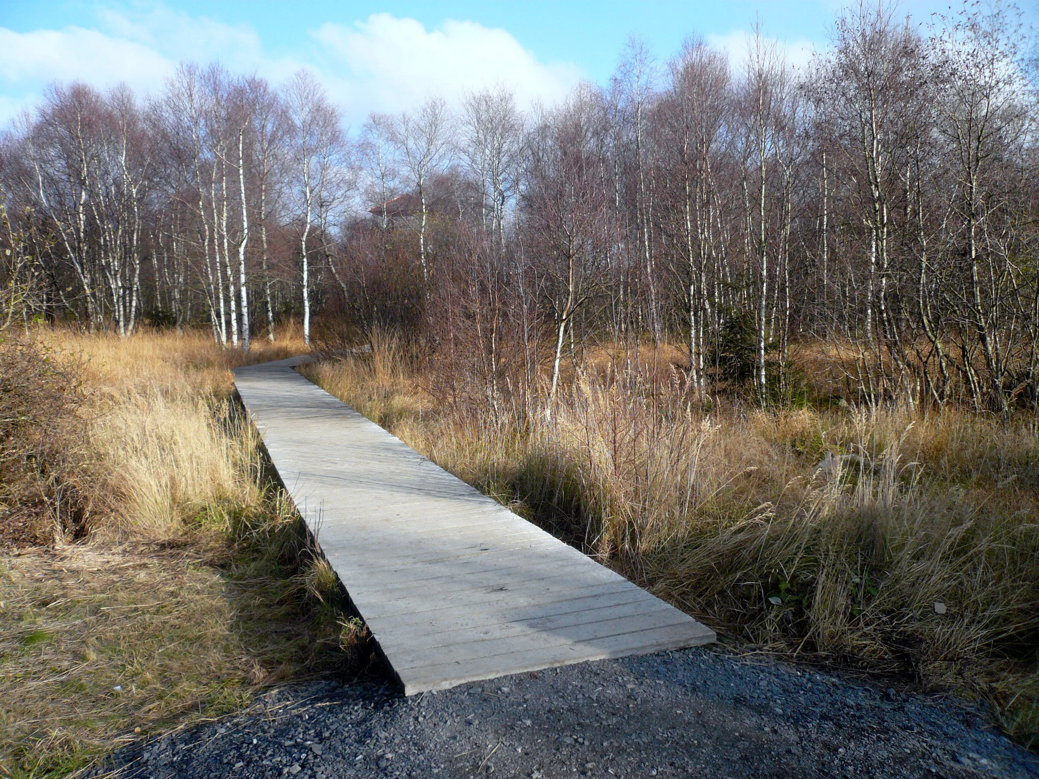
A wooden boardwalk path winds through a marshy landscape with sparse, leafless birch trees and golden-brown grasses under a partly cloudy sky.
A wooden boardwalk path leading through the peatland landscape at Rotes Moor.

Rotes Moor wildlife and species highlights

The wildlife profile of Rotes Moor is shaped by the combination of open bog, wet meadow, boggy woodland, and open water. The protected area hosts around 122 bird species, roughly half of them songbirds. Raptors are particularly visible above the open expanses, including red kites, common buzzards, Eurasian hobbies, and hen harriers during migration. Snipe, jack snipe, and woodcock find rich feeding in the soft ground; lapwings favour the short-cropped damp meadows; and curlews occasionally pass through during migration.

Around 36 mammal species have been recorded, including pine marten, polecat, stoat, weasel, red fox, stone marten, badger, raccoon, roe deer, wild boar, and the rare Eurasian water shrew. Six bat species use the area and overwinter in a former clay mine tunnel in the Mathesberg. The dammed lake supports breeding mallards and teal, and the visitor platform offers good viewing for waterfowl and twilight-hunting bats.

Invertebrate diversity is also notable. About 31 butterfly species have been recorded, including several rare bog specialists such as the large heath, the violet fritillary complex, and the high bog fritillary. The bog hosts roughly 27 dragonfly species, including the northern emerald, the bog hawker, and the small boghaunter, while 137 leafhopper species and around 100 true bug species round out a rich insect fauna.
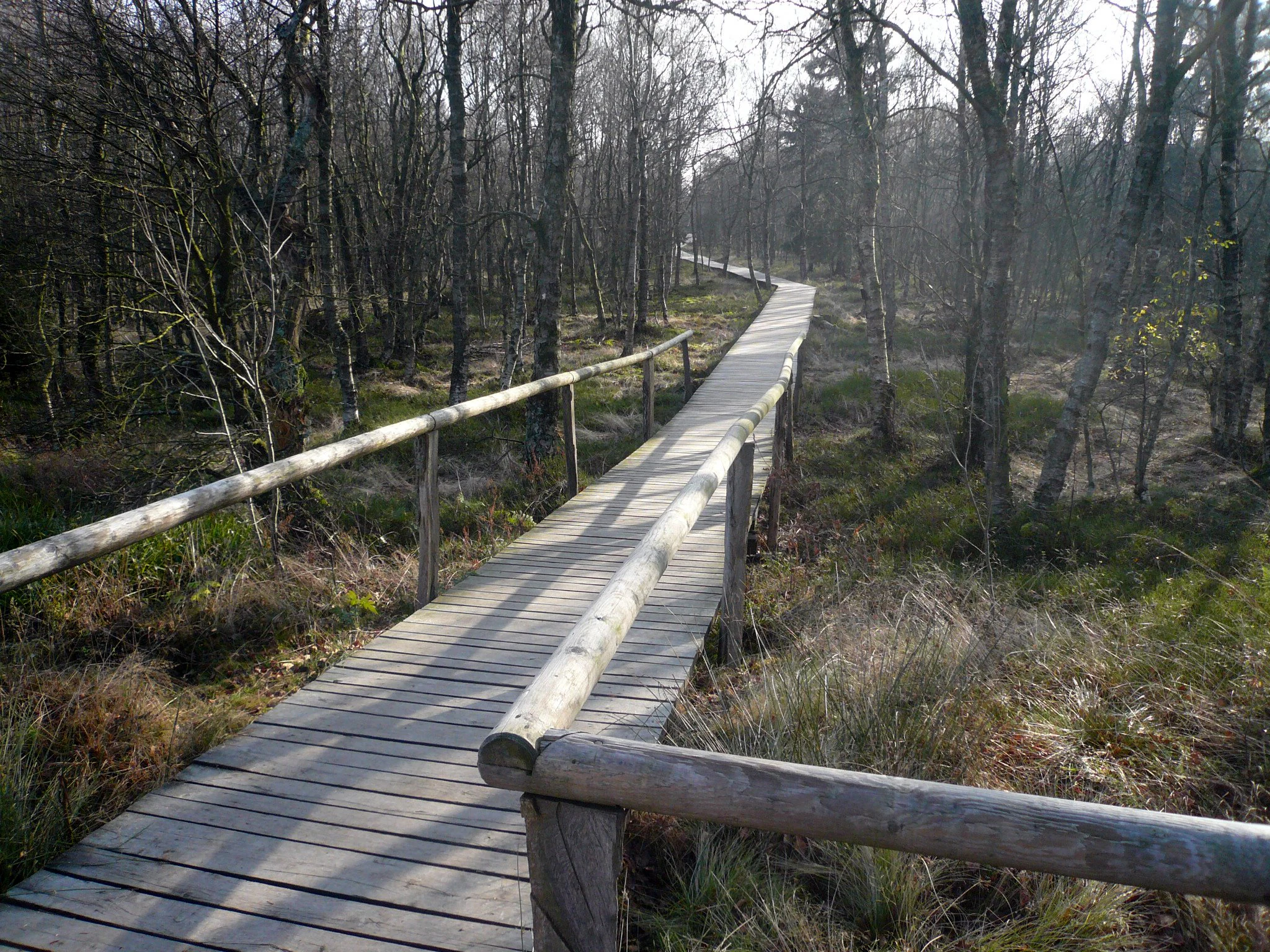
A wooden boardwalk with railings extends into a sparse forest of thin trees in a marshy environment.
A wooden boardwalk path winds through the bog landscape at Rotes Moor.

Rotes Moor conservation status and protection priorities

Rotes Moor is one of the oldest and largest nature reserves in the German state of Hesse, designated in 1979, and it sits within the Rhön Biosphere Reserve and the European Natura 2000 network. The conservation importance of the site rests on its role as one of the last surviving raised bogs in the central German uplands, a habitat type that has been almost entirely destroyed elsewhere in Europe.

Active restoration has been the central feature of conservation work here. After the cessation of peat cutting in 1984, managers systematically blocked the old drainage ditches with sheet piling, removed encroaching spruce plantations, cleared invasive shrubs, and built small dams to raise water levels. By 2024, the rewetting of the Leegmoor had allowed floating peat moss mats to develop, a development considered a milestone in the recovery of the bog.

Conservation significance also extends to the broader landscape. The Carpathian birch woodlands around the upper margin are protected for their rarity in central Europe, while the boggy meadows, the reservoir, and the surrounding upland forest together form an important refuge for species that depend on a mosaic of wet and dry habitats. Rotes Moor is widely cited as a model for the long, patient work of restoring a damaged highland peatland.

Rotes Moor cultural meaning and human context

The cultural identity of Rotes Moor is deeply tied to its long-standing reputation as a place of fear, mystery, and folklore. For centuries, local people considered the bogs of the Rhön to be sinister places, and several legends grew up around the moorland. One story tells of a community that was swallowed by the rising waters of the bog after robbing and drowning a group of nuns. Another describes how the devil himself diverted underground streams into the Rhön highlands, creating the bogs when his plan to flood the valleys failed.

The cultural history of the area is also shaped by the abandoned villages of Mohrdorf and Hasenhof. Founded in the 16th century by the lords of Fulda to counter the expansion of Würzburg, both settlements were destroyed in the Thirty Years' War, after which their inhabitants fled to the warmer lowlands and never returned. Today, only foundations, a restored village well, and a forest meadow mark the former settlement sites.

In a more positive vein, the clean air, the rural quiet, and the dark skies of the Rhön plateau have for decades made the moor a place of nature study, school outings, and gentle ecotourism, with guided walks offered several times a week and a wheelchair-accessible boardwalk leading across the bog.
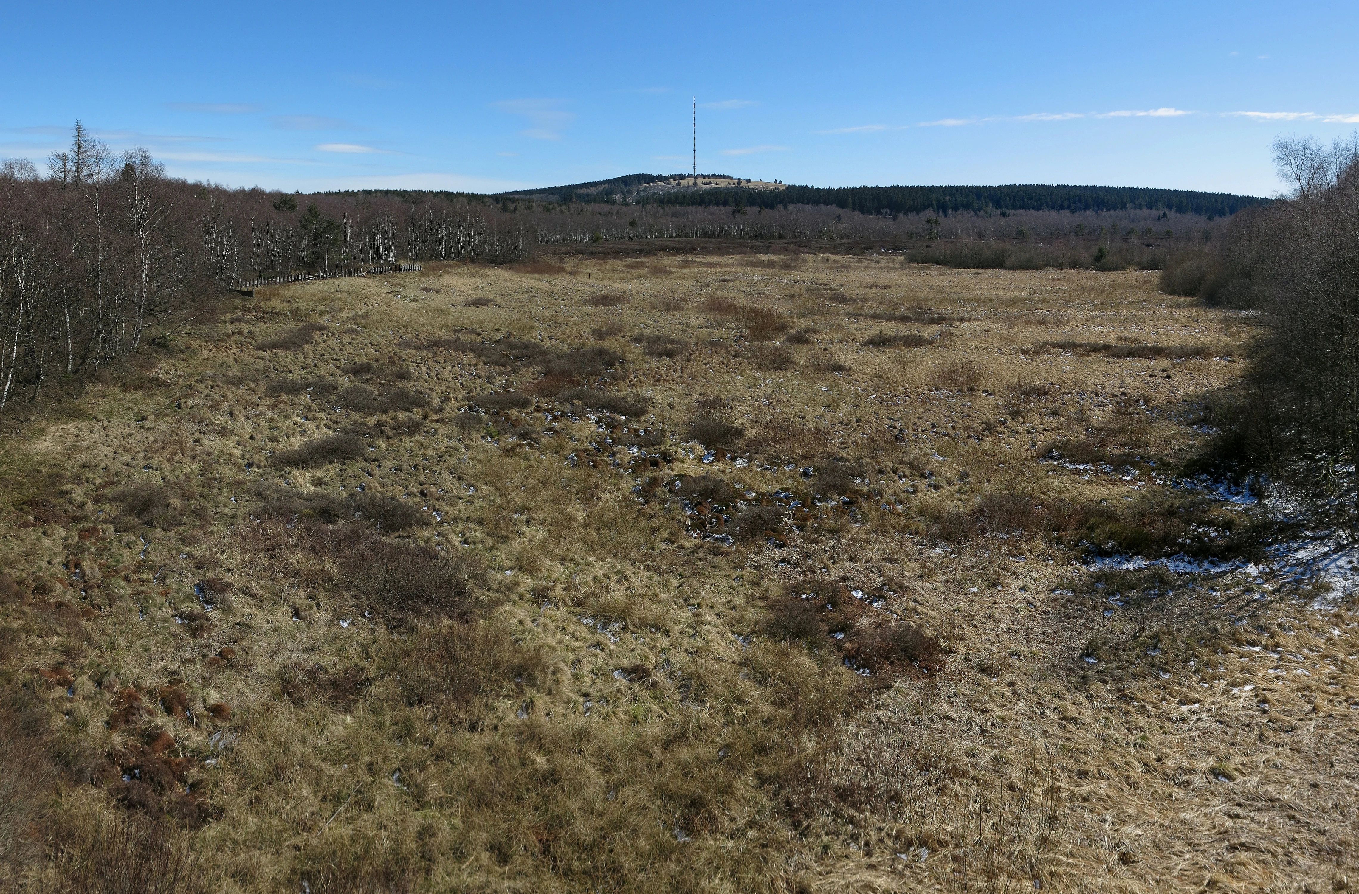
A high-angle view looking over a sprawling, yellowish-brown moorland landscape in early spring, flanked by dark forests, with a distant hill topped by a transmission tower under a clear blue sky.
A wide view of the Rotes Moor high bog seen from the observation tower, with the Heidelstein summit visible in the distance.

Top sights and standout views in Rotes Moor

The most striking highlights of Rotes Moor include the surviving high bog with its red Sphagnum mosses, the dammed Moorweiher lake, the rare Carpathian birch woodland along the bog margin, and the easy-to-walk boardwalk that makes a sensitive landscape accessible to all visitors. The observation tower near the north end of the boardwalk offers an excellent vantage point for reading the landscape, from the bare cutover area to the protected high bog core beyond the barrier.

Equally distinctive is the long human story of the site, from centuries of peat mining for fuel and spa mud to the modern rewetting program that has allowed floating peat moss mats to reform. Standing at the heart of the Rhön Biosphere Reserve and the European Natura 2000 network, Rotes Moor combines the qualities of an active restoration project, a refuge for highland bog specialists, and a layered cultural landscape with legends, abandoned villages, and prehistoric pollen archives preserved in its peat.
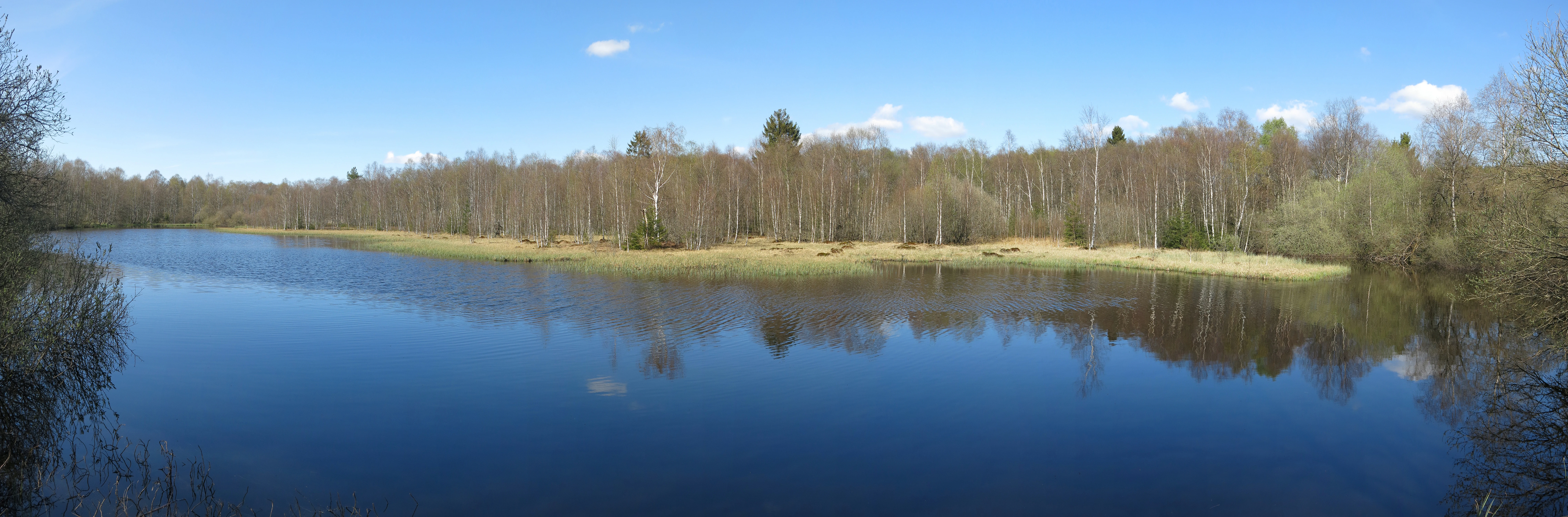
A panoramic photograph showing a calm, dark-water pond surrounded by a sparse forest of thin trees and grasses under a clear blue sky.
A wide view of the pond situated within the Rotes Moor nature reserve.

Best time to visit Rotes Moor

The most comfortable period for visiting Rotes Moor is late spring through early autumn, when the highland paths are free of snow and the rich flora of cottongrass, marsh marigold, and heather is at its seasonal peak. In May, the bright yellow of marsh marigolds lights up the wet meadows; by summer, dragonflies and damselflies swarm over the reservoir and the wet moss hollows. Bird activity is highest in spring and early summer, when ground-nesting species such as snipe and lapwing are displaying.

The Rhön plateau is cold and windy even in midsummer, with possible frost at any time of year on the open sections of the boardwalk. Snow can cover the moor for up to 110 days in winter, so out-of-season visits require warm clothing and care on icy paths. For most visitors, the long days of June, July, and August combine the best weather, the most active wildlife observation, and the richest display of flowering plants in the surrounding meadows.

Monthly climate preview

Track measured temperature and precipitation rhythms across the coordinate point

Rotes Moor Climate Normals and Average Temperature Profiles

Representative coordinates record long-term temperature swings from sub-zero winter minimums to warm summer maximums alongside consistent daily precipitation. Opening the complete monthly dataset reveals full weather variations across every period of the year.
Annual mean8 °C
-2 °C18 °C
Jan-2°
Feb-1°
Mar
Apr
May12°
Jun16°
Jul18°
Aug18°
Sep13°
Oct
Nov
Dec-1°
Warmest month
July

18 °C

Coolest month
January

-1.6 °C

Wettest month
July

2.6 mm/day

Driest month
April

1.5 mm/day

Park location guide

Geography guide, regional context, and park location map for Rotes Moor

Rotes Moor park geography, regions, and map view in Germany

Understand where Rotes Moor sits in Germany through a broader geographic reading of the surrounding landscape, nearby location context, and its mapped position within the national park landscape.

How Rotes Moor fits into Germany

Germany is a federal republic in Western and Central Europe with a population of over 83 million across sixteen constituent states. It is Europe's largest economy by nominal GDP and a major global exporter and importer. The capital is Berlin, and the country borders Denmark, Poland, Czech Republic, Austria, Switzerland, France, Luxembourg, Belgium, and the Netherlands.

Wider geography shaping Rotes Moor in Germany

Germany is located in Western and Central Europe, spanning 357,022 km². It borders Denmark to the north, Poland and the Czech Republic to the east, Austria and Switzerland to the south, and France, Luxembourg, Belgium, and the Netherlands to the west. The country has coastlines on the Baltic Sea and North Sea to the north, with the Alps located in the southern region.

Map view of Rotes Moor

Use this park location map to pinpoint Rotes Moor in Germany, understand its exact geographic position, and read its mapped placement within the surrounding landscape more clearly.

Pigeon | © OpenStreetMap contributors

Location context for Rotes Moor

Hesse

Visual reference for raised bogs, peatland restoration zones, and basalt ridge habitats

Rotes Moor Photos, Landscapes, and Protected Upland Scenery

Visual documentation captures the varied terrain, sphagnum moss communities, and Carpathian birch woodlands defining the protected highland environment. Photographic records reveal the ecological contrast between restored peat bogs and surrounding basalt hills across the plateau.

A common snipe, a small brown and white speckled bird with a long straight bill, stands in shallow muddy water.

A red kite flying with wings spread wide against a clear blue sky, showing its reddish-brown plumage and distinct forked tail.

A wooden observation tower stands in a moorland area, surrounded by bare trees under a clear blue sky, with a wooden boardwalk and signage in the foreground.

A wooden boardwalk path winds through a marshy landscape with sparse, leafless birch trees and golden-brown grasses under a partly cloudy sky.

A wooden boardwalk with railings extends into a sparse forest of thin trees in a marshy environment.

A modern wooden visitor center building with solar panels on its slanted roof, surrounded by trees and a grassy foreground.

A high-angle view looking over a sprawling, yellowish-brown moorland landscape in early spring, flanked by dark forests, with a distant hill topped by a transmission tower under a clear blue sky.

A panoramic photograph showing a calm, dark-water pond surrounded by a sparse forest of thin trees and grasses under a clear blue sky.

A thick forest scene dominated by birch trees with white bark and lush green undergrowth on the forest floor.

A scientific diagram labeled Waldentwicklung im Roten Moor/Hochrhön showing pollen analysis data over time; vertical bars display the presence of various tree species such as birch, hazel, pine, and beech relative to depth in meters and historical time periods.

A calm, dark-water pond in a moorland setting, reflecting a line of leafless birch trees and a clear blue sky.

A wooden boardwalk path winds through a boggy forest with bare trees in early spring.

A dense stand of slender birch trees with white, papery bark in a moorland forest setting.

A landscape view of a clearing in Rotes Moor showing fallen trees, logs piled in the foreground, and standing forest in the distance under a blue sky.

A wooden boardwalk path winds through a sparse birch forest, leading to a tall wooden observation tower in the distance.

Bright yellow marsh marigold flowers and large green leaves partially covered by patches of fresh snow, situated near dark standing water.

Park atlas

Compare adjacent highland moors, biosphere reserves, and protected landscapes across the Rhön mountains.

Exploring Other Parks Near Rotes Moor and Protected Areas in the Surrounding Region

Browsing other parks near Rotes Moor reveals connected upland habitats, protected wetlands, and regional conservation areas across the surrounding highland terrain. Expanding the search helps travelers examine similar peatlands, basalt ridges, and biosphere reserves in neighboring mountain terrain.
Watercolor painting of a sweeping, green highland landscape with rolling hills in the background and a winding stream flowing through meadow and moorland.
Nature reserveThüringen
About 2.1 km away#1 closest

Southeast

Lange Rhön Nature Reserve: A Detailed Map and Geographic Overview of the Basalt Plateau

Highland meadow and bog landscape in Thüringen

Lange Rhön serves as the central basalt spine of the Rhön highlands, featuring a long, narrow plateau characterized by gentle slopes and wide-reaching views. This protected nature reserve encompasses significant raised bog systems and extensive grassland habitats, providing essential insights into the volcanic geology and upland biodiversity of the central German region.

Relief
Mountain
Climate
Temperate
Access
Moderate access
Scope
Terrestrial
Nature reserveLandkreis Fulda
About 2.1 km away#2 closest

East

Kesselrain Nature Reserve: Protected Woodland Geography in the Rhön Region of Hesse

Mapping a historic nature reserve in Landkreis Fulda

Kesselrain represents a key conservation site within the Rhön mountains, offering a look at structurally complex forest habitats and north-facing slopes with alpine-influenced vegetation. Spanning over thirty hectares, this nature reserve in Landkreis Fulda serves as a prime example of protected woodland geography and diverse mountain terrain within the German state of Hesse.

Area
0.316 km²
Established
1940
Protected landscapeHesse
About 5.9 km away#3 closest

Northwest

Naturpark Hessische Rhön: Geographic Profile and Protected Landscape Mapping

Mapping the Rhön low mountains and upland ecosystems in Hesse

Naturpark Hessische Rhön encompasses approximately 720 square kilometers of varied terrain north and west of Fulda. The area features a distinct mosaic of forests, streams, and protected biotope complexes. This overview provides insight into the regional geography and the conservation structure defining this prominent upland protected landscape.

Area
720 km²
Established
1962
Relief
Upland
Scope
Terrestrial
A watercolor illustration of a rolling natural landscape with soft green trees, light purple hills in the distance, and a pale stream or meadow in the foreground.
Nature reserveHessen
About 11 km away#4 closest

North

Langenstüttig und Basaltblockmeer am Buchschirmküppel bei Batten: Protected Nature Reserve Atlas

Volcanic geology and diverse forest ecosystems in the Hessen Rhön highlands

Langenstüttig und Basaltblockmeer am Buchschirmküppel bei Batten is a significant nature reserve in the Rhön highlands of Hessen. The area is defined by its extensive basalt blockfields, locally known as Basaltblockmeer, and a mosaic of montane forests including beech, ash, and alder woodlands. This protected zone offers a clear look at how geological history and forest succession shape the natural terrain of this upland region.

Area
0.975 km²
Established
2013
IUCN
IV
Nature reserveHessen
About 12 km away#5 closest

North

Naturschutzgebiet Westlicher Rhönwald: Protected Forest and Volcanic Geology in Hessen

Core biosphere zone and montane beech woodland reserve

Spanning 44 hectares of the Hessian Rhön, Naturschutzgebiet Westlicher Rhönwald functions as a strictly protected zone dedicated to natural forest succession. The reserve is characterized by a volcanic basalt cap over a shell limestone foundation, creating cool and moist soil conditions ideal for a diverse beech-rich canopy. It remains a focal point for understanding montane woodland development in the central European uplands.

Area
0.444 km²
Established
1997
IUCN
IV
Relief
Mountain
Nature reserveThuringia
About 18 km away#6 closest

North

Werra bis Treffurt mit Zuflüssen: Protected River and Floodplain Network in Thuringia

Mapping an extensive 191 kilometer Natura 2000 river corridor.

The Werra bis Treffurt mit Zuflüssen protected area serves as a vital ecological corridor in Thuringia. This site encompasses a complex mosaic of fast-flowing highland brooks, expansive floodplain meadows, inland salt sites, and rare dissolution lakes. Its geography bridges high-altitude source regions with lower river valleys, creating a distinctive landscape transect that supports essential freshwater habitats and rare aquatic species across the state.

Area
22.6 km²
Established
2008
IUCN
IV
Relief
Mixed relief
A horizontal watercolor illustration depicting rolling green hills, patches of forest, and fallen trees in the foreground on a plain white background.
Nature reserveHessen
About 24 km away#7 closest

North

Naturschutzgebiet Breiter Berg bei Haselstein: Hessen Nature Reserve and Forest Atlas

Protected basalt terrain and forest mosaic in the Rhön

This nature reserve protects a vital cluster of beech woodland, moist gallery forests, and meadows in the Nüsttal municipality. The area is defined by its rounded hills, basalt-keuper soil substrates, and status as a protected Natura 2000 site within the broader Rhön biosphere conservation landscape.

Area
1.822 km²
Established
1997
IUCN
IV
Nature reserveThuringia
About 27 km away#8 closest

Northeast

Ibengarten Nature Reserve: Protected Yew Forest Landscape in the Thuringian Rhön

A historic protected area preserving rare ancient yew stands in central Germany.

Ibengarten encompasses a 56-hectare reserve in Thuringia, recognized for its dense concentration of wild European yew trees. This unique woodland environment, set against the basalt ridges of the Rhön, provides an essential look at historical conservation efforts and old-growth forest dynamics in the German low mountains.

Area
0.561 km²
Established
1938
IUCN
IV

Common questions about visiting, size, designation, and location context for Rotes Moor

Rotes Moor FAQs for park facts, access, geography, and protected area context

Find quick answers about Rotes Moor, including protected-area facts, park geography, trail and visitor context, and how the park fits into its surrounding country and regional landscape.
MoriAtlas Explorer

Continue Your Protected Areas Search Across the Global Atlas

Deepen your exploration by continuing the structured search for national parks and protected areas worldwide. Utilize the comprehensive filtering capabilities to compare different conservation landscapes and refine your understanding of global park geography. Discover more about the distribution and characteristics of protected natural areas.

Global natural geography