
Mori Atlas logo
Protected landscapeSam Houston National Forest

Explore the unique Piney Woods geography, pine-covered ridges, and creek-lined bottomlands of this Texas forest

Sam Houston National Forest: A Comprehensive Look at this Texas Protected Landscape

Sam Houston National Forest represents a significant protected area within the Piney Woods region of East Texas, encompassing pine ridges and hardwood bottomlands shaped by historic ecological processes. This geographic profile examines the forest terrain, including the Little Lake Creek Wilderness and Big Creek Scenic Area, while highlighting the intersection of ridge-and-bottomland topography with adjacent reservoirs like Lake Conroe and Lake Livingston. The data provides a structural overview of the landscape distribution and the diverse forest habitats that define this expansive Texas natural area.

Piney Woodsnational foresteast Texashiking trailswilderness areascenic area
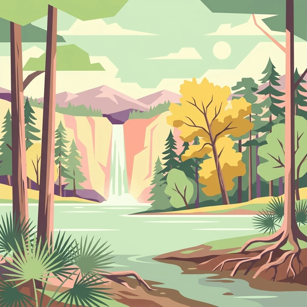
A graphic illustration featuring a lake in the foreground, surrounded by pine and deciduous trees, with a waterfall cascading from a cliff in the background under a pale sun.

Sam Houston National Forest

Protected landscape

Park overview

Structured park overview, official facts, and landscape profile for Sam Houston National Forest

Sam Houston National Forest park facts, protected area profile, and essential visitor context

Review the core facts for Sam Houston National Forest, including designation, size, terrain, visitor scale, habitats, and operating context in one park-focused overview.

About Sam Houston National Forest

Sam Houston National Forest occupies a substantial block of the east Texas Piney Woods, stretching across portions of Montgomery, San Jacinto, and Walker counties roughly 50 miles north of Houston. The forest was formally established in 1936 on lands that, decades earlier, had been cut over by private loggers and damaged by fire. From its earliest days under U.S. Forest Service management, the emphasis has been on fire protection, replanting cutover land, and improving tree density in young stands, which together rebuilt a forest that today supports a mix of loblolly pine, shortleaf pine, longleaf pine, and a rich diversity of bottomland hardwoods along the west and east forks of the San Jacinto River.

The forest is at its core a multi-use landscape. In addition to recreation, it is managed for timber, grazing, fish and wildlife, water, and minerals under a balanced framework reinforced by the Multiple Use-Sustained Yield Act of 1960. Recreation is a defining feature: the 128-mile Lone Star Hiking Trail passes through the heart of the forest, and the Little Lake Creek Wilderness and Big Creek Scenic Area protect some of its most ecologically distinctive interior. Three developed recreation areas, Cagle, Double Lake, and Stubblefield, anchor camping and day-use activity, and the forest's edges are tied to two large reservoirs, Lake Conroe to the southwest and Lake Livingston to the northeast.

Wildlife and habitat management are central to the forest's identity. The entire forest is a designated wildlife management area in cooperation with Texas Parks and Wildlife Department, and the red-cockaded woodpecker, a federally protected species, is a particular focus of habitat management across pine stands. Bald eagles winter along Lake Conroe, white-tailed deer are the most pursued game animal, and habitat for feral hogs, eastern gray squirrels, wild turkey, quail, and a wide variety of reptiles, amphibians, and fish is interwoven with the forest's creeks and reservoirs. Together, these layers of ecological, recreational, and historical significance make Sam Houston National Forest a defining east Texas landscape and one of the state's most visited federal forests.

Quick facts and research context for Sam Houston National Forest

Sam Houston National Forest is a U.S. Forest Service-administered national forest in east Texas, established on October 13, 1936, and managed jointly with the state's other national forests from offices in Lufkin. It spans about 163,000 acres across three counties and is bordered by two large reservoirs, Lake Conroe and Lake Livingston, that anchor much of its recreation profile. The forest is a designated wildlife management area, is bisected by the west and east forks of the San Jacinto River, and contains both the Little Lake Creek Wilderness and the Big Creek Scenic Area as protected interior landscapes.

Protection and recognition

Documented terrestrial protection scope, establishment year, and management context.

Sam Houston National Forest Protection Status and Designation History

Sam Houston National Forest maintains a documented terrestrial protection status established in 1936. Public records track its official designation history and management scope without additional international recognition sources.

Protection details

Protection scope
Terrestrial
Designated year
1936
Transboundary protection
No
Park context

Deeper park guide and search-rich context for Sam Houston National Forest

Sam Houston National Forest history, landscape, wildlife, and travel context

Explore Sam Houston National Forest through its history, landscape character, ecosystems, wildlife, conservation priorities, cultural context, and seasonal travel timing in a structured park guide built for atlas discovery and search intent.

Why Sam Houston National Forest stands out

Sam Houston National Forest is best known for being one of the largest remaining stretches of the Piney Woods ecosystem in Texas, with extensive pine and hardwood forests shaped by fire, logging history, and decades of restoration. It is widely recognized for the 128-mile Lone Star Hiking Trail, the Little Lake Creek Wilderness, and Big Creek Scenic Area, which together showcase the forest's ridges, creeks, and mature bottomland hardwoods. Its proximity to Houston and its lakeside recreation also make it one of the most heavily used national forests in Texas for camping, boating, and wildlife-oriented activities.
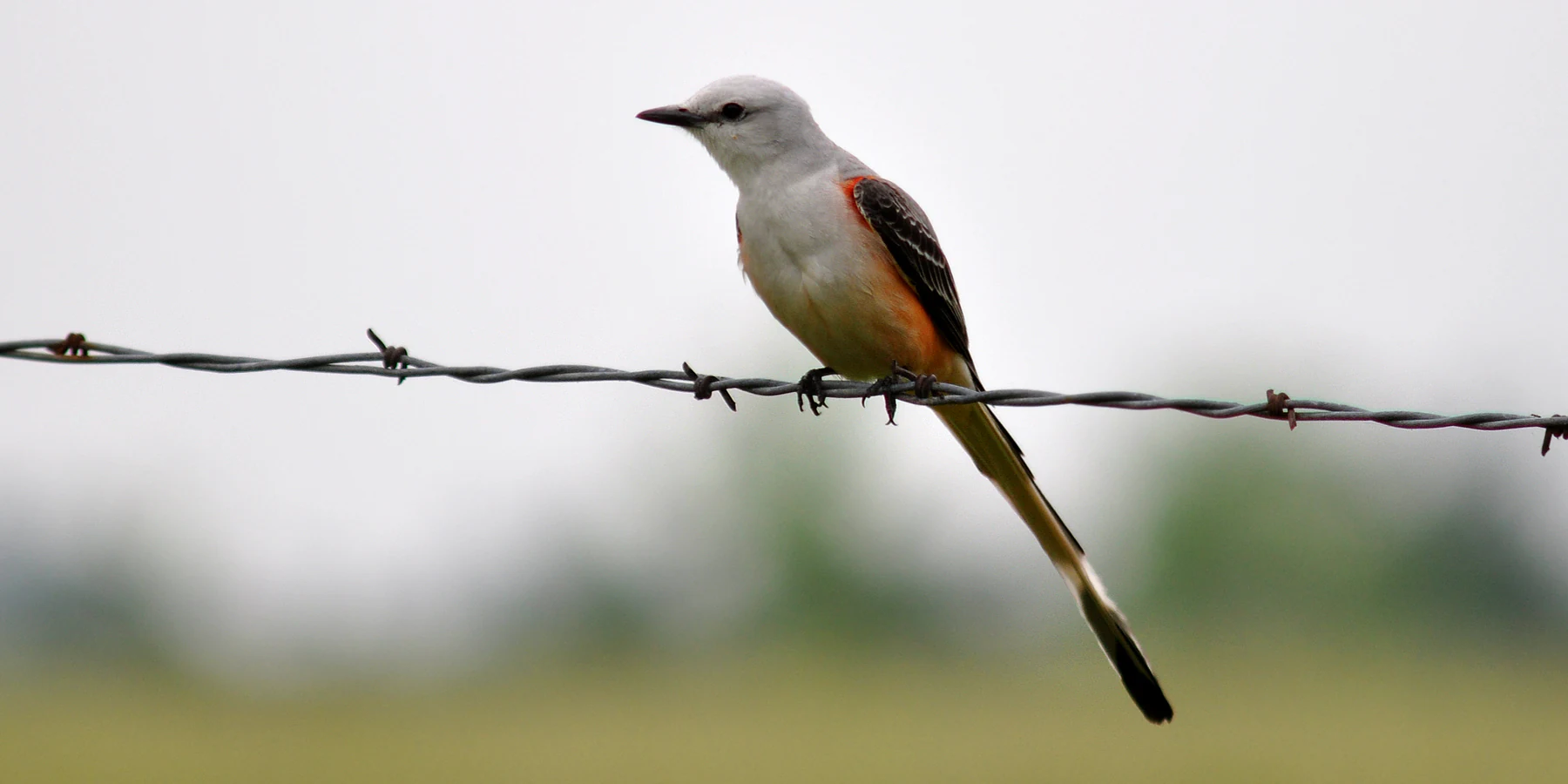
A Scissor-tailed Flycatcher bird with light grey and salmon-pink feathers perched on a single strand of barbed wire against a blurred green background.
A Scissor-tailed Flycatcher perched on a barbed wire fence in Walker County, Texas.

Sam Houston National Forest history and protected-area timeline

The three counties that today contain Sam Houston National Forest, Montgomery, San Jacinto, and Walker, have evidence of human occupation extending back roughly 12,000 years. More recently, the basins of the San Jacinto and Trinity Rivers were home to Atakapan-speaking groups including the Bidai, Patiri, Deadose, and Akokisa, who lived as primarily hunters and gatherers with some practice of agriculture. Disease and pressure from European settlers contributed to the near-extinction of these communities in the early 19th century, but archaeological sites within the present-day forest document occupations from about 7,000 years ago through the 20th century.

In 1934, the Texas Legislature invited the federal government to purchase land for the creation of National Forests in Texas. The lands that became Sam Houston National Forest had largely been cut over by private loggers or damaged by fire, with little well-stocked timber. Early Forest Service management focused on fire protection, replanting cutover areas, and improving tree density in existing young stands. The forest itself was formally established on October 13, 1936, and has been managed continuously ever since, including under the multiple-use framework that was placed into federal law by the Multiple Use-Sustained Yield Act of 1960. Mineral rights on many of the original purchase tracts were reserved by private owners, shaping the long-term character of mineral exploration within the forest.

Sam Houston National Forest landscape and geographic character

Sam Houston National Forest lies within the Gulf Coastal Plains, with soils developed from old non-calcareous sediments of the Tertiary and Pleistocene that range from slightly to severely erosive. Topographically, the forest is a tapestry of pine-covered ridgetops separated by broad creek channels and hardwood bottomlands. Its primary water systems are the west and east forks of the San Jacinto River, which gather numerous small creeks draining the interior; a smaller portion of the forest drains toward Lake Livingston on the Trinity River. Two large reservoirs frame the forest: Lake Conroe, impounded on the west fork of the San Jacinto in 1972 near Conroe, and Lake Livingston, impounded on the Trinity in 1968 near Coldspring.

Within this broader setting sit two particularly distinctive landscape units. The 3,855-acre Little Lake Creek Wilderness, designated under the Texas Wilderness Act of 1984, sits on the western edge of the Piney Woods north of the city of Montgomery, with Little Lake Creek, Pole Creek, and Sand Branch creating a rich ecological mosaic of pine ridgetops and mature hardwood bottomlands, much of the latter unlogged since the 1920s. The 1,420-acre Big Creek Scenic Area, set aside in 1962, preserves another stretch of varied forest landscape further east. Together these interior landscapes and the surrounding reservoirs give the forest a layered character of ridge-and-bottomland topography, flowing creeks, and large open-lake shorelines.
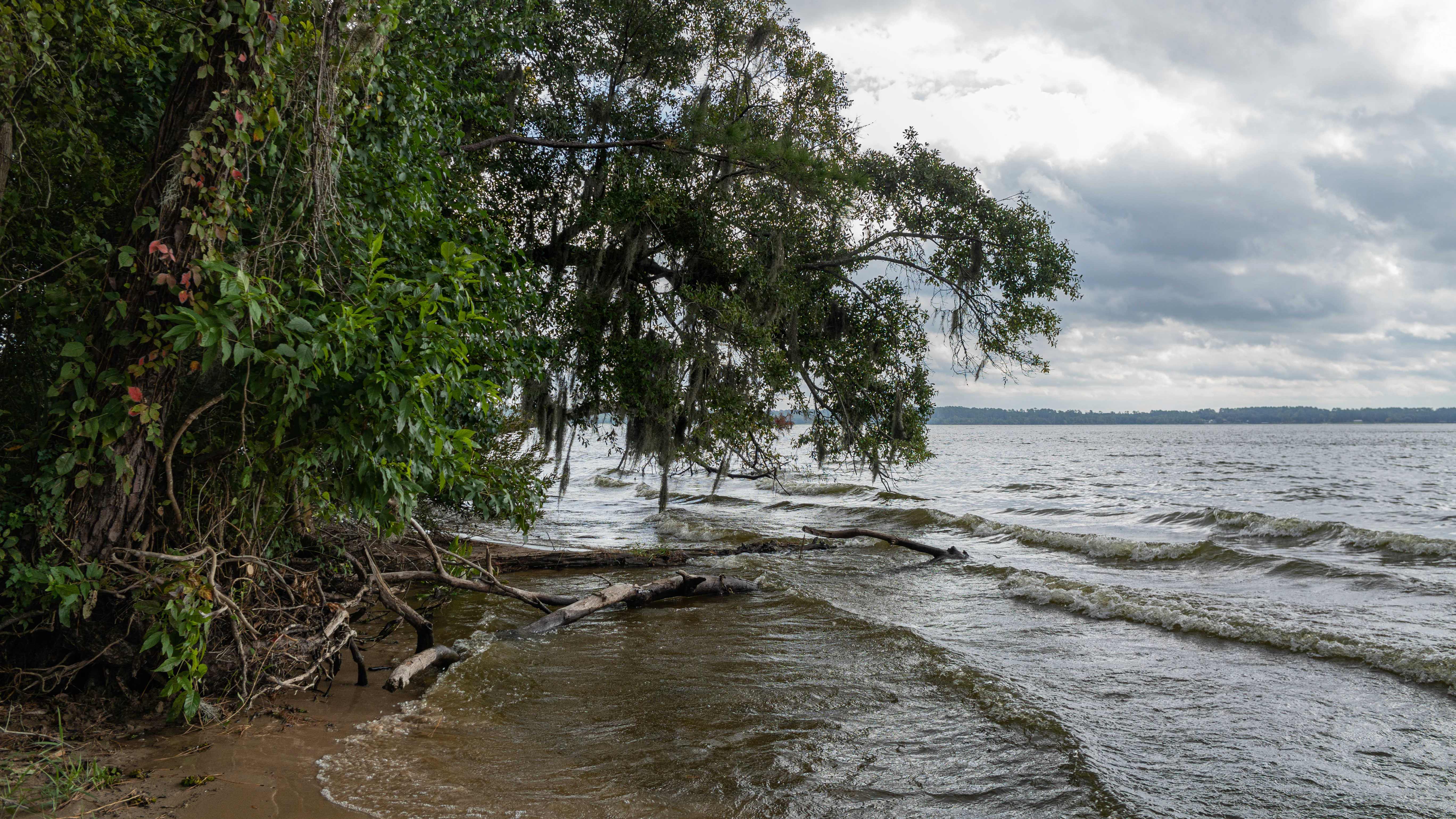
A lakeshore scene with green trees hanging over the water, driftwood on the sand, and ripples on the lake under a cloudy sky.
The shoreline of Lake Conroe within the Sam Houston National Forest.

Sam Houston National Forest ecosystems, habitats, and plant life

Ecologically, Sam Houston National Forest represents a southern expression of the Piney Woods, where fire-maintained pine communities meet diverse, sometimes old-growth, hardwood bottomlands. Loblolly pine and shortleaf pine dominate many ridgetops, while longleaf pine also occurs in portions of the forest. The hardwood mix along creeks and in bottoms includes American elm, American sweetgum, black tupelo, eastern American black walnut, hackberries, and multiple species of oaks, forming the kind of mixed forest community that supports a broad range of wildlife. Dwarf palmettos grow along the shoreline of Lake Conroe, and understory wildflowers contribute to a striking seasonal display in early spring.

Fire is an active part of the forest's ecology. Prescribed fire is used to manage fuels, improve habitat for threatened and endangered species, and stimulate understory growth that supplies forage for wildlife. Weather, fuel conditions, seasonal timing, and application techniques are carefully weighed when burns are conducted. The combination of fire-shaped pine communities and protected creekside hardwoods creates a varied habitat mosaic across the forest, supporting everything from cavity-nesting birds to amphibians dependent on moist bottomlands.
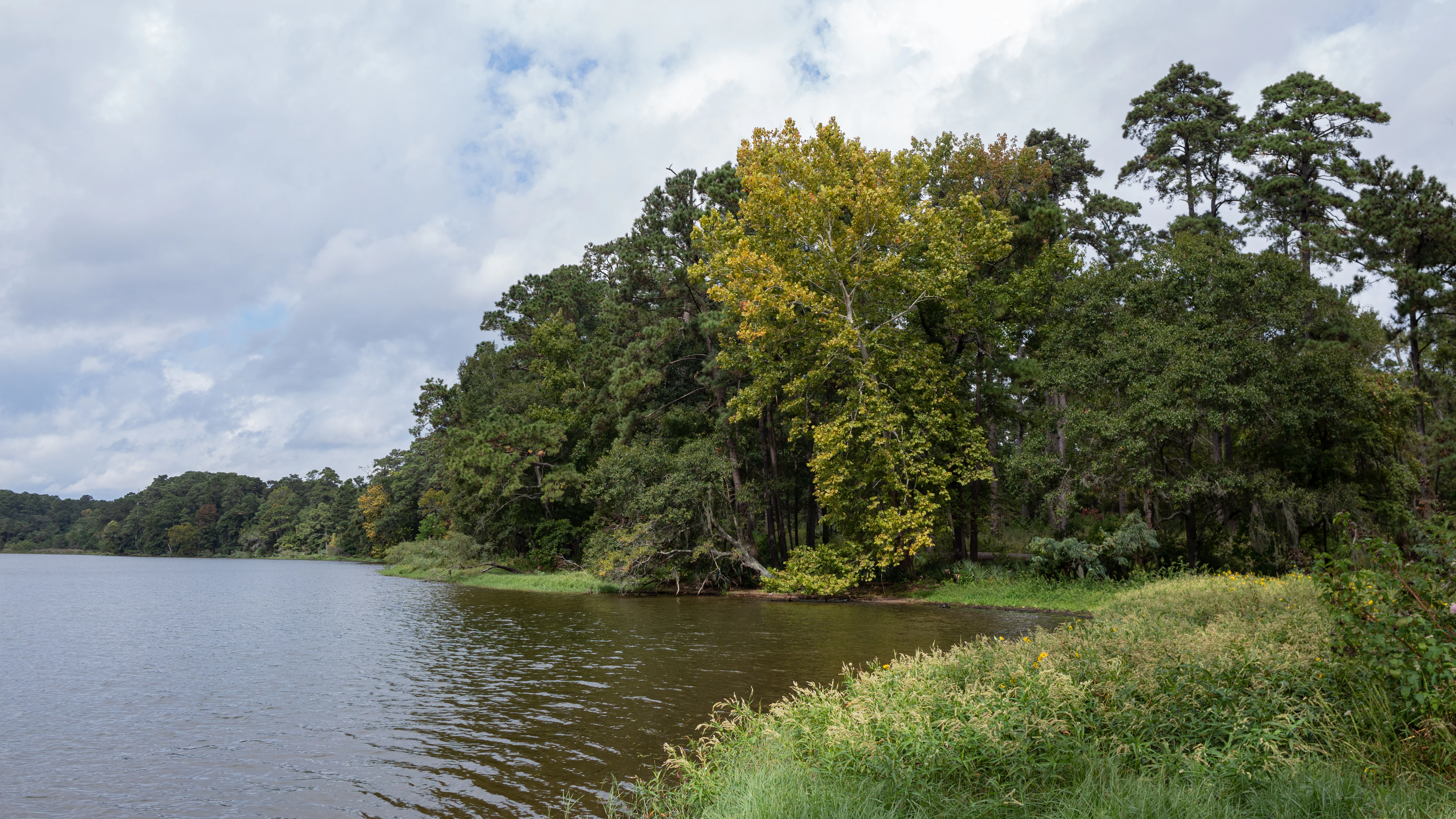
A landscape view of a calm lake bordered by a dense forest with a mix of green and early autumn foliage under a cloudy sky.
A scenic view of the shoreline along Lake Conroe in Sam Houston National Forest.

Sam Houston National Forest wildlife and species highlights

White-tailed deer are the most pursued game animal in Sam Houston National Forest, with eastern gray squirrels second, and feral hogs present throughout the forest as an introduced species that can cause significant ecological damage. Quail and dove are typically found around newly regenerated timberland, and wild turkey restoration has been a focus of habitat programs funded through the forest's wildlife management area designation. Lake Conroe and surrounding forest lands provide wintering habitat for bald eagles, which can occasionally be seen soaring over the lake or perched in tall shoreline pines, and the entire forest supports a population of the federally protected red-cockaded woodpecker, an endangered species that depends on large living pines for nesting cavities.

Other notable fauna includes pileated woodpeckers, crows, owls, and a wide variety of other birds of prey, along with waterfowl on the surrounding lakes. Reptile diversity is high, including broad-headed skink, ground skink, green anole, six-lined racerunner, alligator snapping turtle, Mississippi map turtle, red-eared slider, ornate box turtle, and smooth softshell turtle, with American alligator possible in any sufficiently large and permanent body of water. Five venomous snake species, including the Texas coralsnake, eastern copperhead, northern cottonmouth, timber rattlesnake, and western pygmy rattlesnake, share the forest with many harmless species such as buttermilk racer, eastern coachwhip, western ratsnake, and western ribbonsnake. Amphibians include American bullfrog, squirrel treefrog, Blanchard's cricket frog, and Strecker's chorus frog, while the San Jacinto River drainage supports fish species ranging from longnose gar and bowfin to largemouth bass and a variety of smaller minnows and darters.
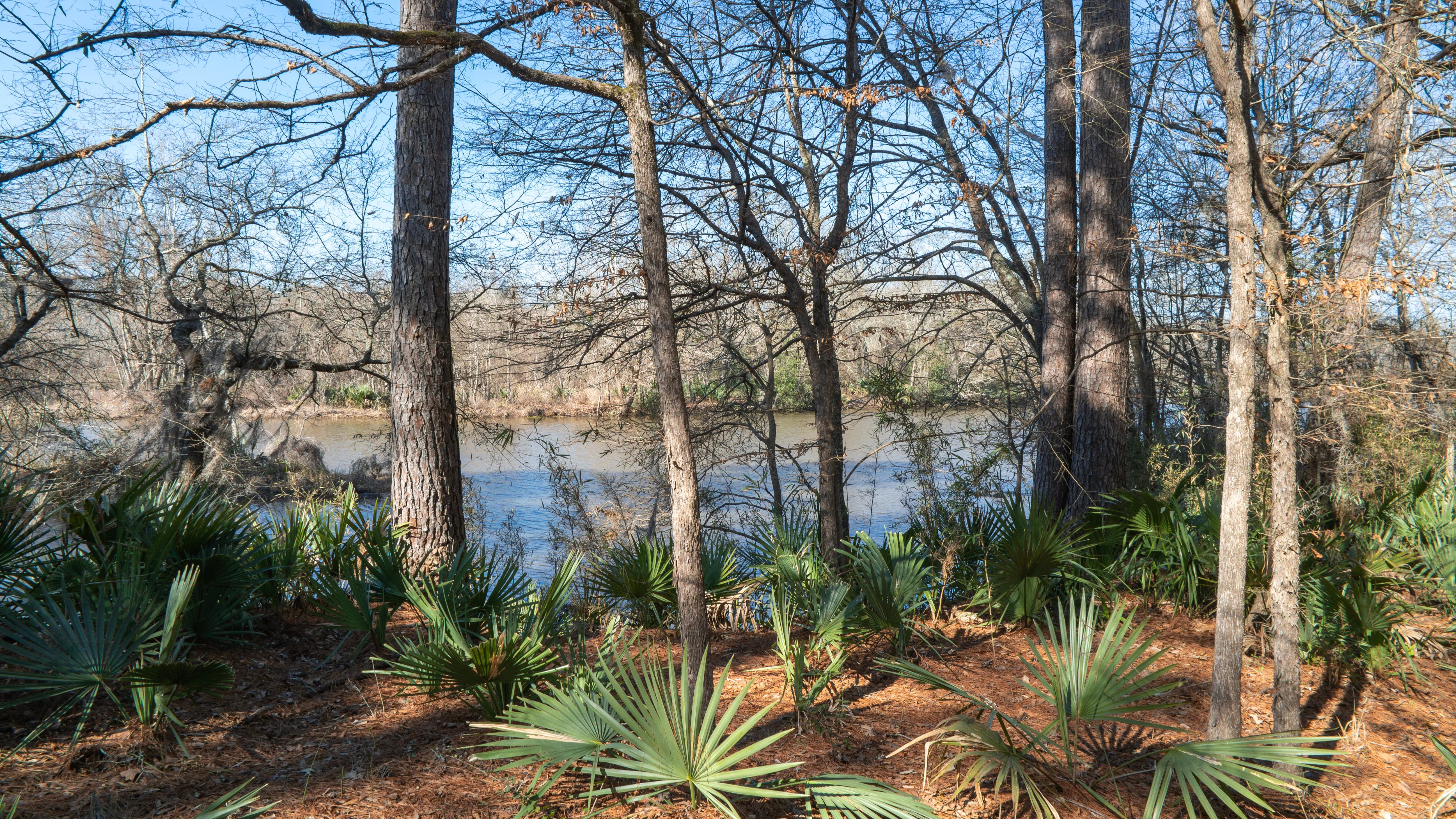
A view of a lake shoreline seen through a foreground of palmetto plants and tall pine trees in a forest setting.
A view through the piney woods toward the shoreline of Lake Conroe in Sam Houston National Forest.

Sam Houston National Forest conservation status and protection priorities

Sam Houston National Forest plays an important conservation role as one of the largest publicly managed Piney Woods landscapes in Texas and as a refuge for species that depend on carefully maintained forest conditions. Its status as a designated wildlife management area, established through cooperation between Texas Parks and Wildlife Department and the U.S. Forest Service, channels hunter fees directly back into habitat improvement programs, including wild turkey restoration, creation of wildlife openings, law enforcement, and data-driven habitat enhancement. Protection of the endangered red-cockaded woodpecker is a particular conservation priority, and management actions wherever the species occurs are oriented toward sustaining the mature pine habitat it requires.

Fire management is another pillar of the forest's conservation strategy. Prescribed fire is used both to reduce accumulated fuels that can fuel catastrophic wildfires and to improve habitat for threatened and endangered species by stimulating new understory growth. The U.S. Forest Service and the Texas Forest Service maintain a cooperative wildfire prevention, detection, and suppression plan, and after-rainfall trail closures help protect soils and sensitive aquatic resources. Cooperative wildlife management, prescribed fire, wilderness and scenic area protections, and timber management on a sustained-yield basis together define the forest's modern conservation framework.

Sam Houston National Forest cultural meaning and human context

The land that is now Sam Houston National Forest carries an extremely long human history, with archaeological evidence of occupation stretching back roughly 12,000 years in Montgomery, San Jacinto, and Walker counties. Before European-American settlement, the San Jacinto and Trinity River basins were home to Atakapan-speaking peoples, the Bidai, Patiri, Deadose, and Akokisa, who were primarily hunters and gatherers with some agricultural practice. Disease and displacement associated with European settlement contributed to their near-extinction by the early 19th century, leaving primarily an archaeological record within the modern forest.

The forest's more recent cultural layer is tied to early 20th-century conservation and rural Texas history. The lands were heavily cut over and fire-damaged before federal acquisition in the 1930s, and the Civilian Conservation Corps played a visible role in building lasting recreation infrastructure, including the picnic shelter and initial facilities at Double Lake Recreation Area in 1937. The forest is named for Sam Houston, the early Texas statesman, giving the landscape an enduring association with Texas state history.
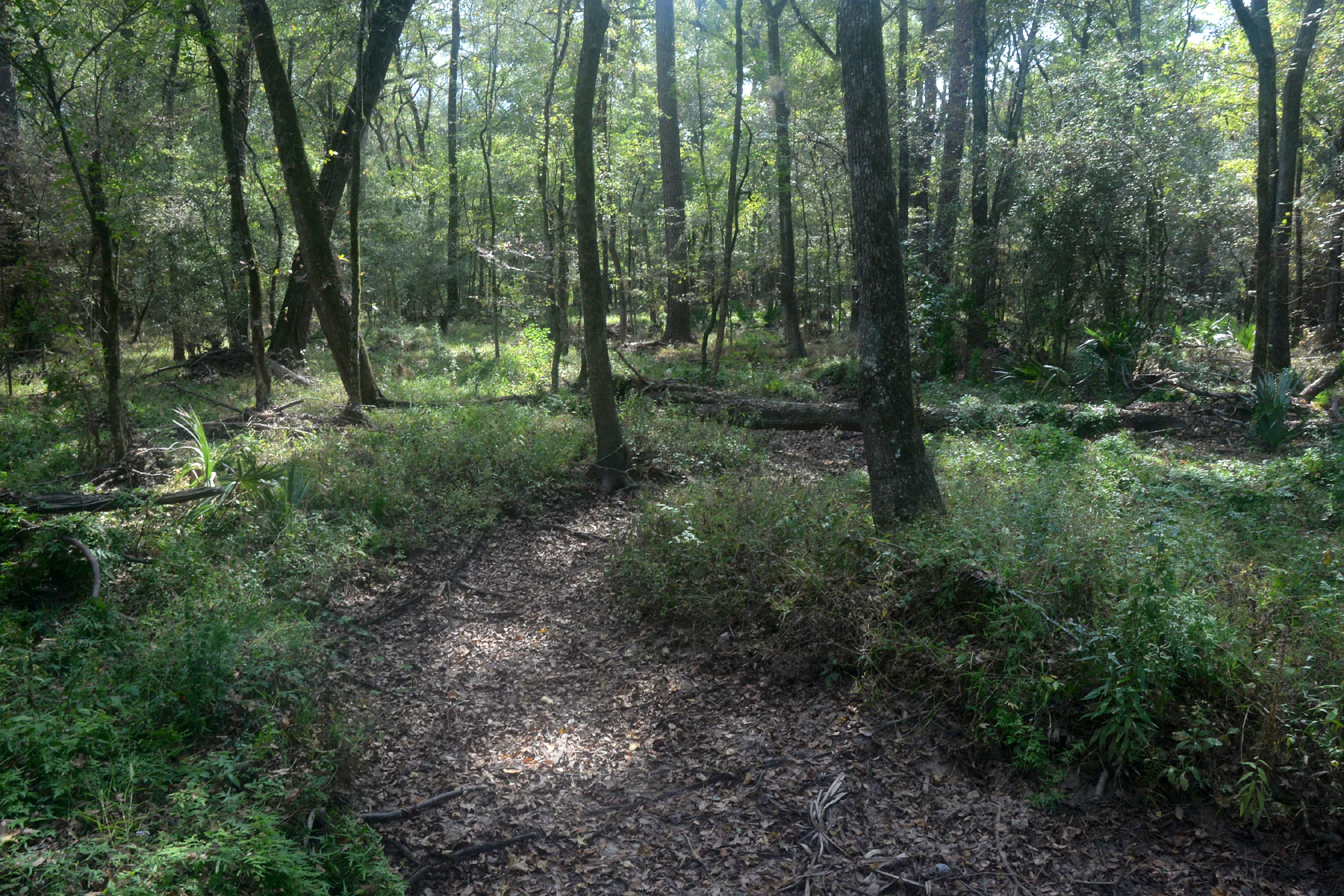
A dirt hiking trail curves through a lush, green forest with dappled sunlight filtering through the canopy and fallen logs on the forest floor.
A shaded path winds through the dense forest of the Little Lake Creek Wilderness in Sam Houston National Forest.

Top sights and standout views in Sam Houston National Forest

Sam Houston National Forest's standout features include the 128-mile Lone Star Hiking Trail, which passes through Big Creek Scenic Area and connects the forest's recreation areas, and the Little Lake Creek Wilderness, a 3,855-acre designated wilderness on the western edge of the Piney Woods. Big Creek Scenic Area adds another 1,420 acres of protected scenic forest and four connecting trail loops, while three developed recreation areas, Cagle, Double Lake, and Stubblefield, anchor camping, swimming, and lake access along Lake Conroe and the San Jacinto River. Together with the forested shoreline of Lake Livingston on the northeast side, these landscapes make the forest a rare combination of long-distance hiking, designated wilderness, large reservoirs, and traditional east Texas Piney Woods habitat within a single public land unit.
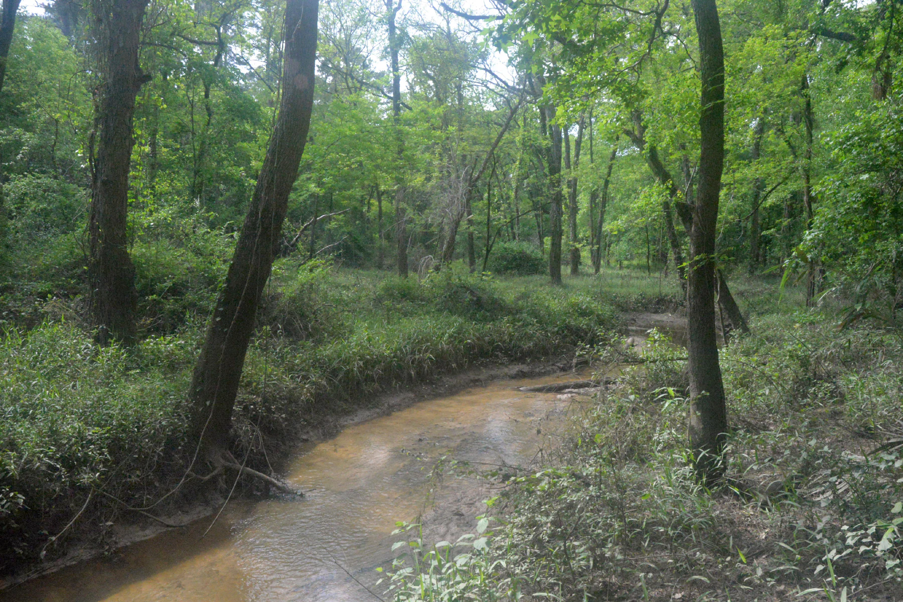
A narrow, dirt-colored creek winds through a dense, green hardwood forest in Sam Houston National Forest.
A tranquil section of the Lone Star Hiking Trail following the winding path of Clear Creek.

Best time to visit Sam Houston National Forest

The most popular seasons for visiting Sam Houston National Forest on foot are winter and spring, when east Texas weather is mild and the understory comes alive with wildflowers; mid-February redbud blossoms and early March dogwood blooms create a notable seasonal display in places like the Cagle Recreation Area. Summers are hot and humid, with average summer temperatures in the low 80s Fahrenheit and mid-summer days commonly reaching the upper 90s, making forested hiking more demanding. Late fall, particularly during deer hunting season in November and December, requires bright, highly visible clothing on trails and attention to hunting-area restrictions. Rainfall is relatively well distributed throughout the year, with slightly drier windows in February through March and September through October, conditions that generally shape comfortable travel periods and influence when multi-use trails are open after wet weather.

Monthly climate preview

Long-term representative temperature and precipitation averages for Sam Houston National Forest

Sam Houston National Forest Climate Normals and Monthly Weather Patterns

Representative coordinate records show measured monthly temperature ranges alongside consistent daily precipitation averages across the protected forest. Examining the full twelve-month profile reveals detailed long-term climate normals for comprehensive geographic analysis.
Annual mean20 °C
10 °C29 °C
Jan10°
Feb12°
Mar16°
Apr20°
May24°
Jun28°
Jul29°
Aug29°
Sep26°
Oct21°
Nov15°
Dec11°
Warmest month
August

28.9 °C

Coolest month
January

9.7 °C

Wettest month
June

4.5 mm/day

Driest month
March

3.1 mm/day

Park location guide

Geography guide, regional context, and park location map for Sam Houston National Forest

Sam Houston National Forest park geography, regions, and map view in United States of America

Understand where Sam Houston National Forest sits in United States of America through a broader geographic reading of the surrounding landscape, nearby location context, and its mapped position within the national park landscape.

How Sam Houston National Forest fits into United States of America

The United States of America is a federal presidential republic and one of the world's largest countries by area and population. It consists of 50 states across a vast territory spanning multiple time zones, with its capital in Washington, D.C. and largest city in New York City. The nation has a diverse economy, influential political system, and significant cultural and military presence globally.

Wider geography shaping Sam Houston National Forest in United States of America

The United States occupies a vast territory in North America, bordered by Canada to the north and Mexico to the south. The 48 contiguous states stretch from the Atlantic to the Pacific Ocean, while Alaska occupies the northwestern region and Hawaii is an archipelago in the Pacific. The country encompasses diverse terrain including the Rocky Mountains, Appalachian Mountains, Great Plains, and extensive river systems.

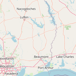
Map view of Sam Houston National Forest

Use this park location map to pinpoint Sam Houston National Forest in United States of America, understand its exact geographic position, and read its mapped placement within the surrounding landscape more clearly.

Pigeon | © OpenStreetMap contributors

Location context for Sam Houston National Forest

Texas

Visual reference for pine ridges, creek bottomlands, and protected habitats

Sam Houston National Forest Photos and Landscape Scenery

Visual records reveal the diverse terrain and Piney Woods habitats defining Sam Houston National Forest. Photography highlights the complex interplay of pine ridges, hardwood creeks, and open shorelines across the protected landscape.

A Scissor-tailed Flycatcher bird with light grey and salmon-pink feathers perched on a single strand of barbed wire against a blurred green background.

A bright green treefrog with an inflated vocal sac perched vertically on rough pine tree bark.

A lakeshore scene with green trees hanging over the water, driftwood on the sand, and ripples on the lake under a cloudy sky.

A landscape view of a calm lake bordered by a dense forest with a mix of green and early autumn foliage under a cloudy sky.

A view of a lake shoreline seen through a foreground of palmetto plants and tall pine trees in a forest setting.

A rustic wooden picnic shelter with a prominent stone chimney set in a pine forest, featuring a partially open-sided structure and a shingled roof.

A dirt hiking trail curves through a lush, green forest with dappled sunlight filtering through the canopy and fallen logs on the forest floor.

A narrow, dirt-colored creek winds through a dense, green hardwood forest in Sam Houston National Forest.

A view into a dense forest of tall pine trees with straight, dark trunks, with a low understory of green grasses and shrubs.

A diamondback watersnake with a dark, patterned body rests on a sandy riverbank surrounded by dry leaves.

A dirt path extends into the distance through a dense forest of pine and deciduous trees in Texas.

Park atlas

Compare surrounding regional geography and connected protected landscapes

Other Parks and Protected Areas Near Sam Houston National Forest

Browse nearby national forests and protected reserves to compare the ecological traits of Sam Houston National Forest with surrounding regional terrain. Expanding the geographic scope allows travelers to examine adjacent piney woods habitats and watershed ecosystems across the broader area.
National parkLouisiana
About 208 km away#1 closest

Northeast

Kisatchie National Forest: Geographic Overview and Protected Landscapes in Louisiana

Mapping the state's largest expanse of protected forest and pine ecosystems.

Spanning over 600,000 acres, Kisatchie National Forest stands as the primary protected natural landscape within Louisiana. Its terrain ranges from ancient upland pine formations and sandstone ridges to complex hardwood bottoms and cypress-tupelo swamps. This area serves as a vital anchor for regional biodiversity, protecting rare hillside seepage bogs and calcareous prairies that have largely vanished from the surrounding southern landscape.

Area
2,440 km²
Established
1930
Relief
Upland
Climate
Subtropical
Wildlife reserveLouisiana
222 km away#2 closest

Northeast

Kisatchie Hills Wilderness: Exploring Louisiana's Rugged Backcountry Protected Landscapes

Upland forest geography and preserved ridge terrain in Louisiana.

Kisatchie Hills Wilderness serves as a rare example of elevated, rugged terrain in Louisiana, offering a protected backcountry environment far removed from coastal marshes. This area provides a specialized map of forest-clad hills, ravines, and clear stream crossings that define a unique regional geography for those tracing Louisiana's diverse natural features.

Area
35.21 km²
Established
1980
IUCN
Ib
Relief
Upland
Marine protected areaTexas
254 km away#3 closest

Southeast

Flower Garden Banks National Marine Sanctuary: Offshore Coral Reefs and Salt Dome Geography

A critical marine protected area landscape in the Gulf of Mexico

Flower Garden Banks National Marine Sanctuary sits roughly 100 nautical miles offshore from the Texas coast, where unique salt dome geology creates elevated ridges that support the northernmost thriving coral reefs in the continental United States. This protected area map highlights the interconnected network of submerged banks and reefs, providing essential habitat for pelagic marine species and rare coral ecosystems in the northwestern Gulf of Mexico.

Area
410 km²
Established
1992
Scope
Marine
Water
Water-dominated
Nature reserveTexas
About 296 km away#4 closest

Southwest

Mission-Aransas National Estuarine Research Reserve: A Texas Coastal Protected Landscape

Mapped estuarine habitats and regional coastal geography

Encompassing a unique mix of terrestrial and marine environments, Mission-Aransas National Estuarine Research Reserve stands as a significant protected corridor on the Texas Coast. The landscape features deep-water bays, sheltered seagrass meadows, and open coastal prairie, offering a clear view of how riverine processes shape the complex shoreline of the western Gulf of Mexico.

Relief
Lowland
Climate
Subtropical
Access
Easy access
Scope
Mixed
Protected areaTexas
297 km away#5 closest

North

Caddo National Grassland: Geographic Overview of a Texas Protected Area

Restored prairie and oak savanna in Fannin County

Located in northeastern Texas, Caddo National Grassland encompasses roughly 17,873 acres across two distinct units. The park illustrates a successful shift from eroded agricultural land to a protected mosaic of native grasses, hardwood stands, and aquatic corridors anchored by Lake Davy Crockett, providing a clear window into the recovery of the southern Great Plains.

Area
72.33 km²
Established
1930
Relief
Lowland
Climate
Temperate
Watercolor painting of a forested landscape with soft rolling mountains in the background and vegetation in the foreground.
Protected landscapeArkansas
336 km away#6 closest

North

Ouachita National Forest: Protected Landscape and Mountain Geography in Arkansas

Exploring the ancient ridges and river corridors of the Ouachita Mountains

Ouachita National Forest protects a unique geological system of east-west folded ridges and sandstone bluffs in the interior United States. This expansive region provides vital habitats for diverse hardwood communities and hosts extensive wilderness areas, offering a deep look into the natural history and terrain of the Ouachita Mountain range within Arkansas.

Area
7,221.44 km²
Established
1907
IUCN
VI
Relief
Mountain
Watercolor painting of soft, rolling green hills and scattered trees against a pale, light-filled sky.
Protected landscapeWise County
343 km away#7 closest

Northwest

Lyndon B. Johnson National Grassland: Atlas and Geographic Landscape Overview

Protected prairie and multiple-use terrain in Wise County

Examine the geographic layout and regional importance of Lyndon B. Johnson National Grassland, a federal protected area in northern Texas. The land offers a unique look at the convergence of open Great Plains prairie and the wooded Cross Timbers, serving as both a working ranching landscape and a preserved natural environment within easy reach of the Dallas-Fort Worth metropolitan area.

Area
82.19 km²
Relief
Lowland
Climate
Temperate
Access
Easy access
Protected landscapeMississippi
363 km away#8 closest

East

Homochitto National Forest: Mapping the Protected Landscapes of Southwestern Mississippi

Regional forest geography and landscape documentation.

Investigate the unique landscape of Homochitto National Forest, an extensive protected area in Mississippi defined by its loess-country topography and managed pine forests. This entry provides essential mapping context and geographic data for those examining the role of this forest within the broader Southeastern United States ecological network and its CCC-rooted heritage.

Area
776.34 km²
Established
1936
Relief
Upland
Scope
Terrestrial

Common questions about visiting, size, designation, and location context for Sam Houston National Forest

Sam Houston National Forest FAQs for park facts, access, geography, and protected area context

Find quick answers about Sam Houston National Forest, including protected-area facts, park geography, trail and visitor context, and how the park fits into its surrounding country and regional landscape.
MoriAtlas Explorer

Continue Your Protected Areas Search Across the Global Atlas

Deepen your exploration by continuing the structured search for national parks and protected areas worldwide. Utilize the comprehensive filtering capabilities to compare different conservation landscapes and refine your understanding of global park geography. Discover more about the distribution and characteristics of protected natural areas.

Global natural geography