Why Ouachita National Forest stands out
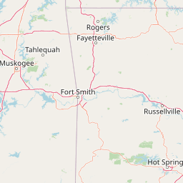
Ouachita National Forest is best known for protecting the rugged and scenic Ouachita Mountains and for containing some of the largest remaining old-growth forests in the United States outside of Alaska. The forest is recognized for its high-elevation stunted oak woodlands, mixed mesophytic hardwood communities, six designated wilderness areas, and the famous Talimena Scenic Drive, a National Scenic Byway that winds through the heart of the range. It also draws attention for the Ouachita National Recreation Trail, an extensive backpacking route, and for the globally significant quartz crystal belt that runs through its rocky uplands.
Ouachita National Forest history and protected-area timeline
Ouachita National Forest was established on December 18, 1907, originally under the name Arkansas National Forest. Its establishment made it the oldest National Forest in the southern United States, a recognition it still holds today. The forest received its current name, Ouachita National Forest, on April 29, 1926, drawing on the French rendering of the Indigenous Washita, meaning 'good hunting grounds.'
During the early 20th century, there was an effort to elevate part of this landscape to a higher level of protection. In the 1920s, Senator Joseph T. Robinson and Representative Otis Wingo, both Democrats, along with Arkansas State Representative Osro Cobb, pushed for the creation of a 165,000-acre national park within the mountains, positioned between Little Rock and Shreveport, Louisiana, and within driving distance of millions of Americans. The proposal attracted strong regional support but was ultimately killed by a pocket veto from President Calvin Coolidge, reportedly due to opposition from the National Park Service and the Department of Agriculture, influenced in part by the nearby presence of Hot Springs National Park. Coolidge instead proposed expanding the existing forest into Oklahoma, a vision realized in 1930 when the forest was extended into Le Flore County, Oklahoma.
The forest's early 20th-century development was also shaped by the Civilian Conservation Corps of the New Deal era. Camp Clearfork, originally constructed by the CCC near Hot Springs, remains one of the physical legacies of that conservation and public works era. Across the decades, the forest grew through additional land acquisitions and donations, including the late-20th-century transfer of the Red Slough Wildlife Management Area to the U.S. Forest Service. Six wilderness areas, totaling approximately 65,000 acres, have been congressionally designated within the forest, formalizing its long-standing role as both a timber-producing landscape and a refuge for old-growth forest, rare flora, and rugged mountain scenery.
Ouachita National Forest landscape and geographic character
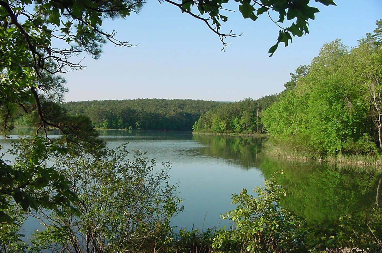
The dominant landscape of Ouachita National Forest is the Ouachita Mountain Range, an east-west oriented system of folded ridges, narrow valleys, and deeply incised streams that is geologically and ecologically distinct from the Ozarks to the north and the coastal plain to the south. The mountains were shaped by tectonic compression hundreds of millions of years ago, producing tilted ridges of sandstone and shale that now run in long parallel bands across much of Arkansas and into eastern Oklahoma.
Above 2,500 feet, the ridge tops support a distinctive high-elevation woodland of stunted oaks, with northern red oak, white oak, post oak, and blackjack oak dominating dry, exposed slopes. Lower elevations transition into mixed hardwood and pine forests, and stream corridors often hold richer, moister vegetation including eastern redcedar, wing elm, gum bumelia, and yaupon. The terrain varies from gentle, forested ridges to steep sandstone bluffs, clear tumbling streams, waterfalls, and scenic overlooks. The Talimena Scenic Drive crosses some of the most expansive and unbroken old-growth ridgelines in the South, and Magazine Mountain, the highest point in Arkansas near Dry Creek Wilderness, anchors the northern part of the range.
The forest's rivers and valleys are equally central to its character. The Ouachita River, Caddo River, Little Missouri River, Cossatot River, and Mountain Fork River cut through the mountains, producing some of the region's most distinctive scenery. The Cossatot is widely described as one of the most challenging whitewater rivers in the interior United States, with steep drops and turbulent runs that contrast strongly with the calm, pool-filled stretches found elsewhere in the forest.
Ouachita National Forest ecosystems, habitats, and plant life
Ouachita National Forest encompasses an unusually diverse range of forest communities for the South Central United States, a result of the east-west orientation of the Ouachita Mountains and the strong elevation gradients that produce distinct vegetation zones. At higher elevations, the forest holds stunted hardwood and oak woodlands with unusually open canopies and slow-growing trees, while middle and lower elevations support more typical southern Appalachian-style hardwood forests, mixed pine-hardwood stands, and richer stream-bottom vegetation.
A defining feature of the forest is its extensive old growth. While exact figures vary, a substantial portion of the forest, likely close to 800,000 acres, has likely never been commercially logged, especially above 2,500 feet on dry, rocky slopes. Old-growth communities include not only high-elevation stunted oak woodlands but also rare patches of eastern redcedar, gum bumelia, winged elm, and yaupon along certain streams. These forests function as ecological anchors for the region, supporting old-tree dependent species, maintaining watershed stability, and preserving genetic reservoirs that are increasingly rare in the South.
The forest's rare and endangered flora adds to its ecological importance. The maple-leaf oak, a globally rare species restricted to a small region around the Ouachita Mountains, occurs in the forest. Caney Creek Wilderness, in particular, harbors a significant example of Appalachian mixed mesophytic forest, a moist, species-rich hardwood community, along with rare moist-hardwood old growth. Across the range, the forest supports an unusually large breadth of vascular plant diversity for an interior southern landscape.
Ouachita National Forest wildlife and species highlights
Wildlife in Ouachita National Forest reflects the forest's unusually broad gradient of habitats, from high ridge tops and dry oak woodlands to moist stream corridors and bottomland wetlands. Hardwood forests support white-tailed deer, wild turkey, black bear, gray fox, eastern gray squirrel, fox squirrel, and a full array of smaller mammals. Black bear populations have grown in parts of the Arkansas and Oklahoma sections of the forest, underscoring the landscape's role as large, connected habitat.
Birds are among the forest's most recognized wildlife resources. Red Slough Wildlife Management Area in the Oklahoma portion of the forest has become an important birding destination due to its wetland character and seasonal waterfowl and shorebird use. Across the broader forest, songbirds, raptors, and game species thrive in the mix of mature hardwood, conifer, and early-successional habitats created by the forest's mosaic management approach.
Aquatic life is also a defining part of the forest's wildlife profile. The clear, spring-fed rivers of the Ouachitas support native fish, crayfish, and freshwater mussel communities, as well as recreational fisheries. The Cossatot River has been noted specifically for its instream biological value, with strong native diversity in a relatively undisturbed system. Combined, the forest's combination of dry ridge, moist stream, and wetland habitats makes it one of the more ecologically rich National Forests in the South Central United States.
Ouachita National Forest conservation status and protection priorities
Ouachita National Forest plays an unusually important role in forest conservation because of the scale of its old-growth woodland. The extensive oak and hardwood stands above 2,500 feet were largely never commercially logged because of their low commercial value, and as a result they contain what is effectively the largest block of old-growth forest in the contiguous United States outside of the Tongass National Forest in Alaska. This makes the forest a critical refuge for old-growth-dependent species, ecological processes, and forest genetic resources that have been largely lost elsewhere in the South.
The forest's six congressionally designated wilderness areas add a second conservation tier. Together they protect roughly 65,000 acres of the most rugged, least-disturbed sections of the Ouachitas, including biologically rich areas such as Caney Creek Wilderness, where rare Appalachian mixed mesophytic forest and moist-hardwood old growth have been preserved. Wilderness designation in this forest is especially significant because these forests function as ecological baselines against which other, more managed, southern forests can be compared.
The forest also contributes to conservation through habitat connectivity and watershed protection. The Ouachita, Caddo, Cossatot, and Little Missouri rivers and their associated forests provide clean water, aquatic habitat, and migration corridors for both terrestrial and aquatic species. The Red Slough Wildlife Management Area adds a wetland conservation function that complements the forest's predominantly upland character. The presence of rare species such as maple-leaf oak further underlines the forest's importance for conserving botanical endemism in the South Central United States.
Ouachita National Forest cultural meaning and human context
The name Ouachita comes from the French rendering of the Indigenous Washita, meaning 'good hunting grounds,' a translation that captures the long-standing importance of these mountains and forests as a homeland and resource for Native peoples long before European contact. The Ouachita region was first entered by Europeans in 1541 during Hernando de Soto's expedition, and later French explorers and traders moved through the region, leaving place names like Fourche La Fave River that still survive on modern maps. These early European influences, combined with the area's Indigenous heritage, give the forest a layered cultural landscape.
In the early 20th century, the forest was also the focus of an ambitious, ultimately unsuccessful campaign to create a major national park in the heart of the mountains. The effort, advanced by Arkansas politicians in the 1920s and supported by public writings such as Osro Cobb's magazine descriptions of the peaks and streams, reflected a regional belief that the area deserved the highest level of protection. The pocket veto by President Calvin Coolidge redirected conservation ambitions toward expanding the existing national forest into Oklahoma, an outcome that shaped the forest's modern two-state configuration.
More recent cultural context includes the legacy of the Civilian Conservation Corps, whose work in the 1930s left enduring facilities such as Camp Clearfork, and the growth of recreation-based communities that have long relied on the forest for tourism, hunting, fishing, and more recently, rockhounding. Quartz crystal collecting in the Ouachita quartz belt is a distinctive regional tradition that bridges geology, hobby collecting, and small-scale economic activity.
Top sights and standout views in Ouachita National Forest
Ouachita National Forest's highlights include the largest block of old-growth forest in the contiguous United States outside of Alaska, six congressionally designated wilderness areas that preserve the most rugged terrain in the Ouachitas, and the Ouachita Mountain Range itself, an east-west folded range unusual in the central United States. The Talimena Scenic Drive, the 223-mile Ouachita National Recreation Trail, and whitewater rivers like the Cossatot together define the forest's strong recreational identity. The world's renowned quartz crystal belt and the rare maple-leaf oak add unique scientific and geological distinctions.
Best time to visit Ouachita National Forest
Spring and fall are typically the most rewarding periods for visiting Ouachita National Forest. Spring brings mild temperatures, lush hardwood foliage, active wildlife, and excellent conditions for hiking, paddling, and enjoying the Talimena Scenic Drive before the heat of summer sets in. Fall is defined by brilliant hardwood leaf color across the ridges and valleys, especially in the old-growth oak and mixed mesophytic zones, paired with cooler weather that makes long-distance hikes and river trips especially enjoyable.
Summer remains attractive for those focused on water-based recreation, including canoeing, fishing, and swimming in the rivers and lakes of the forest, though temperatures and humidity in the South Central United States can be high. Winters are generally mild but variable, with occasional freezes and occasional snow on the highest peaks; lower-elevation sections remain accessible year-round. Birdwatching at Red Slough in the Oklahoma portion of the forest peaks during migration periods, offering additional seasonal motivation for off-season visits.