
Mori Atlas logo
Protected landscapeSawtooth National Recreation Area

Tracing the mapped boundaries of glaciated granite peaks, high-country alpine lakes, and expansive river headwaters.

Sawtooth National Recreation Area: An Iconic Protected Landscape of the Northern Rocky Mountains

Spanning over 700,000 acres in central Idaho, the Sawtooth National Recreation Area represents a massive protected landscape centered on the jagged granite summits of the Sawtooth Range. The terrain features deep glacier-carved basins containing hundreds of alpine lakes, including Redfish and Stanley, while protecting the headwaters of major waterways like the Salmon and Boise rivers. Visitors encounter an extensive network of designated wilderness, including the Cecil D. Andrus-White Clouds Wilderness, forming a primary hub for northern Rocky Mountain geographic exploration.

alpine lakessawtooth mountainsglacial landscapewilderness areanational forestrugged peaks
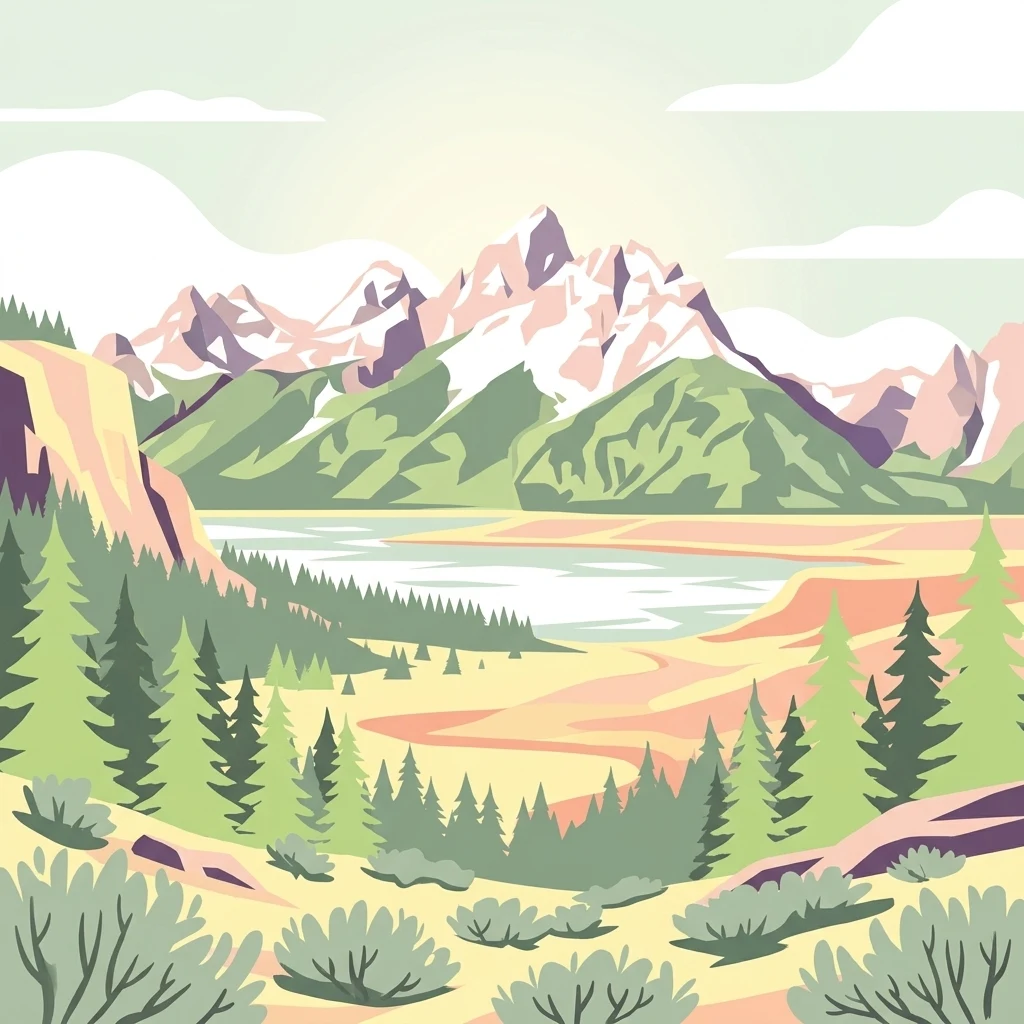
A flat vector illustration featuring snow-capped jagged mountain peaks in the distance, a winding river or lake in the valley, and pine forests with scrub brush in the foreground.

Sawtooth National Recreation Area

Protected landscape

Park overview

Structured park overview, official facts, and landscape profile for Sawtooth National Recreation Area

Sawtooth National Recreation Area park facts, protected area profile, and essential visitor context

Review the core facts for Sawtooth National Recreation Area, including designation, size, terrain, visitor scale, habitats, and operating context in one park-focused overview.

About Sawtooth National Recreation Area

The Sawtooth National Recreation Area is a broad landscape-scale protected area in the heart of central Idaho, where wilderness, working forest, and small mountain communities meet. It was created in 1972 to preserve and manage a particularly scenic and ecologically important portion of the Sawtooth National Forest, encompassing not only the namesake Sawtooth Mountains but also the White Cloud, Boulder, and Smoky ranges. The recreation area surrounds the Sawtooth Valley, a U-shaped glacial trough that serves as both a scenic corridor and a hub for outdoor activity.

Within its roughly 730,000 acres, the SNRA includes three formally designated wilderness areas. The Sawtooth Wilderness, established at the same time as the recreation area itself, protects the core of the Sawtooth Range, while the Hemingway–Boulders Wilderness and the Cecil D. Andrus–White Clouds Wilderness were designated in 2015, expanding the area's protected wilderness footprint significantly. Together, these wilderness areas preserve large tracts of undisturbed alpine terrain, from high cirques and exposed ridges to lodgepole pine forests, subalpine meadows, and shaded creek valleys.

The recreation area's hydrology is just as important as its peaks. The headwaters of the Salmon River, often called the "River of No Return," originate in the Sawtooth Valley and flow north through Stanley before continuing east. The Big Wood, Boise, and Payette rivers also begin here, meaning water that falls within the SNRA ultimately reaches four major drainage systems across the American West. This combination of mountain scenery and river origins makes the area unusually rich in both terrestrial and aquatic habitat.

Recreation within the SNRA is centered on its lakes, trails, and rivers. Hiking and backpacking routes lead to alpine lakes, jagged summits, and remote basins, while the Salmon River corridor supports rafting, kayaking, and fly fishing. Smaller lakes such as Stanley Lake, Pettit Lake, and Yellow Belly Lake offer accessible front-country experiences, while more strenuous routes climb into the White Clouds and Boulders. The recreation area's headquarters are located near Ketchum, with an additional ranger station in Stanley, making the landscape relatively approachable for visitors coming from Sun Valley or from the north via Highway 75.

Beyond recreation, the SNRA plays an important role in forest and watershed management. Past outbreaks of mountain pine beetles have affected large stands of lodgepole pine, and modern management has shifted toward prescribed fire, selective thinning, and fuels reduction, often coordinated with local communities through initiatives like the Sawtooth Valley Wildfire Collaborative. This blend of wilderness protection, active forest stewardship, and recreational access defines the modern character of the Sawtooth National Recreation Area.

Quick facts and research context for Sawtooth National Recreation Area

The Sawtooth National Recreation Area was established on August 22, 1972, by federal law, and is administered by the U.S. Forest Service within Sawtooth National Forest. It spans about 730,000 acres across four Idaho counties and protects three designated wilderness areas along with a large surrounding buffer of national forest lands.

The recreation area is anchored by the Sawtooth Mountains and includes portions of the White Cloud, Boulder, and Smoky ranges. Its summit elevation reaches above 11,800 feet at Castle Peak, and its lowest terrain sits within the Salmon River headwaters near the small community of Stanley. The area is also the birthplace of major western rivers, notably the Salmon River, often referred to as the "River of No Return."

Protection and recognition

Explore terrestrial conservation records and designated management frameworks

Sawtooth National Recreation Area Protection Status and International Recognition

Sawtooth National Recreation Area maintains a documented terrestrial protection status within official conservation frameworks. Official records compile designated management scope, international recognition sources, and administrative history without assuming specific conservation outcomes.

Protection details

Protection scope
Terrestrial
Transboundary protection
No
Park context

Deeper park guide and search-rich context for Sawtooth National Recreation Area

Sawtooth National Recreation Area history, landscape, wildlife, and travel context

Explore Sawtooth National Recreation Area through its history, landscape character, ecosystems, wildlife, conservation priorities, cultural context, and seasonal travel timing in a structured park guide built for atlas discovery and search intent.

Why Sawtooth National Recreation Area stands out

The Sawtooth National Recreation Area is best known for the dramatic Sawtooth Range, a jagged line of granite peaks that gives the area its name, and for the hundreds of glacier-carved alpine lakes that lie beneath the high summits. Stanley Lake, Redfish Lake, Alturas Lake, and Sawtooth Lake are among the most recognizable destinations and anchor the region's reputation as an iconic Idaho wilderness. Equally central to the area's identity are its river headwaters, particularly the main Salmon River, and its network of three wilderness areas. Combined with classic Rocky Mountain scenery and easy accessibility from Sun Valley and Stanley, the SNRA has become a signature landscape for outdoor recreation in the northern U.S. Rockies.
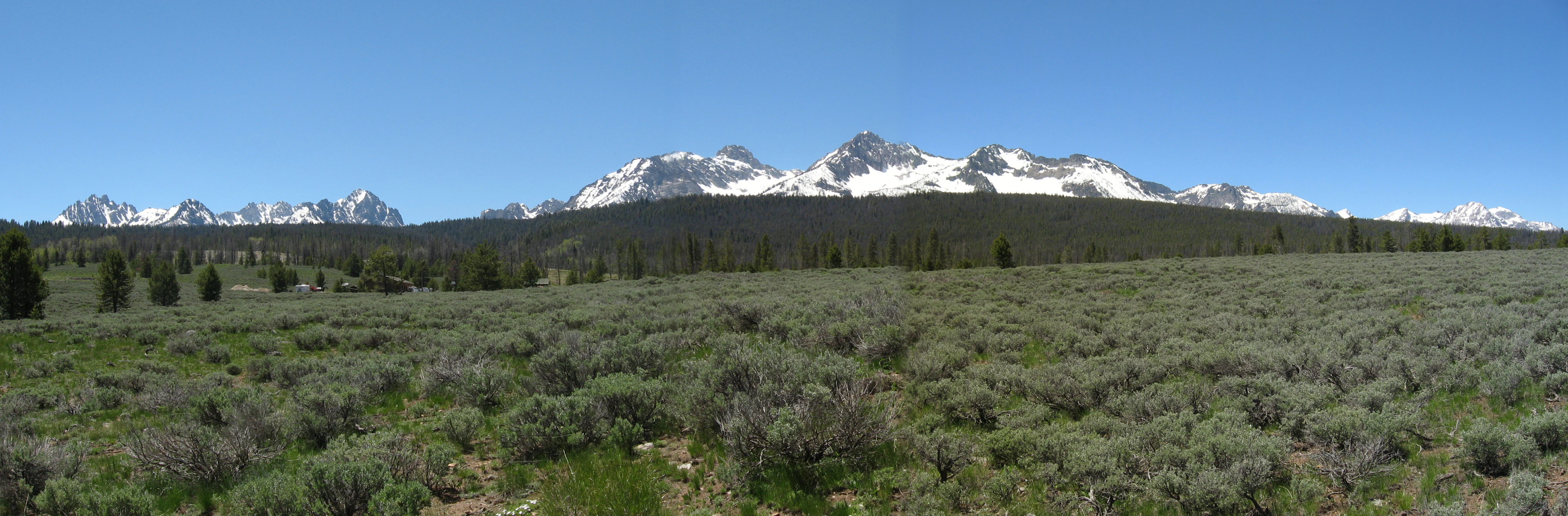
Panoramic landscape of the Sawtooth Mountain range featuring jagged snow-capped peaks in the distance above a dark forest band and sagebrush foreground under a clear blue sky.
A wide panoramic view of the Sawtooth Mountains, Idaho.

Sawtooth National Recreation Area history and protected-area timeline

The Sawtooth National Recreation Area was created on August 22, 1972, by Public Law 92-400. The same law formally established the Sawtooth Wilderness, transforming the earlier Sawtooth Primitive Area into a designated wilderness within the new recreation area. The recreation area was conceived as a way to protect both the dramatic scenery of the Sawtooth Range and the broader Sawtooth Valley, while still allowing active management of the surrounding national forest lands.

In 2015, two additional wilderness areas were added to the recreation area by Public Law 114-46. The Hemingway–Boulders Wilderness and the Cecil D. Andrus–White Clouds Wilderness expanded protected wilderness significantly, bringing new ranges and additional habitat into the National Wilderness Preservation System. These designations reflected decades of local advocacy and a growing recognition of the ecological value of the White Cloud and Boulder ranges.

Between 1998 and 2010, the region experienced a serious outbreak of mountain pine beetle, which killed large numbers of lodgepole pines across the Sawtooth Valley. In response, forest managers increased active management activities, including prescribed fire, commercial logging, and non-commercial thinning of dead and diseased trees. These efforts, supported by local groups such as the Sawtooth Valley Wildfire Collaborative, aim to reduce wildfire risk, restore beetle-damaged forests, regenerate young growth, and limit the spread of bark beetles and dwarf mistletoe.

Cultural and institutional life around the SNRA has also shaped its modern identity. The Sawtooth Interpretive and Historical Association, founded in 1972, manages educational programs, the Stanley Museum, and the Redfish Visitor Center on Redfish Lake as one of the oldest national forest visitor centers in the contiguous United States. The Sawtooth Society, established in 1997, has worked to protect open space, secure conservation easements, enhance recreation infrastructure, and coordinate volunteer stewardship projects, helping to safeguard the landscape that defines the recreation area today.

Sawtooth National Recreation Area landscape and geographic character

The landscape of the Sawtooth National Recreation Area is defined by glaciation. During past ice ages, massive glaciers carved the Sawtooth, White Cloud, Boulder, and Smoky mountains, leaving behind classic alpine features such as glacial lakes, moraines, hanging valleys, cirques, and arêtes. The jagged skyline of the Sawtooth Range, with its sharp granite spires, is itself a product of this intense glacial sculpting.

The Sawtooth Mountains are the visual centerpiece of the area, with Thompson Peak standing as the highest summit in the range. To the east, the White Cloud Mountains contain Castle Peak, the highest point in the entire recreation area, while the Boulder Mountains, anchored by Ryan Peak, and the Smoky Mountains, topped by Saviers Peak, add additional high-elevation terrain. Between these ranges lies the Sawtooth Valley, a broad U-shaped glacial trough that connects the mountains and frames many of the area's lakes and rivers.

The hydrology of the SNRA is equally prominent in its landscape character. The Salmon River originates within the area, flowing north through the Sawtooth Valley before turning east near Stanley and tracing parts of the recreation area's northern border. The headwaters of the Big Wood, Boise, and Payette rivers also begin here, feeding major downstream watersheds across southern and central Idaho. The 40-mile Sawtooth Fault runs beneath the valley, with geological evidence pointing to significant prehistoric earthquakes on this structure thousands of years ago.

Hundreds of lakes dot the SNRA, most formed in basins scoured by ancient glaciers. Redfish, Alturas, Pettit, Yellow Belly, Stanley, and Sawtooth lakes are among the largest and most visited, surrounded by lodgepole pine forests, granite walls, and open meadows. Together, the peaks, valleys, rivers, and lakes create a landscape that reads as a textbook example of northern Rocky Mountain scenery.
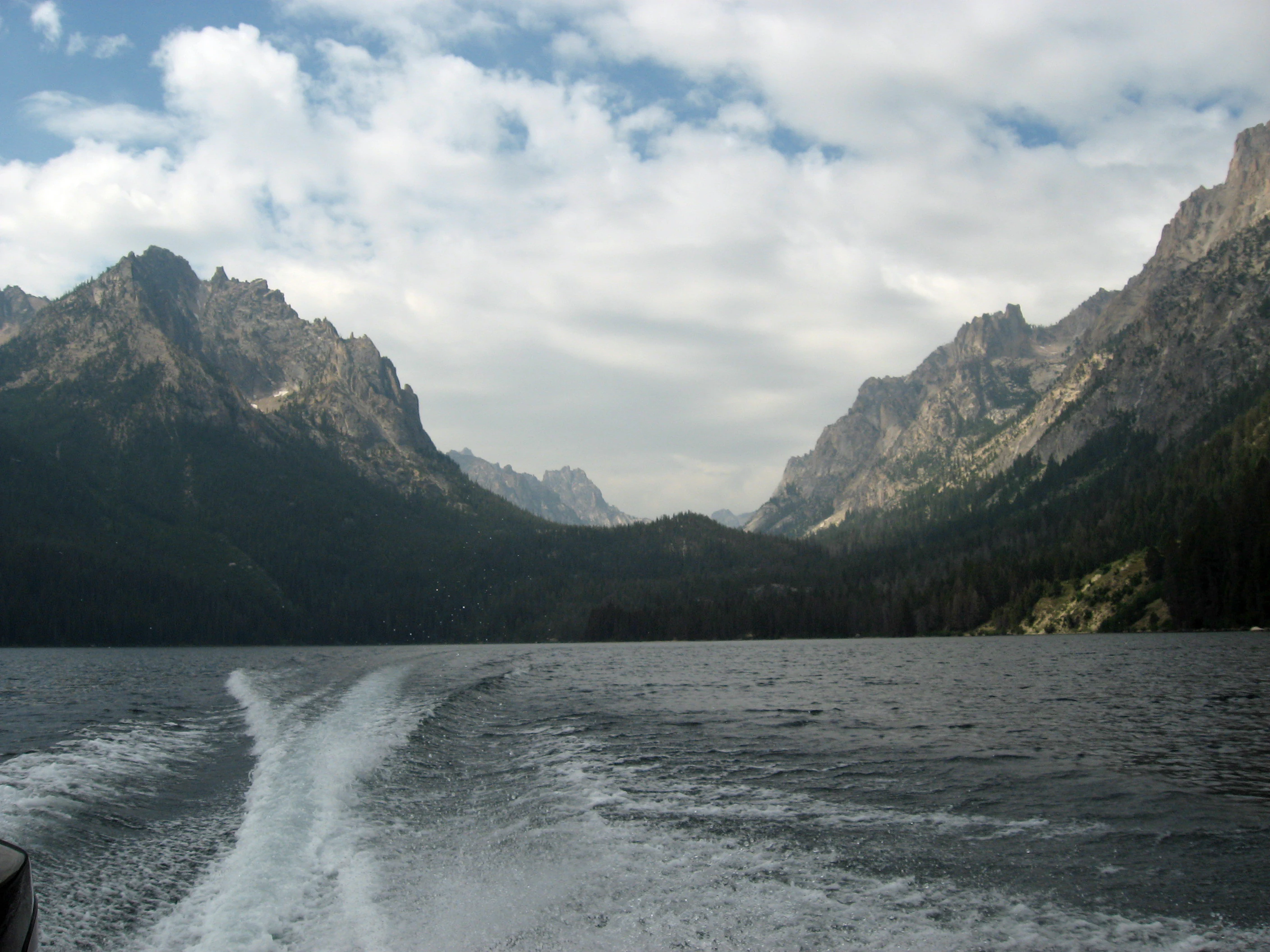
A wide view of a large alpine lake with a prominent boat wake in the foreground, leading toward steep, rocky mountains under a cloudy sky.
A boat wake on Redfish Lake, viewed toward the rugged mountains of the Sawtooth National Recreation Area.

Sawtooth National Recreation Area ecosystems, habitats, and plant life

The Sawtooth National Recreation Area encompasses a wide spectrum of Rocky Mountain ecosystems, from low river valleys lined with cottonwoods and willows to exposed alpine ridges above treeline. Lodgepole pine forests dominate much of the montane zone, particularly in the Sawtooth Valley, where repeated generations of fire and beetle outbreaks have shaped stand structure and age classes. Subalpine fir, Engelmann spruce, whitebark pine, and limber pine appear at higher elevations, while aspen stands add pockets of broadleaf cover along streams and in burned areas.

The area's elevation range, from river valleys near a few thousand feet to summits above 11,800 feet, produces strong ecological zonation. Wet meadows, fens, and willow thickets occupy the valley floor and glacial benches, while krummholz and alpine tundra cap the highest ridges. Glacial soils and rocky moraines create well-drained but often harsh conditions that support hardy montane and subalpine plant communities rather than dense lowland forests.

Riparian environments along the Salmon River and its tributaries form some of the most ecologically productive habitats within the SNRA. These corridors mix cool, oxygen-rich water with shaded banks and dense vegetation, providing critical habitat for fish, amphibians, and a wide range of birds and mammals. The many small lakes scattered across the area further diversify habitat structure, especially when paired with upstream wetlands and outlet creeks.

Because the area includes three designated wilderness areas and extensive surrounding national forest, ecological processes here remain relatively intact compared with many lower-elevation landscapes. Large predator populations, intact migratory corridors, and connected high-country habitats contribute to a sense of functional wilderness ecology, even where active forest management is practiced outside the wilderness boundaries.
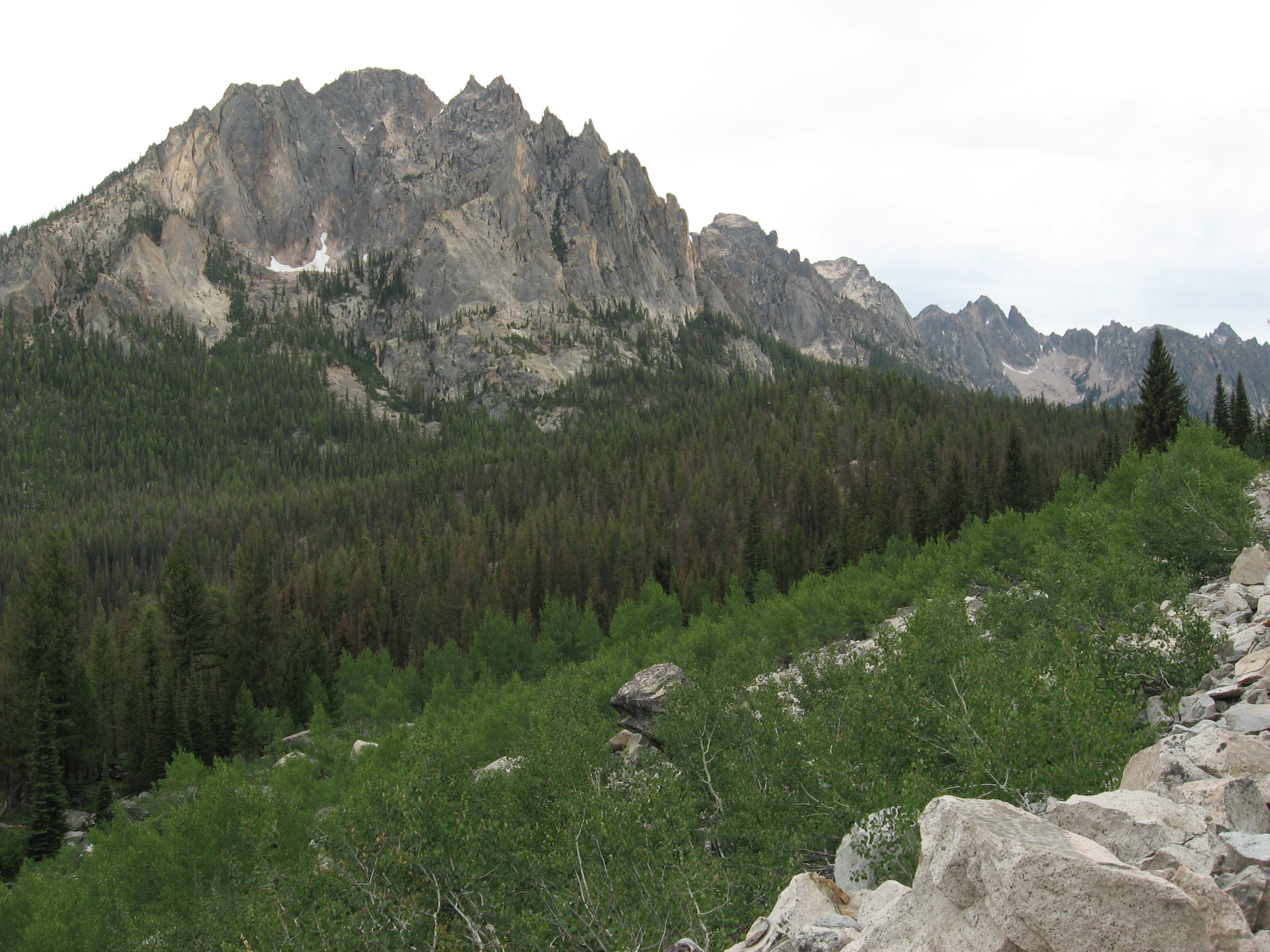
A wide landscape view of the jagged Grand Mogul mountain peak in the Sawtooth National Recreation Area, towering over a coniferous forest and a rocky foreground.
The craggy peaks of the Sawtooth Mountains rising above a dense pine forest and deciduous brush.

Sawtooth National Recreation Area wildlife and species highlights

Wildlife in the Sawtooth National Recreation Area reflects the broader richness of central Idaho's mountains and forests. The area is home to elk, mule deer, moose, mountain goats, bighorn sheep, black bears, mountain lions, and a variety of smaller mammals such as marmots, pikas, red squirrels, and pine martens. Beaver activity along creeks and in upper meadows shapes local hydrology and creates the lush willow habitats that support many other species.

Large carnivores are a defining part of the area's wildlife identity. Timber wolves were reintroduced in the 1990s and are part of the broader central Idaho wolf population. Wolverines are known to use the SNRA's high country, and the area contains significant habitat for the endangered Canada lynx, though confirmed sightings have been rare in recent years. Earlier discussions about reintroducing grizzly bears to the area were ultimately abandoned.

Avian life is equally varied. The forests, meadows, and alpine zones support raptors such as golden eagles, bald eagles, and great horned owls, while hummingbirds, mountain bluebirds, and Clark's nutcrackers are among the more conspicuous songbirds and corvids. Wetland and lakeshore habitats attract waterfowl, ospreys, and occasionally trumpeter swans, especially during migration.

Aquatic species are also a focal point of wildlife management in the SNRA. Bull trout serve as the management indicator species, and annual monitoring efforts track their populations in the area's streams and lakes. The Salmon River and its tributaries support robust runs of native trout as well as seasonal Chinook salmon and steelhead migration, and the area's high water quality is widely recognized as central to maintaining healthy fish populations and the species that depend on them.
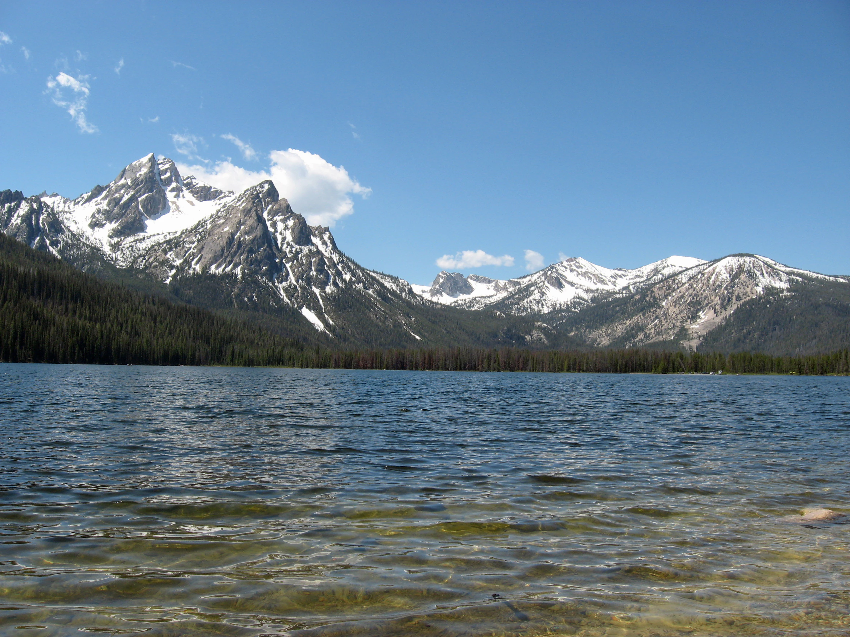
A wide view of a calm blue lake in the foreground with a dense coniferous forest and snow-capped rugged mountain peaks rising in the background under a clear sky.
Stanley Lake with the Sawtooth Mountains in the background, Sawtooth National Recreation Area.

Sawtooth National Recreation Area conservation status and protection priorities

The Sawtooth National Recreation Area plays a significant conservation role in the northern Rockies by protecting a large block of relatively intact mountain habitat across the Sawtooth, White Cloud, Boulder, and Smoky ranges. The designation of the Sawtooth Wilderness in 1972, followed by the Hemingway–Boulders and Cecil D. Andrus–White Clouds wilderness areas in 2015, has progressively secured core habitat for species that require undisturbed landscapes, including wolverines, Canada lynx, elk, and mountain goats.

Watershed conservation is equally important here. As the headwaters of the Salmon, Big Wood, Boise, and Payette rivers, the SNRA influences downstream water quality and quantity across a wide swath of Idaho. Cold, clean waters support bull trout and other native salmonids, while intact riparian corridors provide habitat for amphibians, birds, and mammals that depend on stable streamside vegetation.

Forest health has become a major conservation focus in recent decades. The mountain pine beetle outbreak between 1998 and 2010 killed large numbers of lodgepole pines, prompting active management programs that combine prescribed fire, selective thinning, and removal of dead and diseased trees. Coordinated by groups such as the Sawtooth Valley Wildfire Collaborative, these efforts aim to reduce wildfire risk, restore damaged forest stands, and limit the spread of bark beetles and dwarf mistletoe.

Conservation in the SNRA is also driven by nonprofit partners and community groups. The Sawtooth Society has worked to secure conservation easements, prevent inappropriate subdivision on private inholdings, and coordinate volunteer stewardship projects, while the Sawtooth Interpretive and Historical Association supports education and long-term public engagement with the landscape. Together, these efforts reinforce the SNRA's function as a working conservation landscape that balances wilderness protection, recreation, and ecological resilience.

Sawtooth National Recreation Area cultural meaning and human context

The cultural fabric of the Sawtooth National Recreation Area is closely tied to the small mountain communities that line its edges, particularly Stanley at the north end of the Sawtooth Valley and Ketchum and Sun Valley to the south. Ranching, guiding, and outdoor recreation have long shaped local life here, and the region has historically drawn artists, writers, and adventurers drawn to the area's quiet and dramatic scenery. John Rember's 2003 memoir "Traplines: Coming Home to the Sawtooth Valley" captures this pre- and post-establishment culture around Stanley.

The area has also appeared in broader American popular culture. Clint Eastwood's 1985 film "Pale Rider" was largely filmed in the Boulder Mountains in the fall of 1984, with the opening credits shot near Stanley against the backdrop of the Sawtooth Range. More recently, the SNRA served as one of the settings for the 2010 Lionsgate animated film "Alpha and Omega."

Educational and interpretive work has its own local tradition. The Sawtooth Interpretive and Historical Association, founded in 1972, has long managed the Stanley Museum and the Redfish Visitor Center and Gallery on Redfish Lake, one of the oldest national forest visitor centers in the contiguous United States. Through summer programs and exhibits, these institutions link the area's natural beauty to its human stories, from early ranger stations to mining-era artifacts and contemporary stewardship efforts.
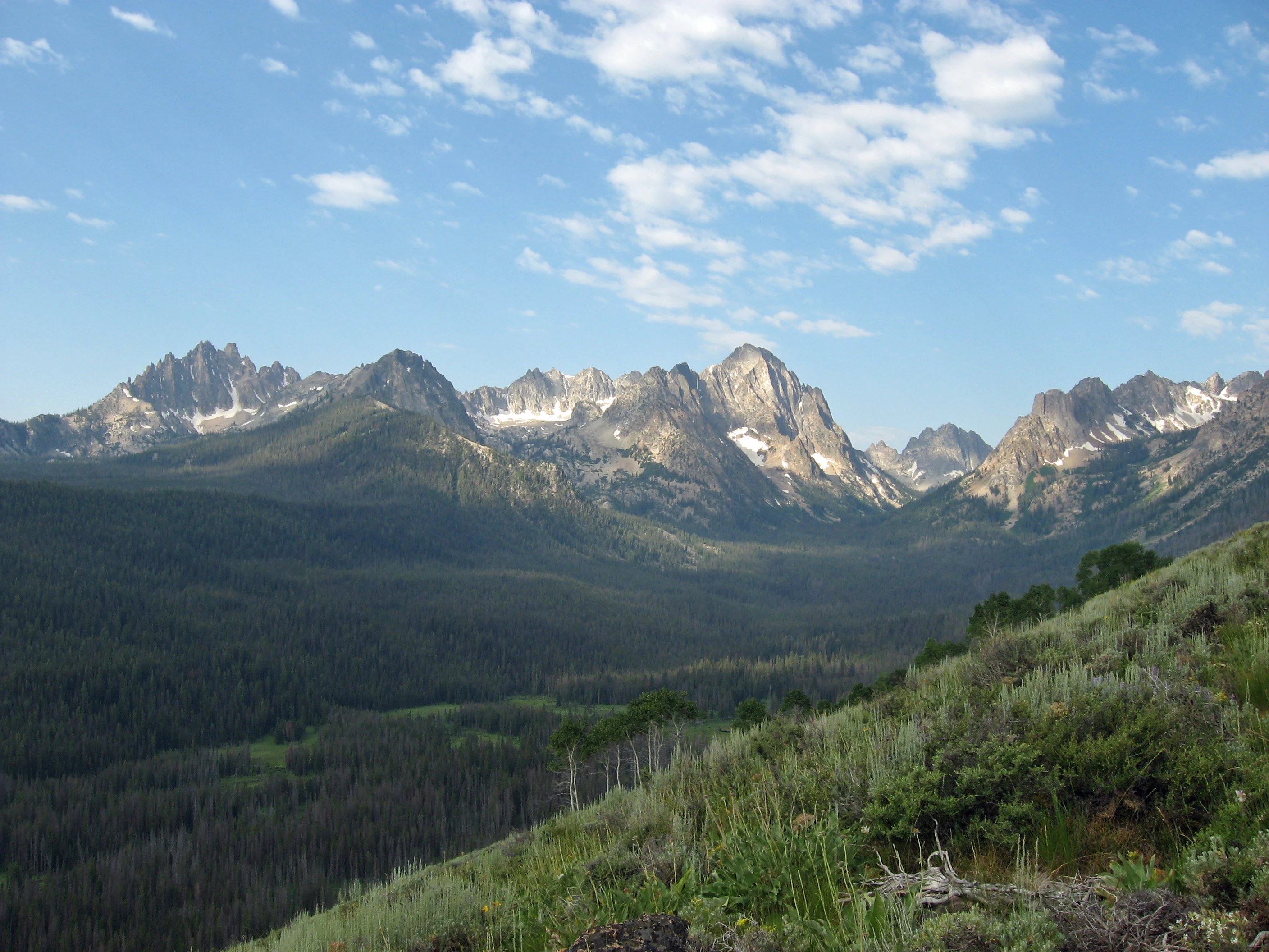
Rugged, jagged mountain peaks with small patches of snow rise above a deep, forested valley under a bright blue sky with scattered clouds.
A wide view of the Sawtooth Mountains from the Alpine Way Trail.

Top sights and standout views in Sawtooth National Recreation Area

The Sawtooth National Recreation Area's most distinctive highlights include the jagged Sawtooth Range with summits like Thompson Peak, the high-elevation White Cloud and Boulder ranges featuring Castle Peak and Ryan Peak, and the iconic glacier-carved lakes such as Redfish, Stanley, Alturas, Pettit, Yellow Belly, and Sawtooth. The headwaters of the Salmon River and its "River of No Return" corridor give the area its strong water-based identity.

Equally notable are the three designated wilderness areas: the Sawtooth Wilderness, the Hemingway–Boulders Wilderness, and the Cecil D. Andrus–White Clouds Wilderness. These protect large swaths of the SNRA's wildest terrain and support populations of elk, mountain goats, wolverines, and reintroduced wolves. Together, the peaks, wilderness, lakes, and rivers give the Sawtooth National Recreation Area a remarkably complete portrait of central Idaho's mountain character.
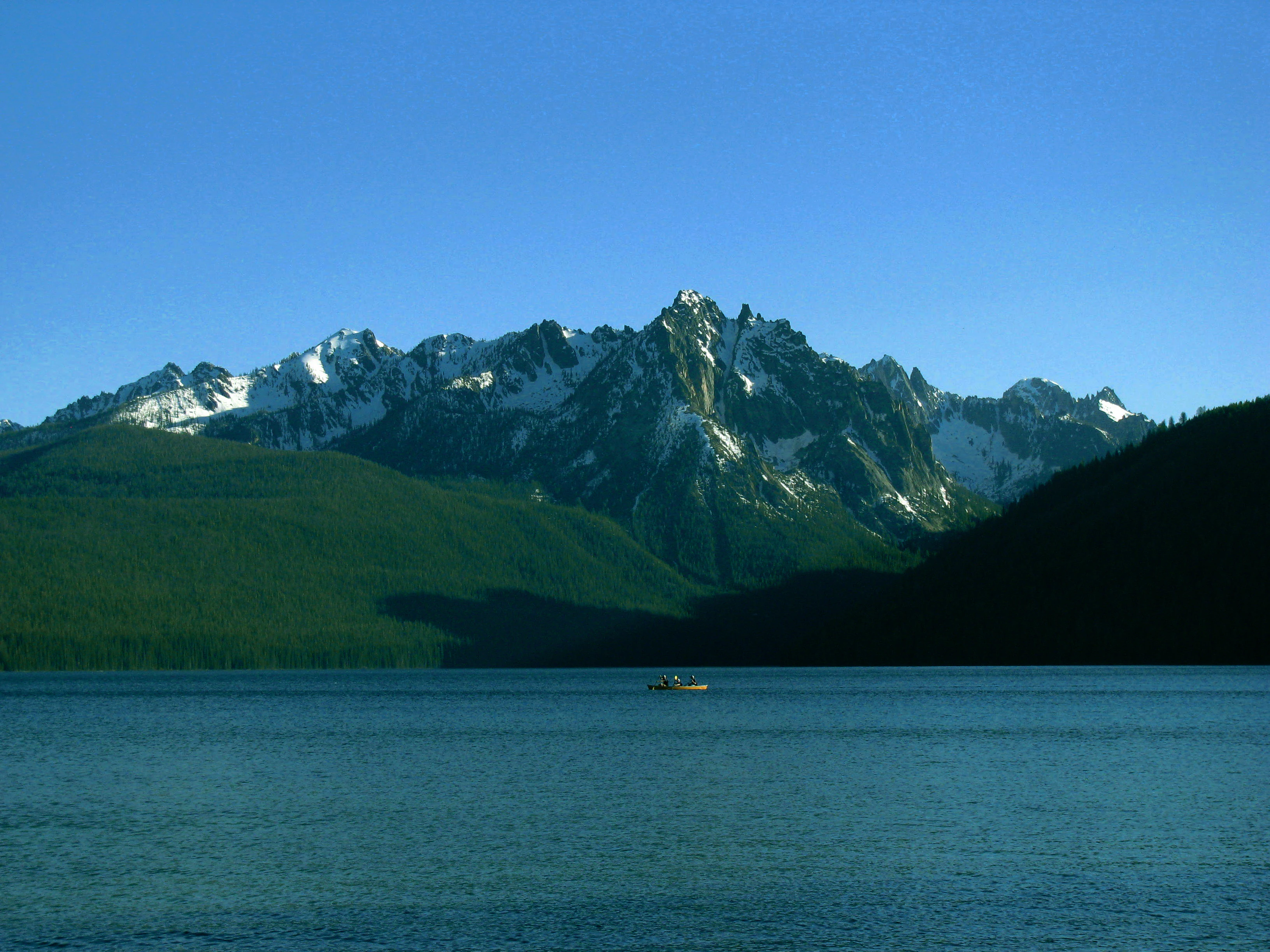
A wide view of Redfish Lake in the foreground, with the snow-capped, jagged peaks of the Sawtooth Range rising in the background under a clear blue sky.
Redfish Lake reflecting the peaks of the Sawtooth Range.

Best time to visit Sawtooth National Recreation Area

Summer is the most accessible and visually rewarding season in the Sawtooth National Recreation Area, when snow has melted from higher elevations and the hundreds of alpine lakes are fully visible. Trails to places like Sawtooth Lake, alpine lakes in the White Clouds, and ridge traverses in the Sawtooth Range are most safely attempted from late June through early September, with July and August offering the most reliable conditions for backpacking, climbing, and high-elevation day hikes.

Spring and early summer bring rushing rivers and snowmelt-fed waterfalls, along with wildflower displays in meadows and along trails, though higher routes may still be snow-covered and some lakes remain partially frozen. Fall is a quieter season with cooler temperatures, fewer crowds, and golden color developing in aspen groves and along the Salmon River corridor, while wildlife viewing can be especially rewarding as animals move to lower elevations. Winter transforms the area into a snow-covered landscape suited to cross-country skiing, snowshoeing, and backcountry hut use, though services thin out and visitors should be prepared for serious alpine winter conditions.
Monthly climate preview

Long term average temperature and precipitation patterns across the elevation

Sawtooth National Recreation Area Climate Normals and Weather by Month

Representative coordinates record sustained subzero winter minimums alongside warm summer peaks, while precipitation rates shift across the annual cycle. Reviewing the complete monthly climate dataset provides deeper insight into long term baseline weather patterns across the protected landscape.
Annual mean2 °C
-10 °C16 °C
Jan-10°
Feb-9°
Mar-5°
Apr-1°
May
Jun10°
Jul16°
Aug16°
Sep10°
Oct
Nov-5°
Dec-10°
Warmest month
July

16 °C

Coolest month
December

-9.6 °C

Wettest month
December

3.2 mm/day

Driest month
August

0.5 mm/day

Park location guide

Geography guide, regional context, and park location map for Sawtooth National Recreation Area

Sawtooth National Recreation Area park geography, regions, and map view in United States of America

Understand where Sawtooth National Recreation Area sits in United States of America through a broader geographic reading of the surrounding landscape, nearby location context, and its mapped position within the national park landscape.

How Sawtooth National Recreation Area fits into United States of America

The United States of America is a federal presidential republic and one of the world's largest countries by area and population. It consists of 50 states across a vast territory spanning multiple time zones, with its capital in Washington, D.C. and largest city in New York City. The nation has a diverse economy, influential political system, and significant cultural and military presence globally.

Wider geography shaping Sawtooth National Recreation Area in United States of America

The United States occupies a vast territory in North America, bordered by Canada to the north and Mexico to the south. The 48 contiguous states stretch from the Atlantic to the Pacific Ocean, while Alaska occupies the northwestern region and Hawaii is an archipelago in the Pacific. The country encompasses diverse terrain including the Rocky Mountains, Appalachian Mountains, Great Plains, and extensive river systems.

Map view of Sawtooth National Recreation Area

Use this park location map to pinpoint Sawtooth National Recreation Area in United States of America, understand its exact geographic position, and read its mapped placement within the surrounding landscape more clearly.

Pigeon | © OpenStreetMap contributors

Location context for Sawtooth National Recreation Area

Idaho
Recorded earthquake history

Review the Earthquake History of Sawtooth National Recreation Area

Examine documented seismic records associated with the geography of the Sawtooth National Recreation Area. MoriAtlas provides a searchable catalogue of historical earthquake events, magnitudes, and locations to help contextualize the seismic landscape of this protected central Idaho region.

Sawtooth National Recreation Area Earthquake History

Catalogued events

987 events

Strongest magnitude

Magnitude 6.9

Most recent event

Sep 12, 2026

This history includes earthquakes recorded inside the park or within 50 km of its borders

Visualizing alpine lakes, rugged granite peaks, and protected wilderness terrain

Sawtooth National Recreation Area Photos and Landscape Scenery

Examine high-resolution imagery showcasing the glaciated valleys, jagged peaks, and protected river headwaters of Sawtooth National Recreation Area. Visual documentation reveals the distinct terrain features, alpine ecosystems, and remote wilderness character defining central Idaho.

Panoramic landscape of the Sawtooth Mountain range featuring jagged snow-capped peaks in the distance above a dark forest band and sagebrush foreground under a clear blue sky.

Panoramic landscape view from a high vantage point overlooking a wide valley floor, with rugged mountain ranges in the distance under a blue sky with scattered clouds.

A wide view of a large alpine lake with a prominent boat wake in the foreground, leading toward steep, rocky mountains under a cloudy sky.

A wide landscape view of the jagged Grand Mogul mountain peak in the Sawtooth National Recreation Area, towering over a coniferous forest and a rocky foreground.

A wide view of a calm blue lake in the foreground with a dense coniferous forest and snow-capped rugged mountain peaks rising in the background under a clear sky.

A wide angle shot of a large alpine lake mostly covered in white ice, with a tall, snow-capped mountain rising directly behind it against a clear blue sky.

Rugged, jagged mountain peaks with small patches of snow rise above a deep, forested valley under a bright blue sky with scattered clouds.

A wide view of Redfish Lake in the foreground, with the snow-capped, jagged peaks of the Sawtooth Range rising in the background under a clear blue sky.

A high angle panoramic view of the rugged Sawtooth mountain range with snow-dusted peaks, overlooking a forested valley with a visible lake in the distance.

A clear alpine lake in the foreground with a dense coniferous forest and a jagged, snow-dusted mountain range in the background.

A dirt hiking trail curves through a mountainside landscape featuring fire-scarred, dead trees and patches of wildflowers and grasses under a clear blue sky.

A green meadow in the foreground with tall grass and shrubs, leading to a forest of pine trees and mountains in the background under a clear blue sky.

A large, rocky mountain peak rises behind a dense coniferous forest and a grassy alpine meadow with scattered granite boulders.

A clear alpine lake reflects a rocky mountain slope with streaks of snow across its face.

A small waterfall cascading over rocks into a stream, framed by tall evergreen trees in a forest setting.

A wide shot of a lush green meadow leading to a forest and rugged, partially snow-capped mountain peaks under a clear blue sky.

Park atlas

Discover related mountain terrain and connected regional protected areas across central Idaho

Explore Parks Near Sawtooth National Recreation Area and Surrounding Protected Landscapes

Compare Sawtooth National Recreation Area against nearby high country terrain and neighboring mountain sanctuaries. Broaden your geographic understanding of the surrounding northern Rockies ecosystem by examining adjacent wilderness zones.
A soft watercolor painting of a mountain landscape with gentle green rolling hills, light green distant peaks, and scattered pink floral accents in the foreground against a white background.
Wildlife reserveIdaho
Park boundaries overlap#1 closest

East

Jim McClure, Jerry Peak Wilderness: Geography and Protected Landscape Map in Idaho

Mapping central Idaho's remote mountain backcountry

Investigate the high-elevation wilderness geography of Jim McClure, Jerry Peak. This protected area in Custer County sits within the Salmon-Challis landscape, featuring a rugged mix of mountain peaks, dense coniferous forests, and remote drainages that define the character of the American West.

Area
473.07 km²
Established
2015
IUCN
Ib
Relief
Mountain
Soft watercolor illustration of a rolling mountain landscape with a forested foreground and faded, distant peaks.
Protected landscapeIdaho
Park boundaries overlap#2 closest

North

Salmon, Challis National Forest: Geography and Protected Land Map in Central Idaho

Extensive alpine ridges and wild river corridors

Spanning over 4.2 million acres, Salmon, Challis National Forest is a foundational protected landscape in Idaho. This area includes the highest peaks in the state, such as Borah Peak, and holds the majority of the Frank Church, River of No Return Wilderness. Utilize this atlas resource to examine the intricate mountain topography, expansive river systems, and the contiguous wild corridors that define this significant portion of the northern Rockies.

Area
17,142.2 km²
Established
1908
Relief
Mountain
Climate
Temperate
Watercolor painting of a calm lake surrounded by forested shores and distant mountains, depicted in soft pastel tones.
Protected landscapeIdaho
Park boundaries overlap#3 closest

South

Sawtooth National Forest: Geographic Overview and Protected Mountain Boundaries

Central Idaho mountain systems and wilderness corridors

Spanning over two million acres, Sawtooth National Forest defines the heart of the Rocky Mountains in Idaho. This protected landscape contains a complex network of glacial basins, alpine lakes, and varied ecosystems ranging from arid sagebrush foothills to high-altitude peaks. Explore the internal boundaries, drainage systems, and structural geography of this significant wilderness area.

Area
8,540.52 km²
Established
1905
Visitors
1.2M annual
Relief
Mountain
A horizontal watercolor illustration depicting a winding river flowing through a forested valley surrounded by soft, hazy mountain silhouettes.
Wildlife reserveIdaho
9.2 km away#4 closest

North

Frank Church, River of No Return Wilderness: Idaho Protected Mountain and River Landscapes

Discover massive roadless geography and river-carved mountain terrain.

Spanning over 2.3 million acres in central Idaho, the Frank Church, River of No Return Wilderness represents one of the most significant intact roadless landscapes in the lower 48 states. This protected area features a complex mosaic of coniferous forests, high-altitude alpine ridges, and the steep, jagged canyons of the Salmon River, creating a unique geographic profile for regional exploration.

Area
9,578.21 km²
Established
1980
IUCN
Ib
Relief
Mountain
Protected landscapeIdaho
60 km away#5 closest

Northwest

Payette National Forest: Geographic Overview of Idaho's Rugged Mountain Wilderness

Protected granite landscapes and glacial basin geography

Encompassing a vast portion of central Idaho, Payette National Forest represents a significant protected wilderness corridor. The forest geography transitions from granite-based alpine peaks and deep river gorges to dense coniferous slopes, providing essential habitat and extensive trail connectivity throughout the Northern Rockies.

Area
9,419.55 km²
Established
1944
Relief
Mountain
Access
Access unknown
A watercolor painting of a wide, rolling landscape with green hills, a winding path or river, and soft mountains in the background against a white background.
Protected landscapeUnited States of America
144 km away#6 closest

Northwest

Hells Canyon National Recreation Area: Geologic Boundaries and Snake River Corridor Atlas

Deep canyon terrain and archaeological heritage in the American Northwest

This protected landscape encompasses the profound depth of the Snake River gorge, featuring rugged basalt cliffs and diverse forested uplands. The area serves as a significant intersection of natural history and ancient cultural presence, providing a detailed look at the topographic complexity defining the Oregon and Idaho boundary region.

Area
2,641 km²
Established
1975
Relief
Mountain
Climate
Temperate
Protected landscapeOregon
144 km away#7 closest

Northwest

Wallowa-Whitman National Forest: A Geographic Overview of Northeastern Oregon Landscapes

Alpine wilderness, mountain ranges, and deep river gorges.

Wallowa-Whitman National Forest protects a vast, varied landscape of granite peaks, alpine meadows, and forested river canyons. This detailed overview covers the geographic significance of the Wallowa and Elkhorn mountains, the Hells Canyon corridor, and the surrounding wilderness regions within Oregon.

Area
9,682 km²
Established
1905
Visitors
505K annual
Relief
Mountain
A watercolor painting showing a wide view of a desert canyon landscape with layered plateaus and earthy tones.
Wildlife reserveIdaho
About 153 km away#8 closest

Southwest

Little Jacks Creek Wilderness: Mapping Idaho Canyon Country and Protected Landscapes

Basalt plateau and stream-cut gorge geography

Little Jacks Creek Wilderness protects a significant high-desert landscape in Idaho characterized by deep canyons and sagebrush-covered plateaus. As part of the Owyhee Canyonlands, this wildlife reserve highlights the geologic interplay of dark basalt and red rhyolite cliffs, providing a stable, undisturbed terrain for geographic and ecological study.

Area
206.1 km²
Established
2009
IUCN
Ib
Relief
Upland

Common questions about visiting, size, designation, and location context for Sawtooth National Recreation Area

Sawtooth National Recreation Area FAQs for park facts, access, geography, and protected area context

Find quick answers about Sawtooth National Recreation Area, including protected-area facts, park geography, trail and visitor context, and how the park fits into its surrounding country and regional landscape.
MoriAtlas Explorer

Continue Your Protected Areas Search Across the Global Atlas

Deepen your exploration by continuing the structured search for national parks and protected areas worldwide. Utilize the comprehensive filtering capabilities to compare different conservation landscapes and refine your understanding of global park geography. Discover more about the distribution and characteristics of protected natural areas.

Global natural geography