
Mori Atlas logo
Nature reserveSchlosspark Benrath

Analyzing the intersection of historic rococo garden design and near natural deciduous forest ecosystems.

Schlosspark Benrath Nature Reserve: A Detailed Geographic Atlas and Protected Landscape Mapping

(Naturschutzgebiet Schlosspark Benrath)

Schlosspark Benrath serves as a significant protected nature reserve situated along the lower Rhine terrace in the Benrath district of Düsseldorf. This geography provides a rare connection between historic baroque linden avenues and a mature, species-rich deciduous woodland that has evolved from former floodplain terrain. By examining the park through a structural lens, one can identify its essential role as an ecological refuge within the urbanized landscape of Nordrhein-Westfalen.

urban forest reservehistoric palace parkrococo gardendeciduous forestoak-hornbeam woodlanddeadwood habitat
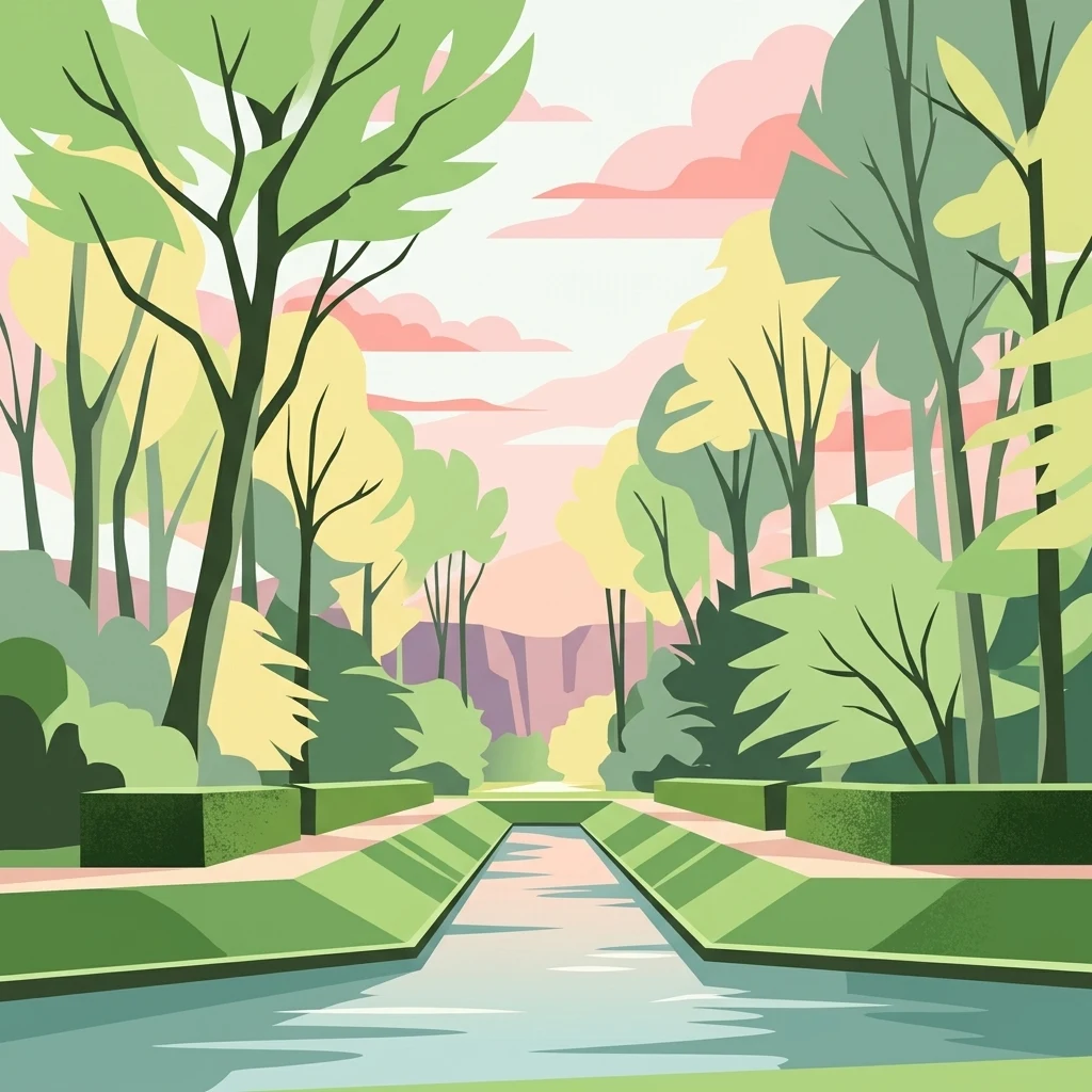
A stylized vector illustration of a peaceful garden canal flanked by symmetrical hedges and tall trees, with a soft pink and orange sunset in the background.

Schlosspark Benrath

Nature reserve

Park overview

Structured park overview, official facts, and landscape profile for Schlosspark Benrath

Schlosspark Benrath park facts, protected area profile, and essential visitor context

Review the core facts for Schlosspark Benrath, including designation, size, terrain, visitor scale, habitats, and operating context in one park-focused overview.

About Schlosspark Benrath

Schlosspark Benrath is a compact yet ecologically valuable nature reserve at the interface between historic garden art and near-natural forest. It sits on the right bank of the Rhine in the southern part of Düsseldorf, surrounding Schloss Benrath, an eighteenth-century rococo palace widely regarded as one of the most important garden-castle ensembles of its era in Germany.

What makes Schlosspark Benrath distinctive is the way its formal Baroque and Rocomo park design has merged with unmanaged woodland processes over the centuries. The original floodplain forest was reshaped in the seventeenth century into a hunting garden, but over time the woodland has reverted to a structurally diverse, multi-layered deciduous forest. Selective, plenter-like management has reinforced this naturalistic character, leaving old trees, deadwood, and a complex understory of yew and holly that are unusual in such a heavily urbanized setting.

Ecologically, the reserve functions as a refugium for forest species within the Rhine-Ruhr metropolitan region. The ponds, channels, and a small relict side-arm of an old watercourse add aquatic and riparian habitats to the forest matrix. Surveys have documented dozens of breeding bird species and hundreds of wood-inhabiting beetle species, including animals protected under European nature conservation law. The park therefore serves both as a cultural landscape of regional historical importance and as a genuinely valuable site for urban forest biodiversity.

In administrative terms, Schlosspark Benrath was formally designated as a Naturschutzgebiet in 2016, placing it under the strict protection regime applied to German nature reserves and integrating it into the broader network of protected sites along the lower Rhine.

Quick facts and research context for Schlosspark Benrath

Schlosspark Benrath is a nature reserve (Naturschutzgebiet) of about 44 hectares in Düsseldorf, North Rhine-Westphalia, situated in the Benrath district on the right bank of the Rhine. It is administered by the Untere Landschaftsbehörde Düsseldorf and was legally designated in 2016.

The reserve is classified as an IUCN Category IV Habitat/Species Management Area and lies at elevations between roughly 50 and 60 meters above sea level. It encompasses the historic park of Schloss Benrath, a major rococo palace, including structured woodland, planted avenues, and a network of ponds and channels. Immediately to the south it connects ecologically with the larger Urdenbacher Kämpen floodplain forest reserve.

Protection and recognition

Documented management scope and official designation records for Schlosspark Benrath.

Schlosspark Benrath Protection Status and Terrestrial Conservation Data

Schlosspark Benrath maintains a documented terrestrial protection scope within international conservation databases. Official management records outline the established designation framework and environmental administrative context.

Protection details

Protection scope
Terrestrial
Transboundary protection
No
WDPA ID
319076
Park context

Deeper park guide and search-rich context for Schlosspark Benrath

Schlosspark Benrath history, landscape, wildlife, and travel context

Explore Schlosspark Benrath through its history, landscape character, ecosystems, wildlife, conservation priorities, cultural context, and seasonal travel timing in a structured park guide built for atlas discovery and search intent.

Why Schlosspark Benrath stands out

Schlosspark Benrath is best known as a close combination of a high-value cultural landscape and a structurally rich, species-rich deciduous forest reserve. The park's woodland grew out of former floodplain forests of the lower Rhine terrace and developed a near-natural character through plenter-like selective management. Its defining features are the star-shaped linden avenues radiating from a central rondel, set within a forest dominated by oak, hornbeam, beech, ash, wild cherry, and sycamore maple. An unusually high share of old yews in the understory, along with holly, gives the forest a distinctive texture. The park is also notable for its rich deadwood fauna, including rare European-protected beetles, and for the birdlife that uses the mature woodland along the edge of the city.
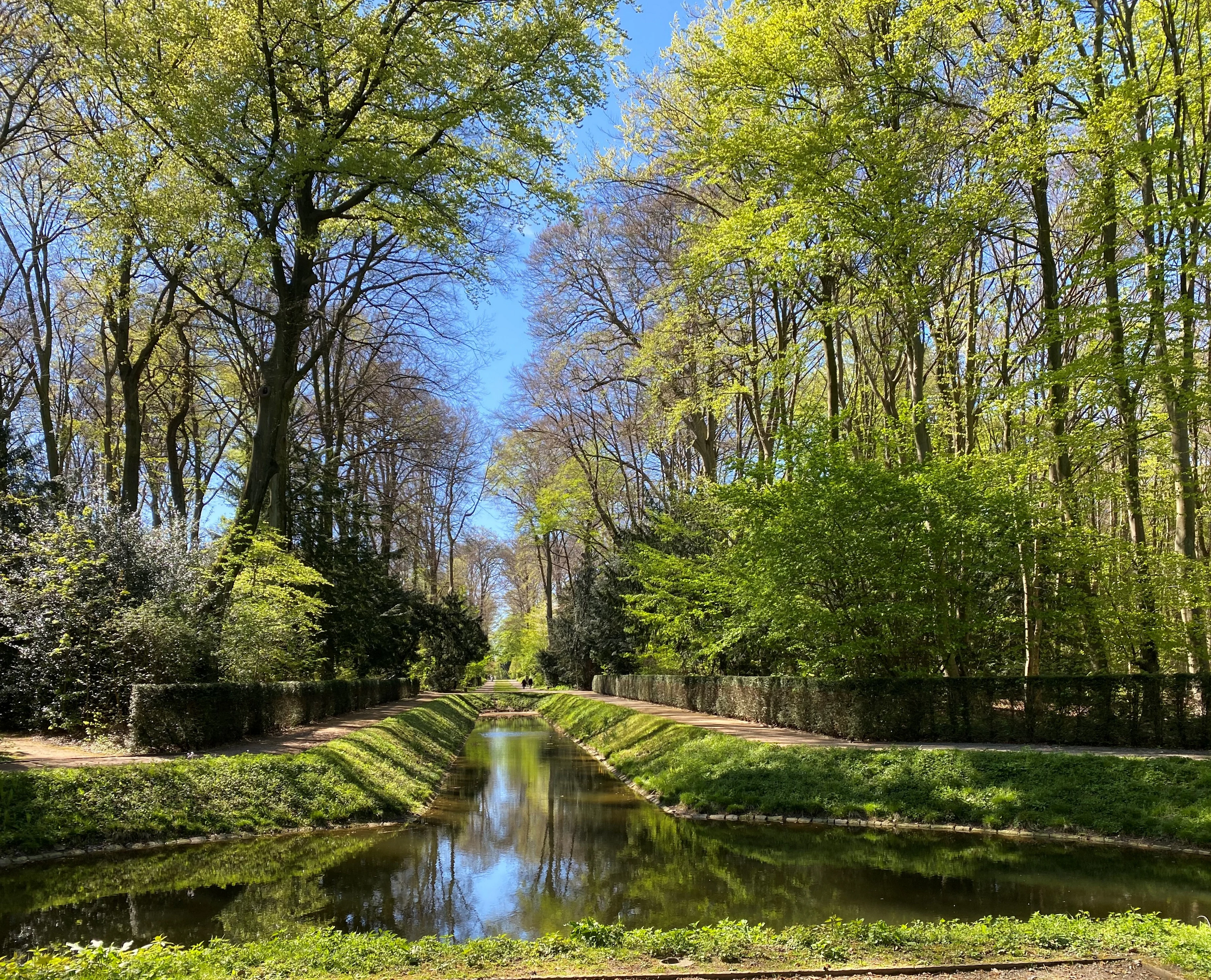
A narrow canal-like pond reflects the green trees and blue sky, flanked by manicured hedges and tall forest trees in Schlosspark Benrath.
The Trompetenweiher pond reflecting the surrounding forest canopy in Schlosspark Benrath.

Schlosspark Benrath history and protected-area timeline

The landscape history of Schlosspark Benrath stretches back well beyond its current protected status. The area originally carried floodplain hardwood forest typical of the lower Rhine terrace, dominated by oak and hornbeam. In the seventeenth century this woodland was reshaped into a structured hunting garden, with carefully aligned avenues and a central rondel that still organizes the park today.

The decisive shift toward today’s forest character came through centuries of relatively light, plenter-style management, which preserved large old trees, encouraged natural regeneration, and allowed deadwood to accumulate. By the twentieth and early twenty-first centuries the woodland had come to resemble a near-natural forest more than a maintained ornamental garden, even while the historic avenues and water features remained clearly legible.

In 2016 the area was formally designated as a nature reserve, Naturschutzgebiet Schlosspark Benrath, through a legal ordinance administered by the Untere Landschaftsbehörde of the city of Düsseldorf. The designation recognized the site’s structural diversity, its connection to the larger Urdenbacher Kämpen floodplain forest to the south, and its importance for protected species such as the stag beetle and the Juchtenkäfer (Osmoderma eremita).

Schlosspark Benrath landscape and geographic character

Schlosspark Benrath occupies a relatively flat stretch of the lower Rhine terrace, sitting only a few meters above the river at elevations around 50 to 60 meters. Despite its modest relief, the landscape has a strongly organized visual structure thanks to the historic Baroque and Rococo park layout.

The most striking landscape feature is the star-shaped avenue system of mature linden trees, which radiates from a central rondel and divides the woodland into clear geometric sectors. These avenues contrast with the otherwise irregular forest interior and give the park its distinctive dual character as both designed landscape and natural forest.

Water is a recurring theme in the terrain. The park is encircled and traversed by ponds and channels of varying size, including the Trompetenweiher and the Viereck-Weiher, and a small channel believed to follow an old side-arm of the Rhine. Ponds, embankments, and a network of paths give the landscape a varied, park-like reading that has persisted alongside the maturing forest.
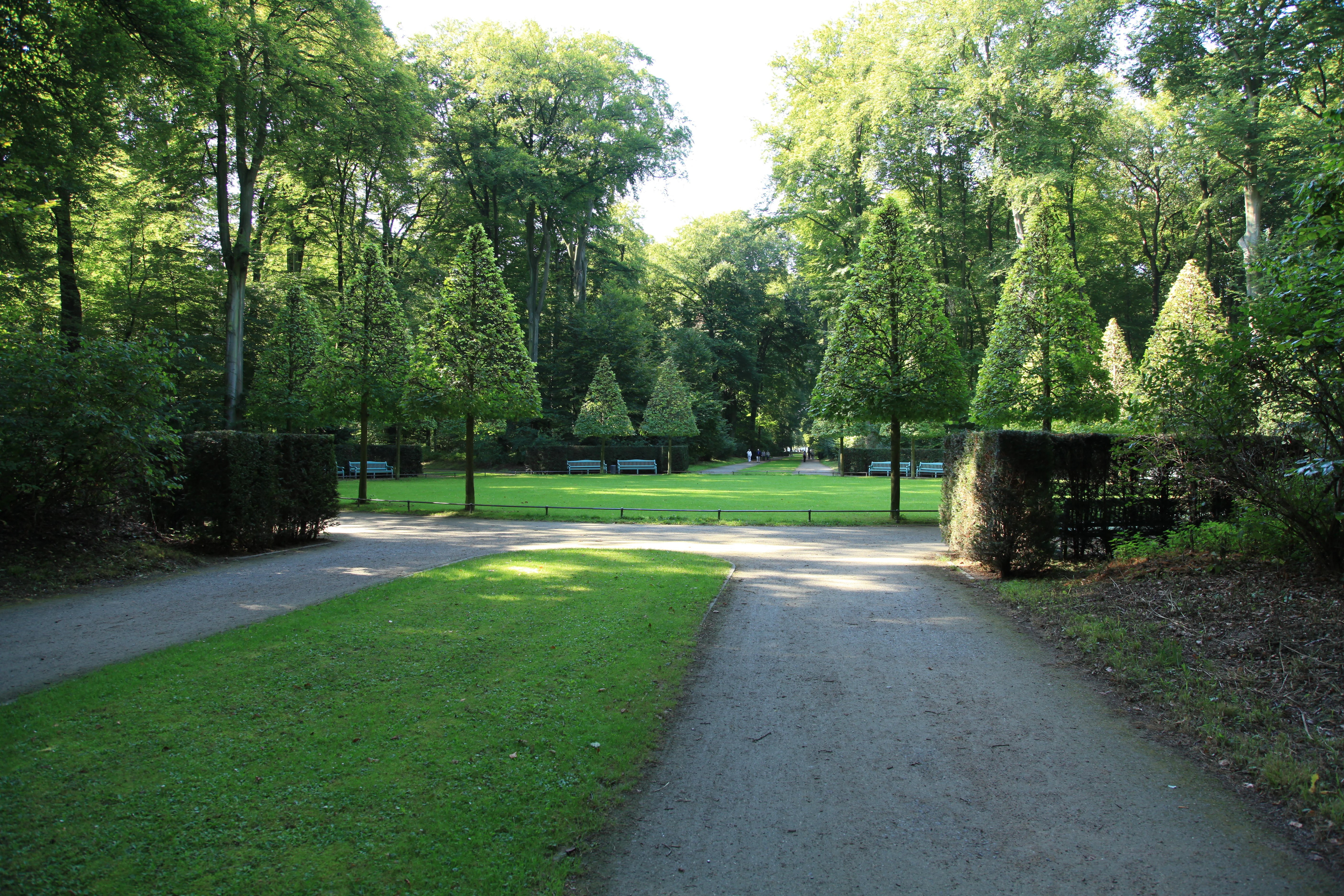
A wide, gravel walking path leads toward a green circular clearing surrounded by tall, shaped trees and dense forest at Schlosspark Benrath.
A tranquil clearing known as a hunting star in the forested parkland of Schlosspark Benrath.

Schlosspark Benrath ecosystems, habitats, and plant life

Ecologically, Schlosspark Benrath is a structurally rich hardwood forest set within a metropolitan landscape. Its tree layer is dominated by pedunculate oak, hornbeam, European beech, ash, wild cherry, and sycamore maple, with additional species appearing in the understory. A particularly notable feature of the understory is the high proportion of old common yew, complemented by scattered holly, which gives the lower levels of the forest a distinctive evergreen character unusual for lowland German forests.

The shrub and herb layers are more sparse than the tree layer, reflecting the dense canopy, but they still support characteristic woodland plants such as wood sedge, wood millet, bramble, and extensive patches of bracken fern. In moist shaded clearings and along water features, flowering woodland plants thrive beneath the trees and shrubs, contributing seasonal color to the otherwise muted forest interior.

Habitats within the reserve include mature broadleaf forest, avenues and parkland trees, old yew-dominated underwood, ponds, channels, and a significant deadwood component. This mosaic is unusually varied for an urban forest and supports a wide range of woodland, wetland, and deadwood-associated species within a small area.
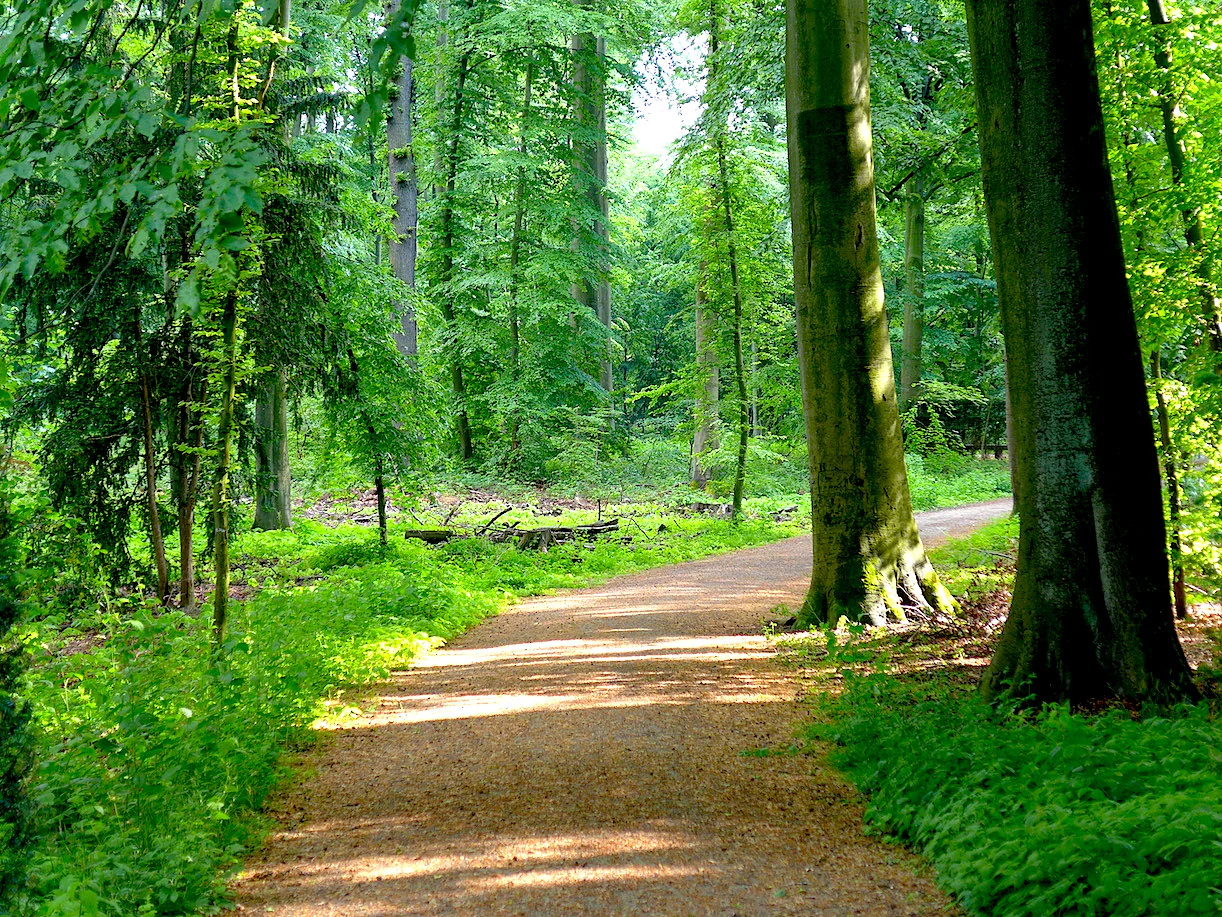
A gravel walking path leads into a dense green forest with tall tree trunks and leafy foliage in Schlosspark Benrath.
A shaded gravel path winding through the lush green forest of Schlosspark Benrath.

Schlosspark Benrath wildlife and species highlights

Schlosspark Benrath supports a notably rich fauna for a forest reserve of its size, particularly in the realms of birds and saproxylic (deadwood-dependent) invertebrates. The mature, structurally diverse woodland and the surrounding ponds give rise to a layered community of breeding and foraging species.

Among birds, surveys have recorded around 82 species using the park, including woodland specialists such as the Eurasian nuthatch, wood warbler, and great spotted woodpecker, as well as larger species of prey like the northern goshawk, which is reported to breed within the park.

Even more conspicuous in ecological terms is the beetle fauna associated with the reserve’s abundant deadwood. Investigative surveys have recorded well over 300 wood-inhabiting beetle species, including the European-protected Juchtenkäfer (Osmoderma eremita) and the stag beetle (Lucanus cervus). These species depend directly on old trees and decaying wood, making the park’s long-standing tolerance of standing and fallen dead trees central to its conservation value.
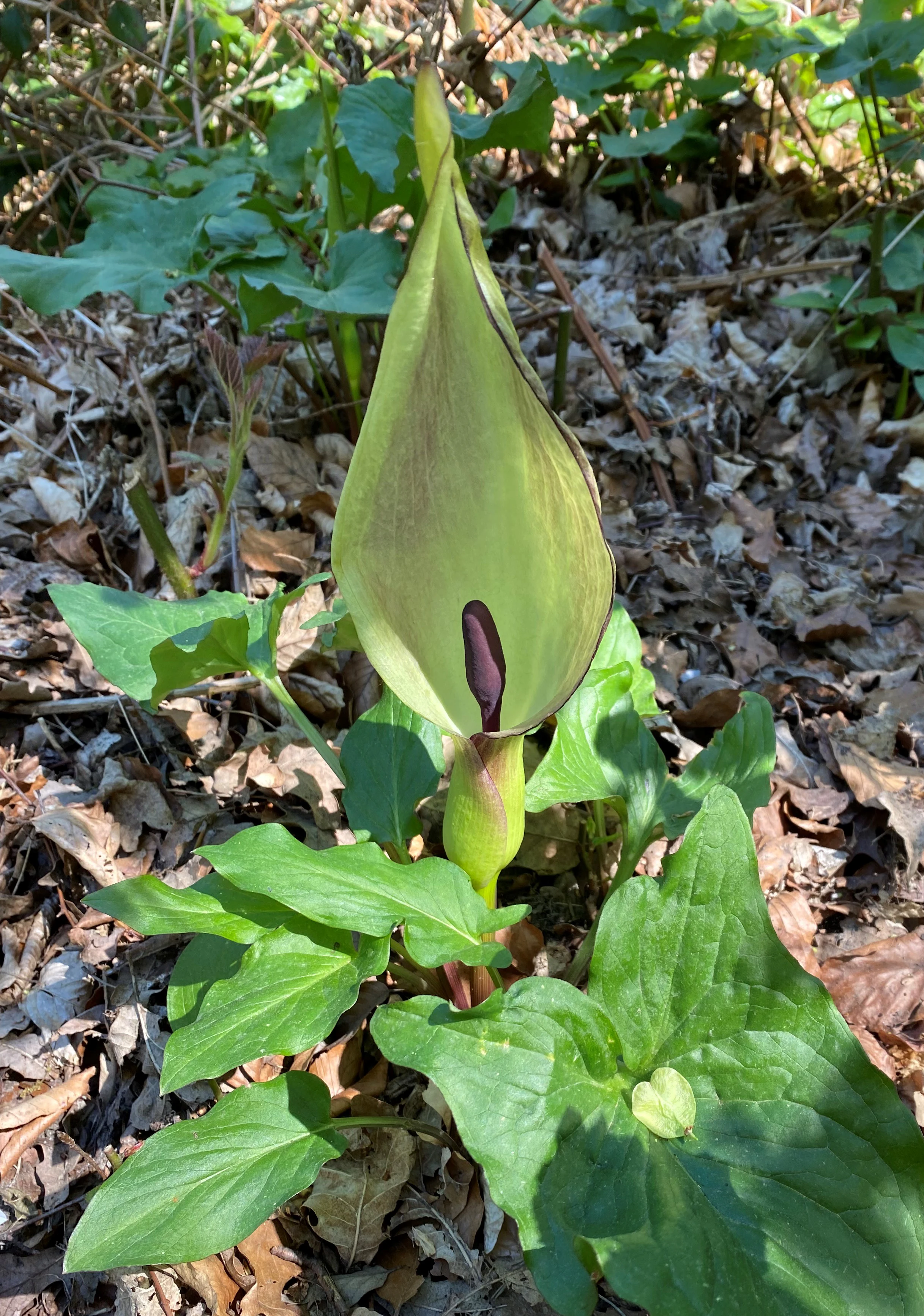
A close up view of an Arum maculatum flower with a pale green spathe and dark purple spadix growing from the forest floor.
A cuckoo pint plant (Arum maculatum) in bloom within the woodlands of Schlosspark Benrath.

Schlosspark Benrath conservation status and protection priorities

From a conservation perspective, Schlosspark Benrath matters because it preserves a structurally complex, near-natural deciduous woodland and its associated deadwood fauna in the middle of one of Europe’s most densely populated regions. The reserve is part of the network of protected sites along the lower Rhine and is classified internationally as an IUCN Category IV Habitat/Species Management Area.

The reserve provides habitat for species protected under European nature conservation law, including the stag beetle and the Juchtenkäfer, both of which depend on old trees and long undisturbed deadwood. Maintaining large old trees, allowing deadwood to remain in the forest, and continuing selective, plenter-like management are central to the conservation strategy. The pond and channel network adds aquatic and semi-aquatic habitat value.

Connectivity is another key conservation dimension. Schlosspark Benrath adjoins the larger floodplain forest reserve of Urdenbacher Kämpen to the south, creating a relatively continuous corridor of protected floodplain and terrace woodland along the right bank of the Rhine, which is significant for species movement and ecological resilience in an urbanized landscape.

Schlosspark Benrath cultural meaning and human context

Schlosspark Benrath carries strong cultural weight as the setting of Schloss Benrath, one of the most important rococo garden-castle ensembles in Germany. The palace and its park were developed in the eighteenth century and have long shaped the identity of the Benrath district in southern Düsseldorf.

The survival of the historic star-shaped avenue system within a maturing forest gives the park a layered cultural reading: it is at once a designed Baroque and Rococo landscape, a nineteenth- and twentieth-century forest, and a present-day nature reserve. The site therefore functions as a reminder that many of Germany’s most ecologically valuable forests grew out of earlier park and hunting-ground landscapes, and that cultural and natural heritage can overlap meaningfully on the same ground.
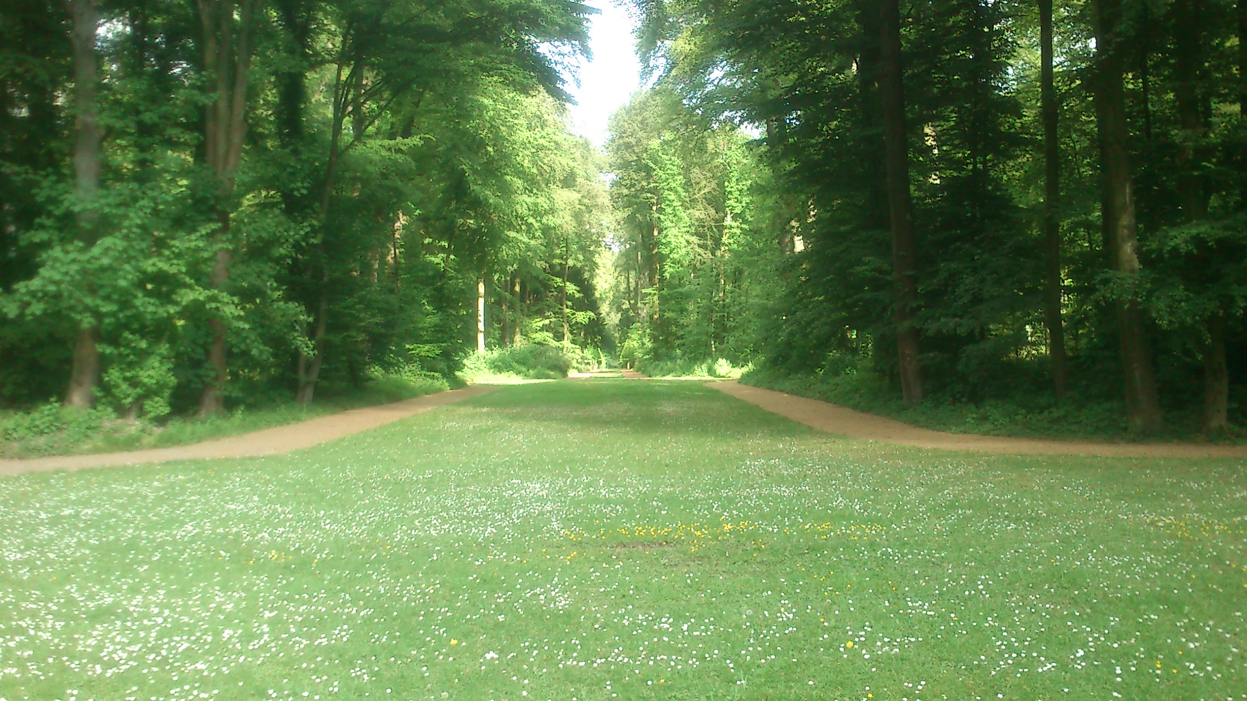
A wide, grassy path leading into a dense green forest, with dirt trails lining both sides of the meadow.
A grassy promenade known as Champagnerallee flanked by old trees in Schlosspark Benrath.

Top sights and standout views in Schlosspark Benrath

A defining highlight of Schlosspark Benrath is the way its historic linden avenues and central rondel still organize a near-natural mature forest, producing a landscape that reads simultaneously as designed park and wild woodland. Equally distinctive is the unusually high share of old yew in the understory, a feature rarely seen in lowland European forests.

The reserve’s rich deadwood fauna is another major point of distinction, with hundreds of beetle species, including those protected at the European level, and a thriving bird community of around 82 species, including breeding goshawks. Combined with its direct ecological connection to the Urdenbacher Kämpen floodplain forests to the south, the park stands out as an unusually high-quality urban forest reserve on the lower Rhine.
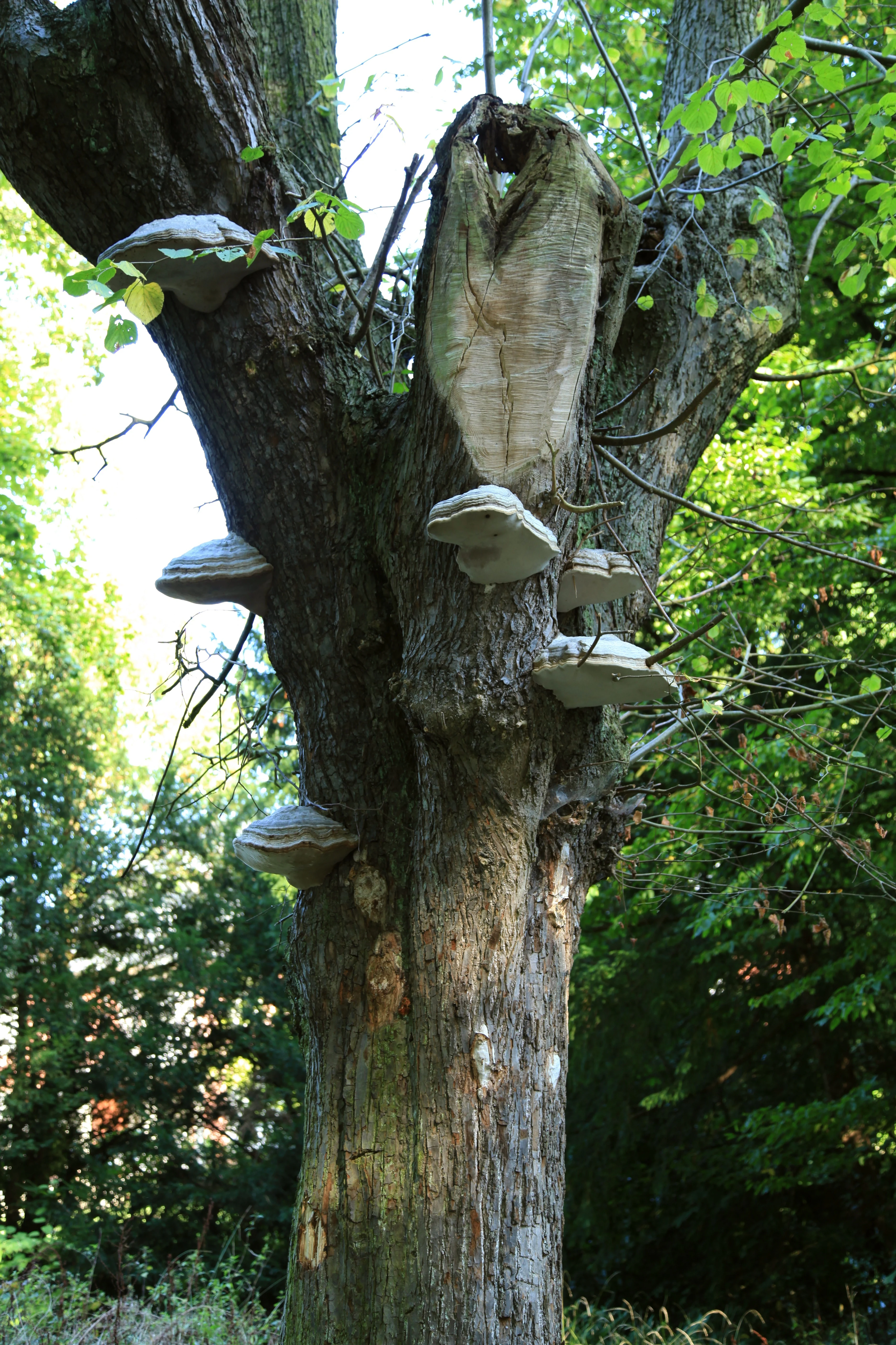
A close-up view of a large tree trunk featuring several shelf fungi attached to the bark, with green foliage visible in the background.
Shelf fungi growing on an aged tree trunk in Schlosspark Benrath.

Best time to visit Schlosspark Benrath

As an evergreen, low-relief forest reserve, Schlosspark Benrath can be visited meaningfully across much of the year. Spring brings fresh green foliage in the canopy and flowering woodland plants in the herb layer, including species such as cuckoo pint (arum) that appear in damp shaded spots under the trees.

Late spring and early summer are a particularly rewarding time for birdwatchers, when woodland species are actively singing and breeding. Autumn offers rich color in the deciduous canopy and a strong atmosphere along the avenues and ponds. Winter reveals the structural details of the forest most clearly, with bare trees, visible deadwood, and open views along the avenues, making it a good season for observing the interaction between historic park design and natural forest processes.

Monthly climate preview

Long-term temperature ranges and monthly precipitation averages for Nordrhein-Westfalen

Schlosspark Benrath Climate Normals and Annual Weather Patterns

Schlosspark Benrath records long-term monthly temperatures ranging from sub-zero winter minimums to warm summer maximums alongside steady precipitation levels across the year. Reviewing these representative coordinate measurements provides essential context on annual climatic rhythms before examining the full twelve-month profile.
Annual mean10 °C
1 °C19 °C
Jan
Feb
Mar
Apr
May13°
Jun17°
Jul19°
Aug19°
Sep15°
Oct10°
Nov
Dec
Warmest month
July

19.2 °C

Coolest month
January

1.3 °C

Wettest month
December

2.6 mm/day

Driest month
April

1.6 mm/day

Park location guide

Geography guide, regional context, and park location map for Schlosspark Benrath

Schlosspark Benrath park geography, regions, and map view in Germany

Understand where Schlosspark Benrath sits in Germany through a broader geographic reading of the surrounding landscape, nearby location context, and its mapped position within the national park landscape.

How Schlosspark Benrath fits into Germany

Germany is a federal republic in Western and Central Europe with a population of over 83 million across sixteen constituent states. It is Europe's largest economy by nominal GDP and a major global exporter and importer. The capital is Berlin, and the country borders Denmark, Poland, Czech Republic, Austria, Switzerland, France, Luxembourg, Belgium, and the Netherlands.

Wider geography shaping Schlosspark Benrath in Germany

Germany is located in Western and Central Europe, spanning 357,022 km². It borders Denmark to the north, Poland and the Czech Republic to the east, Austria and Switzerland to the south, and France, Luxembourg, Belgium, and the Netherlands to the west. The country has coastlines on the Baltic Sea and North Sea to the north, with the Alps located in the southern region.

Map view of Schlosspark Benrath

Use this park location map to pinpoint Schlosspark Benrath in Germany, understand its exact geographic position, and read its mapped placement within the surrounding landscape more clearly.

Pigeon | © OpenStreetMap contributors

Location context for Schlosspark Benrath

Nordrhein-Westfalen

Visualizing the historic linden avenues, deciduous woodland habitats, and protected terrain of Düsseldorf

Schlosspark Benrath Photos and Landscape Scenery

Visual records capture the distinctive balance between historic rococo garden design and near-natural floodplain forest across the reserve. Examining these protected landscapes reveals the structural complexity of old yew understories, winding waterways, and mature oak habitats.

A narrow canal-like pond reflects the green trees and blue sky, flanked by manicured hedges and tall forest trees in Schlosspark Benrath.

A dirt hiking path leading into a dense, sunlit forest with large deciduous trees and dappled lighting.

A wide, gravel walking path leads toward a green circular clearing surrounded by tall, shaped trees and dense forest at Schlosspark Benrath.

A gravel walking path leads into a dense green forest with tall tree trunks and leafy foliage in Schlosspark Benrath.

A close up view of an Arum maculatum flower with a pale green spathe and dark purple spadix growing from the forest floor.

A group of ducks swimming in a calm pond, with autumn-colored trees reflected in the water and overhanging branches in the foreground.

A wide, grassy path leading into a dense green forest, with dirt trails lining both sides of the meadow.

A close-up view of a large tree trunk featuring several shelf fungi attached to the bark, with green foliage visible in the background.

A dirt hiking path leading into a sun-dappled deciduous forest with dense green foliage on both sides.

A ground level view of a lush green forest with mature trees, showing a bed of fallen brown leaves on the ground and soft-focus evergreen branches in the immediate foreground.

A narrow, green, algae-covered stream winds through a dense, sun-dappled forest, with a dirt path in the foreground.

A large, weathered tree stump heavily covered in green moss sits on a forest floor with dappled sunlight filtering through the trees.

A peaceful pond reflecting surrounding trees under bright, hazy daylight within a forest park setting.

Park atlas

Compare adjacent floodplain reserves and regional nature areas across North Rhine-Westphalia

Exploring Parks Near Schlosspark Benrath and Surrounding Protected Landscapes

Browsing other protected areas near Schlosspark Benrath reveals broader ecological patterns along the lower Rhine terrace. Comparing adjacent woodland reserves provides valuable context on urban forest habitats and regional conservation geography.
A soft watercolor illustration of a calm stream winding through a wetland or bog area, with gentle hills in the background and a split tree trunk in the foreground.
Nature reserveNordrhein-Westfalen
About 6.5 km away#1 closest

East

Hildener Stadtwald, Bereich Biesenbach: Protected Wetland and Heathland Geography

Nature reserve complex in the Mettmann district of Nordrhein-Westfalen

This compact nature reserve preserves a critical network of bog woodland and stream-fed alder swamp within the sand-dominated terrain of the Bergische Heideterrasse. The area demonstrates a clear transition between elevated dry forest margins and permanently wet peat moss communities, anchoring a wider regional system of protected heathland habitats.

Area
0.09 km²
Established
1938
IUCN
IV
Relief
Lowland
Watercolor painting of a meandering stream flowing through a green meadow, with trees in the background.
Nature reserveNordrhein-Westfalen
About 7.1 km away#2 closest

Northeast

Hildener Stadtwald, Bereich Sandbach-Krebsbach Protected Nature Reserve and Wetland Geography

A mapped overview of the Bergische Heideterrasse riparian corridor.

Hildener Stadtwald, Bereich Sandbach-Krebsbach stands as an important nature reserve within the urbanised landscape of North Rhine-Westphalia. The area is characterized by its hydrologically dynamic sandy brooks, old-growth alder stands, and distinct microhabitats ranging from wet heath to dry oak-birch forests. This protected entity offers a clear look at the structural complexity of lowland mire ecosystems within a broader regional forest context.

Area
0.27 km²
Established
1938
IUCN
IV
Relief
Lowland
A horizontal watercolor illustration showing a landscape with sparse trees, grasses, and soft pastel colors representing a heathland habitat.
Nature reserveNordrhein-Westfalen
About 7.4 km away#3 closest

East

Hildener Heide, östlich Taubenberg: Protected Nature Reserve and Heathland Atlas

Mapping the ecological landscape in Nordrhein-Westfalen

Hildener Heide, östlich Taubenberg is a distinct nature reserve in the Mettmann district, notable for its intact wet heath and bog asphodel populations. This protected area contributes to a wider forest and heath network across the Bergische Heideterrasse, showcasing how active conservation management shapes unique lowland terrain.

Area
2 km²
Established
1993
IUCN
IV
Watercolor illustration showing a wide landscape with rolling hills in soft pink and purple tones, a line of green conifer and deciduous trees, and a grassy foreground with a winding path or stream
Nature reserveNordrhein-Westfalen
About 7.5 km away#4 closest

East

Hildener Heide, Schönholz Nature Reserve: Geography and Protected Area Context

A preserved mosaic of inland heath and bog forest habitats.

Hildener Heide, Schönholz provides a critical window into the rare wetland ecosystems of the Bergische Heideterrasse. This nature reserve in North Rhine-Westphalia retains a distinct mosaic of peat-moss-dominated bog woodland, wet heath, and alder-ash floodplain forest, offering a high density of threatened habitats within a protected geographic framework.

Area
0.36 km²
Established
1938
IUCN
IV
Relief
Lowland
Watercolor painting of a tranquil, marshy landscape with soft green trees, grass, and a winding path, rendered in a pale, minimalist style.
Nature reserveNordrhein-Westfalen
About 7.5 km away#5 closest

East

Krüdersheide und Götsche Nature Reserve: Geographic Mapping and Protected Land Data

Wetland mosaic and bog forest habitats in Nordrhein-Westfalen

Located in Solingen, the Krüdersheide und Götsche nature reserve protects essential bog woodland, peat cushions, and stream habitats on the Bergische Heideterrasse. This 55-hectare site serves as an important ecological corridor for moisture-dependent flora and fauna within an urbanized region of Nordrhein-Westfalen. Study its mapped boundaries and terrain context through our specialized atlas database.

Area
0.547 km²
Established
2005
IUCN
IV
Relief
Lowland
A soft watercolor painting of a small grove of trees standing near a body of water, featuring pale green and yellow tones.
Nature reserveNordrhein-Westfalen
About 8.3 km away#6 closest

East

Naturschutzgebiet Hildener Heide, südlich Sandberg: Protected Area and Landscape Atlas

Bog woodland and wet heathland geography in North Rhine-Westphalia.

Examine the topography and habitat mosaic of Naturschutzgebiet Hildener Heide, südlich Sandberg. This nature reserve serves as an important ecological anchor on the Bergische Heideterrasse, preserving rare wetland, alder bog forest, and heath vegetation within a compact and structurally diverse geographic footprint.

Area
0.08 km²
Established
1938
IUCN
IV
Relief
Lowland
Watercolor illustration of a peaceful lake with trees on a small island and flowering meadows in the foreground.
Nature reserveNordrhein-Westfalen
About 8.4 km away#7 closest

Southeast

Monheimer Baggersee Nature Reserve: Geographic Overview and Protected Landscape Mapping

Located within the Lower Rhine terrace of Nordrhein-Westfalen

Monheimer Baggersee represents a vital protected landscape shaped from a former gravel quarry. This reserve provides a comprehensive geographic look at mineral-substrate habitats, irregular lake shorelines, and specialized avian breeding grounds within the urbanized Mettmann district.

Area
0.712 km²
Established
1981
IUCN
IV
Relief
Lowland
Watercolor painting of a green valley with a winding stream and gentle hills in the background.
Nature reserveNordrhein-Westfalen
About 8.5 km away#8 closest

North

Morper Bachtal: Mapped Nature Reserve and Stream Valley Geography in Germany

Protected wetland landscapes and regional habitat connectivity.

Morper Bachtal represents a tightly layered protected area where open water, reedbeds, and beech forests converge along the Rotthäuser Bach. This detailed look at its landscape composition and position within the district of Mettmann reveals the significance of its compact, undulating terrain and corridor role in German regional geography.

Area
0.74 km²
Established
1984
IUCN
IV
Relief
Upland

Common questions about visiting, size, designation, and location context for Schlosspark Benrath

Schlosspark Benrath FAQs for park facts, access, geography, and protected area context

Find quick answers about Schlosspark Benrath, including protected-area facts, park geography, trail and visitor context, and how the park fits into its surrounding country and regional landscape.
MoriAtlas Explorer

Continue Your Protected Areas Search Across the Global Atlas

Deepen your exploration by continuing the structured search for national parks and protected areas worldwide. Utilize the comprehensive filtering capabilities to compare different conservation landscapes and refine your understanding of global park geography. Discover more about the distribution and characteristics of protected natural areas.

Global natural geography