
Mori Atlas logo
Nature reserveSchönleitenmoos im Wierlinger Forst

A preserved post-glacial raised bog located on the Rhine-Danube watershed in Landkreis Oberallgäu.

Schönleitenmoos im Wierlinger Forst Protected Nature Reserve and Glacial Bog Landscape

(Naturschutzgebiet Schönleitenmoos im Wierlinger Forst)

Schönleitenmoos im Wierlinger Forst is a protected nature reserve in the Bavarian Allgäu that showcases the post-glacial development of an ombrotrophic raised bog. This small, bowl-shaped peatland sits at 932 meters above sea level and serves as a geographic watershed point between the Rhine and Danube river basins. The area preserves a distinct vegetation zonation, ranging from spruce forest margins to stunted bog pines and open water-filled hollows, including a notable extra-Alpine population of rust-leaved alpine rose.

raised bogpeatlandHochmoorbavariaallgäurhine-danube watershed
A stylized, flat-design illustration of a forest bog landscape with coniferous trees, a winding marshy stream, and soft hills in the background under a sunrise.

Schönleitenmoos im Wierlinger Forst

Nature reserve

Park overview

Structured park overview, official facts, and landscape profile for Schönleitenmoos Nature Reserve

Schönleitenmoos Nature Reserve park facts, protected area profile, and essential visitor context

Review the core facts for Schönleitenmoos Nature Reserve, including designation, size, terrain, visitor scale, habitats, and operating context in one park-focused overview.

About Schönleitenmoos Nature Reserve

Schönleitenmoos im Wierlinger Forst is a long-established Bavarian nature reserve located in the Wierlinger Forst, a forested area southwest of Kempten in the Oberallgäu district. Although small, only about 23 hectares, it encapsulates a complete and scientifically documented example of a post-glacial raised bog in the northern Alpine foothills, and it has been protected since the late 1950s.

The reserve sits astride a particularly meaningful hydrological feature: the watershed between the Rhine and the Danube river systems. Its peat body is the legacy of an Eisrandsee, a proglacial lake that formed as Alpine glaciers melted at the end of the last ice age and the drainage of the new ice-front landscape was still being established. As sediment and plant material accumulated, this lake first developed into a flat lowland bog (Flachmoor) and, with continued peat growth and increasing isolation from groundwater, eventually into an ombrotrophic Hochmoor fed only by rainwater.

For visitors and naturalists, the reserve demonstrates a textbook paludification sequence in miniature. The outer edge is dominated by spruce forest; moving inward the canopy breaks into a stunted, tree-formed Spirke (Pinus rotundata) woodland; this then transitions into dense, shrubby Latschenkiefer (Pinus mugo subsp. mugo) dwarf pine; and finally the center opens into wet, Sphagnum-rich peat surfaces with water-filled Schlenken. This zonation, together with the unusually low-pH, nutrient-poor conditions, supports both common raised bog species and a number of specialized bog plants that are otherwise rare in the region.

To the northwest, the much larger Breitenmoos nature reserve extends the protected peatland complex, making Schönleitenmoos part of a wider network of ice-age remnant bogs in the Wierlinger Forst that together conserve the geomorphological and ecological character of this part of the Allgäu.

Quick facts and research context for Schönleitenmoos Nature Reserve

Schönleitenmoos is a 23-hectare nature reserve (Naturschutzgebiet) in the Landkreis Oberallgäu, Bavaria, in the municipal area of Weitnau. It was officially designated in 1959, with the protected area formally established around 1960. The reserve lies on the Rhine-Danube watershed at roughly 932 meters above sea level and contains a classic glacial-origin raised bog with open bog pools, Sphagnum-dominated peat surfaces, and a characteristic transition through moor pine and spruce forest at its edges.

The site is registered in the World Database on Protected Areas under WDPA ID 82549 and carries the German federal nature reserve reference NSG-By-OA-00079.01. To its northwest lies the larger 85.77-hectare Breitenmoos nature reserve, with which Schönleitenmoos forms part of a broader corridor of protected peatlands in the Wierlinger Forst.

Protection and recognition

Review documented protected area records and official registry data

Schönleitenmoos im Wierlinger Forst Protection Status and Records

Schönleitenmoos im Wierlinger Forst holds documented protection status within the global database registry. Verified conservation records assemble official designation metrics and international administrative references for analytical review.

Protection details

WDPA ID
82549
Park context

Deeper park guide and search-rich context for Schönleitenmoos Nature Reserve

Schönleitenmoos Nature Reserve history, landscape, wildlife, and travel context

Explore Schönleitenmoos Nature Reserve through its history, landscape character, ecosystems, wildlife, conservation priorities, cultural context, and seasonal travel timing in a structured park guide built for atlas discovery and search intent.

Why Schönleitenmoos Nature Reserve stands out

Schönleitenmoos is best known for being an ecologically well-preserved raised bog on the Rhine-Danube watershed, with a clear vegetation zonation running from spruce forest on the outer rim, through tree-forming bog pine (Spirke) and shrubby dwarf pine (Latsche), to open, water-filled bog hollows in the center. Its second, more unusual claim to prominence is the extra-Alpine population of the rust-leaved alpine rose (Rhododendron ferrugineum) growing within the bog pine moor woodland. This is one of the very few occurrences of the species far from the main Alpine chain and was a primary reason for designating the area as a nature reserve. The alpine rose stand is itself additionally registered as a natural monument (Naturdenkmal).
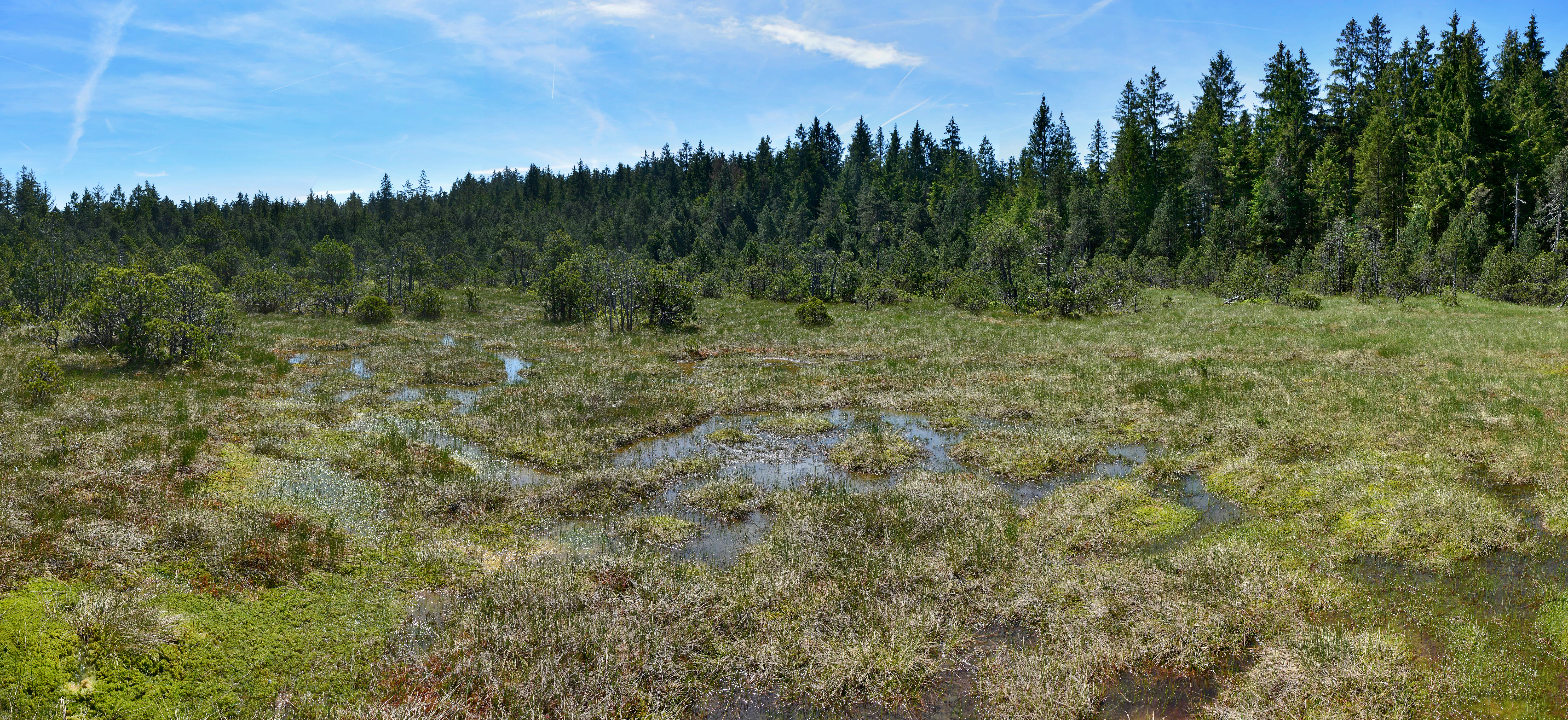
A wide view of the Schönleitenmoos bog, characterized by low-lying wetland vegetation, small meandering water channels, and a dense evergreen forest border under a blue sky.
The Schönleitenmoos nature reserve, featuring a characteristic raised bog landscape with mossy vegetation and small pools of water.

Schönleitenmoos Nature Reserve history and protected-area timeline

Schönleitenmoos has been recognized as ecologically significant since the mid-twentieth century. The site was officially designated as a Naturschutzgebiet in 1959, with formal establishment often cited as 1960, making it an early entry in Bavaria's inventory of protected raised bogs.

The decision to protect the area was closely tied to the botanical discovery of a population of the rust-leaved alpine rose (Rhododendron ferrugineum) growing in the bog pine woodland. Because this species is otherwise predominantly Alpine, its extra-Alpine occurrence here was regarded as exceptional and became a principal reason for placing the bog under formal conservation status. The alpine rose stand within the moor woodland was additionally recorded as a Naturdenkmal, a natural monument, reinforcing its heritage value.

In the broader context, Schönleitenmoos is part of a wave of post-war nature conservation in Bavaria that sought to safeguard the remaining ice-age peatlands of the Alpine foothills and their associated vegetation. The neighboring 85.77-hectare Breitenmoos reserve, to the northwest, was similarly protected in this era and together the two sites represent a sustained effort to maintain a connected complex of glacial-origin bog ecosystems in the Wierlinger Forst.

Schönleitenmoos Nature Reserve landscape and geographic character

The landscape of Schönleitenmoos is classic Allgäu ice-age terrain. The reserve lies in a gently undulating stretch of forested plateau in the Wierlinger Forst at roughly 932 meters above sea level, on the Rhine-Danube watershed, where very small amounts of surface water fall on one side toward the Rhine basin and on the other toward the Danube.

The defining landform is the bog itself. Schönleitenmoos is a small, bowl-shaped Hochmoor produced by the infilling of a former glacial marginal lake from the last ice age. The peat surface, fed only by precipitation, rises gently toward the center and is pitted with open, water-filled Schlenken, while the outer margins drop off into transitional forests. The result is a typical, open, almost treeless interior surrounded by a tight collar of increasingly stunted woodland.

At the landscape scale, Schönleitenmoos is not a visually dramatic site, but it is precisely this compact, basin-like setting that allows it to display the full sequence of raised-bog landforms in a small area: peat domes, wet hollows, bog pines, and forest fringes, with the larger Breitenmoos bog complex extending the same character to the northwest.
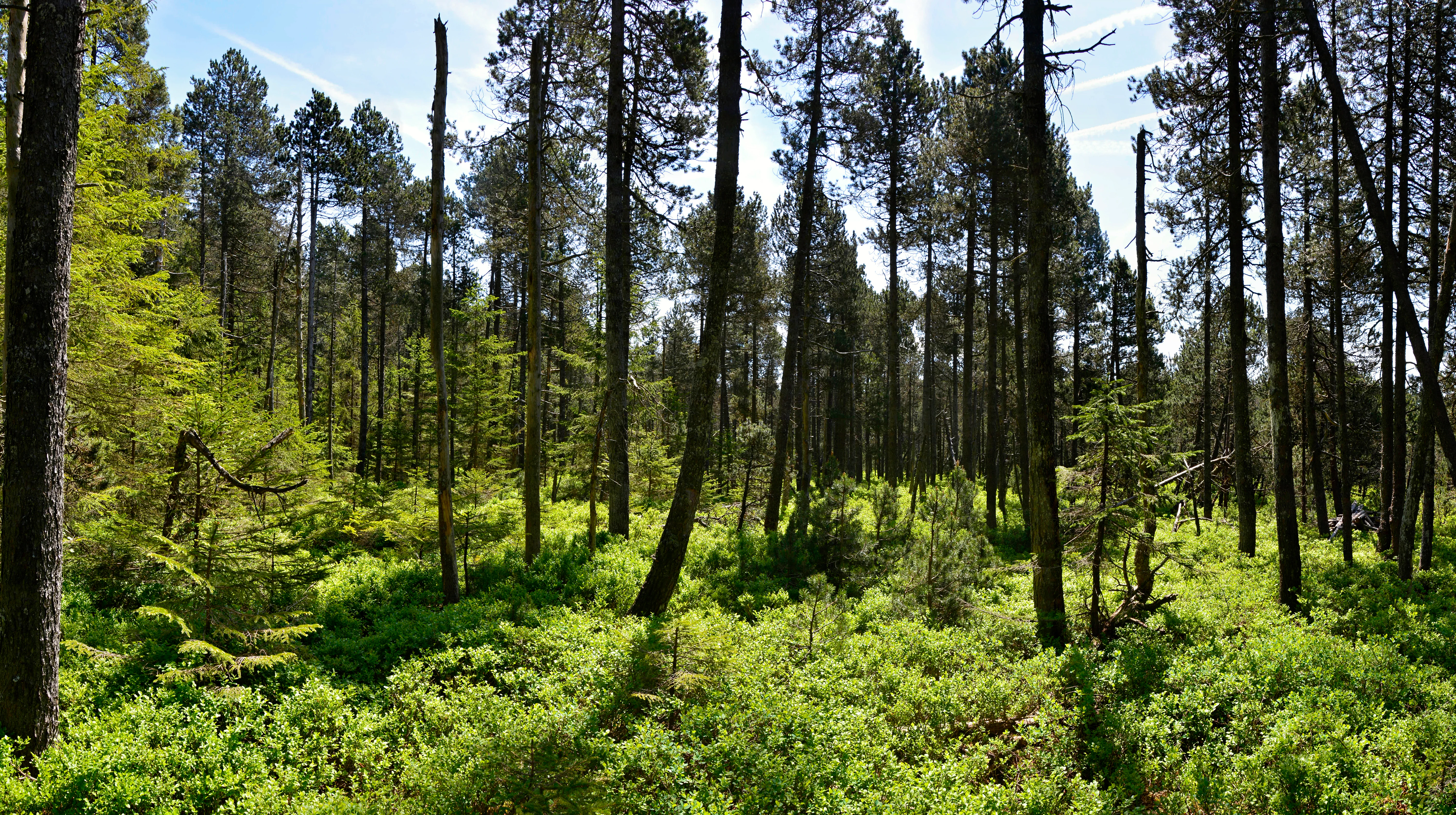
A sunny forest scene with slender pine trees rising above a dense, green ground cover of small shrubs in a Bavarian moorland.
A view of the transition zone in the Schönleitenmoos nature reserve, featuring mountain pine and dense undergrowth.

Schönleitenmoos Nature Reserve ecosystems, habitats, and plant life

Ecologically, Schönleitenmoos is a textbook ombrotrophic raised bog in the northern Alpine foothills. The vegetation shows a clear concentric zonation: tall spruce forest at the outer edge, a belt of tree-formed Spirke (Pinus rotundata), an inner thicket of Latschenkiefer (Pinus mugo), and finally an open central zone dominated by Sphagnum mosses and wet bog hollows. The Sphagnum carpet, made up of species such as Sphagnum cymbifolium, Sph. acutifolium, Sph. medium, Sph. rubellum, and Sph. cuspidatum, creates strongly acidic and nutrient-poor conditions that shape the whole plant community.

In the bog interior, characteristic peatland plants thrive among the Sphagnum cushions, including white beak-sedge (Rhynchospora alba), deergrass (Trichophorum cespitosum), and hare's-tail cottongrass (Eriophorum vaginatum). Mixed among them are dwarf shrubs of the heath family: bog rosemary (Andromeda polifolia), common cranberry (Vaccinium oxycoccus), bog bilberry (Vaccinium uliginosum), and heather (Calluna vulgaris), plus insectivorous round-leaved sundew (Drosera rotundifolia) and intermediate sundew (Drosera intermedia). The slightly drier bog pine woodland supports common heather, Vaccinium myrtillus, and the highlight of the site: a population of rust-leaved alpine rose (Rhododendron ferrugineum).

Additional floristic interest includes spring gentian (Gentiana verna), willow gentian (Gentiana asclepiadea), globeflower (Trollius europaeus), marsh cow-wheat (Melampyrum pratense subsp. paludosum), lesser butterfly-orchid-like orchids such as the spotted orchid (Orchis maculatus, reported with some uncertainty) and the small twayblade (Listera cordata), and the familiar ling heather (Calluna vulgaris) on the bog margin. Together these species give Schönleitenmoos a plant inventory more typical of Alpine peatlands than of the Allgäu foothills, despite its modest size.

Schönleitenmoos Nature Reserve wildlife and species highlights

The native Wikipedia source focuses predominantly on the botanical and ecological character of Schönleitenmoos, and does not provide detailed accounts of its fauna. The reserve's value for wildlife is fundamentally linked to its bog structure: the Sphagnum-rich, waterlogged peat surfaces, bog pools, and dense moor-pine thickets create distinctive microhabitats typical of glacial-origin raised bogs in the Allgäu.

Such habitats support the kinds of invertebrates, amphibians, and bog-specialist birds commonly associated with intact Alpine-foreland peatlands, including dragonflies around the open Schlenken, peatland-breeding bird species that use the Latschenkiefer zone for nesting, and small mammal and invertebrate communities shaped by the bog's strongly acidic, nutrient-poor conditions. The rust-leaved alpine rose stand itself also provides a localized habitat of phytological and structural interest, although no specific faunal species are highlighted in the source.

Because the source material is purely botanically oriented, a more detailed wildlife profile cannot be supported here without speculation.

Schönleitenmoos Nature Reserve conservation status and protection priorities

Schönleitenmoos is protected as a Bavarian Naturschutzgebiet under the reference NSG-By-OA-00079.01 and is recorded internationally in the World Database on Protected Areas as WDPA ID 82549. It was designated in 1959 and formally established around 1960, an early effort to safeguard a complete, well-developed example of a post-glacial raised bog on the Rhine-Danube watershed in the Oberallgäu.

From a conservation standpoint, the reserve's primary significance is the protection of a small but ecologically intact ombrotrophic Hochmoor, including its characteristic vegetation zonation from spruce forest to Sphagnum-dominated bog interior. The site is especially valued for its population of rust-leaved alpine rose (Rhododendron ferrugineum) growing within the spiral-pine moor woodland, one of the few extra-Alpine populations of this typically Alpine species. The alpine rose stand is additionally designated as a Naturdenkmal, reflecting its singular botanical significance.

Taken together with the neighboring Breitenmoos reserve (around 85.77 hectares), Schönleitenmoos contributes to a broader network of protected glacial peatlands in the Wierlinger Forst, preserving both the geomorphological legacy of the last ice age and the rare plant communities that depend on these cold, nutrient-poor, rain-fed bog systems.

Schönleitenmoos Nature Reserve cultural meaning and human context

Schönleitenmoos sits within the Wierlinger Forst, part of the forested landscape southwest of Kempten in the Allgäu region of Bavarian Swabia. While the source material does not describe indigenous or traditional land use, the broader cultural context is one of late-twentieth-century Bavarian nature conservation: the recognition and protection of small, ecologically rich peatland remnants that had survived centuries of forestry and land use in the Alpine foothills.

The site's inclusion in the Naturdenkmal register, alongside formal protection as a Naturschutzgebiet, reflects a regional tradition of marking exceptional natural features, including unusual plant populations such as the extra-Alpine alpine rose stand, as part of local natural heritage.

Top sights and standout views in Schönleitenmoos Nature Reserve

The key highlights of Schönleitenmoos are its compact, fully developed vegetation zonation from spruce forest through moor pines (Spirke and Latsche) to Sphagnum peatland with open bog pools, and its rare extra-Alpine population of rust-leaved alpine rose in the bog pine woodland, which is also a registered natural monument.

Equally distinctive is the reserve's location directly on the Rhine-Danube watershed at around 932 meters above sea level, and its origin as a Holocene raised bog that grew from a post-glacial proglacial lake, documented in references such as Hermann Oblinger's 1965 study of the site in the Berichte des Naturwissenschaftlichen Vereins für Schwaben.

Best time to visit Schönleitenmoos Nature Reserve

Schönleitenmoos is most rewarding to visit in late spring and summer, when the Sphagnum mats and surrounding bog vegetation are fully active and the rare alpine rose flowers in the bog pine woodland. Late spring, roughly May into June, typically brings the gentians, globeflower, and the early insectivorous sundews, while summer (June to August) is when the heathers, bog rosemary, cranberry, and the Latschenkiefer thicket are at their fullest.

Late summer and early autumn often show the richest colors of the bog, with reddening Sphagnum cushions, ripening berries, and the structurally most visible expression of the zonation from spruce forest to open peat surface. In winter, deep snow tends to cover the bog entirely and access becomes impractical. Because the reserve is a protected peatland, visitors should expect only soft, weather-dependent paths and should plan visits with weather-appropriate footwear, regardless of season.

Monthly climate preview

Long term representative point measurements for temperature and precipitation distribution

Schönleitenmoos im Wierlinger Forst Climate Normals and Annual Temperature Rhythms

Schönleitenmoos im Wierlinger Forst experiences measured long term monthly temperatures ranging from sub zero winter lows to warm summer maximums alongside varying daily precipitation rates. Examining the full twelve month climate profile reveals complete monthly normals and detailed seasonal weather patterns across the sampled elevation.
Annual mean7 °C
-3 °C16 °C
Jan-3°
Feb-2°
Mar
Apr
May11°
Jun14°
Jul16°
Aug16°
Sep12°
Oct
Nov
Dec-2°
Warmest month
July

16.2 °C

Coolest month
January

-2.8 °C

Wettest month
June

5.4 mm/day

Driest month
February

2.7 mm/day

Park location guide

Geography guide, regional context, and park location map for Schönleitenmoos Nature Reserve

Schönleitenmoos Nature Reserve park geography, regions, and map view in Germany

Understand where Schönleitenmoos Nature Reserve sits in Germany through a broader geographic reading of the surrounding landscape, nearby location context, and its mapped position within the national park landscape.

How Schönleitenmoos Nature Reserve fits into Germany

Germany is a federal republic in Western and Central Europe with a population of over 83 million across sixteen constituent states. It is Europe's largest economy by nominal GDP and a major global exporter and importer. The capital is Berlin, and the country borders Denmark, Poland, Czech Republic, Austria, Switzerland, France, Luxembourg, Belgium, and the Netherlands.

Wider geography shaping Schönleitenmoos Nature Reserve in Germany

Germany is located in Western and Central Europe, spanning 357,022 km². It borders Denmark to the north, Poland and the Czech Republic to the east, Austria and Switzerland to the south, and France, Luxembourg, Belgium, and the Netherlands to the west. The country has coastlines on the Baltic Sea and North Sea to the north, with the Alps located in the southern region.

Map view of Schönleitenmoos Nature Reserve

Use this park location map to pinpoint Schönleitenmoos Nature Reserve in Germany, understand its exact geographic position, and read its mapped placement within the surrounding landscape more clearly.

Pigeon | © OpenStreetMap contributors

Location context for Schönleitenmoos Nature Reserve

BayernLandkreis Oberallgäu

Visual reference guide to glacial raised bog terrain, moor pine woodland, and peatland habitats.

Schönleitenmoos im Wierlinger Forst Photos and Protected Landscape Imagery

Visual documentation captures the distinctive raised bog topography, open water pools, and transitional forest fringes characteristic of this protected Bavarian nature reserve. Photographic records illustrate the compact vegetation zonation and rare alpine flora defining the local environment.

A wide view of the Schönleitenmoos bog, characterized by low-lying wetland vegetation, small meandering water channels, and a dense evergreen forest border under a blue sky.

A wide, slightly elevated panoramic view of an open moorland area dotted with small, sparse evergreen trees, with a dense coniferous forest visible in the background under a blue sky.

A sunny forest scene with slender pine trees rising above a dense, green ground cover of small shrubs in a Bavarian moorland.

Park atlas

Compare surrounding regional reserves and connected peatland landscapes

Other Parks and Protected Areas Near Schönleitenmoos im Wierlinger Forst

Browse protected areas and wetland reserves located near Schönleitenmoos im Wierlinger Forst in the Bavarian foothills. Comparing adjacent alpine fringe habitats provides deeper context into regional post-glacial landforms and watershed geography.
Watercolor illustration of a lush natural ravine with a small cascading waterfall, surrounded by green forest slopes and distant rolling hills.
Nature reserveBavaria
About 2.4 km away#1 closest

East

Rohrbachtobel im Wirlinger Forst Nature Reserve and Bavarian Pre-Alpine Forest Geography

Mapped protected gorge landscapes and molasse geology in the Oberallgäu district

Rohrbachtobel im Wirlinger Forst offers a unique look at small-scale protected landscapes in Germany. This nature reserve features a dramatic stream-cut gorge and serves as a natural habitat for diverse plant species, including European yew and multiple orchid varieties, within the wider context of the Bavarian pre-Alpine forest zone.

Area
0.14 km²
Established
1959
Relief
Upland
Scope
Terrestrial
A soft watercolor painting showing rolling green hills and a forested ridgeline against a pale sky on a white background.
Nature reserveBaden-Württemberg
About 6.9 km away#2 closest

Northwest

Adelegg Nature Reserve: Geographic Profile of an Alpine-Influenced Forested Ridge in Baden-Württemberg

Mapping deep ravine terrain and protected forest mosaics in Germany

The Adelegg nature reserve represents a vital Natura 2000 site within the Westallgäu region. This protected area features a striking vertical relief composed of steep, forested slopes and high-elevation grasslands. Explore the geographic layout of this ridge, which includes a complex array of calcareous beech forests, rare orchid habitats, and diverse ravine ecosystems that define this rugged southwestern German landscape.

Area
6.33 km²
Established
2019
Relief
Mountain
Climate
Temperate
A watercolor painting showing a panoramic view of a wetland with coniferous trees, soft green forest lines, and reddish bog vegetation against a pale background.
Nature reserveBaden-Württemberg
About 10 km away#3 closest

West

Bodenmöser und Hengelesweiher Nature Reserve: Mapped Geography and Protected Wetland Atlas

A diverse mosaic of peatlands and lakes in Westallgäu

Bodenmöser und Hengelesweiher represents a significant conservation network in southwestern Germany. This detailed view covers the distribution of calcareous fens, raised bogs, and dark-water pools that characterize the pre-Alpine hill landscape. Learn about the geographic configuration of this protected site as it bridges nutrient-poor lake ecosystems with surrounding alder woodlands and wet meadow corridors near Isny im Allgäu.

Area
7.59 km²
Established
2019
Nature reserveBavaria
About 23 km away#4 closest

Southwest

Nagelfluhkette Nature Park: Mapping the Alpine Ridges and Conglomerate Landscapes

A cross-border nature reserve in the Bavarian Alps.

Nagelfluhkette Nature Park is defined by its dramatic vertical transitions and unique Nagelfluh conglomerate geology. This protected area connects valley wetlands like the Großer Alpsee with steep mountain summits along the Hochgrat ridge. The region serves as an essential example of integrated conservation, linking forests, high-altitude moorlands, and traditional alpine agricultural landscapes across the Bavarian and Vorarlberg border.

Area
480 km²
Established
2008
Relief
Mountain
Climate
Alpine
Protected landscapeBaden-Württemberg
About 24 km away#5 closest

Northwest

Uferbewuchs der Eschach Protected Landscape and Riparian Corridor Map

Riparian conservation within the Riß-Aitrach-Platten of Baden-Württemberg

Tracing the protected linear riparian corridors of the Eschach stream, this area is a significant example of urban-edge conservation in Germany. It maintains continuous stream-bank vegetation through the Leutkirch municipal landscape, linking directly to broader floodplain habitats of the Aitrach river system through its glacial-plateau geographic setting.

Established
1953
IUCN
V
A soft, panoramic watercolor painting featuring green, rolling hills and a winding river or stream through a forested landscape against a bright, hazy sky.
Nature reserveBaden-Württemberg
About 33 km away#6 closest

Northwest

Altdorfer Wald Nature Reserve: Geographic Atlas and Protected Landscape Overview

Mire, spring, and forest ecosystems in Baden-Württemberg

The Altdorfer Wald nature reserve consolidates a significant network of watercourses, peatlands, and old-growth forest stands across the Upper Swabian Pre-Alpine hills. This protected area stands as a primary focal point for understanding the interplay between hydrological richness, calcareous deposits, and diverse temperate forest habitats within the regional geography of Baden-Württemberg.

Area
13.71 km²
Established
2019
Relief
Upland
Climate
Temperate
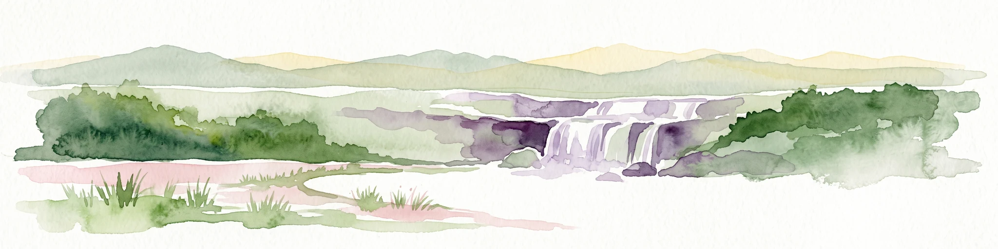
A soft watercolor painting of a rolling landscape featuring a winding river, grassy plains, and distant hills in muted green, pink, and yellow tones.
Protected landscapeBodenseekreis
About 42 km away#7 closest

West

Spätwürmeiszeitliche Terrassen zwischen Burnau, Prestenberg, Vorderreute, Buch und Krumbach Geography

A protected landscape site in the Bodenseekreis district

Spätwürmeiszeitliche Terrassen zwischen Burnau, Prestenberg, Vorderreute, Buch und Krumbach is defined by its series of level river terraces resulting from Würm ice age glacial retreat. Spanning roughly 22 hectares near the Schwarzach river, the site remains a vital example of fluvioglacial geomorphology and regional landscape preservation within the pre-Alpine foreland.

Area
0.22 km²
Established
1963
Relief
Upland
Climate
Temperate
Watercolor painting of a tranquil wetland landscape with pine trees, grassy shorelines, and distant rolling hills against a soft background.
Nature reserveBaden-Württemberg
About 46 km away#8 closest

Northwest

Feuchtgebiete um Bad Schussenried: Protected Wetland Mosaic and Regional Geography

Nature reserve complex in the Upper Swabian hill country

Feuchtgebiete um Bad Schussenried is an essential European FFH site spanning seven protected sub-areas. The landscape encompasses a dense patchwork of lowland fens, alder forests, and kettle-hole lakes, representing the unique glacial terrain of Upper Swabia through its intricate peatland and spring mire systems.

Area
6.1 km²
Established
2019

Common questions about visiting, size, designation, and location context for Schönleitenmoos Nature Reserve

Schönleitenmoos Nature Reserve FAQs for park facts, access, geography, and protected area context

Find quick answers about Schönleitenmoos Nature Reserve, including protected-area facts, park geography, trail and visitor context, and how the park fits into its surrounding country and regional landscape.
MoriAtlas Explorer

Continue Your Protected Areas Search Across the Global Atlas

Deepen your exploration by continuing the structured search for national parks and protected areas worldwide. Utilize the comprehensive filtering capabilities to compare different conservation landscapes and refine your understanding of global park geography. Discover more about the distribution and characteristics of protected natural areas.

Global natural geography