
Mori Atlas logo
Nature reserveSchwarzhölzl

Mapping the ecological remnants of the Dachauer Moos and its diverse peatland habitat mosaic

Schwarzhölzl Nature Reserve and Protected Wetland Forest Landscape in Bavaria, Germany

(Naturschutzgebiet Schwarzhölzl)

Schwarzhölzl stands as a significant protected nature reserve representing the last surviving lowland peat forest fragments of the historic Dachauer Moos near Munich. This area encompasses a complex mosaic of bog pine woodland, peat birch forests, and traditional wet meadows that define the local Bavarian hydrology. By examining the mapped boundaries and terrain, visitors can trace the intersection of urban green belt conservation and the rare wetland ecosystems sustained by the Kalterbach stream and local groundwater.

Niedermoorwaldlowland peat forestbog pine woodlandDachauer Moos remnantStreuwiesen and FeuchtwiesenFFH area
An artistic graphic illustration featuring a waterfall cascading down a rocky mountain valley into a winding river, surrounded by birch and pine trees in a flat, colorful geometric style.

Schwarzhölzl

Nature reserve

Park overview

Structured park overview, official facts, and landscape profile for Schwarzhölzl

Schwarzhölzl park facts, protected area profile, and essential visitor context

Review the core facts for Schwarzhölzl, including designation, size, terrain, visitor scale, habitats, and operating context in one park-focused overview.

About Schwarzhölzl

Schwarzhölzl is a small but ecologically significant nature reserve on the northwestern edge of Munich, representing one of the last fragments of the historical Dachauer Moos peatland. Its location within the Feldmoching district, bordering the communities of Karlsfeld and Oberschleißheim, places it at the interface between dense urban Munich and the historically agricultural Dachau plain, giving it both ecological and recreational importance.

The reserve's identity is rooted in its character as a Niedermoorwald, a lowland peat forest that has developed over centuries on waterlogged, peat-rich soils. The dominant bog pines give the woodland its characteristic dark, almost brooding appearance, an effect that locally gave rise to the name Schwarzhölzl. Mixed with these pines are areas of peat birch woodland, creating a varied canopy structure over the moist ground layer. Surrounding the wooded core are open wet meadows and traditional late-cut meadows, which are maintained as part of the reserve's conservation management.

Although it covers only a modest area by national park standards, Schwarzhölzl carries considerable conservation weight. It is designated as a Naturschutzgebiet under Bavarian law and is also an FFH area under the European Habitats Directive, specifically because of its importance for the Helm-Azurjungfer, a strongly threatened damselfly of clean, well-vegetated small water bodies. The reserve is also part of Munich's Grüngürtel, the green belt of protected open spaces that encircles the city, anchoring it both administratively and functionally within Munich's broader ecological network.

For Munich's residents, Schwarzhölzl serves a dual purpose. It is a refuge for specialized wetland species and a peaceful natural contrast to the surrounding cityscape, while also functioning as a much-used Naherholungsgebiet for walks, nature observation, and informal leisure in close proximity to residential neighborhoods.

Quick facts and research context for Schwarzhölzl

Schwarzhölzl lies in the northwestern outskirts of Munich in the Feldmoching district, with portions also falling within Karlsfeld and Oberschleißheim. It is classified as a Naturschutzgebiet (nature reserve) in Bavaria and forms part of Munich's wider Grüngürtel (green belt) of protected open spaces. The reserve is characterized by Niedermoorwald (lowland peat forest) with bog pines, peat birch woodland, Feuchtwiesen (wet meadows), and Streuwiesen (late-cut meadows). It also lies within a designated FFH (Fauna-Flora-Habitat) area and a Landschaftsschutzgebiet (landscape protection area), reflecting its ecological significance at a European level. The Mückensee lies at its northern edge, and the Kalterbach stream runs through the area from south to north.

Protection and recognition

Documented protection scope and recognition records for Schwarzhölzl

Schwarzhölzl Protection Status and Terrestrial Conservation Data

Schwarzhölzl maintains a recorded terrestrial protection scope within the regional conservation inventory. Structured records compile available management parameters and official designation context for geographic analysis.

Protection details

Protection scope
Terrestrial
Transboundary protection
No
Park context

Deeper park guide and search-rich context for Schwarzhölzl

Schwarzhölzl history, landscape, wildlife, and travel context

Explore Schwarzhölzl through its history, landscape character, ecosystems, wildlife, conservation priorities, cultural context, and seasonal travel timing in a structured park guide built for atlas discovery and search intent.

Why Schwarzhölzl stands out

Schwarzhölzl is best known as one of the last surviving wet woodland fragments of the Dachauer Moos, a vast peatland that once stretched north of Munich and was progressively drained from the early 19th century onward. The reserve's defining features are its dark bog pines, peat birch woodland, and intact mosaic of wet meadows, late-cut meadows (Streuwiesen), and small open water bodies. It is also widely recognized as an important refuge for threatened wetland species, including the rare Helm-Azurjungfer damselfly, which is explicitly cited as a reason for its FFH designation.
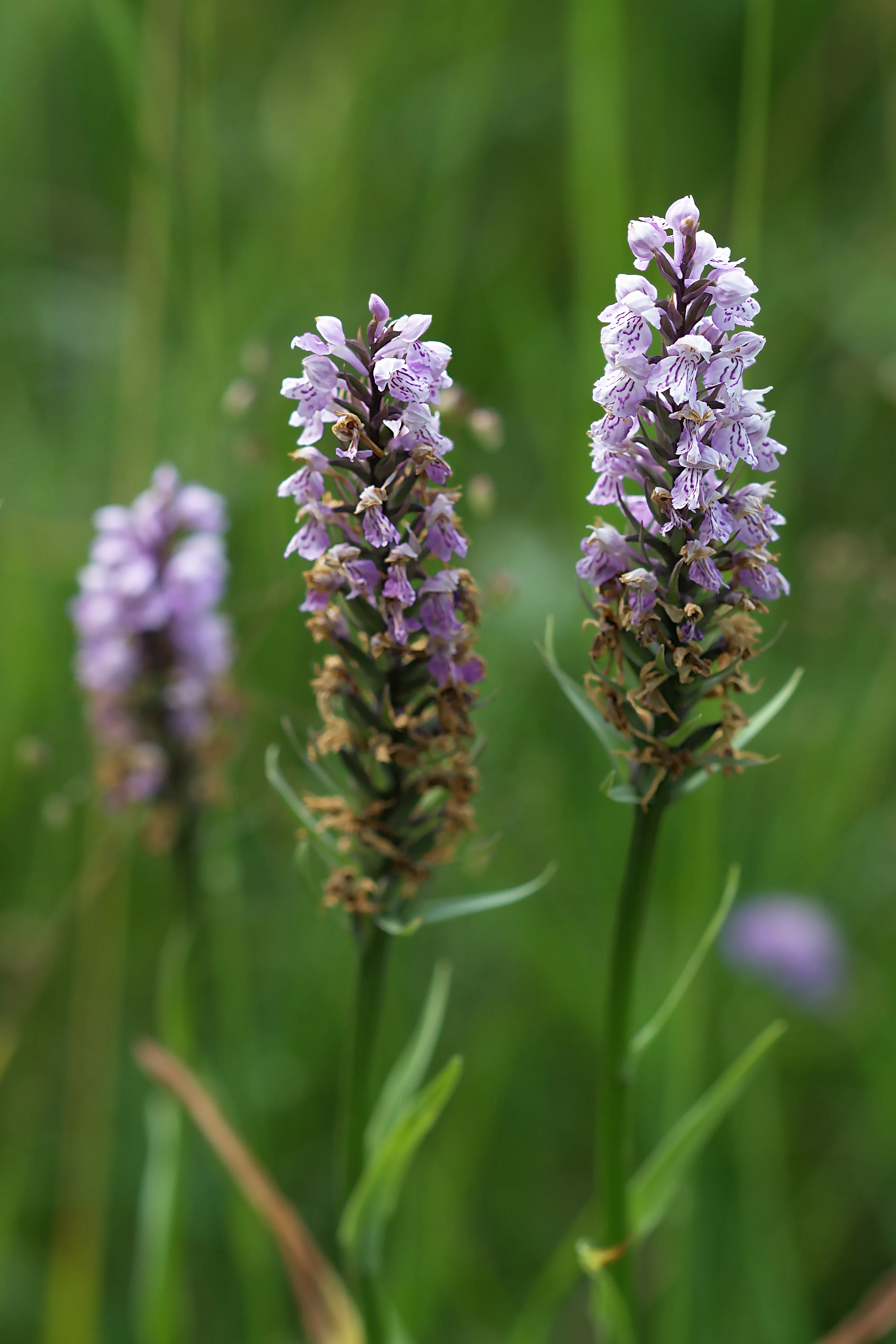
Close up view of three Dactylorhiza orchid flower spikes with light purple spotted petals in a green meadow setting.
Spotted orchids blooming in the Schwarzhölzl nature reserve.

Schwarzhölzl history and protected-area timeline

The history of Schwarzhölzl is essentially a history of the slow loss and partial rescue of one of the last fragments of the Dachauer Moos. From around 1800, Munich breweries, and most notably the Löwenbrauerei, began extracting peat from the Dachauer Moos for fuel. This industrial harvesting initiated a steady decline of the groundwater table across the entire peatland, including the area that would later be known as Schwarzhölzl. The traditional extensive land use of the area, the practice of cutting reed grass for bedding (Streumahd), was also abandoned, allowing the first pines to colonize the drying peatland. Foresters further encouraged this woodland development, transforming open moor into a peat forest.

In 1913, the resulting Schwarzhölzl was designated as a nature reserve for the first time, but this protection was short-lived. Between 1915 and 1917, the Kalterbach stream, which originally meandered through the area from south to north, was straightened and deepened, drainage channels were dug, and the surrounding land was made arable. This conversion enabled intensive farming on former peatland, even as the reserve designation nominally remained.

The damaging trend accelerated in the second half of the 20th century. Drainage and agricultural intensification continued through the 1950s and 1960s, with wet meadows being plowed up and surrounding woody vegetation destroyed. Schwarzhölzl itself was densely replanted with spruce, a tree species ill-suited to the peatland habitat. From 1970 onward, the construction of the Oberschleißheim regatta course had a further major impact: the birch-covered forest section called Torfeinfang was cleared, a road was built through Schwarzhölzl, and excavated material from the regatta was piled onto a late-cut meadow. The construction also lowered the groundwater table by at least 1.5 meters, triggering peat decomposition, weakening the pine population, and reducing the flow of the Kalterbach.

A turning point came with the work of the Karlsfeld conservationist Josef Koller, who died in 2010. Shocked by the destruction, Koller began a long campaign to protect the remaining fragments of Schwarzhölzl. His 1969 application to protect the area was initially unsuccessful, but he continued working through decades of opposition. He pioneered hay transfer from the Lochhauser Sandberg and the Garchinger Heide to the Schwarzhölzlberg, creating species-rich dry habitats, and fought lifelong battles against invasive neophytes, agricultural intensification, scrub encroachment, and inappropriate forestry. Through public outreach, birding walks, and his 1990 book Geliebtes Schwarzhölzl, he raised awareness of what the area meant as a remnant of the Dachauer Moos. His efforts were instrumental in the reserve's second formal protection designation in 1994, by which time the Bavarian government (Regierung von Oberbayern) finally recognized its significance.

Today, the Bund Naturschutz in Bayern manages several key sites in Schwarzhölzl with official permission, including Schwarzhölzlberg, Bergfußwiese, Thürwinkelwiese, Danner-Wiese, the former timber storage site, and the Bachdreieck. In the spirit of Josef Koller, the organization also tends to surrounding biotopes, Streuwiesen, and the Moosgraben, recognizing that the reserve's character depends on the wider landscape mosaic surrounding it. Despite ongoing threats from heavy recreational use, a nearby federal road (Bundesstraße 471), and disturbance from the Badersfeld moor experimental station, Schwarzhölzl has become both a successful conservation case and a popular local recreation area.

Schwarzhölzl landscape and geographic character

The landscape of Schwarzhölzl is defined by the surviving edge of a once much larger peatland, the Dachauer Moos. Its flat, low-lying terrain rests on peat-rich, waterlogged soils that support a distinctive mosaic of wetland habitats rather than dramatic relief. The most visually striking feature is the Niedermoorwald itself, where bog pines rise out of moist peat, often with exposed or stilt-like root systems that give the woodland a stark, sculptural quality. The dark tones of these pines are the origin of the reserve's name.

Beyond the central forest, the landscape opens up into areas of moor birch woodland and a network of meadows: Feuchtwiesen (wet meadows) and traditional Streuwiesen (late-cut meadows) that occupy the surrounding flatter land. Open water is present in the form of the Mückensee at the northern edge and along the Kalterbach, the small stream that flows through the area from south to north. Although the stream was straightened in the early 20th century, it still structures the reserve's hydrology and ecology.

Local relief is modest but not absent. The Schwarzhölzlberg is a small elevated area within or adjacent to the woodland that supports drier habitat, and the so-called 'Bergfußwiese' (mountain-foot meadow) marks the transition between this slightly raised ground and the surrounding wet meadows. Together, the damp forest, the open meadows, and the small water features create a varied micro-landscape of considerable ecological interest despite its modest scale.
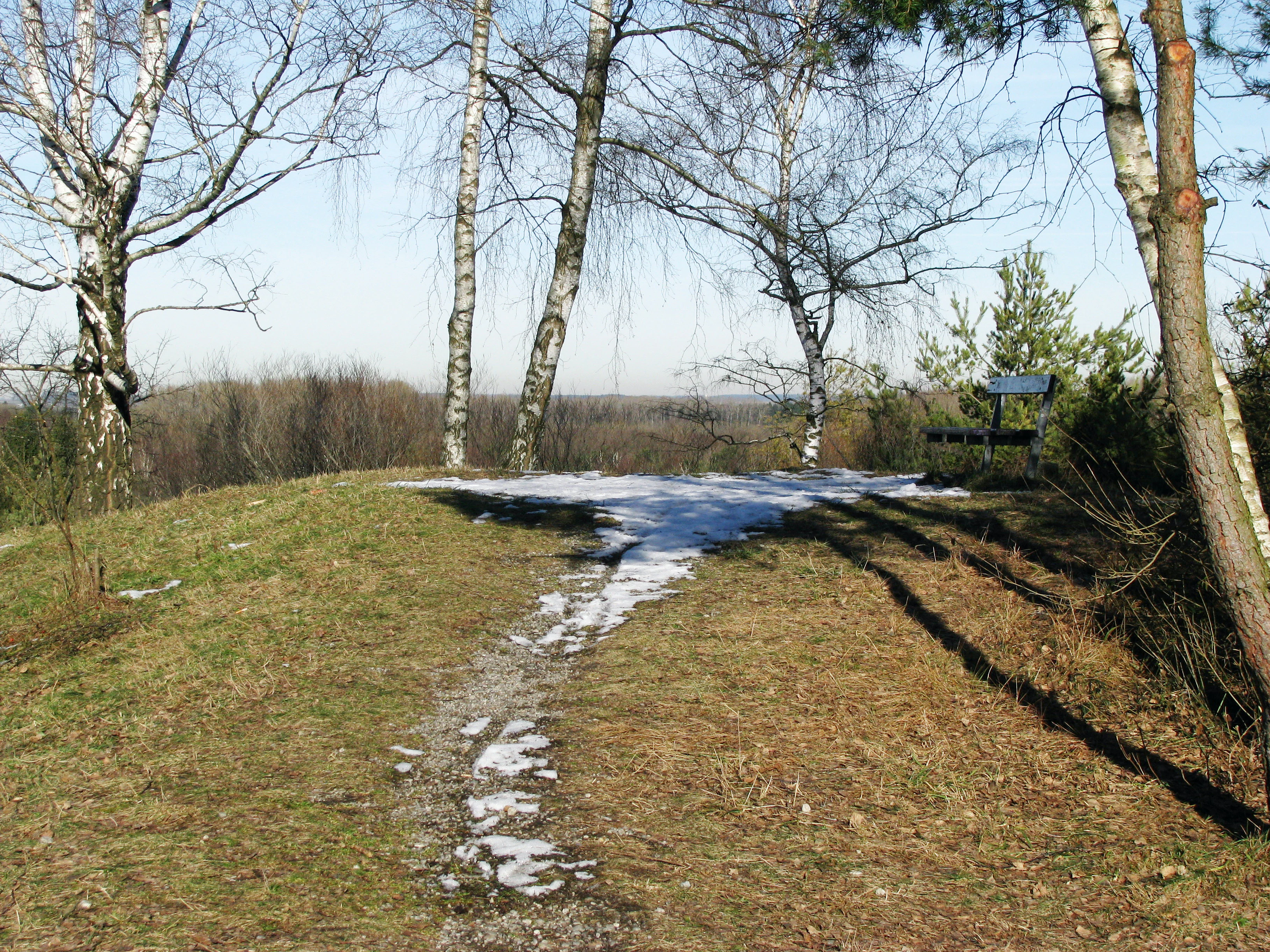
A gentle grassy hill with patches of melting snow, topped by slender birch trees and a small wooden bench overlooking the surrounding wooded landscape.
A viewpoint atop a small rise in the Schwarzhölzl nature reserve, featuring birch trees and a wooden bench.

Schwarzhölzl ecosystems, habitats, and plant life

Ecologically, Schwarzhölzl is best understood as a fragmentary but ecologically coherent relic of the historical Dachauer Moos. Its central habitat is the Niedermoorwald, the lowland peat forest dominated by bog pines and peat birch, a community that is now rare across Germany. This wet woodland forms the ecological heart of the reserve and supports characteristic peatland vegetation in its understory.

Around the forested core, the mosaic of habitats is maintained through active conservation management. Feuchtwiesen and traditional Streuwiesen remain key elements of this mosaic, providing both habitat structure and botanical diversity valued in Central European wetland conservation. The Schwarzhölzlberg adds a small dry-grassland component to the otherwise damp landscape, contrasting with the wet core and supporting floristic elements derived from the Garchinger Heide and the Lochhauser Sandberg via historical hay transfer.

The reserve is also integrated into wider European ecological frameworks. As a designated FFH area under the EU Habitats Directive, Schwarzhölzl is explicitly recognized for its contribution to protecting the strongly threatened Helm-Azurjungfer, a damselfly that depends on specific types of small, well-vegetated water bodies. The combination of forested peatland, open wet meadows, and clean, slow-moving water bodies creates a habitat network that supports a much wider suite of specialized wetland flora and fauna beyond any single headline species.
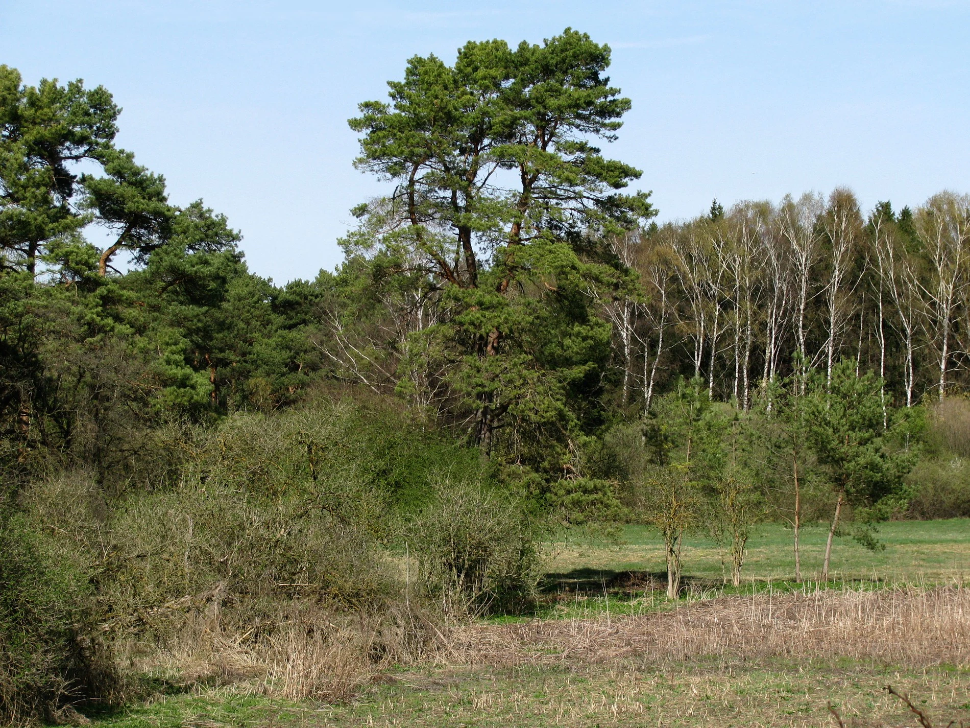
A landscape view of the Schwarzhölzl area showing a mixture of open grassy meadow, dense green forest, and tall pine trees under a clear sky.
A view of the wetland and forest habitat within the Schwarzhölzl nature reserve in Munich.

Schwarzhölzl wildlife and species highlights

Schwarzhölzl's wildlife character is shaped by the interface between peat forest, wet meadows, and small open water bodies. These habitats support communities typical of Central European lowland peatlands, with particular importance for invertebrates, amphibians, and birds that depend on moist, structurally varied landscapes.

The reserve is officially recognized at the European level for its importance to the Helm-Azurjungfer, a strongly threatened damselfly associated with clean, well-structured small water bodies. This designation reflects a broader ecological reality: the combination of slow-moving ditches, ponds, and stream margins within and around the woodland supports a rich invertebrate fauna.

Birdlife in and around Schwarzhölzl has historically been a focus of attention, with Josef Koller organizing ornithological walks to raise public awareness of the reserve. The mosaic of wet woodland, meadows, and water attracts a range of species typical of Bavarian lowland wetland mosaics, reflecting the area's role both as a refuge and as a stepping stone in the wider landscape of the Munich north plain.
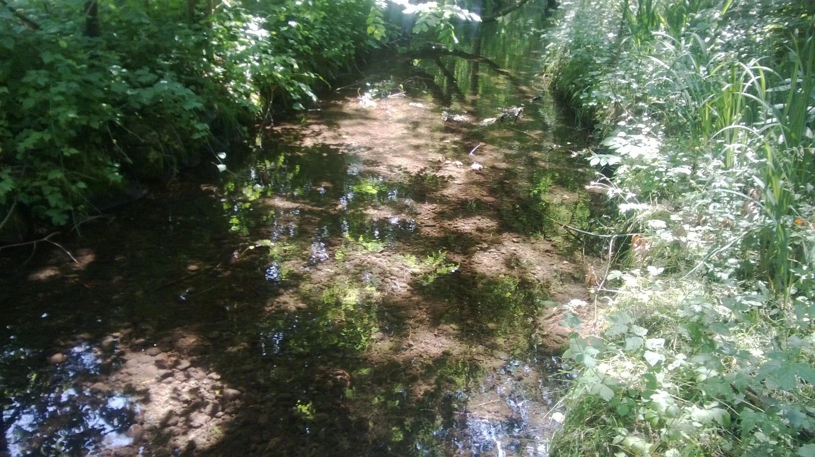
A shallow, narrow stream flows through a lush, green, wooded area with dappled sunlight reflecting on the water surface.
A narrow stream flowing through the wooded wetlands of the Schwarzhölzl nature reserve.

Schwarzhölzl conservation status and protection priorities

Schwarzhölzl holds layered conservation significance. It is designated as a Bavarian Naturschutzgebiet and is also part of a Landschaftsschutzgebiet and an FFH area under the European Habitats Directive, the latter specifically because of the threatened Helm-Azurjungfer. These overlapping designations reflect recognition that even relatively small peatland fragments can carry disproportionate value for biodiversity conservation at a regional and European scale.

The reserve's conservation story is also notable as a long-term citizen-driven effort. From the late 1960s onward, Josef Koller campaigned for the protection, restoration, and public understanding of Schwarzhölzl, ultimately being instrumental in the 1994 re-designation as a Naturschutzgebiet. Today, the Bund Naturschutz in Bayern continues active management on key sites such as Schwarzhölzlberg, Bergfußwiese, Thürwinkelwiese, Danner-Wiese, the former timber storage site, and the Bachdreieck, including mowing and invasive species control. Surrounding biotopes, Streuwiesen, and the Moosgraben are also tended, with the understanding that the integrity of Schwarzhölzl depends on the wider mosaic of habitats around it.

Despite this protection, ongoing pressures remain. Heavy recreational use causes localized disturbance, the adjacent Bundesstraße 471 contributes traffic noise and road salt to the ecosystem, and the groundwater flow from south to north is partially blocked by the road. Additional disturbance has been linked to experimental work at the Badersfeld moor research station. Together these pressures illustrate the constant tension between an urban-edge nature reserve's ecological role and its exposure to surrounding human activity.

Schwarzhölzl cultural meaning and human context

Culturally, Schwarzhölzl is deeply tied to the identity of Munich's northwestern periphery and to the long battle by local conservationists, most notably Josef Koller, to save a meaningful slice of the historical Dachauer Moos. Koller's 1990 book Geliebtes Schwarzhölzl is itself a local cultural landmark, framing the site as a 'beloved landscape' whose fate illustrates the broader 20th-century story of peatland loss across northern Munich. The reserve is also part of Munich's Grüngürtel, an urban green-belt concept that shapes how Munichers understand their city's relationship to surrounding open landscapes.

Top sights and standout views in Schwarzhölzl

Schwarzhölzl's highlights center on the rarity and the survival story of its habitat mosaic. The dark bog pine peat forest, with sculptural, stilt-rooted pines rising from the peat, gives the woodland an immediate visual signature. Around it, the combination of peat birch woodland, traditional Streuwiesen, and the small waters of the Mückensee and the Kalterbach create an unusually rich habitat network for a site of this size. The reserve's importance for the Helm-Azurjungfer has earned it recognition under the European Habitats Directive, while its place within Munich's Grüngürtel ties it to the city's wider strategy of protecting accessible natural areas around the urban core. The site is also a notable example of long-term citizen-led conservation, anchored in Josef Koller's decades of work and continued today by the Bund Naturschutz.

Best time to visit Schwarzhölzl

Spring and early summer are particularly rewarding for visiting Schwarzhölzl, when the orchids and other flowering plants in the reserve's meadows and forest edges are visible and the wet habitats are at their most biologically active. Late spring through early summer is also generally the best window for observing dragonflies and damselflies around the small water bodies, including the species of conservation interest. Late summer and early autumn offer quieter conditions, with mature meadow habitats and a calm atmosphere suited to observing the mosaic landscape as a whole. Visits in winter are possible but less rewarding for active wildlife observation, given the area's dependence on damp habitats and warm-season species activity.
Monthly climate preview

Long-term representative averages tracking temperature swings and precipitation rhythm in Bavaria

Schwarzhölzl Climate Normals, Annual Temperature, and Monthly Precipitation Patterns

Representative coordinates record long-term temperature swings from sub-zero winter minimums to warm summer maximums alongside varying monthly precipitation. Examining complete monthly climate normals illuminates the broader environmental rhythms shaping the terrain.
Annual mean8 °C
-1 °C18 °C
Jan-1°
Feb
Mar
Apr
May13°
Jun16°
Jul18°
Aug18°
Sep13°
Oct
Nov
Dec
Warmest month
July

18 °C

Coolest month
January

-1.2 °C

Wettest month
June

4.6 mm/day

Driest month
February

2 mm/day

Park location guide

Geography guide, regional context, and park location map for Schwarzhölzl

Schwarzhölzl park geography, regions, and map view in Germany

Understand where Schwarzhölzl sits in Germany through a broader geographic reading of the surrounding landscape, nearby location context, and its mapped position within the national park landscape.

How Schwarzhölzl fits into Germany

Germany is a federal republic in Western and Central Europe with a population of over 83 million across sixteen constituent states. It is Europe's largest economy by nominal GDP and a major global exporter and importer. The capital is Berlin, and the country borders Denmark, Poland, Czech Republic, Austria, Switzerland, France, Luxembourg, Belgium, and the Netherlands.

Wider geography shaping Schwarzhölzl in Germany

Germany is located in Western and Central Europe, spanning 357,022 km². It borders Denmark to the north, Poland and the Czech Republic to the east, Austria and Switzerland to the south, and France, Luxembourg, Belgium, and the Netherlands to the west. The country has coastlines on the Baltic Sea and North Sea to the north, with the Alps located in the southern region.

Map view of Schwarzhölzl

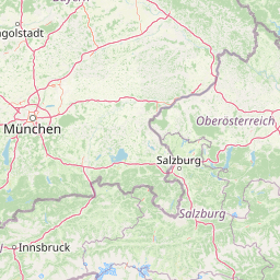
Use this park location map to pinpoint Schwarzhölzl in Germany, understand its exact geographic position, and read its mapped placement within the surrounding landscape more clearly.

Pigeon | © OpenStreetMap contributors

Location context for Schwarzhölzl

Bavaria

Explore the visual character, dark bog pines, and wetland habitats defining the protected reserve.

Schwarzhölzl Photos and Landscape Scenery: Visualizing the Protected Lowland Peat Forest

Visual documentation reveals the distinctive terrain of the lowland peat forest, highlighting dark bog pines and waterlogged soils across the surviving Munich reserve. Detailed photography illustrates the intricate mosaic of wet meadows, peat birch woodland, and protected micro-landscapes that characterize the terrain.

Close up view of three Dactylorhiza orchid flower spikes with light purple spotted petals in a green meadow setting.

A close up view of the base of a pine tree in a forest, showing thick, textured bark, exposed roots, and a moss-covered mound of soil at the base.

A gentle grassy hill with patches of melting snow, topped by slender birch trees and a small wooden bench overlooking the surrounding wooded landscape.

A landscape view of the Schwarzhölzl area showing a mixture of open grassy meadow, dense green forest, and tall pine trees under a clear sky.

A shallow, narrow stream flows through a lush, green, wooded area with dappled sunlight reflecting on the water surface.

Park atlas

Compare adjacent wetland reserves, forest fragments, and regional conservation areas

Explore Parks Near Schwarzhölzl and Surrounding Protected Landscapes

Browse other protected areas near Schwarzhölzl to examine related lowland peat forests and regional wetland habitats. Comparing neighboring reserves provides valuable context for understanding the broader ecological footprint of the Dachauer Moos.
A horizontal watercolor illustration of a landscape with green pine trees in the foreground, a pale yellow meadow, and soft purple and green rolling mountains in the background against a white background.
Nature reserveBavaria
About 45 km away#1 closest

South

Schellenbergmoor Nature Reserve: Geographic Mapping of Bavarian Pre-Alpine Wetland Landscapes

Protected peatland terrain in the Tölzer Moorachse corridor

Schellenbergmoor functions as a protected nature reserve situated in the pre-Alpine hill and moorland zone of Upper Bavaria. This site preserves rare raised and transitional bog habitats, serving as a critical node for hydrology and ecosystem connectivity between Lake Starnberg and the Loisach river basin.

Established
1987
Nature reserveLandkreis Eichstätt
About 70 km away#2 closest

Northwest

Naturwaldreservat Tucherwald: Protected Karst Forest Landscape in Landkreis Eichstätt

A study in non-intervention woodland and natural forest dynamics

Naturwaldreservat Tucherwald preserves a diverse mosaic of beech, oak, and linden forest on the steep, limestone slopes of the southern Frankenalb. This protected area offers insight into unmanaged forest succession, standing deadwood habitats, and the unique microclimates found within the Wellheim Dry Valley regional geography.

Area
0.541 km²
Established
1998
Relief
Upland
Scope
Terrestrial
A horizontal watercolor illustration featuring a gentle heathland landscape with soft green meadows, patches of pink wildflowers, and purple rolling hills in the background.
Nature reserveLower Saxony
About 71 km away#3 closest

North

Sandharlander Heide Nature Reserve: Protected Landscape and Geological Atlas

Mapped botanical diversity in the Jura foothills

Sandharlander Heide represents a vital protected area where Jurassic limestone meets thin layers of Pleistocene sand. This geological overlap creates a specialized environment for over 200 plant species, showcasing the complex relationship between soil chemistry and grassland conservation in the German landscape.

Area
0.257 km²
Established
1970
Relief
Lowland
Climate
Temperate
Nature reserveBavaria
About 90 km away#4 closest

Southwest

Naturwald Kramer Nature Reserve: Protected Alpine Forest Boundaries in Bavaria

Mapping natural forest dynamics across the Ammergauer Alps

Naturwald Kramer represents a major forest protection zone in the Bavarian Alps. This area spans a rugged vertical mosaic of mountain mixed forests and snow heath pine woodlands on dolomite bedrock, providing essential insight into non-intervention forestry and diverse alpine mountain terrain.

Area
15.91 km²
Established
2020
IUCN
IV
Nature reserveWeißenburg-Gunzenhausen
About 90 km away#5 closest

Northwest

Schambachried: Protected Calcareous Fen and Wetland Geography in Weißenburg-Gunzenhausen

Historic nature reserve marking the karst and valley transition

Schambachried preserves a rare calcareous lowland fen within the Treuchtlingen Pforte of Bavaria. As the oldest nature reserve in Middle Franconia, this protected area offers a concentrated study of botanical diversity at the meeting point of the Weißenburger Alb limestone plateau and the Schambach valley stream system.

Area
0.069 km²
Established
1973
IUCN
IV
Relief
Lowland
A watercolor painting showing a panoramic view of soft mountain ridges and evergreen forests flanking a winding valley stream.
Nature reserveOberbayern
About 92 km away#6 closest

South

Schachen und Reintal: A Protected Alpine Landscape in the Wetterstein Mountains

Geographic atlas and nature reserve mapping for Oberbayern

Spanning from the Zugspitzplatt to the rugged Jubiläumsgrat, Schachen und Reintal serves as a vital nature reserve in the Bavarian Alps. The area preserves a wide topographical gradient of limestone terrain, river-carved gorges, and pristine forests, providing an essential look at the protected high alpine geography of the Wetterstein range.

Area
39.636 km²
Established
1970
IUCN
IV
Nature reserveBaden-Württemberg
About 93 km away#7 closest

West

Donaumoos Nature Reserve: A Detailed Atlas of Wetland Geography in Baden-Württemberg

Mapped mire ecosystems and diverse protected landscapes.

Donaumoos spans 14 sub-areas throughout the Donau-Iller-Lech plateau, defining a landscape of wet meadows, tall herb fringes, and alluvial forests. This protected area offers a deep look into the hydrological identity and ecological connectivity of the upper Danube wetland network, serving as a critical habitat node within the broader German Natura 2000 protected-land framework.

Area
9.16 km²
Established
2019
Nature reserveOberbayern
About 93 km away#8 closest

South

Naturwaldreservat Wettersteinwald: Protected Nature Reserve and Alpine Forest Geography

Oberbayern, Germany; subalpine forest conservation and limestone mountain terrain

Uncover the ecological structure of Naturwaldreservat Wettersteinwald, one of the oldest nature forest reserves in the Bavarian Alps. Located on steep Wetterstein limestone, the area encompasses a compact mosaic of spruce and stone pine, protecting essential habitat for rare saproxylic beetle species within its defined 42 hectare boundaries.

Area
0.426 km²
Established
1978
Relief
Mountain
Climate
Alpine

Common questions about visiting, size, designation, and location context for Schwarzhölzl

Schwarzhölzl FAQs for park facts, access, geography, and protected area context

Find quick answers about Schwarzhölzl, including protected-area facts, park geography, trail and visitor context, and how the park fits into its surrounding country and regional landscape.
MoriAtlas Explorer

Continue Your Protected Areas Search Across the Global Atlas

Deepen your exploration by continuing the structured search for national parks and protected areas worldwide. Utilize the comprehensive filtering capabilities to compare different conservation landscapes and refine your understanding of global park geography. Discover more about the distribution and characteristics of protected natural areas.

Global natural geography