
Mori Atlas logo
Protected landscapeSequoia National Forest

Tracing the geological terrain from foothill chaparral to high altitude alpine summits and watersheds

Sequoia National Forest: A Vast Protected Landscape in the Southern Sierra Nevada of California

Sequoia National Forest occupies over 1.1 million acres in California, bridging the divide between western foothills and the high peaks of the southern Sierra Nevada. The forest protects extensive giant sequoia groves, glacier-carved canyons, and dramatic granite monoliths like The Needles. This region serves as a critical conservation area that encompasses diverse climate zones, ranging from low elevation oak woodlands to alpine ridges exceeding 12,000 feet in height.

national forestSierra Nevadagiant sequoiagranite spiresold growth forestwilderness areas
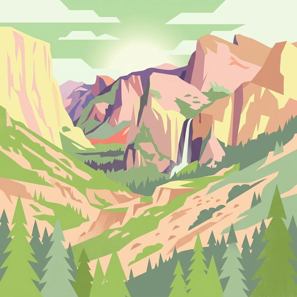
A stylized illustration showing a deep valley flanked by large granite cliffs and evergreen forests, with a waterfall cascading down the side of a cliff under a bright, stylized sun.

Sequoia National Forest

Protected landscape

Park overview

Structured park overview, official facts, and landscape profile for Sequoia National Forest

Sequoia National Forest park facts, protected area profile, and essential visitor context

Review the core facts for Sequoia National Forest, including designation, size, terrain, visitor scale, habitats, and operating context in one park-focused overview.

About Sequoia National Forest

Sequoia National Forest is one of the largest protected natural landscapes in the southern Sierra Nevada, encompassing more than 1.1 million acres of montane and high-mountain terrain in east-central California. The forest is administered by the U.S. Forest Service, with headquarters in Porterville and ranger district offices at Dunlap, Kernville, Lake Isabella, and Springville. Together with the adjacent Sequoia and Kings Canyon National Parks, it forms part of one of the largest contiguous blocks of federally protected land in the Sierra Nevada.

The forest is defined by extraordinary ecological diversity. Its terrain stretches from the dry chaparral and oak woodlands of the western foothills near 1,000 feet elevation up through montane forests, subalpine conifer stands, and alpine zones above 12,000 feet. This vertical compression produces a layered landscape of vegetation types, microclimates, and wildlife habitats packed into a relatively compact region.

What makes Sequoia National Forest especially distinctive is its relationship with the giant sequoia. The forest contains many of the world's remaining groves of Sequoiadendron giganteum, including the Redwood Mountain Grove, the largest grove by area anywhere in the species' range. In 2000, President Bill Clinton proclaimed more than 300,000 acres of the forest as the Giant Sequoia National Monument specifically to protect these irreplaceable groves and the watersheds that sustain them. Six designated wilderness areas within the forest extend the protected character deeper into the backcountry.

The forest also contains striking geological features. The Needles, a series of granite spires along a narrow ridge above the Kern River, is among the most photographed and recognizable landmarks. The broader landscape includes glacier-carved U-shaped valleys, towering granite domes, deep river canyons, and high meadows. With more than 2,500 miles of roads and roughly 850 miles of trails, the forest supports a substantial recreational program alongside its conservation mission.

Quick facts and research context for Sequoia National Forest

Sequoia National Forest is a federally administered national forest located in the southern Sierra Nevada of California, spanning more than 1.1 million acres across Tulare, Kern, and Fresno counties.

Established in 1908 and governed by the U.S. Forest Service, the forest contains dozens of named giant sequoia groves, six designated wilderness areas, and the 328,000-acre Giant Sequoia National Monument proclaimed in 2000. Its elevation range from about 1,000 feet in the foothills to over 12,000 feet at the Sierra crest supports four stacked ecological zones and habitat for threatened species including the Little Kern golden trout.

Protection and recognition

Examine official terrestrial protection records and international recognition data.

Sequoia National Forest Protection Status and Designated Terrestrial Conservation Records

Terrestrial protection status records outline the documented management framework governing Sequoia National Forest. Conservation datasets compile official designation details and international recognition metrics without proprietary claims.

Protection details

Protection scope
Terrestrial
Transboundary protection
No
WDPA ID
1969330
Park context

Deeper park guide and search-rich context for Sequoia National Forest

Sequoia National Forest history, landscape, wildlife, and travel context

Explore Sequoia National Forest through its history, landscape character, ecosystems, wildlife, conservation priorities, cultural context, and seasonal travel timing in a structured park guide built for atlas discovery and search intent.

Why Sequoia National Forest stands out

Sequoia National Forest is best known as one of the principal protected landscapes for the giant sequoia, the world's largest tree species by volume. The forest's named groves are distributed across the Kings, Kaweah, Tule, and Kern River watersheds, several of which rank among the largest and most ecologically significant giant sequoia groves on Earth. Beyond its sequoia groves, the forest is also recognized for dramatic granite landforms such as The Needles, a series of spires along a narrow ridge above the Kern River; for nearly 200,000 acres of old-growth coniferous forest; for its six designated wilderness areas; and for its role in the larger Sequoia and Kings Canyon conservation landscape on the southern Sierra Nevada's western slope.
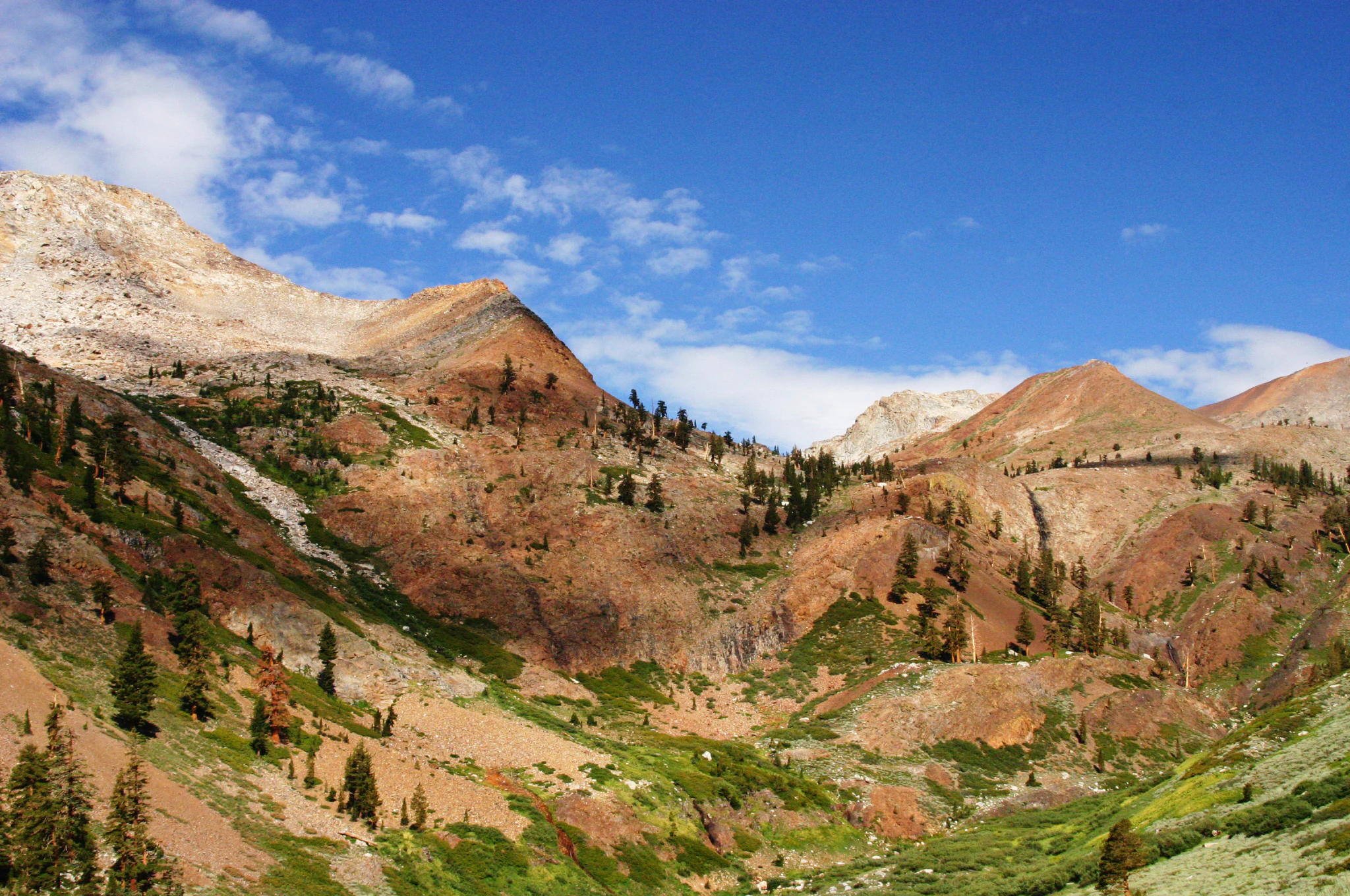
A wide, bright landscape view of a rocky mountain slope with sparse pine trees under a clear blue sky, likely near Farewell Gap.
The rugged terrain of the Golden Trout Wilderness within Sequoia National Forest.

Sequoia National Forest history and protected-area timeline

Sequoia National Forest traces its administrative origins to the early twentieth century conservation era, when forest reserves were reorganized into national forests under the newly created U.S. Forest Service. The forest was formally established on July 1, 1908, carved from a portion of the earlier Sierra Forest Reserve. In March 1909, President Theodore Roosevelt expanded the forest by presidential proclamation, and in 1910 the boundaries were dramatically reshaped when the Kern National Forest was carved out of the southern sector. That land was returned to Sequoia National Forest in 1915, giving the forest essentially the footprint it retains today.

Throughout the late nineteenth and early twentieth centuries, portions of the forest were affected by logging. Several giant sequoia groves were partially cut during the 1890s and the early 1900s, including the Converse Basin Grove, where the General Noble Tree, then among the very largest giant sequoias in the world, was felled for the 1893 World's Columbian Exposition. Most groves ultimately retained enough old-growth trees, either because individual giants proved impractical to fell or because selective logging practices left seed sources intact, to maintain their ecological character.

The early twentieth century also saw the development of fire lookout infrastructure across the forest, most notably the lookout tower perched atop the spire called The Magician at The Needles, which served the Forest Service until it was destroyed by a structural fire on July 28, 2011.

The most consequential modern event in the forest's conservation history was the April 15, 2000 proclamation of the Giant Sequoia National Monument by President Bill Clinton, setting aside roughly 328,000 acres of sequoia-bearing forest within the existing national forest. Two decades later, severe wildfires in 2020 and 2021 changed the conservation picture again, with the Castle Fire and the Windy Fire burning tens of thousands of acres of mature sequoia groves and prompting a reassessment of fire management policy for the species.

Sequoia National Forest landscape and geographic character

Sequoia National Forest occupies the heart of the southern Sierra Nevada's western slope, a region shaped by long geological processes that have produced one of California's most dramatic mountain landscapes. Elevations climb sharply from foothill canyons near 1,000 feet up to alpine ridges and summits above 12,000 feet, producing more than 11,000 feet of vertical relief that compresses multiple climate and vegetation zones into a small geographic footprint.

The terrain is profoundly influenced by Pleistocene glaciation. Glaciers carved the broad U-shaped valleys, polished granite domes, and steep-walled cirques that define the high country today. Exposed granite monoliths rise above the forest floor throughout the range. The Needles above the Kern River, a slender ridge crowned by a series of jagged granite columns, is the best-known of these landforms; a historic fire lookout once stood atop the spire called The Magician before it was destroyed by fire in 2011.

The forest's western edge transitions gradually into foothills covered in chaparral and oak woodland, while the eastern reaches approach more arid terrain near the boundary of the Mojave region. The Kern River cuts a major canyon through the southern portion of the forest, while the Tule, Kaweah, and Kings River watersheds each carve their own distinctive valleys in the northern and central sectors. Across the forest, scattered meadows, glacial lakes, and rocky ridgelines shape a landscape of extraordinary geological variety.
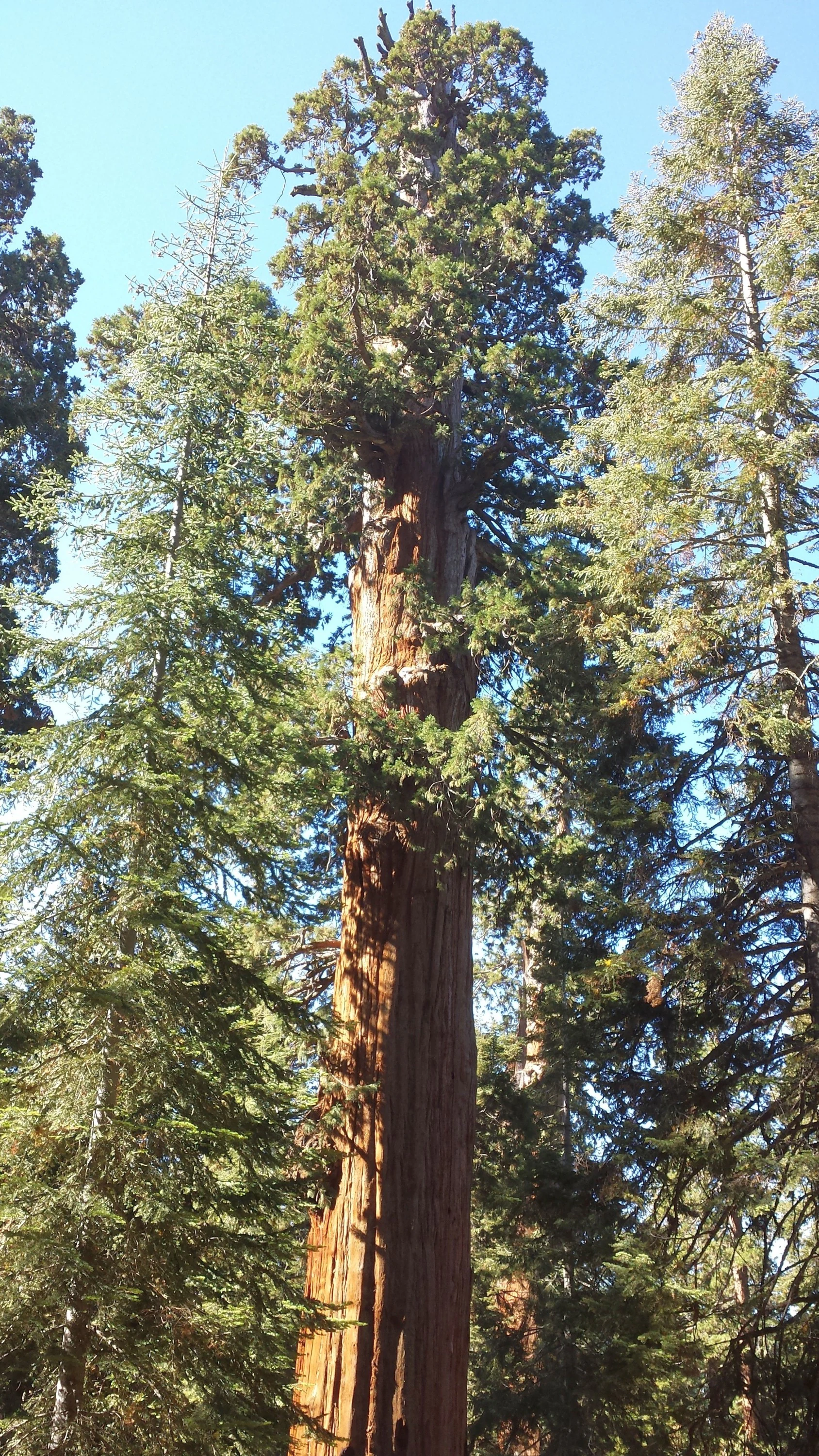
A low angle, full height view of the massive trunk and canopy of the Genesis tree, surrounded by a dense forest of other conifers under a clear sky.
The Genesis Tree, a massive giant sequoia located in the Mountain Home Grove of Sequoia National Forest.

Sequoia National Forest ecosystems, habitats, and plant life

Sequoia National Forest contains one of the most ecologically layered landscapes in California. Because the elevation range is wide and the geography transitions between west-side and east-side Sierra Nevada climates, the forest supports four distinct ecological zones stacked from foothills to alpine ridges.

The lowest elevations are dominated by chaparral shrublands and oak woodlands, with characteristic species such as scrub oak, manzanita, and seasonal displays of wildflowers. Moving upward, these slopes transition into montane forests of ponderosa pine, Jeffrey pine, white fir, red fir, incense-cedar, sugar pine, and Douglas-fir. This is also the elevation zone where most of the forest's giant sequoia groves occur, though the sequoias occupy a narrower elevation band than the surrounding conifers.

Above the montane zone, subalpine forests of lodgepole pine and other hardy conifers grade toward true alpine environments near the Sierra crest. Scattered wetland niches, including montane meadows, fens, and riparian zones along the Kern, Tule, and Kaweah Rivers, support specialized aquatic and wetland flora. Across all zones, the forest contains a substantial portion of California's old-growth coniferous forest, with roughly 196,000 acres of old growth documented within its boundaries.
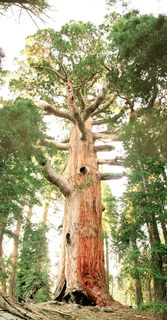
A towering, mature Giant Sequoia tree with reddish, textured bark and a hollowed base, standing in a coniferous forest.
The Great Bonsai Giant Sequoia tree in the Mountain Home Grove of Sequoia National Forest.

Sequoia National Forest wildlife and species highlights

The varied habitats of Sequoia National Forest support a diverse community of wildlife typical of the southern Sierra Nevada. Mammals range across all elevation zones; black bears are common in the oak woodlands and montane forests, mule deer graze the meadows and forest edges, mountain lions range across the backcountry, and tree squirrels and chipmunks are abundant throughout the coniferous zones.

Birdlife reflects the layered nature of the habitat. California quail forage in chaparral and oak woodland edges, scrub jays occupy foothill slopes, and a wide variety of montane forest birds, including nuthatches, woodpeckers, warblers, and flycatchers, inhabit the coniferous zone. Higher elevations support raptors and corvids adapted to the open alpine terrain. The Traill's flycatcher, olive-sided flycatcher, and other migratory songbirds breed in the forest's mid-elevation habitats.

The forest also harbors less conspicuous but ecologically important species. Reptiles include gopher snakes and the western fence lizard, while amphibians such as the California newt inhabit moist microhabitats along streams and meadows. Aquatic species include the threatened Little Kern golden trout, a subspecies endemic to the upper Kern River basin that is one of the most ecologically significant fish species in the forest and a focus of conservation management inside the Kern River watershed.
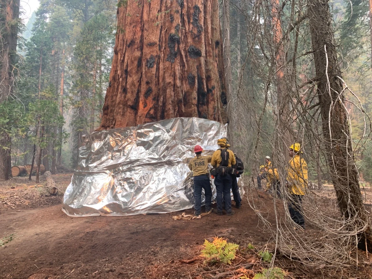
A group of firefighters in yellow gear and hard hats wrapping the base of a massive giant sequoia tree in thick metallic fire-resistant foil.
Firefighters wrap the base of a giant sequoia in protective foil to shield it from wildfire in Sequoia National Forest.

Sequoia National Forest conservation status and protection priorities

Sequoia National Forest plays a disproportionate role in the conservation of the giant sequoia, one of the rarest and most extraordinary tree species on Earth. While giant sequoias are restricted to a narrow elevational band on the western Sierra Nevada, the forest protects a major portion of the remaining global grove network and the watersheds that sustain them. The 2000 establishment of the Giant Sequoia National Monument within the forest added an explicit layer of administrative protection aimed at preserving the groves, their soils, and their hydrology.

The forest contains nearly 200,000 acres of old-growth coniferous forest, which provides essential denning and roosting habitat for wildlife and stores significant long-term carbon. Six designated wilderness areas within the forest, including the Domeland, Golden Trout, Jennie Lakes, Kiavah, Monarch, and South Sierra Wildernesses, further protect key backcountry areas from development and motorized use.

Recent wildfire activity has reshaped the conservation picture for giant sequoias. The 2020 Castle Fire burned approximately 131,000 acres within the forest, of which more than 13,000 acres of giant sequoia groves burned, with high-severity fire killing more than 90 percent of mature sequoias in some burned grove areas. The 2021 Windy Fire then burned a further roughly 97,000 acres across the southern forest, with over 3,000 acres of giant sequoia groves inside its perimeter. Together, the two fires destroyed an estimated 10 to 14 percent of all mature giant sequoias worldwide, prompting intensive scientific and management attention to drought, fuel accumulation, and high-severity fire risk in sequoia habitat.

Sequoia National Forest cultural meaning and human context

The southern section of Sequoia National Forest's Giant Sequoia National Monument surrounds the eastern half of the Tule River Indian Reservation, home to the Tule River band of the Yokuts, an Indigenous people with deep historical and cultural ties to the southern Sierra Nevada landscape. This proximity places the forest within a living Indigenous cultural geography that reflects centuries of land use, seasonal movement, and stewardship connections between the community and the surrounding mountain landscape.

A different kind of cultural imprint comes from the late nineteenth-century timber economy. Several giant sequoia groves were partially logged during the 1890s and 1900s, including the Converse Basin Grove, where the General Noble Tree, then among the very largest sequoias alive, was felled and shipped east as a display piece for the 1893 World's Columbian Exposition in Chicago. The stump, known as the Chicago Stump, remains visible today. Throughout the early twentieth century, fire lookout networks added another layer of cultural landscape to the forest, most prominently at The Needles, where a lookout tower served the Forest Service until 2011.

Top sights and standout views in Sequoia National Forest

Among Sequoia National Forest's standout features are its dozens of named giant sequoia groves across the Kings, Kaweah, Tule, and Kern River watersheds, including the Redwood Mountain Grove, the world's largest sequoia grove by area. The Needles granite spires above the Kern River, the Boole Tree and several other historically significant giant sequoias, the 328,000-acre Giant Sequoia National Monument, and the forest's six designated wilderness areas together define the area's strongest points of distinction.

Best time to visit Sequoia National Forest

Summer through early autumn is the most generally accessible period for Sequoia National Forest, particularly for high-elevation trails, alpine viewpoints, and deep backcountry travel, because winter snow closes many of the forest's higher roads. Spring brings wildflower displays and flowing creeks to the foothill chaparral and oak woodland zones, while autumn can produce striking color in the montane forest, especially around the mid-elevation sequoia groves.

Across the full elevation range, late spring through fall provides the most consistent conditions for exploring the forest's varied terrain, viewing wildlife such as deer and black bears, and visiting the lowest groves, which remain snow-free much earlier in the year than the mountain roads.
Monthly climate preview

Long-term representative temperature ranges and precipitation patterns across the year

Sequoia National Forest Climate Normals and Monthly Weather Statistics

Sequoia National Forest records measured long-term temperature swings alongside distinct monthly precipitation averages from a representative coordinate. Accessing the complete twelve-month climatology profile allows detailed comparison of seasonal temperature norms and precipitation totals across the protected landscape.
Annual mean15 °C
6 °C25 °C
Jan
Feb
Mar
Apr11°
May16°
Jun21°
Jul25°
Aug25°
Sep22°
Oct16°
Nov10°
Dec
Warmest month
July

25.3 °C

Coolest month
December

6.3 °C

Wettest month
January

1.9 mm/day

Driest month
August

0 mm/day

Park location guide

Geography guide, regional context, and park location map for Sequoia National Forest

Sequoia National Forest park geography, regions, and map view in United States of America

Understand where Sequoia National Forest sits in United States of America through a broader geographic reading of the surrounding landscape, nearby location context, and its mapped position within the national park landscape.

How Sequoia National Forest fits into United States of America

The United States of America is a federal presidential republic and one of the world's largest countries by area and population. It consists of 50 states across a vast territory spanning multiple time zones, with its capital in Washington, D.C. and largest city in New York City. The nation has a diverse economy, influential political system, and significant cultural and military presence globally.

Wider geography shaping Sequoia National Forest in United States of America

The United States occupies a vast territory in North America, bordered by Canada to the north and Mexico to the south. The 48 contiguous states stretch from the Atlantic to the Pacific Ocean, while Alaska occupies the northwestern region and Hawaii is an archipelago in the Pacific. The country encompasses diverse terrain including the Rocky Mountains, Appalachian Mountains, Great Plains, and extensive river systems.

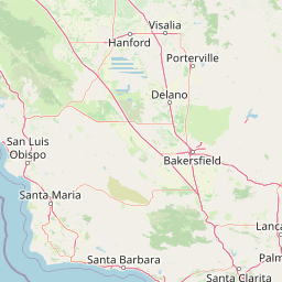
Map view of Sequoia National Forest

Use this park location map to pinpoint Sequoia National Forest in United States of America, understand its exact geographic position, and read its mapped placement within the surrounding landscape more clearly.

Pigeon | © OpenStreetMap contributors

Location context for Sequoia National Forest

California
Natural feature types

Browse the Geographic Natural Features of Sequoia National Forest

Continue your study of the southern Sierra Nevada by examining the specific natural landmarks of Sequoia National Forest. This collection serves as a focused index for the canyons, peaks, and forested groves that comprise the broader protected landscape.
Recorded earthquake history

Browse the Historical Earthquake Catalogue for Sequoia National Forest

Examine historical seismic records and event data associated with the landscapes of Sequoia National Forest. This catalogue offers a structured view of magnitudes and depths for recorded events, allowing for a clearer understanding of the seismic history of the southern Sierra Nevada region.

Sequoia National Forest Earthquake History

Catalogued events

2,596 events

Strongest magnitude

Magnitude 7.1

Most recent event

Aug 23, 2026

This history includes earthquakes recorded inside the park or within 50 km of its borders

Visual exploration of giant sequoia groves, granite spires, and mountain terrain

Sequoia National Forest Photos and Protected Landscape Scenery

Photographic collections reveal the complex terrain, ancient groves, and diverse habitats spanning the southern Sierra Nevada. Examining these visual records provides a deeper understanding of the protected landscapes, topography, and ecological character defining the region.

A wide, bright landscape view of a rocky mountain slope with sparse pine trees under a clear blue sky, likely near Farewell Gap.

A towering ancient Giant Sequoia tree, known as the Boole Tree, stands in the foreground with rugged, snow-dusted mountains in the background under a blue sky.

A low angle, full height view of the massive trunk and canopy of the Genesis tree, surrounded by a dense forest of other conifers under a clear sky.

A towering, mature Giant Sequoia tree with reddish, textured bark and a hollowed base, standing in a coniferous forest.

A group of firefighters in yellow gear and hard hats wrapping the base of a massive giant sequoia tree in thick metallic fire-resistant foil.

Park atlas

Compare adjacent mountain terrain, high Sierra watersheds, and regional forest reserves.

Parks Near Sequoia National Forest and Connected Southern Sierra Protected Areas

Browse other parks near Sequoia National Forest to evaluate connected mountain geography and regional conservation zones. Comparing these protected landscapes reveals broader patterns in Sierra Nevada terrain and high elevation ecosystems.
A soft watercolor painting of rolling hills and mountain ridges, featuring shades of green, yellow, and faint pink on a white background.
Wildlife reserveCalifornia
Park boundaries overlap#1 closest

Southeast

Domeland Wilderness: Granite Spires and Kern Plateau Geography in the Southern Sierra Nevada

A protected wilderness landscape on the California high plateau

Spanning over 130,000 acres, Domeland Wilderness offers a deep look into the geological transition zone of the southern Sierra Nevada. The protected landscape is characterized by its iconic granite domes and spires, vast summer range meadows for deer, and the winding course of the Wild and Scenic South Fork Kern River. This atlas entry details the rugged terrain, ridge boundaries, and ecological diversity found across this lightly visited high-altitude wilderness.

Area
526.42 km²
Established
1964
IUCN
Ib
Relief
Mountain
A horizontal watercolor painting depicting a mountain range in the background with rolling hills and a winding river or stream in the foreground.
Protected landscapeCalifornia
Park boundaries overlap#2 closest

North

Inyo National Forest: An Atlas of Protected Landscapes and Sierra Nevada Geography

High altitude wilderness and volcanic terrain in Eastern California

Spanning from the arid Owens Valley floor to the 14,000 foot crest of the Sierra Nevada, Inyo National Forest remains a cornerstone of the American West. This protected landscape contains the Ancient Bristlecone Pine Forest, Mount Whitney, and the Mono Inyo volcanic chain, providing a dense geographic record of glacial, tectonic, and ecological diversity across a vast managed corridor.

Area
7,702.71 km²
Established
1907
IUCN
Ib
Relief
Mountain
Watercolor painting of a lake bordered by a coniferous forest with mountain silhouettes in the distance.
Wildlife reserveTulare County
Park boundaries overlap#3 closest

North

Jennie Lakes Wilderness in Tulare County: Sierra Nevada Protected Landscape Map

High-country geography and wilderness boundaries

Jennie Lakes Wilderness offers a distinct look at high Sierra Nevada topography, featuring granite ridges, alpine lakes, and deep canyons. This Tulare County reserve acts as a critical transition zone between adjacent national parks, preserving a diverse mix of subalpine forests and rugged mountain peaks within its 10,500 acre boundary.

Area
42.72 km²
Established
1984
IUCN
Ib
Relief
Mountain
Wildlife reserveKern County
Park boundaries overlap#4 closest

Southeast

Kiavah Wilderness: Geographic Overview of the Scodie Mountains Plateau

Protected desert wilderness in Kern County, California

Kiavah Wilderness provides a vital protected landscape in Kern County, defined by the Scodie Mountains and a dramatic escarpment above the Mojave Desert floor. Known for its rare pinyon-juniper woodlands and seasonal springs, this wilderness area preserves the complex geography linking the southern Sierra Nevada to the broader Mojave basin.

Area
357.3 km²
Established
1994
IUCN
Ib
Relief
Mountain
National parkCalifornia
Park boundaries overlap#5 closest

North

Kings Canyon National Park National Park: California Protected Landscape & Geography Atlas

Mapped park boundaries and regional natural context.

Kings Canyon National Park stands as a key protected national park within California, offering a specific focus for geographic understanding and atlas-based exploration. This page details the park's mapped boundaries and its integration into the broader regional geography of California. For users interested in the distribution of protected lands and the mapping of natural landscapes, Kings Canyon National Park provides a crucial point of study within the comprehensive park atlas.

Area
1,869.25 km²
Established
1890
IUCN
II
Visitors
641K annual
National parkCalifornia
Park boundaries overlap#6 closest

North

Sequoia National Park National Park: Geographic Identity and Protected Landscape Atlas

Explore mapped boundaries and the terrain of this California protected area.

Gain a structured understanding of Sequoia National Park as a protected landscape, focusing on its mapped geographic boundaries and its context within California. This entry provides foundational data for exploring the park's natural terrain and its role in a broader atlas of conservation lands, ideal for users seeking detailed geographic information.

Area
1,635.19 km²
Established
1890
IUCN
II
Visitors
1.2M annual
A soft watercolor painting showing a range of gentle rolling hills and mountains in pale green, yellow, and violet tones against a white background.
Protected landscapeCalifornia
Park boundaries overlap#7 closest

North

Sierra National Forest: Protected Landscapes of the Central California Sierra Nevada

Geography of alpine lakes, conifer forests, and mountain basins

Spanning from 900 to nearly 14,000 feet in elevation, Sierra National Forest protects a massive vertical range of California terrain. Discover its iconic wilderness areas and reservoir-studded landscape, providing a deep look at the geographic connectivity between major national parks in the central Sierra Nevada.

Area
5,300 km²
Established
1893
Relief
Mountain
Climate
Alpine
A watercolor painting showing a panoramic view of mountain ranges, a treeline, and a calm body of water in the foreground.
Wildlife reserveCalifornia
6.7 km away#8 closest

North

John Muir Wilderness: Sierra Nevada Protected Landscape and High Mountain Geography

California wilderness area with glacial basins and granite peaks

John Muir Wilderness represents one of the largest protected high-elevation areas in the contiguous United States. Spanning the Sierra Nevada crest, its granite terrain is sculpted by Pleistocene glaciation into sharp arêtes, deep canyons, and hundreds of alpine lakes. This wilderness serves as a vital geographic anchor for mountain ecosystems, offering an extensive look at the high-country landscape of eastern California.

Area
2,641.76 km²
Established
1964
IUCN
Ib
Relief
Mountain

Common questions about visiting, size, designation, and location context for Sequoia National Forest

Sequoia National Forest FAQs for park facts, access, geography, and protected area context

Find quick answers about Sequoia National Forest, including protected-area facts, park geography, trail and visitor context, and how the park fits into its surrounding country and regional landscape.
MoriAtlas Explorer

Continue Your Protected Areas Search Across the Global Atlas

Deepen your exploration by continuing the structured search for national parks and protected areas worldwide. Utilize the comprehensive filtering capabilities to compare different conservation landscapes and refine your understanding of global park geography. Discover more about the distribution and characteristics of protected natural areas.

Global natural geography