

Mori Atlas logo
Protected areaShell Beach

A detailed geographic study of Atlantic shoreline habitats, nesting ecosystems, and community-led conservation zones.

Shell Beach: Mapping the Coastal Protected Landscapes of Guyana's Barima-Waini Region

Shell Beach stretches across 120 kilometers of Guyana's northern Atlantic coastline, forming a vital corridor for four species of nesting sea turtles. This protected area within the Barima-Waini Region integrates broad sandy beaches with tidal flats, mangroves, and coastal forest mosaics. Mapping these natural boundaries reveals the intersection of marine ecosystems and the historic stewardship of local Amerindian communities.

coastal protected areasea turtle nesting beachAtlantic coastlineGuyana conservationIUCN Category VIcommunity-based conservation
A flat-style digital illustration of a sandy beach bordered by palm trees and the ocean, featuring a fallen log in the foreground.

Shell Beach

Protected area

Park overview

Structured park overview, official facts, and landscape profile for Shell Beach, Guyana

Shell Beach, Guyana park facts, protected area profile, and essential visitor context

Review the core facts for Shell Beach, Guyana, including designation, size, terrain, visitor scale, habitats, and operating context in one park-focused overview.

About Shell Beach, Guyana

Shell Beach runs along the open Atlantic coast of northern Guyana in the Barima-Waini Region, close to the frontier with Venezuela. Its setting is characteristic of the Guianas' coastal plain, with broad sandy shores backed by a narrow strip of coastal vegetation and small Amerindian settlements. The shoreline faces the Atlantic directly, and the interplay between beach, nearshore waters, and inland habitats creates the conditions required for an exceptionally rich sea turtle nesting system.

The protected area was formally established in 2011, but its conservation story stretches back several decades earlier. The beach first drew international scientific attention through the work of the English ecologist Peter Pritchard, who began visiting the area in the 1960s and documented the scale of turtle nesting as well as the heavy pressure from hunting of adults and eggs. Together with Romeo De Freitas, Pritchard founded the Guyana Marine Turtle Conservation Society to organize protection of nesting turtles, an effort that eventually brought in global organizations and local communities. Since 2001, the WWF and local partners have coordinated a structured conservation program across the beach and its surrounding communities.

A defining feature of Shell Beach today is the integration of Amerindian communities into the protection framework. Residents of Almond Beach, Gwennie Beach, and nine other nearby villages participate in patrolling nesting sections, monitoring nesting events, and protecting eggs and hatchlings. The beach continues to host nesting for four of the world's eight sea turtle species: the Green, Hawksbill, Leatherback, and Olive Ridley, making it one of the few places globally where such a concentration of sea turtle reproduction occurs along a single shoreline system.

Although modest in officially designated area, around 31.77 square kilometers of core protected coastal habitat, Shell Beach represents a much larger landscape of ecological and cultural importance through its roughly 120-kilometer extent along the Guyana coast. It exemplifies the country's approach to protected areas that link biodiversity conservation with indigenous livelihoods and community stewardship.

Quick facts and research context for Shell Beach, Guyana

Shell Beach is an IUCN Category VI protected area on Guyana's northern Atlantic coast, managed with a focus on sustainable use alongside conservation. It lies within the Barima-Waini administrative region, with the regional town of Mabaruma acting as the nearest settlement of note. The protected area covers approximately 31.77 square kilometers of delineated coastal and marine habitat around a nesting beach system that runs for around 120 kilometers along the shore. It is distinguished primarily by its role as a multi-species sea turtle nesting ground of regional and global importance.

Protection and recognition

Documented conservation scope, management framework, and status records

Shell Beach Protection Status and Official International Recognition Data

Shell Beach maintains a mixed protection scope governed by documented administrative frameworks and regional criteria. Official records compile available designation history, management parameters, and international recognition sources for structured analysis.

Protection details

Protection scope
Mixed
Transboundary protection
No
Park context

Deeper park guide and search-rich context for Shell Beach, Guyana

Shell Beach, Guyana history, landscape, wildlife, and travel context

Explore Shell Beach, Guyana through its history, landscape character, ecosystems, wildlife, conservation priorities, cultural context, and seasonal travel timing in a structured park guide built for atlas discovery and search intent.

Why Shell Beach, Guyana stands out

Shell Beach is best known for hosting nesting populations of four sea turtle species: the endangered Leatherback, the critically endangered Hawksbill, the endangered Green, and the vulnerable Olive Ridley. This unusually high concentration of nesting species on a single beach system makes it one of the most significant sea turtle nesting sites along the South American Atlantic coast. The beach also became famous as the site where pioneering turtle conservation work in Guyana was first developed in the late twentieth century. The combination of long, relatively undisturbed sandy beaches, the proximity of offshore feeding grounds, and a network of nearby Amerindian communities that participate in protection efforts gives Shell Beach a distinctive identity as both an ecological hotspot and a model of community-led coastal conservation.
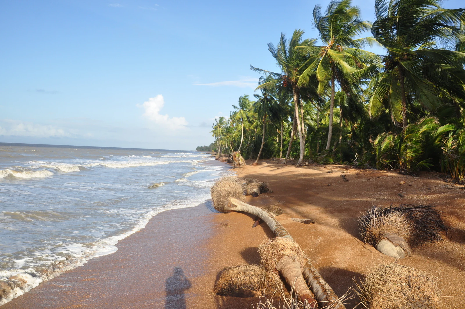
A view along a sandy beach with coconut palm trees leaning towards the water on the right and waves rolling onto the shore on the left.
Coconut palms line the sandy shoreline at Shell Beach.

Shell Beach, Guyana history and protected-area timeline

The conservation history of Shell Beach is closely bound up with the twentieth-century scientific and grassroots movement to protect sea turtles in Guyana. Although the beach itself had long been used by local communities, the nesting populations of Green, Hawksbill, Leatherback, and Olive Ridley turtles came under increasing pressure from the harvesting of adult turtles and their eggs. In the 1960s, the English ecologist Peter Pritchard began visiting the area and documenting both the nesting phenomenon and the threats facing it. His visits laid the foundation for organized conservation in the region.

Pritchard, working alongside Romeo De Freitas, established the Guyana Marine Turtle Conservation Society, one of the earliest formal efforts to protect sea turtles in Guyana. The society's work helped bring international attention to Shell Beach, and Pritchard was later recognized by Time magazine as a 'Hero of the Planet' in 2000 for his contributions to chelonian conservation.

In 2001, the World Wide Fund for Nature (WWF) joined with local organizations and Amerindian communities to coordinate a broader protection program across the beach. This collaboration established community-based monitoring, nesting beach patrols, and structured protection through the decades that followed. In 2011, Shell Beach was formally established as a protected area, consolidating its legal status and securing its future as a dedicated sea turtle nesting reserve. Amerindians from villages such as Almond Beach and Gwennie Beach remain central participants in the day-to-day stewardship of the area.

Shell Beach, Guyana landscape and geographic character

Shell Beach occupies the open northern coastline of Guyana in the Barima-Waini Region, where the country's low-lying coastal plain meets the Atlantic Ocean. The shoreline is long, flat, and sandy, running for roughly 120 kilometers and forming a continuous chain of nesting habitat. Coconut palms and other coastal vegetation line parts of the beach, giving way inland to the mosaic of mangrove, swamp, and coastal forest characteristic of northern Guyana.

The offshore environment is integral to the beach's character. Shallow nearshore waters provide foraging areas for adult sea turtles during the nesting season, while offshore currents along the Guianas' coast influence both the movement of turtles and the conditions that shape nesting success. The combination of broad sandy beaches, gently sloping nearshore terrain, and a relatively undisturbed coastline distinguishes Shell Beach from more heavily developed stretches of shore elsewhere in the region.

Inland from the beach, the broader landscape includes the small Amerindian settlements that have historically been tied to the coast. The interaction between land and sea here is fundamental: the beach itself is the focal point of the protected area, but the surrounding coastal ecosystems, including tidal flats, mangroves, and low coastal forest, support the broader ecological network in which nesting turtles live.

Shell Beach, Guyana ecosystems, habitats, and plant life

The natural character of Shell Beach is defined by the interface between sandy beach, nearshore Atlantic water, and the narrow coastal habitat belt that runs along northern Guyana. The beach habitat itself is relatively simple, dominated by open sand that provides nesting space for sea turtles, with scattered vegetation including coconut palms and patches of coastal shrub and herbaceous plants. The protected area's IUCN Category VI designation reflects a management approach that recognizes sustainable use of natural resources alongside conservation objectives.

Ecologically, the beach is part of a wider coastal ecosystem that includes mangrove fringes, tidal mudflats, and coastal swamp forest typical of the Guianas' northern shore. These habitats together support a food web in which juvenile and adult sea turtles find foraging opportunities, while the beach provides the dry nesting substrate essential to their reproductive cycle. The role of the nesting beach as a seasonal biological hotspot of regional and global importance gives the surrounding habitats a heightened conservation significance.

At a broader scale, Shell Beach forms one of the key ecological anchors of the Barima-Waini coastline, a region known more widely for its extensive wetlands, rainforests further inland, and rich biodiversity. The concentration of multi-species nesting activity on a single shoreline system reinforces the importance of protecting the full coastal strip rather than isolated fragments of nesting habitat.

Shell Beach, Guyana wildlife and species highlights

Shell Beach is fundamentally a sea turtle landscape. The beach hosts nesting populations of four of the world's eight sea turtle species: the Green sea turtle, the critically endangered Hawksbill turtle, the endangered Leatherback, and the vulnerable Olive Ridley. Each nesting season, these species come ashore along roughly 120 kilometers of beach to lay their clutches in the sand, making the area one of the most important sea turtle nesting complexes along the South American Atlantic coast.

Leatherbacks are particularly significant here, as the species nests in numbers that have drawn international scientific attention since the 1960s. The combination of hawksbill, green, and olive ridley nesting alongside leatherbacks on the same shoreline is biologically unusual and gives the area a profile of global conservation importance. Nesting activity is seasonal and synchronized broadly with regional patterns of coastal and ocean conditions along the Guianas.

While the protected area's identity is centered on sea turtles, the surrounding habitats also support other coastal wildlife typical of the Guianas' northern shore, including a variety of shorebirds and the broader fauna associated with the adjacent mangrove and coastal forest systems. The beach's continued protection supports not only the turtles themselves but the wider coastal ecological community of which they are a part.

Shell Beach, Guyana conservation status and protection priorities

Shell Beach is one of Guyana's most important coastal conservation sites, with protection significance that extends well beyond the country's borders because of its role as a multi-species sea turtle nesting area. The beach's designation as a protected area in 2011 formalized decades of conservation work and gave legal backing to ongoing protection. The area is managed as an IUCN Category VI protected area, recognizing both conservation and sustainable use of natural resources.

The fundamental conservation value of the site lies in its nesting populations. Each season, four sea turtle species, including the critically endangered Hawksbill, the endangered Leatherback and Green turtle, and the vulnerable Olive Ridley, come ashore to reproduce. Protecting this nesting activity safeguards not only the turtles themselves but the future of multiple marine turtle populations in the western Atlantic. The beach's roughly 120-kilometer extent provides redundancy across nesting sites, making it less vulnerable to localized disturbance than shorter nesting beaches.

Shell Beach is also notable as a model of community-based conservation. Since the early 2000s, the WWF has worked alongside local organizations and Amerindian communities to organize patrols, monitor nesting, and protect eggs and hatchlings. The involvement of communities such as Almond Beach and Gwennie Beach in conservation activities is a defining feature of the protected area, blending traditional local presence on the coast with structured international support and national protection status.

Shell Beach, Guyana cultural meaning and human context

Shell Beach is closely tied to the Amerindian communities of the Barima-Waini coast, whose residents have long lived alongside the beach and its wildlife. Villages such as Almond Beach and Gwennie Beach are central to the area's identity, both as historical coastal settlements and as participants in the modern conservation program that protects nesting turtles.

For these communities, the relationship with the beach has shifted over time. Historically, turtle meat and eggs formed part of the local subsistence economy, and unregulated harvesting placed significant pressure on nesting populations. The emergence of organized conservation from the late twentieth century onward transformed this relationship, with community members now playing active roles in monitoring nesting turtles, protecting clutches, and supporting broader protection efforts. This shift has become a defining cultural aspect of Shell Beach's modern identity, illustrating how a coastal protected area can be grounded in local heritage and community life rather than imposed from outside.

Top sights and standout views in Shell Beach, Guyana

Shell Beach's defining strengths lie in the combination of its biological importance and its community-based model of protection. The presence of four sea turtle species nesting along a single, long, relatively undisturbed Atlantic shoreline places it among the most significant multi-species sea turtle nesting complexes in the western Atlantic. The beach's roughly 120-kilometer extent, its designation as a protected area, and its management within an IUCN framework lend it durable conservation value.

Equally distinctive is the area's human story. The involvement of Amerindian communities in protection, the legacy of pioneering work by figures such as Peter Pritchard and Romeo De Freitas, and the structured partnership with WWF have created a conservation tradition that blends science, local knowledge, and community stewardship. Shell Beach stands out as a place where global biodiversity priorities intersect directly with local coastal culture.

Best time to visit Shell Beach, Guyana

Sea turtle nesting at Shell Beach follows seasonal patterns tied to the broader rhythms of the western Atlantic coast, with peak nesting activity occurring during the warmer months of the year when conditions on the beach and offshore favor the reproductive cycle of Green, Hawksbill, Leatherback, and Olive Ridley turtles. Visiting during this nesting season offers the strongest opportunity to witness the area's defining natural phenomenon, though exact timing should always be confirmed locally because nesting periods can shift year to year.

Outside of peak nesting, the beach remains a quiet coastal landscape dominated by long sandy shoreline, coconut palms, and offshore Atlantic views. The dry season generally offers calmer conditions and easier access along the coast, while the wetter season brings lusher coastal vegetation and a more atmospheric, green character to the inland habitats. Travelers interested primarily in scenery and coastal ambience may find the shoulder periods between peak nesting and peak rains especially rewarding.

Monthly climate preview

Long term representative point measurements for Barima Waini protected geography

Shell Beach Climate Normals, Annual Temperature and Precipitation Rhythm

Representative coordinates track baseline temperature ranges and monthly precipitation shifts across the protected landscape. Detailed weather by month breakdowns provide complete historical averages for structured comparison.
Annual mean27 °C
26 °C28 °C
Jan26°
Feb26°
Mar27°
Apr27°
May27°
Jun27°
Jul27°
Aug28°
Sep28°
Oct28°
Nov28°
Dec27°
Warmest month
September

28 °C

Coolest month
February

26.4 °C

Wettest month
June

8.9 mm/day

Driest month
March

2 mm/day

Park location guide

Geography guide, regional context, and park location map for Shell Beach, Guyana

Shell Beach, Guyana park geography, regions, and map view in Guyana

Understand where Shell Beach, Guyana sits in Guyana through a broader geographic reading of the surrounding landscape, nearby location context, and its mapped position within the national park landscape.

How Shell Beach, Guyana fits into Guyana

Guyana, officially the Co-operative Republic of Guyana, is a developing country on the northern coast of South America. It is part of The Guianas and the Commonwealth Caribbean, and is the only English-speaking nation in mainland South America. The country is known for its low population density, diverse ethnic composition, and membership in CARICOM.

Wider geography shaping Shell Beach, Guyana in Guyana

Guyana is located on the northern coast of South America, bordering the Atlantic Ocean to the north, Suriname to the east, Brazil to the south and southwest, and Venezuela to the west. The country is part of The Guianas region and has a land area of 214,969 km², making it the third-smallest sovereign state in mainland South America.

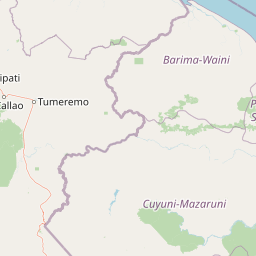
Map view of Shell Beach, Guyana

Use this park location map to pinpoint Shell Beach, Guyana in Guyana, understand its exact geographic position, and read its mapped placement within the surrounding landscape more clearly.

Pigeon | © OpenStreetMap contributors

Location context for Shell Beach, Guyana

Barima-Waini

Examine protected area views, sandy shorelines, and coastal ecosystems across the Atlantic margin.

Shell Beach Photos and Landscape Scenery: Visualizing Guyana Coastal Habitats

Visual records capture the expansive sandy coastline, mangrove mosaics, and nearshore marine environments defining Shell Beach. Examining these protected habitats clarifies the terrain and ecological character supporting regional sea turtle nesting zones.

A view along a sandy beach with coconut palm trees leaning towards the water on the right and waves rolling onto the shore on the left.

Park atlas

Discover adjacent coastal landscapes and connected conservation regions

Explore Protected Areas and Parks Near Shell Beach for Regional Comparison

Browse nearby national parks and protected areas to compare regional coastal geography and marine habitats. Extending the search beyond Shell Beach provides broader context on Atlantic shoreline ecosystems and regional conservation networks.
Nature reserveEstado Bolívar
About 27 km away#1 closest

Southwest

Reserva forestal de Imataca: Geographic Overview of a Major Venezuelan Nature Reserve

Mapping the Sierra de Imataca and regional forest ecosystems

Reserva forestal de Imataca serves as a key conservation zone, characterized by the Sierra de Imataca and a dense network of major rivers. This large-scale protected area provides an essential look at the tropical wilderness and upland forest terrain found within Estado Bolivar, mapping out a significant slice of the Venezuelan Guayana region.

Area
38,219 km²
Established
1961
Relief
Mountain
Climate
Tropical
National parkDelta Amacuro
About 220 km away#2 closest

Northwest

Parque nacional Mariusa: A Detailed Geographic Study of Orinoco Delta Wetlands

Mapped tidal channels and protected wetland geography

Located in Delta Amacuro, Parque nacional Mariusa represents a key protected area where the Orinoco River meets the Atlantic. Its geography is defined by a dynamic system of caños, seasonally flooded rainforests, and mangrove forests that support high ecological complexity. This atlas entry provides an overview of the park boundaries and the physical terrain that shapes this critical Venezuelan protected landscape.

Area
3,310 km²
Established
1991
IUCN
II
Water
Water-dominated
National parkVenezuela
About 245 km away#3 closest

Northwest

Mariusa National Park: Protected Orinoco Delta Wetlands and River Geography

A vast tidal river delta ecosystem in eastern Venezuela.

Mariusa National Park protects an essential segment of the Orinoco River Delta, characterized by its labyrinthine network of tidal channels and dense swamp forests. This protected area spans approximately 3,310 square kilometers of flooded landscape, where freshwater river systems interact with daily Atlantic tidal flows to maintain a globally significant wetland environment.

Area
3,310 km²
Established
1991
Relief
Lowland
Climate
Tropical
National parkBolívar State
About 324 km away#4 closest

Southwest

Canaima National Park: Detailed Geographic Atlas and Protected Landscape Overview

Explore mapped boundaries and natural terrain in Bolívar State.

Delve into the protected landscape of Canaima National Park, a significant natural area located in the expansive Bolívar State of Venezuela. This page provides a focused view on the park's geography, mapped terrain, and its position within the Guiana Highlands, offering critical context for understanding protected areas. Users can investigate the park's boundaries and its contribution to the regional geographic atlas, appreciating its distinct natural characteristics.

Area
30,000 km²
Established
1962
IUCN
II
Visitors
100K annual
National parkPotaro-Siparuni
About 330 km away#5 closest

South

Kaieteur National Park: Iconic South American Waterfall and Protected Forest Landscape

Discover the unique geography and mapped boundaries of this Guiana Shield natural wonder.

Kaieteur National Park is a significant protected area in Guyana, celebrated globally for Kaieteur Falls, the world's largest single-drop waterfall by volume. This national park preserves over 242 square miles of untouched tropical rainforest, offering critical habitat for endemic species and a profound example of the Guiana Shield's ancient geological formations and diverse ecosystems. Its location deep within the Potaro-Siparuni Region underscores its role as a vital bastion of wilderness and a landmark in South American protected landscapes.

Area
630 km²
Established
1929
IUCN
II
Relief
Mixed relief
National parkDiego Martin
About 349 km away#6 closest

Northwest

Chaguaramas National Park in Diego Martin: Coastal Landscape and Protected Area Geography

Mapping the peninsular terrain and northern coastal boundaries of Trinidad

Chaguaramas National Park is defined by its strategic coastal position between the Caribbean Sea and the Gulf of Paria. As a significant protected area in the Diego Martin region, it features a blend of coastal flats and forested foothills that extend from the Northern Range. This overview examines the geographic layout, terrain features, and protected boundaries that define the identity of this unique Trinidadian landscape.

Established
1961
Scope
Terrestrial
Water
Major water bodies
National parkSucre
About 361 km away#7 closest

Northwest

Península de Paria National Park: Venezuela's Protected Landscape Geography and Atlas Context

Explore mapped park boundaries and regional geographic setting.

Discover Península de Paria National Park, a vital protected area within the Sucre region of Venezuela. This page offers a detailed look at the park's geographic identity, focusing on its mapped boundaries and its significance as a national park for atlas-based exploration. Understand its landscape context and its contribution to Venezuela's network of protected lands, providing a clear geographic overview for researchers and explorers.

Area
375 km²
Established
1978
IUCN
II
Relief
Mountain
National parkSucre State
About 413 km away#8 closest

Northwest

Turuépano National Park: National Park Protected Landscape and Geographic Context

Explore the mapped boundaries and natural terrain of Sucre State's national park.

Investigate Turuépano National Park, a protected national park situated within Sucre State, Venezuela. This entry provides detailed geographic context and information on its mapped protected-area boundaries, essential for understanding its role in the region's natural landscape atlas. Explore the specific terrain and protected land features that define this significant Venezuelan park.

Area
726 km²
Established
1991
IUCN
II
Relief
Lowland

Common questions about visiting, size, designation, and location context for Shell Beach, Guyana

Shell Beach, Guyana FAQs for park facts, access, geography, and protected area context

Find quick answers about Shell Beach, Guyana, including protected-area facts, park geography, trail and visitor context, and how the park fits into its surrounding country and regional landscape.
MoriAtlas Explorer

Continue Your Protected Areas Search Across the Global Atlas

Deepen your exploration by continuing the structured search for national parks and protected areas worldwide. Utilize the comprehensive filtering capabilities to compare different conservation landscapes and refine your understanding of global park geography. Discover more about the distribution and characteristics of protected natural areas.

Global natural geography
