
Visitor Essentials
When to Visit Shikotsu-Toya National Park: The Short Answer
Deciding when to visit Shikotsu-Toya National Park requires balancing two distinct travel experiences: the accessible, hiking-friendly conditions of the warmer months and the rugged, geothermal appeal of the winter season. There is no single universal window for a visit, as the park’s primary attractions,volcanic caldera landscapes and onsen hot spring resorts,respond differently to Hokkaido’s significant seasonal shifts. Your experience will be shaped primarily by whether you prioritize outdoor caldera exploration or the atmospheric, snow-covered thermal bathing that characterizes the region in winter.
The Summer Hiking Window and Climate Context
For those focused on trekking around Lake Shikotsu, Lake Toya, and the surrounding volcanic slopes like Mount Tarumae or Mount Usu, the most accessible period runs from June through September. During these months, temperatures move into a moderate range, with daily means consistently climbing above 13 degrees Celsius and peaking in August at approximately 20 degrees Celsius. The climate in this window is defined by longer daylight hours, reaching a maximum of over 15 hours in June, which provides ample time for trail navigation. Precipitation patterns during the summer months do increase, particularly in August, where rainfall normals are higher compared to the rest of the year. Visitors should expect high humidity levels during this season, which can influence comfort levels during strenuous activities.
The Winter Geothermal and Landscape Appeal
Visiting during the winter months, specifically from December through March, offers a starkly different encounter with the park. This period is defined by sub-zero temperature averages, with January and February experiencing mean temperatures near negative 3.7 degrees Celsius and minimums that can drop toward negative 10 degrees Celsius. While these conditions make high-elevation hiking significantly more challenging and often restricted by snow, they enhance the appeal of the park’s established hot spring resorts, such as those found in Noboribetsu. The contrast of soaking in mineral-rich thermal waters while the surrounding landscape is frozen creates a specialized, atmospheric experience that is distinct from the summer season. Daylight hours are at their shortest during this time, falling to under 9.5 hours, which necessitates careful planning for shorter days and lower light levels.
Interaction of Timing and Park Infrastructure
The interaction between weather, daylight, and physical access defines the rhythm of travel here. Spring and autumn serve as transitional periods where temperature variability is high and conditions can change rapidly. Because the park’s geography relies on volcanic formations and high-altitude caldera lakes, weather is not merely a backdrop but a primary determinant of access. While the climate data provides a reliable baseline for what to expect, travelers must remain aware that conditions can shift, and specific areas within the park may be subject to variable access throughout the year. Always verify current trail conditions and transport status before finalizing your travel dates to align your expectations with the realities of the season.
Seasonal Planning
Best Months to Visit Shikotsu-Toya National Park for Every Traveler
Peak Hiking and Outdoor Exploration: June to September
For travelers prioritizing high-altitude access and extended daylight, the window from June through September represents the most reliable period for outdoor activity. During these months, the park shifts away from the freezing temperatures observed in early spring, with mean temperatures climbing into the mid-teens and low 20s. June offers the longest daylight hours of the year, providing a practical advantage for those planning longer treks around Lake Shikotsu or the volcanic trails near Mount Usu.
August stands out as the warmest month, with daily highs averaging 26 degrees Celsius. While this period is popular, it also sees the highest precipitation levels, often manifesting as short-lived but intense rain. Travelers who choose this window trade the quiet, icy isolation of winter for the necessity of planning around moisture and fluctuating visitor patterns. This is the optimal time for observing the volcanic geology and the diverse forest habitats of Hokkaido when trails are largely free of significant snowpack.
Transition Seasons and Alpine Stability: May and October
May and October serve as the shoulder periods, where the park environment undergoes significant shifts in temperature and vegetation. In May, the landscape awakens from the long winter, though higher elevations may retain residual snow, and the average daily maximum of nearly 18 degrees Celsius makes for a brisk, invigorating experience. This month is particularly well-suited for visitors interested in the resurgence of natural activity, provided they are prepared for cooler nights that hover just above freezing.
October provides a cooling, stable environment as the park prepares for the winter cycle. With mean temperatures dropping to around 11 degrees Celsius, the period is marked by clearer, crisp conditions compared to the wetter late summer. It represents a compromise between the warmth of the peak summer months and the harsh, high-wind conditions of the late year. Travelers choosing October benefit from a more contemplative pace, as the crowds associated with peak foliage or summer holiday periods begin to taper.
The Geothermal and Winter Landscape: November to April
From November through April, the park transforms into a cold-weather destination characterized by persistent sub-zero temperatures and significant snowfall. While the average daytime temperatures in early winter can still reach 7 degrees Celsius, the consistent freezing lows by January and February dictate the primary activities. This season is best suited for visitors seeking the park's famed geothermal resorts, such as those in Noboribetsu. The stark contrast between the freezing air and the warmth of volcanic hot springs is the defining experience of this season. Visitors during this window must prioritize specialized gear for ice and cold, acknowledging that these months are defined by reduced daylight and environmental conditions that require increased caution during transit.
Annual Climate Overview
Temperature, Precipitation, and Daylight Trends in Shikotsu-Tōya National Park
Understanding the Annual Climate Arc
The climate of Shikotsu-Tōya National Park is defined by a sharp transition between intense, snow-heavy winters and a relatively brief but temperate summer window. Based on long-term climate normals from 1991 to 2020, the region experiences significant seasonal shifts in mean temperatures and daylight that directly influence how the volcanic landscape is accessed. It is essential to note that these values represent historical climate averages at a specific base elevation and do not function as daily weather forecasts or accounts of conditions at higher volcanic elevations, where temperature drops and wind speeds are typically more severe.
The Shift from Winter Cold to Spring Awakening
Winter in the park is marked by persistent sub-zero temperatures and high humidity, with mean temperatures lingering near or below freezing from December through March. January and February are the coldest months, featuring average minimums dipping below negative ten degrees Celsius. During this period, wind speeds remain high, hovering around 5.6 meters per second, which exacerbates the perception of cold for anyone moving between geothermal sites and transit hubs.
As April arrives, a noticeable pivot occurs. The mean temperature climbs into positive territory at 4.37 degrees Celsius, and daylight duration extends significantly to over thirteen hours. This transition is usually the period when snow accumulation begins to stabilize and retreat, marking the start of the primary shift toward the park's more accessible season. However, visitors during this time should remain aware that higher-altitude trails often retain snow long after the lower valleys show signs of early spring.
Summer Warmth and Humidity Patterns
Summer in the park is relatively compressed, peaking between July and August. These are the warmest months, with mean temperatures reaching approximately 18 degrees Celsius and 20 degrees Celsius, respectively. These months also represent the period of maximum daylight, stretching to over fifteen hours in June, which provides the most expansive window for outdoor exploration.
One critical climate factor during the summer is the rise in precipitation. August, in particular, records the highest daily precipitation average in the park, often coupled with humidity levels that remain consistently high throughout the summer months. While these conditions support the lush, green vegetation that frames the caldera lakes, they also imply that summer visitors should prepare for frequent, though not necessarily prolonged, rainfall. Wind speeds hit their annual minimums during the June-July window, providing a rare period of relative calm that contrasts sharply with the blustery winter months.
The Autumnal Cooling Trend
September acts as a bridge between the humid summer and the rapidly cooling late year. While mean temperatures remain comfortable at roughly 17 degrees Celsius, the drop in daylight hours and a slight decrease in humidity signal the approaching transition. By October, the average minimum temperature drops toward 4 degrees Celsius, and the wind speeds begin their steady climb back toward winter levels. This period is often characterized by crisp, clear air as humidity levels reach their annual low point of around 80 percent, providing the best conditions for visibility across the caldera lakes before the first winter snows arrive in November.
Annual Climate Patterns
Understanding Seasonal Transitions and Weather Patterns in Shikotsu-Toya
Defining the Annual Climate Phases
Shikotsu-Toya National Park does not follow a strict, four-season calendar in terms of visitor utility. Instead, the park operates on a distinct rhythm dictated by the transition from deep winter stability to an extended, humid summer cycle. By analyzing the 1991-2020 climate normals, the year is best understood through three primary environmental phases: the Winter Deep Freeze, the Spring Awakening, and the High Summer Period. Understanding these transitions is essential for anticipating conditions across the volcanic landscape.
The Winter Deep Freeze: December to March
The winter phase is defined by sub-zero temperatures and persistent, high-wind conditions. During December, January, and February, the park experiences its lowest mean temperatures, often dipping below -10 degrees Celsius at night. This is not merely a period of cold; it is characterized by consistent, high humidity and significant wind speeds, which frequently exceed 5 meters per second. These factors combine to create a stark, snow-heavy environment. While this weather phase offers a stable climate for those specifically seeking winter photography or geothermal bathing in Noboribetsu, it is marked by restricted access and a lack of the thermal comfort found later in the year. The transition out of this phase begins in March as daylight hours increase to over 11 hours, though mean temperatures remain near freezing.
The Spring Awakening: April to May
April and May represent the primary transition window in the park. This period is defined by the rapid shift from winter dormancy to warmer, more active conditions. In April, average maximum temperatures rise toward 13 degrees Celsius, and wind speeds begin a noticeable decrease, dropping from the higher values recorded in winter. The length of daylight expands significantly, reaching over 14 hours by May. Visitors should note that this is a highly variable time of year; while the snow cover begins to retreat, conditions can fluctuate between mild, sunny days and sudden, cool weather systems. This phase serves as the critical bridge between the isolation of the snowy months and the full accessibility of the summer season.
The High Summer Period: June to October
From June through October, the park enters its most stable environmental phase. This period is characterized by the highest mean temperatures of the year, with August reaching a peak mean of over 20 degrees Celsius. Precipitation patterns change here, with July and August recording the highest rainfall levels of the year. Despite the increased moisture, this phase provides the longest daylight hours and the mildest conditions for exploring volcanic trails and caldera lakes. By September, the environment begins a slow, comfortable cooling trend as mean temperatures drop below 18 degrees Celsius and humidity levels start to decline. This makes late summer and early autumn an ideal transition back toward the cooler, quieter atmosphere that precedes the return of the winter cycle in November.
Seasonal Experiences
Experiencing Shikotsu-Toya National Park Through the Seasons
Volcanic Landscapes and Active Geothermal Sites
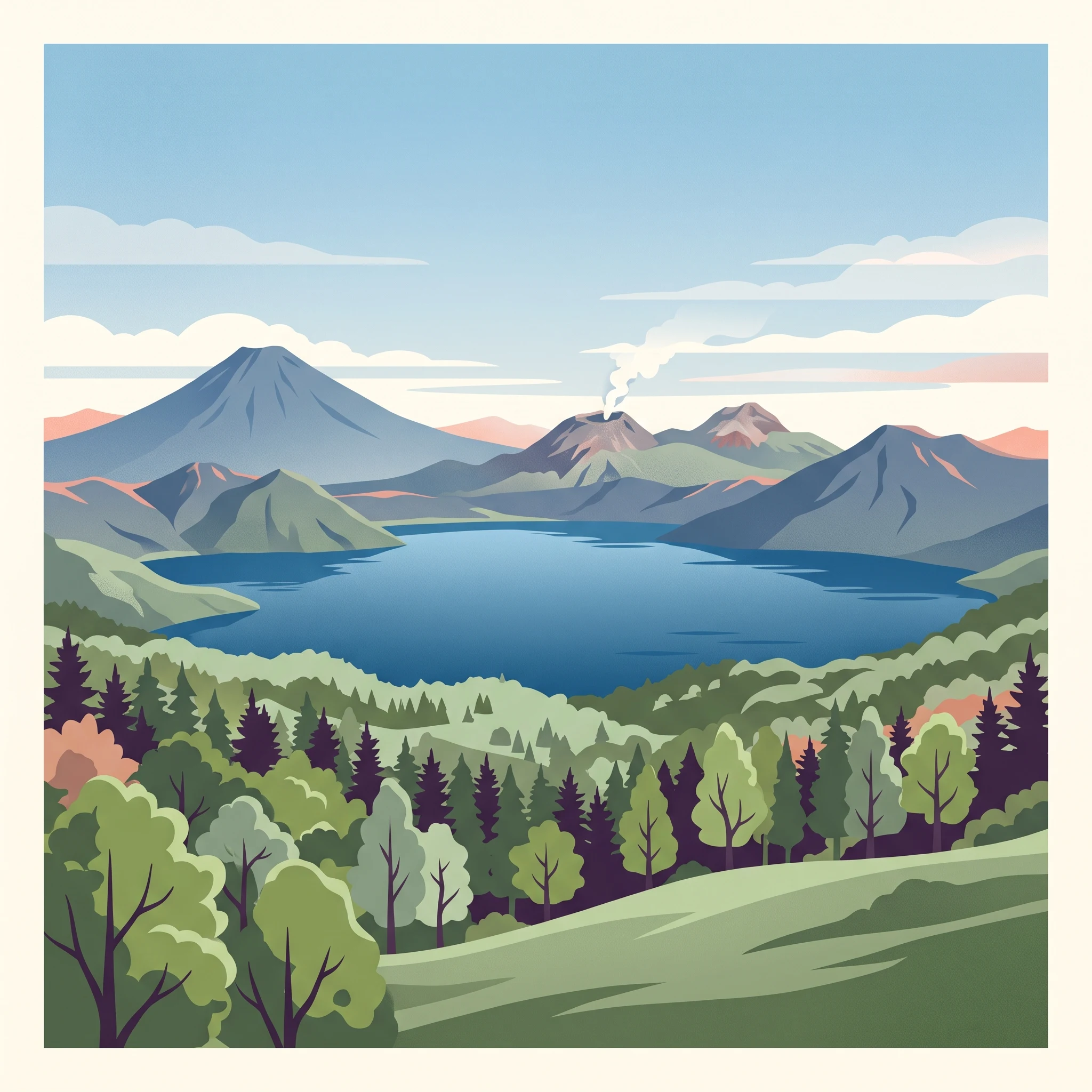
The park's most iconic geological features, such as the active craters of Mount Usu and the geothermal activity at Noboribetsu's Jigokudani, remain accessible across the seasons, though their character shifts significantly with the weather. During the warmer months, specifically from June through September, the Nishiyama Crater Trail and areas around the Showashinzan volcanic dome are most accessible for walking. The moderate temperatures and longer daylight hours of these months allow for safer observation of the post-eruption landscapes where the remnants of roads and buildings are visible. As autumn arrives, the cooling air and lower humidity make these exposed, thermal-rich areas more comfortable for longer exploration, as the lack of deep snow allows clear passage along maintained trails.
Seasonal Utility of Caldera Lakes
Lake Shikotsu and Lake Tōya serve as the park's primary water-based destinations, and their experiential value is tied closely to the annual daylight cycle. In the peak of summer, the deep, clear waters are central to recreational activities like boating. By contrast, the winter season provides a distinct environment for these lakes. Because of the persistent geothermal activity in the region, Lake Tōya remains unfrozen even during the coldest months when mean temperatures hover near zero degrees Celsius or lower. This thermal persistence provides a unique visual contrast of open water against the surrounding snow-covered caldera rim. Visitors interested in the intersection of traditional bathing culture and natural landscapes should note that the lakeside hot spring resorts, particularly those near Lake Shikotsu, offer a different experience when the ambient air temperature is below freezing, as the outdoor steam from the mineral-rich baths becomes more pronounced.
Walking and Exploration Conditions
Nature trails and forest paths, including the terrain around the moss-carpeted canyons, exhibit different degrees of passability throughout the year. The spring thaw, typically spanning from April into May, marks the beginning of the hiking season as snowmelt recedes. During these months, trails may still be damp, and visitors must rely on official park updates regarding trail maintenance before setting out. Summer provides the most stable footing for longer walks into forested zones, as high humidity and rainfall totals, which peak in August and September, keep the lush vegetation vibrant. Those seeking a more solitary experience in the park's interior forests often look to the cooling transition periods in late September and October, when the risk of lingering mud from summer rains decreases and the humidity levels begin to drop significantly.
Visitor Priorities
Best Times to Visit Shikotsu-Tōya National Park for Hiking, Landscapes, and Hot Springs
Choosing the Ideal Window for Caldera Hiking
For travelers prioritizing hiking, the most suitable period aligns with the shift toward stable, warmer conditions and the availability of snow-free trails. The window from late June through early September offers the most consistent access to the higher-elevation volcanic trails surrounding Mount Usu and Mount Tarumae. During this timeframe, mean temperatures peak between 14 degrees Celsius and 20 degrees Celsius, and daylight duration provides ample time for longer excursions before the evening transition. The primary compromise for hikers during these months is higher relative humidity, which reaches its annual zenith in July at nearly 90 percent. Hikers should anticipate that while trail conditions are optimal, the peak summer warmth can make mid-day ascents physically demanding compared to the crisp, cooler air of the late spring or early autumn shoulder seasons.
Prioritizing Mild Weather and Longer Days
Visitors who prefer moderate temperatures without the humidity of late summer will find late May and early June to be the most balanced months. During this period, the landscape transitions out of the spring thaw, offering average maximums near 18 to 21 degrees Celsius and noticeably lower precipitation than the July and August peak. Daylight is also at its annual maximum during this window, with June providing over 15 hours of light, which is advantageous for those aiming to explore multiple lakeside areas in a single day. The trade-off for this mildness is the potential for residual snow patches at higher elevations and the fact that alpine trail access may still be restricted by park management until local authorities confirm the safety of higher-altitude routes.
Thermal Bathing and Landscape Appreciation
For those primarily interested in the geothermal experience at sites like Noboribetsu or the lakeside onsen resorts, the late autumn and winter months provide a unique atmospheric contrast. As temperatures drop below freezing from December through March, the stark landscape of Jigokudani (Hell Valley) becomes particularly evocative. The cold air, often hovering between -10 degrees Celsius and 3 degrees Celsius, enhances the visibility of the geothermal steam plumes. While these months offer the most iconic sensory experience of the park's volcanic heat, visitors must accept the trade-off of very short daylight hours, which dip to under 9 hours in December. Additionally, while the resort areas generally remain accessible, the winter environment limits the ability to explore beyond the immediate hot spring vicinities, making this period less suitable for travelers looking for diverse outdoor activity.
Visitor Access
Seasonal Road Access and Planning for Shikotsu-Tōya National Park
Managing Seasonal Road Access and Route Limitations
Navigating Shikotsu-Tōya National Park requires an understanding of how seasonal weather patterns interact with regional infrastructure. While the caldera regions around Lake Shikotsu and Lake Toya remain central hubs, access to higher elevations and specific mountain routes is subject to periodic changes. Roads leading to remote trailheads or scenic overlooks may experience temporary closures, particularly during the shoulder months of late autumn and early spring, as crews assess snow accumulation and road stability. Because these restrictions are determined by current safety assessments and maintenance schedules, you must verify the status of mountain routes with the official park authorities before attempting to transit through higher-altitude areas.
Public Transport and Independent Travel Considerations
Public transit accessibility is a significant planning variable for those travelling without a private vehicle. While major hubs like New Chitose Airport provide direct access to Lake Shikotsu and major cities such as Sapporo connect to Toya Station, the frequency of bus services can be lower than in urban areas, and connections to trailheads or specific volcanic lookouts are often limited. If you plan to rely on public transportation, it is essential to check current schedules and service availability well in advance of your visit. For travelers who prefer flexibility, renting a car provides the most reliable way to navigate between the dispersed attractions of the park, though winter driving requires specialized equipment and experience with snowy, icy road conditions common from December through March.
Monitoring Volcanic Alert Levels and Official Notifications
Given the active volcanic nature of the park, including features like Mount Usu and the surrounding geothermal zones, visitor access is occasionally subject to adjustments based on volcanic activity levels. Authorities may restrict access to specific areas, such as hiking trails near active craters or certain geothermal fields, if safety monitoring suggests increased risk. These operational changes can occur with little notice. Always check the official website of the Ministry of the Environment or local park signage upon arrival for the most current information regarding closures or restricted zones. Relying on outdated maps or general travel advice can lead to unplanned detours, so prioritize information gathered directly from the responsible agencies during your trip planning process.
Seasonal Safety and Preparation
Weather Expectations and Seasonal Safety in Shikotsu-Tōya National Park
Navigating Volatile Volcanic Conditions
Preparation for a visit to the park requires recognizing that the landscape is geologically active and climatically diverse. Whether you are exploring the geothermal activity of Jigokudani or hiking the ridges around Lake Shikotsu, you must treat the environment as fluid. Temperatures can shift significantly between low-lying lake basins and exposed mountain slopes. Visitors should anticipate that long-term climate normals represent broader trends rather than specific daily conditions. Because the park features active volcanic sites such as Mount Usu and Mount Tarumae, you must always consult official hazard maps and real-time volcanic activity alerts provided by the Japan Meteorological Agency before heading to any trailhead or remote geothermal area.
Preparing for Seasonal Temperature Extremes
Seasonal preparation hinges on the stark differences between the humid, warm summer and the harsh, deep-freeze winter. During the peak summer months of July and August, when mean temperatures reach their annual high, the primary focus is on managing humidity and staying hydrated. Even in summer, cloud cover and elevation can cause rapid temperature drops, making layered clothing essential for mountain hiking. Conversely, the winter period from December to March demands preparation for sub-zero temperatures and consistent snow cover. The park's mean temperatures often drop well below freezing, and the combination of high wind speeds and low daylight hours necessitates a cautious approach to outdoor time management. You must ensure your equipment and clothing are rated for these cold-weather realities, prioritizing windproof and moisture-wicking layers to maintain body heat in the exposed caldera regions.
Terrain-Specific Safety and Wildlife Awareness
Beyond weather, safety in the park involves respecting the inherent characteristics of a wild, forested volcanic landscape. The park is documented as bear habitat, which necessitates basic precautions. To mitigate risk, hikers are encouraged to remain aware of their surroundings, keep noise levels consistent in dense forest areas, and secure all food items properly. These practices are standard for navigating Hokkaido's wilderness. Furthermore, trail conditions in the park change rapidly during the spring thaw and following heavy autumn precipitation. Routes that appear clear on maps may be affected by mud, late-season snow patches, or storm damage. Never rely solely on printed maps or digital route planning tools for current conditions. Always check local trail status reports, visitor center notices, or official government portals for the latest information on accessibility and route safety before your departure. If a trail or access point is marked as restricted, it is critical to respect those warnings, as they are established based on current geological or environmental assessments.
Final Planning
How to Choose the Best Time to Visit Shikotsu-Toya National Park
Choosing the right time to visit Shikotsu-Toya National Park requires reconciling the physical demands of high-elevation volcanic terrain with the sensory appeal of Hokkaido's geothermal environment. The decision effectively splits into two distinct travel objectives: the pursuit of active, snow-free exploration across the park's caldera landscapes or the immersion in a colder, winter-defined experience centered on thermal resorts and dramatic, ice-bound scenery. By identifying which priority anchors your trip, the selection of your travel window becomes a matter of balancing personal tolerance for weather conditions against the accessibility of the park's key features.
Prioritizing Active Exploration and Caldera Access
If your primary goal is to traverse the hiking trails around Mount Tarumae or to experience the full extent of the volcanic caldera rim, the window from late June through September provides the most reliable conditions. This period is defined by the highest temperatures of the year, facilitating mountain access when snow accumulation is negligible. The trade-off for this accessibility is a higher level of humidity and increased precipitation, particularly toward August. Travelers who prefer temperate, dryer conditions should focus on the transition periods in early June or late September. These months often serve as a balance between the thawing landscape of late spring and the initial onset of colder, high-latitude autumn air, providing shorter but arguably more stable windows for extended outdoor movement.
Prioritizing Geothermal Immersion and Seasonal Landscapes
Travelers focused on the thermal resorts of Noboribetsu or the scenic atmosphere of Lake Toya during the winter months prioritize a different set of trade-offs. The period from December through March transforms the park into a starkly different environment, where the focus shifts toward localized, resort-based activities and visual appreciation of the volcanic landscape under deep snow. While this season requires careful attention to winter-specific transport logistics and lower daylight availability, it offers a unique experiential quality that is physically incompatible with summer hiking goals. Choosing this window assumes a preference for cold-climate sightseeing and the restorative nature of Japanese hot springs over mountain-based recreation.
Finalizing Your Decision
Ultimately, there is no single best time to visit because the park serves two different functions depending on the season. If you are uncertain, consider whether you prefer long daylight hours and trail-based activity, which align with the summer months, or if the atmospheric qualities of a snowy volcanic retreat align better with your travel intent. Regardless of the window you select, recognize that climate normals provide a baseline for planning rather than a guarantee of conditions. Before finalizing your departure, you must verify the latest official alerts regarding volcanic activity, road closures, and seasonal transport availability, as these factors can shift rapidly regardless of historical weather patterns.