

Mori Atlas logo
Nature reserveSiebleber Teich

A historic ducal fishpond landscape featuring diverse reedbeds and lowland wetland terrain

Siebleber Teich Nature Reserve: Mapping the Protected Wetland Landscapes of Thuringia, Germany

(Naturschutzgebiet Siebleber Teich)

Siebleber Teich serves as a significant protected nature reserve located within the Siebleber Senke of Thuringia, Germany. This lowland basin preserves a delicate mosaic of shallow open water, dense reedbeds, and historic eighteenth century embankments. The site functions as a vital wetland sanctuary, offering unique insights into the regional geography and the long term conservation of shallow riparian habitats within an agricultural setting.

pondwetlandreedbednature reserveamphibiansbirdwatching
A flat-style digital illustration showing a wooden footbridge extending into a calm pond, surrounded by grassy banks, birch trees, and distant hills under a soft sun.

Siebleber Teich

Nature reserve

Park overview

Structured park overview, official facts, and landscape profile for Siebleber Teich

Siebleber Teich park facts, protected area profile, and essential visitor context

Review the core facts for Siebleber Teich, including designation, size, terrain, visitor scale, habitats, and operating context in one park-focused overview.

About Siebleber Teich

Siebleber Teich is a small artificial pond and protected wetland in the district of Gotha, Thuringia, situated a few hundred meters north of the Seeberg hill. The pond occupies the Siebleber Senke, a natural lowland depression that originated as the remnant of a late glacial lake which reached its greatest extent roughly between 7300 and 3800 BCE. Although the modern water body is far smaller than this original lake, the basic basin shape reflects that prehistoric landscape.

The pond was deliberately created at the beginning of the eighteenth century, after local communities of Siebleben, Tüttleben, and Cobstädt were instructed to drain the surrounding marshland and open up ditches for agriculture. The construction started in 1717 under ducal supervision, employing militia soldiers with wheelbarrows, spades, and hand tools, and was largely completed by 1719. Stone embankments were raised on the south, east, and north sides, and linden trees were later planted along the east dam, with a few individuals still standing more than 280 years later.

For most of its modern history the pond served the ducal court of Saxe-Gotha-Altenburg as a fishpond, stocked with carp, pike, tench, perch, and various whitefish. Yields were modest, complicated by shallow water, winter kill, summer droughts, leaking dams, reed encroachment, and silting up. By the nineteenth century the focus shifted to forestry, gamekeeping, and, after 1967, full nature conservation. Today the area is a public recreation landscape, while still functioning as one of the more ecologically interesting small wetlands in the region.

The reserve is closely tied to surrounding cultural and natural landmarks, including the Mönchshof estate with its castle and park, the Seeberg hill with its famous Seeberg caves, and the Geierslache stream that feeds the pond. Pastures, avenues of trees along the dikes, traditional ways through the marsh, and a log cabin blockhütte at the water's edge give the reserve a distinct cultural landscape quality that complements its ecological importance.

Quick facts and research context for Siebleber Teich

Siebleber Teich lies in the district of Gotha in Thuringia, north of the Seeberg hill and within the historical Siebleber Senke lowland. It is an artificial pond constructed in the early eighteenth century on the remains of a late glacial lake, with a planned surface area far larger than its present day water body of about 16 hectares.

The pond has a mean depth of roughly 0.8 meters and a maximum depth of about 1.5 meters, sitting at around 275 meters above sea level. It is fed mainly by the Geierslache stream and drains east into the Roth, then onward to the Apfelstädt, Gera, Unstrut, Saale, and Elbe. Protected as a nature reserve since 1967, it is part of the Natura 2000 habitat site Seeberg-Siebleber Teich and is recognized for its reedbeds, stonewort communities, moor frogs, and rich birdlife.

Protection and recognition

Terrestrial conservation framework and official designation timeline established in 1967.

Siebleber Teich Protection Status and Documented Designation History

Historical records indicate a terrestrial protection status established for Siebleber Teich in 1967. Structured administrative entries compile available management scope and international recognition data.

Protection details

Protection scope
Terrestrial
Designated year
1967
Transboundary protection
No
Park context

Deeper park guide and search-rich context for Siebleber Teich

Siebleber Teich history, landscape, wildlife, and travel context

Explore Siebleber Teich through its history, landscape character, ecosystems, wildlife, conservation priorities, cultural context, and seasonal travel timing in a structured park guide built for atlas discovery and search intent.

Why Siebleber Teich stands out

Siebleber Teich is best known as a compact but ecologically rich lowland pond within an otherwise more agricultural landscape. Its defining character comes from the interplay between open shallow water and dense reedbelts, which together support a wide range of waterbirds, amphibians, and specialized vegetation such as stonewort algae. The reserve is also notable for its long history as a former ducal fishpond and the way that eight centuries of pond management, drainage schemes, and ownership disputes have left their mark on the landscape. Today it stands out in the region as one of the few remaining protected shallow wetland complexes in the Gotha district, with cultural layers stretching from late glacial times to twenty first century conservation efforts.
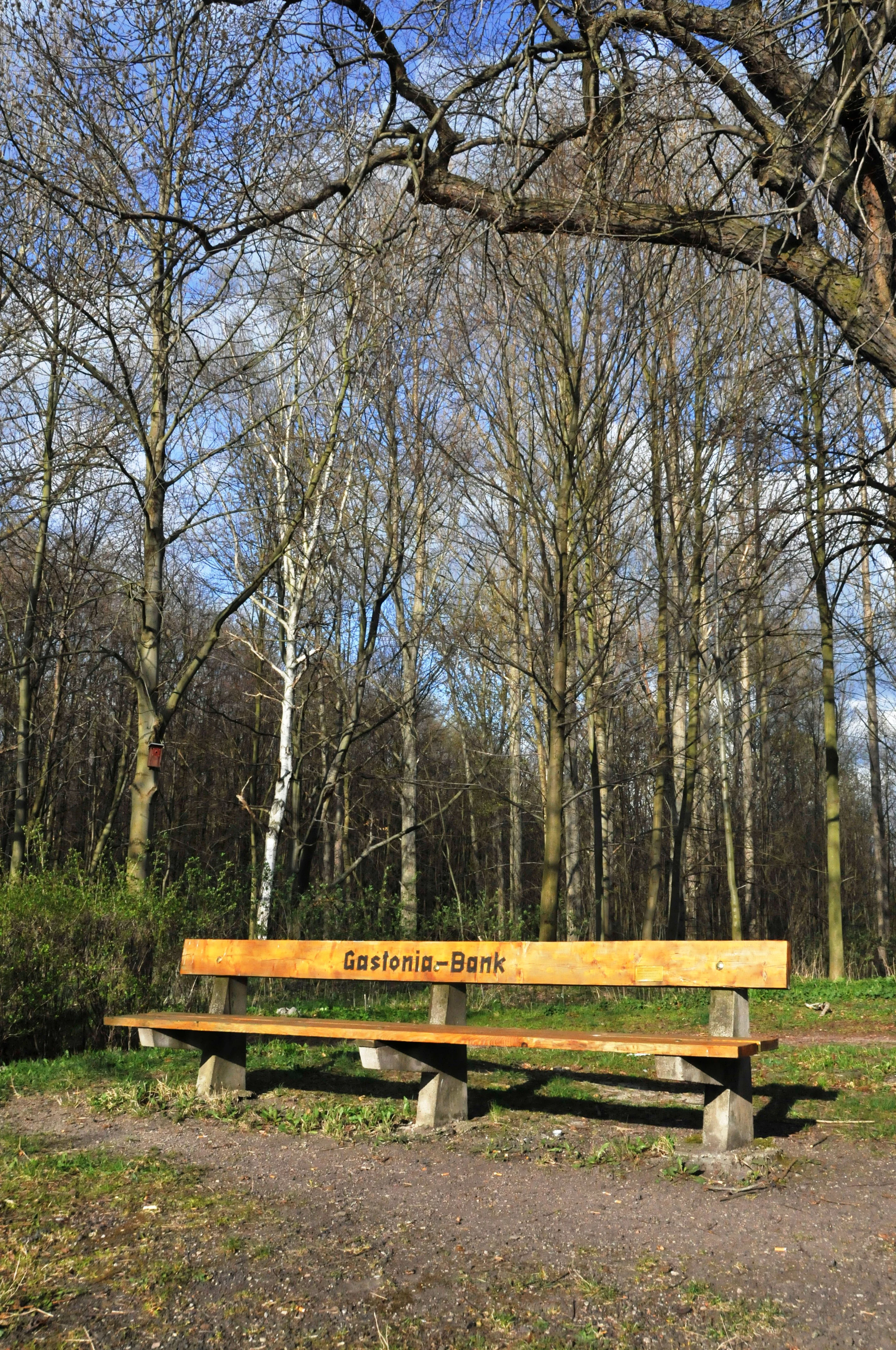
A long wooden park bench with the text Gastonia-Bank burned into the wood, positioned on a dirt path in front of a dense, leafless forest.
A wooden bench marked Gastonia-Bank situated in the Siebleber Teich nature reserve.

Siebleber Teich history and protected-area timeline

The Siebleber Teich has a layered history that begins long before the artificial pond was created. The Siebleber Ried, or marsh, was the relic of an ice age lake that was at its largest between roughly 7300 and 3800 BCE. For thousands of years this was simply wetland, until rising demand for farmland prompted authorities to drain it.

Late in the seventeenth century the Gotha city council ordered the communities of Tüttleben and Cobstädt to open their ditches and let the water flow away, on pain of a fine of ten Reichstaler. A ducal decree of 23 September 1697 set this in motion, and in 1717 the actual pond construction was ordered. Work began in June 1717, was first paused for winter, and was substantially completed in 1719. By that point a roughly square water body had been excavated and surrounded by protective levees on three sides.

From 1718 onward the pond was used for fish farming, with regular stockings and yielding catches of carp, pike, perch, tench, and whitefish. Yields were modest at best; major fish kills were recorded in the hard winters of 1754-55 and 1779-80, and the pond repeatedly faced drought, siltation, and overgrowth of reeds. Several attempts were made to drain the pond and use the bed for crops or to dredge sediment out through the Roth stream, but none succeeded in restoring the original function fully.

Ownership of the pond and the surrounding marshland became a long running dispute between the duchy, the city of Gotha, and the community of Siebleben, lasting more than a century before an enduring agreement was reached in 1822. After a domain split in 1905 and final state acquisition in 1912, the focus gradually shifted from fisheries to forestry, gamekeeping, and recreation. The official beginning of conservation came in 1912, when forest councillor von Blücher argued the pond should be preserved for landscape beauty and for the benefit of birds. The decisive step, however, was the 1967 designation of the Siebleber Teich as a nature reserve, which still defines the site today.

Siebleber Teich landscape and geographic character

The Siebleber Teich lies within the Siebleber Senke, a flat, bowl shaped depression tucked between the Seeberg hill to the south and the gentle slopes around the villages of Siebleben, Tüttleben, and Seebergen. The pond itself is small, roughly 400 meters across, with a perimeter close to 1.6 kilometers and a surface only modestly above sea level at around 275 meters elevation.

Its scenery is defined by three large embankments on the south, east, and north sides, which frame the open water and tower just above the surrounding marshes. These levees carry wide grassy paths, mature avenues of linden and other trees, and small rest areas. The western side of the pond is softer, melting into wetland, reed meadow, and pasture.

Surrounding landforms include the rounded silhouette of the Seeberg, the historic park of the Mönchshof with its castle, and the orchards and meadows that border the village of Siebleben. A small wooden footbridge, a piping inlet from the Geierslache, and a tradition of reed cutting all shape the visible character of the site. The overall impression is of a cultivated, light filled pond set firmly inside a frame of dry meadows, marshland, and forested hill slopes.
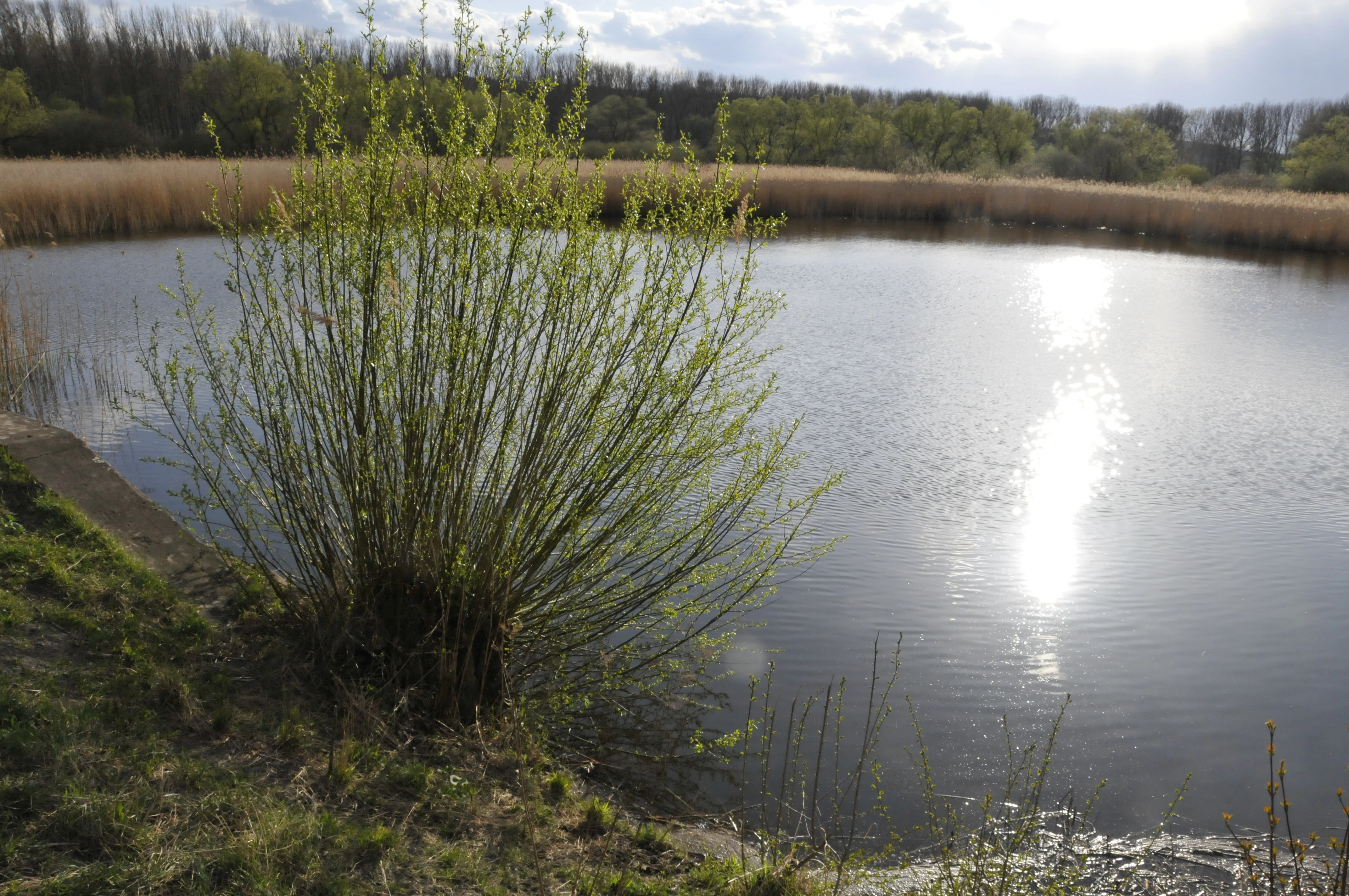
A calm, circular pond surrounded by tall grasses and trees, with bright sunlight reflecting on the water surface.
A view of the Siebleber Teich pond and its surrounding vegetation.

Siebleber Teich ecosystems, habitats, and plant life

Ecologically the Siebleber Teich is dominated by shallow open water and very extensive reedbeds. Stonewort algae communities colonies have established themselves in places, and the shore line is rich in reeds, sedges, and damp meadow species. The pond is amphibian rich, and the moor frog in particular is regarded as a species of conservation interest in the area.

The surrounding depression supports wet grassland and moist woodland, anchored by alder, willow, and planted linden. Historically the levees have been planted with fast growing shrub species and trees, partly to bind the soil, partly for bark and fuel. While the wood today is partly monocultural, sections of natural alder and willow wetland remain.

Despite its small area, the site functions as a refugium in the lower Thuringian basin because open water, marsh, and meadow coexist within a few hundred meters. This mosaic has allowed species that would otherwise not find suitable habitat in the surrounding agricultural land to survive here, especially amphibians and wetland plants. Even if the water body and its vegetation are modest in area, their ecological function for the district is disproportionately large.
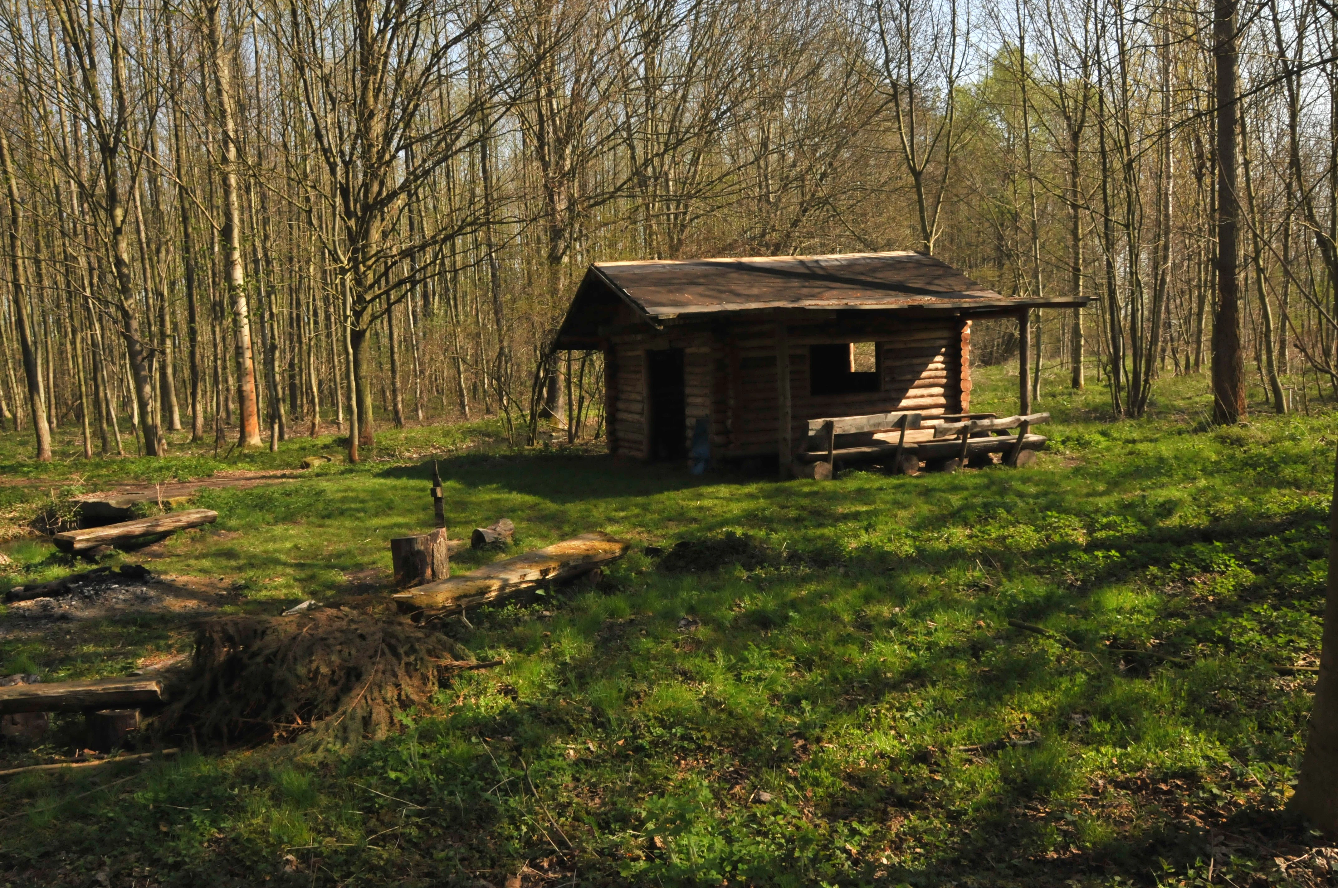
A small wooden log cabin stands in a clearing surrounded by deciduous trees, featuring an attached bench seating area and a fire pit in the foreground.
A rustic log cabin and picnic area within the wooded grounds of Siebleber Teich.

Siebleber Teich wildlife and species highlights

Birdlife is the headline wildlife story of the Siebleber Teich. In earlier decades observers documented more than 120 different bird species in the area, of which around 62 were confirmed breeding species and another 12 were suspected of breeding. By the early 2000s, however, ongoing silting up, reed encroachment, predation, and disturbance from dogs and cats had reduced the breeding bird count to around 37 species at the site.

The pond is still locally famous as a spring staging post for common starlings, which arrive in March in their thousands, rest and pair at the water, and continue north to their breeding grounds; the same flocks pause again in autumn on their way south. Waterbirds and reed zone species that have benefited from protection include marsh harrier, red kite, raven, and several buzzard species, although all are also regarded as predation pressure on smaller breeding birds.

Mammals in the area are typical of moist lowland in central Germany, including wild boar and red fox, which are significant nest predators at the pond. The moor frog is the most often cited amphibian. A planned buffer strip with electric fencing around the main breeding reed areas has been drawn up specifically to keep predators, free roaming dogs, and people at a safe distance during the core breeding period.
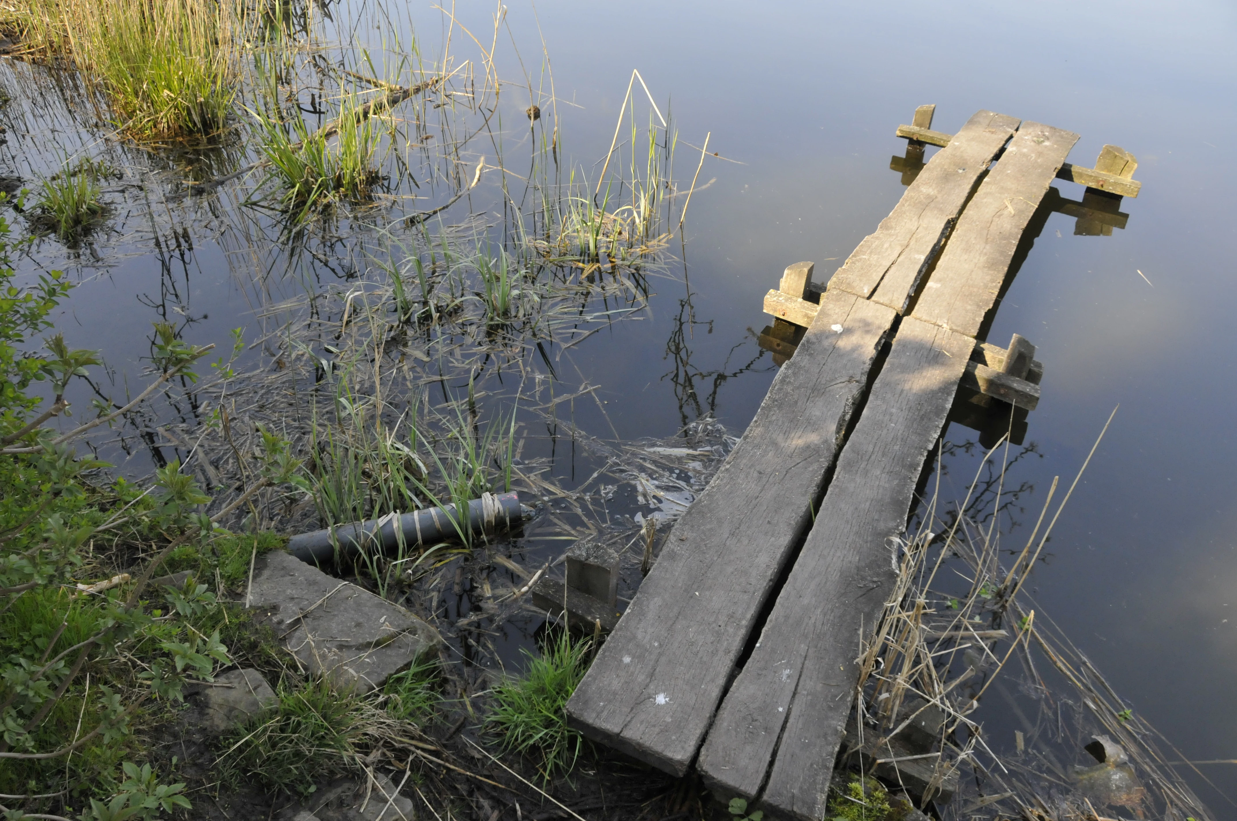
A simple wooden boardwalk pier extends from a grassy, reedy shore into the still water of a pond.
A small wooden pier extending into the calm waters of Siebleber Teich.

Siebleber Teich conservation status and protection priorities

The Siebleber Teich has been a formally protected nature reserve in Germany since 11 September 1967, when the regional council of the time approved the designation. It covers around 27 hectares and is one of the older protected small wetland sites in the Gotha district. Today it sits inside the EU Habitats Directive site Seeberg-Siebleber Teich, which links it directly to the Natura 2000 network.

The conservation effort focuses on three linked challenges. The first is the steady advance of reeds and natural silting up, which without intervention would gradually transform the open water into marsh and eventually dry land. The second is the lack of fresh water, since the only real inflow, the Geierslache, supplies only around 30 cubic meters per day, and climate related water loss adds further strain. The third is predation pressure from wild boar, foxes, and free roaming dogs and cats, which has reduced the breeding bird community significantly.

Proposed solutions include rediverting historic springs such as the Schmiedebrunnen into the Geierslache, covering open upstream sections in pipe to reduce sediment, removing willow dams and resealing the critical east levee, and creating an unmolested reed buffer with electric fencing around the main breeding area. A working group, the Arbeitsgruppe Siebleber Teich, coordinates these efforts together with land and forestry authorities and local citizens. Outside observers and conservationists, including the author of the book Der Siebleber Teich, continue to push for measures against progressive silting up.

Siebleber Teich cultural meaning and human context

The Siebleber Teich is deeply connected to the duchy of Saxe-Gotha-Altenburg and to the city of Gotha. The pond was conceived as part of an early modern drainage and improvement project and fell entirely within the realm of ducal estate management. Even today the surrounding landscape features reminders of that culture: the historic Mönchshof with its park, the surviving linden avenues along the east levee planted in 1724, a memorial stone for the nature poet Hermann Löns, and a bench donated in 2004 by the partner city of Gastonia in North Carolina.

Traditional land use shaped the relationships between the ruling duke, the city council of Gotha, and the rural communities of Siebleben and Tüttleben. A century long dispute over rights, leases, and grazing reflected broader social tensions between court and countryside, and the 1822 settlement laid the groundwork for modern land tenure at the pond. The continuing custom of reed cutting, willow coppicing, and selective reedbed management connects today's nature reserve to a centuries old working landscape. The site also sits in the cultural orbit of the Seeberg and its prehistoric and historical attractions, which together form a notable day trip destination in the Gotha region.
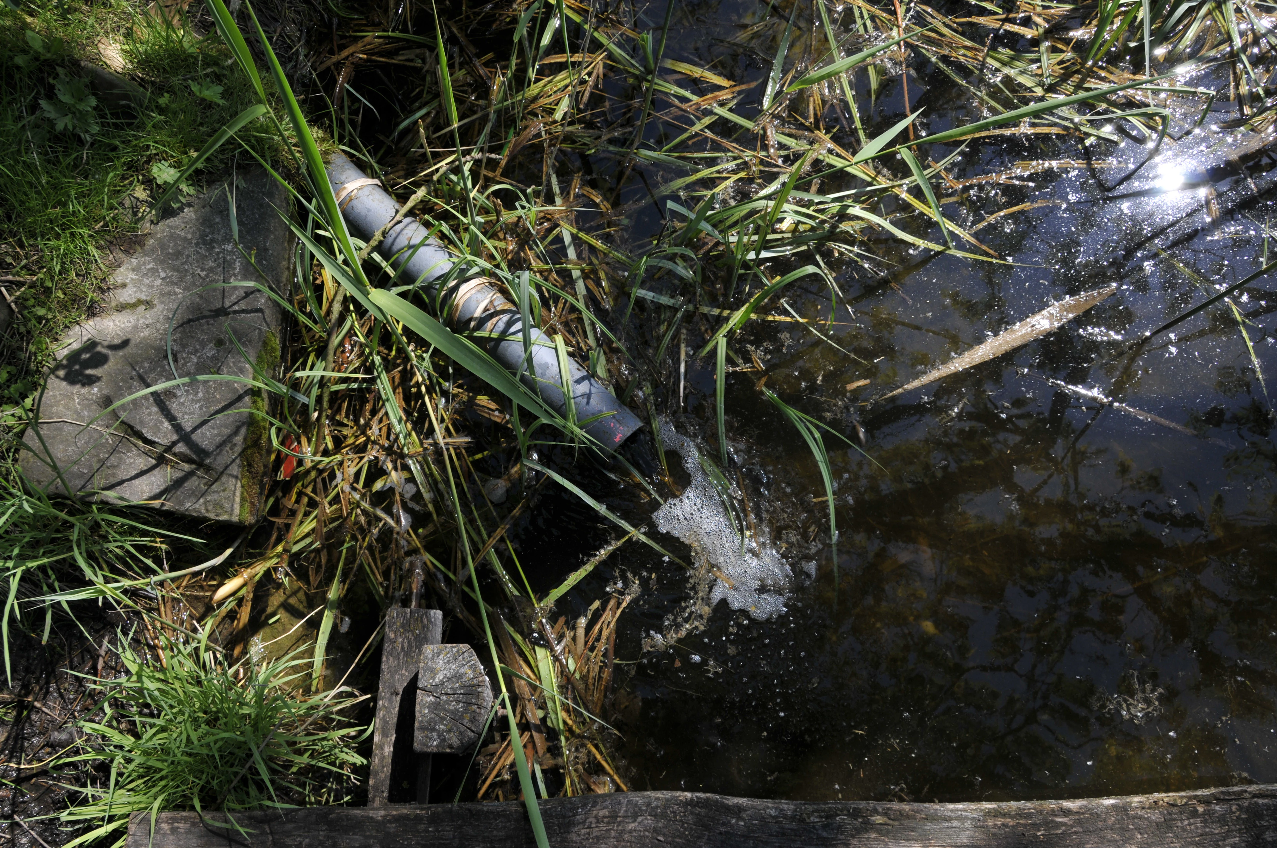
A close-up view of a grey pipe feeding water into the Siebleber Teich, surrounded by tall marsh grasses.
The inlet of the Geierslache stream into the Siebleber Teich.

Top sights and standout views in Siebleber Teich

The strongest highlight of Siebleber Teich is the compact meeting point between open shallow water and what remains one of the densest reed complexes in the Gotha district, a combination that supports amphibian populations and historically more than a hundred recorded bird species. The fact that this mosaic has survived in the middle of an otherwise intensively used agricultural landscape makes the reserve stand out.

A second highlight is the layered history visible in the landscape itself. More than 280 year old linden trees, the eighteenth century embankments, and the still legible traces of the former ducal fishpond combine with later conservation designations to create a site that is at once ecological and cultural heritage.

A third highlight is accessibility and quiet recreation value. Walks from Gotha, Siebleben, or Seebergen reach the Ostdamm and the pond within a few kilometers, and small visitor features like a log cabin hut, a Hermann Löns memorial table, and seated resting points give the reserve a friendly public feel without compromising its quiet wetland character.

Best time to visit Siebleber Teich

The most rewarding time to visit Siebleber Teich is spring and early summer, when the reserve's bird activity peaks. This is the best season for hearing reedbed warblers, witnessing the great starling passage in March, and observing the moor frog and other amphibians in the damp meadows near the water. Daylight hours are long and approachable, and the linden and alder along the embankments are in fresh leaf.

Late summer and early autumn bring ripening reed and a more contemplative mood, with better chances of seeing waterbirds resting during autumn migration. Winter at the pond is quieter and colder, with frozen shallow sections possible, but it is also the season in which conservationists plan reed cutting, so visitors may see the management work that keeps the open water from disappearing altogether. Dog walkers in particular should plan trips outside the core bird breeding period from April to the end of July, when access rules around sensitive zones are strictest.


Monthly climate preview

Long-term representative point measurements for Thuringia protected terrain

Siebleber Teich Climate Normals, Annual Temperature and Precipitation Rhythm

Historical climate normals for Siebleber Teich reveal a measured annual rhythm of changing monthly temperatures and steady precipitation values across the coordinate sample. Access the complete twelve-month record to examine detailed long-term averages and examine deeper meteorological variations.
Annual mean8 °C
-1 °C18 °C
Jan-1°
Feb
Mar
Apr
May12°
Jun16°
Jul18°
Aug18°
Sep14°
Oct
Nov
Dec
Warmest month
July

18.4 °C

Coolest month
January

-1.3 °C

Wettest month
July

2.6 mm/day

Driest month
April

1.4 mm/day

Park location guide

Geography guide, regional context, and park location map for Siebleber Teich

Siebleber Teich park geography, regions, and map view in Germany

Understand where Siebleber Teich sits in Germany through a broader geographic reading of the surrounding landscape, nearby location context, and its mapped position within the national park landscape.

How Siebleber Teich fits into Germany

Germany is a federal republic in Western and Central Europe with a population of over 83 million across sixteen constituent states. It is Europe's largest economy by nominal GDP and a major global exporter and importer. The capital is Berlin, and the country borders Denmark, Poland, Czech Republic, Austria, Switzerland, France, Luxembourg, Belgium, and the Netherlands.

Wider geography shaping Siebleber Teich in Germany

Germany is located in Western and Central Europe, spanning 357,022 km². It borders Denmark to the north, Poland and the Czech Republic to the east, Austria and Switzerland to the south, and France, Luxembourg, Belgium, and the Netherlands to the west. The country has coastlines on the Baltic Sea and North Sea to the north, with the Alps located in the southern region.

Map view of Siebleber Teich

Use this park location map to pinpoint Siebleber Teich in Germany, understand its exact geographic position, and read its mapped placement within the surrounding landscape more clearly.

Pigeon | © OpenStreetMap contributors

Location context for Siebleber Teich

Thuringia

Explore the shallow wetland habitats, embankments, and reedbed scenery of the nature reserve.

Siebleber Teich Photos and Landscape Scenery: Visual Protected Area Guide

Visual documentation captures the open water, dense reedbeds, and surrounding terrain of the lowland protected area. Examining these environmental details provides a clearer understanding of the wetland habitats and regional geography.

A long wooden park bench with the text Gastonia-Bank burned into the wood, positioned on a dirt path in front of a dense, leafless forest.

A narrow, straight stream flows through a deciduous forest with a dirt path running alongside it.

A calm, circular pond surrounded by tall grasses and trees, with bright sunlight reflecting on the water surface.

A small wooden log cabin stands in a clearing surrounded by deciduous trees, featuring an attached bench seating area and a fire pit in the foreground.

A simple wooden boardwalk pier extends from a grassy, reedy shore into the still water of a pond.

A semicircular stone bench with a central table sits in a shaded, woodland clearing at Siebleber Teich.

A close-up view of a grey pipe feeding water into the Siebleber Teich, surrounded by tall marsh grasses.

Park atlas

Discover related wetland reserves and surrounding lowland conservation landscapes

Other Parks and Protected Areas Near Siebleber Teich for Regional Comparison

Compare Siebleber Teich with other protected areas across the surrounding Gotha region to understand regional wetland distribution. Exploring adjacent nature reserves reveals broader ecological patterns connecting local waterbird habitats and lowland riparian terrain.
A horizontal watercolor illustration depicting soft green rolling hills and a forested ridge against a pale white background.
Protected landscapeThuringia
About 13 km away#1 closest

North

Fahner Höhe Protected Landscape: Geography and Natural Terrain of the Thuringian Basin

Mapped limestone ridge and woodland protected area in central Germany

Fahner Höhe stands as a significant geological landmark in Thuringia, characterized by its long, narrow Muschelkalk ridge. The area features dense oak-hornbeam forests, deep erosional features like the Imtalgraben, and a rich variety of spring flora. As a designated protected landscape and Natura 2000 site, it offers a distinct contrast to the surrounding lowland basin, serving as a vital natural asset for the regional geography.

Area
26 km²
Relief
Upland
Climate
Temperate
Access
Easy access
Watercolor painting of a rolling landscape with green and muted red washes, depicting the Schwellenburg hill region.
Nature reserveThuringia
About 17 km away#2 closest

Northeast

Schwellenburg Nature Reserve: Mapping the Gypsum Karst Landscapes of Thuringia

A study of xerothermic grasslands and historical geological terraces.

The Schwellenburg is an elongated ridge of gypsum bedrock that creates a sharp topographic contrast to the surrounding agricultural plains of the Thuringian Basin. This nature reserve serves as an important botanical and entomological site, where historical quarrying has shaped a series of distinct, stepped terraces that host specialized, heat-loving vegetation typical of steppe environments.

Area
0.225 km²
Established
1939
Relief
Upland
Climate
Temperate
Nature reserveIlm-Kreis
About 17 km away#3 closest

Southeast

Gottesholz Nature Reserve: Mapping the Protected Landscapes of Ilm-Kreis, Thuringia

A study of shell-limestone woodland geography

Gottesholz serves as an essential nature reserve in Ilm-Kreis, defined by its porous shell-limestone bedrock and rich, diverse vegetation. This detailed view covers the physical landscape, the strict forest reserve status, and the ecological markers that define this distinctive central German site.

Area
0.593 km²
Established
1961
IUCN
IV
Watercolor illustration of a landscape featuring green fields, trees, a river, and distant hills under a pale sky
National parkThuringia
About 20 km away#4 closest

Northwest

Hainich National Park: Protected Ancient Beech Forest Landscape in Thuringia, Germany

Regional geography and primeval forest boundaries

Hainich National Park occupies 75 square kilometers of the larger Hainich forest in western Thuringia. This canonical protected area is defined by its ancient beech woodland and ongoing forest restoration processes. The geography of the region, situated between Eisenach and Bad Langensalza, provides a critical example of primary forest dynamics and central European biodiversity, serving as an anchor for environmental research and landscape analysis.

Area
75 km²
Established
1997
IUCN
II
Climate
Temperate
A watercolor painting of a rolling, forested landscape with soft green and pink tones, featuring gentle hills and vegetation.
National parkThuringia
About 20 km away#5 closest

Northwest

Nationalpark Hainich: Exploring the Geography of Thuringia's Beech Forest Wilderness

Mapped protected landscapes in the German heartland

Nationalpark Hainich protects one of the most important remaining deciduous woodlands in Central Europe. This detailed atlas entry covers the park's rolling terrain, the transition of its former training grounds into wild forest, and the geographic context of its position within the broader Thuringian landscape.

Area
75 km²
Established
1997
Relief
Upland
Climate
Temperate
Nature reserveThuringia
About 23 km away#6 closest

North

Herbslebener Teiche Nature Reserve: Mapping the Wetland Mosaic and Floodplain Geography

A critical protected wetland and floodplain landscape in central Thuringia, Germany.

Herbslebener Teiche encompasses a varied landscape of reed beds, ponds, and riparian zones within the Unstrut river basin. This nature reserve provides essential habitat structure through its complex arrangement of fallow land, sedge meadows, and open water bodies, marking it as a significant protected entity in the Thuringia region.

Area
0.993 km²
Established
2000
Relief
Lowland
Climate
Temperate
Nature reserveThuringia
About 24 km away#7 closest

South

Saukopfmoor Nature Reserve: A Protected Raised Bog in Thuringia, Germany

Mapping peatland ecosystems within the Thuringian Forest

Saukopfmoor functions as a managed nature reserve in the Thuringian Forest, protecting valuable raised bog habitat that relies on specific high-elevation conditions. This site stands as a key example of peatland conservation in central Germany, revealing how stable mountain microclimates sustain specialized flora and complex hydrological processes across the regional landscape.

Area
0.346 km²
Established
1961
IUCN
IV
Climate
Temperate
Nature reserveThuringia
About 25 km away#8 closest

Southeast

Veronikaberg Nature Reserve: Protected Muschelkalk Ridge and Forest Landscapes in Thuringia

Geographic overview of the southern Reinsberge range.

Veronikaberg functions as a critical nature reserve at the southeastern edge of the Ohrdrufer Platte. The landscape is defined by its Muschelkalk geology, which supports a unique microclimate for beech and yew forests. This record details the park boundaries and the terrain transitions that characterize this significant conservation site in central Germany.

Area
1.161 km²
Established
1961
Relief
Mountain
Water
No major water

Common questions about visiting, size, designation, and location context for Siebleber Teich

Siebleber Teich FAQs for park facts, access, geography, and protected area context

Find quick answers about Siebleber Teich, including protected-area facts, park geography, trail and visitor context, and how the park fits into its surrounding country and regional landscape.
MoriAtlas Explorer

Continue Your Protected Areas Search Across the Global Atlas

Deepen your exploration by continuing the structured search for national parks and protected areas worldwide. Utilize the comprehensive filtering capabilities to compare different conservation landscapes and refine your understanding of global park geography. Discover more about the distribution and characteristics of protected natural areas.

Global natural geography