
Mori Atlas logo
Nature reserveSilkeborgskovene

Tracing the protected forest boundaries and aquatic mosaic of the central Jutland lake highland

Silkeborgskovene: A Comprehensive Atlas of Denmark's Significant Inland Forest and Lake Nature Reserve

Silkeborgskovene serves as a major protected forest and lake landscape within the central Jutland region of Denmark. The area incorporates a significant assembly of historic state forests, including Nordskov and Vesterskov, interconnected with a complex Gudenå-linked freshwater system. This geographic database provides a detailed look at the reserve's mosaic of beech woodlands, oligotrophic lakes, and hanging mires, which together form one of the largest unified forest-lake complexes in the nation.

inland forestslake landscapeSøhøjlandNatura 2000EU habitat areabeech forest
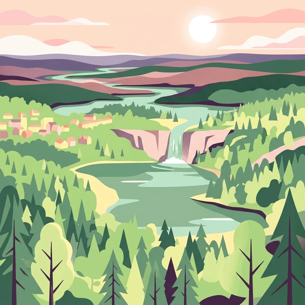
A flat-style digital illustration showing a lush forest landscape with a winding river, a waterfall cascading into a lake, and small buildings in the distance under a pale sun.

Silkeborgskovene

Nature reserve

Park overview

Structured park overview, official facts, and landscape profile for Silkeborgskovene

Silkeborgskovene park facts, protected area profile, and essential visitor context

Review the core facts for Silkeborgskovene, including designation, size, terrain, visitor scale, habitats, and operating context in one park-focused overview.

About Silkeborgskovene

Silkeborgskovene is a Jutland forest-lake protected area just south and east of Silkeborg, defined by the glacial and erosional shaping of the central Danish Søhøjland. Its terrain is marked by broad, forested valleys and hollows that the Gudenå and its tributaries have carved and continue to drain, and where former tributaries once flowed, the present-day landscape now holds chains of clear, often nutrient-poor lakes rather than river channels. The result is an unusual combination of deep, mature woodland interrupted by open water and mire, an arrangement that gives the reserve both scenic structure and ecological complexity.

The area is naturally organized into several large forest blocks. The four principal state forests, Nordskov, Vesterskov, Østerskov, and Sønderskov, form the core, with extensions into Lysbro Skov and Rustrup Skov linking the complex southward into the broader region's plantation belt. Across these blocks the canopy is dominated by beech, with oak-mixed, alder, and ash communities, as well as beech on mor soils with holly, filling different moisture and soil niches. Dry heath, hanging mires, spring pools, and small calcareous fens punctuate the forest, especially along valley margins.

The lakes are central to the area's identity. About one-sixth of the site consists of open water, ranging from the relatively shallow Borresø, Thorsø, Almindsø, and Ørnsø to the deeper Slåensø, and the brown-water lakes Uglsø, Mørksø, and Avnsø. To the west of Vesterskov lies the mire complex of Tranevig, while Jenskær, a small impounded lake surrounded by meadows, sits in the valley between Vesterskov and Rustrup Skov. The lakes together support habitats classified as lobelia lakes, charophyte lakes, nutrient-rich lakes, and dystrophic lakes, each of them nationally protected under the Danish system.

As Natura 2000 site number 57, corresponding to EU habitat area H181, the reserve is part of the European Union's ecological network and one of the country's important inland forest-habitat sites. The Natura 2000 plan adopted in 2011 governs its conservation through joint actions by Silkeborg Kommune and Naturstyrelsen; obligations continue into subsequent planning periods, and the natural plan is aligned with the regional water plan for Randers Fjord (water plan 1.5). The site is a rare example where Danish forest, lake, and mire protection converge in a single large landscape.

Quick facts and research context for Silkeborgskovene

Silkeborgskovene lies in Region Midtjylland within Silkeborg Kommune, covering roughly 1,455 hectares, of which about 1,409 hectares are state-owned. Somewhat more than one-fifth of the protected footprint falls under the Danish Nature Protection Act §3, encompassing about 254 hectares of lake and pond habitat, 48 hectares of bog, 4 hectares of heath, 8 hectares of freshwater meadow, and 12.2 kilometers of watercourse.

The reserve is contiguous with one of Denmark's largest unbroken forest complexes and is hydrologically tied to the Gudenå, the country's longest river. Its Natura 2000 designation was approved in 2011, with management plans renewed in subsequent planning periods and coordinated with the Randers Fjord water plan 1.5.

Protection and recognition

Analysis of terrestrial protection scope and Natura 2000 recognition records

Silkeborgskovene Protection Status and Documented Designation History

Terrestrial protection status for Silkeborgskovene includes documented designation history established in 2011 alongside official Natura 2000 recognition sources. Structured administrative records compile verified conservation frameworks, management scope, and international listings for this protected area.

International recognition

Protection details

Protection scope
Terrestrial
Designated year
2011
Transboundary protection
No
Park context

Deeper park guide and search-rich context for Silkeborgskovene

Silkeborgskovene history, landscape, wildlife, and travel context

Explore Silkeborgskovene through its history, landscape character, ecosystems, wildlife, conservation priorities, cultural context, and seasonal travel timing in a structured park guide built for atlas discovery and search intent.

Why Silkeborgskovene stands out

Silkeborgskovene is best known for being one of the largest protected inland forest-lake complexes in Denmark, situated in the rolling lake highland south of Silkeborg. The defining character of the area is the close interplay between four historic state forests and a string of clear, often oligotrophic lakes, anchored by the long erosional valleys carved by glacial and post-glacial processes and now shaped by the Gudenå watershed. Within this framework, several features stand out. The northern end of Østerskov holds three pristine brown-water lakes, Uglsø, Mørksø, and Avnsø, surrounded by species-rich mires. Slåensø reaches depths of up to twelve meters, while Hårup Sande in Nordskov retains low dunes formed by historical sand drift. These habitats together account for the area's standing in Danish conservation policy.
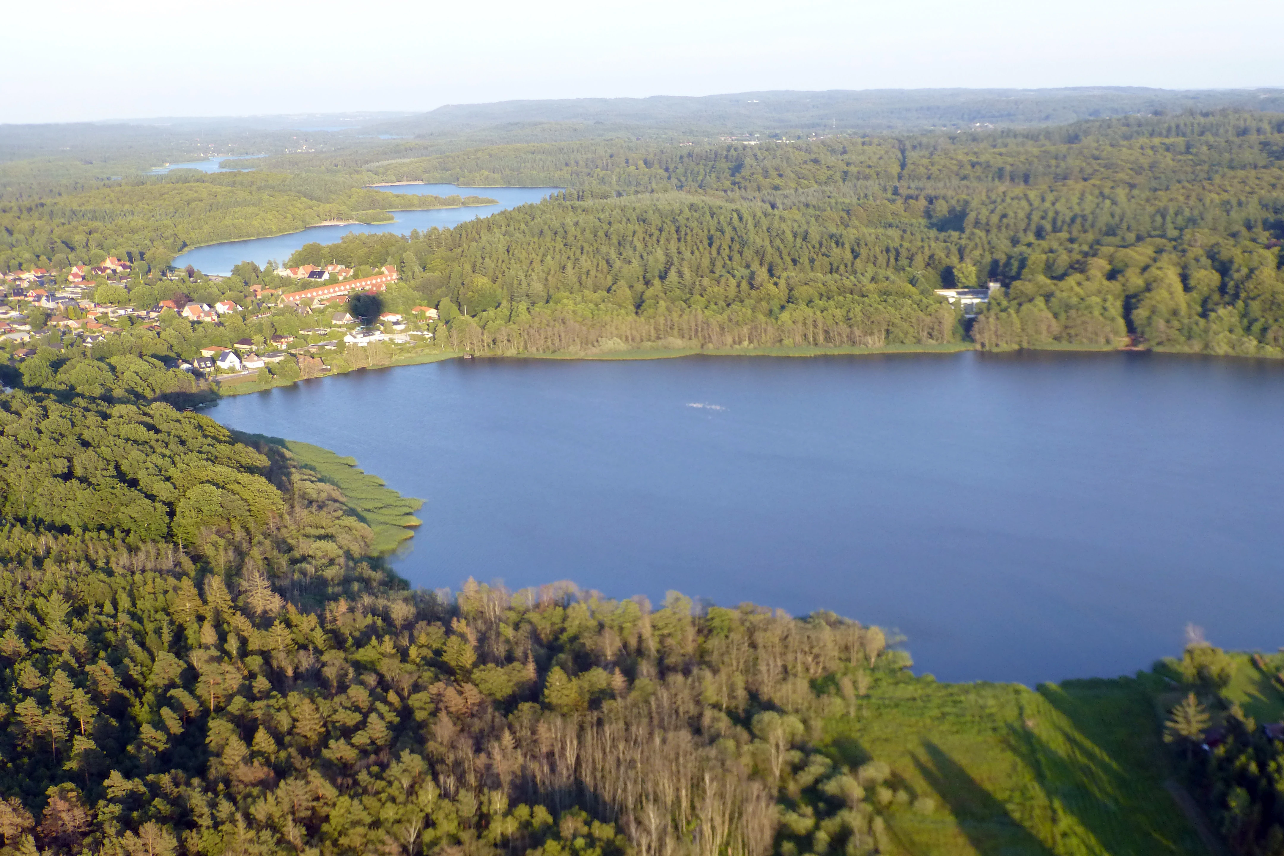
Aerial perspective looking down at a large lake surrounded by expansive green forests and a small residential area in Denmark.
An aerial view of Ørnsø lake and the surrounding dense forests within Silkeborgskovene.

Silkeborgskovene history and protected-area timeline

Silkeborgskovene's identity as a coherent forest area predates modern conservation by centuries. The four core state forests, Nordskov, Vesterskov, Østerskov, and Sønderskov, have a long history as publicly owned Danish woodland, and the wider southern belt of plantations extends one of the country's oldest and largest connected forest estates.

Modern protection arrived with Denmark's entry into the European Union's Natura 2000 ecological network. Local designations under the Danish Nature Protection Act had already secured parts of the area before the broader habitat classification. In 2011 a formal Natura 2000 plan for site number 57 was adopted, tasking Silkeborg Kommune and Naturstyrelsen with binding management measures. The plan has since been renewed and refined for later planning periods, with current planning covering the 2022 to 2027 cycle. Throughout this time, Silkeborgskovene's natural plan has been coordinated with the Randers Fjord water plan 1.5, integrating forest, lake, and stream management under a single regulatory frame.

Silkeborgskovene landscape and geographic character

The landscape of Silkeborgskovene is shaped by the broader Søhøjland, the central Jutland lake highland, where glacial and post-glacial erosion have carved broad valleys into a gently undulating surface. These erosional valleys are the area's most distinctive landform: once channels of meltwater and ancient rivers, they now hold chains of lakes and mires rather than active streams, while the surrounding uplands are draped in unbroken forest. The result is a landscape of alternating woodland ridges, valley hollows, open water, and soft mires, with occasional sandy and duned sections where historical sand drift left its mark.

The lakes range widely in character. Slåensø, in the southern part of the area, is among the deeper lakes, reaching roughly twelve meters, while Ørnsø, Borresø, Thorsø, and Almindsø occupy broader plateaus of the lake highland. In the northern part of Østerskov, three small brown-water lakes, Uglsø, Mørksø, and Avnsø, sit among mires that act as their organic setting. In the eastern part of Nordskov, the Hårup Sande locality preserves low dunes created during past episodes of sand drift, lending that section a more open, sandy character unusual in an otherwise forested reserve. The carved valleys also generate small springs and seeps along their margins, contributing to the diversified wet and dry habitat mosaic.

Silkeborgskovene ecosystems, habitats, and plant life

Ecologically, Silkeborgskovene is structured around an unusually varied mix of habitats for a Danish inland site. Forest dominates, and several distinct woodland communities are recognized: beech on mor soils with holly is one of the area's headline habitats, alongside classic beech on mull soils and oak-mixed forest. On wetter ground, alder-ash forest and forested peat bog, including hanging mires, contribute wooded habitats that support moisture-loving flora.

The lake systems contribute a parallel set of protected aquatic habitats. Lobelia lakes, with submerged isoetid vegetation, occur alongside charophyte lakes, nutrient-rich lakes, and dystrophic brown-water lakes, each holding different water chemistry and vegetation profiles. Around these lakes there are typically zones of spring mires along valley flanks, calcareous fens in seepage zones, and dry heath on upland soils, giving the reserve an unusually complete vertical profile from aquatic vegetation through mire to dry upland forest.

Streams and watercourses integrate the landscape. Roughly twelve kilometers of watercourse cross the area, including parts of the Gudenå system and small brooks draining the erosional valleys. These lotic habitats, along with their associated mud banks and small sedge patches, extend the habitat mosaic beyond the lake basins themselves.

Silkeborgskovene wildlife and species highlights

Silkeborgskovene's habitat diversity underpins its wildlife value. Among the species formally listed for the Natura 2000 site, the brook lamprey inhabits the area's streams and is regarded as an indicator of clean, well-oxygenated water. The great crested newt occupies ponds and small water bodies, while the pond bat forages along the wooded lake shores and open water margins, where insects concentrate. Otters use the lake-river systems and their riparian cover, demonstrating that the area retains functional freshwater mammal populations.

Beyond these formally listed species, the woodland mosaic supports typical central Jutland forest fauna. The combination of mature beech, oak-mixed, and alder-ash stands with extensive mires and lakeshore habitat provides the structural conditions for resident forest birds, amphibians in the spring pools, and invertebrates associated with both deadwood-rich forest and open mire.

Silkeborgskovene conservation status and protection priorities

Silkeborgskovene is significant at the national and European levels as one of Denmark's most important inland Natura 2000 habitat sites, encompassing a rare combination of oligotrophic and dystrophic lakes, mires, dry heath, springs, calcareous fens, and several categories of mature forest. Its classification as EU habitat area H181 was driven by the unusual concentration of habitat types typically representing different biogeographic regions, placing the forest and lake complex within the European Union's ecological network.

Domestically, the area benefits from overlapping protections. Roughly 314 hectares, more than one-fifth of the total 1,355-hectare footprint, are covered under the Danish Nature Protection Act §3, securing lakes, bogs, heath, meadows, and watercourses regardless of their status as forested or open land. Natura 2000 planning approved in 2011 added a binding management framework carried out jointly by Silkeborg Kommune and Naturstyrelsen, and continued in subsequent planning periods with coordination to the regional water plan for Randers Fjord. This layering of national, municipal, and European instruments gives the reserve a relatively robust conservation basis.

Silkeborgskovene cultural meaning and human context

Silkeborgskovene lies at the cultural heart of central Jutland, in a landscape that has shaped regional identity for centuries. The forests south of Silkeborg, including Nordskov, Vesterskov, Østerskov, and Sønderskov, form part of a long-standing tradition of Danish state forestry and recreational use; today they serve as both working forests and popular destinations for walking, sailing on the lakes, and excursions into the Søhøjland.

The surrounding Silkeborg area has a strong cultural association with Danish writers and painters, including figures of the late nineteenth century who were drawn to the Søhøjland's mix of forest, water, and quiet rural settings. While the reserve itself is defined primarily by its natural and ecological values, its protection status reinforces the area's role as a public landscape for residents and visitors to the historic lake highland.

Top sights and standout views in Silkeborgskovene

Silkeborgskovene's standout quality is the way large, mature forest and a string of clear lakes are woven together in one of Denmark's largest connected forest-lake landscapes. The four-part structure of Nordskov, Vesterskov, Østerskov, and Sønderskov, enriched by Lysbro Skov and Rustrup Skov, provides extensive woodland continuity; the Gudenå-linked lakes, from Ørnsø and Slåensø to the trio of brown-water lakes in northern Østerskov, provide structural and biological contrast.

A second highlight is habitat richness within a relatively compact area. Lobelia lakes, dry heath, hanging mires, springs, calcareous fens, and several types of beech and oak forest all fall within a single Natura 2000 envelope, complemented by species such as brook lamprey, great crested newt, pond bat, and otter. These characteristics, combined with the area's layered national and European protection, make Silkeborgskovene a notable reference point for inland forest and freshwater conservation in Denmark.

Best time to visit Silkeborgskovene

Silkeborgskovene's climate is generally cool and temperate, with mild summers and cold winters in central Jutland. Late spring and early summer are typically a productive time to experience the area's mix of woodland and lake landscapes: the forest understory and meadows around lakes like Almindsø, Borresø, and Ørnsø show their most varied vegetation, and visitors can combine walking through the four state forests with sailing or kayaking on the open waters.

Late summer and early autumn tend to favor quieter forest walks and viewing of the lakes under stabilized weather conditions, when heath and mire vegetation retain their characteristic structure and the woodland canopies are fully developed. Winter visits offer an atmospheric, sparse appreciation of the glacial landforms and lake network, though shorter days limit the time available for outdoor activity.

Monthly climate preview

Long-term representative temperature ranges and monthly precipitation averages for Silkeborgskovene

Silkeborgskovene Climate Normals and Annual Weather Patterns by Month

Representative coordinate records show average temperatures shifting from sub-zero winter minimums to mid-summer highs alongside steady precipitation totals. Examining the complete twelve-month record reveals detailed monthly temperature distributions and long-term precipitation normals across the terrain.
Annual mean8 °C
1 °C16 °C
Jan
Feb
Mar
Apr
May11°
Jun14°
Jul16°
Aug16°
Sep13°
Oct
Nov
Dec
Warmest month
July

16.5 °C

Coolest month
February

0.8 °C

Wettest month
October

2.9 mm/day

Driest month
April

1.6 mm/day

Park location guide

Geography guide, regional context, and park location map for Silkeborgskovene

Silkeborgskovene park geography, regions, and map view in Denmark

Understand where Silkeborgskovene sits in Denmark through a broader geographic reading of the surrounding landscape, nearby location context, and its mapped position within the national park landscape.

How Silkeborgskovene fits into Denmark

Denmark is a constitutional monarchy and Nordic country in Northern Europe. It is the southernmost of the Scandinavian countries, bordering Germany to the south, Norway to the north, and Sweden to the southwest. The country consists of the Jutland peninsula and an archipelago of islands, with Copenhagen as its capital and largest city. Denmark has a population of over 6 million and is characterized by flat, arable land, sandy coasts, and a temperate climate.

Wider geography shaping Silkeborgskovene in Denmark

Denmark occupies the Jutland peninsula and roughly 406 islands in Northern Europe. It is situated between the North Sea to the west and the Baltic Sea to the east. The country borders Germany to the south and is connected to Sweden via the Øresund Bridge. Denmark is predominantly flat terrain with low elevation, the highest point being Møllehøj at 170.86 meters.

Map view of Silkeborgskovene

Use this park location map to pinpoint Silkeborgskovene in Denmark, understand its exact geographic position, and read its mapped placement within the surrounding landscape more clearly.

Pigeon | © OpenStreetMap contributors

Location context for Silkeborgskovene

Region Midtjylland

Visualizing the mature beech woodland, oligotrophic lakes, and glacial valley terrain of Denmark

Silkeborgskovene Landscape Photography and Protected Area Scenery

Visual records capture the distinctive character of mature forest canopies, clear lake waters, and rolling upland terrain across the central Jutland lake highland. Examining field photography reveals the complex interplay between historic state woodlands, brown water lakes, and protected freshwater habitats.

Aerial perspective looking down at a large lake surrounded by expansive green forests and a small residential area in Denmark.

Park atlas

Compare regional geography, forest habitats, and surrounding protected areas across central Jutland.

Explore Parks Near Silkeborgskovene and Connected Protected Landscapes

Continue geographic discovery by comparing Silkeborgskovene with other protected areas and forest reserves in the surrounding region. Examining adjacent natural terrain reveals broader patterns across Danish inland watersheds and woodland ecosystems.
A minimalist watercolor painting showing rolling green hills and pink heather under a white sky.
Protected landscapeSilkeborg Municipality
About 0.9 km away#1 closest

East

Sindbjerg og Stovbjerg: Protected Heath and Glacial Landscape near Silkeborg Municipality

Twin heather summits overlooking the central Danish lake district

Sindbjerg og Stovbjerg features two prominent summits that have remained open heathland since early conservation efforts in 1919. This protected landscape offers a rare perspective on the Gudenå tunnel valley, providing panoramic vantage points across Borre Sø and the surrounding forested ridges of Jutland.

Area
0.22 km²
Established
1910
Relief
Upland
Climate
Temperate
A horizontal watercolor illustration depicting a river flowing through a lush green valley with rolling hills in the background under a soft, warm sky.
Protected areaCentral Denmark Region
About 7.3 km away#2 closest

Southeast

Salten Å Protected Area: Geography and Landscape Atlas of Central Denmark

Mapping inland river valleys and protected heathland corridors

Salten Å serves as a primary freshwater tributary and a protected natural corridor in the Central Denmark Region. This atlas entry provides insight into the valley's diverse terrain, spanning from the elevated inland heath at Sepstrup Sande to the forest-lined slopes and lake systems that characterize this unbroken Jutland habitat.

Water
Major water bodies
Panoramic watercolor illustration of a lake with green and pink trees and purple mountains in the background.
Protected areaCentral Denmark Region
About 7.8 km away#3 closest

Southeast

Natura 2000-område nr. 52: Protected Lake and River Landscape in Central Denmark

Mapping freshwater habitats, mires, and sandy heath ridges.

Centered on the Salten Å river valley and the expansive waters of Mossø and Salten Langsø, this protected area represents one of the most significant freshwater networks in Denmark. The territory includes diverse habitat types ranging from calcareous fens and rare raised bogs to sandy dry heaths and Atlantic beech woodlands, creating a vital ecological corridor within the Central Denmark Region.

Area
44.7 km²
Established
2011
Watercolor painting of a soft, hazy landscape with stylized evergreen trees and wildflowers in the foreground and rolling hills in the background.
Protected areaRegion Midtjylland
About 9 km away#4 closest

South

Natura 2000-område nr. 53 Sepstrup Sande, Vrads Sande, Velling Skov og Palsgård Skov Atlas

Protected glacial heathlands and forest landscapes in Central Jutland.

Analyze the topography of this expansive Danish protected area, where flat sandy plains meet undulating moraine hills. The territory contains diverse habitats including the Tingdalsøer lake chain, inland dune complexes, and dense beech woodlands, offering a deep look into the glacial history and regional geography of Central Jutland.

Area
55.72 km²
Relief
Mixed relief
Water
Major water bodies
Nature reserveRegion Midtjylland
About 16 km away#5 closest

Southeast

Natura 2000-område nr. 54 Yding Skov og Ejer Skov: Geography and Protected Area Context

Glacial plateau and forest reserve in Region Midtjylland

Natura 2000-område nr. 54 Yding Skov og Ejer Skov covers roughly 130 hectares of diverse Danish terrain. The reserve encompasses mature broadleaf forests and rare seepage habitats, mapped alongside significant Bronze Age archaeological sites. This protected landscape provides a clear view into the glacial geography and woodland conservation efforts characterizing eastern Jutland.

Area
1.3 km²
Established
2011
Relief
Upland
Climate
Temperate
A horizontal watercolor painting depicting a gentle, rolling green landscape with tall grasses in the foreground and soft hills in the background.
Protected areaAarhus Kommune
About 27 km away#6 closest

East

Årslev Engsø Protected Area in Aarhus Kommune: Geographic and Wetland Map

Restored freshwater lake and ecological tunnel valley habitat

Årslev Engsø is a primary example of freshwater restoration located in the Aarhus Å valley of Denmark. This protected area features a shallow lake basin, managed wet meadows, and essential reed bed habitats that serve as a crucial filtering system for the downstream watershed. Through our mapped atlas, examine the terrain and geographic context of this wetland environment situated near the eastern Jutland coast.

Area
2.1 km²
Established
2003
Relief
Lowland
Climate
Temperate
A wide watercolor illustration of a lake surrounded by green trees and rolling hills, with a small tree and pink flowers in the foreground.
Nature reserveAarhus Kommune
About 29 km away#7 closest

East

Brabrand Sø Nature Reserve: Mapped Geography of an Aarhus Glacial Tunnel Valley

Protected freshwater wetlands and urban green corridors in Denmark

Brabrand Sø represents a rare, shallow freshwater lake and wetland complex located at the edge of the Aarhus urban fabric. This nature reserve, formed within a post-glacial tunnel valley, remains a cornerstone of the regional landscape through its integration of bird habitats, drinking-water protection, and open meadow terrain. The area offers a profound look at how peri-urban green infrastructure sustains both ecological health and geological character in the Aarhus Kommune region.

Area
1.54 km²
Established
1959
Relief
Lowland
Climate
Temperate
Watercolor painting of a hilly, green, and light-filled landscape featuring low mounds and soft vegetation typical of moorland.
Protected areaDenmark
About 32 km away#8 closest

North

Ø Bakker Protected Area: A Map of the Heath-Covered Ridge in Central Jutland, Denmark

Glacial ridge geography in the Nørreå valley

Ø Bakker stands as a striking geological landmark where a heather-clad hill ridge rises sharply from the lowland meadows of Denmark. This protected area offers clear insights into the undulating terrain and dry heath habitats preserved between the meanders of the Nørreå river, providing a valuable study in regional glacial geomorphology and conservation mapping.

Area
2.85 km²
Established
1975
Relief
Upland
Climate
Temperate

Common questions about visiting, size, designation, and location context for Silkeborgskovene

Silkeborgskovene FAQs for park facts, access, geography, and protected area context

Find quick answers about Silkeborgskovene, including protected-area facts, park geography, trail and visitor context, and how the park fits into its surrounding country and regional landscape.
MoriAtlas Explorer

Continue Your Protected Areas Search Across the Global Atlas

Deepen your exploration by continuing the structured search for national parks and protected areas worldwide. Utilize the comprehensive filtering capabilities to compare different conservation landscapes and refine your understanding of global park geography. Discover more about the distribution and characteristics of protected natural areas.

Global natural geography