
Mori Atlas logo
Protected landscapeSmall Isles

Tracing the volcanic terrain, marine boundaries, and conservation landscapes of the Inner Hebrides archipelago.

Small Isles Protected Landscape and Regional Geography within the Scottish Highlands

The Small Isles archipelago represents a significant protected landscape in the Inner Hebrides, defined by the geological complexity of Rùm, Eigg, Canna, and Muck. This area serves as a focal point for integrated terrestrial and marine conservation efforts, ranging from rugged mountainous peaks to fertile basaltic soils and coastal skerries. Our atlas data maps the unique terrain and regional boundaries that anchor this group as a cornerstone of the Scottish Highlands natural heritage.

Inner HebridesarchipelagoislandsseabirdsManx shearwaterwhite-tailed sea eagle
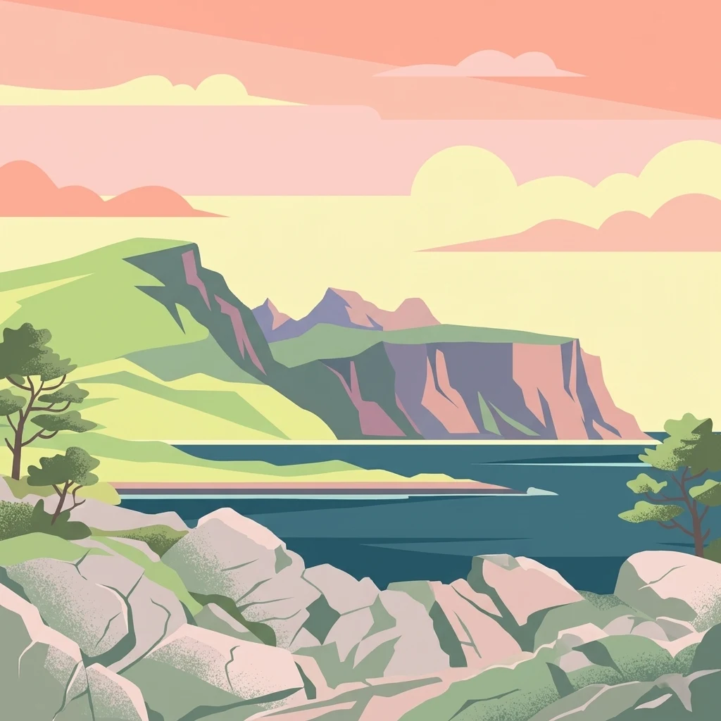
A digital illustration of a coastal landscape with green grassy cliffs, dark blue water, and rocky foreground elements under a soft sunset-toned sky.

Small Isles

Protected landscape

Park overview

Structured park overview, official facts, and landscape profile for Small Isles

Small Isles park facts, protected area profile, and essential visitor context

Review the core facts for Small Isles, including designation, size, terrain, visitor scale, habitats, and operating context in one park-focused overview.

About Small Isles

The Small Isles form a compact but remarkably varied archipelago in the Inner Hebrides, anchored between the large islands of Skye and Mull and the rocky mainland coast of Ardnamurchan. Although the term 'small' has been attached to the group since the early eighteenth century, the islands are by no means tiny: Rùm alone ranks among the fifteen largest islands in Scotland. Together with Canna, Eigg, and Muck, and a scatter of smaller islets, the archipelago forms a coherent Hebridean unit that is recognised both geographically and administratively as a single civil parish.

Geologically and ecologically, the four main islands present strong contrasts. Rùm is mountainous, dominated by ancient igneous formations that rise to high peaks and support extensive moorland and cliff habitats. Canna and Sanday are lower-lying and famous for fertile soils and rich seabird cliffs. Eigg combines a dramatic central ridge with coastal lowlands and a notable geological mix, while Muck is the smallest and gentlest of the four, with rolling terrain and pastoral ground. These different characters have shaped very different land-use traditions and conservation histories across the group.

The archipelago's conservation profile is unusually rich for its size. Rùm is a national nature reserve, a Special Area of Conservation, and a Special Protection Area, while Canna and Sanday are jointly designated as an SPA. The surrounding waters include a Nature Conservation Marine Protected Area covering roughly 800 square kilometres around Rùm, Canna, and Oigh-sgeir, with additional SAC recognition for harbour porpoise habitat around all four islands. Combined with a national scenic area designation stretching from the high tops of Rùm down into the marine zone, the islands form one of the most layered protected landscapes in the Hebrides.

The Small Isles are also notable for the diversity of their ownership. Rùm is largely held by the Scottish state through NatureScot, while Canna and Sanday have been owned by the National Trust for Scotland since the early twentieth century. Eigg made international headlines in 1997 when residents and supporters completed a community buyout, a pioneering moment in Scottish crofting and community-ownership history. Muck continues in private family ownership, rounding out a singular mix of state, charity, community, and private stewardship within one small archipelago.

Quick facts and research context for Small Isles

The Small Isles are an archipelago in the Inner Hebrides, administratively part of the Highland council area in Lochaber, Scotland. They lie south of Skye and north of Mull and Ardnamurchan, in waters long important for Hebridean travel and fishing.

There are four main islands: Canna, Rùm, Eigg, and Muck, with several smaller islets and skerries. Rùm is the largest, and is both a national nature reserve and a Special Area of Conservation. The islands and surrounding sea are jointly designated as a national scenic area. Ownership is highly varied, including state, a national conservation charity, a community trust, and private individuals.

Protection and recognition

Documented conservation scope and established recognition timeline

Small Isles Protection Status and Official Designation History

Small Isles maintains a mixed protection scope established through records dating from 1981. Fact-based management parameters and administrative designations outline the formal conservation framework for this protected area.

Protection details

Protection scope
Mixed
Designated year
1981
Transboundary protection
No
Park context

Deeper park guide and search-rich context for Small Isles

Small Isles history, landscape, wildlife, and travel context

Explore Small Isles through its history, landscape character, ecosystems, wildlife, conservation priorities, cultural context, and seasonal travel timing in a structured park guide built for atlas discovery and search intent.

Why Small Isles stands out

The Small Isles are best known for Rùm's internationally important seabird colonies, including one of the world's largest gatherings of Manx shearwaters, and for the early phase of the white-tailed sea-eagle reintroduction to Scotland, based on Rùm between 1975 and 1985. The surrounding marine environment is similarly celebrated, holding the only known UK colony of fan mussels and supporting harbour porpoise populations. The group as a whole is recognised as one of Scotland's national scenic areas, blending rugged Hebridean landscapes with marine beauty. The islands have also become well known as an example of diverse, community-rooted land stewardship, ranging from a community buyout on Eigg to conservation charity ownership on Canna.
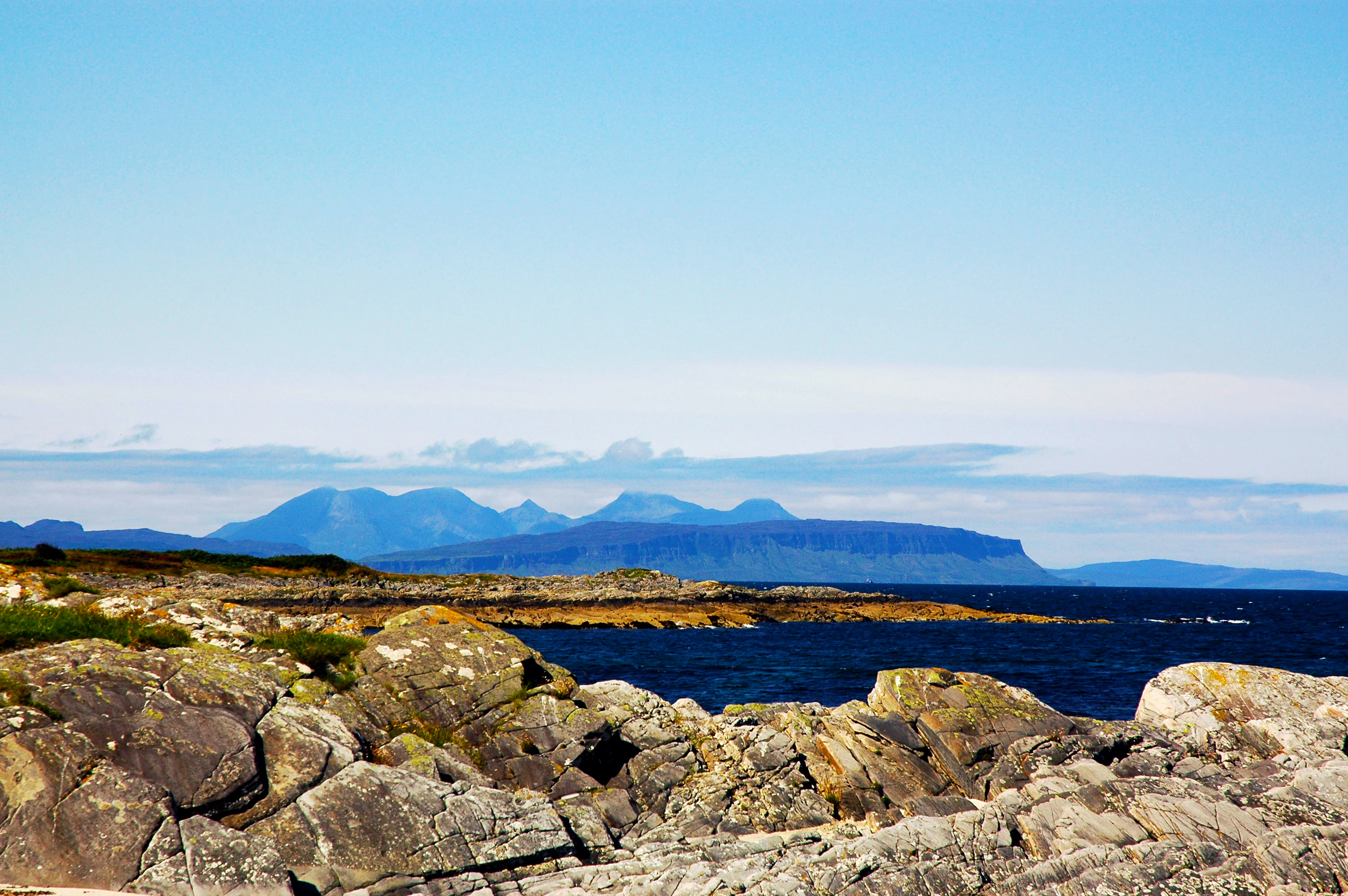
A coastal landscape looking across a rocky foreground and blue sea toward a series of distant, hazy mountain islands on the horizon.
A distant view of the Small Isles, including Rum and Eigg, as seen from the Scottish mainland.

Small Isles history and protected-area timeline

The administrative history of the Small Isles stretches back well beyond modern conservation designations. Although historically divided between two counties: Canna, Rùm, and Muck in Argyll, and Eigg in Inverness-shire, the entire group was reorganised under Inverness-shire in 1891, and today forms part of the Highland council area.

The civil parish itself carries a longer story. It was created in 1726 from part of the Sleat parish on Skye, and was originally known as the parish of Eigg, or 'Short Isles'. According to historical accounts, the familiar name 'Small Isles' evolved through a simple linguistic drift from 'Short' to 'Small' over subsequent generations. The corresponding Gaelic name, Na h-Eileanan Tarsainn, translates as 'cross isles', referring to the group's position between Morar and Uist.

The twentieth century brought dramatic changes in ownership. Rùm was transferred into state hands and gradually converted into an experimental nature reserve, where major conservation milestones were achieved, including the release of eighty-two white-tailed sea-eagles between 1975 and 1985. Canna and Sanday were acquired by the National Trust for Scotland, ensuring long-term conservation management. In 1997, the community of Eigg completed one of the most celebrated community buyouts in Scotland, taking the island into community ownership. Across all four islands, this layered history of stewardship continues to shape how the archipelago is managed today.

Small Isles landscape and geographic character

The landforms of the Small Isles reflect the geological complexity of the Inner Hebrides. Rùm dominates the group, with a mountainous interior built largely from ancient igneous rocks and shaped by past volcanic activity. Its skyline of rugged peaks and high moorland contrasts with the deeply indented coastline, producing long sea cliffs that host major seabird colonies. Canna and Sanday form a softer pair of low-lying islands, with fertile basaltic soils and gentler coastal scenery, punctuated by stacks and skerries.

Eigg has its own distinctive silhouette, featuring a prominent central ridge that rises above varied coastal terrain. The island is celebrated both for its dramatic landforms and for its geological variety, with rocks from multiple periods exposed across a relatively small area. Muck is the smallest and least rugged of the main islands, characterised by rolling ground, pasture, and a quieter coastline, though still ringed by skerries and reefs.

Surrounding the main islands is a constellation of smaller landforms, including the tidal islet of Sanday, Eilean Chathastail near Eigg, Eilean nan Each off Muck, and the more remote skerries of Hyskeir (also known as Òigh-sgeir), Garbh Sgeir, Eagamol, Humla, and Dubh Sgeir. These small features have long served as navigational landmarks and seabird refuges, and contribute to the maritime character that defines the archipelago's landscape.

Small Isles ecosystems, habitats, and plant life

The Small Isles together form one of the most ecologically significant island groups in the Inner Hebrides, with habitats ranging from high mountain moorland on Rùm to fertile coastal grasslands on Canna, Sanday, and Eigg. Heath, blanket bog, machair-influenced coastal turf, sea cliffs, and maritime woodland fragments all contribute to a diverse mosaic across a compact area.

Marine ecology is integral to the natural character of the group. The waters around Rùm, Canna, and Hyskeir are designated as a Nature Conservation Marine Protected Area and a Special Area of Conservation, with seabed habitats that support unusual species, including the only known UK colony of fan mussels. The broader sea area around all four main islands is recognised at the European level for its importance to harbour porpoises, linking the archipelago into wider North Atlantic marine conservation networks.

Together with their national scenic area status, these designations reflect a landscape where terrestrial and marine ecosystems are managed as a unified natural system, rather than as separate environments along a coastline.

Small Isles wildlife and species highlights

The wildlife identity of the Small Isles is strongly shaped by their importance for seabirds and raptors, particularly on Rùm and on the Canna-Sanday pair. Rùm hosts one of the world's largest colonies of Manx shearwaters, a species whose underground nesting sites shape much of the island's ecological character, while the cliffs of the group support breeding guillemots, kittiwakes, Atlantic puffins, shags, and red-throated divers. Golden eagles are also present on Rùm, where the species has formed an important element of the reserve's identity.

The early phase of the white-tailed sea-eagle reintroduction programme in Scotland was based on Rùm, with eighty-two eagles released between 1975 and 1985. This work effectively relaunched the species in the western Highlands and islands, and the descendants of those released birds continue to influence raptor conservation across much of the region. The archipelago's combination of remote cliffs, varied prey, and protected status has made it a long-term stronghold for many species.

Below the waterline, the surrounding sea is similarly rich. The waters are recognised for their importance to harbour porpoises, and the seabed communities include the rare fan mussels found within the marine protected area. The interplay between terrestrial breeding sites and nearby feeding grounds is a defining feature of the wildlife experience across the Small Isles.

Small Isles conservation status and protection priorities

The Small Isles occupy an unusually prominent place in Scottish conservation, recognised at international, national, and local levels. Rùm is both a national nature reserve and a Special Area of Conservation, protecting habitats such as upland heath, bog, and marine communities. Canna and Sanday are jointly designated as a Special Protection Area for their breeding seabirds, while Rùm's SPA status is linked to its golden eagles, Manx shearwaters, and red-throated divers. Together with the surrounding waters, these designations create a layered framework of protection that few other small Hebridean island groups enjoy.

The marine environment carries its own conservation weight. A Nature Conservation Marine Protected Area covers roughly 800 square kilometres around Rùm, Canna, and Hyskeir, an area that includes the only known UK population of fan mussels. The seas around all four main islands are also recognised as a Special Area of Conservation for harbour porpoises, embedding the archipelago within European marine habitat networks.

At the broader landscape level, the islands and their surrounding sea are united under the Small Isles national scenic area, one of forty such designations in Scotland. This status ensures coordinated protection of scenery across both land and marine zones, supporting an integrated view of conservation that links seabird cliffs, pastoral lowlands, and offshore waters within a single protected framework.

Small Isles cultural meaning and human context

The Small Isles carry a layered cultural identity rooted in Gaelic language, crofting life, and long-standing maritime connections. The Gaelic name Na h-Eileanan Tarsainn reflects the islands' role as a 'crossing' between mainland districts, and the historic parish system has bound the islands together as both an ecclesiastical and administrative community since 1726. Fishing, crofting, and small-scale farming have shaped the rhythms of island life for generations, supported by ferry links that connect the group to Mallaig and, in summer, to Arisaig.

The most visible modern expression of local cultural identity is the community ownership of Eigg, secured in 1997 and widely seen as a milestone in Scottish land reform. Eigg's community trust, alongside the National Trust for Scotland's long stewardship of Canna and Sanday, gives the archipelago a distinctive cultural profile built on resident-led and place-based custodianship, reinforced by a small but persistent year-round population across the inhabited islands.

Top sights and standout views in Small Isles

Highlights of the Small Isles include Rùm's seabird cliffs and its role as the birthplace of modern sea-eagle recovery in Scotland; the twin-character Canna and Sanday complex, rich in breeding seabirds and held in long-term conservation ownership; the community-owned island of Eigg and its varied geology; and the quieter pastoral landscapes of Muck. Out at sea, the marine protected area around Rùm, Canna, and Hyskeir adds another layer of distinction, anchoring the archipelago as a place where land and sea are managed together.

Best time to visit Small Isles

Late spring and early summer are widely considered the most rewarding time to experience the Small Isles, when seabird colonies are at their busiest, cliff-side vegetation is in fresh condition, and longer daylight hours support fuller ferry days. Wildlife interest remains strong into autumn, particularly for raptors and marine mammals, while winter brings a quieter character, with dramatic light, frequent storms, and minimal tourism infrastructure. Visitors typically reach the islands via the Caledonian MacBrayne ferry from Mallaig, whose year-round timetable and seasonal Arisaig service shape practical access across the archipelago.

Monthly climate preview

Measured monthly averages for temperature and precipitation across the protected area

Small Isles Climate Normals and Long Term Temperature Patterns

Long term climate data for Small Isles reveals measured average temperatures ranging from five to fourteen degrees alongside consistent monthly precipitation values. Reviewing the complete twelve month profile provides detailed numerical context for regional temperature and moisture patterns.
Annual mean9 °C
5 °C14 °C
Jan
Feb
Mar
Apr
May10°
Jun12°
Jul14°
Aug14°
Sep13°
Oct10°
Nov
Dec
Warmest month
August

13.8 °C

Coolest month
February

5.4 °C

Wettest month
January

5.9 mm/day

Driest month
May

2.9 mm/day

Park location guide

Geography guide, regional context, and park location map for Small Isles

Small Isles park geography, regions, and map view in United Kingdom

Understand where Small Isles sits in United Kingdom through a broader geographic reading of the surrounding landscape, nearby location context, and its mapped position within the national park landscape.

How Small Isles fits into United Kingdom

The United Kingdom is a parliamentary constitutional monarchy located in northwestern Europe, consisting of four constituent countries: England, Scotland, Wales, and Northern Ireland. As a major global power with over 69 million residents, it maintains significant international influence in politics, economics, and culture.

Wider geography shaping Small Isles in United Kingdom

The United Kingdom is an island nation located in northwestern Europe, surrounded by the Atlantic Ocean, North Sea, English Channel, Celtic Sea, and Irish Sea. It shares a land border with the Republic of Ireland to the west. The territory includes the island of Great Britain, the northeastern portion of Ireland, and most of the smaller British Isles islands.

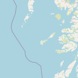
Map view of Small Isles

Use this park location map to pinpoint Small Isles in United Kingdom, understand its exact geographic position, and read its mapped placement within the surrounding landscape more clearly.

Pigeon | © OpenStreetMap contributors

Location context for Small Isles

HighlandScotland

Browse authentic imagery of rugged terrain, coastal habitats, and protected island environments

Small Isles Photos and Visual Scenery: Exploring Hebridean Landscapes

Visual records capture the distinctive geological features, dramatic sea cliffs, and varied marine habitats that define the archipelago. Examining these protected landscapes provides a clearer understanding of the terrain and ecological character across every island.

A coastal landscape looking across a rocky foreground and blue sea toward a series of distant, hazy mountain islands on the horizon.

Park atlas

Compare adjacent coastal landscapes, marine reserves, and island habitats across the surrounding Scottish region.

Explore Protected Areas and Parks Near Small Isles in the Inner Hebrides

Browse national parks and protected areas situated close to Small Isles to uncover broader Hebridean conservation landscapes. Evaluating adjacent island geography provides deeper context into regional landforms, marine habitats, and coastal ecosystems.
Protected landscapeHighland
About 38 km away#1 closest

Southeast

Morar, Moidart and Ardnamurchan National Scenic Area: Coastal Geography and Protected Lands

A mapped overview of peninsulas, lochs, and Highland terrain

Investigate the protected landscape of Morar, Moidart and Ardnamurchan. This area combines dramatic basalt cliffs, silver sands, and significant historical sites within a remote maritime setting. Gain clarity on the overlapping conservation zones and the complex geography that shapes this distinctive Scottish coastal region.

Area
369.6 km²
Established
1981
Relief
Mixed relief
Access
Moderate access
Marine protected areaLochaber
About 43 km away#2 closest

Southeast

Loch Sunart Marine Protected Area: Coastal Geography and Highland Seascape Atlas

Deep-water marine basins and protected Highland coastal terrain.

Discover the mapped landscape of Loch Sunart, a 31-kilometre sea loch in the Lochaber region of Scotland. This marine protected area is characterized by its complex underwater bathymetry, ranging from shallow tidal channels to deep basins reaching 124 metres, providing a unique look into the intersection of terrestrial Highland mountains and essential underwater bivalve and reef communities.

Area
49 km²
Established
2014
IUCN
IV
Relief
Lowland
Marine protected areaHighland
About 50 km away#3 closest

Northeast

Loch Alsh Nature Conservation Marine Protected Area: Geography and Protected Boundaries

A vital Highland marine landscape featuring rare underwater flame shell colonies.

Loch Alsh sits as a distinct marine boundary in the Northwest Highlands of Scotland. This protected area safeguards a vast seafloor ecosystem, most notably a massive flame shell colony that has transformed local understanding of marine biodiversity in the region. The loch landscape blends ancient metamorphic geology with the fjord-like waters separating Skye from the mainland, offering a unique perspective on protected coastal terrains.

Area
0.75 km²
Established
2014
Relief
Mountain
Climate
Temperate
A soft, impressionistic watercolor painting of a Scottish loch surrounded by rolling green hills and distant mountain silhouettes.
Marine protected areaRoss and Cromarty
About 64 km away#4 closest

Northeast

Loch Carron Marine Protected Area: Coastal Geography and Protected Seabed Landscape Atlas

Exploring the tidal basins and underwater terrain of Ross and Cromarty.

Loch Carron stands as a landmark marine protected area defined by its dramatic underwater depth changes and robust tidal currents. This protected sea loch features the world's largest flame shell colony nestled beneath the cliffs at Strome Castle. The surrounding Highland geography of Ross and Cromarty creates a compressed, mountain-framed landscape that influences the rich ecological character of this essential coastal habitat.

Area
23 km²
Established
2019
Relief
Lowland
Climate
Temperate
Marine protected areaArgyll and Bute
About 71 km away#5 closest

Southeast

Loch Creran Marine Protected Area: Atlas and Coastal Geography of Argyll and Bute

Mapped tidal basins, flame shell reefs, and Atlantic oakwood habitats

Loch Creran is a primary example of integrated marine and coastal conservation on the west coast of Scotland. Characterized by its long, narrow form and dramatic bathymetry, the loch creates a rich environment where rapid tidal currents meet sheltered forest shorelines. This record provides a detailed look at the geographic structure, protected seabed zones, and the transition from sea loch to the ancient woodlands at the head of the inlet.

Area
12 km²
Established
2014
IUCN
IV
Relief
Lowland
Marine protected areaScotland
About 73 km away#6 closest

Southeast

Loch Sunart to the Sound of Jura Marine Protected Area: A Scottish Marine Geography Guide

Charting habitat management and Quaternary seabed geology in the western Highlands.

This protected area reaches across the waters of Loch Sunart, the Sound of Mull, the Firth of Lorne, and the Sound of Jura. By mapping this diverse bathymetry, the area safeguards essential marine habitats and the rare common skate population within a complex network of Highland sounds and coastal basins.

Area
741 km²
Established
2014
IUCN
IV
Climate
Temperate
Protected landscapeHighland
About 75 km away#7 closest

North

Trotternish National Scenic Area: A Geographic Atlas of the Isle of Skye Protected Landscape

Basalt escarpments and geologic landmarks in the Scottish Highlands

Trotternish National Scenic Area features a long, continuous basalt escarpment that defines the spine of northern Skye. This protected landscape contains complex ridge formations, dramatic coastal cliffs, and a rich record of Jurassic geology. Learn about the physical geography, mapped extent, and natural terrain that make this region a key protected area within the Highland geography of Scotland.

Established
1981
Relief
Upland
Climate
Temperate
Access
Moderate access
Protected landscapeArgyll and Bute
About 90 km away#8 closest

Southeast

Scarba, Lunga and the Garvellachs National Scenic Area: Protected Island Geography

Coastal landscapes and tidal seascapes of Argyll and Bute

Gain insight into the distinct protected landscape of the Scarba, Lunga and the Garvellachs National Scenic Area. This area balances mountainous moorland with green meadows, while its submerged marine reefs and fierce tidal waters contribute to a complex ecological and geographic identity within the Firth of Lorn.

Area
65 km²
Established
1981
Relief
Upland
Climate
Temperate

Common questions about visiting, size, designation, and location context for Small Isles

Small Isles FAQs for park facts, access, geography, and protected area context

Find quick answers about Small Isles, including protected-area facts, park geography, trail and visitor context, and how the park fits into its surrounding country and regional landscape.
MoriAtlas Explorer

Continue Your Protected Areas Search Across the Global Atlas

Deepen your exploration by continuing the structured search for national parks and protected areas worldwide. Utilize the comprehensive filtering capabilities to compare different conservation landscapes and refine your understanding of global park geography. Discover more about the distribution and characteristics of protected natural areas.

Global natural geography