
Mori Atlas logo
Protected landscapeSmith River National Recreation Area

Tracing the wild river corridors and forested ridges of this California protected landscape

Smith River National Recreation Area: A Mapped Exploration of Klamath Mountain Watersheds

Smith River National Recreation Area preserves a vast, water-defined expanse in northwestern California, where the rugged geology of the Klamath Mountains meets dense coastal forests. This protected landscape centers on the Smith River, a celebrated wild and scenic waterway, and functions as an inland watershed anchor adjacent to the redwood-rich coastal zone. The terrain rises through steep, forest-covered ridges and deep canyons, creating a complex geography of alpine-influenced forests and salmon-bearing tributaries that sustain a unique, moisture-rich ecosystem.

national recreation areaKlamath MountainsSmith Riverwild and scenic riverfisherysteelhead
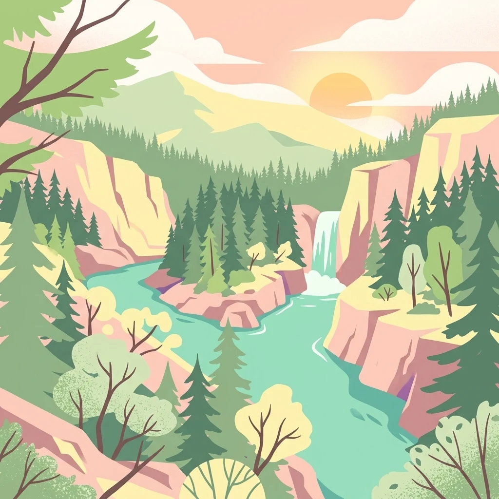
A stylized illustration of a river canyon at sunset with tall pine trees, rocky cliffs, and a small waterfall flowing into the river.

Smith River National Recreation Area

Protected landscape

Park overview

Structured park overview, official facts, and landscape profile for Smith River National Recreation Area

Smith River National Recreation Area park facts, protected area profile, and essential visitor context

Review the core facts for Smith River National Recreation Area, including designation, size, terrain, visitor scale, habitats, and operating context in one park-focused overview.

About Smith River National Recreation Area

Smith River National Recreation Area is a federally protected landscape in far northwestern California, set among the steep ridges and forested valleys of the Klamath Mountains. Although technically classified as a National Recreation Area rather than a stand-alone national park, it functions as a major protected natural area in its own right, and is one of the most important inland complements to the famous redwood groves of the California coast. It also represents the type of place that drives MoriAtlas's interest in high-quality, park-level protected-area entities that can support rich detail pages and meaningful regional discovery.

The recreation area lies within Six Rivers National Forest and is managed by the U.S. Forest Service. Its boundaries lie in Del Norte County, with Crescent City as the nearest major city. The northern edge of the recreation area meets the southern boundary of Redwood National and State Parks, creating an unusual landscape transition from the protected coastal redwoods to the rugged interior watershed that drains the Klamath Mountains.

Landscape-wise, the area is dominated by the watershed of the Smith River, one of the longest rivers in the National Wild and Scenic Rivers System. The river flows through deep canyons, forested slopes, and small communities such as Hiouchi and Gasquet, while U.S. Route 199 follows the river valley as the Smith River Scenic Byway. Above the river corridor, the Klamath Mountains rise into forested ridgelines with heavy rainfall, frequent winter storms, and fog-influenced summers shaped by marine moisture from the Pacific.

Recreationally, the Smith River National Recreation Area is best understood as a water-based and forest-based destination. The clean, cold waters of the Smith support prized populations of steelhead and chinook salmon, drawing anglers from across the country. Rafting and canoeing are popular on calmer stretches, while five developed campgrounds near major streams and along the Smith River itself provide access points into the backcountry. Hiking trails weave through the forest and along the river, though seasonal rainfall can dramatically affect water levels, road access, and trail conditions.

Ecologically, the area sits at an intersection of coastal and interior forest types, hosting species such as Port Orford cedar that have very limited geographic ranges. Conservation concerns here include the protection of these at-risk trees and the management of heavy seasonal rainfall events that shape how both people and ecosystems interact with the landscape.

Quick facts and research context for Smith River National Recreation Area

Smith River National Recreation Area lies entirely within Del Norte County in the far northwestern corner of California, near the city of Crescent City. It is administered by the U.S. Forest Service and forms a section of Six Rivers National Forest, created by Congress in 1990. The recreation area covers a large expanse of mountain and river country in the Klamath Mountains, bisected by U.S. Route 199, which is designated the Smith River Scenic Byway.

The defining feature is the Smith River, recognized as one of the longest National Wild and Scenic Rivers in the United States. The area receives heavy annual rainfall and is influenced by marine moisture coming off the Pacific, supporting lush forests, salmon and steelhead habitat, and sensitive tree species such as Port Orford cedar. It functions as an inland recreational and ecological counterpart to the adjacent Redwood National and State Parks.

Protection and recognition

Documented terrestrial protection scope and recognized conservation history

Smith River National Recreation Area Protection Status and Formal Designations

Smith River National Recreation Area maintains a documented terrestrial protection scope within the regional conservation network. Structured facts outline the recorded management framework and international recognition data associated with the protected landscape.

Protection details

Protection scope
Terrestrial
Transboundary protection
No
Park context

Deeper park guide and search-rich context for Smith River National Recreation Area

Smith River National Recreation Area history, landscape, wildlife, and travel context

Explore Smith River National Recreation Area through its history, landscape character, ecosystems, wildlife, conservation priorities, cultural context, and seasonal travel timing in a structured park guide built for atlas discovery and search intent.

Why Smith River National Recreation Area stands out

Smith River National Recreation Area is best known for the wild and scenic Smith River corridor, where trophy-sized steelhead and chinook salmon make the area famous among freshwater anglers. The combination of clean, salmon-bearing waters and remote Klamath Mountain terrain sets it apart from many other California recreation areas. It is also recognized for its connection to the broader redwood landscape of northwestern California. Where Redwood National and State Parks protect the coastal giant sequoia and redwood forests, Smith River National Recreation Area protects the mountainous interior watershed that feeds the region's iconic rivers. The presence of Port Orford cedar, foggy coastal-influenced summers, and dense rain-fed forests further define its ecological character.
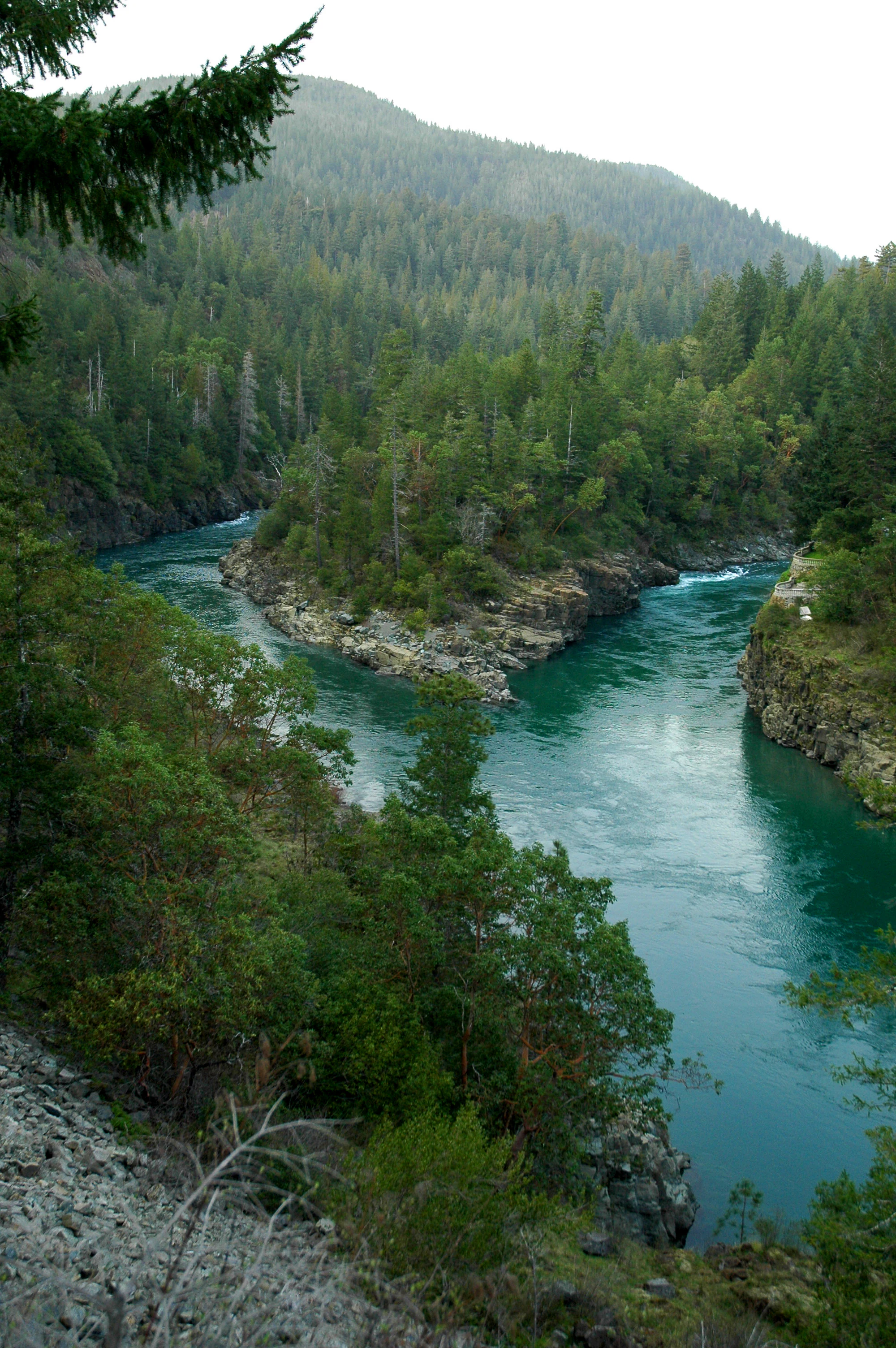
A high-angle view of a river confluence where two branches of a teal-colored river meet around a rocky, tree-covered point, surrounded by dense evergreen forest on hillsides.
The confluence of the South Fork Smith River and the main Smith River within the Smith River National Recreation Area.

Smith River National Recreation Area history and protected-area timeline

Smith River National Recreation Area was formally established by an act of the United States Congress on November 16, 1990. Congress created the recreation area to recognize the unique recreational, scenic, and ecological value of the Smith River corridor in northwestern California, particularly its standing as one of the longest rivers in the National Wild and Scenic Rivers System.

The recreation area was placed within the existing Six Rivers National Forest and is managed by the U.S. Forest Service, an agency of the U.S. Department of Agriculture. Its creation reflected a growing recognition in the late twentieth century of the value of protecting not just iconic park landscapes like the redwoods, but also the wild watersheds and mountain terrain that feed them.

A notable historical layer of the area runs through its transportation corridor. U.S. Route 199, formerly part of California's state highway system, was once signed as California State Route 199. The route connects U.S. Route 101 near Crescent City, California, with Interstate 5 in Grants Pass, Oregon, traversing about 80 miles between the Pacific coast and the interior of southern Oregon. Today, this highway is designated the Smith River Scenic Byway and forms part of both the National Forest Scenic Byway system and California's scenic highway framework, linking the recreation area to the broader regional travel network.

Smith River National Recreation Area landscape and geographic character

The landscape of Smith River National Recreation Area is defined by the Klamath Mountains, a rugged range in northwestern California and southwestern Oregon known for their complex geology, mixed forest types, and deeply incised river valleys. Within the recreation area, the terrain rises in forested ridges and drops down into narrow canyons carved by the Smith River and its tributaries.

The Smith River itself is the central landscape feature. It flows through a long, winding valley that gives the recreation area much of its scenic identity. Smaller creeks and tributaries descend from the surrounding ridges, joining the river along the way and creating networks of cascades, pools, and gravel bars. Along the river corridor, the small communities of Hiouchi, Gasquet, and Patrick Creek Lodge mark the transition between wilderness and civilization.

Climate strongly shapes how the landscape looks and feels. The region receives very high annual rainfall, with the largest amounts falling during winter months. In summer, marine moisture from the Pacific Ocean rolls up the Coast Range mountains, producing foggy conditions that linger in valleys and along the river. The combination of abundant moisture, varied elevation, and coastal influence creates forests with multiple layers of vegetation and an unusually lush understory for California mountain country.

Smith River National Recreation Area ecosystems, habitats, and plant life

Ecologically, Smith River National Recreation Area sits at the meeting point of coastal and interior Pacific Northwest ecosystems. The region's combination of heavy rainfall, mild temperatures, and varied topography supports dense, multi-layered forests, salmon-bearing streams, and rare tree species with very limited natural ranges. This makes the area one of the more ecologically distinctive protected landscapes in California.

One of the most notable ecological elements is the presence of Port Orford cedar, a conifer whose range extends only about 50 miles inland from the southern Oregon coast into far northern California. Because these trees are highly susceptible to a root disease caused by the pathogen Phytophthora lateralis, forest managers treat the area with particular care, sometimes closing roads and campgrounds during rainy seasons when contaminated soil could be spread by vehicles, animals, or people.

Beneath the forest canopy, a dense understory of ferns, mosses, and shrubs thrives on the abundant moisture. The river system itself is rich in aquatic biodiversity, hosting salmon, steelhead, and other species that depend on cold, clean, flowing water. This makes the river and its tributaries the ecological backbone of the recreation area, with each stream functioning as both habitat and a connective thread between the mountains and the Pacific.

Smith River National Recreation Area wildlife and species highlights

Wildlife in Smith River National Recreation Area is closely tied to the area's rivers, forests, and coastal-influenced climate. The Smith River and its tributaries are particularly important for fish, with populations of steelhead and chinook salmon using the clean, cold waters of the system. These species have made the recreation area famous among anglers and are central to how the area is perceived ecologically.

The river system also supports a wider community of freshwater and riparian wildlife. Streamside zones, gravel bars, and forested corridors along the Smith River create habitat for waterfowl, wading birds, amphibians, and small mammals. The dense forests on the surrounding slopes provide cover and food for deer, black bears, and a variety of smaller forest mammals typical of the Klamath Mountains.

Birdlife benefits from the area's position between interior mountains and the foggy coast. Raptors, owls, and a wide range of forest songbirds can be found within the recreation area, particularly in the more intact forest patches along the river corridor. Salmon runs also draw predators and scavengers to the river in season, creating short-term but dramatic pulses of animal activity along the banks.

Smith River National Recreation Area conservation status and protection priorities

Smith River National Recreation Area is significant from a conservation standpoint because it protects a long stretch of one of the most pristine river systems in the western United States. The Smith River's designation as a National Wild and Scenic River carries with it protections for water quality, free-flowing character, and the outstandingly remarkable values for which the river was designated, including scenic quality, recreation, fisheries, and ecology.

The recreation area also functions as a buffer and complement to Redwood National and State Parks. By protecting the mountainous interior of the Klamath region, it helps safeguard the broader watershed that supports the iconic coastal redwoods and the diverse forests of northwestern California. The U.S. Forest Service manages these lands with attention to long-term ecological integrity, balancing recreation with the protection of sensitive habitats.

One of the most active conservation concerns in the area is the protection of Port Orford cedar from the root disease caused by Phytophthora lateralis. Because the pathogen spreads easily in wet soil and muddy conditions, management actions such as seasonal road and campground closures are used to limit the movement of contaminated material. These efforts reflect a broader recognition that even remote-looking landscapes require active stewardship to keep invasive threats and ecological degradation in check.

Smith River National Recreation Area cultural meaning and human context

The cultural context of Smith River National Recreation Area is shaped primarily by the human relationship with the river corridor and the surrounding Klamath Mountains. Small communities such as Hiouchi, Gasquet, and Patrick Creek Lodge have long histories tied to the Smith River, sustaining themselves through forestry, ranching, recreation services, and the steady flow of travelers along what is now U.S. Route 199.

The road itself is a major cultural thread in the area. Long before it became the Smith River Scenic Byway, this route served as a critical connection between the California coast and the interior of southern Oregon, once signed as California State Route 199 and now designated as a National Forest Scenic Byway and part of the Redwood Highway system. Its role in regional travel, commerce, and migration has left a lasting imprint on how the landscape is experienced today.

Recreation itself has become an important cultural layer. Fishing in particular forms a strong regional tradition, and the Smith River's reputation for steelhead and chinook salmon makes angling culture a meaningful part of how local communities and visitors relate to the area. There is limited documented cultural material in the available sources beyond this transportation and recreation-oriented context, so deeper historical or indigenous dimensions should be left null rather than speculated about.

Top sights and standout views in Smith River National Recreation Area

Smith River National Recreation Area's strongest highlights are its wild river, its remote mountain setting, and its place within the larger redwood-region landscape network. The Smith River stands out as one of the longest National Wild and Scenic Rivers in the United States, and its clean waters support both exceptional fishing and a sense of untouched natural character that is increasingly rare in California.

Equally compelling is the area's connection to Redwood National and State Parks. Travelers can move directly from the protected coastal redwoods into the mountainous interior of the Klamath region, experiencing a transition from one of the world's most famous forest ecosystems into a wilder, less-visited river and mountain country. The recreation area's foggy summers, dense forests, and rare tree species such as Port Orford cedar add further layers of distinction to a landscape that combines water, forest, and mountain scenery in a uniquely northwestern California way.

Best time to visit Smith River National Recreation Area

Smith River National Recreation Area is shaped by a strongly seasonal climate, and the time of year matters more here than in many drier parts of California. Winters are the wettest period, with very high rainfall that can swell creeks and rivers, complicate road travel, and make forest roads or campgrounds inaccessible. Visitors during this season should expect the landscape to feel especially dramatic, but also be prepared for changing conditions.

Summers bring a quieter and often foggier character to the area. Moisture-laden clouds rise up the Coast Range from the Pacific Ocean, producing cool, misty mornings and a softer atmospheric quality over the river and forests. Late spring through early fall tends to be the most reliable window for fishing, rafting, canoeing, and hiking, with lower water levels, longer daylight, and easier access to trails and campgrounds.

The single most important consideration is the relationship between rainfall and outdoor activity. Periodic heavy rainfall can affect everything from river fishing to hiking conditions, and even summer visitors should be ready for sudden shifts in weather. Travelers who come with flexibility and an understanding that the river drives the rhythm of the landscape will get the most out of a visit.

Monthly climate preview

Long-term average temperature and precipitation patterns across twelve recorded months

Smith River National Recreation Area Climate Normals and Weather by Month

Representative coordinate records show measured variations in average monthly temperature and daily precipitation totals for Smith River National Recreation Area. Reviewing the complete twelve-month climate profile provides deeper context on long-term thermal and moisture patterns.
Annual mean11 °C
4 °C20 °C
Jan
Feb
Mar
Apr
May11°
Jun15°
Jul20°
Aug20°
Sep17°
Oct12°
Nov
Dec
Warmest month
July

19.8 °C

Coolest month
December

3.8 °C

Wettest month
December

9.3 mm/day

Driest month
July

0.2 mm/day

Park location guide

Geography guide, regional context, and park location map for Smith River National Recreation Area

Smith River National Recreation Area park geography, regions, and map view in United States of America

Understand where Smith River National Recreation Area sits in United States of America through a broader geographic reading of the surrounding landscape, nearby location context, and its mapped position within the national park landscape.

How Smith River National Recreation Area fits into United States of America

The United States of America is a federal presidential republic and one of the world's largest countries by area and population. It consists of 50 states across a vast territory spanning multiple time zones, with its capital in Washington, D.C. and largest city in New York City. The nation has a diverse economy, influential political system, and significant cultural and military presence globally.

Wider geography shaping Smith River National Recreation Area in United States of America

The United States occupies a vast territory in North America, bordered by Canada to the north and Mexico to the south. The 48 contiguous states stretch from the Atlantic to the Pacific Ocean, while Alaska occupies the northwestern region and Hawaii is an archipelago in the Pacific. The country encompasses diverse terrain including the Rocky Mountains, Appalachian Mountains, Great Plains, and extensive river systems.

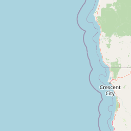
Map view of Smith River National Recreation Area

Use this park location map to pinpoint Smith River National Recreation Area in United States of America, understand its exact geographic position, and read its mapped placement within the surrounding landscape more clearly.

Pigeon | © OpenStreetMap contributors

Location context for Smith River National Recreation Area

CaliforniaDel Norte County
Natural feature types

Explore the Geographic Landmarks of Smith River National Recreation Area

Browse the extensive collection of natural features associated with Smith River National Recreation Area to understand its complex topography. Through MoriAtlas, trace the relationship between mountain ridges, wild river corridors, and protected forest landscapes across this significant California region.
Recorded earthquake history

Review the Historical Earthquake Catalogue for Smith River National Recreation Area

Investigate recorded seismic events associated with the geography of Smith River National Recreation Area. This MoriAtlas collection offers a factual look at historical earthquake data, including event magnitudes and epicentre proximity, to provide a clear view of regional seismic activity.

Smith River National Recreation Area Earthquakes

Catalogued events

66 events

Strongest magnitude

Magnitude 5.6

Most recent event

Apr 11, 2026

This history includes earthquakes recorded inside the park or within 50 km of its borders

Visual reference for Klamath Mountain terrain and wild river scenery

Smith River National Recreation Area Photos and Landscapes

Visual records capture the rugged Klamath Mountain terrain and wild river corridors defining Smith River National Recreation Area. Detailed photography provides clear insight into rain-fed old-growth forests, steep river canyons, and protected natural habitats across the region.

A high-angle view of a river confluence where two branches of a teal-colored river meet around a rocky, tree-covered point, surrounded by dense evergreen forest on hillsides.

Park atlas

Compare adjacent Klamath Mountain terrain and connected regional park geography

Other Parks Near Smith River National Recreation Area and Surrounding Protected Landscapes

Browsing other parks near Smith River National Recreation Area reveals adjacent Klamath Mountain watersheds and connected coastal reserves. Comparing regional protected areas provides broader geographic context for the entire northwestern California wilderness network.
National parkCalifornia
Park boundaries overlap#1 closest

South

Redwood National and State Parks: Protected Landscape Geography and Mapped Boundaries

Explore California's protected area atlas.

Gain a structured understanding of Redwood National and State Parks as a protected national park within the geographic context of California. This dedicated page focuses on its mapped boundaries and protected landscape identity, offering critical atlas-level insights for regional geography exploration and conservation land context. Discover how this protected area fits into the larger mapped terrain.

Area
562.88 km²
Established
1968
IUCN
V
Visitors
458.4K annual
An artistic watercolor illustration showing a line of green evergreen trees in the foreground with hazy, distant mountains in the background against a light, neutral sky.
Protected landscapeOregon
Park boundaries overlap#2 closest

North

Rogue River, Siskiyou National Forest: Mapped Geography and Protected Area Overview

Tracing volcanic peaks and river-carved mountain terrain in Oregon

Spanning nearly 7,300 square kilometers, the Rogue River, Siskiyou National Forest acts as a crucial ecological anchor in the Pacific Northwest. This overview details its unique mountain geography, the extensive wilderness tracts within its boundaries, and the river systems that define its mountainous character.

Area
6,973.46 km²
Established
2004
Visitors
915K annual
Relief
Mountain
Watercolor painting of a peaceful river landscape, featuring rolling green hills, dense trees, and distant soft-toned mountains.
Protected areaCalifornia
Park boundaries overlap#3 closest

Southwest

Six Rivers National Forest: Exploring Protected River Valleys and Mountain Terrain in California

A regional protected area spanning California river systems

Six Rivers National Forest defines much of the rugged landscape in northwestern California. Named for the six major river drainages within its borders, the area features a unique combination of coastal forests, deep river canyons, and high-country ridges that offer significant insight into the region's broader geographic and ecological character.

Area
3,875.2 km²
Established
1947
Relief
Mountain
Climate
Mediterranean
Wildlife reserveOregon
3.4 km away#4 closest

North

Kalmiopsis Wilderness: Mapping the Protected Landscapes and Geology of Southwestern Oregon

Botanical richness and dramatic canyon terrain in the Klamath Mountains

Kalmiopsis Wilderness preserves a dramatic landscape of steep ridges and river-cut valleys across 180,000 acres in southwestern Oregon. Known for its distinct serpentine soils and high botanical diversity, the wilderness area offers a look at complex mountain ecology and significant Wild and Scenic River headwaters within the Rogue River-Siskiyou National Forest.

Area
727.44 km²
Established
1964
IUCN
Ib
Relief
Mountain
Wildlife reserveCalifornia
20 km away#5 closest

East

Red Buttes Wilderness: Mapping the Protected Mountain Geography of the Siskiyou Range

A rugged wilderness reserve straddling California and Oregon

Red Buttes Wilderness preserves a complex mountainous terrain shaped by ancient metamorphic rocks and glacial history. The area features high ridgelines, alpine lakes, and specialized botanical habitats, providing a vital window into the ecological and geological diversity of the broader Klamath and Siskiyou mountain landscapes.

Area
80.7 km²
Established
1984
IUCN
Ib
Relief
Mountain
Protected landscapeCalifornia
24 km away#6 closest

Southeast

Marble Mountain Wilderness: Exploring Protected Mountain Landscapes in Northern California

Klamath Mountains Wilderness and Alpine Geography

Spanning hundreds of thousands of acres, Marble Mountain Wilderness offers a dense concentration of subalpine fir, deep glacial lakes, and steep drainage basins. This northern California protected landscape provides an atlas of rugged ridges and marble-toned peaks that represent one of the most ecologically diverse backcountry areas in the region.

Area
978.3 km²
Established
1964
IUCN
Ib
Relief
Mountain
A watercolor painting of soft, layered mountain ridges and forests in muted green, yellow, and red tones, presented in a wide, horizontal format against a white background.
Protected landscapeCalifornia
About 33 km away#7 closest

Southeast

Klamath National Forest; Protected Landscape Geography and Mapped Wilderness Boundaries

Diverse mountain terrain in Northern California

Klamath National Forest represents a significant protected area in Northern California, encompassing a vast, rugged landscape that bridges the Klamath Mountains and the Cascade Range. Its terrain is characterized by deeply incised river valleys, exposed rocky summits, and an intricate mosaic of coniferous forests. This geographic detail provides essential context on the forest's role as a major site for wilderness protection and ecological study in the Pacific Northwest.

Area
7,033 km²
Established
1905
Relief
Mountain
Climate
Temperate
A soft watercolor painting depicting a serene landscape with gentle green hills, a small forest, and a calm lake at sunrise or sunset.
Protected landscapeCalifornia
51 km away#8 closest

Southeast

Shasta, Trinity National Forest: Mapping the Protected Landscapes of Northern California

Volcanic peaks, expansive reservoirs, and rugged mountain wilderness

Spanning over two million acres, Shasta, Trinity National Forest represents a major protected landscape in Northern California. The geography includes the iconic Mount Shasta volcano and the complex shoreline of Shasta Lake, while hosting expansive wilderness areas and diverse terrain ranging from oak-forested foothills to alpine meadows.

Area
8,942.87 km²
Established
1954
Relief
Mountain
Climate
Temperate

Common questions about visiting, size, designation, and location context for Smith River National Recreation Area

Smith River National Recreation Area FAQs for park facts, access, geography, and protected area context

Find quick answers about Smith River National Recreation Area, including protected-area facts, park geography, trail and visitor context, and how the park fits into its surrounding country and regional landscape.
MoriAtlas Explorer

Continue Your Protected Areas Search Across the Global Atlas

Deepen your exploration by continuing the structured search for national parks and protected areas worldwide. Utilize the comprehensive filtering capabilities to compare different conservation landscapes and refine your understanding of global park geography. Discover more about the distribution and characteristics of protected natural areas.

Global natural geography