
Mori Atlas logo
Protected landscapeSpätwürmeiszeitliche Terrassen zwischen Burnau, Prestenberg, Vorderreute, Buch und Krumbach

A study in late Würm glacial river terraces within the Upper Swabian hill country

Spätwürmeiszeitliche Terrassen zwischen Burnau, Prestenberg, Vorderreute, Buch und Krumbach Protected Landscape

(Landschaftsschutzgebiet 'Spätwürmeiszeitliche Terrassen zwischen Burnau, Prestenberg, Vorderreute, Buch und Krumbach' (LSG-Nr. 4.35.026))

Spätwürmeiszeitliche Terrassen zwischen Burnau, Prestenberg, Vorderreute, Buch und Krumbach serves as a compact protected landscape in the Bodenseekreis district of Germany. This area features well preserved fluvioglacial terraces formed by meltwater during the closing stages of the last ice age, offering a clear record of the geological evolution that defines the Oberschwäbisches Hügelland.

landscape protection areaLandschaftsschutzgebietglacial terraceslate Würm ice ageUpper Swabian hill countryfluvioglacial landforms
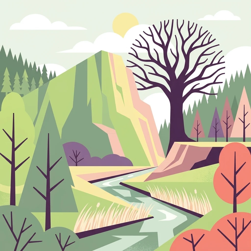
A flat vector-style illustration featuring a winding river flowing through a terraced landscape with hills, a large bare tree in the foreground, and pine forests under a pale sky.

Spätwürmeiszeitliche Terrassen zwischen Burnau, Prestenberg, Vorderreute, Buch und Krumbach

Protected landscape

Park overview

Structured park overview, official facts, and landscape profile for Spätwürmeiszeitliche Terrassen zwischen Burnau, Prestenberg, Vorderreute, Buch und Krumbach

Spätwürmeiszeitliche Terrassen zwischen Burnau, Prestenberg, Vorderreute, Buch und Krumbach park facts, protected area profile, and essential visitor context

Review the core facts for Spätwürmeiszeitliche Terrassen zwischen Burnau, Prestenberg, Vorderreute, Buch und Krumbach, including designation, size, terrain, visitor scale, habitats, and operating context in one park-focused overview.

About Spätwürmeiszeitliche Terrassen zwischen Burnau, Prestenberg, Vorderreute, Buch und Krumbach

Spätwürmeiszeitliche Terrassen zwischen Burnau, Prestenberg, Vorderreute, Buch und Krumbach is a compact landscape protection area in Tettnang, Baden-Württemberg, that was established to conserve a distinctive set of glacial landforms. Although it covers only around 22 hectares, the site plays an important role in protecting one of the more clearly preserved late Würm terrace systems in this part of the pre-Alpine foreland. The terraces are the geological fingerprint of meltwater activity at the close of the last ice age, when braided river systems reorganized the landscape and left behind flat, step-like deposits as the ice retreated.

Geographically, the protected area sits in the northeastern portion of Tettnang, near the boundary with Landkreis Ravensburg. It lies southwest of the Schwarzach river, which in this stretch marks the district border, and stretches between the small settlements of Vorderreute to the northeast, Obereisenbach to the southwest, and Krumbach to the south. The Kreisstraße 7712 passes to the southwest of the area, providing regional access through the surrounding agricultural and forested landscape. From a natural regional perspective, the terraces belong to the Oberschwäbisches Hügelland, the rolling hill country that characterizes much of Upper Swabia between the Alps and the Swabian Jura.

The conservation value of the area is fundamentally geological. The terrace steps document the changing positions of glacial meltwater channels, and they preserve sediments and landforms that are otherwise vulnerable to agricultural leveling, construction, or natural erosion. By protecting these features, the regulation aims to retain the terrain's scientific and landscape value in a region where gentle topography and intensive land use often mask underlying glacial history.

Administratively, the protected area was designated by the Landratsamt Tettnang in its role as the untere Naturschutzbehörde, the lower-level nature conservation authority responsible for smaller protected sites in the district. Its LSG number 4.35.026 places it within the systematic catalogue of landscape protection areas of the Bodenseekreis, alongside a wide range of other glacial, wetland, lakeside, and forest protection areas that together form a dense network of small conservation zones around the Bodensee.

Quick facts and research context for Spätwürmeiszeitliche Terrassen zwischen Burnau, Prestenberg, Vorderreute, Buch und Krumbach

Spätwürmeiszeitliche Terrassen zwischen Burnau, Prestenberg, Vorderreute, Buch und Krumbach is a legally designated Landschaftsschutzgebiet with the identification number 4.35.026. The roughly 22 hectare site lies within the municipal area of Tettnang, in the northern part of the Bodenseekreis in Baden-Württemberg, southwest Germany. It was placed under protection on 25 January 1963 through a regulation issued by the Landratsamt Tettnang acting as the lower nature conservation authority. The terrain sits around 527 meters above sea level and forms part of the broader Oberschwäbisches Hügelland natural region.

Protection and recognition

Documented terrestrial boundaries and conservation designations

Protection Status and Designated Scope of Spätwürmeiszeitliche Terrassen zwischen Burnau, Prestenberg, Vorderreute, Buch und Krumbach

Spätwürmeiszeitliche Terrassen zwischen Burnau, Prestenberg, Vorderreute, Buch und Krumbach maintains a recorded terrestrial protection scope within its regional landscape. Structured records detail the official conservation status and administrative designation history associated with this protected area.

Protection details

Protection scope
Terrestrial
Transboundary protection
No
Park context

Deeper park guide and search-rich context for Spätwürmeiszeitliche Terrassen zwischen Burnau, Prestenberg, Vorderreute, Buch und Krumbach

Spätwürmeiszeitliche Terrassen zwischen Burnau, Prestenberg, Vorderreute, Buch und Krumbach history, landscape, wildlife, and travel context

Explore Spätwürmeiszeitliche Terrassen zwischen Burnau, Prestenberg, Vorderreute, Buch und Krumbach through its history, landscape character, ecosystems, wildlife, conservation priorities, cultural context, and seasonal travel timing in a structured park guide built for atlas discovery and search intent.

Why Spätwürmeiszeitliche Terrassen zwischen Burnau, Prestenberg, Vorderreute, Buch und Krumbach stands out

The protected area is most notable for its preservation of late Würm glacial terraces, a series of flat, stepped landforms created by meltwater rivers and shifting stream channels at the end of the last ice age. Within the context of the Upper Swabian hill country, these terraces offer a compact but instructive record of late glacial river history and fluvioglacial landscape formation. The site is also valued as a representative example of the small, geologically focused Landschaftsschutzgebiete that complement the larger nature reserves of the Bodensee region.
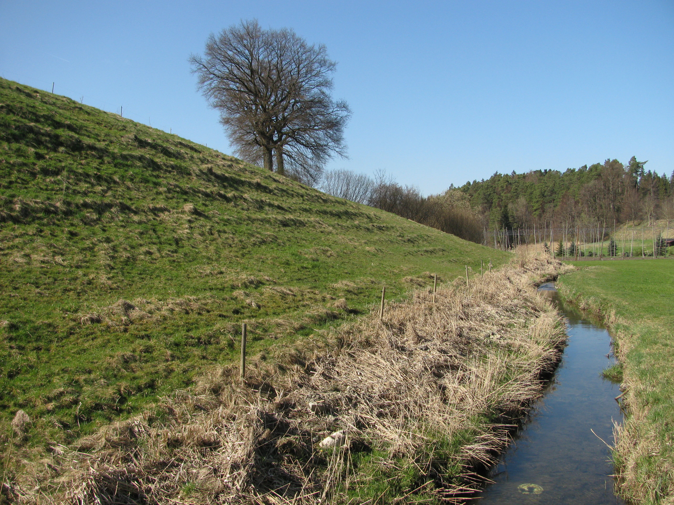
A green, grassy, terraced hillside slopes down toward a small, narrow stream in a rural German landscape under a clear blue sky.
A small stream flowing alongside a glacial river terrace landscape near Tettnang.

Spätwürmeiszeitliche Terrassen zwischen Burnau, Prestenberg, Vorderreute, Buch und Krumbach history and protected-area timeline

The protected landscape was formally designated on 25 January 1963 through a regulation issued by the Landratsamt Tettnang acting as the lower nature conservation authority. Its establishment was part of the broader post-war wave of conservation designations in Baden-Württemberg, when many small but scientifically meaningful glacial and cultural landscapes were placed under protection as Landschaftsschutzgebiete. The selection of this specific area reflects a long-standing regional interest in preserving the late Würm glacial terraces as a record of the final stages of the last ice age in the Upper Swabian hill country.

Spätwürmeiszeitliche Terrassen zwischen Burnau, Prestenberg, Vorderreute, Buch und Krumbach landscape and geographic character

The terrain is defined by a series of flat, step-like terraces that step gently across the Upper Swabian hill country. These landforms are the legacy of late Würm glacial meltwater, which reshaped the valleys with shifting braided streams as the ice sheet retreated. Today the terraces appear as broad, level surfaces separated by low scarps, creating a subtle but clearly readable staircase in the land.

The area sits at roughly 527 meters above sea level and falls naturally within the Oberschwäbisches Hügelland, a region of smoothly rolling hills, glacial deposits, and shallow glacial valleys. To the northeast, the Schwarzach river, a tributary of the Schussen, marks the boundary with Landkreis Ravensburg and gives the surrounding landscape a quiet valley character. Between the terraces and the river, smaller slopes and edge habitats help frame the protected system. The combination of open terrace flats, low scarp edges, and nearby stream valley gives the area its compact but geologically expressive appearance.

Spätwürmeiszeitliche Terrassen zwischen Burnau, Prestenberg, Vorderreute, Buch und Krumbach ecosystems, habitats, and plant life

Although the core value of the protected area is geological, its terrace landforms support the ecological character typical of this part of Upper Swabia. The flat terrace surfaces, low scarps, and edges next to the Schwarzach valley give rise to a mosaic of grassland, hedgerow, small woodland patches, and stream-side habitats that is characteristic of the Oberschwäbisches Hügelland.

The landscape protection status helps maintain this mosaic by limiting land use changes that would otherwise erase the subtle relief of the terraces. In ecological terms, the area functions as a small but representative piece of the glacial terrain that defines Upper Swabia, and its protection indirectly preserves the habitat patterns that depend on that terrain.

Spätwürmeiszeitliche Terrassen zwischen Burnau, Prestenberg, Vorderreute, Buch und Krumbach conservation status and protection priorities

The central purpose of the protected landscape is the conservation of geomorphologically significant late Würm glacial terraces. By maintaining these features in their natural shape, the designation protects an unusually clear local record of glacial river history that would otherwise be vulnerable to agricultural leveling or development. As a Landschaftsschutzgebiet within the Bodenseekreis network, it contributes to a broader regional effort to preserve the glacial and cultural landscape elements of Upper Swabia alongside neighboring sites such as drumlins, end moraines, and lake-edge protection areas.

Top sights and standout views in Spätwürmeiszeitliche Terrassen zwischen Burnau, Prestenberg, Vorderreute, Buch und Krumbach

The protected area's most distinctive feature is its compact system of late Würm glacial terraces, step-like landforms that document the final phase of the last ice age in the Upper Swabian foreland. Their preservation within a small 22 hectare landscape protection area, combined with the scenic context of the Schwarzach valley and the gentle hills of the Oberschwäbisches Hügelland, makes the site a quietly characteristic example of how glacial history continues to shape the Bodensee region's everyday landscape.

Monthly climate preview

Long-term temperature ranges and precipitation averages across representative coordinates

Climate Normals and Annual Weather Patterns for Spätwürmeiszeitliche Terrassen zwischen Burnau, Prestenberg, Vorderreute, Buch und Krumbach

Historical climate records outline the measured annual temperature rhythm and monthly precipitation distribution across representative coordinates at Spätwürmeiszeitliche Terrassen zwischen Burnau, Prestenberg, Vorderreute, Buch und Krumbach. Devolved twelve-month profiles provide comprehensive numerical comparisons for analyzing long-term meteorological trends within the protected area.
Annual mean8 °C
-1 °C18 °C
Jan-1°
Feb-1°
Mar
Apr
May12°
Jun16°
Jul18°
Aug18°
Sep13°
Oct
Nov
Dec
Warmest month
July

17.9 °C

Coolest month
January

-1.3 °C

Wettest month
June

5.1 mm/day

Driest month
February

2.8 mm/day

Park location guide

Geography guide, regional context, and park location map for Spätwürmeiszeitliche Terrassen zwischen Burnau, Prestenberg, Vorderreute, Buch und Krumbach

Spätwürmeiszeitliche Terrassen zwischen Burnau, Prestenberg, Vorderreute, Buch und Krumbach park geography, regions, and map view in Germany

Understand where Spätwürmeiszeitliche Terrassen zwischen Burnau, Prestenberg, Vorderreute, Buch und Krumbach sits in Germany through a broader geographic reading of the surrounding landscape, nearby location context, and its mapped position within the national park landscape.

How Spätwürmeiszeitliche Terrassen zwischen Burnau, Prestenberg, Vorderreute, Buch und Krumbach fits into Germany

Germany is a federal republic in Western and Central Europe with a population of over 83 million across sixteen constituent states. It is Europe's largest economy by nominal GDP and a major global exporter and importer. The capital is Berlin, and the country borders Denmark, Poland, Czech Republic, Austria, Switzerland, France, Luxembourg, Belgium, and the Netherlands.

Wider geography shaping Spätwürmeiszeitliche Terrassen zwischen Burnau, Prestenberg, Vorderreute, Buch und Krumbach in Germany

Germany is located in Western and Central Europe, spanning 357,022 km². It borders Denmark to the north, Poland and the Czech Republic to the east, Austria and Switzerland to the south, and France, Luxembourg, Belgium, and the Netherlands to the west. The country has coastlines on the Baltic Sea and North Sea to the north, with the Alps located in the southern region.

Map view of Spätwürmeiszeitliche Terrassen zwischen Burnau, Prestenberg, Vorderreute, Buch und Krumbach

Use this park location map to pinpoint Spätwürmeiszeitliche Terrassen zwischen Burnau, Prestenberg, Vorderreute, Buch und Krumbach in Germany, understand its exact geographic position, and read its mapped placement within the surrounding landscape more clearly.

Pigeon | © OpenStreetMap contributors

Location context for Spätwürmeiszeitliche Terrassen zwischen Burnau, Prestenberg, Vorderreute, Buch und Krumbach

Baden-WürttembergBodenseekreis

Visualizing the late Würm glacial terraces and protected terrain of Upper Swabia

Spätwürmeiszeitliche Terrassen zwischen Burnau, Prestenberg, Vorderreute, Buch und Krumbach Photos and Landscape Scenery

Visual documentation reveals the flat stepped landforms and fluvioglacial topography defining Spätwürmeiszeitliche Terrassen zwischen Burnau, Prestenberg, Vorderreute, Buch und Krumbach. Photographic records illustrate the protected terrain and river valley character across the Upper Swabian hill country.

A green, grassy, terraced hillside slopes down toward a small, narrow stream in a rural German landscape under a clear blue sky.

Park atlas

Explore nearby protected areas and regional conservation landscapes

Parks Near Spätwürmeiszeitliche Terrassen zwischen Burnau, Prestenberg, Vorderreute, Buch und Krumbach

Browse other parks located near Spätwürmeiszeitliche Terrassen zwischen Burnau, Prestenberg, Vorderreute, Buch und Krumbach to compare similar glacial landforms and regional terrain. Continuing through the surrounding region provides deeper context on local protected landscapes and preAlpine geological formations.
Protected landscapeBaden-Württemberg
About 7 km away#1 closest

Southwest

Tettnanger Wald mit Hochwacht, Krüntenbühl, Reichenbühl, Argenhardter Kopf, Schoos und Steilrand des Argentales an dem Schwandenbogen: Geography and Protected Boundaries

A Glacial Landscape Protection Area in the Lake Constance Basin

This protected landscape in Baden-Württemberg captures a classic moraine terrain shaped by glacial retreat. With its system of ridges, dead-ice hollows, and escarpments along the Argen valley, the area serves as a critical geological reference point. Explore the detailed topography and mapped boundaries of this forest landscape within the broader Bodenseebecken region.

Area
7.01 km²
Established
1954
A soft, panoramic watercolor painting featuring green, rolling hills and a winding river or stream through a forested landscape against a bright, hazy sky.
Nature reserveBaden-Württemberg
About 11 km away#2 closest

North

Altdorfer Wald Nature Reserve: Geographic Atlas and Protected Landscape Overview

Mire, spring, and forest ecosystems in Baden-Württemberg

The Altdorfer Wald nature reserve consolidates a significant network of watercourses, peatlands, and old-growth forest stands across the Upper Swabian Pre-Alpine hills. This protected area stands as a primary focal point for understanding the interplay between hydrological richness, calcareous deposits, and diverse temperate forest habitats within the regional geography of Baden-Württemberg.

Area
13.71 km²
Established
2019
Relief
Upland
Climate
Temperate
Protected landscapeBaden-Württemberg
About 11 km away#3 closest

Southwest

Steilrand und Schotterfeld des Argentals südlich der Kochermühle Protected Landscape Atlas

Glacial geomorphology and river terrace geography in Baden-Württemberg

This protected area provides a diagrammatic view of the Argen valley's ice-age origins. By preserving a Late Glacial terrace complete with its characteristic steep edge and gravel-strewn surfaces, it offers an essential geographic reference for understanding the retreat of the Würm ice within the wider Bodenseebecken region.

Area
0.081 km²
Established
1954
Relief
Lowland
Climate
Temperate
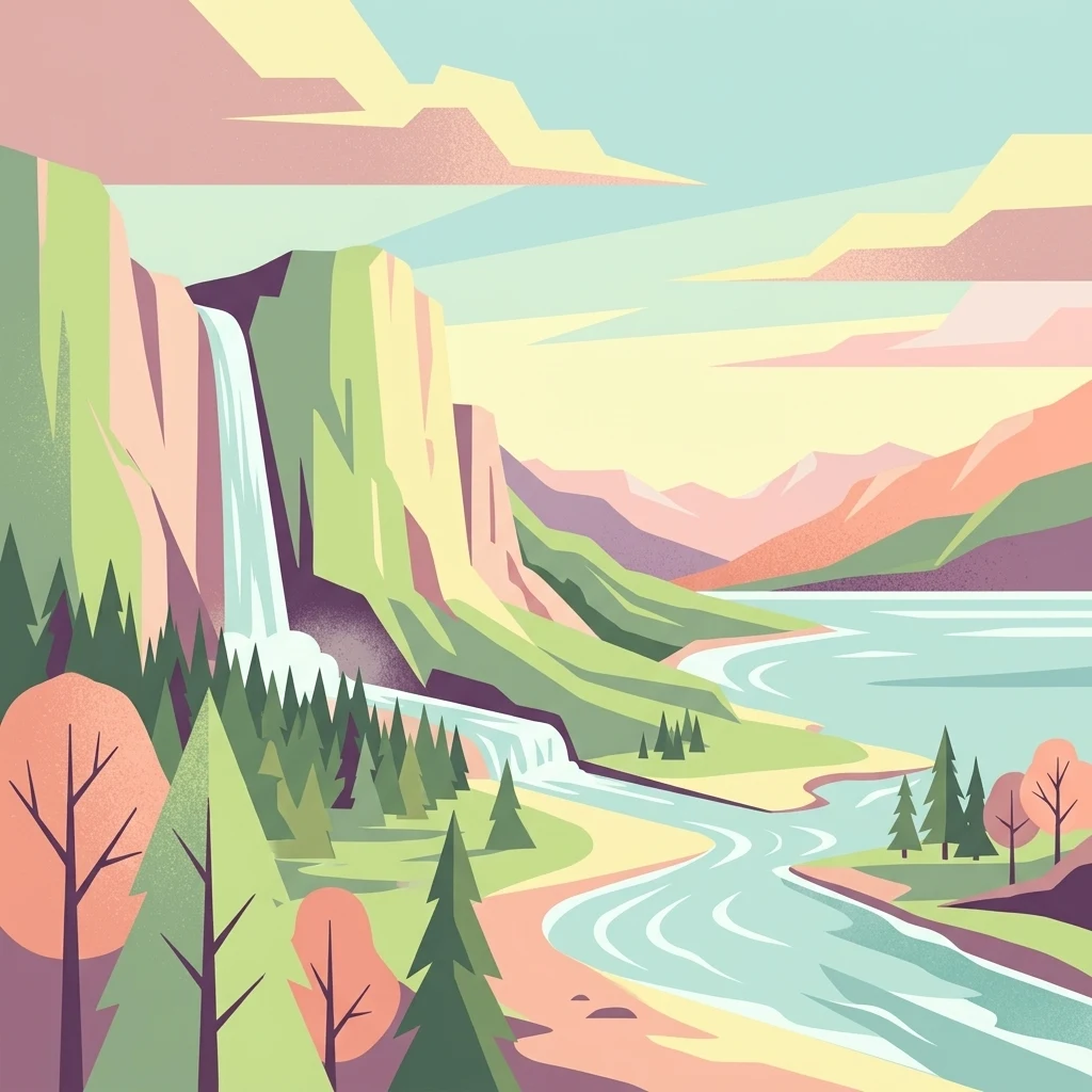
A flat, stylized illustration showing a waterfall cascading from a cliff into a river that flows alongside a forest towards a large body of water under a soft-toned sky.
Protected landscapeBaden-Württemberg
About 13 km away#4 closest

Southwest

Württembergisches Bodenseeufer: Protected Shoreline Landscapes of Lake Constance

A regional atlas of riparian habitats in Baden-Württemberg

Württembergisches Bodenseeufer preserves over 180 hectares of natural shoreline across Friedrichshafen, Langenargen, and Kressbronn am Bodensee. This protected landscape highlights essential riparian ecology, featuring diverse river mouth environments and largely unaltered forest edges that define the southern borders of the Bodenseekreis district.

Area
1.88 km²
Established
1940
Relief
Lowland
Climate
Temperate
A horizontal watercolor painting depicting a soft-focus valley scene with rolling hills, scattered green trees, and a light sky.
Nature reserveBaden-Württemberg
About 19 km away#5 closest

Northwest

Deggenhauser Tal Nature Reserve: Mapped Geography and Protected Valley Landscapes

Glacial terrain and watershed ridges in Baden-Württemberg

Investigate the protected geography of Deggenhauser Tal, an expansive nature reserve in the Oberschwäbisches Hügelland. This record maps the complex network of stream corridors, steep valley slopes, and ridge heights that define this Natura 2000 protected area. Gain insights into the glacial relief and varied land use patterns that characterize this essential southwestern German valley ecosystem.

Area
8.492 km²
Established
2019
Protected landscapeBaden-Württemberg
About 19 km away#6 closest

West

Württembergisches Bodenseeufer, Neufassung Teilbereich Friedrichshafen-West Protected Landscape

Mapped greenbelt corridor along the Lake Constance shoreline in Baden-Württemberg.

This protected landscape encompasses a vital 114-hectare corridor of lakeshore habitats and cultural land near Friedrichshafen. It preserves a critical mix of reed beds, shallow-water zones, and riparian woodland galleries that maintain the near-natural state of the Württemberg lakeshore. The area serves as a significant ecological bridge between the waters of Lake Constance and the urbanised inland terrain of the surrounding Bodenseekreis district.

Area
1.14 km²
Established
2004
Relief
Lowland
Scope
Mixed
A watercolor painting showing a panoramic view of a wetland with water, grasses in the foreground, green hills, and purple-toned mountains in the distance.
Nature reserveVorarlberg
About 21 km away#7 closest

South

Rhine Delta Nature Reserve: Mapped Wetlands and Alpine Foothills Geography in Vorarlberg

A dynamic freshwater delta and critical bird habitat in Austria

The Rhine Delta constitutes the largest wetland biotope on Lake Constance, characterized by ongoing sediment deposits and an evolving shoreline. Its geography includes dense riparian forests, alluvial plains, and shallow bays that provide refuge for diverse amphibians and birds. This nature reserve serves as a prime example of large-scale wetland conservation nestled between the Alpine foothills and the open waters of the lake.

Area
20.65 km²
Established
1982
Relief
Lowland
Climate
Temperate
A watercolor painting showing a panoramic view of a wetland with coniferous trees, soft green forest lines, and reddish bog vegetation against a pale background.
Nature reserveBaden-Württemberg
About 22 km away#8 closest

East

Bodenmöser und Hengelesweiher Nature Reserve: Mapped Geography and Protected Wetland Atlas

A diverse mosaic of peatlands and lakes in Westallgäu

Bodenmöser und Hengelesweiher represents a significant conservation network in southwestern Germany. This detailed view covers the distribution of calcareous fens, raised bogs, and dark-water pools that characterize the pre-Alpine hill landscape. Learn about the geographic configuration of this protected site as it bridges nutrient-poor lake ecosystems with surrounding alder woodlands and wet meadow corridors near Isny im Allgäu.

Area
7.59 km²
Established
2019

Common questions about visiting, size, designation, and location context for Spätwürmeiszeitliche Terrassen zwischen Burnau, Prestenberg, Vorderreute, Buch und Krumbach

Spätwürmeiszeitliche Terrassen zwischen Burnau, Prestenberg, Vorderreute, Buch und Krumbach FAQs for park facts, access, geography, and protected area context

Find quick answers about Spätwürmeiszeitliche Terrassen zwischen Burnau, Prestenberg, Vorderreute, Buch und Krumbach, including protected-area facts, park geography, trail and visitor context, and how the park fits into its surrounding country and regional landscape.
MoriAtlas Explorer

Continue Your Protected Areas Search Across the Global Atlas

Deepen your exploration by continuing the structured search for national parks and protected areas worldwide. Utilize the comprehensive filtering capabilities to compare different conservation landscapes and refine your understanding of global park geography. Discover more about the distribution and characteristics of protected natural areas.

Global natural geography