
Mori Atlas logo
Nature reserveSpey

Tracing the protected riverbank mosaic, soft-wood forests, and riparian meadow terrain of this vital German habitat

Spey Nature Reserve: A Detailed Geographical Exploration of the Lower Rhine Floodplain Landscape

(Naturschutzgebiet Die Spey)

Spey Nature Reserve stands as a preserved ecological relict of the Lower Rhine, showcasing a complex mosaic of riparian landforms. Situated between Krefeld and Meerbusch in North Rhine-Westphalia, the reserve maps a dynamic strip of floodplain between the main dike and the active river channel. This area integrates softwood forest, meadow grasslands, and river shoreline to form a critical migratory corridor and biodiversity refuge within a dense regional geography.

floodplainLower Rhinesoftwood floodplain forestwet meadowsriparian habitatNatura 2000
A stylized vector illustration of a valley with a winding river in the foreground, coniferous trees, and a tall waterfall cascading down high rocky cliffs in the background.

Spey

Nature reserve

Park overview

Structured park overview, official facts, and landscape profile for Die Spey Nature Reserve

Die Spey Nature Reserve park facts, protected area profile, and essential visitor context

Review the core facts for Die Spey Nature Reserve, including designation, size, terrain, visitor scale, habitats, and operating context in one park-focused overview.

About Die Spey Nature Reserve

Die Spey is a compact but ecologically rich nature reserve in the floodplain landscape just outside the main Rhine dike, in the northwestern part of North Rhine-Westphalia. Although it covers only a little over one hundred hectares and is administered as two separate protected areas by two different authorities, it represents one of the more intact relicts of the historical Rhine floodplain that once extended along this stretch of the river.

The reserve captures the layered character of a working floodplain. Above the riverbank are open sand and gravel flats and muddy reed- and sedge-dominated shoreline vegetation. Behind these margins lie stands of softwood floodplain forest, especially in the southern part, where silver willows form the backbone of the woodland along with alder and ash. Further back from the active flood zone, the northern part of the reserve is dominated by lowland hay meadows, river valley grasslands, and tall herb communities. The result is a small but exceptionally varied habitat mosaic in which wetland, woodland, and dry grassland types meet within a short distance of the main Rhine channel.

A defining element of the southern section is a still water body that originated as a wet excavation and is hydrologically connected to the Rhine. Together with the surrounding wetlands and shoreline zones, this lake acts as a quiet area for fish, amphibians, and waterbirds, and contributes significantly to the reserve's value as aquatic habitat. Vegetation along the river itself includes characteristic Rhine floodplain trees and shrubs adapted to periodic inundation.

From a conservation perspective, Die Spey stands out not because it is large or spectacular, but because it preserves a coherent set of habitat types that have become increasingly rare in intensively used Rhine floodplains. Its formal status as a Natura 2000 and FFH site, its integration into the regional biotope network, and its close functional link with the neighbouring Latumer Bruch area all reinforce its role as a node of floodplain biodiversity in the Lower Rhine region.

For visitors and researchers, Die Spey offers an accessible example of how a small protected floodplain can sustain rare woodland, meadow, and wetland species at the same time. While it is not a tourist destination in the conventional sense, its ecological profile makes it one of the more interesting protected floodplain fragments along the Lower Rhine.

Quick facts and research context for Die Spey Nature Reserve

Die Spey is classified as an IUCN Category IV protected area, designated as a Habitat and Species Management Area. Its combined area is just over 100 hectares, divided into a northern part within Krefeld and a southern part within Meerbusch in Rhein-Kreis Neuss. The reserve sits at elevations between roughly 24 and 31 metres above sea level, on flat floodplain terrain directly beside the Rhine.

Both halves of the reserve together form a single Natura 2000 and FFH site under the identifier DE-4606-301. It is functionally linked with the neighbouring Latumer Bruch FFH site and is part of the broader Biotopverbund Krefelder Süden biotope network, reinforcing its role as a coherent floodplain habitat complex rather than an isolated patch.

Protection and recognition

Terrestrial protected area records and international recognition history

Spey Protection Status and Documented Conservation Framework

Spey maintains a documented terrestrial protection scope within official global databases without linked international recognition sources. Conservation tracking compiles baseline designation records and management frameworks for comparative ecological research.

Protection details

Protection scope
Terrestrial
Transboundary protection
No
WDPA ID
162745
Park context

Deeper park guide and search-rich context for Die Spey Nature Reserve

Die Spey Nature Reserve history, landscape, wildlife, and travel context

Explore Die Spey Nature Reserve through its history, landscape character, ecosystems, wildlife, conservation priorities, cultural context, and seasonal travel timing in a structured park guide built for atlas discovery and search intent.

Why Die Spey Nature Reserve stands out

Die Spey is best known for preserving a near-natural mosaic of Rhine floodplain habitat types within a small, easily overlooked area. The reserve is especially associated with its softwood floodplain forests, dominated by silver willow and enriched by alder and ash, and with its species-rich hay meadows and Stromtal grasslands. The site is also widely recognised for its value to birds, functioning simultaneously as a breeding area, a stopover for migratory species, and a refuge for waterbirds along the Rhine. Its combination of woodland, meadow, wetland, and direct river shoreline makes it a textbook example of the Lower Rhine floodplain landscape.
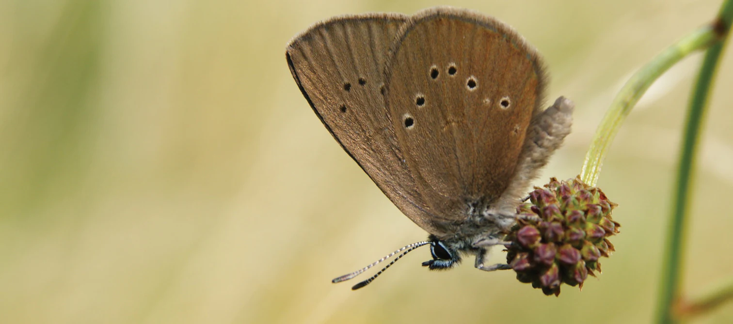
A close up view of a dusky large blue butterfly resting on the flower head of a plant against a blurred background.
A dusky large blue butterfly perched on a plant.

Die Spey Nature Reserve history and protected-area timeline

Die Spey was formally protected in two stages in the late 1980s. The southern part, lying within the city of Meerbusch in the Rhein-Kreis Neuss, was designated in 1987, while the northern part, located in the Linn district of Krefeld, was designated in 1988. The two halves are managed by different authorities: the Krefeld section by the lower landscape authority of the city of Krefeld, and the Meerbusch section by the Rhein-Kreis Neuss.

Although administratively separate, the two parts together constitute a single Natura 2000 and FFH area under the shared name Die Spey, reflecting a recognition that the ecological value of the floodplain depends on the whole mosaic functioning as one landscape rather than as two unrelated parcels. The reserve also has a documented scientific history, including a 1981 university thesis examining the vegetation of the left-Rhenish dune areas near Nierst, to the north of Die Spey, which helped establish the importance of this stretch of the floodplain for conservation planning.

Die Spey Nature Reserve landscape and geographic character

The landscape of Die Spey is shaped entirely by the Lower Rhine. Elevation is low and flat, generally between about 24 and 31 metres above sea level, and the entire reserve lies in the Deichvorland, the strip of land between the main flood dike and the active river. Because this zone still floods periodically, terrain features are subtle: gentle relief, natural levees along the river, slightly lower backwaters, and the artificial but ecologically integrated basin of a former wet excavation in the south.

The Rhine itself defines one edge of the area. Where bank protection allows, the shoreline shows open sand and gravel banks with pioneer vegetation and reed communities, and the river's hydrology continues to influence the rest of the reserve. The flood dike forms the outer, higher edge, separating this dynamic floodplain strip from the more urban and agricultural surroundings of Krefeld and Meerbusch.

Within these bounds, the visual landscape shifts abruptly from wooded to open. Near the river, silver-willow-dominated softwood forest and riverside trees create dense, damp woodland. Slightly inland, the reserve opens into wide hay meadows and tall herb vegetation, with rows of poplars and other trees occasionally breaking the fields. The southern lake adds an open water element to the scene, while the northern part of the area feels more agricultural and meadow-like. The overall impression is of a small but layered floodplain that reflects both natural processes and long coexistence with traditional land use.
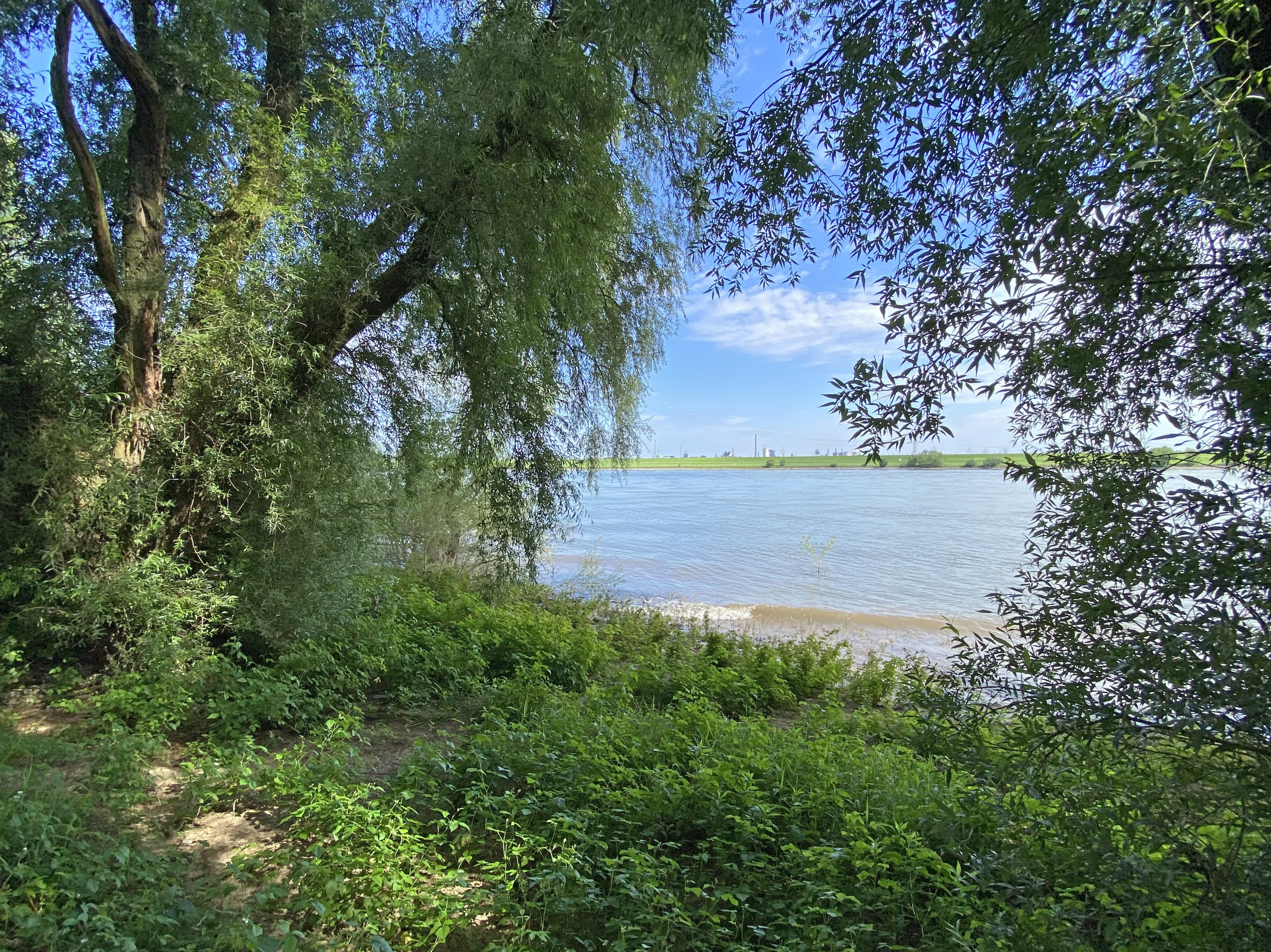
A wide view of the Rhine river looking across from the wooded banks of the Spey nature reserve, with green trees and undergrowth in the foreground and a distant dike on the opposite shore.
A view of the Rhine river from the Spey nature reserve, characterized by dense riparian vegetation.

Die Spey Nature Reserve ecosystems, habitats, and plant life

Ecologically, Die Spey is a textbook example of the habitat diversity that once characterised the Lower Rhine floodplain. Several formally recognised habitat types overlap within its boundaries, including softwood alluvial forests of willow, alder, and ash, lowland hay meadows, Stromtal meadows, moist tall herb vegetation, and shoreline communities of reeds, sedges, and pioneer plants on sand and gravel.

The woodland component is dominated by silver willow, a species highly adapted to regular flooding, with alder and ash adding structural and species diversity. These softwood communities are typical of active floodplains and are among the habitat types most reduced across central Europe. The meadow component includes both standard lowland hay meadows and the more specialised river valley grasslands that develop under the influence of the Rhine's flooding dynamics. Along the shoreline, reeds and sedges occupy the zones where mud and shallow water accumulate, and the southern lake provides still-water conditions alongside the river.

Overall, the reserve functions less as a single habitat type and more as an interconnected habitat complex. The proximity of woodland, open meadow, wet shoreline, and still water allows species movements and ecological processes that depend on this kind of mosaic, which is the primary reason the site carries Natura 2000 and FFH designations.
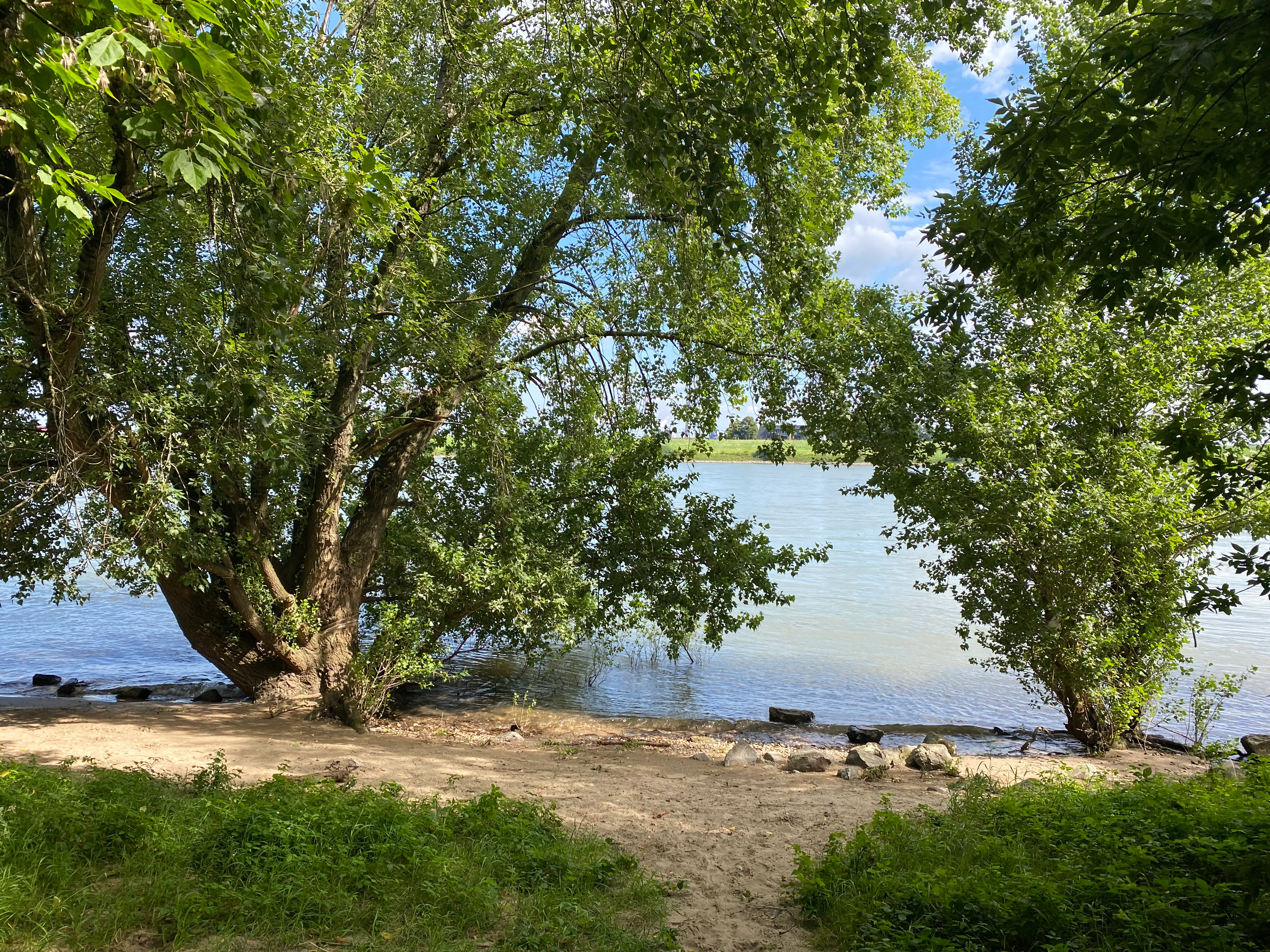
A view of the Rhine riverbank featuring a sandy shore in the foreground framed by leafy green deciduous trees under a blue sky.
The riverbank of the Rhine in the Spey nature reserve.

Die Spey Nature Reserve wildlife and species highlights

Die Spey is particularly notable for its birdlife. The combination of woodland edge, open meadow, wetland, and shoreline means that breeding waterbirds, meadow-nesting species, and woodland birds all find habitat within a compact area. Species documented at the site include nightingale and golden oriole in the wooded parts, little ringed plover on the open banks, and more occasional records of threatened migrants such as ruff and smew. The reserve is also valued as a resting and feeding area for migratory waterbirds moving along the Rhine corridor and as a stepping stone for broader migration routes.

Aquatic and semi-aquatic wildlife is supported by the river shoreline and the southern lake. Fish such as the European river lamprey are noted as present, and amphibians use the wet habitats for breeding. The waterbody, reedbeds, and soft shoreline vegetation together act as a refuge zone for these groups. Traces of beaver have also been recorded at the former excavation lake, indicating that larger mammals continue to use the reserve despite its small size.

Among invertebrates, the threatened dark knapweed blue butterfly is highlighted as a particularly important species. Its dependence on specific meadow plants and ant species ties its conservation directly to the continued management of the grassland component. The presence of this species illustrates how the reserve's value extends well beyond birds and into the often less visible realm of insect conservation in Rhine floodplain meadows.
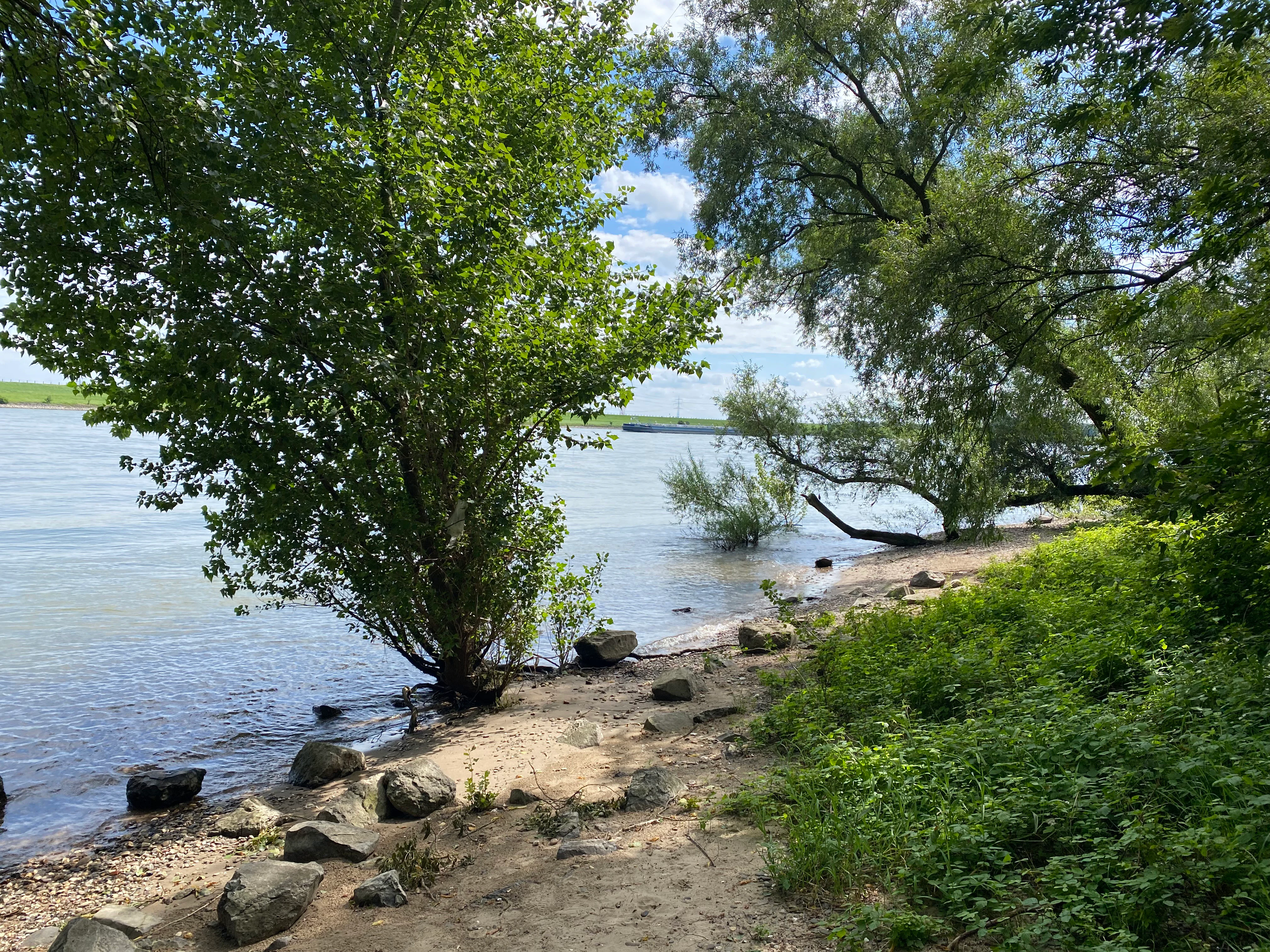
A sandy and rocky riverbank along the Rhine with lush green trees and shrubs, under a sky with light clouds.
The riverbank of the Rhine in the Spey nature reserve.

Die Spey Nature Reserve conservation status and protection priorities

Die Spey is protected at multiple levels. It is formally designated as a nature reserve under German nature conservation law, classified as an IUCN Category IV Habitat and Species Management Area. Its two halves also jointly form a Natura 2000 and FFH site, which brings it into the European network of protected habitats and imposes commitments to maintain favourable conservation status for the listed habitat types and species.

The reserve's conservation importance lies in its role as a relatively well preserved relict of the Rhine floodplain landscape in North Rhine-Westphalia, an environment that has been heavily altered elsewhere through agriculture, settlement, and flood control. By protecting a coherent mosaic of softwood forest, wet meadow, reedbed, and shoreline habitats within a single site, Die Spey preserves ecological functions such as bird breeding habitat, migratory stopover habitat, fish spawning habitat, and insect habitat that cannot easily be replaced elsewhere in the region.

The site is also embedded in a wider conservation landscape. It is adjacent to the Latumer Bruch FFH area and forms part of the Biotopverbund Krefelder Süden biotope network, which strengthens its resilience and supports species movements between floodplain fragments. Together, these overlapping designations make Die Spey a small but disproportionately important node in the Lower Rhine's ecological infrastructure.

Die Spey Nature Reserve cultural meaning and human context

Die Spey does not centre on prominent built cultural heritage, and its cultural dimension is closely bound up with traditional floodplain land use rather than with monuments or historical sites. The current landscape reflects centuries of coexistence between the river and its inhabitants: meadows cut for hay, pastures grazed by livestock, small arable patches within the floodplain, and the long-standing relationship between villages such as Linn and Nierst and the land in front of their dike.

The very name, Die Spey, refers to a local Flurstrich, a named tract of floodplain land, which underlines that this area has long been a recognised part of the regional cultural landscape as well as a natural one. Management of the reserve today continues this tradition, balancing ecological protection with the maintenance of open meadow and pasture elements that are themselves part of the Lower Rhine's rural identity.
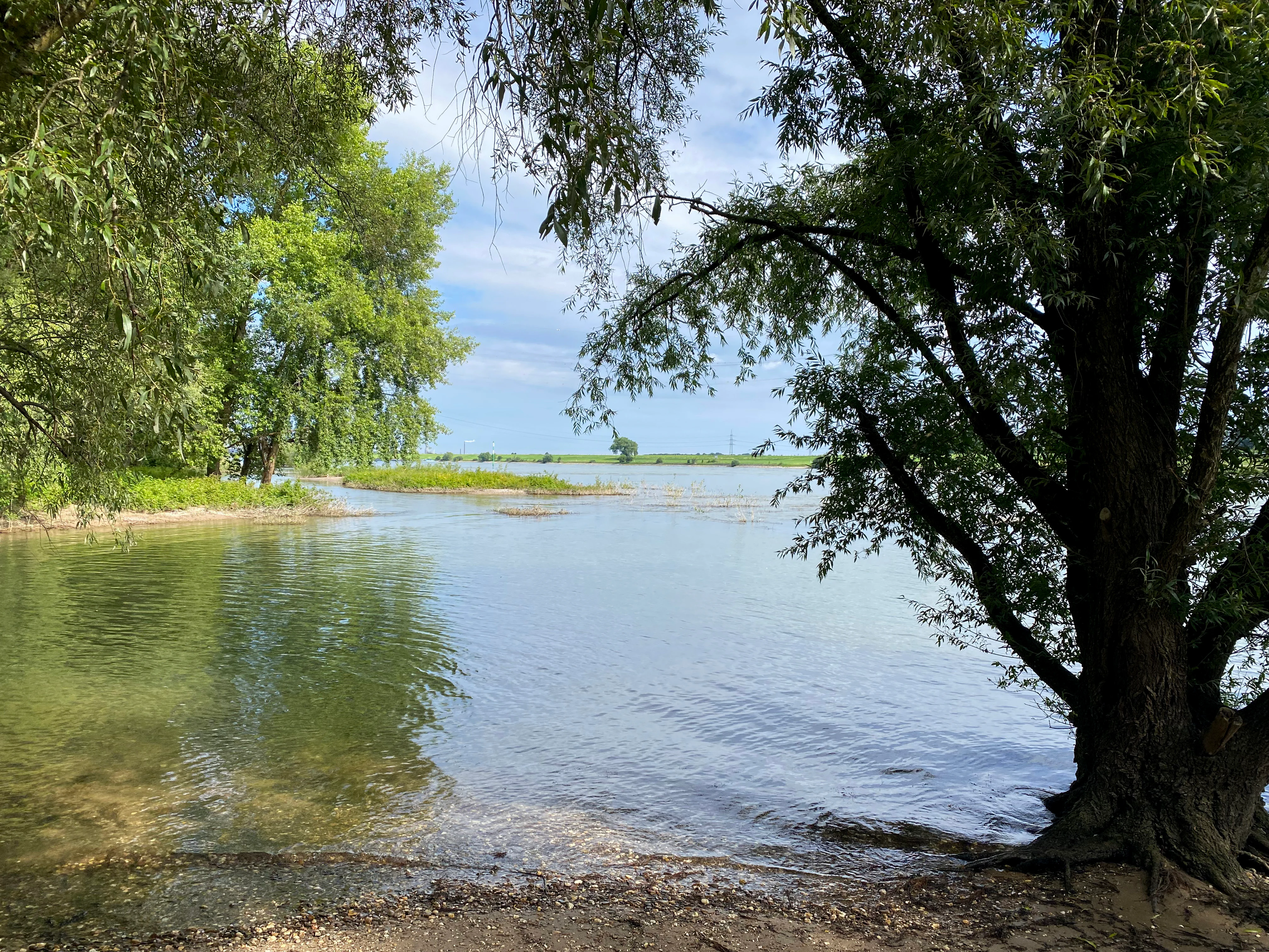
A peaceful lake or pond scene framed by lush green trees at the shore, with a glimpse of open water and a small island in the distance under a partly cloudy sky.
A tranquil view of the water connection between the Rhine river and the former gravel pit at Die Spey nature reserve.

Top sights and standout views in Die Spey Nature Reserve

What makes Die Spey stand out is the density and quality of its floodplain habitat mosaic compressed into a small area near a major urban region. Within just over one hundred hectares, it combines softwood floodplain forest, hay meadows, Stromtal grasslands, reedbeds, open shoreline, and a still-water lake, all ecologically linked rather than artificially separated.

The reserve is equally notable for its multi-layered bird value, functioning simultaneously as breeding habitat for woodland and meadow species, as resting and feeding habitat for migratory waterbirds, and as a stepping stone along the Rhine corridor. The presence of threatened species such as the dark knapweed blue butterfly, occasional sightings of vulnerable migrant birds like ruff and smew, recorded river lamprey, and beaver traces together confirm the site's role as a refuge for species that have declined elsewhere in intensively used floodplains.
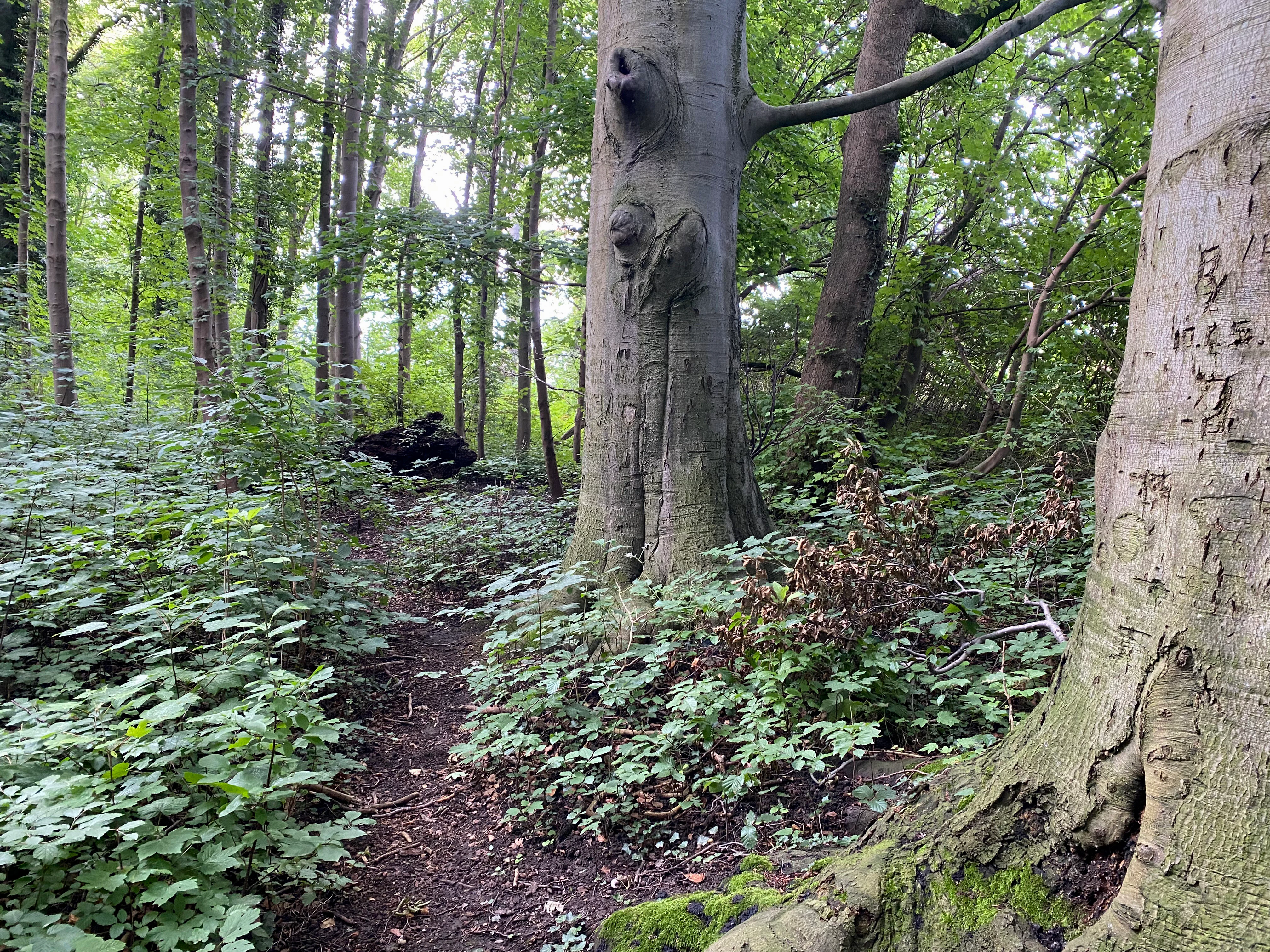
A narrow dirt trail leads into a lush green forest, flanked by mature trees with thick trunks and undergrowth.
A narrow trail winds through the dense deciduous forest of the Spey Nature Reserve.

Best time to visit Die Spey Nature Reserve

Die Spey is primarily a nature reserve rather than a conventional visitor destination, and any appreciation of the site depends on the season. Late spring and early summer are the most rewarding periods for visiting the area, when hay meadows are at their richest, the softwood forests are in full leaf, and breeding birds such as nightingale and golden oriole are most active. This is also the best window for the threatened dark knapweed blue butterfly, which depends on the flowering of its specific meadow host plants.

Early autumn brings migration, when waterbirds and meadow birds use the reserve as a stopover along the Rhine corridor, while winter can offer sightings of waterfowl in the floodplain and along the river. Periodic flooding of the Deichvorland can temporarily alter access and visibility across the meadows, so visitors should treat the site as a dynamic floodplain landscape where conditions change with the river rather than as a fixed scenic destination.

Monthly climate preview

Measured monthly temperature ranges and precipitation patterns across representative terrain

Spey Climate Normals and Long-Term Average Temperature Rhythm

Representative coordinates document monthly temperature variations and precipitation rates across the landscape from NASA climate records. Examining the complete twelve-month profile reveals detailed baseline normals for long-term meteorological comparison.
Annual mean10 °C
1 °C19 °C
Jan
Feb
Mar
Apr
May13°
Jun16°
Jul19°
Aug18°
Sep15°
Oct10°
Nov
Dec
Warmest month
July

18.6 °C

Coolest month
January

1.5 °C

Wettest month
December

2.8 mm/day

Driest month
April

1.6 mm/day

Park location guide

Geography guide, regional context, and park location map for Die Spey Nature Reserve

Die Spey Nature Reserve park geography, regions, and map view in Germany

Understand where Die Spey Nature Reserve sits in Germany through a broader geographic reading of the surrounding landscape, nearby location context, and its mapped position within the national park landscape.

How Die Spey Nature Reserve fits into Germany

Germany is a federal republic in Western and Central Europe with a population of over 83 million across sixteen constituent states. It is Europe's largest economy by nominal GDP and a major global exporter and importer. The capital is Berlin, and the country borders Denmark, Poland, Czech Republic, Austria, Switzerland, France, Luxembourg, Belgium, and the Netherlands.

Wider geography shaping Die Spey Nature Reserve in Germany

Germany is located in Western and Central Europe, spanning 357,022 km². It borders Denmark to the north, Poland and the Czech Republic to the east, Austria and Switzerland to the south, and France, Luxembourg, Belgium, and the Netherlands to the west. The country has coastlines on the Baltic Sea and North Sea to the north, with the Alps located in the southern region.

Map view of Die Spey Nature Reserve

Use this park location map to pinpoint Die Spey Nature Reserve in Germany, understand its exact geographic position, and read its mapped placement within the surrounding landscape more clearly.

Pigeon | © OpenStreetMap contributors

Location context for Die Spey Nature Reserve

North Rhine-Westphalia

Explore detailed imagery of riparian habitats, softwood forests, and river shoreline terrain.

Spey Photos and Protected Landscape Scenery: Visualizing the Lower Rhine Floodplain

Examine authentic Spey photos and protected area scenery to understand the diverse floodplain habitat mosaic along the Lower Rhine. Visual documentation reveals the subtle terrain variations, riverside woodlands, and open wetlands that define this protected nature reserve.

A close up view of a dusky large blue butterfly resting on the flower head of a plant against a blurred background.

A wide view of a calm lake in autumn with a dense line of trees displaying yellow and green leaves, reflected clearly in the water surface.

A wide view of the Rhine river looking across from the wooded banks of the Spey nature reserve, with green trees and undergrowth in the foreground and a distant dike on the opposite shore.

A view of the Rhine riverbank featuring a sandy shore in the foreground framed by leafy green deciduous trees under a blue sky.

A sandy and rocky riverbank along the Rhine with lush green trees and shrubs, under a sky with light clouds.

A large, leafy tree with low-reaching, horizontal branches situated on a sandy bank next to a body of water in a forest.

A peaceful lake or pond scene framed by lush green trees at the shore, with a glimpse of open water and a small island in the distance under a partly cloudy sky.

A narrow dirt trail leads into a lush green forest, flanked by mature trees with thick trunks and undergrowth.

A wide view of a mown hay field in the foreground, with several tall, narrow poplar trees standing in the grassy meadow and a line of dense forest in the background under a blue sky with scattered clouds.

A wide view of a green meadow with a line of tall deciduous trees under a blue sky with scattered white clouds.

A wide, sunny landscape view of green meadows and a line of tall deciduous trees under a bright blue sky with scattered white clouds.

A small tree trunk partially chewed through by a beaver, surrounded by wood shavings on the forest floor.

A wide, grassy field leads toward a line of tall, leafless trees under a bright sky with sun flare.

A dirt path winds through lush green trees and vegetation along the bank of a wide river under a clear blue sky.

Park atlas

Compare surrounding regional geography and adjacent river floodplains.

Explore Other Parks Near Spey and Connected Protected Landscapes

Browse nearby national parks and protected areas sharing similar river valley terrain and wetland habitats. Expanding the search beyond Spey reveals broader regional conservation networks and adjacent lowland ecosystems.
A soft watercolor painting of a winding stream through a grassy meadow with gentle hills in the background.
Nature reserveNordrhein-Westfalen
About 3.9 km away#1 closest

Southwest

Latumer Bruch Nature Reserve and Protected Wetland Geography in Nordrhein-Westfalen

A mapped overview of floodplain forests and Rhine channel landscapes

Latumer Bruch protects a unique lowland mosaic of alder swamp forest and dry grassland ridges near Krefeld. This nature reserve functions as a vital wetland refuge and floodwater retention basin, offering deep insight into the complex hydrologic character and ecological connectivity of the Lower Rhine region.

Area
1.85 km²
Established
1982
IUCN
IV
Relief
Lowland
Watercolor painting of a green wetland landscape with a small body of water and soft rolling hills in the background.
Nature reserveNordrhein-Westfalen
About 4.8 km away#2 closest

South

Ilvericher Altrheinschlinge Nature Reserve: Mapped Protected Landscapes in Nordrhein-Westfalen

Tracing the ancient oxbow meander of the Lower Rhine

Investigate the unique physical geography of the Ilvericher Altrheinschlinge, where ancient river dynamics create a preserved loop of floodplain forest and wet grassland. This nature reserve provides essential habitat connectivity in Nordrhein-Westfalen, offering a clear look at how human infrastructure and natural wetland systems intersect along the modern Rhine valley.

Area
3.081 km²
Established
1981
IUCN
IV
Relief
Lowland
A watercolor painting showing a gentle, winding blue river flowing through a lush green landscape with soft hills in the distance.
Nature reserveNordrhein-Westfalen
About 9.4 km away#3 closest

Southwest

Der Meerbusch Nature Reserve: Mapped Protected Landscapes and Floodplain Forest Geography in Nordrhein-Westfalen

A historic alder swamp woodland and protected wetland habitat in the Lower Rhine region.

Der Meerbusch is a specialized nature reserve that preserves the ecological memory of the Lower Rhine through its intact alder swamp woodlands and old river channel formations. By examining the mapped boundaries and terrain, visitors can understand how this forest fragment functions as a critical wetland sanctuary within the industrialized landscape of Nordrhein-Westfalen.

Area
0.54 km²
Established
1987
IUCN
IV
Relief
Lowland
Nature reserveKrefeld
About 11 km away#4 closest

Northwest

Hülser Bruch Nature Reserve: Geographic Atlas and Protected Landscape Mapping for Krefeld

A historic glacial plain and protected wetland habitat in the Lower Rhine region.

Hülser Bruch represents a vital protected area in Krefeld, characterized by clay rich soils, high groundwater levels, and ancient brook channels. The reserve preserves a distinct mosaic of coppice woodland and earthen embankments that reveal the geomorphological influence of Pleistocene ice sheets on this lowland territory.

Area
4.3 km²
Established
2002
Relief
Lowland
Climate
Temperate
A horizontal watercolor illustration of a calm stream flowing through a wetland with green trees and grasses along the banks.
Nature reserveNordrhein-Westfalen
About 11 km away#5 closest

East

Hummelsbach Nature Reserve: Mapped Protected Brook and Floodplain Landscape in Nordrhein-Westfalen

Protected sandy stream and alder woodland mosaic

Located in the Mettmann district of Nordrhein-Westfalen, Hummelsbach preserves a near-natural sandy brook and alder floodplain forest. This reserve functions as an essential ecological bridge between rolling hill forests and lowland floodplains, providing a concentrated look at specialized habitats within a mosaic of meadows and wet woodland.

Area
0.13 km²
Established
1984
IUCN
IV
Watercolor painting of a calm pond with cattails in the foreground and rolling hills in the background.
Nature reserveNorth Rhine-Westphalia
About 15 km away#6 closest

Southeast

Naturschutzgebiet Pillebachtal, Dernkamp und Gallberg: Protected Landscape and Geography

Nature reserve in North Rhine-Westphalia, Germany

An urban-adjacent nature reserve, this area provides a mapped look at the transition between mature beech forest stands and moist wetland corridors along the Pillebach stream. It serves as a study in ecological structure, featuring reed beds, meadow springs, and gallery woodlands that offer a protected refuge within the Rhine-Ruhr metropolitan region.

Area
0.745 km²
Established
1996
IUCN
IV
A watercolor illustration of a gentle winding stream flowing through a lush green valley at dawn or dusk.
Nature reserveNordrhein-Westfalen
About 15 km away#7 closest

East

Schwarzbachtal bei Götzenberg: Nature Reserve and Protected Landscape in North Rhine-Westphalia

Mapped stream valley, floodplain, and forest geography

Schwarzbachtal bei Götzenberg is an ecologically rich nature reserve located near Ratingen in the Mettmann district. The protected area features a well-preserved stretch of the Schwarzbach stream, old-growth beech stands, and complex wetland mosaics including reedbeds and ponds, providing essential habitat within a suburban landscape.

Area
0.54 km²
Established
1984
IUCN
IV
Relief
Lowland
Watercolor painting of a green valley with a winding stream and gentle hills in the background.
Nature reserveNordrhein-Westfalen
About 17 km away#8 closest

Southeast

Morper Bachtal: Mapped Nature Reserve and Stream Valley Geography in Germany

Protected wetland landscapes and regional habitat connectivity.

Morper Bachtal represents a tightly layered protected area where open water, reedbeds, and beech forests converge along the Rotthäuser Bach. This detailed look at its landscape composition and position within the district of Mettmann reveals the significance of its compact, undulating terrain and corridor role in German regional geography.

Area
0.74 km²
Established
1984
IUCN
IV
Relief
Upland

Common questions about visiting, size, designation, and location context for Die Spey Nature Reserve

Die Spey Nature Reserve FAQs for park facts, access, geography, and protected area context

Find quick answers about Die Spey Nature Reserve, including protected-area facts, park geography, trail and visitor context, and how the park fits into its surrounding country and regional landscape.
MoriAtlas Explorer

Continue Your Protected Areas Search Across the Global Atlas

Deepen your exploration by continuing the structured search for national parks and protected areas worldwide. Utilize the comprehensive filtering capabilities to compare different conservation landscapes and refine your understanding of global park geography. Discover more about the distribution and characteristics of protected natural areas.

Global natural geography