
Mori Atlas logo
Nature reserveSpitzenberg-Schießplatz Rothenstein-Borntal

Mapping the ecological mosaic of forest slopes, dry grassland, and historic terrain

Spitzenberg-Schießplatz Rothenstein-Borntal: A Protected Nature Reserve in Thuringia Germany

(Naturschutzgebiet Spitzenberg-Schießplatz Rothenstein-Borntal)

Spitzenberg-Schießplatz Rothenstein-Borntal stands as a significant nature reserve situated along the western slopes of the Saale river valley in Thuringia. This protected area features a unique geographic composition that blends the forested Spitzenberg ridgeline with the open terrain of the former Rothenstein-Borntal firing range. Through this atlas entry, observe how the convergence of these distinct habitats creates a vital landscape for wild orchids and rare flora within the regional conservation network.

nature reserveThuringiaSaale valleyorchid habitatdry grasslandsemi-open forest
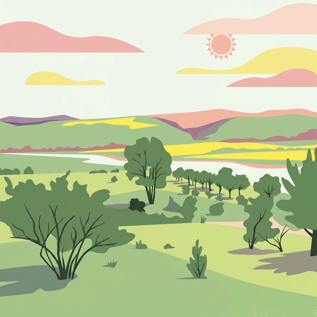
A minimalist digital illustration showing green rolling hills, scattered trees, and soft-colored clouds under a stylized sun.

Spitzenberg-Schießplatz Rothenstein-Borntal

Nature reserve

Park overview

Structured park overview, official facts, and landscape profile for Spitzenberg-Schießplatz Rothenstein-Borntal

Spitzenberg-Schießplatz Rothenstein-Borntal park facts, protected area profile, and essential visitor context

Review the core facts for Spitzenberg-Schießplatz Rothenstein-Borntal, including designation, size, terrain, visitor scale, habitats, and operating context in one park-focused overview.

About Spitzenberg-Schießplatz Rothenstein-Borntal

Spitzenberg-Schießplatz Rothenstein-Borntal is a nature reserve that sits at the geographic interface between the city of Jena and the rural district of Saale-Holzland in Thuringia, central Germany. Its landscape is shaped by the Saale river valley, with the reserve occupying the forested slopes and upper terrain that rise west of the river, just south of the Jena urban area. The protected area is composed of two strongly contrasting units: the wooded crest and slopes of the Spitzenberg, and the more open, historically disturbed terrain of the Rothenstein-Borntal, a former military shooting range (Schießplatz).

Ecologically, the reserve's importance lies in the persistence of traditional, semi-open forest structures and dry grassland patches that have survived alongside a site with a long history of human use. The combination of woodlands, clearings, and dry slopes creates conditions that are particularly favorable to wild orchids, and the site is recognised regionally as an outstanding orchid habitat. This ecological significance is the reason a substantial share of the land is now owned by the NABU Foundation for National Natural Heritage, which has committed to the long-term care and preservation of the orchid-rich habitats.

Geographically, the reserve is well-bounded by surrounding infrastructure: the A4 motorway runs along its northern edge, the federal road B88 and the Saale river lie to its east, and the regional road L2309 marks parts of its southwestern border. The community of Rothenstein, after which the reserve is partly named, sits on the eastern side of the Saale river. Together with neighbouring protected landscapes, including Kernberge und Wöllmisse bei Jena and Leutratal und Cospoth, the reserve forms part of a wider network of nature reserves preserving the natural and cultural landscape of the Jena Saale valley.

Quick facts and research context for Spitzenberg-Schießplatz Rothenstein-Borntal

Spitzenberg-Schießplatz Rothenstein-Borntal is a German nature reserve (NSG 371) located south of Jena in Thuringia, partly within the Saale-Holzland-Kreis. It was first placed under protection in 1961 and is listed in the World Database on Protected Areas under WDPA ID 319128.

The reserve covers about 544 hectares and is classified as an IUCN Category IV Habitat/Species Management Area. It lies on the western slopes of the Saale valley near Rothenstein, bordered by the A4 motorway to the north, the B88 federal road and the Saale river to the east, and regional road L2309 along its southwestern edge. A large part of the area belongs to the NABU Foundation for National Natural Heritage and is maintained as a long-term orchid habitat.

Protection and recognition

Examine the official protected area designation and registry tracking data.

Spitzenberg-Schießplatz Rothenstein-Borntal Protection Status and Records

Spitzenberg-Schießplatz Rothenstein-Borntal holds documented entries within global protected area databases to verify conservation boundaries. Registry archives track administrative designations and official conservation frameworks for spatial analysis.

Protection details

WDPA ID
319128
Park context

Deeper park guide and search-rich context for Spitzenberg-Schießplatz Rothenstein-Borntal

Spitzenberg-Schießplatz Rothenstein-Borntal history, landscape, wildlife, and travel context

Explore Spitzenberg-Schießplatz Rothenstein-Borntal through its history, landscape character, ecosystems, wildlife, conservation priorities, cultural context, and seasonal travel timing in a structured park guide built for atlas discovery and search intent.

Why Spitzenberg-Schießplatz Rothenstein-Borntal stands out

The reserve is most famous as one of the most significant orchid sites in the Jena region and along the middle Saale. Its combination of wooded ridges, open former military firing-range clearings, and dry, sun-exposed slopes supports exceptionally rich wild orchid populations, which is the reason the NABU Foundation took the area into its care. It also stands out for blending two distinct landscape elements: the natural forested ridgeline of the Spitzenberg and the open, historically disturbed terrain of the Rothenstein-Borntal former Schießplatz. This mix of closed forest and open habitat is unusual for the area and contributes to its biodiversity value, supporting both woodland species and the light-loving plants of calcareous and semi-dry grassland.
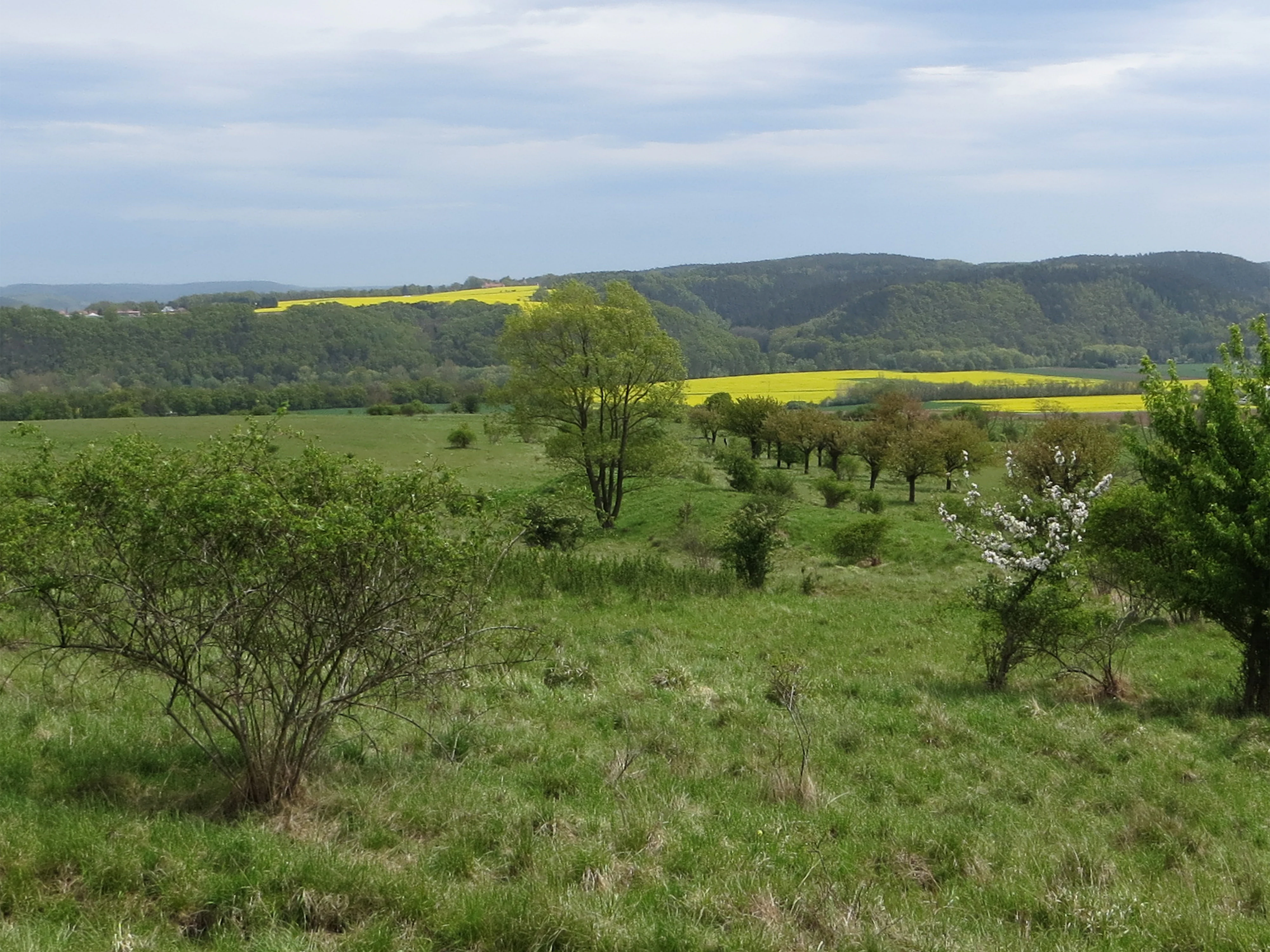
A wide view of a rolling green meadow with scattered shrubs and trees under an overcast sky, with yellow fields and wooded hills in the distance.
A view across the open meadows and scattered trees of the Spitzenberg-Schießplatz Rothenstein-Borntal nature reserve, with yellow rapeseed fields visible on the distant slopes.

Spitzenberg-Schießplatz Rothenstein-Borntal history and protected-area timeline

The area that is today the Spitzenberg-Schießplatz Rothenstein-Borntal nature reserve was first placed under formal protection in 1961, when it was designated as a Naturschutzgebiet under German nature conservation law. The historical use of the southern part of the territory as a military firing range, the Rothenstein-Borntal Schießplatz, left a distinctive imprint on the landscape, producing a mosaic of open and partly disturbed ground that later proved valuable for certain light-demanding plant communities.

In 2003 the protected area was re-established or refined in its current form, consolidating the Spitzenberg slopes with the former shooting range into a single integrated reserve. A significant later development was the transfer of ownership of much of the reserve to the NABU Foundation for National Natural Heritage, securing long-term, dedicated management aimed specifically at maintaining the site's orchid populations. These two milestones, the 1961 designation and the subsequent acquisition by NABU, define the modern conservation history of the area.

Spitzenberg-Schießplatz Rothenstein-Borntal landscape and geographic character

The landscape of Spitzenberg-Schießplatz Rothenstein-Borntal is defined by the western slopes and ridgelines of the middle Saale valley in Thuringia. The reserve rises above the Saale river, which flows past its eastern boundary, forming part of a forested corridor that links the natural areas around Jena with those further down the Saale.

The terrain is varied, mixing the wooded slopes of the Spitzenberg ridge with the more open, plateau-like terrain of the Rothenstein-Borntal. The former Schießplatz leaves a distinctive imprint on the landscape, with broader clearings, tracks, and open areas that interrupt the otherwise continuous forest cover. Dry, sun-exposed slopes and rocky or shallow-soil areas alternate with denser forest stands, creating the structural variety that supports the reserve's biodiversity. From elevated points within the area, including the Spitzenberg, there are wide views eastward across the Saale valley toward settlements such as Schiebelau.

Spitzenberg-Schießplatz Rothenstein-Borntal ecosystems, habitats, and plant life

Ecologically, the reserve is best understood as a mosaic of forest, semi-open woodland, and dry open habitats set within the Saale river valley. The dominant land cover is mixed deciduous and coniferous woodland on the valley slopes, interspersed with clearings and open areas originating from the historic use of the southern sector as a shooting range.

The combination of slope exposure, varying soil depth, and historic disturbance has produced habitat conditions particularly favorable to specialist plant communities. Dry and semi-dry grassland patches, warm woodland edges, and light-rich open areas support floristically rich assemblages, while the closed forest stands preserve typical valley-slope woodland communities. These varied habitats together underpin the reserve's reputation as one of the most important orchid-rich sites in the Jena region and a notable stronghold of calcareous and dry-loving flora along the middle Saale.

Spitzenberg-Schießplatz Rothenstein-Borntal wildlife and species highlights

While the wildlife of the reserve is not extensively described in the principal public sources, the habitat mosaic supports a typical range of central German valley-forest fauna. Wooded slopes, edges, and clearings create conditions suitable for common woodland birds, small mammals of mixed forest, and insects associated with open, flower-rich dry habitats, the latter group benefiting especially from the orchid-rich open areas that the reserve is managed to protect.

The presence of large open areas with abundant wildflowers, including orchids, also makes the site attractive for pollinator groups such as wild bees, hoverflies, and butterflies. The reserve's role for pollinators and for species that depend on semi-open, warm habitats is widely considered one of its key biodiversity contributions in the regional conservation network.

Spitzenberg-Schießplatz Rothenstein-Borntal conservation status and protection priorities

Conservation is the central purpose of Spitzenberg-Schießplatz Rothenstein-Borntal. Classified as an IUCN Category IV Habitat/Species Management Area, the reserve is managed specifically to protect particular habitats and species assemblages rather than as a strict wilderness reserve. Its principal conservation focus is the preservation of orchid-rich habitats, which the NABU Foundation for National Natural Heritage took on long-term stewardship of to ensure that active management can continue regardless of land-use pressures in the surrounding region.

The reserve also contributes to landscape-scale conservation by connecting with other protected areas around Jena and across the Saale-Holzland-Kreis, including Kernberge und Wöllmisse bei Jena, Leutratal und Cospoth, and Hufeisen-Jenzig. Together, these protected areas maintain ecological corridors along the Saale valley and safeguard important dry-woodland and grassland habitats typical of this part of Thuringia. The combination of formal nature reserve status, dedicated foundation ownership, and integration into this wider network gives the site a comparatively strong conservation outlook.

Spitzenberg-Schießplatz Rothenstein-Borntal cultural meaning and human context

The reserve's cultural context is closely tied to both the natural heritage traditions of Thuringia and to the military history encoded in its name. The 'Schießplatz' element of the name reflects the site's long-standing use as a firing range, an imprint that still structures the open-clearings pattern found across parts of the reserve today.

At a broader scale, the area belongs to the Saale-Holzland cultural landscape around Jena, a region where dense networks of forest reserves, valley slopes, and small rural communities such as Rothenstein have coexisted for centuries. The acquisition of much of the reserve by the NABU Foundation represents a more recent chapter in this history, embedding the landscape within Germany's wider tradition of private and foundation-led nature conservation alongside its formal state-designated protection.

Top sights and standout views in Spitzenberg-Schießplatz Rothenstein-Borntal

Spitzenberg-Schießplatz Rothenstein-Borntal stands out for the unusual combination of a forested valley ridge with a former military firing range that has, over time, become an ecologically valuable mosaic of woodland and open habitat. Its biggest claim to ecological fame is its exceptional richness in wild orchids, a feature that drove the NABU Foundation's acquisition of much of the land.

The reserve also offers expansive views eastward across the Saale valley toward villages such as Schiebelau and forms part of an interconnected chain of protected landscapes around Jena. Its position south of the city, between the A4 motorway corridor and the Saale river, makes it an important natural area within easy reach of the Jena urban area, while still preserving a strongly rural, forested character.

Best time to visit Spitzenberg-Schießplatz Rothenstein-Borntal

The reserve is most rewarding to visit in late spring and early summer, when wild orchids and other dry-habitat plants are typically in bloom across the open slopes and former firing-range clearings. Late spring also brings fresh foliage to the surrounding forests and clear views across the Saale valley from elevated points such as the Spitzenberg ridge.

In summer, the mix of shaded woodland and sun-exposed dry slopes creates comfortable walking conditions in the cooler forested sections, while autumn highlights the deciduous woodland character of the valley slopes. Winter visits offer quieter, more open conditions and unobstructed views across the landscape, although the experience is more about scenery than the botanical highlights of the warmer months.


Monthly climate preview

Long-term temperature ranges and monthly precipitation patterns sampled at a representative coordinate

Spitzenberg-Schießplatz Rothenstein-Borntal Climate Normals and Annual Weather Rhythm

Representative point records capture the measured annual temperature progression and monthly precipitation rhythm across the terrain. Detailed twelve-month profiles provide comprehensive numerical context for evaluating long-term climate normals.
Annual mean9 °C
-1 °C19 °C
Jan-1°
Feb
Mar
Apr
May13°
Jun17°
Jul19°
Aug19°
Sep14°
Oct
Nov
Dec
Warmest month
July

19.1 °C

Coolest month
January

-0.9 °C

Wettest month
July

2.6 mm/day

Driest month
April

1.3 mm/day

Park location guide

Geography guide, regional context, and park location map for Spitzenberg-Schießplatz Rothenstein-Borntal

Spitzenberg-Schießplatz Rothenstein-Borntal park geography, regions, and map view in Germany

Understand where Spitzenberg-Schießplatz Rothenstein-Borntal sits in Germany through a broader geographic reading of the surrounding landscape, nearby location context, and its mapped position within the national park landscape.

How Spitzenberg-Schießplatz Rothenstein-Borntal fits into Germany

Germany is a federal republic in Western and Central Europe with a population of over 83 million across sixteen constituent states. It is Europe's largest economy by nominal GDP and a major global exporter and importer. The capital is Berlin, and the country borders Denmark, Poland, Czech Republic, Austria, Switzerland, France, Luxembourg, Belgium, and the Netherlands.

Wider geography shaping Spitzenberg-Schießplatz Rothenstein-Borntal in Germany

Germany is located in Western and Central Europe, spanning 357,022 km². It borders Denmark to the north, Poland and the Czech Republic to the east, Austria and Switzerland to the south, and France, Luxembourg, Belgium, and the Netherlands to the west. The country has coastlines on the Baltic Sea and North Sea to the north, with the Alps located in the southern region.

Map view of Spitzenberg-Schießplatz Rothenstein-Borntal

Use this park location map to pinpoint Spitzenberg-Schießplatz Rothenstein-Borntal in Germany, understand its exact geographic position, and read its mapped placement within the surrounding landscape more clearly.

Pigeon | © OpenStreetMap contributors

Location context for Spitzenberg-Schießplatz Rothenstein-Borntal

Thuringia

Visualizing the forested ridges, military clearings, and orchid habitats of Thuringia

Spitzenberg-Schießplatz Rothenstein-Borntal Photos and Landscape Scenery

Visual documentation reveals the varied terrain, steep wooded slopes, and semi-open clearings that define the protected landscape. Examining these field photographs provides deeper insight into the rare orchid habitats and valley ecosystems preserved along the Saale river.

A wide view of a rolling green meadow with scattered shrubs and trees under an overcast sky, with yellow fields and wooded hills in the distance.

Park atlas

Compare surrounding valley forests and related conservation landscapes in the region

Explore Protected Areas Near Spitzenberg-Schießplatz Rothenstein-Borntal

Browse other protected areas and nature reserves located close to Spitzenberg-Schießplatz Rothenstein-Borntal for regional geographic comparison. Expanding the search helps reveal connected valley corridors and similar woodland habitats across the middle Saale district.
Nature reserveThuringia
About 2.4 km away#1 closest

Northwest

Leutratal und Cospoth Nature Reserve: Mapping Calcareous Grasslands in Thuringia

A study of limestone slopes and orchid-rich habitats in central Germany

Leutratal und Cospoth serves as a prime example of protected Muschelkalk landscape in Thuringia. This reserve captures the complex transition between open grasslands, scrub, and beech forests within the middle Saale valley, offering deep insights into the region's unique geological and botanical heritage.

Area
5.829 km²
Established
1961
IUCN
IV
Relief
Upland
A soft watercolor painting of a green landscape with trees, rolling hills, and a body of water under a light sky.
Nature reserveThuringia
About 4.8 km away#2 closest

Northwest

Jenaer Forst Nature Reserve: Mapping the Protected Limestone Plateau and Forest Terrain

Protected nature reserve in Thuringia, Germany

Jenaer Forst is a 540 hectare nature reserve in Thuringia, characterized by dry calcareous woodland and active restoration work. The site is a study in landscape recovery, balancing forest management with the protection of orchid-rich habitats on its limestone plateau. This detailed atlas entry provides insights into the park boundaries, geological features, and ecological significance of this peri-urban forest zone.

Area
5.411 km²
Established
2008
IUCN
IV
Nature reserveThuringia
About 11 km away#3 closest

North

Windknollen Nature Reserve: Mapping Protected Limestone Landscapes in Thuringia

Examining the plateau geography and former training site boundaries

The Windknollen nature reserve occupies a distinct position on the Muschelkalk limestone plateau near Jena. Its protected status reflects an evolution from historical battlefield use to a formal conservation area within the National Natural Heritage framework. The terrain is defined by exposed; dry-adapted vegetation across 185 hectares of highland geography.

Area
1.851 km²
Established
1997
IUCN
IV
Nature reserveWeimarer Land
About 15 km away#4 closest

West

Seeteich Blankenhain Nature Reserve: Geographic Map and Protected Area Context

Wetland landscape situated in the Weimarer Land district

Seeteich Blankenhain is a distinct nature reserve in Germany, characterized by its historic pond and surrounding moist lowland ecosystems. This site remains a focal point for ecological research and conservation, offering a layered landscape of reed zones and woodland that supports a diverse bird community. Its presence within the regional geography of Weimarer Land highlights the importance of small-scale wetland preservation in the Thuringian landscape.

Established
1991
Relief
Lowland
Access
Access unknown
Scope
Terrestrial
A soft watercolor painting of a rolling landscape with green hills, scattered trees, and pale, earthy foreground textures.
Nature reserveThuringia
About 20 km away#5 closest

South

Buchenberg bei Krölpa Nature Reserve: Mapped Geography and Protected Landscape Context

A restored limestone quarry habitat located in Thuringia, Germany.

Buchenberg bei Krölpa stands as a regionally significant nature reserve located east of Krölpa. Formerly a site of limestone extraction, the protected area now functions as a managed habitat, characterized by its broken, stepped terrain and slopes that host native orchid species and dry grassland vegetation within the broader Thuringian countryside.

Area
0.201 km²
Established
1996
IUCN
IV
Relief
Upland
Nature reserveThuringia
About 20 km away#6 closest

North

Lohholz Nature Reserve: Protected Forest and Meadow Mosaic in Thuringia

Mapped deciduous woodlands and river valley meadow geography

Lohholz constitutes an isolated nature reserve in Thuringia, showcasing a distinct mosaic of broadleaf forest and traditional orchard meadows. The terrain slopes toward the Saale river valley, featuring varied grassland communities and a vital spring-fed brook. This protected area offers a look at forest preservation within a landscape predominantly utilized for agricultural purposes.

Area
0.304 km²
Established
1995
IUCN
IV
Relief
Upland
Protected landscapeThuringia
About 22 km away#7 closest

West

Landschaftsschutzgebiet Mittleres Ilmtal: Protected Landscape Geography and Map Discovery

Thuringia regional atlas and protected area profile

Gain insight into the diverse topography of Landschaftsschutzgebiet Mittleres Ilmtal, which spans roughly 150 square kilometers. This protected landscape is characterized by its dramatic shifts from Buntsandstein forests in the Tannrodaer Sattel to the elevated Muschelkalk escarpments, offering a detailed case study in German mid mountain geography.

Area
150 km²
Relief
Upland
Climate
Temperate
Access
Access unknown
A horizontal watercolor painting showing a soft, stylized landscape of rolling green hills, gentle slopes, and a calm body of water against a light pastel sky.
Nature reserveThuringia
About 24 km away#8 closest

Southeast

Plothener Teiche Nature Reserve: Geographic Map and Protected Wetland Landscape Overview

Historic pond landscapes in the Saale-Orla-Kreis region of Thuringia

Plothener Teiche serves as a defining example of medieval-origin fishpond management in central Germany. This protected landscape combines open water basins, reed-lined margins, and woodland edges within the Thüringer Schiefergebirge and Obere Saale Nature Park. The area provides essential habitat for migratory bird populations and stands as a restored model of European wetland ecology.

Established
1967
IUCN
IV
Relief
Lowland
Climate
Temperate

Common questions about visiting, size, designation, and location context for Spitzenberg-Schießplatz Rothenstein-Borntal

Spitzenberg-Schießplatz Rothenstein-Borntal FAQs for park facts, access, geography, and protected area context

Find quick answers about Spitzenberg-Schießplatz Rothenstein-Borntal, including protected-area facts, park geography, trail and visitor context, and how the park fits into its surrounding country and regional landscape.
MoriAtlas Explorer

Continue Your Protected Areas Search Across the Global Atlas

Deepen your exploration by continuing the structured search for national parks and protected areas worldwide. Utilize the comprehensive filtering capabilities to compare different conservation landscapes and refine your understanding of global park geography. Discover more about the distribution and characteristics of protected natural areas.

Global natural geography