
Mori Atlas logo
Nature reserveStein – Rachelsberg

Discover the unique karst-like terrain and forested summits of the Eichsfelder Schweiz region.

Stein – Rachelsberg Nature Reserve: Mapped Muschelkalk Hills and Regional Geography in Thuringia

(Naturschutzgebiet Stein-Rachelsberg)

Stein – Rachelsberg is a protected nature reserve in the northern foothills of the Gobert, situated in the Eichsfeld region of Thuringia, Germany. This mapped landscape encompasses a dense cluster of separate Muschelkalk summits, including the Rachelsberg and Hesselkopf, rising above deeply incised valleys to create a distinctive low mountain profile. The terrain preserves yew-rich forest stands and karst-like cliff formations, serving as a critical component of the cross-border biotope network along the former inner-German border.

nature reserveMuschelkalk landscapedeciduous forestlow mountain hillsEichsfelder Schweizrock outcrops
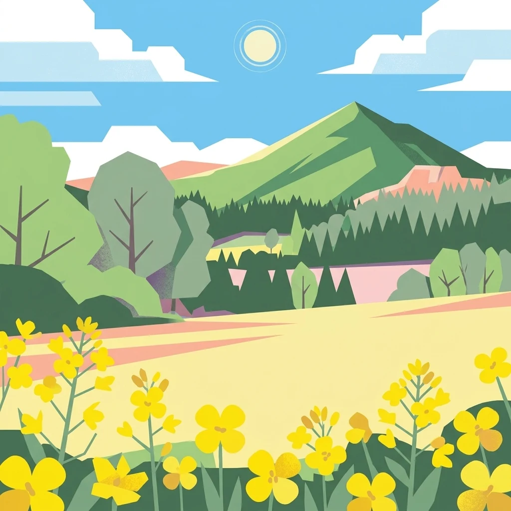
Vector-style flat illustration showing yellow flowering plants in the foreground, rolling green hills and forests in the midground, and blue skies with white clouds in the background.

Stein – Rachelsberg

Nature reserve

Park overview

Structured park overview, official facts, and landscape profile for Stein-Rachelsberg Nature Reserve

Stein-Rachelsberg Nature Reserve park facts, protected area profile, and essential visitor context

Review the core facts for Stein-Rachelsberg Nature Reserve, including designation, size, terrain, visitor scale, habitats, and operating context in one park-focused overview.

About Stein-Rachelsberg Nature Reserve

Stein-Rachelsberg Nature Reserve lies in the northern Gobert range, a forested low mountain area that straddles the Thuringia-Hesse border in central Germany. Although the territory is formally part of the Eichsfeld region in Thuringia, much of the adjoining landscape historically belonged to Hesse, and the entire area carries the regional nickname Eichsfelder Schweiz. The reserve protects a densely structured hill country of Muschelkalk ridges, named summits, steep wooded slopes, and small valleys shaped by erosion and ancient landslides.

Geologically, the reserve sits within a sequence of Lower Muschelkalk in the higher slopes, Upper Buntsandstein (Röt) in the valleys, and Middle Buntsandstein near the Altenstein castle site, with surface layers of tumbled Muschelkalk blocks where slope movement has occurred. This creates the broken, cliff-edged scenery that defines the local topography and gives each hilltop an individual silhouette. Notable summits include the Rachelsberg at 523.4 meters, the Dieberg up to 510 meters, the Hesselkopf at 506 meters, the Goburg up to 500 meters, Auf dem Stein at 496.1 meters, the Kahlenberg, the Iberg at 426.1 meters, and the Scharfenberg at 375.6 meters.

The reserve is not crossed by any major road. Instead, it is reached through a dense network of hiking trails, including the Eichsfelder Schweiz premium trail (P16) near Asbach-Sickenberg. The Burgruine Altenstein stands inside the protected area boundaries but, together with the ground immediately around it, is excluded from the reserve itself. The wider landscape position, accessibility by foot, and scenic density have combined to give the region its long-standing identity as one of the most picturesque low mountain areas in the Eichsfeld.

Quick facts and research context for Stein-Rachelsberg Nature Reserve

Stein-Rachelsberg lies in the Landkreis Eichsfeld in Thuringia, near the Hessian border and Bad Sooden-Allendorf. The reserve covers about 506 hectares, was designated as nature reserve number 068 in 2023, and forms part of the FFH area Stein-Rachelsberg-Gobert as well as the Vogelschutzgebiet Werrabergland südwestlich Uder. Its forests, cliffs, and yew populations on steep Muschelkalk slopes are characteristic of the Eichsfelder Schweiz landscape.

Protection and recognition

Examine the documented conservation scope and formal recognition records.

Stein – Rachelsberg Protection Status and Terrestrial Area Designation

Stein – Rachelsberg maintains a documented terrestrial protection scope within its regional landscape. Conservation records provide structured administrative details without imported international recognition sources.

Protection details

Protection scope
Terrestrial
Transboundary protection
No
Core area
1.5 km²
Park context

Deeper park guide and search-rich context for Stein-Rachelsberg Nature Reserve

Stein-Rachelsberg Nature Reserve history, landscape, wildlife, and travel context

Explore Stein-Rachelsberg Nature Reserve through its history, landscape character, ecosystems, wildlife, conservation priorities, cultural context, and seasonal travel timing in a structured park guide built for atlas discovery and search intent.

Why Stein-Rachelsberg Nature Reserve stands out

Stein-Rachelsberg is best known for its rugged Muschelkalk hill landscape: a dense cluster of separate summits, including the Rachelsberg, Hesselkopf, Dieberg, Goburg, Auf dem Stein, Kahlenberg, Iberg, and Scharfenberg, rising above deeply cut valleys. The area is also recognized for its yew-rich deciduous forest stands, karst-like cliff formations, landslip features, and the historic Burgruine Altenstein set within the reserve.
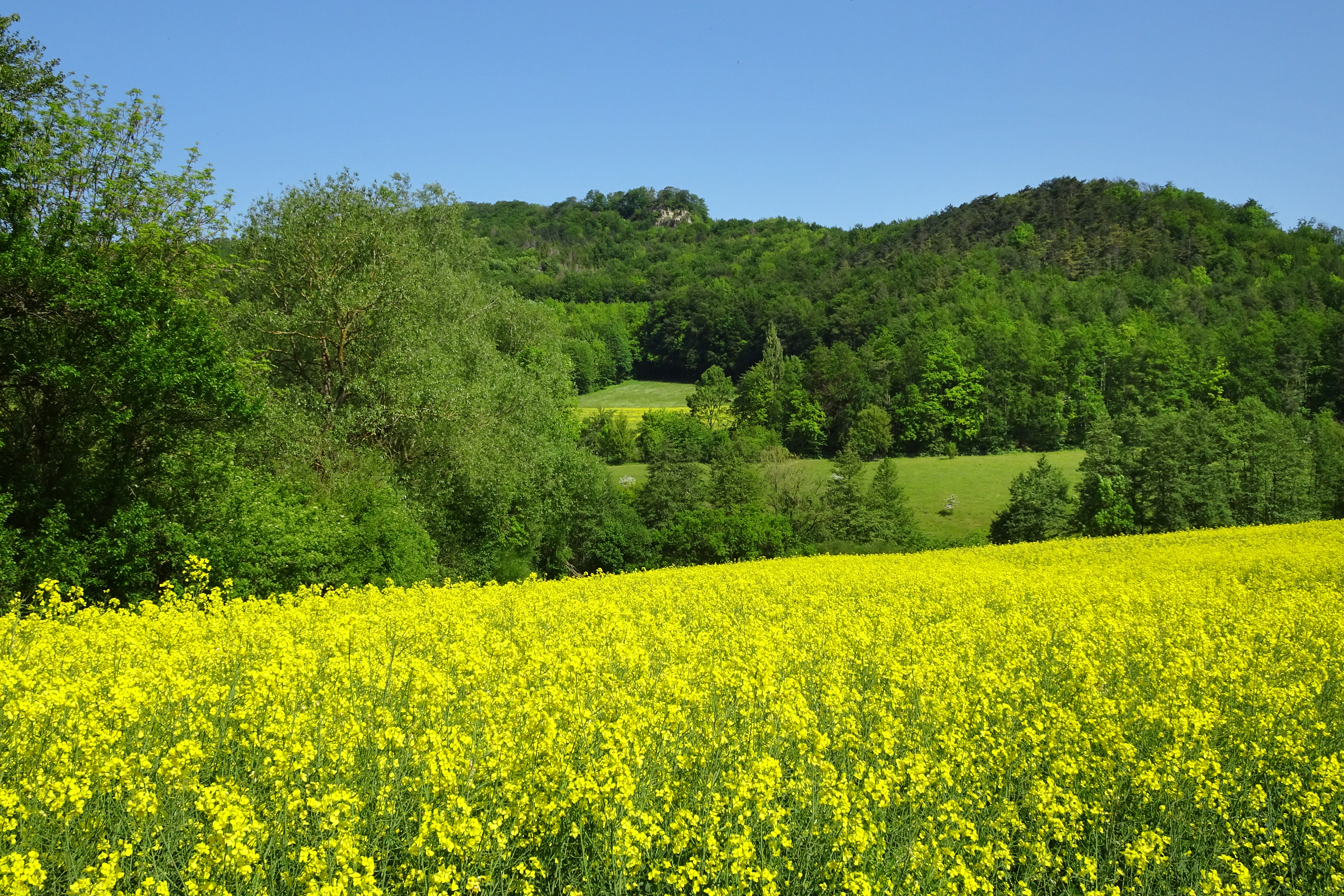
A wide view of a vibrant yellow rapeseed field under a clear blue sky, with rolling forested hills in the distance.
A bright yellow rapeseed field in the foreground with the forested hills of the Nase and Scharfenberg area in the background.

Stein-Rachelsberg Nature Reserve history and protected-area timeline

Stein-Rachelsberg was formally established as a nature reserve relatively recently, receiving its legal protection in 2023 under nature reserve number 068 in the Landkreis Eichsfeld. The designation marked it as the youngest nature reserve in the Eichsfeld region and capped several decades of ecological interest in the area. Earlier scientific documentation includes the 1988 unpublished proposal by R. Haupt for protecting the Stein hill area near Asbach, as well as a 1992 university thesis by C. Bruns on the deciduous forest communities of the Lengenberg and the Stein forest near Bad Sooden-Allendorf. A 2020 publication by K. Kullmann provided the first detailed survey of a yew population (Taxus baccata) on the Rachelsberg, documenting distribution, stand characteristics, and regeneration.

The reserve also occupies a historically charged location. A Cold War era patrol road of the East German border troops (Kolonnenweg) crosses part of the territory at the Hesselkopf, a reminder of the former inner-German border that cut the broader landscape in two. This border-era corridor has, in ecological terms, become an asset, since it underpins the reserve's role in the cross-border Biotopverbund Eichsfeld-Werratal along the Grünes Band Deutschland. The 2024 article by Arne Willenberg in Eichsfeld Journal summarizes the establishment of the reserve and frames it as the culmination of long-standing regional conservation interest in the Stein hills.

Stein-Rachelsberg Nature Reserve landscape and geographic character

The reserve is a classic low mountain landscape shaped by layered sedimentary rocks and long-term erosion. The higher slopes and hill summits are formed of Lower Muschelkalk limestone, producing resistant caprock features and cliff edges, while the valleys are cut into the softer Upper Buntsandstein (Röt), with additional Middle Buntsandstein exposures in a few locations. Where erosion and landslips have been active, scattered Muschelkalk blocks have been carried down over sandstone terrain, creating the appearance of broken rock fields and stepped slope morphology.

The visual identity of the area is defined by many separate hilltops, each with its own profile. The Rachelsberg rises to 523.4 meters and is the highest of the protected summits. The Dieberg, Hesselkopf, Goburg, Auf dem Stein, Iberg, and Scharfenberg form a dense ring of viewpoints. Together, these summits and the ridges between them create a strongly articulated skyline, which is the reason local people have long referred to the area as the Eichsfelder Schweiz. Beyond the geological structure, the landscape is also shaped by forested cover, deep valleys, and small dry valleys and rocky ledges that add micro-relief to the otherwise forested terrain.

Stein-Rachelsberg Nature Reserve ecosystems, habitats, and plant life

Stein-Rachelsberg protects a representative cross-section of the deciduous forest flora of the southern Eichsfeld on calcareous substrates. The dominant vegetation cover consists of mixed deciduous woodland occupying the Muschelkalk slopes and ridge flanks, while valleys and more acidic exposures support related but distinct forest communities. The combination of bedrock types within a relatively compact protected area gives the reserve unusually high local habitat diversity for the region.

Among the more ecologically significant features is a population of yew (Taxus baccata) on the Rachelsberg, documented in 2020 and noted as a notable occurrence for a low mountain area of this kind. The reserve's position at the interface of Thuringian and Hessian forest communities, combined with its exposure on steep, rocky, often north-facing slopes, encourages a forest mosaic that includes mature stands, regenerating areas, and structurally rich edge habitats along cliff lines and rock-fall fields. Because the reserve lies inside the Eichsfeld-Werratal biotope corridor along the former inner-German border, it also contributes to the ecological continuity of one of the most important green infrastructure lines in central Germany.

Stein-Rachelsberg Nature Reserve wildlife and species highlights

Wildlife interest in Stein-Rachelsberg is closely tied to its woodland structure and its role in broader protected area networks. The reserve is part of the Vogelschutzgebiet Werrabergland südwestlich Uder, meaning that it holds recognized conservation value for bird species associated with structured deciduous forest, edge habitats, and the wider Werra valley landscape. Mixed woodlands on rocky slopes, broken cliff lines, and older deciduous stands offer nesting and foraging habitat for typical low mountain forest species.

Stein-Rachelsberg Nature Reserve conservation status and protection priorities

Stein-Rachelsberg carries strong conservation significance as a young, formally protected state reserve and as an important node in multiple overlapping regional and European designations. It is a component of FFH area number 19, Stein-Rachelsberg-Gobert, which links it into the European Natura 2000 network and supports the protection of forest habitat types on calcareous bedrock. It is also within the Vogelschutzgebiet Werrabergland südwestlich Uder and the Landschaftsschutzgebiet Obereichsfeld, providing layered protection from site to landscape level.

The reserve's location along the former inner-German border, where the Grünes Band Deutschland and the Biotopverbund Eichsfeld-Werratal run, adds a key conservation function. This corridor connects habitats across the Thuringia-Hesse boundary and links Stein-Rachelsberg to the adjoining Hessian nature reserve Kalkklippen südlich des Iberges on the other side of the border. Within the reserve itself, a 150.2-hectare core area between the Kahlenberg and the Rachelsberg has been set aside from forestry use, providing a fully undeveloped reference zone for long-term forest and cliff habitat development on Lower Muschelkalk.

Stein-Rachelsberg Nature Reserve cultural meaning and human context

The reserve sits in a region of layered cultural heritage. The Eichsfeld has historically been a Catholic enclave within largely Protestant Thuringia, and the broader landscape carries centuries of small-scale rural land use, pilgrimage routes, and castle history. Inside the protected area, the Burgruine Altenstein stands as a prominent medieval ruin, although the ruin and the ground immediately around it are not part of the nature reserve itself. The regional nickname Eichsfelder Schweiz reflects a long tradition of appreciating the area as a scenic landscape comparable to Switzerland on a much smaller scale, an identity that has shaped local tourism, hiking culture, and literary descriptions of the region for generations.

Top sights and standout views in Stein-Rachelsberg Nature Reserve

The tallest summit of the reserve, the Rachelsberg at 523.4 meters, and a distinctive ring of neighbouring hilltops including the Hesselkopf, Dieberg, Goburg, Auf dem Stein, Iberg, and Scharfenberg.

A 150-hectare forest core zone between the Kahlenberg and Rachelsberg that is fully excluded from forestry use, alongside a documented yew population on the Rachelsberg.

A position within the FFH area Stein-Rachelsberg-Gobert and the cross-border Biotopverbund Eichsfeld-Werratal, connected directly to the Hessian Kalkklippen südlich des Iberges reserve along the former inner-German border.

Best time to visit Stein-Rachelsberg Nature Reserve

Late spring and early summer are a strong choice for visiting Stein-Rachelsberg. Forest cover on the Muschelkalk slopes is at its freshest, the network of trails around Asbach-Sickenberg is in active use, and the rock outcrops and cliff lines are most visible when leaves are still relatively light. Daylight hours in this part of central Germany also allow full enjoyment of the multiple viewpoints from the Rachelsberg, Hesselkopf, and surrounding summits.

Monthly climate preview

Measured temperature and precipitation averages for Stein – Rachelsberg

Stein – Rachelsberg Climate Normals and Long-Term Weather by Month

Historical climatology records for Stein – Rachelsberg document measured monthly temperature swings from sub-zero winter minimums to warm summer maximums alongside consistent daily precipitation. Reviewing the complete twelve-month sequence helps analyze long-term environmental patterns across the protected coordinate.
Annual mean8 °C
-1 °C18 °C
Jan-1°
Feb
Mar
Apr
May12°
Jun16°
Jul18°
Aug18°
Sep14°
Oct
Nov
Dec
Warmest month
July

18.2 °C

Coolest month
January

-0.9 °C

Wettest month
July

2.6 mm/day

Driest month
April

1.5 mm/day

Park location guide

Geography guide, regional context, and park location map for Stein-Rachelsberg Nature Reserve

Stein-Rachelsberg Nature Reserve park geography, regions, and map view in Germany

Understand where Stein-Rachelsberg Nature Reserve sits in Germany through a broader geographic reading of the surrounding landscape, nearby location context, and its mapped position within the national park landscape.

How Stein-Rachelsberg Nature Reserve fits into Germany

Germany is a federal republic in Western and Central Europe with a population of over 83 million across sixteen constituent states. It is Europe's largest economy by nominal GDP and a major global exporter and importer. The capital is Berlin, and the country borders Denmark, Poland, Czech Republic, Austria, Switzerland, France, Luxembourg, Belgium, and the Netherlands.

Wider geography shaping Stein-Rachelsberg Nature Reserve in Germany

Germany is located in Western and Central Europe, spanning 357,022 km². It borders Denmark to the north, Poland and the Czech Republic to the east, Austria and Switzerland to the south, and France, Luxembourg, Belgium, and the Netherlands to the west. The country has coastlines on the Baltic Sea and North Sea to the north, with the Alps located in the southern region.

Map view of Stein-Rachelsberg Nature Reserve

Use this park location map to pinpoint Stein-Rachelsberg Nature Reserve in Germany, understand its exact geographic position, and read its mapped placement within the surrounding landscape more clearly.

Pigeon | © OpenStreetMap contributors

Location context for Stein-Rachelsberg Nature Reserve

Thuringia

Visual exploration of Muschelkalk hills, rocky slopes, and forested low mountain terrain

Stein – Rachelsberg Photos and Landscape Scenery

Visual documentation captures the rugged topography, limestone outcrops, and forested hill summits that define the protected reserve. Photographic records reveal the intricate terrain, valley formations, and distinctive geological features shaping the local ecosystem.

A wide view of a vibrant yellow rapeseed field under a clear blue sky, with rolling forested hills in the distance.

A wide, grassy meadow landscape with a path made of perforated concrete paving blocks leading toward a distant forested hill under a clear blue sky.

Park atlas

Compare surrounding low mountain landscapes and connected regional reserves

Parks Near Stein – Rachelsberg: Discover Related Protected Areas in Central Germany

Browse other protected areas and forested Muschelkalk hills located near Stein – Rachelsberg. Extending geographic comparisons across the surrounding border region reveals broader patterns in central German conservation landscapes.
Wide watercolor illustration of green trees and hills with purple mountains in the background under a pale sky.
Nature reserveThuringia
Mapped location lies within the park boundary#1 closest

South

Stein, Rachelsberg, Gobert: A Protected Limestone Landscape in Western Thuringia

Mapping a historic nature reserve and beech forest complex

Stein, Rachelsberg, Gobert stands as a key protected area within Thuringia. This nature reserve offers deep insights into limestone ridge geography, historic border woodland continuity, and diverse habitats ranging from dry grasslands to tufa springs and orchid-rich beech forests.

Area
7.16 km²
Established
1999
IUCN
IV
Relief
Mountain
Watercolor painting of a green landscape with rolling hills, a winding path or stream, and trees on both sides against a light background.
Nature reserveWerra-Meißner-Kreis
About 2.4 km away#2 closest

South

Kalkklippen südlich des Iberges Nature Reserve and Muschelkalk Landscape Atlas

Protected beech forests and active landslide topography

This nature reserve in Werra-Meißner-Kreis reveals an active Muschelkalk ridge characterized by steep limestone cliffs and boulder-strewn talus slopes. Study the site's unique ecological composition, featuring noble hardwood-rich beech forests and native European yew populations that highlight the region's complex natural history and geological significance.

Area
0.473 km²
Established
1995
IUCN
IV
A horizontal watercolor illustration depicting gentle rolling hills, grassy meadows, and distant mountain silhouettes in muted pastel tones.
Nature reserveThuringia
About 2.6 km away#3 closest

Northwest

Röhrsberg - Hasenwinkel - Mühlberg: Mapping the Protected Landscapes of Thuringia

Geological ridge systems and native forest habitat networks.

The Röhrsberg - Hasenwinkel - Mühlberg nature reserve represents a significant protected area in Thuringia, characterized by the juxtaposition of Muschelkalk limestone hills and Zechstein dolomite ridges. This site offers a concentrated view of regional terrain, shifting from closed beech forests to open juniper heaths. It serves as an essential geographic reference for understanding the ecological mosaic of the lower Werra hill country.

Area
4.51 km²
Established
1999
IUCN
IV
Relief
Upland
A horizontal watercolor illustration showing a soft, panoramic landscape with rolling green hills, small clumps of trees, and rocky formations on a white background.
Nature reserveLandkreis Eichsfeld
About 4.8 km away#4 closest

Northwest

Hasenwinkel bei Fretterode: Protected Dolomite Ridge and Juniper Heath in Landkreis Eichsfeld

Nature reserve geography and landscape analysis

The Hasenwinkel bei Fretterode nature reserve is characterized by a prominent dolomite ridge rising above the agricultural lands of Landkreis Eichsfeld. This site offers an look at historically grazed calcareous grasslands and rocky outcrops. Our mapping covers its extent as a vital component of the regional protected-area network, showcasing its ecological importance and distinctive geology.

Area
0.062 km²
Established
1939
IUCN
IV
Relief
Upland
Watercolor painting of a rolling forested ridge under a pale sky.
Nature reserveThuringia
About 5.9 km away#5 closest

Northeast

Lengenberg Nature Reserve: A Geographical Overview of the Eichsfeld Ridge

Protected beech and yew woodlands in Thuringia, Germany

The Lengenberg Nature Reserve forms a prominent, fully forested ridge within the Eichsfeld region of Thuringia. Renowned for hosting one of the most substantial yew populations in central Europe, the reserve showcases a geological transition between shell limestone and red sandstone. This mapping of the terrain provides insight into the ecological structure of the Eichsfeld-Hainich-Werratal area.

Area
0.26 km²
Established
1961
Relief
Mountain
Climate
Temperate
A soft watercolor illustration depicting a winding river landscape with lush trees and rolling hills in the background.
Nature reserveLandkreis Eichsfeld
About 7.5 km away#6 closest

Northwest

Kelle, Teufelskanzel Nature Reserve: Geographic Overview and Protected Area Atlas

Steep slopes and sandstone ridges in Landkreis Eichsfeld

Situated along the Höheberg ridge in Thuringia, Kelle, Teufelskanzel represents a vital 200 hectare nature reserve. Its geography is defined by deep V-shaped valleys, dramatic rock outcrops like the Teufelskanzel, and a dense mix of deciduous forests that form part of the historic Inner German Border conservation zone.

Area
2.002 km²
Established
1996
IUCN
IV
Relief
Mountain
A wide watercolor illustration of a rolling landscape with green fields, patches of pink flowers, and distant purple hills under a pale sky.
Nature reserveWerra-Meißner-Kreis
About 8.8 km away#7 closest

Southwest

Jestädter Weinberg: Protected Zechstein Cliffs and Werra River Valley Mosaic

A botanical and geological hotspot in northern Hesse

Jestädter Weinberg represents a critical protected landscape defined by its steep dolomite rock faces and sun-exposed slopes. This nature reserve provides an essential habitat for orchids and diverse insect populations, bridging the gap between high-altitude limestone ridges and the riparian meadows of the Werra river valley.

Area
0.6 km²
Established
1924
IUCN
IV
Relief
Upland
A soft, minimalist watercolor painting of rolling hills and trees set against a white background.
Nature reserveHessen
About 9.2 km away#8 closest

Southwest

Bilstein im Höllental: Protected Diabase Cliff and Ravine Forest in Hessen

Geological landscape and Natura 2000 protected area

Discover the geographic significance of Bilstein im Höllental, a nature reserve in the Werra-Meißner-Kreis that showcases a rare juxtaposition of warm rock refuges and cool, shaded ravine environments. The reserve protects significant cliff-dwelling plant communities and traces of medieval history upon its 284-meter diabase summit, providing a focused example of geological resistance shaping valley terrain.

Area
0.032 km²
Established
1960
IUCN
IV
Relief
Mountain

Common questions about visiting, size, designation, and location context for Stein-Rachelsberg Nature Reserve

Stein-Rachelsberg Nature Reserve FAQs for park facts, access, geography, and protected area context

Find quick answers about Stein-Rachelsberg Nature Reserve, including protected-area facts, park geography, trail and visitor context, and how the park fits into its surrounding country and regional landscape.
MoriAtlas Explorer

Continue Your Protected Areas Search Across the Global Atlas

Deepen your exploration by continuing the structured search for national parks and protected areas worldwide. Utilize the comprehensive filtering capabilities to compare different conservation landscapes and refine your understanding of global park geography. Discover more about the distribution and characteristics of protected natural areas.

Global natural geography