

Mori Atlas logo
Nature reserveStigsnæs-Borreby-Basnæs Nor

Mapping the natural terrain and fjord geography of this significant Southern Zealand nature reserve

Stigsnæs-Borreby-Basnæs Nor: A Protected Coastal Wetland and Bird Migration Landscape in Denmark

(Fredningen Stigsnæs-Borreby-Basnæs Nor)

Stigsnæs-Borreby-Basnæs Nor is a protected landscape spanning the southwestern tip of the Zealand fjord system. The area creates a vital corridor for raptor and bird migration where agricultural fields meet reed beds, coastal meadows, and marshes. By examining its unique topography, including Borreby Mose and Basnæs Nor, visitors can understand the ecological importance of this Danish wetland and its role within the broader coastal geography.

wetlandscoastal meadowsbird migrationraptor migrationreed bedsfjord landscape

Stigsnæs-Borreby-Basnæs Nor

Nature reserve

Park overview

Structured park overview, official facts, and landscape profile for Stigsnæs-Borreby-Basnæs Nor

Stigsnæs-Borreby-Basnæs Nor park facts, protected area profile, and essential visitor context

Review the core facts for Stigsnæs-Borreby-Basnæs Nor, including designation, size, terrain, visitor scale, habitats, and operating context in one park-focused overview.

About Stigsnæs-Borreby-Basnæs Nor

Stigsnæs-Borreby-Basnæs Nor is a landscape-level protected area in southern Zealand, Denmark, that preserves a varied combination of agricultural land, marshland, shallow coastal waters, and historic estate grounds. It lies along the western side of the broader Skælskør Fjord system, extending across roughly 1,215 hectares. The protection covers both the open countryside around Borreby Manor and the more natural shoreline and wetland complexes along Stigsnæs, Basnæs Nor, Østerhoved, and Sevedø.

Geographically, the protected area is tied to the transitional zone between Zealand's inland agricultural landscape and its south-facing fjord coast. Much of the area is dominated by open fields belonging to the Borreby estate, but the natural value of the landscape is unusually concentrated along the coastal fringes, where shallow water, reed beds, and salt-influenced meadows create conditions that are rare in Denmark's otherwise heavily cultivated countryside. Borreby Mose, an enclosed arm of Skælskør Inderfjord, and the reed-edged shallows at Basnæs Nor form the ecological core of the site.

The protection of the landscape has been built up in two layers. In 1978, three separate zones were placed under landscape protection, covering the tip of Stigsnæs, an area around Magleby, and a third zone made up of Østerhoved and Sevedø. A second round of protection in 1987 added another 323 hectares, allowing the three zones to become a single continuous protected landscape. This two-step history has shaped the area's current identity as a large, connected coastal and agricultural reserve rather than a collection of isolated pockets.

Today, Stigsnæs-Borreby-Basnæs Nor is recognized for both its ecological and its cultural value. It falls within a major Natura 2000 site, and a significant portion of its wetland area carries Ramsar status, making it part of an international framework of protected wetlands. At the same time, the area contains historic landscape elements such as the Borreby estate grounds and the restored Stigsnæs Kystbatteri, a coastal battery dating to the wars against England. Together, these features give the protected area a layered character that combines wetland ecology, open coastal scenery, cultural heritage, and agricultural land use.

Quick facts and research context for Stigsnæs-Borreby-Basnæs Nor

Stigsnæs-Borreby-Basnæs Nor is a Danish landscape protection area (fredning) covering approximately 1,215 hectares in the southern part of Zealand. The protection was established in two phases, beginning in 1978 and expanded in 1987 by about 323 hectares, creating a continuous landscape that links Stigsnæs, Magleby, the Borreby estate, Østerhoved, and Sevedø.

The protected area forms part of Natura 2000 site number 162, covering Skælskør Fjord and the surrounding sea and coast, and includes a substantial Ramsar-designated wetland area. The landscape combines open farmland surrounding Borreby Manor, coastal meadows on the Stigsnæs peninsula, and reed-fringed fjord shallows at Basnæs Nor, making the region significant for both agriculture and ecological protection.

Protection and recognition

Documented 1978 designation records and mixed protection scope details

Stigsnæs-Borreby-Basnæs Nor Protection Status and Conservation History

Stigsnæs-Borreby-Basnæs Nor preserves a mixed protection scope established through official designation records dating back to 1978. Consolidated data details the recorded conservation history, management framework, and recognized status parameters for this protected landscape.

Protection details

Protection scope
Mixed
Designated year
1978
Transboundary protection
No
Park context

Deeper park guide and search-rich context for Stigsnæs-Borreby-Basnæs Nor

Stigsnæs-Borreby-Basnæs Nor history, landscape, wildlife, and travel context

Explore Stigsnæs-Borreby-Basnæs Nor through its history, landscape character, ecosystems, wildlife, conservation priorities, cultural context, and seasonal travel timing in a structured park guide built for atlas discovery and search intent.

Why Stigsnæs-Borreby-Basnæs Nor stands out

Stigsnæs-Borreby-Basnæs Nor is best known for being one of the most important autumn bird migration points in eastern Denmark. The Stigsnæs peninsula juts out into the sea at the southwestern edge of the Zealand fjord landscape, and because migrating birds follow land as far as possible before crossing water, the tip of Stigsnæs acts as a funnel that concentrates passing raptors. Thousands of common buzzards and honey buzzards pass through, joined by ospreys, sparrowhawks, and hen harriers, alongside hundreds of thousands of wood pigeons, chaffinches, and bramblings. The Borreby Mose wetland, cut off from the main fjord by a levee, is also widely known as a close-range site for watching waterfowl and waders throughout spring and autumn migration.
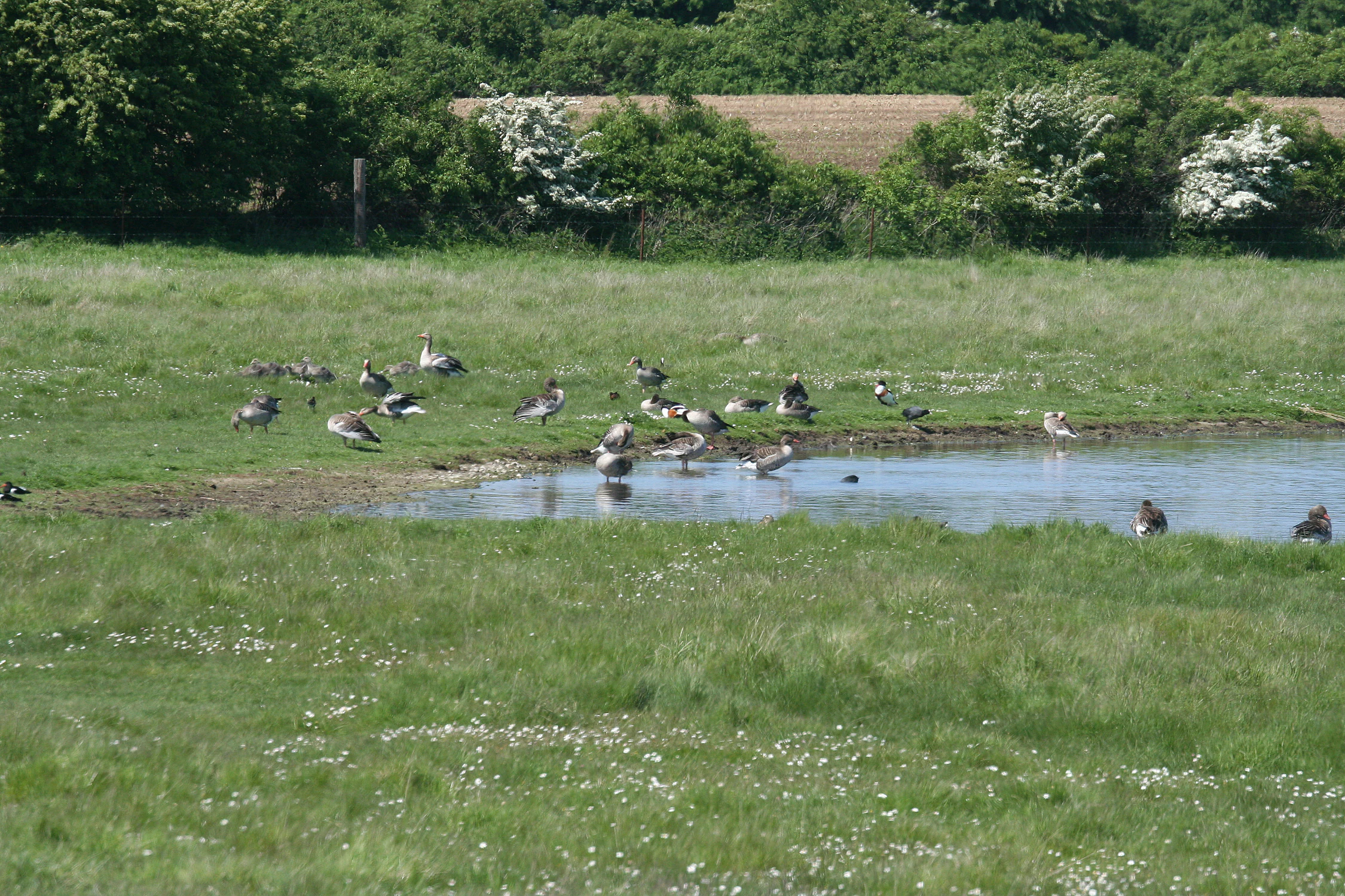
Meadows near Borreby Manor
Meadows located near Borreby Manor

Stigsnæs-Borreby-Basnæs Nor history and protected-area timeline

The protected landscape at Stigsnæs-Borreby-Basnæs Nor was established in two separate phases of Danish nature protection. In 1978, the initial designation brought three distinct areas under landscape protection: the tip of the Stigsnæs peninsula, a zone around the Magleby parish area, and a third area covering Østerhoved and Sevedø. At this stage, the protected landscape existed as three disconnected pieces, leaving significant ecological gaps between them.

In 1987, an additional roughly 323 hectares were placed under protection. This second designation closed the gaps between the earlier zones and allowed the landscape protection to form a single, continuous area. The result was a unified protected landscape that combined the natural coastlines of Stigsnæs, Østerhoved, and Sevedø with the Borreby estate lands and Magleby area, creating one of the more substantial landscape fredninger in southern Zealand.

Within this broader history, cultural layers remain visible in the modern landscape. The Stigsnæs coastal battery, constructed during the wars against England in the early nineteenth century, was restored and reopened as a publicly accessible site in 2019, marking a renewed effort to make the area's military and cultural heritage available alongside its natural features. The Borreby estate continues to shape much of the surrounding farmland, preserving a long continuity of human land use across the protected area.

Stigsnæs-Borreby-Basnæs Nor landscape and geographic character

The landscape of Stigsnæs-Borreby-Basnæs Nor spans the southwestern tip of the Zealand fjord coast, centered on the Stigsnæs peninsula and its broad agricultural hinterland. Most of the open land is occupied by fields belonging to Borreby Manor, creating large, rolling agricultural vistas that sweep toward the coast. The edge of this cultivated zone is where the landscape becomes more natural, with the open farmland transitioning into wetland, reed bed, and coastal meadow formations.

Along the northern side of the peninsula, the Borreby Mose marsh sits between the fields and Skælskør Inderfjord. This marsh is an enclosed arm of the fjord itself, separated by a human-built levee and shaped by centuries of land management. The result is a landscape where wet meadows and reed beds lie directly next to dry, agriculturally intense fields.

The eastern side of the protected area presents a sharper contrast. Toward Basnæs Nor, the shallow waters and reed swamp edge are mostly natural, with only isolated areas that have been reclaimed by diking. The outer tip of Stigsnæs itself is dominated by industrial use, including a ferry harbor and a large power station, which stands out visually from the surrounding agricultural and natural landscape. Just inland from the harbor, Stigsnæs Forest contains the restored Stigsnæs Kystbatteri, blending coastal woodland scenery with early-nineteenth-century military heritage.

Stigsnæs-Borreby-Basnæs Nor ecosystems, habitats, and plant life

The habitats of Stigsnæs-Borreby-Basnæs Nor fall into several distinct types that together create a rich coastal and wetland mosaic. Coastal meadows along Stigsnæs, Østerhoved, and Sevedø support characteristic salt-influenced plant communities, while the sheltered waters of Skælskør Inderfjord and Basnæs Nor host extensive reed beds and shallow brackish water zones.

Borreby Mose is the most distinctive enclosed habitat in the protected area. Cut off from the open fjord by a levee, it functions as an inland wetland complex of wet meadows and reed swamp. This marsh is biologically valuable because it offers calm, shallow conditions that do not exist elsewhere nearby, supporting waterfowl and wading birds outside the heavily trafficked main fjord.

The cultural-adjacent habitats around Borreby Manor add another layer to the area's ecology. Old estate grounds near the manor host a set of plants tied historically to human cultivation, including species such as gemserod and pomeranshøgeurt. While the broader area's plant life is described in the source material as relatively under-studied, the coastal meadows have historically been known for specialized strandplanter including asparagus, strandbede, and dansk kokleare, with rarer finds once including tangurt.

Stigsnæs-Borreby-Basnæs Nor wildlife and species highlights

The wildlife character of Stigsnæs-Borreby-Basnæs Nor is defined primarily by birds, and the area holds significance for both breeding and migratory species. Stigsnæs is widely recognized as one of the most important places in Denmark to observe autumn raptor migration. Because the peninsula is the last piece of high ground before birds must cross open water on their southwestern route, it acts as a natural funnel that compresses migrating flocks into a narrow corridor. Common buzzards and honey buzzards pass through in their thousands each autumn, joined by ospreys, sparrowhawks, and hen harriers in significant numbers. The raptor passage is supported by enormous movements of wood pigeons, with several hundred thousand passing the area, as well as dense flocks of smaller migrants such as chaffinches and bramblings.

Borreby Mose is the other major wildlife feature in the protected area. As an enclosed arm of the fjord, it provides unusually close viewing conditions for waterfowl and waders, and is highlighted in the source material as the place on Zealand offering the closest observation of these species. Ducks such as wigeon and teal are regularly recorded, and the marsh also supports large flocks of grey lag geese and important gatherings of lapwings and golden plovers.

The most distinctive breeding record in the area belongs to the black-tailed godwit, whose only known Zealand breeding locality is in this protected landscape. The mix of shallow water, coastal meadow, enclosed marsh, and open reed bed supports a varied bird community through much of the year, making the site important as both a breeding habitat for waders and a staging area for migratory waterbirds.

Stigsnæs-Borreby-Basnæs Nor conservation status and protection priorities

Stigsnæs-Borreby-Basnæs Nor sits within a wider sequence of conservation designations that reflect its ecological significance. The protected area is part of Natura 2000 site number 162, a network designation that recognizes its importance within the European framework of protected habitats and species. A substantial portion of the wetland area also carries Ramsar status, placing it within the international convention on wetlands of international importance, especially as waterfowl habitat.

In Danish terms, the area is protected as a landscape fredning, a national-level conservation designation focused on preserving the combined landscape, cultural, and natural values of a given area. This dual landscape protection status, combined with the Natura 2000 and Ramsar recognition, demonstrates that the area is valued on three layers: its broad scenery, its specific habitat and species value, and its function within international conservation networks.

The conservation value of the area is shaped strongly by its combination of ecological habitats. The shallow fjord waters and reed-swamp complex at Basnæs Nor, the enclosed Borreby Mose, and the open coastal meadows together create an unusually varied environment for waterbirds and raptors. The presence of an internationally important raptor migration bottleneck at Stigsnæs gives the site a conservation weight that extends well beyond local habitat protection, while the breeding presence of black-tailed godwit adds a rare species dimension that reinforces the area's ecological importance on the Zealand coast.

Stigsnæs-Borreby-Basnæs Nor cultural meaning and human context

The cultural identity of Stigsnæs-Borreby-Basnæs Nor is closely tied to the Borreby estate, which dominates much of the landscape and continues to shape its agricultural character. Around the manor, plant communities reflect long-term human cultivation, including species tied to estate gardens and old cultural environments. These elements link the protected area directly to Denmark's broader tradition of manor landscapes.

A second cultural feature is the Stigsnæs Kystbatteri, a restored coastal battery built during the early nineteenth-century wars against England. After restoration, the battery reopened as a publicly accessible site in 2019, reconnecting the area with this military and historical heritage and adding a heritage-tourism dimension to the natural landscape.

Top sights and standout views in Stigsnæs-Borreby-Basnæs Nor

The defining highlight of Stigsnæs-Borreby-Basnæs Nor is its role as one of Denmark's premier autumn raptor migration sites, where the geography of the peninsula funnels thousands of birds of prey past the coastline. The enclosed Borreby Mose adds a second major highlight, offering unusually close observation of waterfowl and waders on a confined wetland system dominated by reed beds and wet meadows.

A third highlight is the layered cultural identity of the area, where the Borreby estate landscape, coastal meadow habitats, and the restored Stigsnæs Kystbatteri combine natural and historical values. From the broader ecological perspective, the inclusion of the site in both Natura 2000 and the Ramsar wetland convention underlines its significance well beyond the regional scale, marking it as a coastal wetland of international importance.

Best time to visit Stigsnæs-Borreby-Basnæs Nor

The strongest seasons to experience Stigsnæs-Borreby-Basnæs Nor are spring and autumn, when migratory bird activity reaches its peak. Autumn is particularly notable because the raptor migration at Stigsnæs is described as spectacular, with significant numbers of buzzards and honey buzzards passing over, supported by large movements of pigeons and finches. Spring migration brings a different but equally dynamic bird experience, especially at Borreby Mose, where waders, ducks, and geese concentrate during their northward movement.

Summer offers quieter conditions and is the best time to see the protected area's special breeding character, including the black-tailed godwit at its only known Zealand breeding locality. Winter can be rewarding around the wetlands but tends to be more focused on waterfowl presence than on the broad migratory spectacle that drives much of the area's wildlife appeal.
Monthly climate preview

Long-term monthly temperature and precipitation rhythm for Stigsnæs-Borreby-Basnæs Nor

Stigsnæs-Borreby-Basnæs Nor Climate Normals and Average Temperature Patterns

Stigsnæs-Borreby-Basnæs Nor records measured long-term averages from NASA power data, showing distinct shifts in monthly temperature and daily precipitation totals. Opening the complete climate profile reveals full twelve-month records for analyzing annual weather rhythms.
Annual mean9 °C
1 °C18 °C
Jan
Feb
Mar
Apr
May12°
Jun15°
Jul18°
Aug18°
Sep15°
Oct10°
Nov
Dec
Warmest month
August

18 °C

Coolest month
February

1.2 °C

Wettest month
August

2.3 mm/day

Driest month
April

1.2 mm/day

Park location guide

Geography guide, regional context, and park location map for Stigsnæs-Borreby-Basnæs Nor

Stigsnæs-Borreby-Basnæs Nor park geography, regions, and map view in Denmark

Understand where Stigsnæs-Borreby-Basnæs Nor sits in Denmark through a broader geographic reading of the surrounding landscape, nearby location context, and its mapped position within the national park landscape.

How Stigsnæs-Borreby-Basnæs Nor fits into Denmark

Denmark is a constitutional monarchy and Nordic country in Northern Europe. It is the southernmost of the Scandinavian countries, bordering Germany to the south, Norway to the north, and Sweden to the southwest. The country consists of the Jutland peninsula and an archipelago of islands, with Copenhagen as its capital and largest city. Denmark has a population of over 6 million and is characterized by flat, arable land, sandy coasts, and a temperate climate.

Wider geography shaping Stigsnæs-Borreby-Basnæs Nor in Denmark

Denmark occupies the Jutland peninsula and roughly 406 islands in Northern Europe. It is situated between the North Sea to the west and the Baltic Sea to the east. The country borders Germany to the south and is connected to Sweden via the Øresund Bridge. Denmark is predominantly flat terrain with low elevation, the highest point being Møllehøj at 170.86 meters.

Map view of Stigsnæs-Borreby-Basnæs Nor

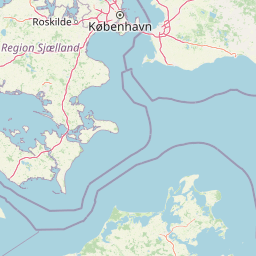
Use this park location map to pinpoint Stigsnæs-Borreby-Basnæs Nor in Denmark, understand its exact geographic position, and read its mapped placement within the surrounding landscape more clearly.

Pigeon | © OpenStreetMap contributors

Location context for Stigsnæs-Borreby-Basnæs Nor

Zealand

Visualizing protected coastal wetlands, marsh habitats, and fjord terrain

Stigsnæs-Borreby-Basnæs Nor Photos and Mapped Landscape Scenery

Visual documentation captures the varied coastal terrain, open wetland habitats, and traditional manor lands shaping the Stigsnæs-Borreby-Basnæs Nor protected area. Photographic records provide clear visual context for evaluating local topography, shoreline ecosystems, and regional migratory bird habitats.

Meadows near Borreby Manor

Park atlas

Compare adjacent fjord systems and surrounding coastal wetland habitats.

Parks Near Stigsnæs-Borreby-Basnæs Nor and Regional Protected Landscapes

Browse other parks near Stigsnæs-Borreby-Basnæs Nor to examine similar coastal meadows, reed beds, and migrating bird routes. Expanding the geographic comparison reveals broader protected terrain across the southern Zealand region.
Nature reserveNaestved Municipality
About 29 km away#1 closest

East

Dybsø Nature Reserve: Protected Coastal Landscape in Naestved Municipality

Geographic atlas of a protected Danish barrier island

Dybsø is a distinct barrier island situated off the coast of Zealand. Its protected landscape consists of open grasslands, coastal reed beds, and freshwater ponds that shelter the shallow waters of the fjord system. As a designated nature reserve, the area represents a critical wildlife refuge, maintained through traditional grazing to preserve its unique maritime terrain and geological history.

Area
1.34 km²
Established
1978
Relief
Lowland
Climate
Temperate
Wildlife reserveDenmark
About 30 km away#2 closest

East

Dybsø Fjord Wildlife Reserve: Coastal Geography and Protected Wetland Map in Denmark

A shallow fjord system on the southwestern coast of Zealand

Dybsø Fjord represents a primary protected landscape in Denmark, featuring a broad and exceptionally shallow lagoon environment. By tracing its boundaries and surrounding peninsulas, users can analyze a critical wetland habitat that supports international bird protection networks and reflects the unique coastal scenery of the Baltic region.

Area
17 km²
Established
1940
Relief
Lowland
Scope
Mixed
Nature reserveKalundborg Municipality
About 35 km away#3 closest

North

Flasken Nature Reserve: Mapped Protected Landscapes in Kalundborg Municipality

Coastal river mouths and brackish lagoon ecology

Flasken stands as a significant protected nature reserve in western Denmark, defined by the confluence of the Halleby Å river and the Storebælt. This mapped landscape provides essential context for understanding the long-term coastal geomorphology of the Reersø tombolo and the wider wetland ecosystems of the Åmosen basin.

Established
1979
Relief
Lowland
Climate
Temperate
Access
Access unknown
Nature reserveFaxe Municipality
About 49 km away#4 closest

East

Bagholt Mose: Protected Peatland Mosaic and Fen Geography in Faxe Municipality, Denmark

A high-value Natura 2000 protected wetland and bog habitat.

Bagholt Mose is a significant nature reserve situated within the Munkeskov forest of southern Zealand. The landscape features a distinct combination of historical peat cuttings and raised bog remnants, which together form a rare mosaic of nutrient-poor and calcareous fen communities that support an exceptional diversity of lowland bog flora.

Area
0.17 km²
Established
1985
Relief
Lowland
Scope
Terrestrial
Nature reserveKalundborg Municipality
About 51 km away#5 closest

North

Saltbæk Vig Nature Reserve: Geography and Protected Wetland Landscapes in Kalundborg Municipality

A brackish lagoon basin shaped by historic land reclamation efforts.

Saltbæk Vig is a major coastal water body on the northwestern edge of Zealand, Denmark, defined by shallow waters and low-lying wetland terrain. This nature reserve serves as an important regional landmark, where historic drainage embankments now form unique boundaries that define the lagoon's ecological character and protected status.

Area
26 km²
Established
1992
Relief
Lowland
Climate
Temperate
Protected landscapeLolland
About 54 km away#6 closest

South

Naturpark Maribosøerne Protected Landscape and Glacial Geography in Denmark

Glacial lake ecosystems on the island of Lolland

The landscape of Naturpark Maribosøerne centers on four interconnected glacial lakes, characterized by twisting shorelines and shallow, nutrient-rich water. This protected area on Lolland blends ancient ice age terrain with historic manor estates, extensive wetlands, and managed forest zones. Its formal status as a Natura 2000 habitat and bird protection zone highlights the ecological importance of this unique southern Danish environment.

Area
11.4 km²
Established
1957
Water
Major water bodies
Nature reserveKalundborg Kommune
About 62 km away#7 closest

North

Nekselø Nature Reserve: An Atlas Entry for the Unique Steppe-Climate Island in Denmark

Coastal geography and protected wetland terrain in Kalundborg Kommune

Nekselø represents a distinctive protected area in Denmark, where a unique microclimate creates favorable conditions for diverse, warmth-loving flora and fauna. As a managed nature reserve in Kalundborg Kommune, it offers a compelling study in island geography and small-scale, community-led conservation efforts within the international Ramsar and Natura 2000 protected frameworks.

Area
2.2 km²
Established
1951
Relief
Lowland
Scope
Mixed
Nature reserveSolrød Kommune
About 67 km away#8 closest

Northeast

Staunings Ø Nature Reserve: Exploring the Coastal Geomorphology of Solrød Kommune

A mapped barrier spit and wetland habitat on the eastern Zealand shoreline.

Staunings Ø functions as a textbook example of a coastal sand bar accretion in the shallow waters of Køge Bugt. This nature reserve protects a vital sequence of dunes, lagoons, and reedbeds that provide a clear view of coastal succession. Located near the urban edge of Solrød Kommune, it serves as a key site for understanding the interaction between natural coastal landforms and maritime environments in eastern Denmark.

Area
0.6 km²
Established
1999
Relief
Lowland
Climate
Temperate

Common questions about visiting, size, designation, and location context for Stigsnæs-Borreby-Basnæs Nor

Stigsnæs-Borreby-Basnæs Nor FAQs for park facts, access, geography, and protected area context

Find quick answers about Stigsnæs-Borreby-Basnæs Nor, including protected-area facts, park geography, trail and visitor context, and how the park fits into its surrounding country and regional landscape.
MoriAtlas Explorer

Continue Your Protected Areas Search Across the Global Atlas

Deepen your exploration by continuing the structured search for national parks and protected areas worldwide. Utilize the comprehensive filtering capabilities to compare different conservation landscapes and refine your understanding of global park geography. Discover more about the distribution and characteristics of protected natural areas.

Global natural geography