


Mori Atlas logo
Protected landscapeSulejowski Park Krajobrazowy

Tracing the riverine geography, reservoir margins, and forest mosaics of the Pilica corridor

Sulejowski Park Krajobrazowy: A Mapped Protected Landscape in the Central Polish Lowlands

Sulejowski Park Krajobrazowy serves as a vital protected landscape within the Lodzkie Voivodeship, anchored by the meandering Pilica river and the expansive waters of the Sulejów Reservoir. This geography spans a diverse terrain of forested valley slopes, sandy terraces, and rare peat-forming meadows that sustain a complex network of lowland habitats. As part of the wider Nadpiliczne group of protected areas, the territory offers a structured view of central Poland's lowland river systems and dense nature reserve clusters.

landscape parklowland river valleyPilica riverreservoir landscapemixed lowland forestpeat meadows
A graphic illustration of a lush river valley with tall birch trees in the foreground, a winding river, and a waterfall cascading from a cliff in the distance under a pale sky.

Sulejowski Park Krajobrazowy

Protected landscape

Park overview

Structured park overview, official facts, and landscape profile for Sulejów Landscape Park

Sulejów Landscape Park park facts, protected area profile, and essential visitor context

Review the core facts for Sulejów Landscape Park, including designation, size, terrain, visitor scale, habitats, and operating context in one park-focused overview.

About Sulejów Landscape Park

Sulejów Landscape Park occupies a long, narrow belt of the central Pilica valley in the Łódzkie Voivodeship, between the southern edge of Skotniki and Łęg Ręczyński and the northern reaches around Smardzewice and Swolszewice Małe near Tomaszów Mazowiecki. On the Równina Piotrkowska plateau to the west, the park's territory extends toward the outskirts of Piotrków Trybunalski, giving the protected area both a deeply incised riverine section and a broader, flatter upland component.

Established in July 1994 through a regulation of the then Piotrków governor and entered into force in October of the same year, the park was created to safeguard one of the most ecologically valuable sections of the Pilica, a river that remains one of the cleanest larger lowland rivers in Poland. The development of the Sulejów Reservoir on the Pilica in the 1970s already transformed the local landscape, and the park's later designation integrated this artificial lake into a formal protection framework, recognizing both the reservoir itself and the surrounding natural systems as a unified landscape worth preserving.

In administrative terms, the park covers land in the communes of Ręczno, Aleksandrów, Tomaszów Mazowiecki, Sulejów, Wolbórz, and Mniszków, as well as parts of the city of Piotrków Trybunalski. Its buffer zone extends further into neighboring communes, including Łęki Szlacheckie, Rozprza, Przedbórz, and Sławno, providing a wider transition area between the intensively protected core and the surrounding agricultural landscape.

The park is part of the Nadpiliczne Landscape Parks, a coordinated group that also includes the Przedbórz Landscape Park and the Spała Landscape Park. Together, these three protected landscapes form a continuous protection corridor along the Pilica, linking fragmented forest patches, river habitats, and reserves into a larger regional conservation network. Within this group, Sulejowski Park Krajobrazowy is notable for being the one most strongly defined by the presence of a major reservoir.

Quick facts and research context for Sulejów Landscape Park

Sulejów Landscape Park lies in the Łódzkie Voivodeship in central Poland and spans roughly 17,026 hectares, with an additional buffer zone covering about 36,411 hectares. The park was created by regulation of the Piotrków governor in July 1994 and originally covered 16,707 hectares.

Its territory stretches across several rural communes and the urban area of Piotrków Trybunalski, and includes parts of the Równina Piotrkowska plateau. Forests cover nearly 70 percent of the park's area, meadows and pastures around 5 percent, and surface waters about 12 percent, dominated by the Sulejów Reservoir. The park belongs to the Nadpiliczne Landscape Parks group and is traversed by the Pilica River Recreational Trail.

Protection and recognition

Explore documented terrestrial conservation status and management scope details.

Sulejowski Park Krajobrazowy Protection Status and Designated Area Facts

Sulejowski Park Krajobrazowy maintains a structured terrestrial protection status within regional conservation frameworks. Formal records compile designated management scope and available recognition data for territorial analysis.

Protection details

Protection scope
Terrestrial
Transboundary protection
No
Buffer area
364.11 km²
Park context

Deeper park guide and search-rich context for Sulejów Landscape Park

Sulejów Landscape Park history, landscape, wildlife, and travel context

Explore Sulejów Landscape Park through its history, landscape character, ecosystems, wildlife, conservation priorities, cultural context, and seasonal travel timing in a structured park guide built for atlas discovery and search intent.

Why Sulejów Landscape Park stands out

Sulejów Landscape Park is best known for its position along the central Pilica valley, where a meandering river, a large twentieth-century reservoir, and forested valley slopes come together within a single protected landscape. The combination of lowland pine and mixed forest with extensive river and reservoir habitats gives the park a layered scenic character typical of central Poland's Pilica corridor. It is also recognized for the density of small nature reserves around it, including the famous Niebieskie Źródła (Blue Springs) reserve near Tomaszów Mazowiecki, which highlight the unusual hydrology of the wider Pilica region. As one of the three Nadpiliczne Landscape Parks, it forms a key element of a coordinated protection system for one of Poland's most characteristic lowland river valleys.
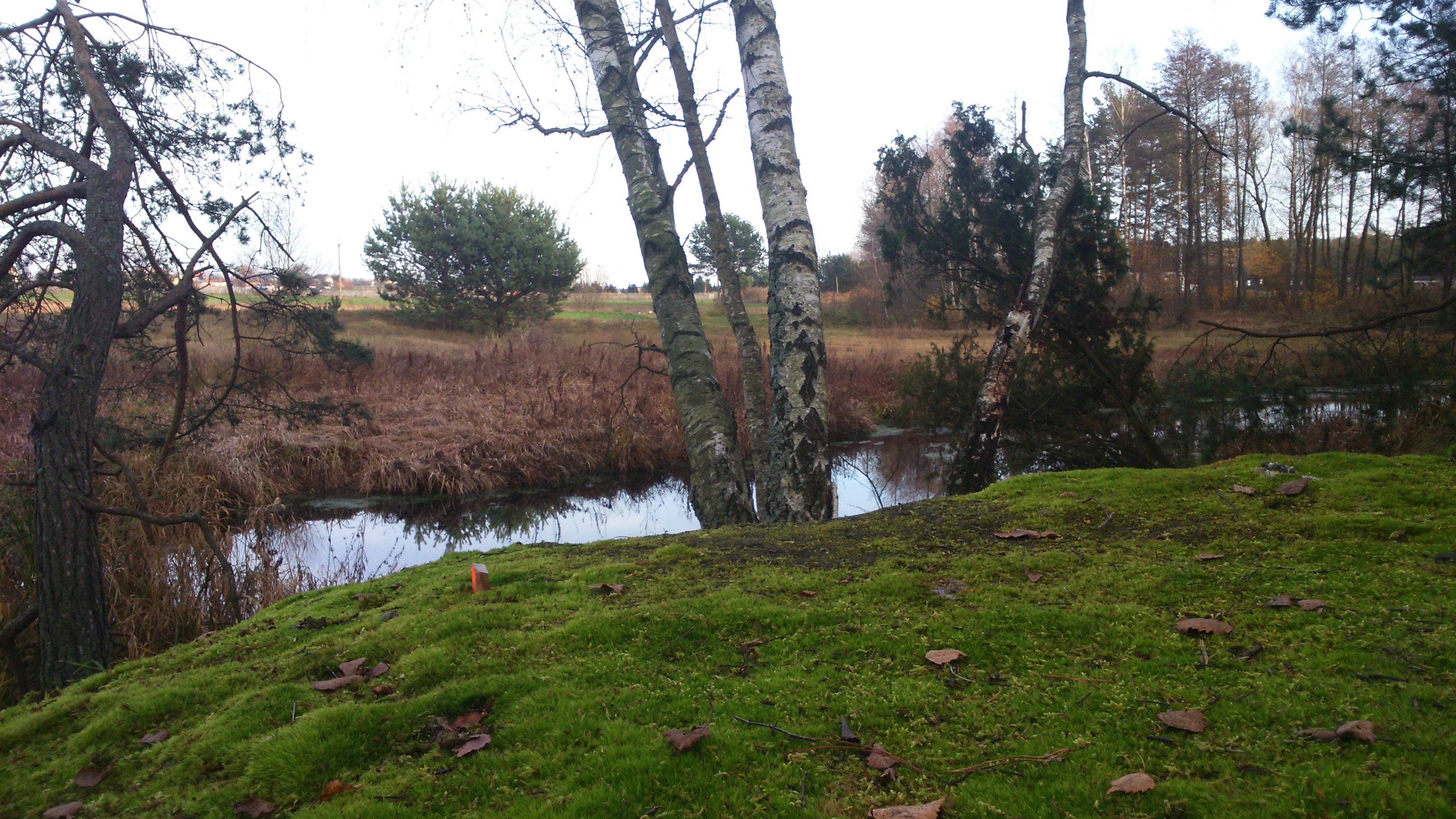
A small, quiet stream winds through a green, moss-covered bank with birch and pine trees in the foreground and a field in the distance.
A tranquil stream flowing through the forested landscape near Karolinów, part of the Sulejowski Landscape Park.

Sulejów Landscape Park history and protected-area timeline

The legal foundation of Sulejów Landscape Park was the Regulation No. 3/94 of the Piotrków governor, issued on July 21, 1994 and published in the official journal of the Piotrków governorate on August 5, 1994. At the time of its establishment, the park covered 16,707 hectares, a figure that was later adjusted to the current area of about 17,026 hectares through subsequent administrative and boundary refinements.

The park entered formal existence in October 1994, completing a process that reflected the growing recognition of the central Pilica valley as an area worthy of landscape-scale protection. Its establishment followed on the creation, two decades earlier, of the Sulejów Reservoir, which fundamentally reshaped the hydrology and scenery of the section of the Pilica that would eventually become the park's core.

Over time, the park became integrated into the broader Nadpiliczne Landscape Parks framework, joining the Przedbórz and Spała landscape parks to form an interconnected protection system along the Pilica.

Sulejów Landscape Park landscape and geographic character

The landscape of Sulejów Landscape Park is shaped primarily by the Pilica river valley, which cuts a broad, gently meandering course through the surrounding lowlands. Within the park's boundaries, this valley hosts the Sulejów Reservoir, a large artificial lake created on the Pilica in the 1970s, whose calm water surface contrasts with the natural river stretches both upstream and downstream of the dam.

Beyond the river axis, the park extends onto parts of the Równina Piotrkowska, a flat to gently undulating plateau that gives the protected area a second, distinctly different landscape character. This combination of deeply set valley with forested slopes, river flats, reservoir margins, and open plateau makes the park geographically more varied than its relatively narrow overall shape might suggest.

The valley character is also reflected in niche geological and soil features. Locally, the terrain supports limestone grasslands on outcrop patches, while flatter depressions accumulate sandy-peat substrates that have given rise to distinctive meadow and peatland habitats along the river corridor.

Sulejów Landscape Park ecosystems, habitats, and plant life

Ecologically, Sulejów Landscape Park is dominated by forest, with woodlands covering close to 70 percent of its area. These forests include both coniferous stands typical of the central Polish lowlands and richer mixed stands of fir, spruce, beech, and broadleaf species such as maple and sycamore. The diversity of forest types reflects the transition between the dry sandy soils of the plateau section and the more moisture-retaining substrates of the valley.

Open habitats make up a smaller but ecologically important share of the park. Meadows and pastures cover roughly 5 percent of the area, often concentrated on the wetter valley flats, while surface waters, dominated by the Sulejów Reservoir, account for around 12 percent. Together, these open and semi-open habitats support distinctive plant communities, including limestone grasslands on suitable outcrops and sandy-peat meadows shaped by the valley hydrology.

The mosaic of forest patches, river corridors, reservoir margins, meadows, and peat-influenced flats creates a clearly layered habitat structure characteristic of the central Pilica valley. This habitat diversity has made the area a focal point for small-scale nature conservation, with numerous reserves embedded within both the park and its wider buffer zone.

Sulejów Landscape Park wildlife and species highlights

While the park's native wildlife profile is integrated into its broader habitat mosaic rather than emphasized as a primary focus of the source material, the combination of large areas of lowland and riverside forest with extensive open water in the Sulejów Reservoir provides a wide range of ecological niches. The river, reservoir, and surrounding wetlands support fish and waterbird communities typical of central Polish lowland river systems, while the mature mixed and coniferous forests sustain typical forest fauna, including deer and smaller woodland mammals.

The mosaic of meadows, peat-influenced flats, and edge habitats between water and forest adds further structural variety, supporting a range of birdlife and insect communities associated with lowland river valleys. The proximity of well-known reserves such as Niebieskie Źródła, located just outside the park in the buffer area, suggests that the wider Sulejów landscape supports species communities of significant regional interest, particularly in habitats tied to clean groundwater and stable riverine conditions.

Sulejów Landscape Park conservation status and protection priorities

Sulejów Landscape Park plays a central role in the conservation of the middle section of the Pilica, one of Poland's most ecologically significant lowland rivers. By combining forests, river corridors, and a major reservoir within a single protected landscape, the park safeguards a complex mosaic of habitats that could not be effectively preserved through isolated site protection alone.

A key feature of the park's conservation structure is its embedded network of nature reserves. Within the park itself, seven nature reserves protect particularly valuable fragments of forest and habitat: Błogie, Gaik, Jaksonek, Las Jabłoniowy, Lubiaszów, Meszcze, and Twarda. The surrounding buffer zone adds four further reserves, including the celebrated Niebieskie Źródła reserve near Tomaszów Mazowiecki, as well as Czarny Ług, Jawora, and Wielkopole. This layered approach, in which a broad landscape park contains and surrounds a network of strict reserves, allows for both large-scale landscape integrity and targeted protection of the most sensitive features.

The park also contributes to a larger regional conservation system through its membership in the Nadpiliczne Landscape Parks, a coordinated group of three protected landscapes along the Pilica that includes the Przedbórz and Spała landscape parks. Through this network, Sulejowski Park Krajobrazowy helps maintain ecological continuity along a major Polish river valley and supports the long-term protection of habitats, hydrological processes, and forest communities across a much wider area than its own boundaries.

Sulejów Landscape Park cultural meaning and human context

The Sulejów area carries a layered human history that has shaped both the landscape and the way it is now protected. The name of the park itself, and of the town of Sulejów, is tied to the historical presence of the Cistercian monastery at Sulejów, founded in the twelfth century and long a center of regional religious, economic, and cultural life. The Pilica valley around the town has been a corridor of settlement, agriculture, and forestry for centuries, leaving a pattern of villages, fields, meadows, and managed woodlands that still frames the park today.

The construction of the Sulejów Reservoir in the 1970s added a more recent layer of cultural and engineering history, transforming the local economy and the relationship between the river and surrounding communities. Today, the park's territory intersects with numerous rural communes and stretches to the edge of Piotrków Trybunalski, one of central Poland's historic cities, reinforcing the park's role as a protected landscape within a long-settled and culturally rich region.

Top sights and standout views in Sulejów Landscape Park

Sulejów Landscape Park stands out for the way it integrates a major artificial reservoir, a natural lowland river, and extensive forests into a single protected landscape along the Pilica. Its dominance of forestland, combined with a substantial open water surface and a network of eleven nature reserves, makes it one of the most habitat-diverse protected areas in the Łódzkie Voivodeship.

Equally significant is the park's role as one of the three Nadpiliczne Landscape Parks, giving it a place within a larger regional strategy for protecting the Pilica valley. The combination of reservoir-based recreation, valley hiking routes, and dense reserve coverage makes the park both a practical outdoor destination and a meaningful conservation landscape in central Poland.

Best time to visit Sulejów Landscape Park

The park's character changes meaningfully across the seasons, and the most rewarding periods to experience it are typically late spring and early autumn. In late spring, rising temperatures and longer days revive the forests, meadows, and reservoir margins, reviving bird activity along the Pilica, the open water of the Sulejów Reservoir, and the buffer zone's wet flats. The interplay of fresh greenery with the broad reservoir surface gives the landscape a particularly vivid appearance at this time of year.

Early autumn brings cooler weather, softer light, and the start of color change in the mixed forests, especially in beech and maple stands. These conditions make the dense woodland sections of the park especially appealing on foot, including along trails such as the Pilica River Recreational Trail, while the reservoir and river edges remain quieter and more reflective. Midsummer visits are possible but tend to favor reservoir-side recreation, while winter highlights the structural contrast between the bare deciduous stands and the open waters of the Pilica corridor.

Monthly climate preview

Long-term temperature ranges and monthly precipitation distribution for Sulejowski Park Krajobrazowy

Sulejowski Park Krajobrazowy Climate Normals and Annual Weather Patterns

Representative coordinates record annual temperature extremes spanning from negative winter averages to warm summer maximums alongside measured monthly precipitation rates. Detailed twelve-month climate normals provide complete statistical context for analyzing long-term meteorological patterns across the protected landscape.
Annual mean8 °C
-3 °C20 °C
Jan-3°
Feb-2°
Mar
Apr
May14°
Jun18°
Jul20°
Aug20°
Sep14°
Oct
Nov
Dec-2°
Warmest month
July

20.2 °C

Coolest month
January

-3.4 °C

Wettest month
July

2.7 mm/day

Driest month
January

1.3 mm/day

Park location guide

Geography guide, regional context, and park location map for Sulejów Landscape Park

Sulejów Landscape Park park geography, regions, and map view in Poland

Understand where Sulejów Landscape Park sits in Poland through a broader geographic reading of the surrounding landscape, nearby location context, and its mapped position within the national park landscape.

How Sulejów Landscape Park fits into Poland

Poland, officially the Republic of Poland, is a Central European country spanning from the Baltic Sea in the north to the Carpathian Mountains in the south. It borders Germany, Czech Republic, Slovakia, Ukraine, Belarus, Lithuania, and Kaliningrad Oblast. The country has a temperate climate, diverse landscapes, and is known for its rich history, cultural heritage, and strong economic position within the EU.

Wider geography shaping Sulejów Landscape Park in Poland

Poland occupies 312,696 km2 in Central Europe, extending from the Baltic Sea coast in the north to the Sudetes and Carpathian Mountains in the south. It borders Germany to the west, Czech Republic and Slovakia to the south, Ukraine and Belarus to the east, and Lithuania and Kaliningrad Oblast to the northeast. The landscape includes lowland plains, uplands, and mountain ranges.

Map view of Sulejów Landscape Park

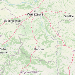
Use this park location map to pinpoint Sulejów Landscape Park in Poland, understand its exact geographic position, and read its mapped placement within the surrounding landscape more clearly.

Pigeon | © OpenStreetMap contributors

Location context for Sulejów Landscape Park

Lodzkie Voivodeship
Recorded earthquake history

Examine Historical Earthquake Records for Sulejowski Park Krajobrazowy

Explore the documented history of seismic events associated with the Sulejowski Park Krajobrazowy geography. This MoriAtlas collection offers a clear, data-driven look at recorded earthquakes near the Pilica river valley, providing event magnitudes and proximity to the protected landscape boundaries for thorough geographical review.

Sulejowski Park Krajobrazowy Earthquake Records

Catalogued events

30 events

Strongest magnitude

Magnitude 4.8

Most recent event

May 30, 2005

This history includes earthquakes recorded inside the park or within 50 km of its borders

Visual exploration of Pilica river valley landscapes, forests, and habitats

Sulejowski Park Krajobrazowy Photos and Protected Area Scenery

Visual documentation captures the forested valley slopes, meandering river stretches, and extensive reservoir waters that define Sulejowski Park Krajobrazowy. Detailed photography reveals local terrain variations, mixed woodland stands, and protected wetland habitats across the central Polish lowlands.

A small, quiet stream winds through a green, moss-covered bank with birch and pine trees in the foreground and a field in the distance.

Park atlas

Compare regional river corridors, neighboring protected landscapes, and connected lowland habitats

Other Parks and Protected Areas Near Sulejowski Park Krajobrazowy

Browsing other parks near Sulejowski Park Krajobrazowy reveals broader conservation corridors along the central Polish lowlands. Extending geographic comparisons across adjacent protected areas provides essential context on regional river valleys and forested reserves.
Nature reserveLodzkie Voivodeship
Mapped location lies within the park boundary#1 closest

Northwest

Rezerwat przyrody Meszcze Nature Reserve: Mapped Protected Landscape and Forest Ecology

Protected fresh mixed forest within the Sulejów Landscape Park context

Rezerwat przyrody Meszcze represents a compact, protected forest block in central Poland. Known for its historical small-leaved lime regeneration, this reserve provides a key case study for forest structure and lowland biodiversity within the Lodzkie Voivodeship, serving as an important part of the Sulejów Landscape Park's protected corridor.

Area
0.353 km²
Established
1959
Relief
Lowland
Scope
Terrestrial
Nature reserveŁódź Voivodeship
About 1.4 km away#2 closest

Northwest

Rezerwat przyrody Dęby w Meszczach: Protected Oak Forest and Regional Geography

Nature reserve in the Równina Piotrkowska of central Poland.

Located in Łódź Voivodeship, this nature reserve is defined by its ancient pedunculate oaks, some over 250 years old. The site protects a unique blend of oak-hornbeam and mixed coniferous forest communities, serving as an ecologically vital fragment of lowland woodland within an agricultural landscape.

Area
0.392 km²
Established
1989
Relief
Lowland
Climate
Temperate
National parkMasovian Voivodeship
2.6 km away#3 closest

Northeast

Kampinos National Park: Geographic Profile and Protected Forest Landscape Map

Inland dune formations and wetland habitats in Masovian Voivodeship

The expansive woodland of Kampinos National Park represents a critical protected area in Poland, characterized by its parabolic sand dunes and low-lying marshes. Gain insights into the geomorphological features of this UNESCO biosphere reserve and trace the complex hydrological network that defines its unique forest environment.

Area
385.44 km²
Established
1959
IUCN
II
Relief
Lowland
A soft watercolor illustration of a marshy landscape with low rolling hills, scattered trees, and a winding stream, rendered in light green and yellow tones on a white background.
National parkMasovian Voivodeship
2.6 km away#4 closest

North

Kampinoski Park Narodowy: Mapping the Inland Dune and Wetland Landscapes of Central Poland

A vital protected area in Masovian Voivodeship

The landscape of Kampinoski Park Narodowy is defined by the Grochalskie Piachy dune complex and diverse riparian habitats. This atlas entry covers the geological history and protected boundaries of this significant lowland forest, tracing the Vistula river valley's influence on the surrounding terrain and ecological character.

Area
385.443 km²
Established
1959
Visitors
1M annual
Relief
Lowland
Nature reserveLodzkie Voivodeship
About 4.3 km away#5 closest

Southeast

Rezerwat przyrody Diabla Góra: Nature Reserve and Geological Landmark in Lodzkie Voivodeship

Mapped sandstone outcrops in the Opoczno Hills

Located in central Poland, Rezerwat przyrody Diabla Góra protects an unusual elevated woodland site characterized by exposed sandstone formations and distinct regional biodiversity. The reserve stands as a prominent geographic feature within the local landscape, offering insights into the natural history and terrain composition of the Opoczno Hills region.

Area
1.612 km²
Established
1987
Relief
Upland
Climate
Temperate
Nature reserveLodzkie Voivodeship
7.8 km away#6 closest

Northeast

Łąki Ciebłowickie Nature Reserve: A Central Poland Floodplain Landscape Analysis

Protected riparian ecosystems and riverine lowland geography

Łąki Ciebłowickie represents an ecologically rich floodplain environment within the Lodzkie Voivodeship. This nature reserve preserves a sequence of vital lowland habitats ranging from marshy meadows to oak-hornbeam forests. Analyze the mapped boundaries and natural terrain features that define this protected riverine mosaic in the heart of central Europe.

Area
4.772 km²
Relief
Lowland
Climate
Temperate
Access
Access unknown
Nature reserveŁódzkie Voivodeship
12 km away#7 closest

Southwest

Łąka w Bęczkowicach Nature Reserve: Mapping Wetland Habitats in Central Poland

Riparian ecosystems and protected peat meadow geography

Łąka w Bęczkowicach serves as a specialized nature reserve in the Łódzkie Voivodeship. Defined by its peat extraction legacy and subsequent development into a vibrant wetland habitat, the area provides essential shelter for rare orchids and riparian wildlife along the Luciąża River, showcasing the ecological evolution of lowland meadows in central Poland.

Area
1.912 km²
Established
2008
Relief
Lowland
Climate
Temperate
Nature reserveLodzkie Voivodeship
About 16 km away#8 closest

Southeast

Jodły Sieleckie Nature Reserve: Geographic Insights and Protected Area Mapping

Woodland conservation in the Łódź Voivodeship

Analyze the protected boundaries and landscape context of Jodły Sieleckie Nature Reserve, a woodland habitat defined by its natural fir regeneration. This site within the Wzgórza Opoczyńskie mesoregion provides a clear look at how forest ecology and remnants of historical mining activity intersect within the central Polish landscape.

Area
0.327 km²
Established
1998
Relief
Upland
Scope
Terrestrial

Common questions about visiting, size, designation, and location context for Sulejów Landscape Park

Sulejów Landscape Park FAQs for park facts, access, geography, and protected area context

Find quick answers about Sulejów Landscape Park, including protected-area facts, park geography, trail and visitor context, and how the park fits into its surrounding country and regional landscape.
MoriAtlas Explorer

Continue Your Protected Areas Search Across the Global Atlas

Deepen your exploration by continuing the structured search for national parks and protected areas worldwide. Utilize the comprehensive filtering capabilities to compare different conservation landscapes and refine your understanding of global park geography. Discover more about the distribution and characteristics of protected natural areas.

Global natural geography