
Mori Atlas logo
Protected landscapeTararua Forest Park

Mapping the ecological gradients and mountainous terrain of a key North Island forest landscape

Tararua Forest Park: Analyzing the Protected Landscape and Alpine Geography of New Zealand

Tararua Forest Park forms a critical backbone of protected land across the southern North Island of New Zealand. This expansive territory encompasses a vertical range from low-lying podocarp forests through dense beech canopies to exposed alpine tussock tops. The geography is characterized by deep river gorges and sharp ridgelines, anchoring a longstanding tradition of forest conservation and rugged wilderness navigation in the region.

forest parkmountain rangealpinetrampingbackcountry hutspodocarp forest
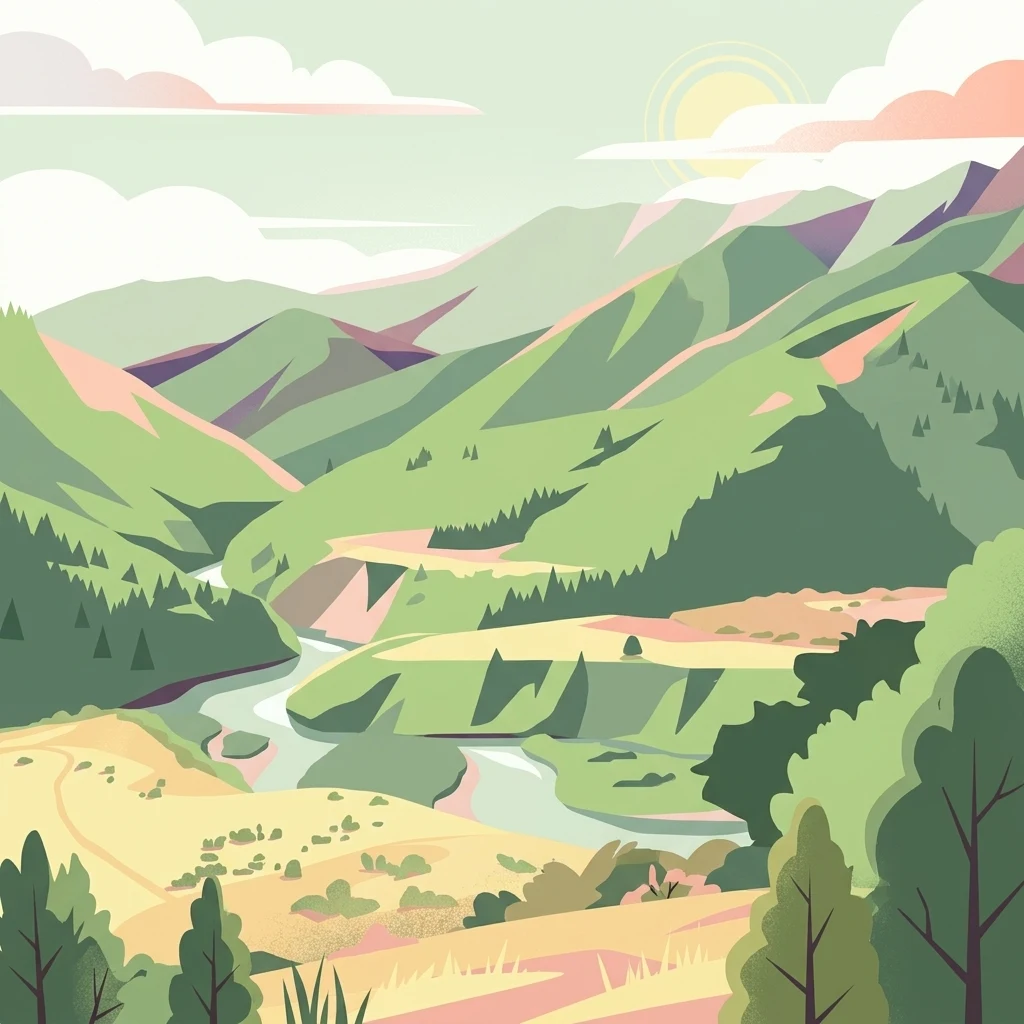
An illustration showing a winding river valley surrounded by green forested mountains, with a sunrise or sunset in the background.

Tararua Forest Park

Protected landscape

Park overview

Structured park overview, official facts, and landscape profile for Tararua Forest Park

Tararua Forest Park park facts, protected area profile, and essential visitor context

Review the core facts for Tararua Forest Park, including designation, size, terrain, visitor scale, habitats, and operating context in one park-focused overview.

About Tararua Forest Park

Tararua Forest Park is one of New Zealand's defining protected natural landscapes, stretching across the southern North Island between the Wairarapa valleys, the Hutt Valley, and the Kāpiti / Horowhenua coast. Covering roughly 1150 square kilometres, the park spans most of the Tararua Range, a rugged chain that forms part of the island's main axial ranges. Mitre Peak, at 1571 meters above sea level, is the highest point; the range also includes other summits above 1500 meters that draw experienced and beginner trampers alike.

The park's significance is rooted both in its ecological character and in its cultural role. Ecologically, it preserves an unusually complete gradient of North Island forest types, from warm temperate lowland podocarp and broadleaf forests along the western and southern river valleys, through mixed forests, into pure red and silver beech forests at mid to high elevation, and finally into alpine tussocklands and herbfields near the summits. Rivers and streams descending both flanks of the range have shaped deep gorges and provide habitat for native fish and aquatic life.

Just as importantly, Tararua Forest Park has become a touchstone of New Zealand outdoor recreation. It contains over 50 official huts and bivouac shelters, forming one of the country's most extensive backcountry hut networks. Tracks range from short introductory walks to demanding multi-day traverses, and the park is frequently compared with Tongariro National Park and the Southern Alps as one of the country's most heavily used tramping grounds. Its role in the birth of New Zealand forest parks, combined with its ongoing tramping culture, gives it both historical and contemporary importance within New Zealand's protected-area system.

Quick facts and research context for Tararua Forest Park

Tararua Forest Park sits in the southern North Island of New Zealand, spanning much of the Tararua Range between the Wairarapa and the Kāpiti Coast / Horowhenua areas. Covering roughly 1150 square kilometres, it is administered by the Department of Conservation and was New Zealand's inaugural forest park, established in 1954.

The terrain includes lowland podocarp and broadleaf forest, mid-elevation beech forest, and exposed alpine tops rising to Mitre Peak at 1571 meters above sea level. The park is the heart of New Zealand's North Island tramping scene and supports extensive hut, track, and campsite infrastructure, alongside ongoing predator control projects targeting rats, stoats, and possums.

Protection and recognition

Examine terrestrial protection details and documented management scope for Tararua Forest Park.

Tararua Forest Park Protection Status and Conservation Recognition Facts

Tararua Forest Park maintains a recorded terrestrial protection status outlining its management scope and conservation boundaries. Official records organize administrative details, territorial attributes, and designation context for geographic reference.

Protection details

Protection scope
Terrestrial
Transboundary protection
No
Park context

Deeper park guide and search-rich context for Tararua Forest Park

Tararua Forest Park history, landscape, wildlife, and travel context

Explore Tararua Forest Park through its history, landscape character, ecosystems, wildlife, conservation priorities, cultural context, and seasonal travel timing in a structured park guide built for atlas discovery and search intent.

Why Tararua Forest Park stands out

Tararua Forest Park is best known for being New Zealand's first forest park and for anchoring the country's North Island tramping culture. Its combination of steep beech-forested ridges, exposed alpine tops, and deep river gorges has shaped generations of New Zealand hiking tradition, from the early work of the Tararua Tramping Club to today's classic multi-day traverses such as the Southern Crossing and the Schormann, Kaitoke. It is also recognised for its ecological gradient, in which warm lowland podocarp forests transition upward into cool beech forest and finally into tussock and herbfield along the main range. The park has become a focal landscape for predator control and native bird restoration through initiatives like Project Kākā, making it a high-profile case study in North Island forest conservation.
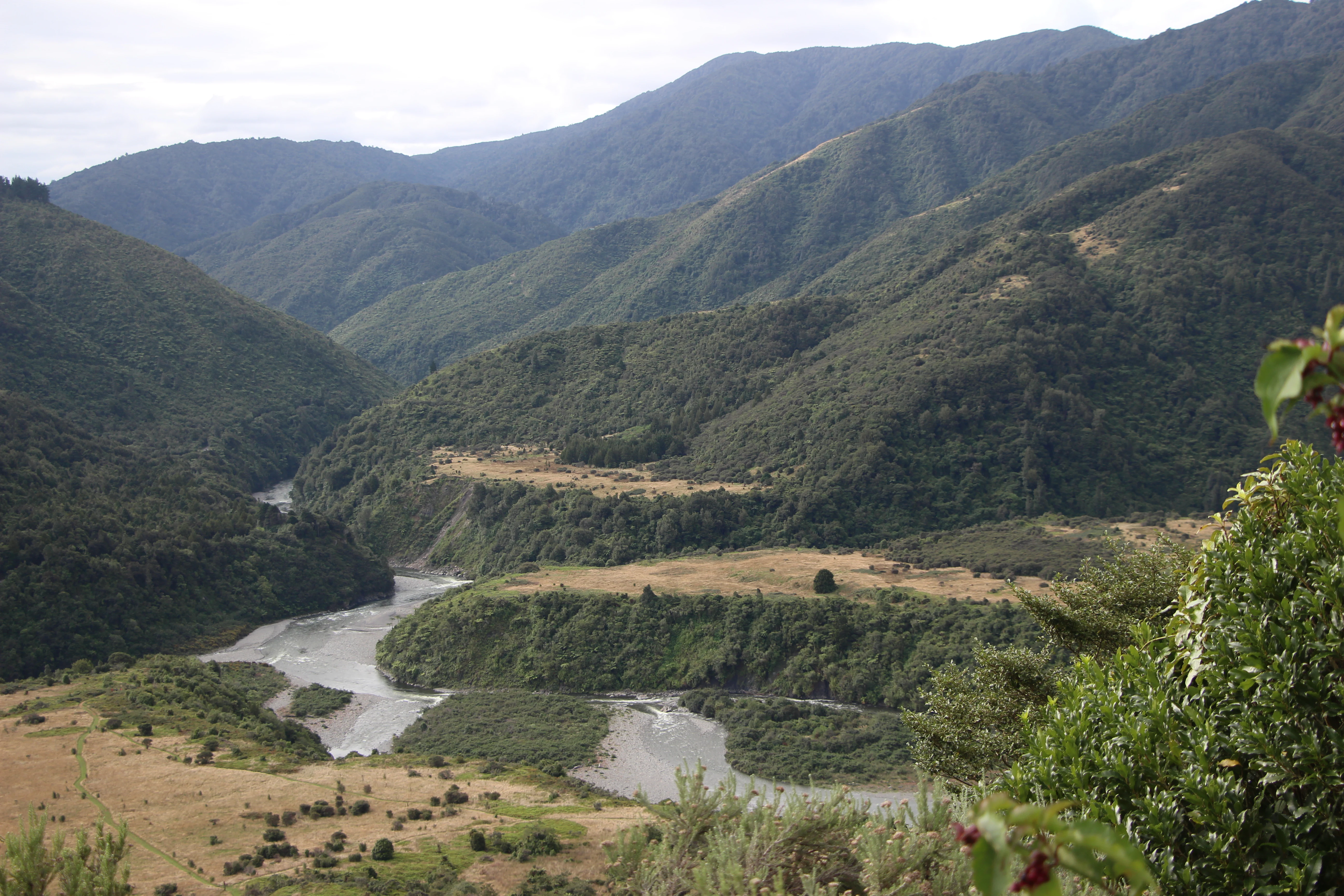
A wide, eye-level landscape shot featuring a winding river cutting through green, forested mountain slopes in New Zealand.
A wide view of the Otaki River flowing through the rugged terrain of the Tararua Forest Park.

Tararua Forest Park history and protected-area timeline

The Tararua Range has had long human significance before becoming a forest park. The mountains formed part of traditional Māori travel routes linking the Wairarapa with the Kāpiti Coast, and the rivers draining the range supplied food resources such as tuna, or freshwater eels. In the late 19th century, European-era settlement brought extensive logging of the lower valleys, extracting heavy timber from forest that had previously seemed inexhaustible. The impact of this clearance helped drive later reappraisal of the range's conservation value, alongside its growing recognition as a recreational landscape for walks and hunts.

In 1954, Tararua Forest Park was formally gazetted as New Zealand's first forest park, combining conservation intent with recreational use during a period when the country was actively shaping its modern protected-area system. The park set the template for subsequent forest parks, which were designed to retain a working, multiple-use character while safeguarding native forests and watersheds.

Over the following decades, the park became the cradle of New Zealand's organised tramping culture. The Tararua Tramping Club, founded in 1919, played a key role in cutting and maintaining tracks and erecting huts; the iconic Field Hut, built in 1924, survives as one of the park's heritage structures. Other regional clubs, including the Wellington Tramping and Mountaineering Club and the Hutt Valley Tramping Club, contributed to an extensive network of routes and shelters that remains a defining feature of the park.

In more recent years, ecological restoration has joined recreation as a central part of the park's story. Project Kākā, launched by the Department of Conservation in 2010, treated a substantial area of the park to suppress rats, stoats, and possums, with the explicit goal of supporting indigenous bird populations such as kākā, kākāriki, and kererū. Monitoring has documented both measurable recovery of native bird numbers and continued vulnerability of those gains to pest reinvasion.

Tararua Forest Park landscape and geographic character

The landscape of Tararua Forest Park is dominated by the spine of the Tararua Range, a steep, deeply dissected chain running roughly southwest to northeast through the southern North Island. From lowland river valleys that begin near sea level on both flanks of the range, the terrain climbs sharply through ridges, spurs, and gullies before breaking into a series of open alpine tops and basins.

The highest point is Mitre Peak at 1571 meters above sea level, with neighbouring summits such as Mount Hector also above 1500 meters. Between these peaks lie tussock-covered tops, exposed rock, and leatherwood shrublands, often swept by strong northwesterly winds. River systems on either side of the range, including the Ōtaki, Waiohine, Waingawa, and Hutt tributaries, have carved deep gorges such as the Waiohine and formed long, winding valleys that shape both the park's scenery and its human approach routes.

This combination of sharp relief, dense forest cover, and sudden exposure to open alpine terrain gives the Tararuas their characteristic structure: a relatively short vertical journey from river-confluence campsites through full coastal broadleaf forest up to cold, windswept summits. The terrain is repeatedly described in tramping literature as serious and demanding, with rapid weather shifts compounding the challenge of steep, broken ground.

Tararua Forest Park ecosystems, habitats, and plant life

Ecologically, Tararua Forest Park is notable for the way it compresses a wide range of North Island forest types into a relatively compact area. On the warmer, western and southern flanks, lowland podocarp-broadleaf forest dominates, with rimu, rātā, kāmahi, and tawa forming the upper canopy over a rich understorey. As elevation rises, these communities grade into mixed broadleaf forests and then into tall stands of red and hard beech, which assume the canopy at higher altitudes before yielding to subalpine scrub.

Along the highest ridge crests, the park holds classic North Island alpine vegetation: extensive tussock grasslands, dense leatherwood stands, and delicate herbfields adapted to wind, frost, and frequent cloud cover. Between these extremes, shaded valleys and stream corridors maintain a wet, mossy character that supports lichens, filmy ferns, and abundant invertebrate life. Rivers and streams that drain the range harbour native fish species including longfin eel and kōaro, both of which are recognised for their ecological and cultural importance.

The result is a finely layered ecological gradient: forest composition, climate, and disturbance regimes shift noticeably over short horizontal distances, making the park an unusually concentrated representation of North Island indigenous ecosystems from the coast to the alpine zone.

Tararua Forest Park wildlife and species highlights

The native birdlife of Tararua Forest Park reflects both the diversity of its habitats and the pressures of introduced predators. In the forested mid and lower elevations, kākā, kererū, tūī, fantail, tomtit, rifleman, and small parakeets such as kākāriki are characteristic residents, while abundant honeydew and nectar sources sustain bellbirds and other forest passerines.

Introduced mammals have shaped the park's wildlife history in important ways. Deer, goats, rats, stoats, and possums have long affected both vegetation and nesting birds, prompting sustained pest control efforts. Project Kākā, active in the park since 2010, demonstrated that intensive control of rats, stoats, and possums can lead to measurable rebounds in bird populations, while also highlighting how quickly pest numbers can recover once suppression ends.

In the rivers and streams of the park, native fish communities include longfin eel and kōaro, both taonga species whose presence underscores the cultural as well as ecological significance of the park's freshwater systems. Together, the birdlife, fish, and predator-control context give the park an enduring profile as a flagship site for North Island forest wildlife restoration.

Tararua Forest Park conservation status and protection priorities

As New Zealand's first forest park, Tararua Forest Park carries special weight in the country's conservation history, having established a model for combining ecological protection with public recreation. Its primary conservation role today centres on safeguarding an unusually complete sequence of native forest types, from lowland podocarp-broadleaf communities up through beech forest and into alpine ecosystems, along with the freshwater systems that link these environments.

Active ecological management, particularly predator control, defines much of the park's current conservation work. Programmes such as Project Kākā have demonstrated that targeted aerial and ground-based control of rats, stoats, and possums over substantial portions of the park can boost native bird populations, while ongoing monitoring highlights the long-term vulnerability of those gains in the absence of sustained effort.

The park also serves as a continuous ecological corridor between protected forest in the wider Wellington, Wairarapa, and Horowhenua landscapes. Its combination of ecological representativeness, accessibility from major population centres, and long history of community engagement through tramping clubs makes it a key reference site for forest conservation policy, restoration science, and biodiversity monitoring in the southern North Island.

Tararua Forest Park cultural meaning and human context

The mountains of Tararua Forest Park hold deep significance in Māori history, having formed long-established travel and resource routes between the Wairarapa and the Kāpiti Coast. Rivers descending from the range supplied key freshwater foods, including tuna (eels), and the forest resources of the valleys were woven into seasonal patterns of use and settlement.

In the 20th century, the park became foundational to New Zealand's tramping culture. The Tararua Tramping Club, established in the early 20th century, helped shape the network of tracks, huts, and sheltered routes in collaboration with regional clubs including the Wellington Tramping and Mountaineering Club and the Hutt Valley Tramping Club. Heritage structures such as Field Hut carry this legacy forward, anchoring the park's identity as the historical heart of New Zealand's backcountry recreation movement.

Top sights and standout views in Tararua Forest Park

Tararua Forest Park stands out for its place at the origin of New Zealand's forest park system and for hosting one of the country's most demanding popular tramping landscapes. The Southern Crossing and the Schormann–Kaitoke traverse are recognised as classic North Island mountain experiences, while the park's combination of road-end campsites, alpine tops, and deep river gorges make it accessible to a wide range of visitors.

Ecologically, the park's compact ecological gradient, from warm podocarp lowlands to beech forest and alpine tussock, is itself a defining highlight. The presence of long-running tramping culture, an extensive hut network, and active predator-control initiatives gives the park an unusually layered identity at the intersection of recreation, restoration, and long-term forest protection.

Best time to visit Tararua Forest Park

The Tararua Range is known for volatile weather, and conditions play a significant role in shaping any visit. Summer and early autumn generally offer the most settled conditions for tramping, when days are longer and the higher alpine tops and ridgelines are comparatively more stable. Colder months can bring snow, ice, and short daylight hours to elevations above roughly 1200 meters, increasing both the difficulty and the seriousness of backcountry travel.

Year-round, the park sees heavy rainfall, frequent cloud, and strong northwest gales on exposed tops, so even in the more favourable months, visitors should plan for rapidly changing conditions. For those primarily interested in forest birdlife and lowland river scenery, the shoulder seasons can offer quieter tracks than the peak summer period without the winter hazards of higher terrain.
Monthly climate preview

Long-term representative temperature ranges and monthly precipitation patterns

Tararua Forest Park Climate Normals and Annual Weather by Month

Tararua Forest Park exhibits a recorded annual temperature rhythm alongside consistent monthly precipitation rates based on historical data from nineteen ninety-one to twenty twenty. Examining the full twelve-month profile provides deeper context for monthly climate variations across this protected area.
Annual mean12 °C
7 °C17 °C
Jan17°
Feb17°
Mar15°
Apr12°
May10°
Jun
Jul
Aug
Sep
Oct11°
Nov12°
Dec15°
Warmest month
February

16.9 °C

Coolest month
July

7.3 °C

Wettest month
June

3.2 mm/day

Driest month
January

1.8 mm/day

Park location guide

Geography guide, regional context, and park location map for Tararua Forest Park

Tararua Forest Park park geography, regions, and map view in New Zealand

Understand where Tararua Forest Park sits in New Zealand through a broader geographic reading of the surrounding landscape, nearby location context, and its mapped position within the national park landscape.

How Tararua Forest Park fits into New Zealand

New Zealand is an island nation in the southwestern Pacific Ocean comprising two main islands and numerous smaller islands. Located east of Australia across the Tasman Sea, it features varied topography with the Southern Alps running along the South Island and volcanic terrain on the North Island. The country was settled by Maori people between 1280 and 1350, followed by European exploration beginning in 1642, and became a Dominion in 1907 before gaining full independence in 1947.

Wider geography shaping Tararua Forest Park in New Zealand

New Zealand lies in the southwestern Pacific Ocean, east of Australia across the Tasman Sea. The country consists of two main islands, the North Island and South Island, plus over 600 smaller islands. The North Island features volcanic plateaus and hills while the South Island is dominated by the Southern Alps mountain range. The country has a long coastline and is surrounded by the Pacific Ocean.

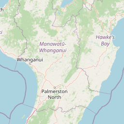
Map view of Tararua Forest Park

Use this park location map to pinpoint Tararua Forest Park in New Zealand, understand its exact geographic position, and read its mapped placement within the surrounding landscape more clearly.

Pigeon | © OpenStreetMap contributors

Location context for Tararua Forest Park

North Island

Visual reference for alpine ridges, river gorges, and native forest habitats

Tararua Forest Park Photos: Scenic Landscapes and Protected Mountain Views

Visual documentation captures the rugged topography, beech forests, and exposed alpine ridges defining Tararua Forest Park. Photographic evidence illustrates the ecological gradients and dramatic terrain transitions spanning New Zealand's pioneering protected area.

A wide, eye-level landscape shot featuring a winding river cutting through green, forested mountain slopes in New Zealand.

Park atlas

Compare regional conservation areas and nearby mountain ranges across the southern North Island

Explore Other Parks Near Tararua Forest Park and Surrounding Protected Landscapes

Visitors exploring Tararua Forest Park can continue browsing adjacent protected natural areas and regional mountain terrain. Comparing nearby reserves reveals broader ecological gradients and connected conservation landscapes across the surrounding region.
A soft watercolor painting of a rolling green landscape with distant hills and foreground vegetation on a plain white background.
Nature reserveWairarapa
About 21 km away#1 closest

Southeast

Fensham Reserve: Protected Lowland Forest Geography and Conservation Mapping in Wairarapa

An essential lowland sanctuary for ancient podocarp and swamp forest ecosystems

Fensham Reserve preserves 48 hectares of significant native forest in the southern North Island of New Zealand. This nature reserve provides essential landscape context for rare kahikatea and pukatea associations, while serving as a crucial wetland refuge for endangered species like the brown mudfish. The area remains a key reference point for understanding regional forest restoration and the protection of long-standing ecological fragments.

Area
0.48 km²
Established
1957
Relief
Lowland
Climate
Temperate
A horizontal watercolor painting showing a calm river winding through green banks with coniferous trees in the background, set against a soft, light-filled sky.
Nature reserveWellington Region
About 28 km away#2 closest

Southwest

Hutt Water Collection Area: Protected Mountain Nature Reserve in the Wellington Region

Forested catchment geography and mountain wilderness

The Hutt Water Collection Area covers 8,900 hectares of steep ridge and valley terrain in the southern Tararua Range. This nature reserve serves as a essential water catchment for the Wellington Region, protecting a diverse environment of native forest, alpine tussock, and sub-alpine bogs. Explore the mapped geography of this critical protected landscape and its role as a sanctuary for rare plant species and native birds.

Area
89 km²
Established
1951
Relief
Mountain
Climate
Temperate
Protected landscapeWellington Region
About 53 km away#3 closest

Southwest

Whitireia Park: Coastal Headland and Protected Landscape in the Wellington Region

Explore mapping of coastal terrain, forests, and harbour boundaries.

Whitireia Park is a prominent coastal reserve in the Wellington Region that balances deep Ngāti Toa cultural significance with a unique geological history shaped by centuries of earthquake uplift. The headland features open grasslands, remnant kohekohe forest, and ongoing wetland restoration that offers a layered view of New Zealand's natural and social history across its accessible harbour-edge geography.

Area
1.8 km²
Established
1976
Relief
Upland
Climate
Temperate
Wildlife reserveWellington Region
About 58 km away#4 closest

Southwest

Wainuiomata Water Collection Area: Protected Forest Terrain and Wellington Catchment Geography

Mapping the native forest canopy and river catchments of New Zealand.

The Wainuiomata Water Collection Area remains a vital conservation landscape, preserving deep river valleys and mature podocarp-broadleaf forest within the Wellington Region. This wildlife reserve functions as a major ecological hub, featuring continuous native bush that supports intensive predator control and species recovery efforts. Its geographic integrity provides a unique perspective on protected catchment management and pristine lowland wilderness in the southern North Island.

Water
Major water bodies
Regional parkWellington Region
About 60 km away#5 closest

Southwest

Wainuiomata Regional Park: Geography and Protected Area Atlas

River valley terrain in the Wellington Region

Wainuiomata Regional Park is a protected river valley setting featuring significant lowland native forest, historic water infrastructure, and restored wetland habitats. This landscape provides a critical link in the conservation geography of the Wellington Region, connecting to extensive forest remnants and supporting a variety of native ecosystems within the Wainuiomata catchment.

Relief
Mixed relief
Water
Major water bodies
A soft watercolor painting of a rolling forested landscape featuring distant mountains and a calm body of water in the foreground.
Protected landscapeWellington Region
About 67 km away#6 closest

Southwest

Remutaka Forest Park: Protected Landscape and Regional Hill Country Geography

A rugged forested reserve spanning the Wellington Region.

Covering extensive territory across the Remutaka Range, this protected landscape is defined by its dramatic ridges and deep river valleys. The area functions as a vital refuge for native bush and birdlife, offering a layered environment that stretches from accessible valley floors to remote upland slopes in the southern North Island.

Area
220 km²
Established
1972
IUCN
V
Relief
Mountain
Nature reserveWellington
About 80 km away#7 closest

Southwest

Te Kopahou Reserve: Nature Reserve Geography and Coastal Landscapes in Wellington

A rugged intersection of forested hills, ridgelines, and coastal cliffs.

Situated on the southern edge of Wellington, Te Kopahou Reserve offers a diverse protected landscape ranging from the summit of Hawkins Hill to the iconic red rocks of the Cook Strait shoreline. This nature reserve provides a critical geographic transition, hosting regenerating native bush, exposed ridgeline trails, and vital habitats for local wildlife, making it a prominent example of regional conservation land on the North Island of New Zealand.

Area
6 km²
Relief
Mountain
Climate
Temperate
Access
Easy access
Marine protected areaMarlborough Region
About 95 km away#8 closest

West

Long Island-Kokomohua Marine Reserve: Mapped Geography and Protected Reef Systems

Explore marine boundaries in the Marlborough Region

Located at the entrance to Queen Charlotte Sound, Long Island-Kokomohua Marine Reserve encompasses significant island and submerged reef features. This protected area serves as an essential site for understanding coastal ecosystem restoration, featuring varied terrain from shallow near-shore reefs to deeper rocky pinnacles that support diverse marine populations.

Area
6.19 km²
Established
1993
Relief
Lowland
Climate
Temperate

Common questions about visiting, size, designation, and location context for Tararua Forest Park

Tararua Forest Park FAQs for park facts, access, geography, and protected area context

Find quick answers about Tararua Forest Park, including protected-area facts, park geography, trail and visitor context, and how the park fits into its surrounding country and regional landscape.
MoriAtlas Explorer

Continue Your Protected Areas Search Across the Global Atlas

Deepen your exploration by continuing the structured search for national parks and protected areas worldwide. Utilize the comprehensive filtering capabilities to compare different conservation landscapes and refine your understanding of global park geography. Discover more about the distribution and characteristics of protected natural areas.

Global natural geography