Mori Atlas logo
Wildlife reserveTaylor Rookery

A rare land-based protected landscape on the Mawson Coast defined by glacial terrain and rock outcrops.

Taylor Rookery Wildlife Reserve: Mapping the Geography of an Antarctic Emperor Penguin Colony

Taylor Rookery represents a unique protected landscape situated on the Mawson Coast of East Antarctica, where the Antarctic ice cap meets the rock outcrops of the Colbeck Archipelago. As the largest known land-based emperor penguin colony, this site offers a critical geographic focus for understanding polar breeding habitats and long-term population stability. Researchers rely on the natural amphitheatre of surrounding hills to monitor the colony from a distance, tracing the environmental patterns of a site protected under the Antarctic Treaty System.

emperor penguin colonyAntarctic wildlifeland-based breeding colonyImportant Bird AreaAntarctic Specially Protected AreaMac. Robertson Land

Taylor Rookery

Wildlife reserve

Park overview

Structured park overview, official facts, and landscape profile for Taylor Rookery

Taylor Rookery park facts, protected area profile, and essential visitor context

Review the core facts for Taylor Rookery, including designation, size, terrain, visitor scale, habitats, and operating context in one park-focused overview.

About Taylor Rookery

Taylor Rookery is one of the most significant emperor penguin breeding sites in Antarctica, distinguished above all by the fact that its birds breed on bare rock rather than on the sea ice used by nearly all other colonies of the species. The rookery occupies a low rocky outcrop at the southwestern corner of a bay defined by Taylor Glacier to the west, the Antarctic ice cap to the south, the islands of the Colbeck Archipelago to the east, and sea ice along the eastern and northern edges. Its position inland from the Mawson Coast, in Mac. Robertson Land, places it deep within East Antarctica, well south of the Antarctic Circle, in a region where the surrounding glaciated terrain dominates the horizon.

The colony is one of only two entirely land-based emperor penguin colonies known to science and is regarded as probably the largest such land-based colony in existence. Its birds gather on rock to breed during the Antarctic winter, when temperatures plunge and darkness prevails, in a setting that contrasts sharply with the more usual image of emperor penguins standing on flat, shifting sea ice. This unusual breeding substrate is a defining feature of the site and a major reason for its scientific and conservation importance.

From a research perspective, Taylor Rookery is unusually well suited to population monitoring. Low rocky hills ring the colony, allowing observers to view every breeding bird from outside the breeding area. A formal count program has run at the site since 1954, making it one of the longest time-series datasets for any emperor penguin colony. Over a fifteen-year window from 1988 to 2002, breeding pair numbers averaged around 3,000 and appeared stable, providing a rare long-term baseline for the species.

The site's protected status reflects both its biological value and its research importance. It is designated Antarctic Specially Protected Area No. 101 under the Antarctic Treaty System and has been recognized as an Important Bird Area by BirdLife International in its global inventory of sites of major bird conservation significance. Together these designations mark Taylor Rookery as a reference site for emperor penguin science and a key component of Antarctic biodiversity protection.

Quick facts and research context for Taylor Rookery

Taylor Rookery is located on the Mawson Coast of Mac. Robertson Land in East Antarctica, approximately 90 kilometers west of Australia's Mawson Station. It is an emperor penguin breeding colony that breeds on a low rock outcrop rather than sea ice, making it one of only two known entirely land-based colonies of the species. The surrounding low rocky hills allow full visual counts of breeding birds without disturbance, and a long-term monitoring program has run continuously since 1954. The site is protected as Antarctic Specially Protected Area No. 101 under the Antarctic Treaty System and is designated an Important Bird Area by BirdLife International.

Protection and recognition

Examine the documented protection scope and international recognition facts

Taylor Rookery Protection Status and International Recognition Details

Taylor Rookery holds a mixed protection scope governed by structured conservation frameworks. Verified administrative parameters and documented international designations define the official conservation standing of the protected area.

Protection details

Protection scope
Mixed
Transboundary protection
No
Park context

Deeper park guide and search-rich context for Taylor Rookery

Taylor Rookery history, landscape, wildlife, and travel context

Explore Taylor Rookery through its history, landscape character, ecosystems, wildlife, conservation priorities, cultural context, and seasonal travel timing in a structured park guide built for atlas discovery and search intent.

Why Taylor Rookery stands out

Taylor Rookery is best known for being the largest known land-based emperor penguin breeding colony in Antarctica, and for hosting one of the longest continuous population monitoring programs for the species. Its setting on rock rather than sea ice sets it apart from the majority of emperor penguin colonies, and the surrounding low hills make it possible to count every breeding pair from a distance, giving the site exceptional scientific value for tracking emperor penguin population trends over decades.

Taylor Rookery history and protected-area timeline

Taylor Rookery's scientific significance is closely tied to the long-running population monitoring program that began at the site in 1954. From the mid-twentieth century onward, researchers based in the region, supported by Australia's Antarctic operations centered on Mawson Station, have returned repeatedly to count breeding emperor penguins at the colony, building one of the most extended time-series datasets for the species in Antarctica.

Over the decades the site has become a reference point for understanding emperor penguin population dynamics. During the fifteen-year period from 1988 to 2002, breeding pair numbers at the colony averaged around 3,000, and the count record suggested a stable trend. This stability, combined with the unusually complete counts made possible by the site's topography, has given the rookery a special role as a benchmark against which other, harder-to-count colonies can be compared.

Recognition of the site's broader importance grew alongside the monitoring effort. Taylor Rookery was eventually designated Antarctic Specially Protected Area No. 101 under the Antarctic Treaty System, formalizing its protection from disturbance, and was subsequently included in BirdLife International's network of Important Bird Areas. These designations reflected the site's standing not only as a breeding location for emperor penguins but also as a long-term scientific observatory in one of the most remote environments on Earth.

Taylor Rookery landscape and geographic character

Taylor Rookery sits in a stark Antarctic landscape shaped by ice and exposed rock. Its immediate setting is a low rocky outcrop at the southwestern corner of a bay where several major Antarctic features converge. To the west rises Taylor Glacier, to the south looms the Antarctic ice cap, to the east lie the islands of the Colbeck Archipelago, and to the north and east the bay is bordered by sea ice. This combination of rock, tidewater ice, and continental ice sheet gives the area a varied and dramatic profile for such a small site.

The colony itself occupies the lowest and most sheltered part of this rocky outcrop, while the surrounding low rocky hills form a natural amphitheatre around the breeding area. These hills are gentle enough to climb but high enough to provide vantage points from which observers can see across the entire colony without entering it, a configuration that has been central to the site's scientific utility.

Beyond the immediate rookery, the wider landscape is the glaciated interior of Mac. Robertson Land along the Mawson Coast, where the Antarctic ice cap dominates the southern horizon and seasonal sea ice shapes the coastline to the north. The interplay between rock, glacier ice, and sea ice creates a setting that is visually austere but ecologically significant, providing both the substrate the emperor penguins need to breed and the geographic isolation that has helped preserve the colony.

Taylor Rookery ecosystems, habitats, and plant life

Ecologically, Taylor Rookery is defined almost entirely by its role as an emperor penguin breeding site, and the surrounding environment is shaped to serve that single purpose. The colony uses a low rock outcrop as its breeding substrate instead of the sea ice that nearly all other emperor penguin colonies depend on, making the local geology rather than local sea ice the critical ecological factor.

The importance of rock for breeding is tied to the emperor penguins' need for a stable surface across the long Antarctic winter. Where sea ice can break up or melt early, exposing eggs and chicks to the ocean, the rocky ground at Taylor Rookery offers a fixed breeding platform that persists regardless of changes in the surrounding sea ice cover. Climate and sea-ice conditions in the wider Mawson Coast region therefore influence the colony indirectly, through access routes used by the birds and through the timing of their arrival and departure, while the breeding site itself remains anchored to stone.

Surrounding habitats are minimal in the conventional sense, because the broader region is dominated by glacial ice, bare rock, and seasonal sea ice rather than vegetation. Yet this very sparseness is what makes the site important for monitoring: the absence of confounding habitats allows the emperor penguin colony to be counted with unusual precision, and the protected area can be managed around a single, clearly defined ecological function.

Taylor Rookery wildlife and species highlights

Emperor penguins are by an enormous margin the dominant wildlife focus at Taylor Rookery, and the site is effectively a single-species breeding area of exceptional importance. The colony has supported an average of roughly 3,000 breeding pairs over recent monitoring decades, making it one of the larger emperor penguin gatherings in Antarctica and almost certainly the largest known to occur on land rather than sea ice.

The colony fits the classic pattern of emperor penguin breeding biology, with adults arriving at the site, breeding, and rearing chicks through the Antarctic winter against an intensely cold backdrop. The use of a rock outcrop instead of sea ice is the key behavioral and ecological signature of this particular colony, distinguishing it from most others of the species.

Few other wildlife groups play a significant role at the site itself, reflecting both the harshness of the environment and the focused nature of the protected area. Occasional visitors such as Antarctic petrels, skuas, or seals may pass through the broader Mawson Coast region, but the emperor penguin colony is the central, defining wildlife feature that has driven Taylor Rookery's designation as an Important Bird Area and as an Antarctic Specially Protected Area.

Taylor Rookery conservation status and protection priorities

Taylor Rookery holds a distinctive place in Antarctic conservation because it protects the breeding habitat of the largest known land-based emperor penguin colony. The site's value is twofold: it safeguards the birds themselves during one of the most vulnerable stages of their life cycle, when eggs and chicks are exposed to extreme cold and predation pressure, and it preserves a fixed, easily observed breeding platform that supports long-term population monitoring.

Protection is anchored in the Antarctic Treaty System. Taylor Rookery is designated Antarctic Specially Protected Area No. 101, a status that restricts human activity at the site and requires any access to be justified for compelling scientific or management reasons. The 26-hectare protected footprint reflects the compact nature of the breeding area itself, rather than a need to encompass wider habitat, because the surrounding environment is largely glacial ice and sea ice and offers little additional terrestrial resource to protect.

Internationally, recognition has come from BirdLife International, which has included the site in its global network of Important Bird Areas. This designation highlights the colony's role as a breeding concentration of a single high-profile species whose conservation status is closely tied to Antarctic sea ice. By combining treaty-level legal protection with international recognition and a multi-decade monitoring dataset, Taylor Rookery serves as both a refuge and a reference site for emperor penguin conservation across the continent.

Taylor Rookery cultural meaning and human context

Taylor Rookery has no permanent human community and no indigenous cultural associations, in keeping with the broader character of interior East Antarctica. The site's human story is essentially a scientific one, shaped by the presence of Australia's Mawson Station roughly 90 kilometers to the east and by the international Antarctic research community that has visited the colony to carry out counts since 1954.

Over time the rookery has acquired a quiet cultural significance within Antarctic science as a familiar destination for monitoring teams from the Mawson region, and as a reference point in international discussions of emperor penguin conservation. Its name derives from Taylor Glacier, which borders the colony to the west, itself one of the named features of the heavily glacierized Mac. Robertson Land coastline.

Top sights and standout views in Taylor Rookery

The strongest features of Taylor Rookery are its role as the largest known land-based emperor penguin breeding colony, its exceptionally long record of population monitoring dating back to 1954, and the unusual accessibility of its breeding birds from surrounding low hills. The site is compact but scientifically rich, formally protected as Antarctic Specially Protected Area No. 101 and recognized internationally as an Important Bird Area by BirdLife International.

For researchers and conservationists, the rookery is equally valued as a benchmark site: its stable long-term counts and land-based breeding substrate make it a natural reference point for understanding emperor penguin populations elsewhere in Antarctica, most of which breed on more variable sea ice habitats.

Best time to visit Taylor Rookery

Because Taylor Rookery sits deep within East Antarctica and is governed by extreme polar conditions rather than conventional tourism cycles, any visit or research campaign must be planned around the Antarctic climate. Emperor penguins breed through the Austral winter, when temperatures are most severe but when the colony is most active and most scientifically interesting, and adult birds and chicks are present when sea ice and weather permit access. The surrounding summer brings somewhat milder temperatures and longer daylight, but the breeding cycle that defines the site's significance still has to be considered in any timing decision. Practical access is heavily constrained by sea ice, weather windows, and the availability of logistics support from nearby stations such as Mawson, and any seasonal guidance for the site should be considered alongside those operational realities rather than as ordinary tourism advice.

Monthly climate preview

Examine long term temperature swings and monthly precipitation trends across the protected coordinate

Taylor Rookery Climate Normals, Average Temperature and Precipitation Rhythm

Taylor Rookery records structured long term climate data detailing monthly temperature ranges and steady precipitation averages from representative coordinate sampling. Reviewing the complete twelve month profile provides deeper insight into annual meteorological rhythms across the protected area.
Annual mean-15 °C
-22 °C-4 °C
Jan-4°
Feb-7°
Mar-13°
Apr-18°
May-20°
Jun-20°
Jul-21°
Aug-22°
Sep-21°
Oct-17°
Nov-9°
Dec-5°
Warmest month
January

-3.9 °C

Coolest month
August

-22 °C

Wettest month
February

1.1 mm/day

Driest month
September

0.8 mm/day

Park location guide

Geography guide, regional context, and park location map for Taylor Rookery

Taylor Rookery park geography, regions, and map view in Antarctica

Understand where Taylor Rookery sits in Antarctica through a broader geographic reading of the surrounding landscape, nearby location context, and its mapped position within the national park landscape.

How Taylor Rookery fits into Antarctica

Centered on the South Pole, Antarctica is the highest, driest, coldest and windiest continent. Almost all of its land is buried beneath ice, yet its coasts and surrounding ocean sustain globally significant colonies of penguins, seals and seabirds.

Wider geography shaping Taylor Rookery in Antarctica

The continent surrounds the geographic South Pole and is separated from other landmasses by the Southern Ocean. A vast ice sheet conceals mountain ranges, basins and plains, exceeds four kilometres in thickness in places and flows outward through glaciers and floating ice shelves. The Transantarctic Mountains divide East and West Antarctica, while the Antarctic Peninsula reaches north toward South America.

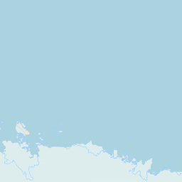
Map view of Taylor Rookery

Use this park location map to pinpoint Taylor Rookery in Antarctica, understand its exact geographic position, and read its mapped placement within the surrounding landscape more clearly.

Pigeon | © OpenStreetMap contributors
Park atlas

Compare adjacent polar reserves and regional protected landscapes across the Mawson Coast

Exploring Other Parks Near Taylor Rookery and Surrounding Antarctic Protected Areas

Visitors exploring Taylor Rookery can continue browsing nearby protected areas and regional reserves across the wider continental margin. Comparing adjacent polar landscapes provides valuable geographic context for understanding isolated wildlife habitats and regional terrain.
Protected areaMac. Robertson Land
About 73 km away#1 closest

East

Rookery Islands Protected Area: Mac. Robertson Land Polar Landscape Atlas

Coastal rocky terrain and international seabird conservation zone

Located in western Holme Bay, the Rookery Islands form a protected rocky archipelago along the Mawson Coast. This site functions as a key reference area for polar seabird populations, including Adélie penguins and southern giant petrels, while providing a clear contrast to the high-relief mountain ranges of the Antarctic mainland.

Area
0.89 km²
Relief
Lowland
Climate
Polar
Access
Remote access
Protected areaMac. Robertson Land
About 250 km away#2 closest

East

Scullin Monolith Protected Area in East Antarctica: Coastal Geography and Habitat Atlas

Ice-free coastal terrain and regional seabird breeding grounds

Scullin Monolith represents a singular landmark of exposed rock along the glaciated coastline of Mac. Robertson Land. Stretching from Mikkelsen Peak toward Douglas Bay, this crescent-shaped promontory remains essential for understanding East Antarctic coastal geography and the dense avian populations that rely on its rare snow-free terrain and protective vertical cliffs.

Established
1931
Relief
Upland
Climate
Polar
Access
Remote access
Protected areaEast Antarctica
About 684 km away#3 closest

Southeast

Amanda Bay Protected Area: Geography and Coastal Ice Mapping in East Antarctica

Glacial inlets, emperor penguin colonies, and stable sea ice

Amanda Bay offers a focused look at the remote East Antarctic coastline, characterized by the Hovde Glacier, Flatnes Ice Tongue, and recurring stable sea ice. This protected area serves as a vital habitat for thousands of emperor penguins and illustrates the complex relationship between glacial cliffs and coastal marine environments across the Prydz Bay margin.

Area
18 km²
Established
1957
Relief
Lowland
Climate
Polar
Protected areaAntarctica
About 2,111 km away#4 closest

East

Frazier Islands Protected Area: Geographic Boundaries and Antarctic Coastal Context

Rocky island terrain within the Vincennes Bay coastal region

Examine the rugged profile of the Frazier Islands, a group of three ice-free rocky outcrops rising from the Southern Ocean. Their protected status and specialized role as a rare continental seabird breeding ground offer a distinct lens into the regional geography and conservation landscapes of East Antarctica.

Relief
Lowland
Climate
Polar
Access
Remote access
Scope
Marine
Protected areaAntarctica
About 2,115 km away#5 closest

East

Ardery Island: Protected Coastal Geography and Antarctic Seabird Habitats

Rugged terrain and avian conservation in the Windmill Islands

Ardery Island represents a compact, rocky protected area within the Antarctic landscape. Known for its steep cliffs and essential seabird colonies, this island serves as a focal point for ecological study along the Budd Coast, offering a distinct example of high-latitude coastal geography.

Relief
Upland
Climate
Polar
Access
Remote access
Scope
Mixed
Protected areaAntarctica
About 2,125 km away#6 closest

East

Clark Peninsula: Antarctic Protected Landscape and Coastal Geographic Atlas

Ice-free rocky terrain on the Budd Coast of Wilkes Land

Clark Peninsula provides a window into the unique geography of East Antarctica, featuring exposed rocky outcrops, coastal coves, and significant glacial moraines. As a dedicated protected area, the site supports long-term ecological research and provides a critical habitat for seabird colonies, offering a detailed look at the interface between continental ice and the Southern Ocean.

Area
9.4 km²
Relief
Lowland
Climate
Polar
Access
Remote access
Nature reserveWestern Cape
About 2,636 km away#7 closest

Northwest

Prince Edward Islands Nature Reserve: Subantarctic Volcanic Landscape and Marine Geography

Remote volcanic terrain and protected ocean boundaries in the southern Indian Ocean.

Discover the geographic profile of the Prince Edward Islands, an uninhabited volcanic nature reserve. Analyze the rugged cliff-lined coastlines, peat-covered uplands, and the surrounding marine protected area that safeguards essential habitats for penguins and threatened seabird species in the southern Indian Ocean.

Area
343 km²
Established
2003
Relief
Mountain
Climate
Tropical
A pale, minimalist watercolor illustration of soft rolling green hills, a tree line, and a body of water in the foreground, against a plain white background.
Protected areaAustralian Antarctic Territory
About 3,277 km away#8 closest

Southeast

Mawson's Huts Protected Area: Antarctic Heritage and Coastal Geographic Landscape

Historic polar structures in the Australian Antarctic Territory

Located at Cape Denison, Mawson's Huts represents a rare preserved footprint of the Heroic Era of Antarctic exploration. The site encompasses specialized scientific buildings set against a challenging coastal landscape, offering insight into the logistical history of polar science within the Australian Antarctic Territory.

Established
1912
Relief
Lowland
Climate
Polar
Access
Remote access

Common questions about visiting, size, designation, and location context for Taylor Rookery

Taylor Rookery FAQs for park facts, access, geography, and protected area context

Find quick answers about Taylor Rookery, including protected-area facts, park geography, trail and visitor context, and how the park fits into its surrounding country and regional landscape.
MoriAtlas Explorer

Continue Your Protected Areas Search Across the Global Atlas

Deepen your exploration by continuing the structured search for national parks and protected areas worldwide. Utilize the comprehensive filtering capabilities to compare different conservation landscapes and refine your understanding of global park geography. Discover more about the distribution and characteristics of protected natural areas.

Global natural geography