
Trip Timing
When is the Best Time to Visit Torotoro National Park
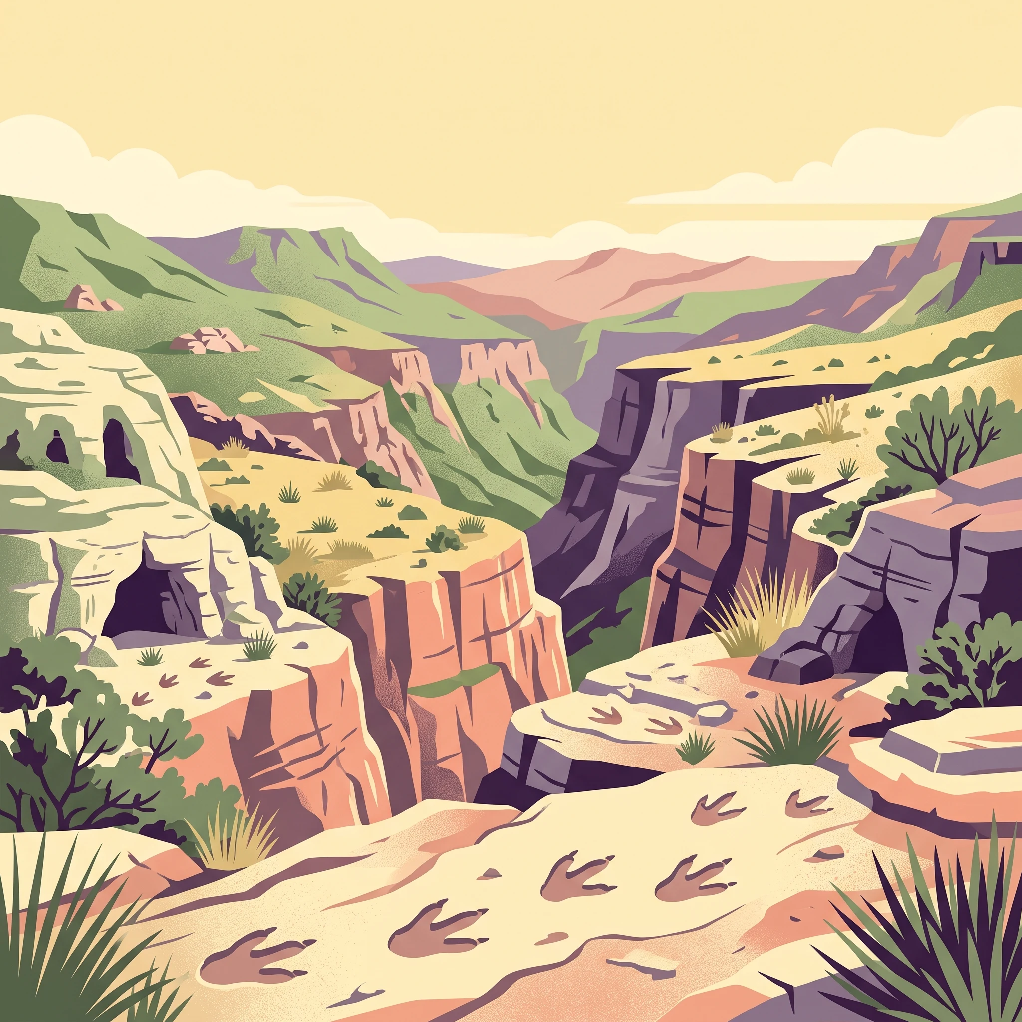
Deciding on the best time to visit Torotoro National Park requires balancing a preference for stable, dry trekking conditions against the trade-offs of colder mountain temperatures and peak visitor volume. For most travelers, the period between May and September serves as the primary window for exploration. During these months, the Andes experience a distinct dry season that minimizes the risk of rain, which is essential for safely traversing the park's dramatic canyon systems, exploring deep caves, and accessing sites where prehistoric dinosaur footprints are located. Because the landscape is semi-arid and characterized by steep limestone formations, dry paths are safer and more accessible than during the wet season.
The Influence of Elevation and Aridity
Torotoro National Park sits at an elevation between 2000 and 3500 meters, a factor that fundamentally dictates the local climate. While the daytime temperatures remain relatively mild throughout the year, the high elevation creates significant diurnal shifts. In the core dry months, travelers often encounter warm, pleasant days followed by near-freezing overnight temperatures. This climate pattern requires visitors to prepare for a wide range of conditions within a single 24-hour cycle. The lack of moisture in the air during the winter period means that humidity levels remain low, creating crisp, clear views across the canyons, which contrasts sharply with the humid, cloud-heavy conditions often present during the summer months from December to March.
Seasonal Constraints on Park Exploration
Rainfall is the most significant factor impacting accessibility in the park. While the summer months bring necessary water to the Andean environment, the associated precipitation can complicate travel through the park's rugged terrain. Increased rainfall can lead to difficult trail conditions, specifically within the deep canyons and narrow karst passages that define the visitor experience. Because the park's primary draws are its paleontological sites and fossilized bone fragments embedded in canyon walls, the ability to hike these routes without the hazard of slick rock or flooded paths is paramount. Visitors aiming for the best time to visit should prioritize the stable, sunnier months of mid-year, even if it means contending with colder nights and the higher likelihood of encountering other travelers on the most popular trails. Those who prefer warmer temperatures and are willing to navigate around afternoon showers may find the transitional months, such as April or October, provide a middle ground between the intensity of the dry season and the wet peak of the summer, though they should be prepared for more variable weather patterns as the seasons shift.
Seasonal Planning
Best Months to Visit Torotoro National Park for Your Travel Priorities
Dry Season Stability for Canyon Exploration
For most travelers, the window between May and September offers the most reliable conditions for accessing the park's rugged terrain. During these months, precipitation levels drop to their lowest, with July and August often seeing almost no measurable rainfall. This dry period is defined by high diurnal temperature variability: while daytime maximums often reach the mid-to-high 20s Celsius, nighttime temperatures can dip to freezing or below at the park's elevation of nearly 2,900 meters. Visitors prioritizing hiking the deep canyon systems or searching for dinosaur tracks in the exposed rock faces will find the clear, dry air beneficial for visibility and trail traction. The trade-off is the need for significant layering; the intense daytime sun requires protection, while early morning expeditions into shaded canyons or cave entrances will necessitate thermal gear.
The Shoulder Transition Periods
The months of April and October serve as bridges between the dry and wet seasons. April follows the heavy rains of the summer, leaving the landscape greener and potentially impacting trail conditions. By this time, rainfall frequency decreases significantly as the transition to the winter dry phase begins. October represents the warming phase leading into the summer; it is often one of the warmer months with maximum temperatures approaching 29 degrees Celsius. Choosing these months can be a strategy for those seeking a compromise between the cold nights of the winter dry season and the consistent rain of the high summer. Visitors should remain aware that these months are transition zones, meaning weather patterns can be less predictable than in the core dry season months of June, July, and August.
Wet Summer Considerations
The period from December through March coincides with the regional rainy season. During this time, humidity levels rise, and frequent, often afternoon-focused, rainfall can affect accessibility. While the park does not close based on a fixed calendar, the increased precipitation naturally impacts the state of rural roads and canyon trails. Travelers selecting this window often encounter a more vibrant, lush landscape that contrasts with the arid brown tones of the winter months. However, the trade-off involves managing mud, potential delays in transit to the park, and a higher probability of needing to adjust daily itineraries due to rain. This period is best suited for those with flexible schedules who are less dependent on specific site access and are prepared for the logistical realities of travelling in the Bolivian highlands during the peak of the rainy cycle.
Annual Climate Data
Understanding Weather and Climate Patterns in Torotoro National Park
Diurnal Temperature Swings in the High Andes
Visitors to Torotoro often find that the most significant climatic factor is not the mean monthly temperature, but the sharp contrast between day and night. Situated at an elevation of approximately 2,800 meters, the park experiences substantial diurnal shifts throughout the year. Daytime maximums frequently climb into the mid-to-high 20s Celsius, particularly during the transition months of September and October. However, because the thin mountain air retains heat poorly once the sun sets, nighttime temperatures can plummet rapidly. During the coldest months of June and July, nighttime lows regularly drop below freezing. This daily oscillation requires visitors to adopt a layering strategy, regardless of the season, as the thermal comfort of a canyon hike can change dramatically within hours.
The Relationship Between Precipitation and Seasonal Visibility
Rainfall in this region is concentrated and seasonal, primarily shaping the landscape between December and March. January and February represent the height of the wet season, with mean daily precipitation levels significantly higher than the rest of the year. This increased humidity and cloud cover can impact visibility across the vast canyon vistas and may affect the accessibility of certain trails that are prone to runoff. Conversely, the dry window from May through August sees remarkably low precipitation, often falling below 0.2 mm per day in July. This extended dry spell is what allows for the most consistent exploration of the park's karst caves and fossil-rich surfaces, as the lack of mud and standing water keeps delicate footpaths and subterranean routes more predictable.
Sunlight and Seasonal Daylight Variability
The park experiences a variance in daylight hours that follows the Southern Hemisphere solar cycle. The longest days occur in December, with approximately 13 hours of daylight, providing an extended window for outdoor activity. While the sun is higher in the sky during these summer months, this period also coincides with the rainy season, creating a trade-off between longer exploration hours and the increased probability of afternoon showers. During the winter months of June and July, daylight hours shorten to approximately 11 hours. While this provides a narrower window for trekking, the drier, crisper air during these months often results in clearer skies, making the shorter days highly effective for photography and observation of the rugged limestone formations.
Understanding the Wind Factor
Wind patterns in the park exhibit a distinct intensification toward the end of the dry season. While winds remain relatively moderate, averaging between 2 and 3 meters per second for much of the year, they begin to pick up in August and reach their peak in September. This increased wind speed can make the exposed canyon rims feel significantly cooler than the ambient air temperature would suggest, even as daily maximum temperatures begin their spring ascent. Travelers planning to spend extended periods on the park's ridges or high-altitude viewpoints should be aware that these windier periods often coincide with the transition into the warmer months, necessitating wind-resistant gear to maintain comfort during periods of sustained exposure.
Note: These values are long-term climate normals (1991 to 2020) for the park's specific elevation range. They are intended as a guide to annual patterns and do not function as real-time weather forecasts for specific travel dates. Local microclimates within deep canyons or cave systems may differ from regional averages.
Seasonal climate patterns
Understanding Seasonal Weather Phases in Torotoro National Park
The Dry Winter Phase: May Through September
The defining period for most visitors to Torotoro National Park is the dry season, which settles over the Andes from May through September. This phase is characterized by low precipitation, with monthly rainfall averages often dropping well below one millimeter per day. During these months, the park shifts into a rhythm of clear, cobalt skies and highly stable conditions that are ideal for navigating the steep trails and deep canyon systems.
While the days are typically warm and bright, visitors should remain aware of the significant diurnal temperature swings typical of this elevation. Nights during the heart of winter, particularly in June and July, can frequently dip below the freezing point. Even though daytime highs usually reach the mid-20s Celsius, the transition from midday sun to midnight chill is sharp. This is not a period of snow-covered landscapes, but rather one of desiccated, arid beauty where the park's karst geology and exposed rock formations, including the famous dinosaur footprints, remain easily accessible and free from the mud and erosion risks associated with the summer rains.
The Transition Months: April and October
April and October function as the essential shoulder seasons for the park, marking the move between the dry winter and the humid, wetter summer. These months represent a period of flux where the predictable weather patterns of the dry season begin to lose their consistency. In April, the final vestiges of the summer rains subside, leaving the landscape lush from the previous months before the long dry stretch begins. It is often a period of moderate temperature stability, avoiding the extreme lows of the mid-winter nights while also dodging the heavy precipitation that defines the approaching summer.
October serves as the inverse, acting as a herald for the coming wet season. Visitors during this month may notice an increase in humidity and the first signs of cloud cover as the regional weather systems shift. These transition months are often quieter than the peak mid-year window, making them a viable alternative for travelers who prefer to balance the risks of mild, early-season rain against the benefit of fewer crowds on the trails.
The Wet Summer Season: December Through March
From December through March, the park enters its most volatile period. Driven by seasonal atmospheric shifts, this phase brings the bulk of the annual rainfall. While this does not equate to constant storms, it does introduce a higher risk of heavy, short-duration downpours that can impact trail conditions and visibility within the deep canyons.
During this time, the landscape transforms significantly, with increased vegetation growth that contrasts with the barren look of the dry season. Humidity levels are at their highest, typically reaching 70 percent or more. While the average maximum temperatures remain warm, the sense of heat can feel different due to the increased moisture in the air. For those planning a visit in this window, the primary trade-off involves accepting potential trail closures or delays caused by saturated ground in exchange for a greener, more vibrant aesthetic and the opportunity to see the park's karst environment under a different light. Travelers during these months should remain flexible, as access to certain subterranean cave systems or narrow canyon floors may be restricted for safety reasons during periods of high rainfall.
Seasonal Experiences
What Visiting Torotoro National Park Is Like Throughout the Year
Navigating Canyon Trails and Paleontological Sites
The core of the Torotoro experience centers on its deep canyon systems and extensive fossilized footprints. Timing your visit to align with these activities requires balancing physical effort with environmental conditions. Because much of the terrain in the El Vergel Canyon and surrounding fossil sites involves steep, exposed trekking, the cooler months between May and August are generally more suitable for long days on the trail. During these months, the lower humidity and lack of significant precipitation minimize the risk of slippery rock surfaces, which is particularly relevant when descending into canyon bottoms or navigating uneven limestone. In contrast, the warmer months from December to March often bring increased rainfall, which can make the canyon trails more challenging and potentially limit accessibility to specific geological formations that may become saturated or prone to temporary closure.
Accessing Karst Cave Systems
Exploring the karst landscape, including the extensive Caverna de Umajalanta, requires a consistent surface climate to ensure safe passage. During the dry season, the cave environment remains stable, allowing for clearer paths through the subterranean chambers. While the internal cave climate is relatively constant, the external approach conditions are heavily influenced by the season. Visiting during the transition months of April or October can offer a middle ground, where you avoid the peak intensity of the summer rains while benefiting from more moderate temperatures than those found in the dead of winter. It is essential to remember that even within the dry season, the diurnal temperature range at 2,900 meters is significant, meaning mornings can be near freezing even when afternoons are warm enough for light clothing. Preparation for these daily swings is as important as choosing a travel window based on seasonal averages.
Aligning Exploration with Seasonal Daylight
The length of the day in Torotoro varies across the year, with daylight peaking around December and reaching its minimum in June. While the difference is not as extreme as at higher latitudes, the shift in daylight hours influences the rhythm of daily tours. During the longer days of late spring and early summer, there is naturally more time to complete the longer circuits, such as the trek to the Ciudad de Ittas rock formations, without feeling rushed. Conversely, in the shorter days of winter, the window for sunlight exposure in deep, narrow features like El Vergel Canyon is more restricted. Visitors arriving in the morning must be mindful that certain canyon floors remain in shadow for much of the day during the winter months, affecting both temperature and lighting conditions for photography. Because group tours often depart in the early morning, understanding the seasonal light shift helps manage expectations for when you will reach specific landmarks.
Travel Priorities
Optimizing Your Torotoro National Park Visit by Travel Goal
Selecting for Clearer Skies and Canyon Visibility
For travelers whose primary goal is capturing the vast scale of the canyon systems or conducting detailed field studies of the fossilized footprint sites, the period from June through August provides the most reliable window. These months coincide with the lowest precipitation normals of the year, frequently dropping below 0.3 mm per day. The benefit of this timing is twofold: it minimizes the risk of sudden downpours that can obscure visibility or render clay-rich trail segments slick, and it provides the highest probability of crisp, clear lighting. While the air remains thin at an elevation near 2,900 meters, the lack of cloud cover during this dry window ensures that the sunlight highlights the geological textures of the limestone formations. The compromise for this visibility is the intensity of the diurnal temperature swing, as nighttime lows often dip below freezing, necessitating quality thermal insulation even if daytime temperatures remain comfortably mild.
Targeting Milder Daytime Temperatures for Extended Trekking
If your priority is sustaining physical activity over long, multi-hour excursions like those required for the route to the Cuidad de Ittas, late spring and early autumn,specifically April, May, and October,offer a balanced climate profile. During these months, the daily mean temperatures hover in the 14°C to 15°C range, avoiding both the sharper chill of the mid-winter months and the higher humidity that arrives with the summer wet season. This period allows for more consistent exertion without the physical stress of managing extreme temperature shifts. Visitors should be aware that while these months are generally moderate, they act as transition phases. October, in particular, may see a gradual uptick in moisture and cloud cover as the park moves toward the wetter December-March cycle. It is a strategic choice for those who prefer to avoid the wind speeds that peak in September, which can occasionally impact comfort during elevated, exposed ridge hikes.
Prioritizing Warmth and Greenery Over Trail Reliability
Travelers who prefer to avoid cold-weather gear and are willing to accept the trade-off of potentially limited access to certain cave systems or canyon floors may find the early wet season of December and January attractive. This is the warmest period of the year, with average maximums reaching toward 27°C to 28°C. The increased precipitation, which peaks significantly during these months, transforms the semi-arid landscape into a greener environment, providing a visual contrast to the starker conditions found during the dry winter. However, the compromise is substantial: moisture impacts the integrity of cave paths and canyon access, and high humidity levels can make strenuous midday hiking feel more taxing than the moderate temperatures of the dry season would suggest. This window is less suited for those whose itinerary depends on fixed access to deeper karst features, where ground water and mud become significant factors.
Visitor Logistics
Seasonal Access and Practical Planning for Torotoro National Park
Navigating Seasonal Transit to Torotoro
Reaching the park involves travel through the eastern Andes, a route that is highly susceptible to the region's precipitation patterns. While minibuses and private transport regularly connect the park with Cochabamba, the reliability of these connections fluctuates significantly based on the time of year. During the drier months from May to September, road conditions are generally more stable, and transit times remain predictable. In contrast, the wetter summer period from December to March can bring heavy rainfall that potentially impacts road integrity. Travelers planning their visit during these months should anticipate that transit may take longer than the standard estimates or encounter unforeseen delays. Because road status and transportation schedules are subject to change due to weather events or infrastructure maintenance, you must verify the latest travel feasibility and operator availability through local transport hubs or your tour provider shortly before your departure date.
Accessing the Park and Local Infrastructure
Torotoro functions as a managed protected area, and accessing specific trailheads or geological sites often requires coordination with local authorities or designated guides. While the town of Torotoro serves as the main base for visitors, the surrounding karst landscape, fossil sites, and canyon rims are managed to ensure conservation and safety. The accessibility of these sites is not merely a function of seasonal weather but also of the operational protocols in place at the time of your visit. Some remote areas or deep canyon trails may be temporarily restricted if rainfall compromises their stability or if active management is underway. Please consult with the local visitor center or official park management offices upon your arrival to receive the most current information regarding which sites are open and any specific entry requirements for the day.
Planning for Variable Transport Modes
Travelers have several options for entering the park, ranging from public minibus services to private 4WD charters. Public transport is the most economical method, though it requires flexibility, as departure times often depend on demand or the bus filling up. Private 4WD transport offers greater convenience, particularly for those carrying equipment or working within a tighter schedule, and is sometimes provided as part of a pre-arranged tour package. If you are considering alternative methods, such as chartering light aircraft from Cochabamba, you must contact local charter companies directly to confirm current operational status, as these services are niche and rely on both weather conditions and operator capacity. Regardless of your chosen mode of transport, always maintain a buffer in your itinerary to account for the realities of mountain travel in this region.
Safety and Gear
Seasonal Safety, Weather Preparation, and Packing for Torotoro National Park
Navigating Diurnal Temperature Swings
Torotoro National Park presents a unique thermal challenge due to its elevation of nearly 2,900 meters. The most significant weather-related preparation for any visitor involves managing extreme daily temperature fluctuations. While daytime maximums frequently reach into the mid-to-high 20s Celsius during both the dry and wet seasons, temperatures after sunset can drop precipitously. In the coldest months of June and July, nighttime temperatures often fall below freezing. Regardless of when you travel, a layering strategy is essential. Expect to transition from light, breathable clothing during the heat of the day to insulating thermal layers or high-quality fleece as soon as the sun dips behind the canyon walls.
Managing Exposure in Semi-Arid Terrain
The park's semi-arid, exposed landscape means that sun protection is a critical year-round consideration rather than a seasonal luxury. The combination of high altitude and lower humidity during the dry season intensifies UV exposure. Visitors spending hours hiking between fossil sites or navigating canyon rims should prioritize physical barriers like wide-brimmed hats and lightweight, long-sleeved garments that offer reliable sun coverage. Because the terrain is often rocky and lacks dense canopy cover, these precautions remain relevant even on cooler, windier days in August or September when the sun remains powerful.
Rain and Trail Stability
During the wetter months from December to March, preparation shifts from managing solar exposure to preparing for sudden, localized moisture. While rainfall levels remain manageable, they can significantly alter the safety and accessibility of steep canyon trails and cave systems. If you are planning a visit during this period, ensure you have appropriate footwear with reliable grip, as limestone surfaces can become exceptionally slick when wet. It is important to remember that heavy rain events can trigger temporary local access issues or require the suspension of specific activities for safety reasons. Always prioritize checking in with the local park authority or your guide regarding current trail statuses before heading out, as these are operational variables that change based on localized conditions.
Monitoring Evolving Conditions
Long-term climate data provides a baseline, but the high-altitude Andean environment can deviate from these norms on any given day. Windy conditions are most frequent in late winter and early spring, which can add a significant wind-chill factor to what might otherwise appear to be a mild day. Always consult the most recent regional forecasts and, more importantly, seek briefings from the park visitor center upon arrival. Local staff are the best source for current route safety information, as they monitor the immediate impact of weather on the park's fragile karst terrain.
Final Trip Decisions
Selecting the Best Time to Visit Torotoro National Park
Synthesizing Your Travel Priorities
Choosing the right time for your visit involves balancing the park's stable, dry-season climate against your specific interests in hiking, geology, or cultural exploration. The most consistent window for travel remains the period between May and September. During these months, the convergence of low precipitation, clearer skies, and cooler, manageable daytime temperatures creates the most reliable conditions for accessing the deep canyon systems and trekking to the park's renowned fossil sites. Travelers who prioritize trail stability and unobstructed views of the karst landscape will find this dry interval particularly advantageous.
Balancing Weather and Accessibility Trade-offs
If you are considering a visit during the transitional months of April and October, you are opting for a middle ground that often features pleasant, moderate weather before the onset or after the conclusion of the peak summer rainfall. While these shoulder periods can provide a balance between the extremes of the dry winter and the humid, rainy summer, they also introduce a degree of unpredictability regarding localized weather shifts and trail conditions. Those who prefer warmer daytime temperatures and are comfortable with the higher likelihood of rain, humidity, and occasional access delays might find the December to March period attractive for its greener, more vibrant landscape. However, this season demands a higher level of flexibility in your itinerary, as heavy precipitation can directly impact road access and the safety of trail surfaces within the limestone canyons.
Finalizing Your Decision
Your final choice should ultimately align with your tolerance for seasonal variability versus your desire for consistent environmental conditions. Regardless of your selected date, remember that climate normals describe long-term patterns rather than daily forecasts. The high-altitude, semi-arid nature of the region ensures that diurnal temperature shifts will remain a constant factor for every visitor, regardless of the month. Before finalizing your bookings or embarking on your journey, verify current park access, site availability, and active weather alerts through official channels. By grounding your planning in these seasonal realities and acknowledging the necessity of real-time verification, you can better prepare for the specific environment you will encounter in the field.