
Why Uggerby Klitplantage and Uggerby Å Estuary stands out
The site is best known for its striking concentration of dune habitat types in close proximity, with green dunes stretching inland from Tannis Bugt around the Uggerby Å estuary. It contains large national populations of blood-red stork's bill grass, important occurrences of dune kale, and populations of the black hairstreak butterfly, sand lizard, and natterjack toad. The river mouth brings additional ecological character through lamprey species and the presence of otter, linking the site's dune identity to a freshwater and estuarine dimension that strengthens its overall conservation profile.
Uggerby Klitplantage and Uggerby Å Estuary history and protected-area timeline
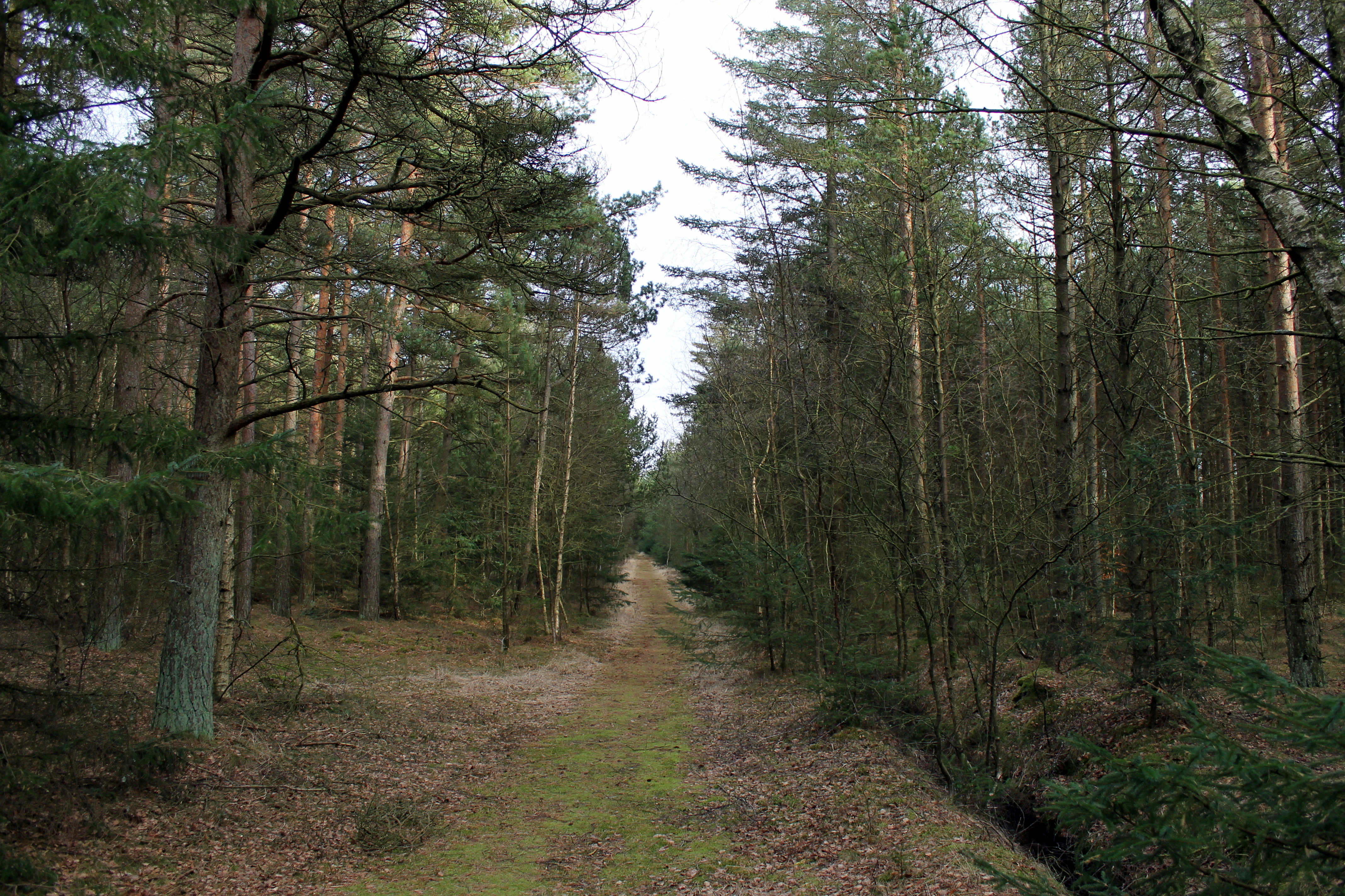
The protected area as it exists today takes its character from two overlapping strands of history. One is the long Danish tradition of planting trees and stabilizing drifting sand along the west and north Jutland coasts, which gave rise to the klitplantage landscape and shaped the dune forest character visitors and ecologists still see.
The second strand is the modern European framework of habitat and species protection, through which the area was formally adopted into Natura 2000 as Danish site number 5. Within the area there are three smaller nature conservation reservations, reflecting earlier national protection efforts that predate the Natura 2000 designation. These overlapping layers of preservation mean the site has been subject to different regimes of protection that converge on the coastal dunes and river mouth.
More recent planning has been carried out under Denmark's Natura 2000 plans for 2022 to 2027, with revised baseline analyses and management documents issued by the Danish Environmental Protection Agency's northern Jutland office, embedding the site in ongoing habitat management and conservation monitoring.
Uggerby Klitplantage and Uggerby Å Estuary landscape and geographic character
The landscape is shaped first and foremost by the coastal dune system along Tannis Bugt. A continuous band of green dunes forms the dominant landform near the shore, fringed toward the sea by younger foredunes and mobile white dunes that shift with wind and weather. Inland, the dune profile matures into grey-green dunes, sea buckthorn-dominated dunes, crowberry-rich dunes, and wooded dune communities, producing a layered scenery typical of long-developed Danish coastal dune belts.
Dune slacks punctuate the higher ridges, some of them recently formed. These low-lying depressions periodically hold fresh water, giving rise to small nutrient-rich and brownwater lakes surrounded by marshy vegetation, tall-herb fringes, and richer fen communities. The combination of dune ridges, damp slacks, and mires creates a strongly undulating terrain where dry sand and moist hollows alternate over short distances.
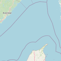
The Uggerby Å carves through this dune belt on its way to the sea, and its river mouth defines the western edge of the site. Along the river, soft mudbank habitats and herbaceous borders add a different topographical rhythm to the dune scenery, while the estuarine zone opens the protected area to the Skagerrak. The result is a landscape that transitions from dry, wind-shaped sand to sheltered, water-influenced lowlands within a single site.
Uggerby Klitplantage and Uggerby Å Estuary ecosystems, habitats, and plant life
Ecologically, the area is a compact showcase of northern European coastal dune ecosystems. The dune habitats span nearly the full development sequence recognized in Danish nature classification, from shifting white dunes near the shoreline to the more stable wooded dunes inland. This continuity is one of the defining ecological features of the site, allowing species tied to very different dune stages to be conserved within the same area.
Wet features provide a strong counterpoint to the sandy habitats. Dune slacks, small nutrient-rich lakes, brownwater lakes, and the winding corridor of Uggerby Å together introduce freshwater, mire, and riparian habitats including herbaceous borders, rich fens, stands of pedunculate oak scrub, wooded raised bog, and alder and ash forest. This internal diversity is reflected in the unusually long list of habitat types that form the basis of the site's Natura 2000 designation.
The combination of sandy, calcareous-rich slack soils and freshwater environments supports a characteristically rich dune flora, including populations of the grass Blodrød Storkenæb at scales that are nationally significant, and rare plant species such as Baltic gentian, broad-leaved cottongrass, and a regionally named orchid species confined to the Vendsyssel area.
Uggerby Klitplantage and Uggerby Å Estuary wildlife and species highlights
The wildlife profile mirrors the site's mix of dry dunes, moist slacks, and running freshwater. Among insects, the area supports populations of the black hairstreak butterfly, a species closely linked to specific dune vegetation. Reptiles are represented by the sand lizard, while amphibians include the natterjack toad, which uses open, sunny dune pools and slacks for breeding.
In the Uggerby Å itself, two lamprey species, the sea lamprey and the brook lamprey, have been recorded, indicating good water quality and intact riverbed structure suitable for these sensitive migratory fishes. The river also supports populations of otter, a mammal that depends on connected freshwater habitats and healthy fish stocks.
Historical records from the area also mention the bog orchid Mygblomst, suggesting that the mire and slack habitats have long provided refuge for specialized plant species. Together, these fauna and flora elements underline how the interaction between dunes, duneslacks, and the river corridor produces a richer wildlife assemblage than the relatively modest 717-hectare footprint alone would suggest.
Uggerby Klitplantage and Uggerby Å Estuary conservation status and protection priorities
As part of the Natura 2000 network, the site is recognized as an EU habitat area of shared European interest. Its conservation value rests on the unusually complete representation of dune habitat types within a single protected area, including several priority habitats such as grey-green dune, juniper dune, and wooded raised bog. Protecting these habitats is considered important not only locally but for the wider conservation of coastal dune ecosystems across northwestern Europe.
Conservation planning is integrated with Denmark's aquatic plans for the northern Kattegat and Skagerrak, linking terrestrial dune protection with marine habitat management seaward of Tannis Bugt. This integration reflects the understanding that dune integrity and coastal marine conditions are ecologically connected, especially around the river mouth where freshwater, brackish, and marine environments meet.
Within the site, three smaller nature conservation reservations add a layer of national protection alongside the Natura 2000 framework. Ongoing management is informed by periodic baseline analyses and nature plans, currently covering the 2022 to 2027 period, which guide monitoring and habitat restoration across dune, slack, mire, and forest communities.
Uggerby Klitplantage and Uggerby Å Estuary cultural meaning and human context
The cultural context of the area is shaped primarily by the long Danish practice of dune planting, in which shifting sands along the west and north Jutland coast were stabilized through afforestation. The term klitplantage reflects this tradition, and the broader region around Hirtshals and Tversted carries the imprint of generations of coastal land management.
Smaller nature conservation reservations within the boundaries also reflect a national tradition of site-based protection that predates the Natura 2000 framework. While the area lacks major built heritage, its surrounding communities along the northwestern Jutland coast have for centuries depended on a relationship with shifting dunes, coastal heath, and the fishery-linked identity of port towns such as Hirtshals. Modern conservation planning continues this engagement, now framed through European habitat and aquatic directives.
Top sights and standout views in Uggerby Klitplantage and Uggerby Å Estuary
A near-complete sequence of coastal dune habitats within a single 717-hectare area, from mobile white dunes near Tannis Bugt inland to wooded dune communities and juniper dune forms.
A freshwater dimension through Uggerby Å and its estuary, with associated habitats such as dune slacks, small nutrient-rich and brownwater lakes, wooded raised bog, and alder and ash forest.
Notable wildlife includes nationally important populations of Blodrød Storkenæb, dune kale, black hairstreak butterfly, sand lizard, and natterjack toad, alongside lamprey species and otter in the river, and rare plants such as Baltic gentian, broad-leaved cottongrass, and a Vendsyssel-distinct orchid.
Best time to visit Uggerby Klitplantage and Uggerby Å Estuary
The dune and coastal character of the area changes visibly with the seasons. Late spring and summer bring the richest display of dune vegetation and the most active period for insects such as the black hairstreak butterfly, as well as warmer conditions for observing reptiles like the sand lizard and amphibians such as the natterjack toad around dune pools.
Autumn offers softer light across the dune ridges and a quieter atmosphere, while winter and early spring expose the structural drama of the dune ridges and the dynamic character of the coastline along Tannis Bugt. Because the landscape and its ecological interest are strongly tied to dynamic dune processes, any season can reveal different aspects of the site's combination of dune, slack, and river habitats.