
Mori Atlas logo
Natural monumentUhliska

A compact Moravian sanctuary preserving rare wet meadow mosaics and alluvial floodplain habitats.

Uhliska Natural Monument and Protected Stream Valley Landscapes in the Zlín Region

Uhliska encompasses a protected natural monument within the rolling terrain of the Zlín Region in eastern Moravia. This unique site preserves a distinct valley corridor along the Černý potok stream, where diverse habitats like Cirsium meadows and ash alder forests create an essential haven for specialized insect species. By safeguarding these delicate ecological transitions, the area serves as a vital component of the regional protected landscape network in the Czech Republic.

nature reservemeadowCirsium meadowdry grasslandash alder forestfloodplain forest
A colorful digital illustration showing a landscape with a small dark pond in the foreground, surrounded by a grove of leafless trees and a green meadow, with a waterfall cascading from a cliff in the background under a sunset sky.

Uhliska

Natural monument

Park overview

Structured park overview, official facts, and landscape profile for Uhliska

Uhliska park facts, protected area profile, and essential visitor context

Review the core facts for Uhliska, including designation, size, terrain, visitor scale, habitats, and operating context in one park-focused overview.

About Uhliska

Uhliska is a compact nature reserve in the Zlín district of the Zlín Region, in the eastern part of Moravia. The protected area lies near the village of Doubravy and occupies a narrow valley section along the Černý potok, a small tributary whose meandering course, pools, and floodplain margin define much of the site. With an area of about 14 hectares and an elevation between roughly 330 and 350 meters, Uhliska is a small but ecologically rich unit within the Czech system of protected natural areas.

The reserve represents a particularly well preserved example of the habitat mosaic that often forms along Moravian lowland and submontane streams. Cirsium meadows, a type of tall herb rich wet meadow associated with traditional mowing practices, dominate the valley floor. On warmer, drier slopes and edges, broad leaved dry grasslands add floristic contrast, while the stream corridor and lower terraces support ash alder gallery forest. Together these habitats create the structural complexity that allows a wide range of plant species and invertebrates to coexist in a very small area.

The conservation importance of Uhliska extends well beyond its modest size because of its entomological fauna. The site is one of the local strongholds for two butterflies listed as European important species: Maculine teleius and Maculine nausithous. Both species depend on very specific combinations of host plants, ant partners, and meadow management practices, making their presence an indicator of a functioning traditional meadow landscape. The reserve therefore serves a dual role as a refuge for these butterflies and as a living example of how historical land use shapes contemporary biodiversity.

Management of Uhliska is delegated to the Agency for Nature Conservation and Landscape Protection of the Czech Republic. The agency's role includes maintaining the open character of the meadows, preserving the natural dynamics of the stream and its small pools, and protecting the populations of rare species that justify the reserve's status. The site is a quiet, non tourist focused natural area, valued primarily by ecologists, conservation managers, and visitors interested in the less celebrated but ecologically valuable reserves of the Moravian countryside.

Quick facts and research context for Uhliska

Uhliska is a nature reserve of about 14 hectares in the Zlín district, Zlín Region, in eastern Moravia, Czech Republic. It was first declared as a natural monument on 1 October 1991 by the Regional Authority of the Zlín Region and was upgraded to nature reserve status in 2019. The reserve sits near the village of Doubravy and follows the valley of the Černý potok, a small meandering tributary. Administratively it falls under the Agency for Nature Conservation and Landscape Protection of the Czech Republic.

Protection and recognition

Review the documented terrestrial protection scope and Natura 2000 recognition for Uhliska.

Uhliska Protection Status, Designated Year, and International Recognition Data

Uhliska maintains formal terrestrial protection status established in 2019 alongside documented Natura 2000 recognition sources. Review the official designation history and management scope recorded for this conservation area.

International recognition

Protection details

Protection scope
Terrestrial
Designated year
2019
Transboundary protection
No
Park context

Deeper park guide and search-rich context for Uhliska

Uhliska history, landscape, wildlife, and travel context

Explore Uhliska through its history, landscape character, ecosystems, wildlife, conservation priorities, cultural context, and seasonal travel timing in a structured park guide built for atlas discovery and search intent.

Why Uhliska stands out

Uhliska is best known for its population of two European important butterfly species, Maculine teleius and Maculine nausithous, which depend on the traditional Cirsium meadows along the Černý potok stream. The reserve combines several rare habitat types in a very compact area, including wet meadows of Cirsium, dry broad leaved grasslands, and ash alder floodplain forest. It is a recognized example of how small Moravian stream valleys can concentrate high botanical and entomological value alongside a typical agricultural landscape.
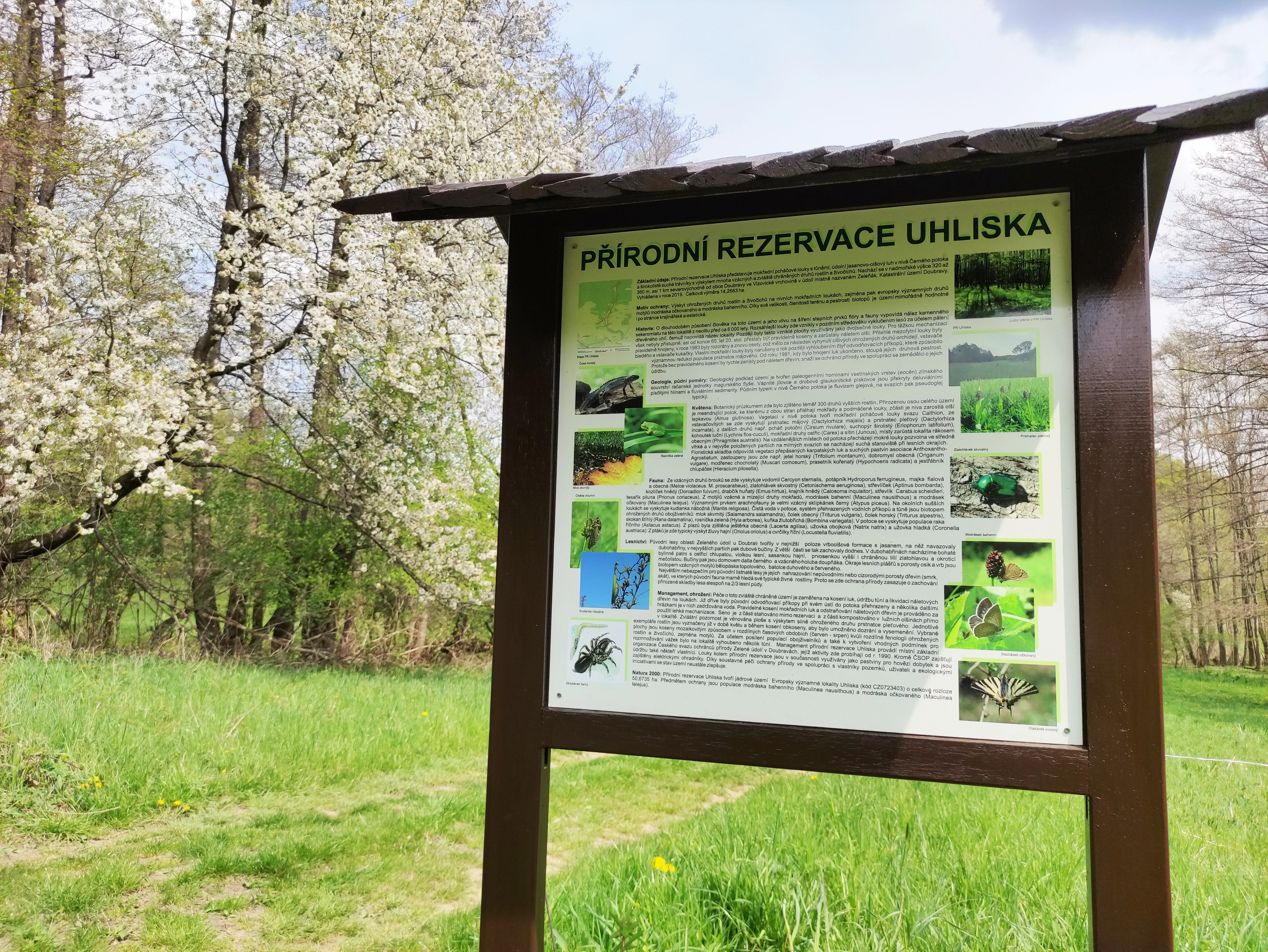
A brown wooden information board stands in a grassy meadow with flowering trees in the background at the Uhliska nature reserve.
Information board at the Uhliska nature reserve in the Czech Republic.

Uhliska history and protected-area timeline

Uhliska was first protected as a přírodní památka, or natural monument, on 1 October 1991 through a declaration by the Regional Authority of the Zlín Region. This early designation reflected the recognized natural value of the meadows and valley forest along the Černý potok, as well as the presence of rare plant and animal communities. As understanding of the site's importance grew, especially regarding its populations of European important butterfly species, the level of protection was revisited.

In 2019, the area was reclassified from a natural monument to a přírodní rezervace, a nature reserve, through Regulation No. 3/2019 of the Zlín Region. This higher category of protection recognized that the combination of meadow, grassland, and floodplain forest habitats at Uhliska, along with the occurrence of several rare and protected species, met criteria for a more stringent protected area status. Since the reclassification, the reserve has been administered by the Agency for Nature Conservation and Landscape Protection of the Czech Republic as part of the national network of small protected sites.

Uhliska landscape and geographic character

The landscape of Uhliska is shaped by a small Moravian stream valley with gently rolling surrounding terrain. The reserve occupies a narrow, meandering section of the Černý potok, with low terraces rising on either side to elevations of about 330 to 350 meters above sea level. The valley floor is soft and moist, marked by curving stream bends, wet soil, and occasional small pools, while the adjacent slopes are warmer and drier.

This subtle topography produces a sharp local contrast in moisture and soil conditions within a very compact area. Cooler, wetter ground along the stream supports tall herb communities, while sun exposed slopes and terrace edges carry drier grassland and transition zones. The overall scenery is one of a quiet agricultural countryside with a clearly defined green corridor of meadow and woodland following the watercourse, typical of small stream valleys in eastern Moravia.
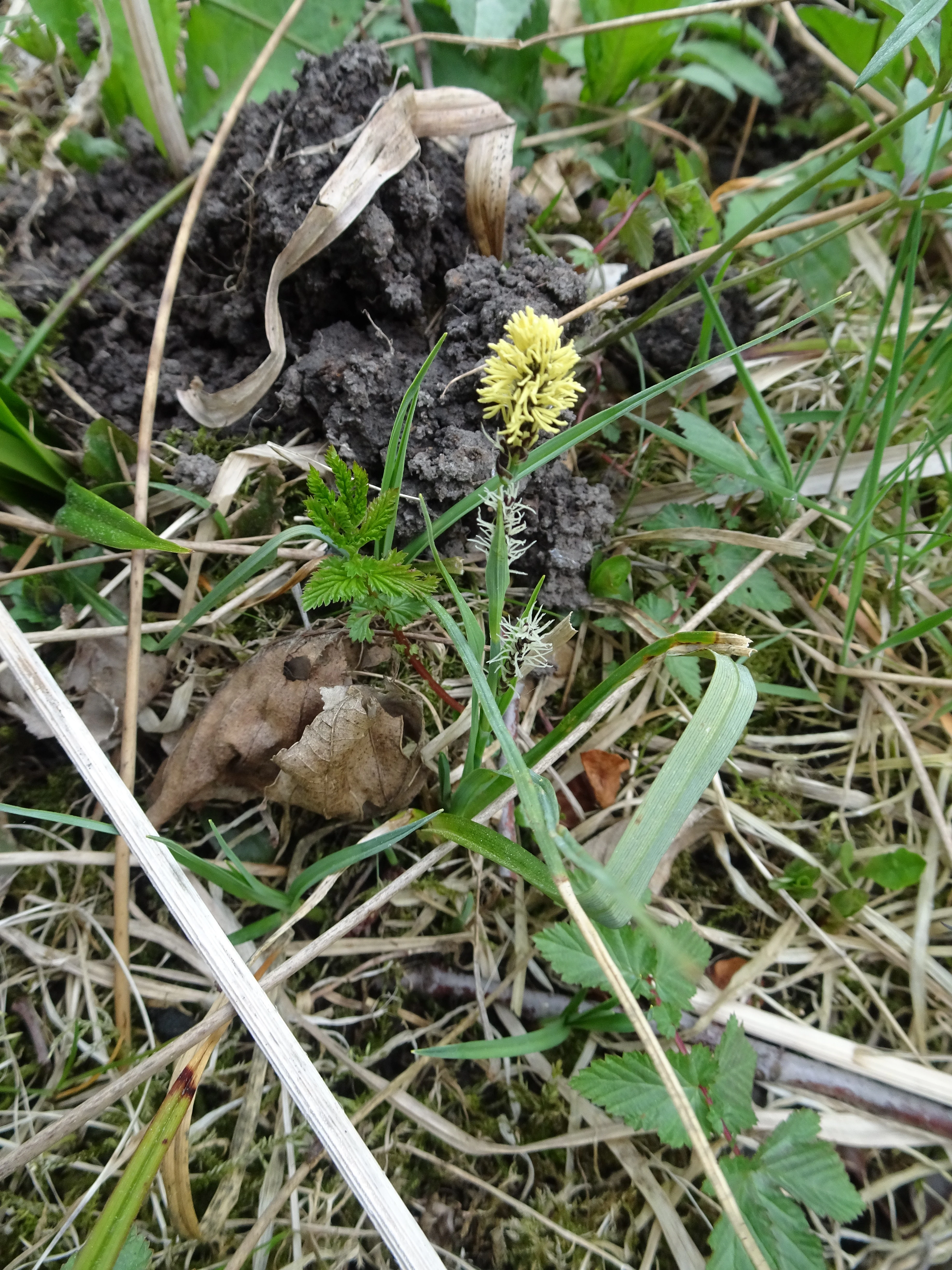
A close-up view of a small Carex pilosa plant with a yellow inflorescence growing from the soil, surrounded by dry grass and other small green plants.
Carex pilosa, commonly known as hairy sedge, growing in the Uhliska nature reserve.

Uhliska ecosystems, habitats, and plant life

Ecologically, Uhliska is defined by a closely interlocked mosaic of three main habitat types. The valley bottom is occupied by Cirsium meadows, tall herb rich wet meadows typical of regularly mowed sites in the Czech foothills. These are supplemented by broad leaved dry grasslands on warmer, better drained slopes, and by ash alder gallery forest, a floodplain woodland type that lines the stream and lower terraces.

Each of these habitats supports distinct plant communities. The wet meadows are known for populations of species such as marsh marigold, and the grasslands and wetland margins feature sedges adapted to seasonally wet conditions. The mosaic structure provides complementary resources for invertebrates, including the host plants and ant fauna necessary for butterflies of European importance. Because the valley is narrow and the habitats grade directly into one another, transitions between forest, wet meadow, and dry grassland occur over very short distances, amplifying the ecological diversity of the small reserve.
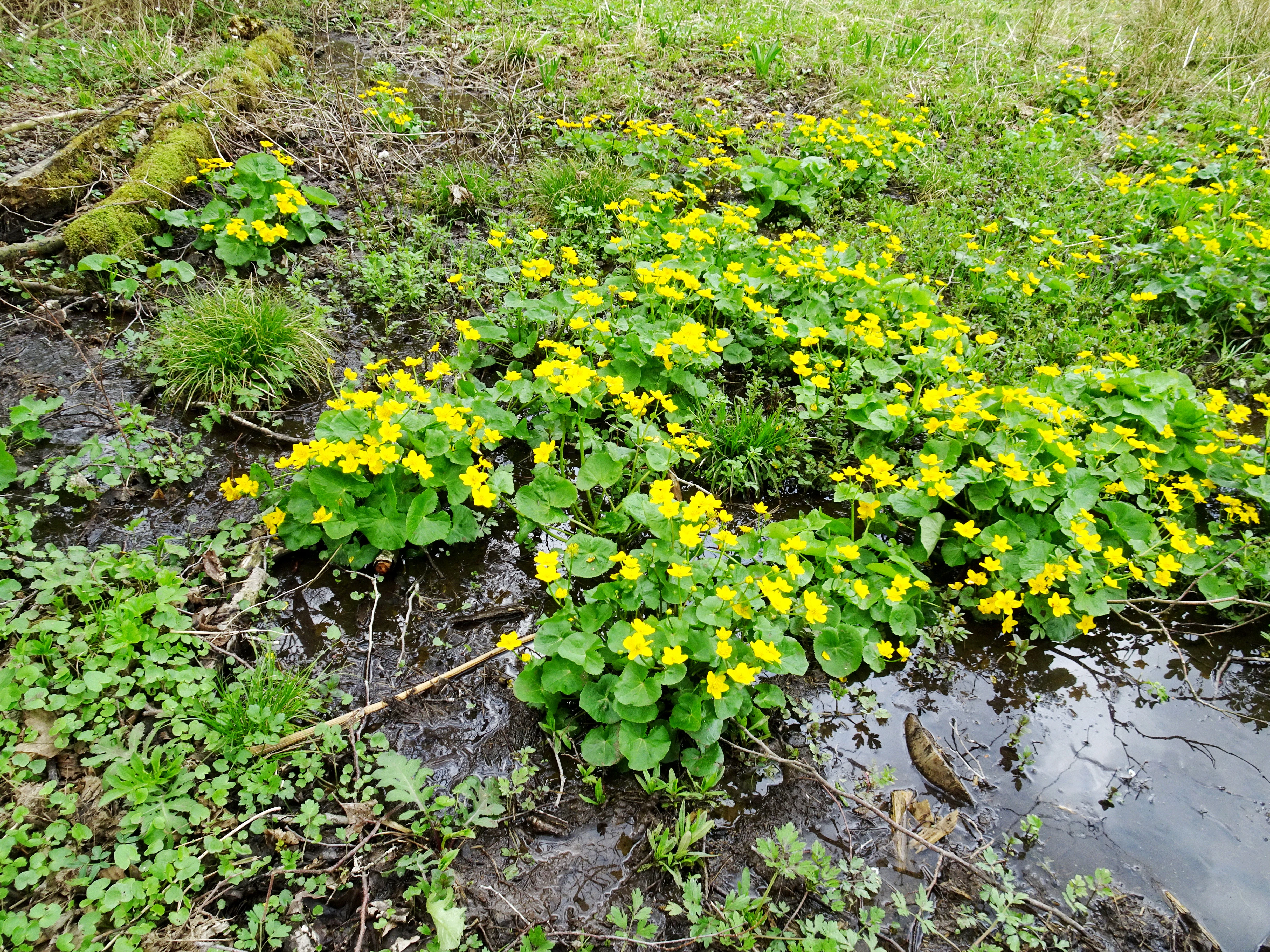
A cluster of yellow marsh marigold flowers growing in a small, damp, muddy area of a meadow.
Marsh marigolds, Caltha palustris, blooming in a wet meadow at Uhliska Nature Reserve.

Uhliska wildlife and species highlights

The most prominent wildlife values of Uhliska are linked to its butterflies and other meadow insects. The reserve supports populations of two species of European importance: Maculine teleius, the scarce large blue, and Maculine nausithous, the dusky large blue. Both species depend on specific combinations of food plants, such as certain Cirsium species and Sanguisorba officinalis, and on particular ant species that tend their larvae.

Beyond butterflies, the habitat mosaic supports a wide range of invertebrates associated with traditional meadows, including moths, bees, and hoverflies that benefit from the long flowering season of unmanaged or lightly managed grasslands. The ash alder floodplain forest and the stream itself provide habitat for amphibians, aquatic invertebrates, and the small fish and invertebrate communities typical of Moravian brooks. Birds associated with mixed agricultural and woodland landscapes regularly use the reserve as part of their territory.
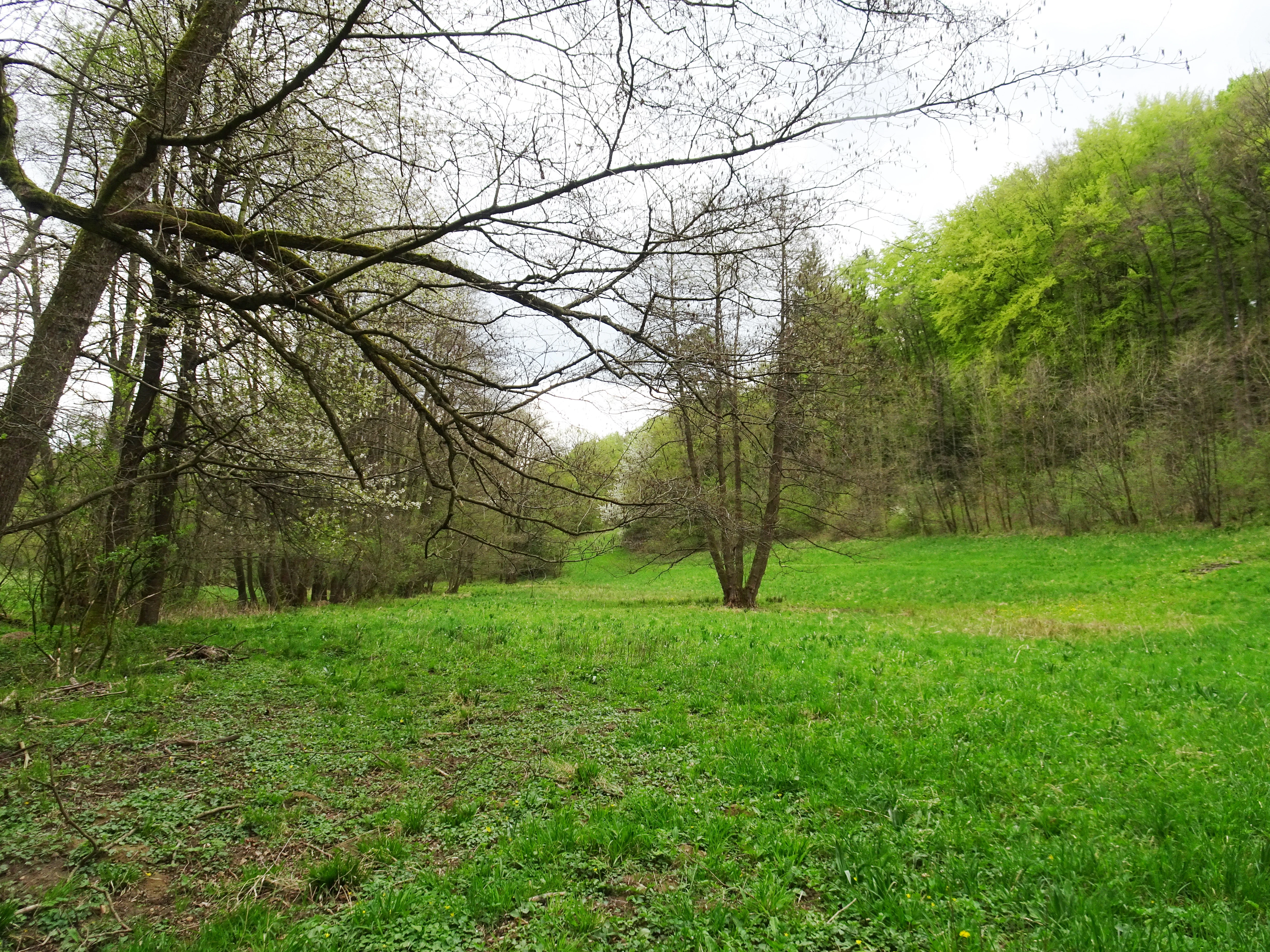
A green meadow bordered by trees under a cloudy sky in the Uhliska nature reserve.
A meadow and forest edge in the Uhliska nature reserve.

Uhliska conservation status and protection priorities

From a conservation perspective, Uhliska is significant because it concentrates several rare habitat types and European important species within an area of only about 14 hectares. The site contributes to the national network of protected natural areas in the Czech Republic by safeguarding a representative example of a Cirsium meadow valley with ash alder floodplain forest, habitat types that have declined across much of Central Europe due to changes in land use and watercourse management.

The reserve's higher level of protection since 2019 reflects the recognized value of its butterfly populations, particularly Maculine teleius and Maculine nausithous, which are among the species for which the Czech Republic has obligations under European nature conservation frameworks. Effective protection at Uhliska depends on maintaining traditional meadow management, preventing encroachment by shrubs or alien species, and preserving the natural dynamics of the Černý potok. The site is therefore managed as part of a broader strategy to maintain functional meadow stream complexes across eastern Moravia.

Uhliska cultural meaning and human context

Uhliska sits within a long settled agricultural landscape of eastern Moravia, where small stream valleys like that of the Černý potok have been used for hay production and grazing for centuries. The contemporary ecological value of the reserve is closely tied to this rural heritage: the persistence of Cirsium meadows and dry grasslands depends on traditional mowing and grazing practices that have shaped the Czech countryside for generations.

The nearby village of Doubravy and other small settlements of the Zlín district provide the local community context for the site. The reserve is not a major cultural landmark, but it reflects the broader pattern in which modest Moravian villages are surrounded by networks of small protected areas that protect fragments of land shaped by historical farming practices. In this sense, Uhliska is as much a piece of the region's living cultural landscape as it is a natural heritage site.
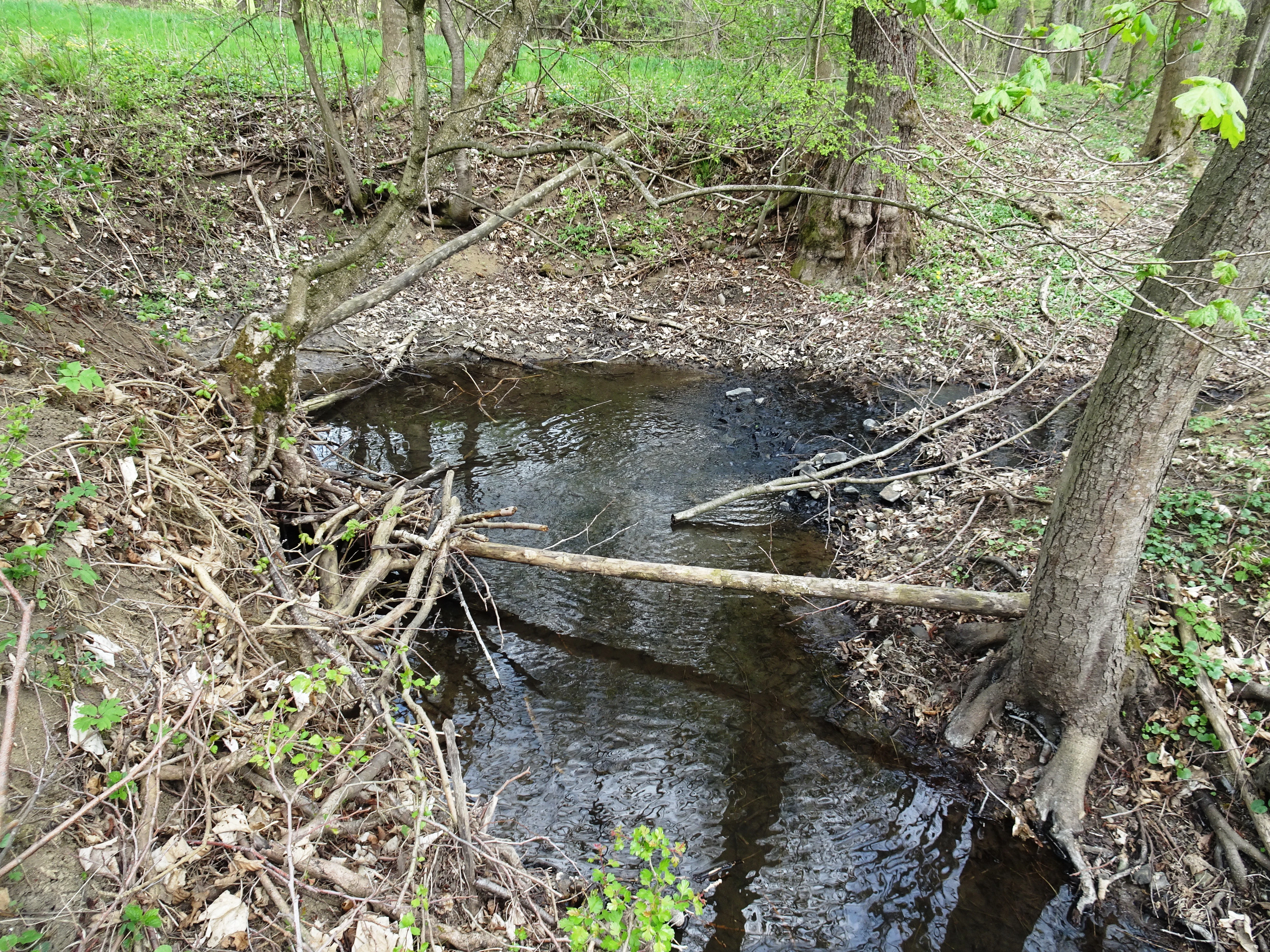
A narrow, dark stream flowing through a forest floor covered in leaf litter, with exposed tree roots and fallen branches along the banks.
Cerny potok stream flowing through the forested landscape of Uhliska Nature Reserve.

Top sights and standout views in Uhliska

Uhliska offers a compact but rewarding set of features for those interested in the less visible side of Czech nature conservation. Its narrow valley along the Černý potok hosts a textbook mosaic of Cirsium meadow, dry grassland, and ash alder floodplain forest within just a few hectares. The reserve is notable for being one of the local strongholds of two European important butterfly species, Maculine teleius and Maculine nausithous, whose presence underscores the value of traditional meadow management. The site also illustrates how small Moravian reserves connect local biodiversity protection to the country's wider network of protected natural areas.

Best time to visit Uhliska

Uhliska is a quiet, low profile natural reserve in the Moravian countryside, and its appeal shifts with the seasons in ways typical of lowland meadow and stream valley sites. Late spring and early summer bring the richest flowering display in the meadows and the main period when butterfly species are most active, making this a particularly fitting window for those interested in meadow flora and entomology. Summer continues to offer strong habitat viewing, with the streamside vegetation in full leaf and the pools along the Černý potok at their fullest. Autumn brings softer light through the valley and a more reflective atmosphere, while winter, though less colorful, reveals the structure of the stream corridor and the gallery forest. Because Uhliska is not a major tourist destination, visits should be planned with respect for the fragile meadows and the site's protected status.


Monthly climate preview

Long-term representative averages and weather by month for Uhliska terrain

Uhliska Climate Normals, Annual Temperature and Precipitation Rhythm

Uhliska records measured average temperatures ranging from negative lows in winter months to warm peaks in midyear, alongside consistent daily precipitation rates. Analyzing weather by month reveals detailed long-term climate normals across the representative coordinate.
Annual mean9 °C
-3 °C20 °C
Jan-3°
Feb-1°
Mar
Apr
May14°
Jun18°
Jul20°
Aug20°
Sep15°
Oct
Nov
Dec-2°
Warmest month
July

20.3 °C

Coolest month
January

-3.4 °C

Wettest month
July

2.6 mm/day

Driest month
February

1.3 mm/day

Park location guide

Geography guide, regional context, and park location map for Uhliska

Uhliska park geography, regions, and map view in Czechia

Understand where Uhliska sits in Czechia through a broader geographic reading of the surrounding landscape, nearby location context, and its mapped position within the national park landscape.

How Uhliska fits into Czechia

Czech Republic is a landlocked Central European country with a population of approximately 10.9 million people. The nation was established as an independent state on January 1, 1993, following the dissolution of Czechoslovakia. Its capital and largest city is Prague, with other major urban centers including Brno, Ostrava, Plzeň, and Liberec.

Wider geography shaping Uhliska in Czechia

The Czech Republic is a landlocked country in Central Europe. It is bordered by Germany to the west, Austria to the south, Poland to the northeast, and Slovakia to the southeast. The landscape is predominantly hilly, with the territory covering 78,871 square kilometers.

Map view of Uhliska

Use this park location map to pinpoint Uhliska in Czechia, understand its exact geographic position, and read its mapped placement within the surrounding landscape more clearly.

Pigeon | © OpenStreetMap contributors

Location context for Uhliska

Zlín Region
Recorded earthquake history

Review the Historical Earthquake Catalogue for the Uhliska Nature Reserve

Explore the documented history of seismic events identified near the Uhliska nature reserve. MoriAtlas compiles these records to provide a clear, factual view of historical regional activity, helping to contextualize the geological background of this Moravian protected landscape.

Uhliska Earthquake History

Catalogued events

1 event

Strongest magnitude

Magnitude 3.1

Most recent event

Mar 9, 2006

This history includes earthquakes recorded inside the park or within 50 km of its borders

Explore detailed scenery, valley terrain, and rare meadow habitats across the nature reserve

Uhliska Landscape and Habitat Photos: Visual Guide to the Protected Stream Valley

Visual records reveal the diverse terrain, meandering stream corridors, and wetland habitats that define the protected landscape of Uhliska. Examining these field photographs helps observers understand the close interaction between traditional valley management and rare regional ecosystems.

A brown wooden information board stands in a grassy meadow with flowering trees in the background at the Uhliska nature reserve.

A small, dark, circular pool of water situated on the forest floor, surrounded by mature deciduous trees and low-growing green ground vegetation.

A close-up view of a small Carex pilosa plant with a yellow inflorescence growing from the soil, surrounded by dry grass and other small green plants.

A cluster of yellow marsh marigold flowers growing in a small, damp, muddy area of a meadow.

A green meadow bordered by trees under a cloudy sky in the Uhliska nature reserve.

A wide, grassy meadow sloping upward toward a dense forest of green trees with a single white-flowering tree visible in the distance.

A narrow, dark stream flowing through a forest floor covered in leaf litter, with exposed tree roots and fallen branches along the banks.

Park atlas

Compare adjacent Moravian valley reserves and regional conservation landscapes

Explore Other Parks Near Uhliska and Surrounding Protected Natural Areas

Visitors exploring Uhliska can browse nearby protected areas and connected stream valley reserves across the surrounding Moravian countryside. Comparing these related locations reveals wider patterns in regional habitat preservation and traditional landscape management.
Protected landscapeZlín District
About 5 km away#1 closest

Northeast

Želechovické paseky Protected Landscape: Map and Regional Geography in Zlín District

Carpathian foothill terrain and mosaic meadow landscapes

An extensive protected area near Zlín, Želechovické paseky features a blend of traditional forest clearing, hillside meadows, and stream valleys. This mapped landscape demonstrates the continuity of the Moravian Carpathian foothills, providing a distinct look at historical land use patterns and natural ecological corridors.

Area
10.479 km²
Relief
Upland
Climate
Temperate
Scope
Terrestrial
A watercolor painting depicting a wide, soft-toned landscape with rolling green hills, a cluster of trees on a small rise, and forested areas in the background.
Natural monumentZlínský kraj
About 6.2 km away#2 closest

Northeast

Na želechovických pasekách Natural Monument: Geographic Context and Botanical Protected Area

Located in Zlínský kraj, eastern Moravia, Czech Republic.

Na želechovických pasekách represents a significant protected area within the Czech Republic. This small natural monument safeguards light-rich deciduous woodland slopes and serves as the sole known site for specific local flora. Explore the mapped terrain and environmental boundaries of this unique botanical site nested within the broader Vizovické vrchy natural park landscape.

Area
0.011 km²
Established
1949
IUCN
IV
Relief
Upland
Watercolor illustration of a lush, green landscape featuring rolling hills and grassy meadows under a pale sky.
Nature reserveZlín District
About 12 km away#3 closest

West

Na letišti Nature Reserve: Mapped Floodplain Landscapes in the Zlín District

A rare oxbow wetland refuge in Eastern Czechia

Located in the Zlín District, Na letišti is a protected natural monument formed from a regulated meander of the Morava River. This site functions as an isolated aquatic refuge, featuring a rich community of beetles and wetland flora that define the character of this lowland floodplain landscape within the Czech Republic.

Area
0.027 km²
Established
1956
IUCN
IV
Relief
Lowland
A soft watercolor painting depicting a gentle, hazy landscape with rolling hills, scattered patches of trees, and a winding path, rendered in light green, yellow, and peach tones against a white background.
Protected landscapeCzechia
About 25 km away#4 closest

North

Hostýnské vrchy Nature Park: Protected Landscape and Carpathian Foothill Geography

Forested ridge terrain across Zlín and Kroměříž districts

Hostýnské vrchy Nature Park represents a significant protected unit in the eastern Czech Republic, characterized by its deep forested ridges and open meadow clearings. As part of the outer Western Carpathians, the area supports diverse habitats including ancient beech and mixed forest stands alongside rare orchid populations. The landscape provides a clear window into the natural geography of central Moravia, with its intricate network of small watercourses and slopes.

Area
204 km²
Established
1989
Water
Minor water
Season
Year-round
Natural monumentJihomoravský kraj
About 25 km away#5 closest

Southwest

Miliovy louky Natural Monument: South Moravia Protected Grassland Geography

Mapping the xerothermic steppe and meadow landscape

Miliovy louky is a protected natural monument located in the Jihomoravský kraj region, noted for its surviving patch of semi-natural dry steppe vegetation. This compact reserve offers a distinct look at the region's historical open terrain, providing a critical haven for dryland flora and butterfly species amidst a backdrop of managed agricultural farmland.

Area
0.084 km²
Established
2014
IUCN
IV
Relief
Upland
A horizontal watercolor painting showing a green wetland area in the foreground with hills and coniferous trees in the background.
Natural monumentZlínský kraj
About 29 km away#6 closest

Northwest

Rameno Moravy Natural Monument: Protected Oxbow and Wetland Geography in Zlínský kraj

Mapping floodplain habitats and riverine natural monuments.

Rameno Moravy is a significant natural monument in the Czech Republic, encompassing a unique oxbow of the Morava River. The site provides a rare example of preserved still-water wetland habitats and diverse marsh communities within the lowland geography of the Zlínský kraj, standing out as a critical botanical site in the broader river basin.

Area
0.02 km²
Established
1995
IUCN
IV
Relief
Lowland
Watercolor painting of green rolling hills and small groves of trees, with a minimalist, airy style.
Nature reserveZlín Region
About 30 km away#7 closest

South

Mechnáčky Nature Reserve: Protected Meadow Biodiversity in the Zlín Region of the Czech Republic

Orchid-rich grasslands and managed Carpathian meadow landscapes

Mechnáčky represents an important nature reserve defined by its remnant flower-rich meadows and diverse invertebrate habitats. Situated in the Zlín Region, this site provides a focused look at the conservation of traditional Carpathian landscapes, including calcareous grasslands and spring-fed slopes that define the unique botanical character of this Czech protected area.

Area
0.109 km²
Established
1982
IUCN
IV
Relief
Upland
A wide, panoramic watercolor illustration showing a calm wetland scene with green reeds in the foreground, a body of water, and a line of trees and hills in the background under a pale sky, with a faded grey area at the bottom.
Natural monumentJihomoravský kraj
32 km away#8 closest

Southwest

Vypálenky Natural Monument: Protected Wetland Geography and Regional Map Context

Lowland floodplain habitat in the South Moravian region

The Vypálenky Natural Monument protects sixty-five hectares of essential floodplain habitat within the Morava River valley. This wetland landscape, defined by its flat terrain and groundwater-fed pools, supports significant communities of rare invertebrates and amphibians, anchoring a larger ecological corridor within the Bzenecká Doubrava and Strážnické Pomoraví protected network.

Area
0.653 km²
Established
2014
IUCN
IV
Relief
Lowland

Common questions about visiting, size, designation, and location context for Uhliska

Uhliska FAQs for park facts, access, geography, and protected area context

Find quick answers about Uhliska, including protected-area facts, park geography, trail and visitor context, and how the park fits into its surrounding country and regional landscape.
MoriAtlas Explorer

Continue Your Protected Areas Search Across the Global Atlas

Deepen your exploration by continuing the structured search for national parks and protected areas worldwide. Utilize the comprehensive filtering capabilities to compare different conservation landscapes and refine your understanding of global park geography. Discover more about the distribution and characteristics of protected natural areas.

Global natural geography