
Mori Atlas logo
National parkUlytau National Park

A detailed geographic look at the Ulytau massif and its unique mountain-steppe terrain

Ulytau National Park: Exploring Protected Mountain-Steppe Landscapes in Central Kazakhstan

(State National Natural Park "Ulytau" (Ұлытау мемлекеттік ұлттық табиғи паркі))

Ulytau National Park encompasses the distinct mountain massif of central Kazakhstan, protecting an isolated range that rises prominently above the surrounding steppe. This protected area covers nearly 59,000 hectares of rocky ridges, intermountain valleys, and weathered summits that hold both ecological value and historical significance. The terrain serves as a vital transition zone, where open grassland plains shift into rugged, elevated outcrops, creating a diverse mountain-steppe mosaic within the heart of the country.

mountain-steppelow mountainssteppesacred peaksKazakh steppecentral Kazakhstan
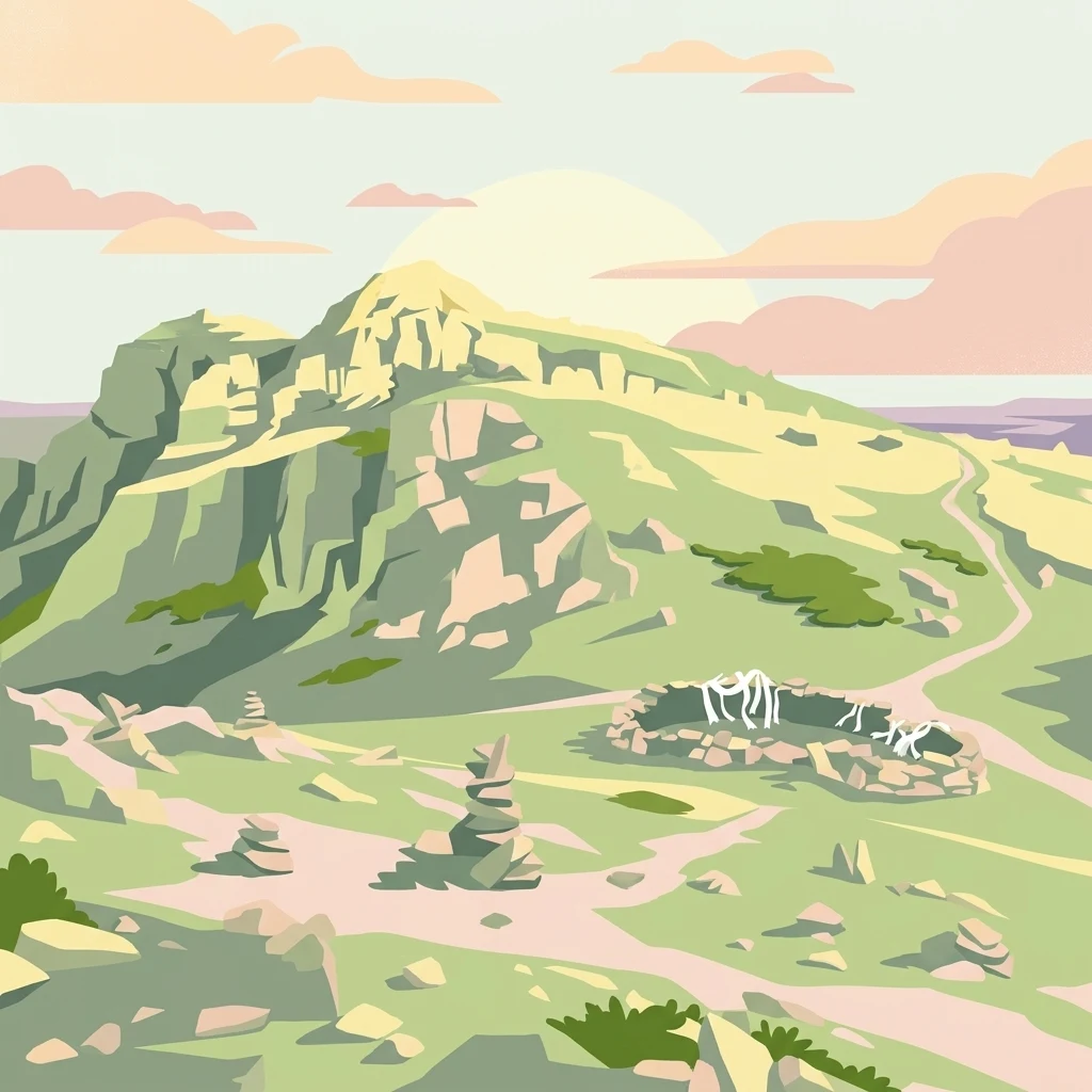
A flat-design illustration of a rocky hill, winding path, stone cairns, and a small circular stone structure under a sunset sky.

Ulytau National Park

National park

Park overview

Structured park overview, official facts, and landscape profile for Ulytau National Park

Ulytau National Park park facts, protected area profile, and essential visitor context

Review the core facts for Ulytau National Park, including designation, size, terrain, visitor scale, habitats, and operating context in one park-focused overview.

About Ulytau National Park

Ulytau National Park occupies a distinctive place in the network of protected natural areas of Kazakhstan. Created in January 2022 through a government resolution and built on a reorganized former forestry institution, the park was designed to combine ecosystem conservation with regional tourism development. Its official name in Kazakh, Ұлытау мемлекеттік ұлттық табиғи паркі, translates to State National Natural Park "Ulytau," and it is administered by the Committee of Forestry and Wildlife under Kazakhstan's Ministry of Ecology, Geology and Natural Resources.

The park spans roughly 58,912 hectares in the Ulytau District of the Ulytau Region, located in the central part of the country. The terrain is dominated by the Ulytau mountain massif, a low but visually striking range that has long served as a landmark in the steppe. Surrounding lowlands and intermountain valleys carry dry steppe vegetation, while the uplands add rocky outcrops, scree slopes and ridgelines that give the protected area its mountain-steppe profile. This combination of habitats supports the kind of ecological mosaic that may otherwise have been fragmented by grazing and land use.

The national park integrates the earlier Ulytau zakaznik, an existing reserve covering about 19,300 hectares, into a broader landscape-level designation. This expansion allows more consistent management across the massif, including the protection of historically and culturally significant peaks such as Akmeshit-Aulie. Although the park is recent in formal terms, the landscapes it protects have long been recognized as a core part of the Kazakh steppe's natural and cultural identity.

From a conservation standpoint, Ulytau National Park represents Kazakhstan's continuing emphasis on large national parks as tools for both ecosystem protection and regional development. Its mountain-steppe setting offers a contrast to the country's deserts, semi-deserts and northern forest zones, highlighting the diversity of Kazakhstan's natural heritage. At the same time, the park provides infrastructure for nature-based tourism in a region with deep cultural resonance.

Quick facts and research context for Ulytau National Park

Ulytau National Park is located in the Ulytau District of Ulytau Region in central Kazakhstan, established on 1 January 2022 through the reorganization of the Ulytau forestry and wildlife хозяйство. It is managed by the Committee of Forestry and Wildlife of the Ministry of Ecology, Geology and Natural Resources of Kazakhstan. The park covers roughly 58,912 hectares and holds IUCN Category II status as a national park.

The territory protects the mountain-steppe ecosystems of the Ulytau massif, an isolated upland system of central Kazakhstan. Its founding incorporates the pre-existing Ulytau zakaznik of about 19,300 hectares, expanding formal protection across the massif. The park is positioned to support both ecological conservation and tourism development in the region.

Protection and recognition

Terrestrial conservation framework, designation history, and administrative scope

Ulytau National Park Protection Status and International Recognition Data

Ulytau National Park maintains a documented terrestrial protection status within its regional conservation framework. Official records outline the governing management scope and available international recognition details for the protected area.

Protection details

Protection scope
Terrestrial
Park context

Deeper park guide and search-rich context for Ulytau National Park

Ulytau National Park history, landscape, wildlife, and travel context

Explore Ulytau National Park through its history, landscape character, ecosystems, wildlife, conservation priorities, cultural context, and seasonal travel timing in a structured park guide built for atlas discovery and search intent.

Why Ulytau National Park stands out

Ulytau National Park is best known for conserving the mountain-steppe ecosystems of the Ulytau massif, one of the iconic small mountain systems of central Kazakhstan. The park protects an isolated range that rises prominently above the surrounding Kazakh steppe, blending rocky uplands, grassy slopes, and open steppe valleys within a single protected landscape. Beyond its ecological role, the park is closely associated with the cultural and historical memory of Ulytau, including sacred peaks and sites tied to the nomadic heritage of the Kazakh people. Its young official status, established only in 2022, also makes it notable as part of a new wave of large national parks in Kazakhstan.
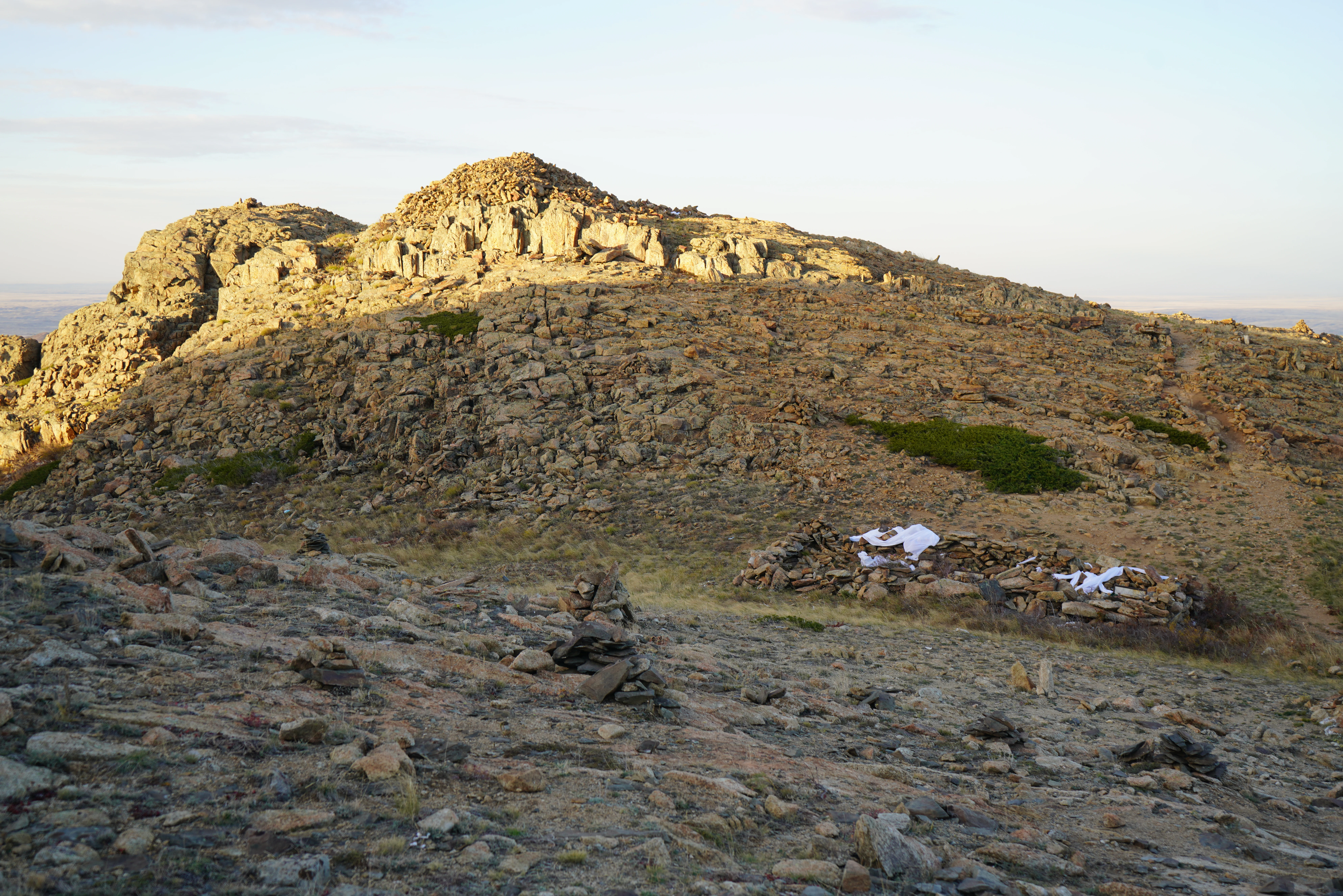
A rocky, arid mountain peak under soft, warm light in Ulytau National Park, featuring a small stone structure on the slope.
The rugged terrain of Aulietau, a significant mountain within Ulytau National Park.

Ulytau National Park history and protected-area timeline

Ulytau National Park was established through Resolution No. 867 of the Government of Kazakhstan, issued on 7 December 2021, and the resolution came into force on 1 January 2022. Rather than being created on entirely new land, the park was formed by reorganizing the existing Ulytau forestry and wildlife хозяйство, the regional institution previously responsible for managing forests and wildlife in the area.

Into this reorganized structure, the authorities incorporated the existing Ulytau zakaznik, a nature reserve of approximately 19,300 hectares that already provided a level of protection to the core mountain-steppe landscapes of the massif. The combined area under the new national park reaches about 58,912 hectares, giving the Ulytau mountains coherent landscape-level protection for the first time.

The park's founding reflects two parallel goals identified in the government decision: the restoration and conservation of the ecosystems and natural complexes of the Ulytau mountain-steppe massif, and the strengthening of the region's tourism potential. At the time of its creation, Ulytau Region was itself a newly drawn administrative unit of Kazakhstan, making the park part of a wider push to formalize the region's environmental, cultural and economic identity through large protected landscapes.

Although formal national park status is recent, the long-term significance of the Ulytau mountains extends far beyond modern administrative history. The mountains carry centuries of cultural, spiritual and nomadic heritage value, and their inclusion in the national park system ties modern conservation efforts to this older landscape identity.

Ulytau National Park landscape and geographic character

The defining landscape feature of Ulytau National Park is the Ulytau mountain massif, an isolated upland that rises from the surrounding Kazakh steppe in central Kazakhstan. The mountains are relatively low by global standards but are visually prominent in the regional context, forming recognizable silhouettes that can be seen from long distances across the open steppe.

Within the park, the terrain shifts between rocky ridges, rounded summits, weathered outcrops and gentler slopes. Intermountain valleys and hollows interrupt the higher elevations, creating a mosaic of habitats ranging from bare rock and scree to grass-covered depressions. Peaks such as Akmeshit-Aulie are among the notable summits inside the protected territory, valued both for their natural setting and for their cultural significance.

Surrounding the upland core are expanses of steppe that gradually give way to the mountains. Dry grassland vegetation dominates these lower areas, reflecting the semi-arid climate of inner Kazakhstan. The transition from steppe to rocky upland to intermountain valley is gradual but ecologically meaningful, giving the park its characteristic mountain-steppe scenery and supporting the range of natural complexes the national park was specifically created to protect.

Ulytau National Park ecosystems, habitats, and plant life

Ulytau National Park protects the mountain-steppe ecosystems and natural complexes of the Ulytau massif, a landscape type that is characteristic of central Kazakhstan but limited in extent. The combination of rocky uplands, grass-covered slopes and open steppe valleys creates a mosaic of habitats within a single protected territory.

Vegetation patterns reflect the semi-arid continental climate. Lower elevations and broader valleys support dry steppe communities, while slopes and higher ground carry thinner, more drought-tolerant plant cover. Rocky outcrops and exposed surfaces host specialized plant communities adapted to harsh conditions. The diversity of microhabitats within the massif is one of the key natural attributes the park aims to preserve.

The broader ecological value of Ulytau lies in its function as a refuge of natural mountain-steppe character in a region historically shaped by grazing, seasonal nomadic use and land conversion. By protecting the massif as a coherent landscape unit rather than just a series of small sites, the park safeguards ecological processes that depend on the combination of steppe and upland habitats. This makes the park an important element of Kazakhstan's protected-area network for mountain-steppe conservation.

Ulytau National Park conservation status and protection priorities

Ulytau National Park's conservation significance lies in its focus on the mountain-steppe ecosystems of the Ulytau massif, a relatively limited but ecologically distinctive landscape type in central Kazakhstan. The park was created through Resolution No. 867 of the Government of Kazakhstan, with conservation of these ecosystems and natural complexes identified as a primary objective.

A key conservation feature is the integration of the pre-existing Ulytau zakaznik, which already protected part of the massif, into a much larger national park. This expansion creates a landscape-level protected area that can support ecological processes dependent on the interaction between the mountains and the surrounding steppe, rather than just isolated sites. Granting the area IUCN Category II national park status underlines its formal recognition as a high-priority protected landscape.

The park is also a tool for managing long-standing pressures on the Ulytau massif, including grazing, vegetation change and other forms of historical land use tied to the region's nomadic and economic traditions. By placing the massif under unified national park governance, the authorities have created a framework for coordinated conservation and restoration, reinforcing the mountain-steppe's role as part of Kazakhstan's broader natural heritage.

Ulytau National Park cultural meaning and human context

The Ulytau mountains carry deep cultural meaning in Kazakh history and identity, and the national park's territory reflects this. Peaks and sites within the park, including Akmeshit-Aulie, are linked to the spiritual and historical memory of the Kazakh steppe.

The very name of the park, drawn directly from the massif, signals the region's symbolic weight. Ulytau has long been associated with nomadic heritage, ritual landscapes and the presence of important historical figures, making it more than a purely natural designation. The creation of Ulytau Region as a new administrative unit around the same time as the national park reflects this broader framing of the territory as a center of national memory.

By incorporating culturally significant peaks and landscapes into a formally protected natural area, Ulytau National Park ties ecosystem conservation to regional cultural identity, treating the massif as both a natural and a heritage landscape.

Top sights and standout views in Ulytau National Park

Ulytau National Park stands out as a young but strategically important national park, created in 2022 to give the Ulytau massif its first coherent landscape-level protection. Its roughly 58,912-hectare territory integrates the former Ulytau zakaznik into a much broader designation, allowing unified management of the mountain-steppe ecosystems of central Kazakhstan.

The park's combination of rocky uplands, intermountain valleys and surrounding steppe gives visitors a clear sense of the mountain-steppe character that defines so much of inner Kazakhstan. Sacred peaks such as Akmeshit-Aulie add a strong cultural dimension, anchoring the natural landscape within the broader heritage of the Kazakh steppe. Managed under the country's central forestry and wildlife authority, Ulytau is positioned at the intersection of ecological conservation, cultural memory and regional tourism development.

Best time to visit Ulytau National Park

The source material does not provide detailed seasonal guidance for visiting Ulytau National Park. As a mountain-steppe protected area in central Kazakhstan, the park's character is shaped by the strongly continental climate of the region, with hot, dry summers and cold winters, and spring and autumn periods that bring milder temperatures and changing landscape conditions. Visitors interested in comfortable weather and clear views of the massif's scenery typically favor these transitional seasons, but detailed seasonal timing is not firmly supported by the available sources and so is not specified further here.
Monthly climate preview

Measured monthly weather patterns and long term thermal rhythms across representative coordinates

Ulytau National Park Climate Normals, Long Term Temperature and Precipitation Records

Ulytau National Park experiences measured annual temperature shifts from deep winter minimums to warm summer maximums alongside consistent multi month precipitation rhythms. Examining the complete twelve month climate profile reveals detailed monthly averages across the representative coordinate dataset.
Annual mean5 °C
-14 °C23 °C
Jan-14°
Feb-12°
Mar-4°
Apr
May15°
Jun21°
Jul23°
Aug22°
Sep14°
Oct
Nov-4°
Dec-11°
Warmest month
July

23.3 °C

Coolest month
January

-14 °C

Wettest month
April

0.7 mm/day

Driest month
September

0.3 mm/day

Park location guide

Geography guide, regional context, and park location map for Ulytau National Park

Ulytau National Park park geography, regions, and map view in Kazakhstan

Understand where Ulytau National Park sits in Kazakhstan through a broader geographic reading of the surrounding landscape, nearby location context, and its mapped position within the national park landscape.

How Ulytau National Park fits into Kazakhstan

Kazakhstan is a Central Asian country spanning vast steppes and plains, bordered by Russia, China, Kyrgyzstan, Uzbekistan, and Turkmenistan, with a coastline along the Caspian Sea. It gained independence from the Soviet Union in 1991 and has a population of approximately 20.5 million people. The country is officially secular but predominantly Muslim, with Kazakh and Russian as official languages.

Wider geography shaping Ulytau National Park in Kazakhstan

Kazakhstan occupies a vast territory in Central Asia, extending into Eastern Europe. Its terrain consists largely of hilly plateaus and plains, with lowlands covering about a third of the area. The southern and eastern regions are mountainous. The country borders Russia to the north and west, China to the east, Kyrgyzstan to the southeast, Uzbekistan to the south, and Turkmenistan to the southwest. It has a coastline along the Caspian Sea.

Map view of Ulytau National Park

Use this park location map to pinpoint Ulytau National Park in Kazakhstan, understand its exact geographic position, and read its mapped placement within the surrounding landscape more clearly.

Pigeon | © OpenStreetMap contributors

Location context for Ulytau National Park

Ulytau Region

Visualizing rocky uplands, mountain-steppe terrain, and central Kazakhstan protected areas

Ulytau National Park Photos and Landscape Scenery Exploration

Visual documentation captures the rugged mountain-steppe terrain, isolated upland massifs, and open grassland habitats characteristic of inner Kazakhstan. Examining protected area photography reveals the distinct environmental transitions and topographical features that define the region.

A rocky, arid mountain peak under soft, warm light in Ulytau National Park, featuring a small stone structure on the slope.

Park atlas

Compare regional mountain-steppe terrain and neighboring conservation zones across central Kazakhstan.

Explore Parks Near Ulytau National Park and Surrounding Protected Landscapes

Browsing other protected areas near Ulytau National Park reveals wider patterns in the mountain-steppe ecosystems of central Kazakhstan. Comparing adjacent reserves helps contextualize the isolated rocky massifs and expansive grasslands that define regional conservation.
Nature reserveKostanay Region
About 165 km away#1 closest

Northwest

Altyn Dala Nature Reserve: Mapping Steppe Biodiversity and Migratory Corridors in Kazakhstan

A comprehensive look at the three-cluster protected landscape and regional geography

Spanning over 489,000 hectares, Altyn Dala Nature Reserve preserves diverse habitats ranging from the Sarykopa lake system to the vast Uly-Zhylyanshyk semi-desert steppe. This detail page tracks the reserve's unique cluster structure, geographic boundaries, and essential role in maintaining the historical integrity of northern Kazakhstan's grassland and river corridor ecosystems.

Area
4,897.66 km²
Established
2012
IUCN
VI
Relief
Lowland
Nature reserveAktobe Region
About 281 km away#2 closest

West

Irgiz-Turgay Nature Reserve: Geographic Map and Protected Land Overview in Kazakhstan

Significant nature reserve within Aktobe Region featuring vast desert and river valley ecosystems.

Irgiz-Turgay Nature Reserve functions as a flagship protected territory for Kazakhstan, spanning vast semi-desert plains and the Turgay River valley. This geographic analysis highlights its role as a crucial sanctuary for steppe wildlife, detailing how its protected boundaries encompass unique wetland meadows, saltwort fields, and arid terrain within the broader northern desert zone.

Area
11,735.1 km²
Established
2007
IUCN
VI
Relief
Lowland
Nature reserveKaraganda Region
About 298 km away#3 closest

East

Karaagash Nature Reserve: Granite Ridge Landscapes in Central Kazakhstan

Protected forest-steppe habitat in the Karaganda region

Karaagash Nature Reserve stands as a sentinel of central Kazakhstan's geography, protecting a rugged area where granite uplands meet ridge-and-valley plains. This reserve supports a diverse array of flora and fauna, offering a representative look at the forest-steppe transition zone and its role in regional conservation.

Area
68 km²
Established
1986
IUCN
IV
Relief
Mountain
Wildlife reserveAkmola Region
About 311 km away#4 closest

North

Atbasar Wildlife Reserve: Protected Steppe Grasslands and Wildlife Habitat in the Akmola Region

Mapping conservation landscapes of northern Kazakhstan

Explore the geographic scope of Atbasar Wildlife Reserve, a significant sanctuary in northern Kazakhstan. This protected area preserves key steppe ecosystems and habitat for marmots and migratory birds within a unique terrain of rocky spurs and open feather grass plains.

Area
751 km²
Established
1976
IUCN
IV
Relief
Upland
Watercolor illustration of a landscape with green hills, a body of water, and grassy foreground under a pink-hued sky
National parkAqmola Region
About 441 km away#5 closest

North

Kokshetau National Park: A Protected Granite Mountain and Forest-Steppe Landscape in Kazakhstan

Explore Aqmola Region's unique protected geography and mapped terrain.

Kokshetau National Park stands as a remarkable protected landscape within Kazakhstan, defined by its ancient granite mountains and its unique position as a forest-steppe island surrounded by open plains. This national park preserves a rich tapestry of boreal forests, lake-filled depressions, and geological wonders, including some of the planet's most ancient rock formations. MoriAtlas provides a structured view of Kokshetau National Park, detailing its mapped boundaries and geographic context within the Aqmola Region, offering users a deep dive into its protected area identity and ecological significance.

Area
1,821 km²
Established
1996
IUCN
II
Relief
Upland
A pale, minimalist watercolor illustration of a soft, rolling landscape with light green and pink washes against a white background.
Wildlife reserveKaraganda Region
About 455 km away#6 closest

East

Bugyly Sanctuary Wildlife Reserve and Protected Mountain Terrain in Karaganda Region

A protected zoological landscape in the heart of central Kazakhstan

Bugyly Sanctuary is a specialized wildlife reserve defined by its low mountain topography, rocky outcrops, and narrow stream-side groves. Situated in the Karaganda Region, the protected area functions as a vital refuge for argali sheep, roe deer, and various ground-nesting birds, standing as a testament to the diverse interior uplands of the Sarysu River basin.

Area
85 km²
Relief
Lowland
Water
Minor water
Protected areaKostanay Region
About 458 km away#7 closest

North

Koibagar-Tyntyugur Lakes: Protected Wetland Geography in Northern Kazakhstan

Steppe-wetland mosaic and Ramsar-recognized migratory habitat

Located in the Kostanay Region, the Koibagar-Tyntyugur Lakes represent a complex system of shallow, interconnected basins. These protected landscapes illustrate the dramatic hydrological cycles of the Saryarka edge, shifting from open water to reed-filled marshes. The region remains a benchmark for conservation, featuring essential waterbird habitats and rare fragments of pristine feather-grass steppe.

Area
623.45 km²
Established
2005
Relief
Lowland
Scope
Terrestrial
Protected areaKostanay Region
About 469 km away#8 closest

Northwest

Taldykol Protected Area: Geographic Atlas and Wetland Landscape Analysis

A vital Ramsar-listed freshwater steppe habitat in Kostanay Region

Taldykol acts as a critical freshwater sanctuary within the dry climate of northern Kazakhstan. This protected area, defined by its central island and willow-fringed margins, forms an essential part of the Kulykol-Taldykol lake system. The basin provides a necessary stopover and breeding site for waterbirds, demonstrating how local water features define the ecological character of the surrounding Kostanay Region steppe terrain.

Area
10.5 km²
Relief
Lowland
Scope
Terrestrial
Water
Water-dominated

Common questions about visiting, size, designation, and location context for Ulytau National Park

Ulytau National Park FAQs for park facts, access, geography, and protected area context

Find quick answers about Ulytau National Park, including protected-area facts, park geography, trail and visitor context, and how the park fits into its surrounding country and regional landscape.
MoriAtlas Explorer

Continue Your Protected Areas Search Across the Global Atlas

Deepen your exploration by continuing the structured search for national parks and protected areas worldwide. Utilize the comprehensive filtering capabilities to compare different conservation landscapes and refine your understanding of global park geography. Discover more about the distribution and characteristics of protected natural areas.

Global natural geography