
Mori Atlas logo
Protected landscapeUmatilla National Forest

A vast mountain terrain spanning river-cut canyons and high-country wilderness in the inland Northwest

Umatilla National Forest: Mapping the Protected Landscapes of the Blue Mountains Region

Umatilla National Forest represents a expansive protected landscape across northeast Oregon and southeast Washington. This mountainous system features basalt-carved canyons, old-growth forests, and vital river drainages that serve as a geographic anchor for the broader Blue Mountains range. The area hosts three primary wilderness zones, offering a detailed look at the diverse terrain and protected boundaries defining this inland Pacific Northwest ecosystem.

national forestBlue Mountainswilderness areasold-growth forestelk habitatPacific Northwest
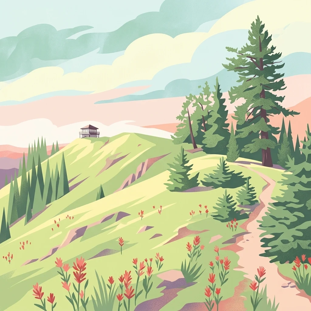
An illustration depicting a dirt path winding through a meadow with red wildflowers towards a fire lookout tower on a green ridgeline, surrounded by evergreen trees.

Umatilla National Forest

Protected landscape

Park overview

Structured park overview, official facts, and landscape profile for Umatilla National Forest

Umatilla National Forest park facts, protected area profile, and essential visitor context

Review the core facts for Umatilla National Forest, including designation, size, terrain, visitor scale, habitats, and operating context in one park-focused overview.

About Umatilla National Forest

Umatilla National Forest is one of the largest national forests in the Pacific Northwest, occupying a major share of the Blue Mountains that form the spine between northeast Oregon and southeast Washington. More than three-quarters of its roughly 1.4 million acres lie in Oregon, where it touches Umatilla, Grant, Morrow, Wallowa, Union, and Wheeler counties. The remainder crosses the state line into Washington, extending into Columbia, Garfield, Asotin, and Walla Walla counties. Forest headquarters are in Pendleton, Oregon, with ranger district offices in Heppner, Ukiah, Pomeroy, and Walla Walla.

The forest's geography is defined by the Blue Mountains' mix of plateau-like ridges, basalt canyons, and river valleys. Major tributaries of the Columbia, including the Umatilla, Walla Walla, Tucannon, and North Fork of the John Day, all rise within or pass through the forest, shaping both the scenery and the ecological patterns. Wilderness and primitive landscapes cover more than 20 percent of the forest, with the Wenaha–Tucannon Wilderness straddling the Oregon–Washington border, the North Fork John Day Wilderness anchoring the southern reaches, and the smaller but ecologically distinct North Fork Umatilla Wilderness protecting the headwaters of the Umatilla River.

Ecologically, Umatilla is a transitional forest where drier interior ponderosa pine and Douglas-fir stands meet higher-elevation mixed conifer and true fir forests. Old-growth forest still accounts for a substantial portion of the landscape, supporting complex wildlife communities. The forest is heavily used for dispersed recreation, including hunting, fishing, hiking, camping, OHV riding, and downhill skiing at Spout Springs and Bluewood ski areas, both of which operate under special use permits within the forest. Jubilee Lake's campground is a focal point for traditional family and group visits.

Culturally, the forest occupies ancestral lands of the Umatilla and other Columbia Plateau tribes, and the name itself comes from a Umatilla word meaning "water rippling over sand." The region retains traces of the broader story of the American West, from the Lewis and Clark expedition along the Columbia, to 1830s missionary settlement, to Oregon Trail emigration and frontier-era gold mining in the North Fork John Day drainage.

Quick facts and research context for Umatilla National Forest

Umatilla National Forest lies mainly in Oregon, with a smaller portion extending into Washington, and is administered by the U.S. Forest Service from headquarters in Pendleton, Oregon. The forest was formally established on July 1, 1908, taking in lands from the earlier Blue Mountains and Heppner National Forests, and later absorbing the Wenaha National Forest in 1920. It crosses ten counties across the two states, with the bulk of its territory in Umatilla, Grant, Columbia, Morrow, Wallowa, and Union counties. The terrain is dominated by the Blue Mountains, with elevations, rivers, and canyons that support extensive wildlife habitat and recreationally significant wilderness areas.

Protection and recognition

Examine official terrestrial conservation measures and recognition data.

Umatilla National Forest Protection Status and Transboundary Geography

Umatilla National Forest maintains documented terrestrial protection status across shared regional boundaries without external international listings. Conservation analysts review recorded administrative designations and geographic scope parameters for comprehensive protected area assessment.

Protection details

Protection scope
Terrestrial
Transboundary protection
Yes
WDPA ID
8884018
Park context

Deeper park guide and search-rich context for Umatilla National Forest

Umatilla National Forest history, landscape, wildlife, and travel context

Explore Umatilla National Forest through its history, landscape character, ecosystems, wildlife, conservation priorities, cultural context, and seasonal travel timing in a structured park guide built for atlas discovery and search intent.

Why Umatilla National Forest stands out

Umatilla National Forest is best known for its expansive Blue Mountains scenery, its high proportion of designated wilderness, and its diversity of large mammals and game fish. The Wenaha, Tucannon Wilderness, the North Fork John Day Wilderness, and the North Fork Umatilla Wilderness are signature landscapes within the forest, each anchoring a different river drainage and ecological character. The forest is also recognized for the size and quality of its elk, deer, bighorn sheep, and trout populations, and for the presence of substantial old-growth forest stands that remain a defining element of its ecology.
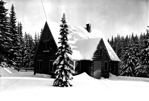
A black and white archival photograph of a gabled, wooden ranger station residence surrounded by snow and conifer trees in 1935.
The residence at the Toll Gate Ranger Station in Umatilla National Forest, photographed in 1935.

Umatilla National Forest history and protected-area timeline

The land that is now Umatilla National Forest has a layered human history that long predates its formal protection. In 1805, the Lewis and Clark expedition traveled along the Columbia River on the forest's northern edge, documenting a landscape already shaped by Indigenous presence. In 1836, missionaries Marcus and Narcissa Whitman passed through the Blue Mountains to establish their mission near Walla Walla, opening a route that thousands of Oregon Trail emigrants would later follow west, with many settling in the surrounding valleys and mountain country.

A major chapter of frontier-era activity came with the 1851 gold discovery along Oregon's North Fork John Day River. The resulting boom drew settlement and hard-rock mining into what is now the heart of the national forest, producing more than $10 million in gold and silver at historical values. Remnants of old mining camps and workings remain visible across the forest, and some gold claims are still active today, linking present visitors directly to the nineteenth-century mining economy.

The modern forest was formally established on July 1, 1908, when Umatilla National Forest was carved out of part of the older Blue Mountains National Forest and all of the Heppner National Forest. In 1920, the Wenaha National Forest was absorbed into Umatilla, consolidating modern boundaries. More recent decades have brought new kinds of historical reckoning and risk: in 2005, the forest was the site of the School Fire, the largest wildfire in the contiguous United States that year, and in 2025 a long investigation led to the conviction of a local resident for poaching hundreds of Native American artifacts from illegal digs within the forest, with hundreds of items returned to the Nez Perce tribe.

Umatilla National Forest landscape and geographic character

The landscape of Umatilla National Forest is shaped by the Blue Mountains, a long, complex range that forms the geographic backbone of northeast Oregon and extends into southeast Washington. Elevations shift from river-cut lowlands along the Columbia's southern tributaries up through rolling forested ridges and into higher subalpine zones. Basalt and other volcanic substrates, carved by water over millions of years, give the forest its characteristic pattern of steep canyons, benches, and rounded uplands.

Rivers are central to the forest's identity. The Umatilla, Walla Walla, Tucannon, and North Fork of the John Day each carve distinctive drainages, and the narrow valley of the North Fork of the Umatilla River hosts its own dedicated wilderness area. The result is a terrain of long forested slopes punctuated by rugged canyon bottoms, open ridgetop vistas, and broad drainage corridors that connect the mountains to the Columbia Plateau.

More than a fifth of the forest is designated wilderness, anchoring three of its most distinctive landscapes. The Wenaha–Tucannon Wilderness straddles the Oregon–Washington border along a remote river corridor. The North Fork John Day Wilderness, shared partly with Whitman National Forest, occupies the southern reaches of the system. The smaller North Fork Umatilla Wilderness protects the upper Umatilla valley, including the headwaters of the river for which the forest is named.

Umatilla National Forest ecosystems, habitats, and plant life

Ecologically, Umatilla National Forest sits within a transitional zone between the drier forests of the Columbia Plateau and the more mesic conifer forests of the central Pacific Northwest. Lower slopes are typically dominated by ponderosa pine and Douglas-fir, often in open, fire-adapted stands, while higher elevations shift toward grand fir, lodgepole pine, and other mixed conifers. A 1993 Forest Service study estimated more than 190,000 acres of old growth, a presence that gives the forest unusual structural complexity and habitat value compared with many other national forests in the region.

The forest's vegetation pattern is strongly tied to its river systems. Riparian corridors along the Umatilla, Tucannon, Wenaha, and John Day forks support moist hardwood and conifer communities that contrast sharply with the surrounding uplands. These riverine environments, combined with the forest's elevation range, create a mosaic of habitats from open pine woodlands to dense, shaded old-growth stands and snow-fed subalpine pockets. The result is a forest that simultaneously supports dry-country species adapted to frequent fire and shade-tolerant species tied to late-successional conditions.

Umatilla National Forest wildlife and species highlights

Umatilla National Forest is widely recognized for the richness of its mammal communities, including several of the larger ungulates and carnivores of the inland Northwest. Moose are present in suitable wet habitat, particularly in northern parts of the forest, while Rocky Mountain elk and mule deer are among the most prominent and abundant big game species. Bighorn sheep occupy select rocky terrain, especially in the more rugged southern and eastern reaches, and both white-tailed deer and mountain goats contribute to the diversity of hoofed mammals.

Predators and smaller carnivores round out the mammal fauna. Black bear and cougar are well established across much of the forest, and timber wolves, coyotes, and badgers are also part of the resident wildlife community. Upland game birds and turkeys add another layer, including Merriam's turkeys, transplanted Rio Grande wild turkeys, blue grouse, ruffed grouse, and Franklin's grouse. Together these species support a strong hunting and wildlife-watching tradition that is central to the forest's recreational identity.

The forest's rivers and streams sustain a notable fishery as well. Chinook salmon and coho salmon migrate through tributaries of the Columbia, and resident trout populations, including steelhead, rainbow trout, brook trout, and lake trout, inhabit many of the forest's cold-water streams and lakes. This combination of large mammals, game birds, and anadromous and resident fish makes the forest one of the more ecologically productive hunting, wildlife-watching, and angling destinations in the region.

Umatilla National Forest conservation status and protection priorities

Umatilla National Forest plays a significant role in conserving the ecological character of the Blue Mountains. With about 1.4 million acres under federal protection, it represents one of the largest connected blocks of forest habitat in interior Oregon and eastern Washington, supporting wide-ranging species such as elk, mule deer, cougar, and black bear. The persistence of more than 190,000 acres of old growth gives the forest particular conservation relevance, providing habitat structure that takes many decades to replace and supporting species that depend on late-successional forest conditions.

Conservation significance extends to the forest's waterways. Headwaters and tributaries that originate in the forest drain into the broader Columbia River system, including salmon-bearing streams that support both Chinook and coho salmon runs as well as resident trout. By buffering water quality, flow regimes, and riparian habitat across hundreds of miles of mountain terrain, the forest contributes directly to aquatic conservation at a regional scale.

The forest's three designated wilderness areas, Wenaha–Tucannon, North Fork John Day, and North Fork Umatilla, anchor the conservation portfolio, preserving substantial tracts where natural processes dominate over active management. Increasingly, the forest is also part of broader conversations about wildfire in the West: the 2005 School Fire highlighted how large-scale fire events can shape both ecological dynamics and management priorities across the Blue Mountains landscape.

Umatilla National Forest cultural meaning and human context

The Umatilla National Forest occupies lands long used and stewarded by Indigenous peoples of the Columbia Plateau, including the Umatilla. The forest's name itself comes from a Umatilla word meaning "water rippling over sand," reflecting the deep relationship between tribal communities and the rivers, canyons, and mountain landscapes of the region. In 2025, a long investigation into artifact poaching within the forest resulted in the recovery and return of more than 500 items to the Nez Perce tribe, an event that underscored the ongoing importance of protecting Indigenous heritage on national forest lands.

The forest is also closely tied to the broader story of westward expansion. It spans routes used by the Lewis and Clark expedition along the Columbia, the 1830s Whitman missionary journey that helped open the Oregon Trail, and the subsequent waves of emigrants who crossed the Blue Mountains. Frontier-era gold mining in the North Fork John Day drainage, beginning in 1851, created a lasting imprint of mining claims, workings, and small settlement remnants that still shape how visitors and historians read the landscape today.

Ranching, timber, and small-town service economies in places like Pendleton, Elgin, Heppner, Ukiah, Pomeroy, and Walla Walla continue to coexist with the forest as both a working landscape and a public amenity, giving the Umatilla a strongly regional cultural identity grounded in the Blue Mountain country.

Top sights and standout views in Umatilla National Forest

Umatilla National Forest's standout features include its sheer size, its three designated wilderness areas, and its unusually rich blend of large-mammal wildlife and salmon-bearing rivers. The Wenaha–Tucannon Wilderness is the largest and most remote of these, while the North Fork John Day Wilderness adds deep canyon country and historic mining heritage, and the North Fork Umatilla Wilderness protects the Umatilla River's headwaters. Substantial old-growth forest cover, a long hunter and angler tradition, and the presence of two operating ski areas within the forest bounds round out a portfolio that distinguishes Umatilla from many of its regional neighbors.

Best time to visit Umatilla National Forest

The Umatilla National Forest is a year-round landscape whose character shifts strongly with the seasons. Late spring through early fall is generally the most accessible period, when higher-elevation roads and trails are clear of snow and the forest's rivers, campgrounds, and hiking routes are at their most inviting. Summer brings warm conditions in the canyons and ridgetops, while early autumn often offers cooler weather, fewer crowds, and the chance to see elk and deer in more visible seasonal patterns. Winter brings snow to higher elevations, transforming areas around Spout Springs and Bluewood into downhill skiing destinations and opening opportunities for cross-country skiing and snowshoeing in the wilderness areas, though some forest roads and trailheads close for the season.
Monthly climate preview

Long-term temperature and precipitation records measured across representative coordinate elevations

Umatilla National Forest Climate Normals and Monthly Weather Patterns

Historical monitoring points record annual temperature fluctuations from negative winter averages up to warm summer highs alongside shifting precipitation rates. Examining the full monthly breakdown provides precise baseline context for analyzing regional meteorological trends across protected elevations.
Annual mean7 °C
-3 °C19 °C
Jan-2°
Feb-1°
Mar
Apr
May10°
Jun14°
Jul19°
Aug19°
Sep15°
Oct
Nov
Dec-3°
Warmest month
July

19.2 °C

Coolest month
December

-2.5 °C

Wettest month
December

2.8 mm/day

Driest month
July

0.5 mm/day

Park location guide

Geography guide, regional context, and park location map for Umatilla National Forest

Umatilla National Forest park geography, regions, and map view in United States of America

Understand where Umatilla National Forest sits in United States of America through a broader geographic reading of the surrounding landscape, nearby location context, and its mapped position within the national park landscape.

How Umatilla National Forest fits into United States of America

The United States of America is a federal presidential republic and one of the world's largest countries by area and population. It consists of 50 states across a vast territory spanning multiple time zones, with its capital in Washington, D.C. and largest city in New York City. The nation has a diverse economy, influential political system, and significant cultural and military presence globally.

Wider geography shaping Umatilla National Forest in United States of America

The United States occupies a vast territory in North America, bordered by Canada to the north and Mexico to the south. The 48 contiguous states stretch from the Atlantic to the Pacific Ocean, while Alaska occupies the northwestern region and Hawaii is an archipelago in the Pacific. The country encompasses diverse terrain including the Rocky Mountains, Appalachian Mountains, Great Plains, and extensive river systems.

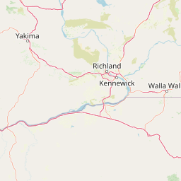
Map view of Umatilla National Forest

Use this park location map to pinpoint Umatilla National Forest in United States of America, understand its exact geographic position, and read its mapped placement within the surrounding landscape more clearly.

Pigeon | © OpenStreetMap contributors

Location context for Umatilla National Forest

OregonWashington

Explore protected area views, rugged river canyons, and old growth forest habitats.

Umatilla National Forest Photos and Scenery: Visualizing Mountain Landscapes

Visual records capture the steep river canyons, rolling forested ridges, and alpine terrain defining Umatilla National Forest across the Pacific Northwest. Studying these protected area photographs reveals the ecological diversity, wilderness character, and mountain topography shaping the region.

A black and white archival photograph of a gabled, wooden ranger station residence surrounded by snow and conifer trees in 1935.

A grassy alpine meadow slopes upward toward a mountain ridgeline under a cloudy sky, with pine trees in the background and a dirt trail in the foreground.

Park atlas

Compare surrounding Blue Mountains terrain and connected regional ecosystems

Parks Near Umatilla National Forest and Related Protected Landscapes

Browse nearby national forests and protected areas that share the ecological characteristics of Umatilla National Forest. Compare adjacent mountain ranges and river drainages to understand the wider conservation geography of the Pacific Northwest.
Protected landscapeOregon
About 16 km away#1 closest

East

Wallowa-Whitman National Forest: A Geographic Overview of Northeastern Oregon Landscapes

Alpine wilderness, mountain ranges, and deep river gorges.

Wallowa-Whitman National Forest protects a vast, varied landscape of granite peaks, alpine meadows, and forested river canyons. This detailed overview covers the geographic significance of the Wallowa and Elkhorn mountains, the Hells Canyon corridor, and the surrounding wilderness regions within Oregon.

Area
9,682 km²
Established
1905
Visitors
505K annual
Relief
Mountain
A horizontal watercolor painting depicting a soft-focus mountain range in shades of purple and pink behind a green forest and a calm blue lake.
Wildlife reserveOregon
About 39 km away#2 closest

Southeast

Eagle Cap Wilderness: Map and Protected Area Overview in Northeastern Oregon

High elevation terrain, glacial valleys, and mountain ecosystems

Spanning over 350,000 acres, Eagle Cap Wilderness defines the high-altitude geography of the Wallowa Mountains. This protected area is characterized by sharp granite ridges, more than 60 named alpine lakes, and deeply carved U shaped glacial valleys. It acts as a primary water source for the region, hosting the headwaters of several major rivers while supporting diverse wildlife populations in a preserved backcountry environment.

Area
1,462.72 km²
Established
1940
IUCN
Ib
Relief
Mountain
A watercolor painting of a wide, rolling landscape with green hills, a winding path or river, and soft mountains in the background against a white background.
Protected landscapeUnited States of America
About 90 km away#3 closest

East

Hells Canyon National Recreation Area: Geologic Boundaries and Snake River Corridor Atlas

Deep canyon terrain and archaeological heritage in the American Northwest

This protected landscape encompasses the profound depth of the Snake River gorge, featuring rugged basalt cliffs and diverse forested uplands. The area serves as a significant intersection of natural history and ancient cultural presence, providing a detailed look at the topographic complexity defining the Oregon and Idaho boundary region.

Area
2,641 km²
Established
1975
Relief
Mountain
Climate
Temperate
A pale, minimalist watercolor illustration showing rolling hills, sparse patches of vegetation, and soft, distant mountains against a light background.
Protected areaFranklin County
About 96 km away#4 closest

Northwest

Juniper Dunes Wilderness: Franklin County Protected Area and Landscape Atlas

An arid shrub-steppe and sand dune wilderness in the Columbia Basin.

Juniper Dunes Wilderness protects a rare ecological confluence of active sand dunes and gnarled western juniper groves within eastern Washington. This wilderness remains a significant study in arid-land geography and biogeographic isolation, providing a protected sanctuary for specialized flora and terrain formations within the broader Columbia Basin landscape.

Area
28.9 km²
Established
1984
IUCN
Ib
Relief
Lowland
A horizontal watercolor painting showing a panoramic view of layered green and purple mountains under a pale sky, with coniferous trees in the foreground.
Protected landscapeOregon
About 102 km away#5 closest

South

Malheur National Forest: Exploring Oregon's Vast Protected Mountain and Desert Landscape

A geographic study of the Blue Mountains and high desert terrain

Spanning over 1.4 million acres, Malheur National Forest represents a complex protected landscape in eastern Oregon. Its geography is defined by a central spine of the Strawberry Mountains, creating a transition zone between arid high desert ecosystems and dense coniferous forests. Known for large wilderness areas and extensive old growth stands, this forest serves as a vital point for understanding the interplay between topographic elevation and regional climate in the Pacific Northwest.

Area
5,929.81 km²
Established
1908
Visitors
242K annual
Relief
Mountain
Protected landscapeIdaho
About 124 km away#6 closest

Southeast

Payette National Forest: Geographic Overview of Idaho's Rugged Mountain Wilderness

Protected granite landscapes and glacial basin geography

Encompassing a vast portion of central Idaho, Payette National Forest represents a significant protected wilderness corridor. The forest geography transitions from granite-based alpine peaks and deep river gorges to dense coniferous slopes, providing essential habitat and extensive trail connectivity throughout the Northern Rockies.

Area
9,419.55 km²
Established
1944
Relief
Mountain
Access
Access unknown
Protected areaOregon
About 175 km away#7 closest

Southwest

Ochoco National Forest: Mapping the Rugged Canyons and High Desert of Central Oregon

A vast protected area defined by rimrock plateaus and pine-forest watersheds.

Located in the heart of the Ochoco Mountains, this protected landscape offers a study in ecological contrast. From its dense ponderosa pine groves to the exposed volcanic ridges of the high desert, the forest acts as a critical habitat corridor for mule deer and elk, while protecting the headwaters of the North Fork Crooked River within a diverse, multi-terrain framework.

Area
3,444.01 km²
Established
1911
Visitors
575K annual
Relief
Mountain
A horizontal watercolor illustration depicting a winding river flowing through a forested valley surrounded by soft, hazy mountain silhouettes.
Wildlife reserveIdaho
About 176 km away#8 closest

East

Frank Church, River of No Return Wilderness: Idaho Protected Mountain and River Landscapes

Discover massive roadless geography and river-carved mountain terrain.

Spanning over 2.3 million acres in central Idaho, the Frank Church, River of No Return Wilderness represents one of the most significant intact roadless landscapes in the lower 48 states. This protected area features a complex mosaic of coniferous forests, high-altitude alpine ridges, and the steep, jagged canyons of the Salmon River, creating a unique geographic profile for regional exploration.

Area
9,578.21 km²
Established
1980
IUCN
Ib
Relief
Mountain

Common questions about visiting, size, designation, and location context for Umatilla National Forest

Umatilla National Forest FAQs for park facts, access, geography, and protected area context

Find quick answers about Umatilla National Forest, including protected-area facts, park geography, trail and visitor context, and how the park fits into its surrounding country and regional landscape.
MoriAtlas Explorer

Continue Your Protected Areas Search Across the Global Atlas

Deepen your exploration by continuing the structured search for national parks and protected areas worldwide. Utilize the comprehensive filtering capabilities to compare different conservation landscapes and refine your understanding of global park geography. Discover more about the distribution and characteristics of protected natural areas.

Global natural geography