
Mori Atlas logo
Protected landscapeUntermarchtal

A connective river valley landscape at the southern transition of the Swabian Alb in Baden-Württemberg

Untermarchtal Protected Landscape: Mapped Geography and Conservation Boundaries in the Upper Danube

(Landschaftsschutzgebiet Untermarchtal)

Untermarchtal represents a strategically significant protected landscape situated where the Danube cuts into the limestone slopes of the Swabian Alb. This geographic area preserves a richly structured mosaic of river corridors, rising valley slopes, and orchard meadows. It serves as a vital connective zone between larger regional conservation areas, maintaining the ecological balance of the upper Danube through its distinctive alluvial and hillside terrain.

protected landscapeDanube valleySwabian Albupper DanubeAlb-Donau-Kreiscalcareous grassland
A stylized digital illustration of a landscape with evergreen trees in the foreground, rolling green hills, a winding path, and distant snow-capped mountains under a soft pastel sky.

Untermarchtal

Protected landscape

Park overview

Structured park overview, official facts, and landscape profile for Untermarchtal

Untermarchtal park facts, protected area profile, and essential visitor context

Review the core facts for Untermarchtal, including designation, size, terrain, visitor scale, habitats, and operating context in one park-focused overview.

About Untermarchtal

Untermarchtal is a compact protected landscape in southern Germany that safeguards one of the most scenically expressive stretches of the upper Danube valley. Although small in absolute terms, the protected landscape is geographically central to a much larger network of reserves that frame the southern edge of the Swabian Alb. It surrounds the village of Untermarchtal and extends across three separate parcels that together capture the valley floor, the adjacent slopes, and the historically significant Urdonautal surroundings.

The designation was issued in 2005 by the lower nature conservation authority of the Alb-Donau-Kreis with the explicit aim of preserving the area's distinctive landforms, its richly structured cultural landscape, and its ecological balance. The protected landscape deliberately protects human-influenced yet ecologically valuable elements; traditional landscape features such as field hedges, scattered orchards, solitary trees, field margins, and species-rich dry grasslands remain characteristic of the area and contribute to its conservation value.

Geographically, Untermarchtal lies within the Mittlere Flächenalb natural region, an area defined by relatively flat karstic uplands that drop sharply toward the Danube. The river itself comes into direct contact with the protected landscape, giving the area a defining orientation along the valley axis. Views from the area extend across the Danube lowlands toward the distant Alps on clear days, reinforcing the area's role as a transitional landscape between the Jura mountains to the south and the Alb plateau to the north.

Quick facts and research context for Untermarchtal

Untermarchtal is a designated protected landscape (Landschaftsschutzgebiet) in the Alb-Donau-Kreis of Baden-Württemberg, administered by the district's lower nature conservation authority. It was formally established by ordinance on 22 April 2005 and carries the official identifier 4.25.128.

The protected area covers about 23 hectares, distributed across three parts, and immediately surrounds the village of Untermarchtal. It lies within the natural region of the Mittlere Flächenalb, where the Danube has carved a distinctive valley into the southern escarpment of the Swabian Alb. The site borders both a Natura 2000 FFH area along the Danube and the Täler der Mittleren Flächenalb bird protection area.

Protection and recognition

Documented conservation parameters and recognized management history

Untermarchtal Protection Status and Official Designation Records

Untermarchtal conservation records compile verified protection status and administrative parameters from official databases. Core designation data provides clear context on international recognition standards and management history.

Protection details

WDPA ID
345200
Park context

Deeper park guide and search-rich context for Untermarchtal

Untermarchtal history, landscape, wildlife, and travel context

Explore Untermarchtal through its history, landscape character, ecosystems, wildlife, conservation priorities, cultural context, and seasonal travel timing in a structured park guide built for atlas discovery and search intent.

Why Untermarchtal stands out

Untermarchtal is known for protecting a visually striking transition between the Danube valley and the Swabian Alb. The protected landscape emphasizes the contrast between the broad river corridor and the steeper slope landscapes that rise immediately to the north, including the historically named Urdonautal setting. Its other defining feature is its role as a connective protected area. Untermarchtal is not an isolated reserve; rather, it ties together the Flusslandschaft Donauwieden nature reserve, the Danube FFH site, and the Täler der Mittleren Flächenalb bird protection area to form a continuous conservation corridor along this stretch of the upper Danube.
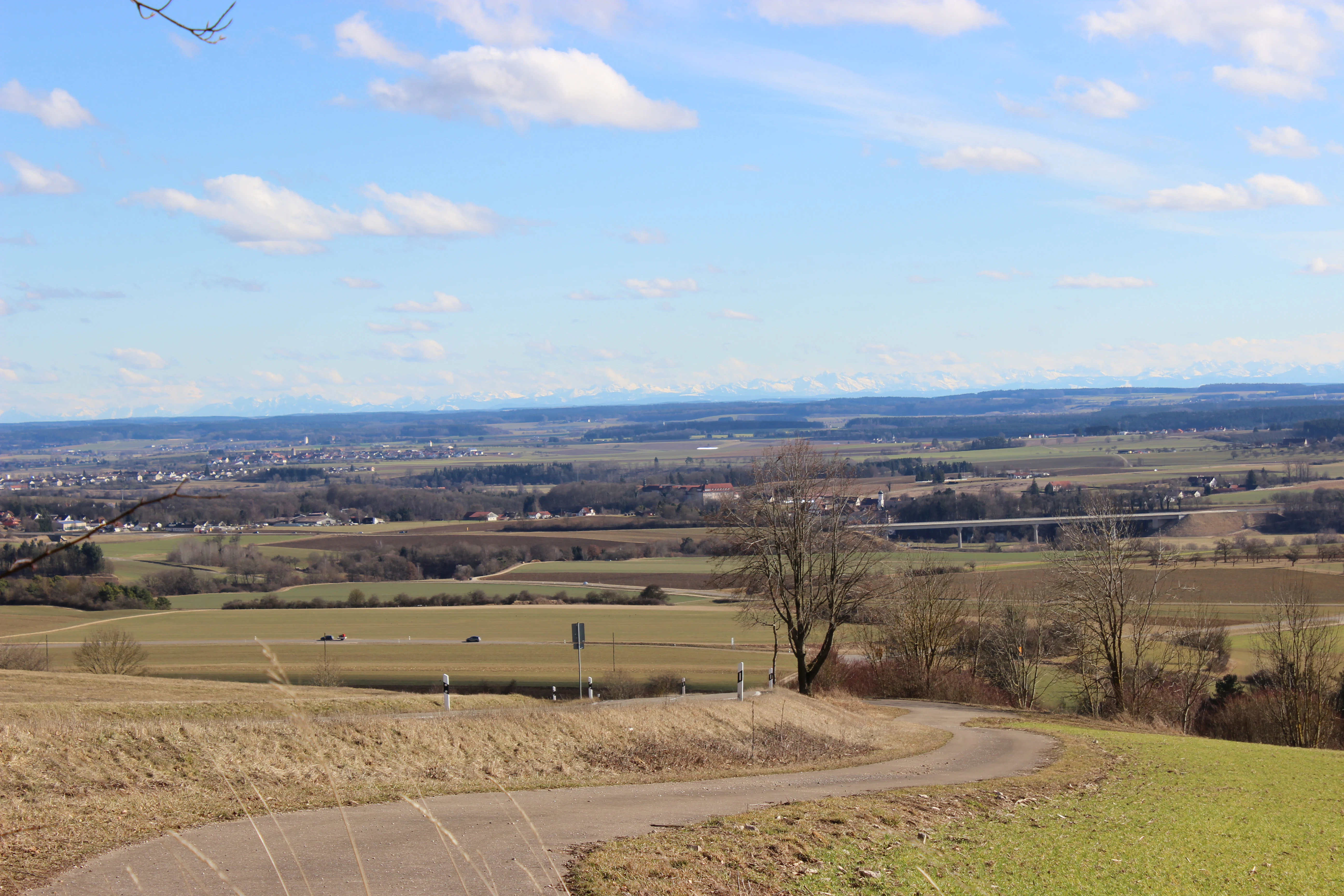
A wide landscape photograph from a high vantage point overlooking rolling fields and a small paved road in the foreground, with distant mountains visible on the horizon under a blue, partly cloudy sky.
A wide view overlooking the Untermarchtal landscape in the Danube valley toward the distant Alps.

Untermarchtal history and protected-area timeline

Before becoming a formal protected landscape, the area around Untermarchtal had long been valued as a regionally significant stretch of the upper Danube. The valley's mix of river, slopes, traditional orchards, and dry calcareous grasslands had already attracted conservation attention through the broader recognition of the Danube corridor between Munderkingen and Riedlingen and the Täler der Mittleren Flächenalb.

The formal creation of the Untermarchtal protected landscape took place on 22 April 2005, when the lower nature conservation authority at the Alb-Donau-Kreis district office issued the establishing ordinance. The designation consolidated protection across three separate parcels around the village and explicitly aimed to maintain the area's value for biodiversity, landscape aesthetics, and local recreation. Since then, the protected landscape has functioned as a connective reserve, reinforcing protection around the adjacent nature reserve and Natura 2000 sites without replacing them.

Untermarchtal landscape and geographic character

The protected landscape's physical setting is defined by the dramatic interface between the upper Danube and the Swabian Alb. The Danube has cut a deep, broad valley through the limestone of the southern Alb, producing a distinctive corridor of flat alluvial terrain flanked by rising slopes. Within the protected area, this morphology is compressed into a small area where the valley floor and the steep northern edge meet.

Landforms include the Danube itself, immediately adjacent lowland stretches, and the rising slopes of the Urdonautal and the area known as the Steige. The slopes are characterized by exposed limestone, dry grassland fragments, and small-scale transitions between woodland, orchard, and open ground. The protected landscape includes both visually open valley sections and more enclosed hillside terrain, producing the richly structured scenery that the designation was created to protect.

Untermarchtal ecosystems, habitats, and plant life

Ecologically, Untermarchtal lies at the overlap between riverine habitats of the upper Danube and the calcareous grassland and slope woodland habitats typical of the Swabian Alb. The valley floor contributes alluvial and near-river habitat elements, while the slopes support dry grassland, scrub transitions, and scattered orchard systems that have long been managed in traditional ways.

The protected landscape explicitly retains these cultural landscape elements because of their ecological value. Field hedges, scattered trees, field groups, and dry grassland patches contribute to habitat diversity at a small scale, supporting invertebrates, birds, and other fauna typical of warm, structured limestone landscapes in southwestern Germany.

Untermarchtal wildlife and species highlights

Although the protected landscape itself is small, its ecological value is enhanced by its position within a much broader conservation corridor. It connects the Danube's river-associated fauna with the bird and habitat communities of the Mittlere Flächenalb valleys. The dry grasslands and orchard structures within the protected area provide habitat for insects and birds typical of calcareous landscapes on the Alb edge.

The adjacent nature reserve along the Donauwiesen between Zwiefaltendorf and Munderkingen and the bird protection area of Täler der Mittleren Flächenalb extend habitat availability well beyond the boundaries of Untermarchtal itself, and the protected landscape functions as a buffer and connective element within this wider mosaic rather than as a self-contained wildlife refuge.

Untermarchtal conservation status and protection priorities

Untermarchtal was designated because of the area's combination of pronounced landscape forms, a richly structured scenery, and a balanced natural environment. The conservation purpose explicitly recognizes the area as a locally, regionally, and beyond-regionally significant recreation space as well as a cultural landscape of ecological value.

By protecting traditional landscape elements such as field hedges, scattered trees, orchard meadows, field margins, and dry grasslands, the designation helps maintain a small-scale mosaic that supports biodiversity on the Alb edge. The protected landscape also has a clear connective conservation function: it strengthens protection around the larger Danube FFH site, the Täler der Mittleren Flächenalb bird protection area, and the Flusslandschaft Donauwiesen nature reserve, contributing to a coherent, multi-layered conservation network along this stretch of the upper Danube.

Untermarchtal cultural meaning and human context

The landscape around Untermarchtal reflects centuries of interaction between farming communities and the demanding terrain at the edge of the Swabian Alb. Small-scale orchards, field hedges, and dry grassland patches are not merely ecological features but remain expressions of traditional land use adapted to the limestone soils and steep slopes of the valley margin. The presence of the historic Urdonautal reference in the designation itself signals the area's deep place in regional landscape memory.

Top sights and standout views in Untermarchtal

The most distinctive features of Untermarchtal are its compressed expression of the Danube valley landscape, its small-scale mosaic of orchard, hedge, and dry grassland, and its role as a connective reserve between larger Danube and Alb-edge conservation areas.

Best time to visit Untermarchtal

The upper Danube valley and the Swabian Alb edge are most visually expressive in late spring and early summer, when dry grasslands on the slopes come into flower and orchard meadows are at their greenest. Late summer and early autumn also offer clearer views across the valley toward the Alps, which are a noted visual feature of the area.

Monthly climate preview

Track representative monthly temperature averages and precipitation metrics for Untermarchtal in Baden-Württemberg.

Untermarchtal Climate Normals and Long-Term Annual Temperature and Precipitation Patterns

Representative coordinate records show measured long-term temperature ranges and precipitation rates across twelve distinct intervals for Untermarchtal. Reviewing the complete monthly profile provides deeper insight into measured baseline climate shifts without relying on live forecasts.
Annual mean8 °C
-2 °C18 °C
Jan-2°
Feb
Mar
Apr
May13°
Jun16°
Jul18°
Aug18°
Sep13°
Oct
Nov
Dec-1°
Warmest month
July

18 °C

Coolest month
January

-1.5 °C

Wettest month
July

3.9 mm/day

Driest month
February

1.9 mm/day

Park location guide

Geography guide, regional context, and park location map for Untermarchtal

Untermarchtal park geography, regions, and map view in Germany

Understand where Untermarchtal sits in Germany through a broader geographic reading of the surrounding landscape, nearby location context, and its mapped position within the national park landscape.

How Untermarchtal fits into Germany

Germany is a federal republic in Western and Central Europe with a population of over 83 million across sixteen constituent states. It is Europe's largest economy by nominal GDP and a major global exporter and importer. The capital is Berlin, and the country borders Denmark, Poland, Czech Republic, Austria, Switzerland, France, Luxembourg, Belgium, and the Netherlands.

Wider geography shaping Untermarchtal in Germany

Germany is located in Western and Central Europe, spanning 357,022 km². It borders Denmark to the north, Poland and the Czech Republic to the east, Austria and Switzerland to the south, and France, Luxembourg, Belgium, and the Netherlands to the west. The country has coastlines on the Baltic Sea and North Sea to the north, with the Alps located in the southern region.

Map view of Untermarchtal

Use this park location map to pinpoint Untermarchtal in Germany, understand its exact geographic position, and read its mapped placement within the surrounding landscape more clearly.

Pigeon | © OpenStreetMap contributors

Location context for Untermarchtal

Baden-Württemberg

Explore the terrain, limestone slopes, and valley habitats defining this protected landscape.

Untermarchtal Photos and Landscape Scenery: Visualizing the Upper Danube Protected Area

Visual records capture the striking transition between the broad upper Danube corridor and the steep limestone slopes rising toward the Swabian Alb. Examining these protected area views reveals the detailed landforms, orchard mosaics, and river valley habitats that characterize the region.

A wide landscape photograph from a high vantage point overlooking rolling fields and a small paved road in the foreground, with distant mountains visible on the horizon under a blue, partly cloudy sky.

Park atlas

Discover adjacent river corridors and connected landscapes across the Swabian Alb

Explore Protected Areas and Parks Near Untermarchtal in the Upper Danube Region

Browse other protected areas and regional reserves situated along the upper Danube valley near Untermarchtal. Comparing adjacent river corridors and limestone slopes helps map the broader conservation network shaping the southern Swabian Alb.
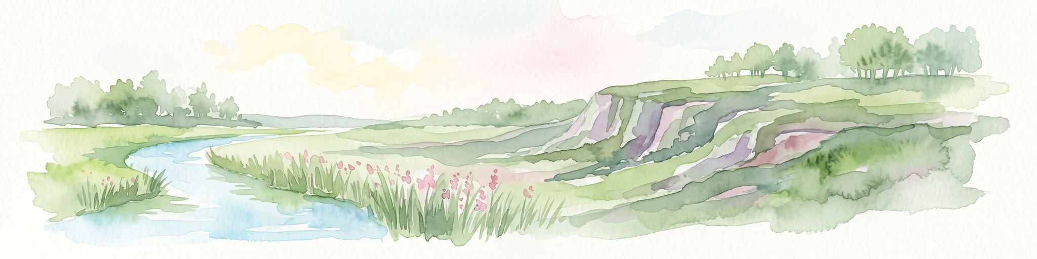
A soft watercolor painting of a calm river winding through rolling green hills under a hazy sky.
Protected areaGermany
About 0 km away#1 closest

Southwest

Donau zwischen Munderkingen und Riedlingen: Geography of a Danube Protected Landscape

Exploring floodplain habitats and Swabian Alb limestone terrain.

Spanning over 1,400 hectares, Donau zwischen Munderkingen und Riedlingen represents a vital protected network along the upper Danube. This area is defined by the sharp transition between dynamic wetland floodplains and the dry, calcareous grasslands of the surrounding plateau, offering a comprehensive look at the riparian and geological character of this historic German river corridor.

Area
14.33 km²
Established
2019
Relief
Lowland
Climate
Temperate
Protected landscapeBaden-Württemberg
About 12 km away#2 closest

West

Tobeltal Protected Landscape: Geological and Geographic Profile in Baden-Wurttemberg

Mapped gorge terrain and regional conservation geography

The Tobeltal protected area features a distinctive 2.2 kilometer valley profile carved into Jurassic limestone. Its narrow gorge, wooded slopes, and Kesselbach spring wetland provide a representative example of the varied terrain found within the Mittlere Flächenalb region of Germany.

Area
0.31 km²
Established
1958
IUCN
V
Protected landscapeBaden-Württemberg
About 15 km away#3 closest

Northwest

Hinter Gleinsgelesberg Protected Landscape: Swabian Alb Geographic Atlas

Successional forest terrain in Baden-Württemberg

Hinter Gleinsgelesberg is a protected forest patch situated on the karstic plateau of the Swabian Alb in southwestern Germany. Originally used as grazing land, the terrain now exhibits a characteristic transition to closed successional woodland. This site acts as a representative element within the broader network of landscape protection areas located along the Mittlere Flächenalb plateau near Pfronstetten and Hayingen.

Area
0.062 km²
Established
1955
IUCN
V
Relief
Upland
Protected landscapeBaden-Württemberg
About 16 km away#4 closest

West

Fuchslochhalde, Ruckenhalde, Steighalde Protected Landscape Map and Regional Geography

Swabian Alb dry-valley terrain and juniper heath habitats

Fuchslochhalde, Ruckenhalde, Steighalde functions as a linear landscape protection area in the Reutlingen district. This site preserves rare juniper heath relicts, boulder fields, and limestone scree slopes across a four-kilometer stretch of the Tiefental valley flank. It is a vital example of regional conservation that documents the transition from historical sheep pastures to natural woodland succession within the broader Mittlere Flächenalb landscape.

Area
0.568 km²
Established
1955
IUCN
V
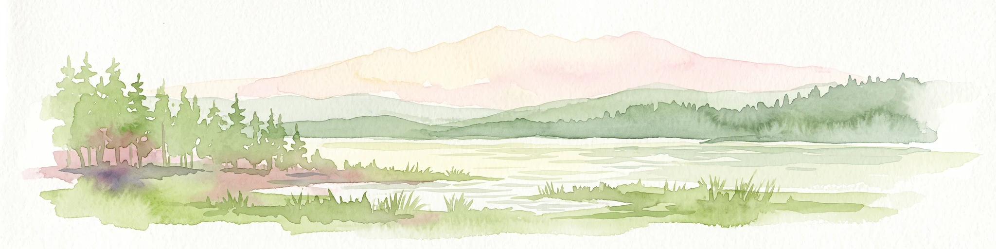
Watercolor painting of a tranquil wetland landscape with pine trees, grassy shorelines, and distant rolling hills against a soft background.
Nature reserveBaden-Württemberg
About 25 km away#5 closest

South

Feuchtgebiete um Bad Schussenried: Protected Wetland Mosaic and Regional Geography

Nature reserve complex in the Upper Swabian hill country

Feuchtgebiete um Bad Schussenried is an essential European FFH site spanning seven protected sub-areas. The landscape encompasses a dense patchwork of lowland fens, alder forests, and kettle-hole lakes, representing the unique glacial terrain of Upper Swabia through its intricate peatland and spring mire systems.

Area
6.1 km²
Established
2019
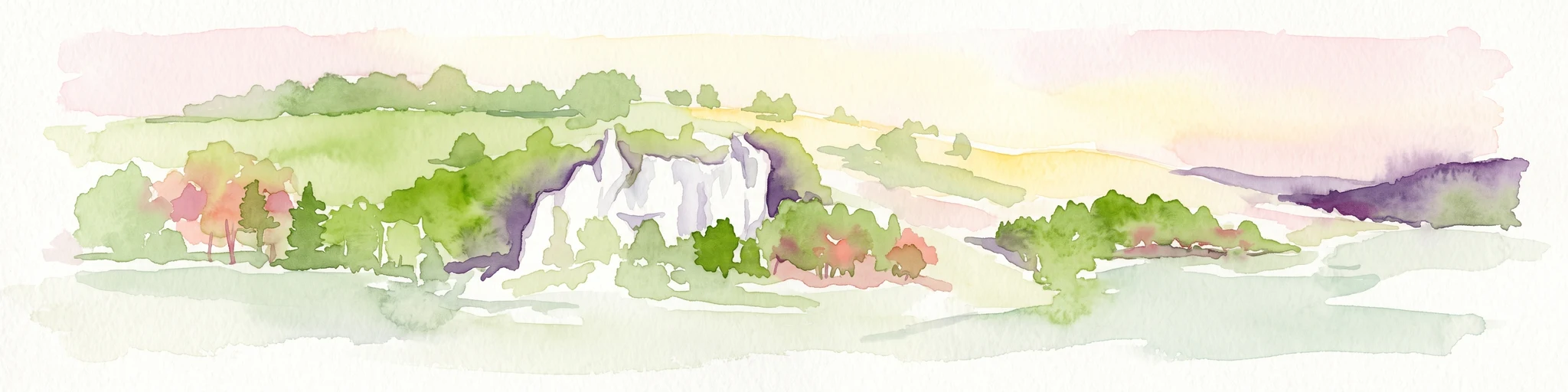
Watercolor painting of a rolling landscape featuring light green hills, patches of trees, and white rock outcrops against a soft, light-colored background.
Protected landscapeBaden-Württemberg
About 25 km away#6 closest

Northwest

Öde im Hartberg Protected Landscape and Geological Features of the Middle Swabian Alb

Juniper heathland and limestone outcrops in Baden-Württemberg

Situated at the mouth of the Fischburgtal, Öde im Hartberg is a significant protected area on the Middle Swabian Alb. The site preserves a unique mosaic of open heath and successional woodland, anchored by the Hartbergfels and Seeburger Nägelesfels limestone monuments. It offers a clear look at the geological and conservation landscape of this southwestern German region.

Area
0.101 km²
Established
1955
IUCN
V
Protected landscapeBaden-Württemberg
About 26 km away#7 closest

South

Oberes Rißtal Protected Landscape: Glacial Geography and Wetland Corridors in Baden-Württemberg

Mapping the upper Riß river valley and its complex fen ecosystems

Oberes Rißtal stands as a crucial protected landscape in Baden-Württemberg, distinguished by its winding river meanders and multi-layered glacial terrain. This area merges the Riß and Würm ice-age legacy with active riparian habitats, including extensive lowland fens, kettle depressions, and traditional meadows. Explore the mapped boundaries and geographic features that define this essential Upper Swabian corridor.

Area
41.638 km²
Established
1975
IUCN
V
Protected landscapeBaden-Württemberg
About 28 km away#8 closest

Northwest

Wolfsschlucht Protected Landscape: Swabian Alb Gorge Geography and Regional Mapping

A key geotope within the central Swabian Alb mountain terrain.

Wolfsschlucht preserves a distinctive limestone gorge and ravine forest system within a compact 1.4 hectare area. Its geography highlights the intersection of karst landforms, steep valley relief, and layered conservation status, serving as a representative model of the central Swabian Alb's geological and ecological character in Baden-Württemberg.

Area
0.014 km²
Established
1955
IUCN
V

Common questions about visiting, size, designation, and location context for Untermarchtal

Untermarchtal FAQs for park facts, access, geography, and protected area context

Find quick answers about Untermarchtal, including protected-area facts, park geography, trail and visitor context, and how the park fits into its surrounding country and regional landscape.
MoriAtlas Explorer

Continue Your Protected Areas Search Across the Global Atlas

Deepen your exploration by continuing the structured search for national parks and protected areas worldwide. Utilize the comprehensive filtering capabilities to compare different conservation landscapes and refine your understanding of global park geography. Discover more about the distribution and characteristics of protected natural areas.

Global natural geography