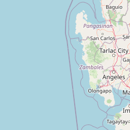

Why Upper Agno River Basin Resource Reserve stands out
The reserve is best known as the high-elevation watershed feeding the Ambuklao and Binga dams, making it one of the most strategically important hydropower catchments in the Philippines. It is also recognized for its mossy cloud forests, Benguet pine slopes, high-altitude dwarf bamboo grasslands, and exceptional concentration of Philippine endemic bird species. Within the protected area, peaks like Mount Mongawto and the seven-peak Mount Purgatory circuit have become notable destinations for hikers seeking pine forest ridges, mossy dwarf forest, and sweeping Cordillera vistas. Ecologically, the reserve stands out for harboring species such as the scale-feathered malkoha, whiskered pitta, and Mount Data shrew-rat, and for supporting high fish diversity among Benguet's river systems.
Upper Agno River Basin Resource Reserve history and protected-area timeline
The Upper Agno basin began its long history of official protection in 1929, when American Governor-General Henry L. Stimson signed Proclamation No. 217, designating about 82 percent of the Cordillera Central range as the Central Cordillera Forest Reserve. A 1932 amendment reduced the reserve by more than a thousand hectares to accommodate mining concessions, and in 1936 a portion of the basin around Mount Data was reclassified into the Baguio-Bontoc Scenic National Park, later renamed Mount Data National Park in 1940.
In 1946, the Philippine government launched the Agno River Development Program, a multi-dam hydropower initiative that eventually produced the Ambuklao Dam in 1956 and the Binga Dam in 1960. The forests protecting these facilities received their own dedicated designation on November 25, 1966, when President Ferdinand Marcos signed Proclamation No. 120, creating the roughly 9,700-hectare Ambuklao Watershed Forest Reserve around the two dams. In 1987, a portion of that reserve encompassing Mount Pulag and several adjacent peaks was carved out as Mount Pulag National Park.
The modern Upper Agno River Basin Resource Reserve was formally established on April 23, 2000, through Proclamation No. 268, which consolidated the various watershed and forest reserves of the upper basin into a single, much larger protected area of about 77,561 hectares. This designation brought the entire upper Agno catchment under one management framework and formally linked the area to its neighbors, Mount Data and Mount Pulag national parks, creating a continuous high-elevation conservation corridor in the Cordillera Central.
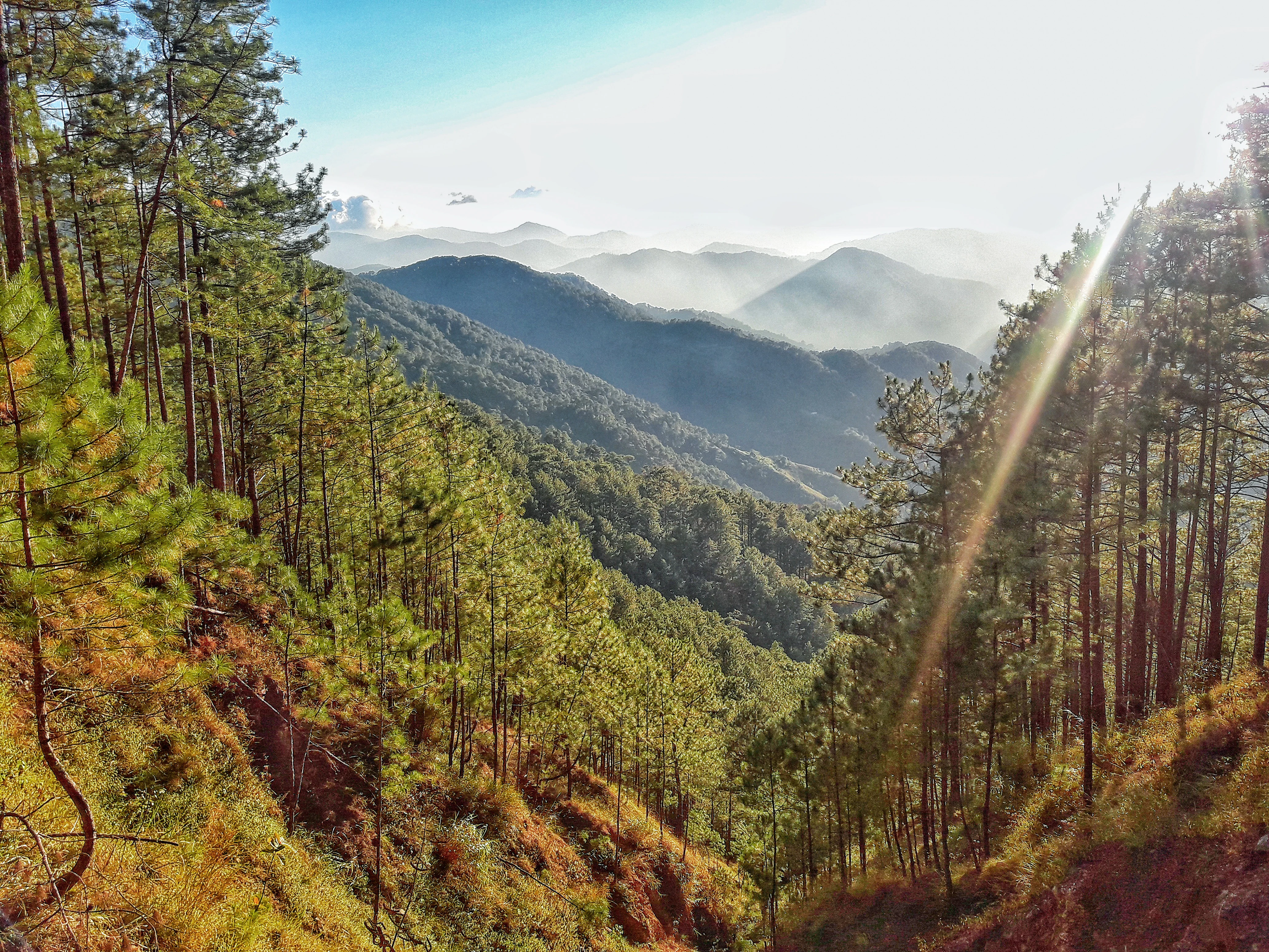
Upper Agno River Basin Resource Reserve landscape and geographic character
The Upper Agno reserve occupies the southeast flank of the Cordillera Central between the Central and Polis ranges, covering a roughly 46-kilometer stretch of the Agno River from the Mount Data National Park boundary down to Binga Dam. Its average elevation of about 1,605 meters makes it the highest sub-basin of the Agno River system, and at least nine named mountain peaks rise above 7,000 feet within or near the reserve.
The highest summit is Mount Mongawto at 2,720 meters, located on the Central range in the municipality of Atok. Other prominent peaks include Mount Nangaoto, Mount Singakalsa, Mount Aki, Mount Ambubungan, Mount Palugloko, Mount Toyangan, Mount Bayoyo, and Mount Palansa. These elevations produce some of the coolest, most variable weather in the Philippines, including frequent hailstorms and fog-laden cloud forest conditions. The Halsema Highway, the country's highest paved national road, runs along portions of the reserve's western boundary, providing dramatic access across the mountain landscape.
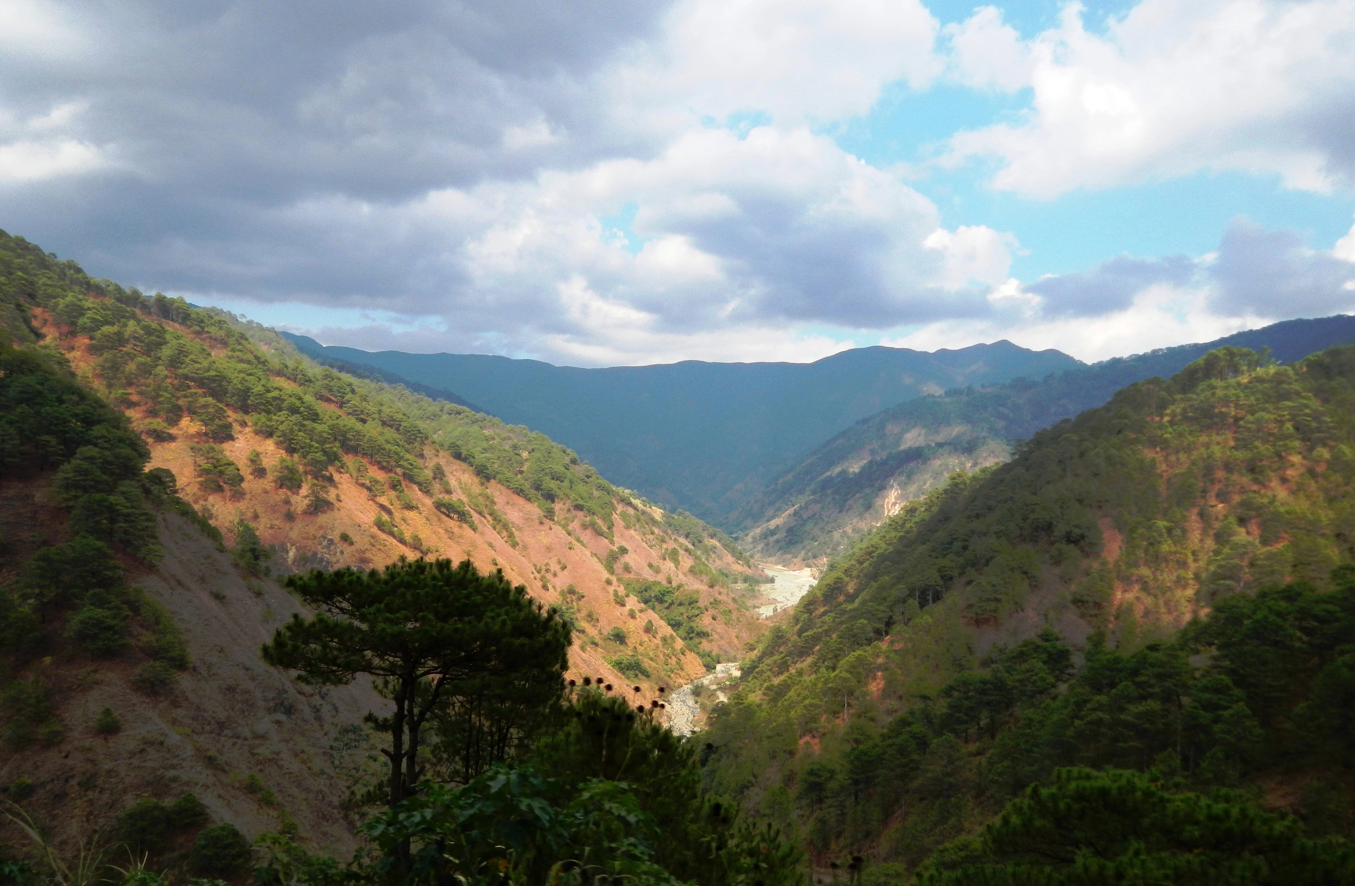
The valleys of the reserve are dominated by the Agno River and its major tributaries, including the Bokod River, the Benneng River, and the Bantay River, along with smaller streams such as Karao, Eddet, and Adaoay. The most distinctive hydrological feature is the Ambuklao Reservoir at the confluence of the Agno and Bokod rivers, with downstream Binga Reservoir anchoring the southern edge. The combination of steep forested ridges, deeply incised river valleys, and high plateau-like summits gives the reserve a layered Cordillera landscape of pine-clad slopes, mossy dwarf forest, and open grassy peaks.
Upper Agno River Basin Resource Reserve ecosystems, habitats, and plant life
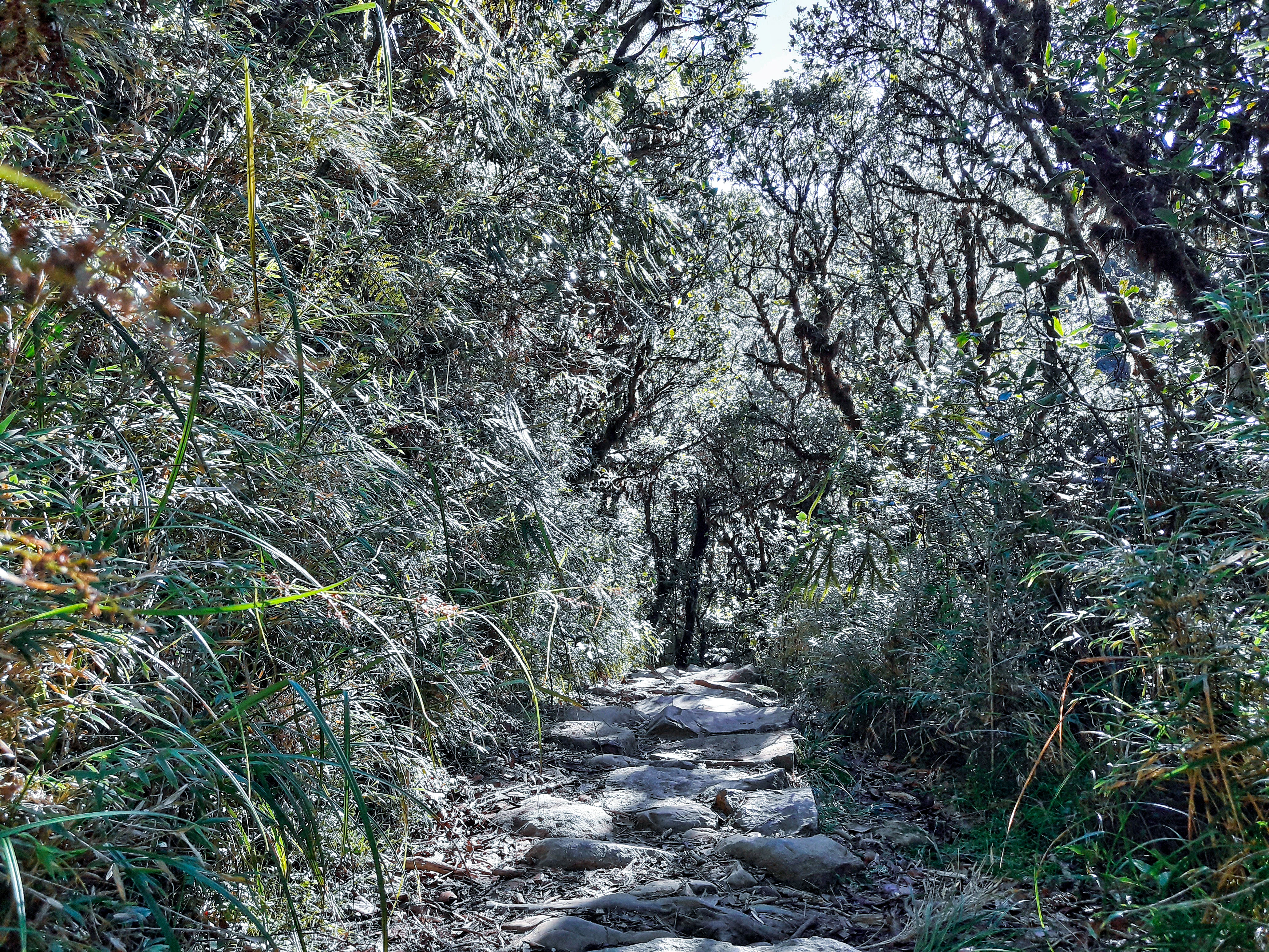
The vegetation of the Upper Agno reserve is arranged in a clear elevational sequence. Lower montane forests are dominated by Benguet pine together with evergreen shrubs and flowering plants such as Gaultheria borneensis and Coprosma granadensis. Above roughly 2,000 meters, the forest transitions into mossy cloud forest, where woody plants of the Ericaceae family are prominent, including several species of Rhododendron and Vaccinium. Above the mossy zone, the summits of the highest peaks support grasslands of dwarf bamboo, along with specialized high-elevation grasses and flowering plants such as Danthonia oreoboloides, Deyeuxia suizanensis, Hypericum pulogense, and Trichophorum subcapitatum.
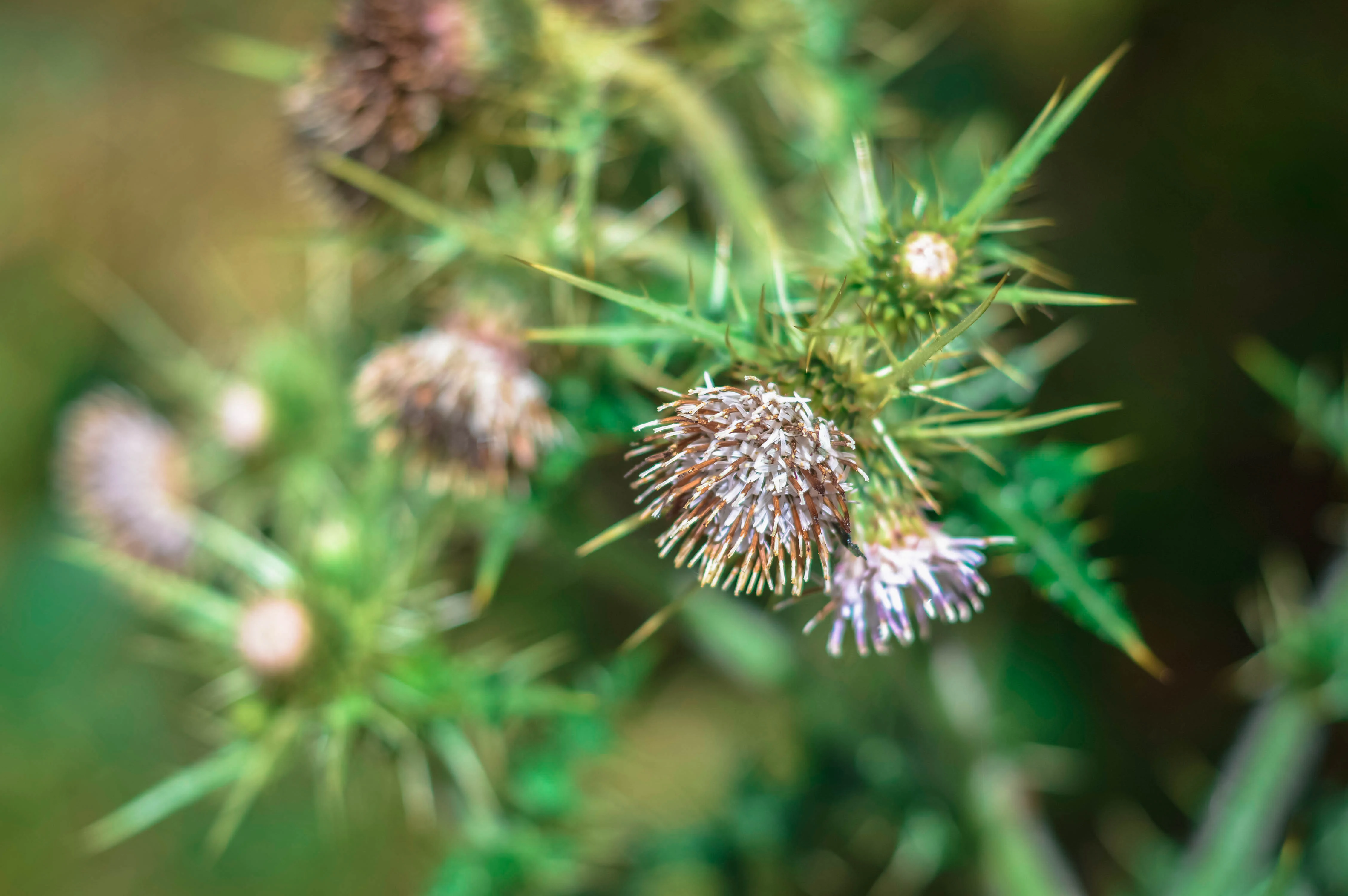
The reserve is also botanically notable for harboring narrow-range endemic ornamental plants. The Philippine thistle, Cirsium luzoniense, is found in the mossy forests of Bokod, and the endemic Begonia merrittii grows in high-elevation habitats within the reserve. In 2020, a new endemic orchid species, Dendrochilum ignisiflorum, was documented from the mossy forest around the 2,300-meter summit of Mount Komkompol, adding to the botanical significance of the area.
The river network itself supports rich aquatic life. The Upper Agno River and its tributaries have the highest fish diversity among the five river systems of Benguet, with native species such as the giant mottled eel, pond loach, Java fat-nose goby, mangrove flathead goby, and mosquitofish. The Ambuklao Reservoir has been heavily stocked with introduced species including silver perch, Celebes goby, common carp, silver carp, bighead carp, and tilapia, and also supports commercially important freshwater shrimp and Asiatic clam.
Upper Agno River Basin Resource Reserve wildlife and species highlights
The reserve supports a substantial concentration of Philippine endemic fauna. At least 70 bird species have been recorded within the protected area, including 46 endemics. Among these are species of strong conservation interest such as the scale-feathered malkoha, mountain shrike, indigo-banded kingfisher, bicolored flowerpecker, balicassiao, flame-breasted fruit dove, Philippine coucal, Philippine scops owl, white-browed jungle flycatcher, blue-headed fantail, lovely sunbird, Luzon striped babbler, the Northern Luzon subspecies of the dark-throated oriole, and the whiskered pitta.
Mammalian wildlife documented in and around the reserve includes the Asian palm civet, Malayan civet, Philippine long-tailed macaque, Northern Luzon giant cloud rat, Mount Data shrew-rat, Luzon shrew, large flying fox, Philippine warty pig, and Philippine deer. The presence of two shrew-rats and a rare Philippine deer population underscores the reserve's value as habitat for forest-dependent mammals in the Cordillera.
Aquatic and reservoir-based wildlife are also significant. The Ambuklao Reservoir has supported commercial aquaculture since 1994, with dozens of fish cage operators harvesting crimson snapper, tilapia, and silver carp within a permitted zone of the artificial lake, illustrating the reserve's blended role as both a wild ecosystem and a managed working landscape.
Upper Agno River Basin Resource Reserve conservation status and protection priorities
The Upper Agno River Basin Resource Reserve is fundamentally a conservation instrument built around water and energy security. By protecting the upper catchment of the Agno River, the reserve safeguards the long-term water yield and sediment behavior feeding the Ambuklao and Binga dams, which historically supplied electrical power to Baguio and Benguet and continue to be important to the Luzon grid. Without this upland forest and grassland cover, the reliability and lifespan of these decades-old hydropower facilities would be at risk.
Ecologically, the reserve is one of the most important upland protected areas in northern Luzon. Its elevational zonation, from lower montane pine forest through mossy cloud forest to high-altitude dwarf bamboo grassland, creates layered habitats that support many Philippine endemics, including recently described species such as the orchid Dendrochilum ignisiflorum. By linking Mount Data National Park upstream and Mount Pulag National Park downstream through contiguous forest and watershed, the reserve strengthens a continuous Cordillera conservation corridor that no single park could provide on its own.
Management is shared among the Department of Environment and Natural Resources, the National Power Corporation, and the hydropower operator SN Aboitiz. This multi-agency structure reflects the reserve's unusual status as both a natural protected area and a critical piece of national energy infrastructure, with conservation goals balanced against hydropower operation, reservoir-based aquaculture, and growing ecotourism use along the Mount Purgatory circuit.
Upper Agno River Basin Resource Reserve cultural meaning and human context
The Upper Agno basin lies within the ancestral landscapes of the Cordillera peoples of northern Luzon, including communities of Benguet and Ifugao whose traditional livelihoods have long been intertwined with these highland forests and rivers. The municipalities surrounding the reserve, such as Atok, Bokod, Kabayan, Kibungan, Buguias, La Trinidad, Hungduan, and Kiangan, are home to indigenous communities whose agricultural terraces, settlements, and resource use have shaped, and been shaped by, the surrounding watersheds for generations.
The reserve's history reflects successive layers of governance, from early twentieth-century American colonial forest reserves and 1930s national park designations, to postwar Philippine hydropower planning under the Agno River Development Program, to contemporary multi-agency conservation management. This layering gives the area a distinctive heritage identity: simultaneously a national infrastructure zone, an ecological refuge, and a highland cultural landscape whose local communities remain integral to its present and future management.
Top sights and standout views in Upper Agno River Basin Resource Reserve
Upper Agno is one of the highest protected watersheds in the Philippines, with an average elevation near 1,600 meters and summits above 2,700 meters, including Mount Mongawto and the seven-peak Mount Purgatory circuit. It protects the headwaters feeding two of the country's oldest hydroelectric dams, Ambuklao and Binga, making it a rare case of a protected area whose existence is directly tied to national energy security.
Its ecological layering, from Benguet pine ridges to mossy cloud forest of ericaceous shrubs and Rhododendron species, and up to dwarf bamboo grasslands on the summits, supports at least 70 recorded bird species, 46 of them Philippine endemics, along with key mammals such as the Philippine deer, Philippine warty pig, and Mount Data shrew-rat. Together with neighboring Mount Pulag and Mount Data national parks, it forms a continuous high-elevation conservation corridor across three provinces of northern Luzon.
Best time to visit Upper Agno River Basin Resource Reserve
The Upper Agno reserve has some of the coolest and most variable weather in the Philippines, including regular hailstorms at the highest elevations. Visitors can generally expect crisper, drier conditions during the traditional cooler dry months of the northern Philippines highland climate, when pine forest ridges, montane mossy forest, and grassland peaks are most accessible and views are clearer.
Rainier periods bring heavier mist, frequent fog in the mossy forest zone, and more challenging trail conditions, but they also coincide with lush vegetation and more active birdlife. Hikers heading to the Mount Purgatory (Mangisi) circuit and other upland peaks should plan for sudden weather changes, layered clothing, and the possibility of hail even outside the most intense rainy months, regardless of season.